Current smoke conditions in Winds (and elsewhere--how to assess smoke/haze conditions in general?)

RyanP

Member
Joined
Mar 1, 2015
Messages
774
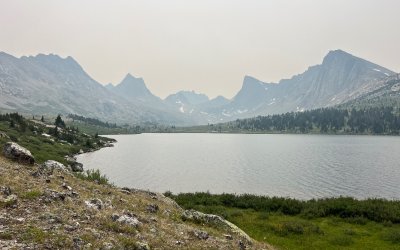
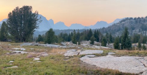
I've been planning to head to the Winds next week (starting this weekend) but am worried about the air quality. Does anyone have a feel for how smoky it is right now? I realize the conditions change daily depending on which direction the wind is blowing, but if it has been consistently smoky for the past week or two, then I'll bail to my Plan B in the San Juans (which hopefully will be more clear? If anyone has recent info for SW CO, I'm all ears as well). I'm fine if the long-distance views from the peaks/passes are hazy, but if I'm in a valley or at a lake, I want to see the mountains around it! (and I'd prefer to see some views from the passes as well)

On a related note--what resources do you use to assess how smoky/hazy it will be in general? I mostly just view the smoke plumes on fire.airnow.gov, but I don't have a good feel for how useful that is in terms of predicting haze levels. If anyone else has any tips/tricks in that regard, please let me know! Do I need to join the appropriate facebook groups (uggh) or alltrails or such (ugggh again)? Do people find local/regional webcams? (sometimes those are poor enough quality that it's hard to tell) Surely I'm not the only one who is willing to change my destination to seek the better air quality...
 
Google has a map layer for "AQI" that I find visually useful. I use this coupled with the Watch Duty app to monitor air quality here in CO.
The smoke is supposed to reach down to Castle Rock last I heard, so San Juans may be ok dependent on how much stronger the fires and winds become through the week.
 
Purple Air is excellent. Thousands of real time sensors, averaged and updated every 10 minutes. While not a guarantee, higher AQI strongly correlates with lower visibility due to smoke. Of course, air quality can change dramatically over the course of a few hours, but I find purple air to be the best resource for current air quality.

Firesmoke.ca has a good map based on PM2.5 plume modeling that goes out a day or two. https://firesmoke.ca/forecasts/current/

Because I look at this stuff multiple times a day, I can tell you the smoke has mostly been in the Pacific NW, western Montana, and a lot of western Canada for the past few weeks I'd expect it to get bad for the places south of there if they start getting more large fires in California.

Editing to add that it looks like this recent low pressure pushed some smoke down there too, but I'd assume it will shift north again once high pressure builds back in.
 
Last edited:

Its as bad as I have seen it here in Island Park. All across OR, WA, ID, MT, WY, UT, NV is bad. Aug is not going to be any better. New starts every couple of days.

Caltopo has a layer to turn on that shows current fires which is helpful.
 
Purple Air is excellent. Thousands of real time sensors, averaged and updated every 10 minutes. While not a guarantee, higher AQI strongly correlates with lower visibility due to smoke. Of course, air quality can change dramatically over the course of a few hours, but I find purple air to be the best resource for current air quality.

Firesmoke.ca has a good map based on PM2.5 plume modeling that goes out a day or two. https://firesmoke.ca/forecasts/current/

Because I look at this stuff multiple times a day, I can tell you the smoke has mostly been in the Pacific NW, western Montana, and a lot of western Canada for the past few weeks I'd expect it to get bad for the places south of there if they start getting more large fires in California.
Thanks--that PurpleAir site does indeed look nice
 
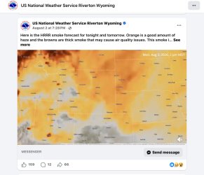
Local news / weather stations may issue future smoke predictions /simulations for the next 48 hours. The National Weather Service for the area also posts future (1-2 days out) simulations on social media, this one on FB.
As of this morning I wasn’t able to see/ run the simulation on the source website for the HRRR smoke forecasts

IMG_7463.jpeg
 
Drove down the East side of the Winds on Hwy 26 yesterday and the smoke was plain awful. Couldn't see the mountains. Worse smoke range-wide than when I was out there last year while the Dollar Lake fire was burning
 
I was also out there with @Bob on the East side during the Dollar Lake fire. Wasn't good. A week later the wind shifted and I went up towards the fire camping near Shannon Pass. Blue skies all day. Then the wind shifted... It was a long night.

Heading back out there in 10 days. Just have to make the best of it. May get lucky if the wind shifts long enough.

To throw another site into the discussion: weather.gov AQI has a slider on the left that animates for the next few days.

Pinedale WYDOT web cam view to the Winds: Winds Pinedale side
 
Last edited:
Back
Top