JDWalters
Member
- Joined
- Apr 21, 2017
- Messages
- 120
Disclaimer: These photos and trip report are from August 2013.
The Crow Pass Trail to Raven Glacier is one of my favorite hikes in Alaska. It is only about 4.5 miles from the parking lot to the glacier, gaining around 2000 feet in elevation. The trail actually goes for 23 miles, from the trailhead at Crow Creek Rd to Eagle River. I have hiked this trail several times, but I have never gone past Raven Glacier.
For the first mile or two, the trail is very easy to follow, as it goes uphill through bushes and trees. Once I got past the treeline, I had spectacular views of the whole valley. The trail splits in several places -- one going higher up the slope, while one is closer to the creek (but still quite a bit above it). It didn't really matter what trail I chose, as long as I kept the creek on my left.
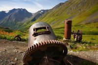
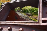
Along one of the trails, there were some "relics" from back in the mining days. Basically the miners left behind the big heavy stuff that they didn't want to drag out. There were also some cables coming down from up the slope.
Farther along past the mining relics, I came to the first of several waterfalls.
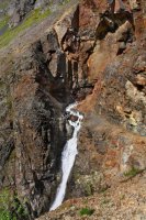
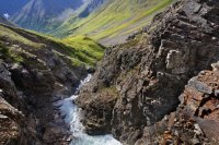
I had hiked this trail several times, but I had always followed the trails up the slope, far to the right of the waterfall. This time, I noticed that I could easily enter the ravine above the falls and follow the creek.
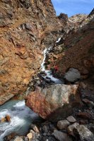
Looking back out towards the valley from which I came...
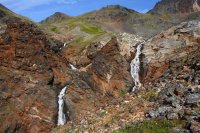
Climbing out of the ravine along the creek, I rejoined the trail and then passed by the upper waterfalls of Crow Creek.
Once above the waterfalls, the majority of the elevation gain was behind me and I was rewarded with this view of Crow Creek and Jewel Glacier high above.
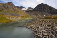
Just steps from that view was Crystal Lake -- the perfect spot for lunch. I was here in late August on this trip -- in June and July, there can be quite a bit of snow still lingering in and around the lake.
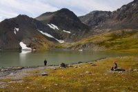
Just a half mile past Crystal Lake, I reached Crow Pass. Many people turn around when they reach this point, but that was not an option on such a beautiful day with a glacier within easy walking distance. However, like many glaciers, reaching it is not as easy as it looks.
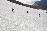
First I had to cross a snowfield (which wasn't too big of a deal)...
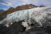
Next obstacle was the moraine. Before tackling that, I walked around a bit and got a photo of Raven Glacier from the other side of the valley.
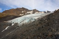
The hanging glacier above Raven Glacier is unnamed, from what I can tell.
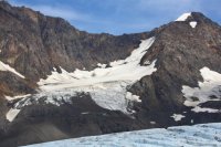
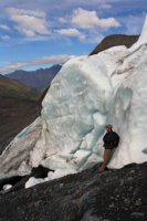
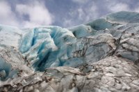
After crossing the sharp and icy moraine, getting onto Raven Glacier was actually pretty easy. I had not brought along crampons, but I had pretty good traction on the ice, and had climbed onto a fairly level section.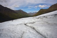
After walking around the glacier for a while, I made my way down to the terminus.
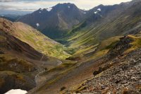
I thought about hiking up to Jewel Glacier on way back, but ended up making a bad route decision. I did get a nice photo of the Crow Creek valley from higher up though.
The Crow Pass Trail to Raven Glacier is one of my favorite hikes in Alaska. It is only about 4.5 miles from the parking lot to the glacier, gaining around 2000 feet in elevation. The trail actually goes for 23 miles, from the trailhead at Crow Creek Rd to Eagle River. I have hiked this trail several times, but I have never gone past Raven Glacier.
For the first mile or two, the trail is very easy to follow, as it goes uphill through bushes and trees. Once I got past the treeline, I had spectacular views of the whole valley. The trail splits in several places -- one going higher up the slope, while one is closer to the creek (but still quite a bit above it). It didn't really matter what trail I chose, as long as I kept the creek on my left.
Along one of the trails, there were some "relics" from back in the mining days. Basically the miners left behind the big heavy stuff that they didn't want to drag out. There were also some cables coming down from up the slope.


Farther along past the mining relics, I came to the first of several waterfalls.

I had hiked this trail several times, but I had always followed the trails up the slope, far to the right of the waterfall. This time, I noticed that I could easily enter the ravine above the falls and follow the creek.

Looking back out towards the valley from which I came...

Climbing out of the ravine along the creek, I rejoined the trail and then passed by the upper waterfalls of Crow Creek.

Once above the waterfalls, the majority of the elevation gain was behind me and I was rewarded with this view of Crow Creek and Jewel Glacier high above.

Just steps from that view was Crystal Lake -- the perfect spot for lunch. I was here in late August on this trip -- in June and July, there can be quite a bit of snow still lingering in and around the lake.

Just a half mile past Crystal Lake, I reached Crow Pass. Many people turn around when they reach this point, but that was not an option on such a beautiful day with a glacier within easy walking distance. However, like many glaciers, reaching it is not as easy as it looks.
First I had to cross a snowfield (which wasn't too big of a deal)...

Next obstacle was the moraine. Before tackling that, I walked around a bit and got a photo of Raven Glacier from the other side of the valley.

The hanging glacier above Raven Glacier is unnamed, from what I can tell.

After crossing the sharp and icy moraine, getting onto Raven Glacier was actually pretty easy. I had not brought along crampons, but I had pretty good traction on the ice, and had climbed onto a fairly level section.

After walking around the glacier for a while, I made my way down to the terminus.


I thought about hiking up to Jewel Glacier on way back, but ended up making a bad route decision. I did get a nice photo of the Crow Creek valley from higher up though.

