Scott Chandler
Wildness is a necessity- John Muir
- Joined
- Jan 4, 2014
- Messages
- 1,099
07/09-12/2015
The job of a wilderness ranger varies a lot. Sometimes it is pretty rough (like the 4th of July weekend… rain, horses, long days…) and other times it can be downright pleasant. Here at the Cloud Peak Wilderness, I find the opportunities to visit the northern end fall into the latter, and while this weekend had its moments, the time I got to spend up there was downright nice.
I started out heading up the trail towards Geneva Pass. Looking at the weather I was unsure of how far I would make it before the weather would force me to settle in. The high country and passes are not a place to be running around when a lingering cold front is dropping lightning all around your Pulaski and radio equipped self.
I’m amazed how few pictures I take on the hike up this trail. It’s not that it isn’t pretty or interesting, I guess it’s just not of documenting/sharing quality.
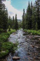
Sure enough, by the time I reached Lake Geneva, I had the dreaded scenario unfolding, flash bangs that raise the hair. Thankfully the lake is nestled in a bowl with lots of big trees. I also got to put my attractive gear down as I patrolled the shoreline.
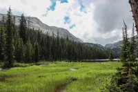
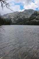
Finding the lake in shockingly nice condition, I decided to bump up at least to Crystal Lake. It is higher but still has enough tree cover to not feel too freaky with the storms. By the time I got there though, the storm had moved off and things were looking nice. After a nice contact with a group at Crystal I decided to bump over the pass into the Sheepherder Basin.
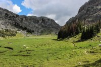
Sadly the contact at Crystal made me pass a gorgeous photo opportunity. Flowers going bonkers in the meadow with the lake and dramatic wall behind it…Y’all will just have to imagine. It wasn’t until I neared the pass that I pulled my camera out again to document the pretty.
Well sure enough, the clearing was another classic Bighorn Sucker Hole. As I cleared the pass I got rain. Luckily, thunder hadn’t formed up again but I hurried along. I did not have much of a plan for where to camp that night, not thinking I’d really make it this far, but remembered cooings from my boss about how nice Granite Lake is saw me headed there. Sure enough I found a nice spot on a granite ledge by the lake with epic views of the mountains. It rivals the camp spot I had last year in Highland Park as best I’ve had out here (maybe it was better just because nice water was nearby.)
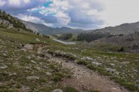
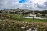
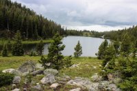
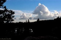
The storm opened up enough for me to cook dinner but dumped hail and rain and lightning while I cowered under a tree for about half of eating it. Getting the sense it wouldn’t let up for a bit I retreated to the tent, but not for the whole evening. I popped out long enough to watch some evening glow upon high, before settling in to sleep.
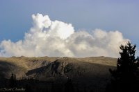
7/10
The next day dawned nice, some high clouds that I’ve learned mean afternoon weather but fine for now. My plan was to explore the basin and see what I could find.
Heading south I first patrolled around the Cliff Lake area. It is amazing how popular that area is for camping but I can never find signs of camps. It is one of those areas (really the whole Sheepherder Basin) that motivates me as a wilderness ranger. Pristine, lots of opportunity for solitude, it shows what the wilderness can be, should be. It’s what I serve to protect.
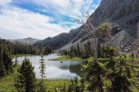
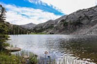
Anyhoo, I’ve always been fascinated by the bowl above Cliff Lake where Crater Lake sits. It beckons as a cool spot that isn’t easy to reach. So… I headed up the cliff to Crater Lake. There was enough of a bouldery break to get up there, but lots of that “world falling away” feeling. Probably the steepest adventure I’ve had in the Bighorns.
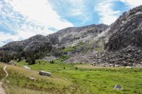
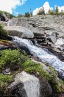
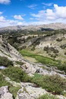
Sure enough, Crater Lake was gorgeous, and signs of damage were old. It was pretty nice.
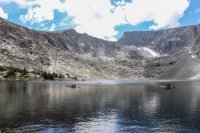
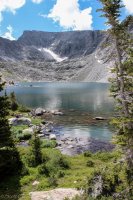
After my time at Crater, and finding my way down, I headed to Lake Elsa. Its one of my favorite places in the CPW, for obvious reasons. I also found it in nice shape, although it is sad that people concentrate their camps so much.
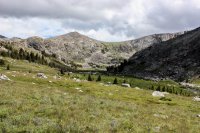
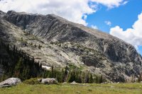
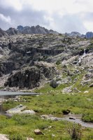
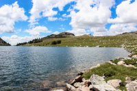
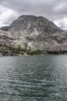
I decided that I had enough time, and still nice enough weather to adventure above Elsa, to the “Birthday Lakes.” I’m not sure if that is their official name, but it’s what we have on the map in the office. It was pretty cool up there, and given more time I will walk around up there more, but a nasty wind picked up and I was getting to that hour where turning back towards camp was due.
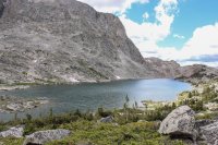
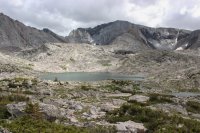
On the way back it rained briefly, but that nasty wind decided to stick around. I was in bed by 1830 because the chill was horrid.
7/11
In the beginning of summer we have to collect a water sample from Emerald Lake, across a divide from the Sheepherder Basin. Luckily the hike over Spear to Emerald isn’t that bad, at least it wasn’t last year. This year it was one of those experiences that makes me seriously doubt why I am a wilderness ranger. Winds were easily cresting the 30’s and wind chill was probably below that, despite a glaring sun and my bubble suit of a government issue weather jacket. I was weather veining, over boulder fields, while regretting all the elevation challenging adventures of the day before.
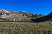
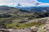
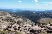
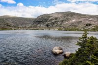
I couldn’t have been happier when Emerald Lake and its brothers appeared in the basin and I headed down.
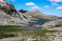
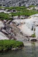
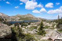
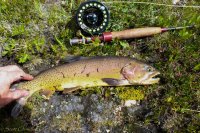
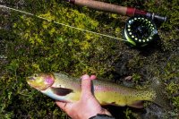
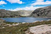
I pretty much spent the rest of the day around Emerald. Long hours the weekend before meant I had a short day and so I took the patrol fairly easily. I met a surprising amount of groups up there, one of which couldn’t seem to think for themselves as they asked A LOT of questions and ended up camping next to my secluded campsite (I have choice words for people like this) but aside from that the time was great. Yeah, it was windy, but it was manageable. The wind even helped with some fly fishing.
7/12
The next day dawned ugly. Windier, greyer, chilly. I quickly grabbed the water sample and headed over the pass and back toward the trailhead.
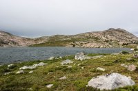
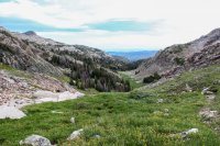
Sure enough, within thirty minutes things cleared up a bit and below the pass the wind was fine so I got adventurous. The last time I hiked this trail I ran down it, all excited with my first water sample, so I didn’t enjoy it much. This time I took my time, and visited an off trail lake that I’ve heard of people going to to fish: Lake Golden. Carefully orienteering I struck off through the trees and eventually found myself above the lake and in a nasty area of krummholtz and ledges. Some struggle ensued and I reached the foot of the lake. It was nice, but I’ll have to visit again when the lake isn’t whitecapping like the ocean because of the gale blowing over Spear.
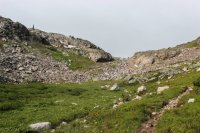
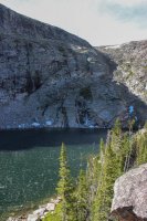
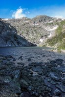
Because I didn’t really like the end of my way in, and it looked like this area was very popular in the past I figured I could find a better way out. Thus ensued one of the worst off trail adventures of my life. There have been many times in the desert, usually associated with canyoneering in which I knew the road was “that way” and I just went. I consider those moments as 80% lost. You have no idea where you are, but you know if you go that way you’ll reach some spot that you do know. This was one of those moments, and may have been more like 90% because the terrain was horrible. Thick forest, lots of downfall, ledges, marshes, creeks, trees that grab your pack as you’re downclimbing a ledge and the ensuing freeing of pack results in a 5 foot fall that feels like 20… It wasn’t awesome. But sure enough I hit the trail.
The rest of the hike was pretty slick. I visited Devil’s Lake, ran into a couple NOLS groups, and cut a few down trees out of the trail. Thankfully no drama, well until the drive back. Nearly had three wrecks with idiots speeding around blind curves (this is NOT an exaggeration) and a few other close calls. In the wilderness the north end is awesome, out...is another story.
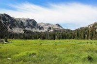
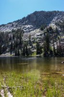
So yeah. Kinda a bipolar weekend. Pretty, solitary, bad weather, idiots (including myself a few times.) Overall pretty nice. I hope y’all enjoyed.
The job of a wilderness ranger varies a lot. Sometimes it is pretty rough (like the 4th of July weekend… rain, horses, long days…) and other times it can be downright pleasant. Here at the Cloud Peak Wilderness, I find the opportunities to visit the northern end fall into the latter, and while this weekend had its moments, the time I got to spend up there was downright nice.
I started out heading up the trail towards Geneva Pass. Looking at the weather I was unsure of how far I would make it before the weather would force me to settle in. The high country and passes are not a place to be running around when a lingering cold front is dropping lightning all around your Pulaski and radio equipped self.
I’m amazed how few pictures I take on the hike up this trail. It’s not that it isn’t pretty or interesting, I guess it’s just not of documenting/sharing quality.

Sure enough, by the time I reached Lake Geneva, I had the dreaded scenario unfolding, flash bangs that raise the hair. Thankfully the lake is nestled in a bowl with lots of big trees. I also got to put my attractive gear down as I patrolled the shoreline.


Finding the lake in shockingly nice condition, I decided to bump up at least to Crystal Lake. It is higher but still has enough tree cover to not feel too freaky with the storms. By the time I got there though, the storm had moved off and things were looking nice. After a nice contact with a group at Crystal I decided to bump over the pass into the Sheepherder Basin.

Sadly the contact at Crystal made me pass a gorgeous photo opportunity. Flowers going bonkers in the meadow with the lake and dramatic wall behind it…Y’all will just have to imagine. It wasn’t until I neared the pass that I pulled my camera out again to document the pretty.
Well sure enough, the clearing was another classic Bighorn Sucker Hole. As I cleared the pass I got rain. Luckily, thunder hadn’t formed up again but I hurried along. I did not have much of a plan for where to camp that night, not thinking I’d really make it this far, but remembered cooings from my boss about how nice Granite Lake is saw me headed there. Sure enough I found a nice spot on a granite ledge by the lake with epic views of the mountains. It rivals the camp spot I had last year in Highland Park as best I’ve had out here (maybe it was better just because nice water was nearby.)


The storm opened up enough for me to cook dinner but dumped hail and rain and lightning while I cowered under a tree for about half of eating it. Getting the sense it wouldn’t let up for a bit I retreated to the tent, but not for the whole evening. I popped out long enough to watch some evening glow upon high, before settling in to sleep.


7/10
The next day dawned nice, some high clouds that I’ve learned mean afternoon weather but fine for now. My plan was to explore the basin and see what I could find.
Heading south I first patrolled around the Cliff Lake area. It is amazing how popular that area is for camping but I can never find signs of camps. It is one of those areas (really the whole Sheepherder Basin) that motivates me as a wilderness ranger. Pristine, lots of opportunity for solitude, it shows what the wilderness can be, should be. It’s what I serve to protect.


Anyhoo, I’ve always been fascinated by the bowl above Cliff Lake where Crater Lake sits. It beckons as a cool spot that isn’t easy to reach. So… I headed up the cliff to Crater Lake. There was enough of a bouldery break to get up there, but lots of that “world falling away” feeling. Probably the steepest adventure I’ve had in the Bighorns.


Sure enough, Crater Lake was gorgeous, and signs of damage were old. It was pretty nice.


After my time at Crater, and finding my way down, I headed to Lake Elsa. Its one of my favorite places in the CPW, for obvious reasons. I also found it in nice shape, although it is sad that people concentrate their camps so much.


I decided that I had enough time, and still nice enough weather to adventure above Elsa, to the “Birthday Lakes.” I’m not sure if that is their official name, but it’s what we have on the map in the office. It was pretty cool up there, and given more time I will walk around up there more, but a nasty wind picked up and I was getting to that hour where turning back towards camp was due.


On the way back it rained briefly, but that nasty wind decided to stick around. I was in bed by 1830 because the chill was horrid.
7/11
In the beginning of summer we have to collect a water sample from Emerald Lake, across a divide from the Sheepherder Basin. Luckily the hike over Spear to Emerald isn’t that bad, at least it wasn’t last year. This year it was one of those experiences that makes me seriously doubt why I am a wilderness ranger. Winds were easily cresting the 30’s and wind chill was probably below that, despite a glaring sun and my bubble suit of a government issue weather jacket. I was weather veining, over boulder fields, while regretting all the elevation challenging adventures of the day before.


I couldn’t have been happier when Emerald Lake and its brothers appeared in the basin and I headed down.


I pretty much spent the rest of the day around Emerald. Long hours the weekend before meant I had a short day and so I took the patrol fairly easily. I met a surprising amount of groups up there, one of which couldn’t seem to think for themselves as they asked A LOT of questions and ended up camping next to my secluded campsite (I have choice words for people like this) but aside from that the time was great. Yeah, it was windy, but it was manageable. The wind even helped with some fly fishing.


7/12
The next day dawned ugly. Windier, greyer, chilly. I quickly grabbed the water sample and headed over the pass and back toward the trailhead.


Sure enough, within thirty minutes things cleared up a bit and below the pass the wind was fine so I got adventurous. The last time I hiked this trail I ran down it, all excited with my first water sample, so I didn’t enjoy it much. This time I took my time, and visited an off trail lake that I’ve heard of people going to to fish: Lake Golden. Carefully orienteering I struck off through the trees and eventually found myself above the lake and in a nasty area of krummholtz and ledges. Some struggle ensued and I reached the foot of the lake. It was nice, but I’ll have to visit again when the lake isn’t whitecapping like the ocean because of the gale blowing over Spear.


Because I didn’t really like the end of my way in, and it looked like this area was very popular in the past I figured I could find a better way out. Thus ensued one of the worst off trail adventures of my life. There have been many times in the desert, usually associated with canyoneering in which I knew the road was “that way” and I just went. I consider those moments as 80% lost. You have no idea where you are, but you know if you go that way you’ll reach some spot that you do know. This was one of those moments, and may have been more like 90% because the terrain was horrible. Thick forest, lots of downfall, ledges, marshes, creeks, trees that grab your pack as you’re downclimbing a ledge and the ensuing freeing of pack results in a 5 foot fall that feels like 20… It wasn’t awesome. But sure enough I hit the trail.
The rest of the hike was pretty slick. I visited Devil’s Lake, ran into a couple NOLS groups, and cut a few down trees out of the trail. Thankfully no drama, well until the drive back. Nearly had three wrecks with idiots speeding around blind curves (this is NOT an exaggeration) and a few other close calls. In the wilderness the north end is awesome, out...is another story.


So yeah. Kinda a bipolar weekend. Pretty, solitary, bad weather, idiots (including myself a few times.) Overall pretty nice. I hope y’all enjoyed.

