IntrepidXJ
ADVENTR
- Joined
- Jan 17, 2012
- Messages
- 3,493
Southern Utah Wanderings | Canyons of the Escalante
Wednesday & Thursday, October 8-9, 2014
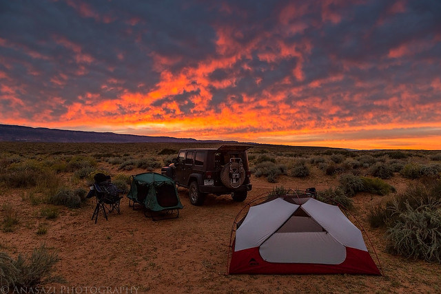
Wednesday morning arrived with another beautiful sunrise from our campsite on Fortymile Ridge. Today we would be starting an overnight backpacking trip into Coyote Gulch. This is a popular backpacking destination in the area, and for good reason since it's a beautiful hike. I had planned to do this hike in the middle of the week so it hopefully wouldn't be as crowded as a weekend, and I think it ended up working well for us.
The clouds above begin to change color as the sun nears the horizon.
Dawn by IntrepidXJ, on Flickr
The Straight Cliffs in the distance light up nicely with a magenta glow.
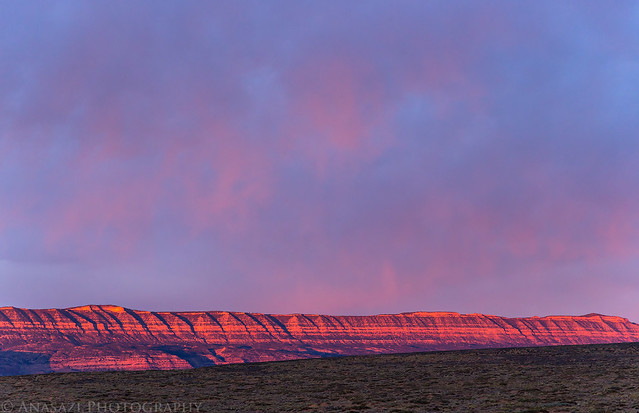
Straight Cliffs Sunrise by IntrepidXJ, on Flickr
After a quick breakfast, we packed up camp and checked to make sure we had everything in our backpacks that we would need for the next two days. I dropped Jared and our packs off at the Crack in the Wall trailhead and drove my Jeep back down the road to park it near the trailhead next to the water tank where we would return the following day. Then I hiked back about two and a half miles to meet Jared and we started our journey into Coyote Gulch.
A nice view of Navajo Mountain as I drove down the road.
Navajo Mountain by IntrepidXJ, on Flickr
Hiking along the road back to the trailhead after dropping my Jeep off.
Road Walking by IntrepidXJ, on Flickr
The clouds in the sky were pretty nice this morning, but unfortunately that wouldn't last very long. As soon as we reached the Crack in the Wall at the rim of the canyon the sky was overcast and would stay that way for the remainder of the day. The conditions were not the best for photography, but I did the best I could. I also had decided to save weight and leave my tripod in the Jeep for this trip, and there were times I wish I had had it with me. I guess that means I'll have to return again in the future so I can take some better photos. That's not a bad thing!
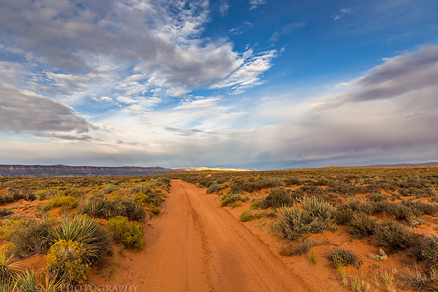
Hiking along the wide trail towards the Crack in the Wall.
To the Crack by IntrepidXJ, on Flickr
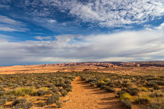
Nice clouds above the desert landscape.
Desert Clouds by IntrepidXJ, on Flickr
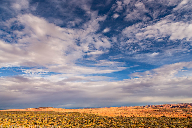
Overcast skies as we reached the rim of the canyon.
Above the Escalante by IntrepidXJ, on Flickr
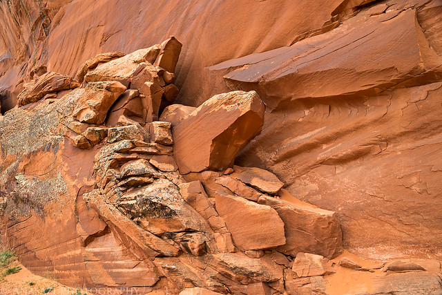
The descent down the Crack in the Wall was easy enough, but I think it would have been more difficult for me coming up this way. We managed to drag our backpacks through the first two narrow sections but had to lower them down before the third. Luckily, I had just enough rope with me to do that. After squeezing through the narrow slots, we continued down the large sand dune to the bottom of the canyon. I certainly wouldn't enjoy hiking back up this soft sand dune in the heat of the day and was glad that we decided to come down this way instead.
That's the beginning of the Crack in the Wall below, and the large sand dune we would be descending.
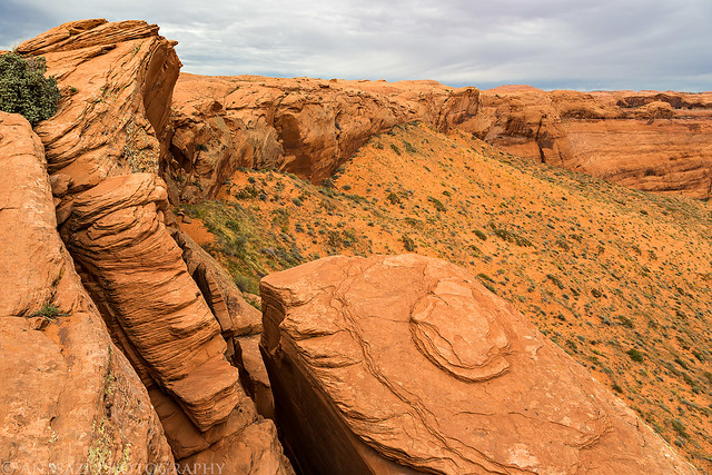
Crack & Dune by IntrepidXJ, on Flickr
Jared in the crack.
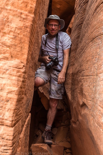
In the Crack by IntrepidXJ, on Flickr
Looking through one of the narrow slots.
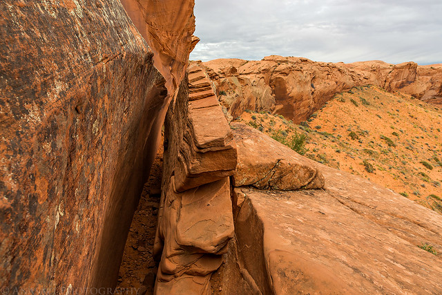
Crack in the Wall by IntrepidXJ, on Flickr
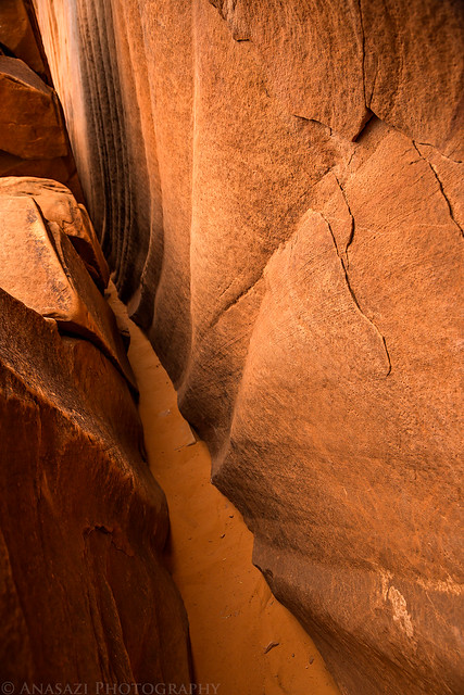
Crack Path by IntrepidXJ, on Flickr
The exit.
Crack Exit by IntrepidXJ, on Flickr
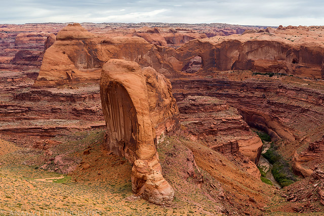
We took a short side hike to get a different view of Stevens Arch. While we were here the sun peeked out briefly from behind the clouds before disappearing again for the rest of the day.
Brief Light by IntrepidXJ, on Flickr
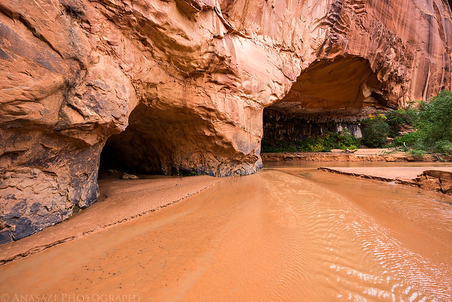
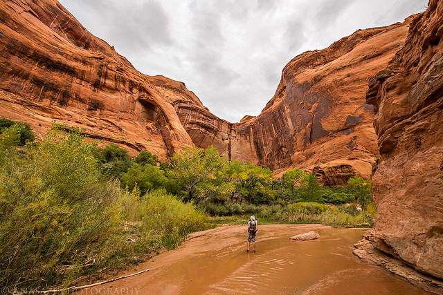
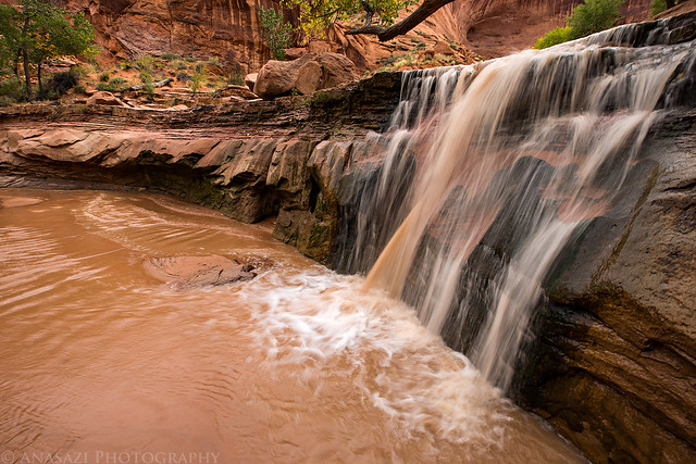
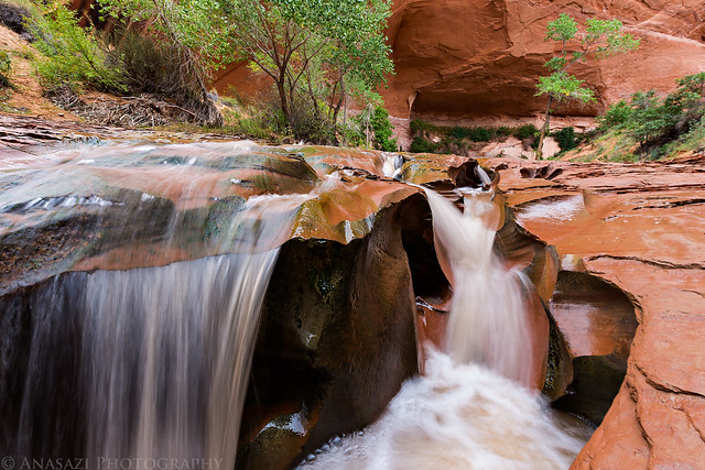
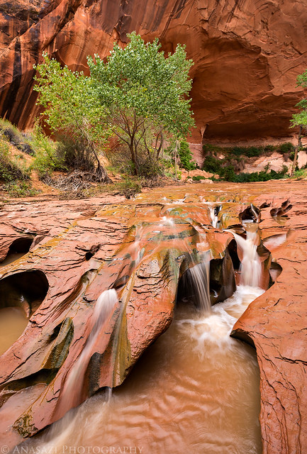
When we reached the bottom of Coyote Gulch, we took off our boots and put on our sandals since we would be mostly hiking through the creek. We passed a few waterfalls and arches along the way. It really was a beautiful and pleasant hike. I can see why so many people like this area.

Lower Coyote Gulch by IntrepidXJ, on Flickr
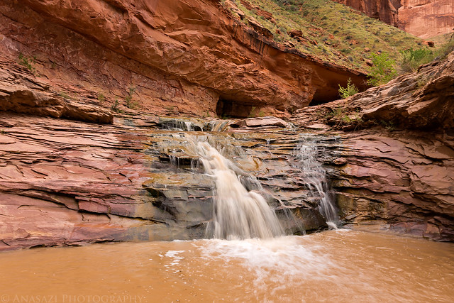
First Waterfall by IntrepidXJ, on Flickr
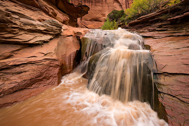
Second Waterfall by IntrepidXJ, on Flickr
Alcoves by IntrepidXJ, on Flickr
Jared stops to take a photo of Cliff Arch.
Photographing Cliff Arch by IntrepidXJ, on Flickr
Tree Falls by IntrepidXJ, on Flickr
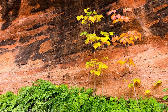
Colors by IntrepidXJ, on Flickr
We climbed up to a large alcove to visit these pictographs along the way.

Coyote Gulch Pictographs by IntrepidXJ, on Flickr
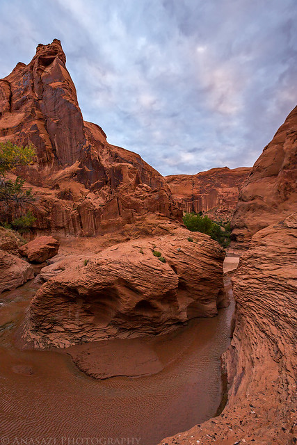
The creek flowing through Coyote Natural Bridge was a cool sight.
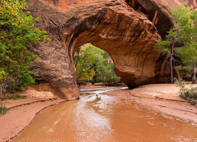
Coyote Natural Bridge by IntrepidXJ, on Flickr
Jared walking through the Choke Point. The deepest water we would walk through on the hike. Please excuse the water drops in this photo, I had apparently splashed some water onto my lens when I hiked through...
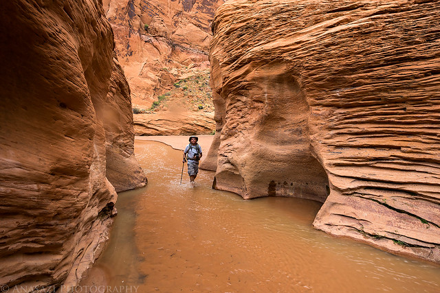
Choke Point by IntrepidXJ, on Flickr
Closeup by IntrepidXJ, on Flickr
We decided to setup camp in a very large alcove just upstream from Swiss Cheese Falls. We still had plenty of daylight left after camp was setup, so we continued on to Jacob Hamblin Arch so we could get some water from the nearby spring and check out the possible exit route. The steep exit at this point was just too sketchy for me, so we decided not to leave that way and that we would find a way out of Hurricane Wash instead.
Swiss Cheese Falls. Our campsite was up in the large alcove hidden behind the cottonwood trees in this photo.
Swiss Cheese Falls by IntrepidXJ, on Flickr
Our tents in the huge alcove.
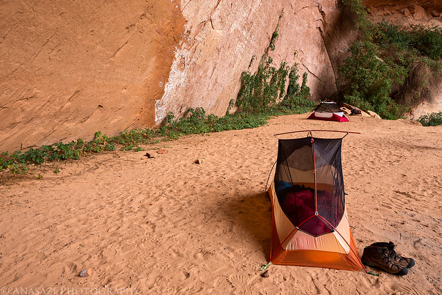
Alcove Camp by IntrepidXJ, on Flickr
After returning back to camp we had some dinner and then watched the sky slightly change color at sunset.
Slight Sunset by IntrepidXJ, on Flickr
I slept well that night and was surprised that it didn't really get cold overnight. I was worried about hiking in the water in colder temperatures in the morning, but that turned out not to be an issue since the air temperature was pleasant.
The clouds starting to finally dissipate at sunrise
Sunrise Near Camp by IntrepidXJ, on Flickr
Sunrise over the Choke Point.
Choke Point Sunrise by IntrepidXJ, on Flickr
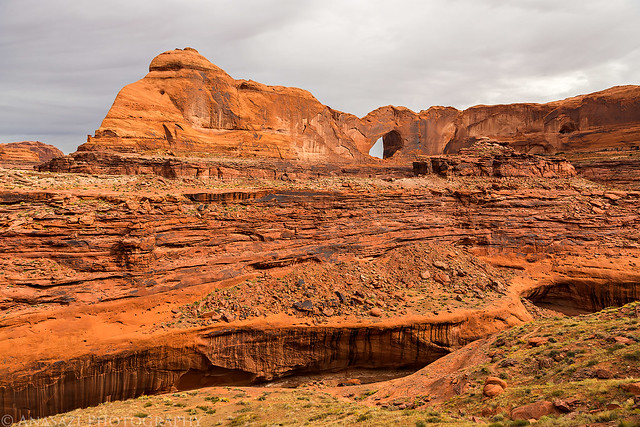
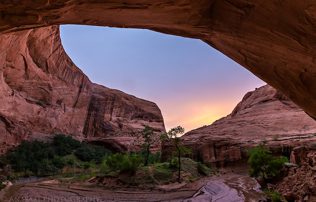
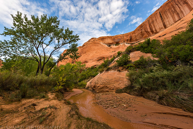
We packed up camp and started hiking back up the canyon past Jacob Hamblin Arch and then through the large alcove towards Hurricane Wash. I was kind of glad that we went this way instead of exiting near Jacob Hamblin Arch since this part of the canyon was still very beautiful and we would have missed it.
A view of the impressive Jacob Hamblin Arch.
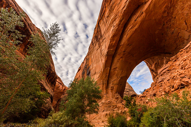
Jacob Hamblin Arch by IntrepidXJ, on Flickr
Looking out from the massive alcove past the arch. While it's not as deep as the Mee Canyon Alcove, it's certainly much higher!
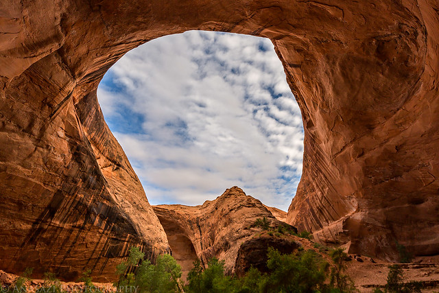
Big Alcove by IntrepidXJ, on Flickr
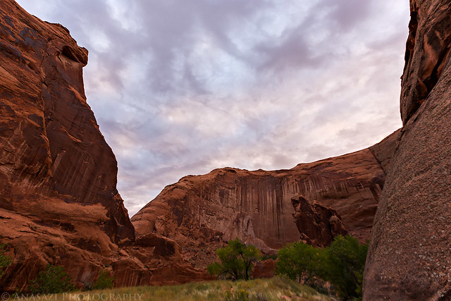
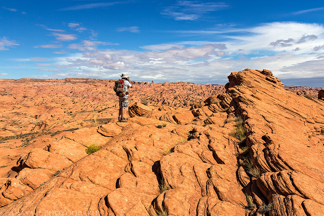
We finally started to see some blue sky as we neared the confluence with Hurricane Wash.
Blue Sky by IntrepidXJ, on Flickr
Along the Wall by IntrepidXJ, on Flickr
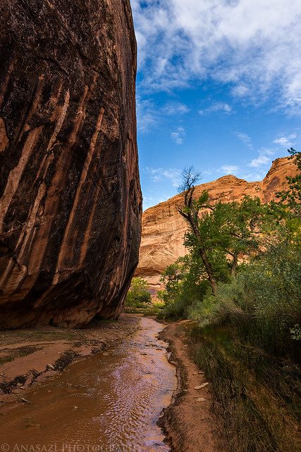
After hiking up Hurricane Wash for a little over a mile we traded our sandals for our boots again and found a way out of the canyon so we could hike cross-country back to my Jeep.
View of the Straight Cliffs as we climbed out of Hurricane Wash.
Back to the Top by IntrepidXJ, on Flickr
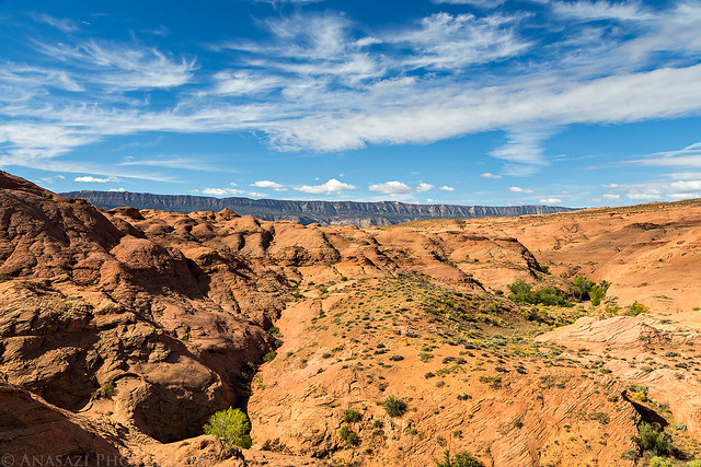
A vast expanse of slickrock in this area.
Sandstoneland by IntrepidXJ, on Flickr
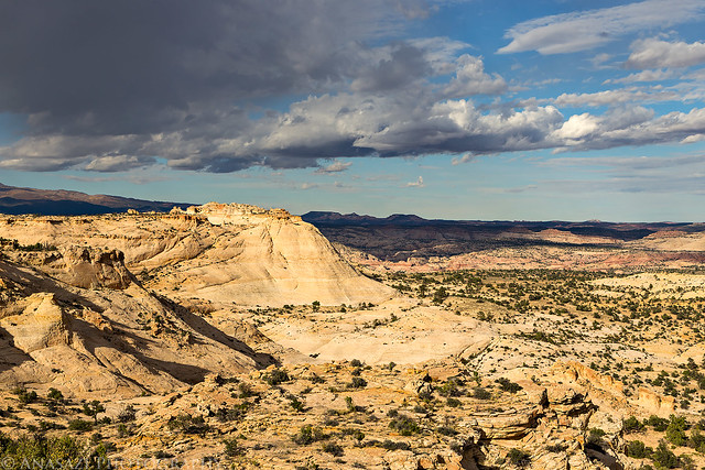
We reached my Jeep at the water tank in the early afternoon and were happy to take our packs off. The round trip loop was about 18 miles according to my GPS, which includes my hike down the road the previous morning. After having some cold drinks from the cooler I realized that we were going to have to head back to town for more ice since the cooler wouldn't make it another night. We drove back down the Hole-in-the-Rock Road to Escalante for fuel, supplies and dinner. We had no other plans for the rest of the day, so we drove around and visited a few spots until we found a campsite near Harris Wash for the night.
We visited the Circle of Life pictographs...

Circle of Life by IntrepidXJ, on Flickr
Stopped at the Head of the Rocks Overlook....
Head of the Rocks by IntrepidXJ, on Flickr
...and drove a short distance down Old Sheffield Road.
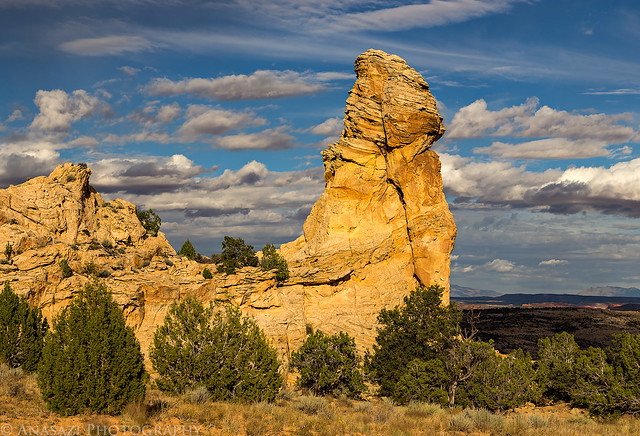
Spire by IntrepidXJ, on Flickr
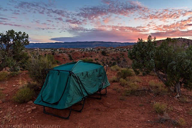
We found a nice campsite high on a ridge above Harris Wash and were treated to another nice sunset.
Great clouds over the Straight Cliffs.
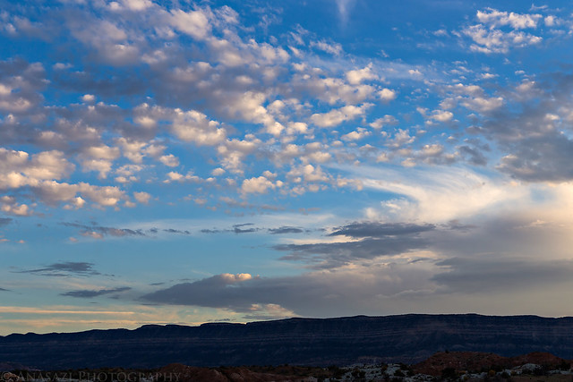
Nice Clouds by IntrepidXJ, on Flickr
Jared had a great view from his tent towards the Henry Mountains.
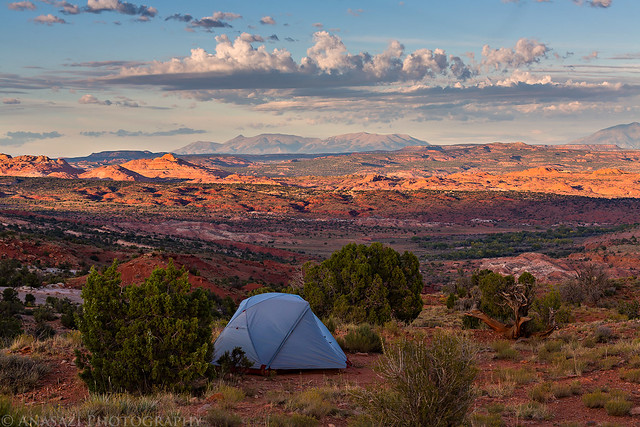
View from Camp by IntrepidXJ, on Flickr
I always like warm evening light on sandstone.
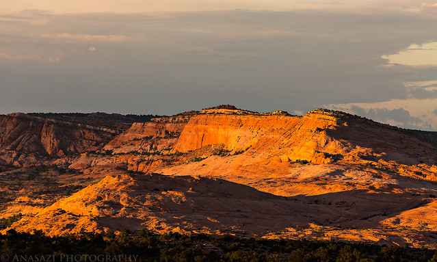
Golden Light by IntrepidXJ, on Flickr
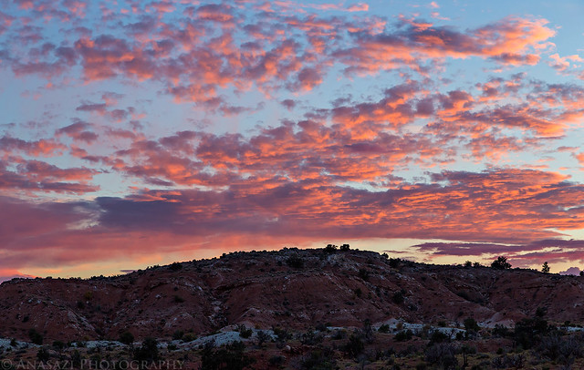
Couldn't get enough of the clouds overhead.
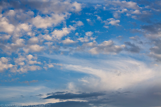
Cloudscape by IntrepidXJ, on Flickr
Long lens pointed at the Henry Mountains at sunset.
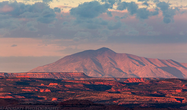
Camp Sunset by IntrepidXJ, on Flickr
Crepuscular rays as the sun set behind the Kaiparowits Plateau.
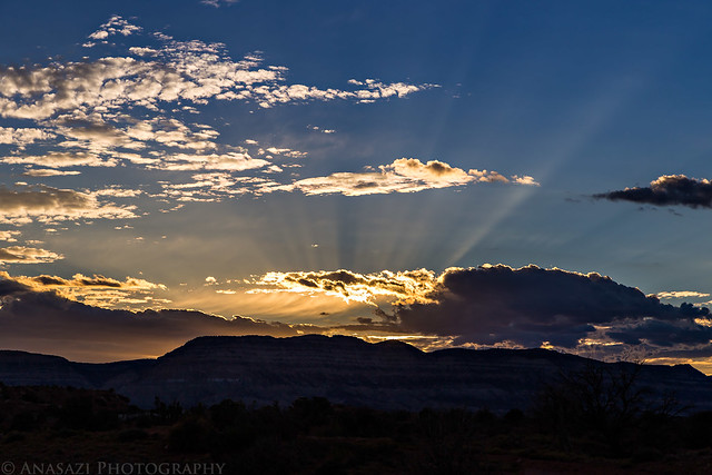
Clouds & Rays by IntrepidXJ, on Flickr
Getting a little abstract with the clouds.
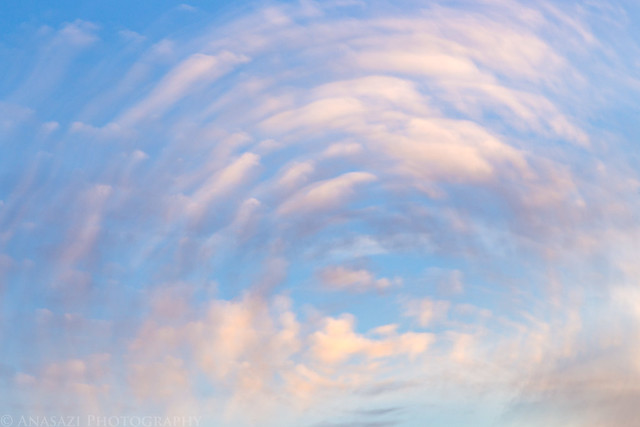
Twisted Sky by IntrepidXJ, on Flickr
The view from my tent wasn't half bad, either!
Harris Wash Camp by IntrepidXJ, on Flickr
What a Sky! by IntrepidXJ, on Flickr
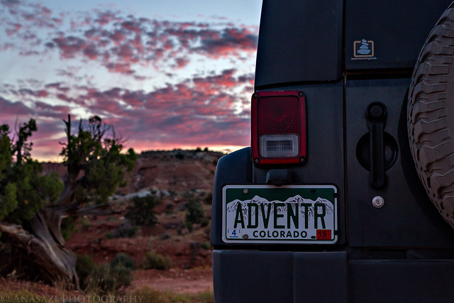
ADVENTR Sunset by IntrepidXJ, on Flickr
>> Coyote Gulch Photo Gallery
>> The Original Trip Report on ADVENTR.CO
Featured image for home page:

Wednesday & Thursday, October 8-9, 2014
Wednesday morning arrived with another beautiful sunrise from our campsite on Fortymile Ridge. Today we would be starting an overnight backpacking trip into Coyote Gulch. This is a popular backpacking destination in the area, and for good reason since it's a beautiful hike. I had planned to do this hike in the middle of the week so it hopefully wouldn't be as crowded as a weekend, and I think it ended up working well for us.
The clouds above begin to change color as the sun nears the horizon.
Dawn by IntrepidXJ, on Flickr
The Straight Cliffs in the distance light up nicely with a magenta glow.
Straight Cliffs Sunrise by IntrepidXJ, on Flickr
After a quick breakfast, we packed up camp and checked to make sure we had everything in our backpacks that we would need for the next two days. I dropped Jared and our packs off at the Crack in the Wall trailhead and drove my Jeep back down the road to park it near the trailhead next to the water tank where we would return the following day. Then I hiked back about two and a half miles to meet Jared and we started our journey into Coyote Gulch.
A nice view of Navajo Mountain as I drove down the road.
Navajo Mountain by IntrepidXJ, on Flickr
Hiking along the road back to the trailhead after dropping my Jeep off.
Road Walking by IntrepidXJ, on Flickr
The clouds in the sky were pretty nice this morning, but unfortunately that wouldn't last very long. As soon as we reached the Crack in the Wall at the rim of the canyon the sky was overcast and would stay that way for the remainder of the day. The conditions were not the best for photography, but I did the best I could. I also had decided to save weight and leave my tripod in the Jeep for this trip, and there were times I wish I had had it with me. I guess that means I'll have to return again in the future so I can take some better photos. That's not a bad thing!
Hiking along the wide trail towards the Crack in the Wall.
To the Crack by IntrepidXJ, on Flickr
Nice clouds above the desert landscape.
Desert Clouds by IntrepidXJ, on Flickr
Overcast skies as we reached the rim of the canyon.
Above the Escalante by IntrepidXJ, on Flickr
The descent down the Crack in the Wall was easy enough, but I think it would have been more difficult for me coming up this way. We managed to drag our backpacks through the first two narrow sections but had to lower them down before the third. Luckily, I had just enough rope with me to do that. After squeezing through the narrow slots, we continued down the large sand dune to the bottom of the canyon. I certainly wouldn't enjoy hiking back up this soft sand dune in the heat of the day and was glad that we decided to come down this way instead.
That's the beginning of the Crack in the Wall below, and the large sand dune we would be descending.
Crack & Dune by IntrepidXJ, on Flickr
Jared in the crack.
In the Crack by IntrepidXJ, on Flickr
Looking through one of the narrow slots.
Crack in the Wall by IntrepidXJ, on Flickr
Crack Path by IntrepidXJ, on Flickr
The exit.
Crack Exit by IntrepidXJ, on Flickr
We took a short side hike to get a different view of Stevens Arch. While we were here the sun peeked out briefly from behind the clouds before disappearing again for the rest of the day.
Brief Light by IntrepidXJ, on Flickr
When we reached the bottom of Coyote Gulch, we took off our boots and put on our sandals since we would be mostly hiking through the creek. We passed a few waterfalls and arches along the way. It really was a beautiful and pleasant hike. I can see why so many people like this area.
Lower Coyote Gulch by IntrepidXJ, on Flickr
First Waterfall by IntrepidXJ, on Flickr
Second Waterfall by IntrepidXJ, on Flickr
Alcoves by IntrepidXJ, on Flickr
Jared stops to take a photo of Cliff Arch.
Photographing Cliff Arch by IntrepidXJ, on Flickr
Tree Falls by IntrepidXJ, on Flickr
Colors by IntrepidXJ, on Flickr
We climbed up to a large alcove to visit these pictographs along the way.
Coyote Gulch Pictographs by IntrepidXJ, on Flickr
The creek flowing through Coyote Natural Bridge was a cool sight.
Coyote Natural Bridge by IntrepidXJ, on Flickr
Jared walking through the Choke Point. The deepest water we would walk through on the hike. Please excuse the water drops in this photo, I had apparently splashed some water onto my lens when I hiked through...
Choke Point by IntrepidXJ, on Flickr
Closeup by IntrepidXJ, on Flickr
We decided to setup camp in a very large alcove just upstream from Swiss Cheese Falls. We still had plenty of daylight left after camp was setup, so we continued on to Jacob Hamblin Arch so we could get some water from the nearby spring and check out the possible exit route. The steep exit at this point was just too sketchy for me, so we decided not to leave that way and that we would find a way out of Hurricane Wash instead.
Swiss Cheese Falls. Our campsite was up in the large alcove hidden behind the cottonwood trees in this photo.
Swiss Cheese Falls by IntrepidXJ, on Flickr
Our tents in the huge alcove.
Alcove Camp by IntrepidXJ, on Flickr
After returning back to camp we had some dinner and then watched the sky slightly change color at sunset.
Slight Sunset by IntrepidXJ, on Flickr
I slept well that night and was surprised that it didn't really get cold overnight. I was worried about hiking in the water in colder temperatures in the morning, but that turned out not to be an issue since the air temperature was pleasant.
The clouds starting to finally dissipate at sunrise
Sunrise Near Camp by IntrepidXJ, on Flickr
Sunrise over the Choke Point.
Choke Point Sunrise by IntrepidXJ, on Flickr
We packed up camp and started hiking back up the canyon past Jacob Hamblin Arch and then through the large alcove towards Hurricane Wash. I was kind of glad that we went this way instead of exiting near Jacob Hamblin Arch since this part of the canyon was still very beautiful and we would have missed it.
A view of the impressive Jacob Hamblin Arch.
Jacob Hamblin Arch by IntrepidXJ, on Flickr
Looking out from the massive alcove past the arch. While it's not as deep as the Mee Canyon Alcove, it's certainly much higher!
Big Alcove by IntrepidXJ, on Flickr
We finally started to see some blue sky as we neared the confluence with Hurricane Wash.
Blue Sky by IntrepidXJ, on Flickr
Along the Wall by IntrepidXJ, on Flickr
After hiking up Hurricane Wash for a little over a mile we traded our sandals for our boots again and found a way out of the canyon so we could hike cross-country back to my Jeep.
View of the Straight Cliffs as we climbed out of Hurricane Wash.
Back to the Top by IntrepidXJ, on Flickr
A vast expanse of slickrock in this area.
Sandstoneland by IntrepidXJ, on Flickr
We reached my Jeep at the water tank in the early afternoon and were happy to take our packs off. The round trip loop was about 18 miles according to my GPS, which includes my hike down the road the previous morning. After having some cold drinks from the cooler I realized that we were going to have to head back to town for more ice since the cooler wouldn't make it another night. We drove back down the Hole-in-the-Rock Road to Escalante for fuel, supplies and dinner. We had no other plans for the rest of the day, so we drove around and visited a few spots until we found a campsite near Harris Wash for the night.
We visited the Circle of Life pictographs...
Circle of Life by IntrepidXJ, on Flickr
Stopped at the Head of the Rocks Overlook....
Head of the Rocks by IntrepidXJ, on Flickr
...and drove a short distance down Old Sheffield Road.
Spire by IntrepidXJ, on Flickr
We found a nice campsite high on a ridge above Harris Wash and were treated to another nice sunset.
Great clouds over the Straight Cliffs.
Nice Clouds by IntrepidXJ, on Flickr
Jared had a great view from his tent towards the Henry Mountains.
View from Camp by IntrepidXJ, on Flickr
I always like warm evening light on sandstone.
Golden Light by IntrepidXJ, on Flickr
Couldn't get enough of the clouds overhead.
Cloudscape by IntrepidXJ, on Flickr
Long lens pointed at the Henry Mountains at sunset.
Camp Sunset by IntrepidXJ, on Flickr
Crepuscular rays as the sun set behind the Kaiparowits Plateau.
Clouds & Rays by IntrepidXJ, on Flickr
Getting a little abstract with the clouds.
Twisted Sky by IntrepidXJ, on Flickr
The view from my tent wasn't half bad, either!
Harris Wash Camp by IntrepidXJ, on Flickr
What a Sky! by IntrepidXJ, on Flickr
ADVENTR Sunset by IntrepidXJ, on Flickr
>> Coyote Gulch Photo Gallery
>> The Original Trip Report on ADVENTR.CO
Featured image for home page: