Coyote Gulch trip May 20-23

Eric_LV Hiker

Member
Joined
May 1, 2016
Messages
7
Hello,

I am planning a 3 day, 2 night trip to Coyote Gulch at the end of the month. I will be entering through the crack in the wall and exiting through Jacob Hamblin. I was wondering about info in regards to weather conditions at that time of the month and what exactly the mileage from crack in the wall to the exit at JHA. Also, places to see. I've heard about ancient Indian ruins and a place called black lagoon to go swimming. Any information would be greatly appreciated! Thank you!
 
Weather can be all over the place that time of year, but if it's nice out, it'll be quite hot. Carry plenty of water. Can't do much but wait and see the forecast when it's close to your trip though. Ruins is a generous term if it's what I'm thinking of. The site with the rock art and some other small things is just up canyon from the 'black lagoon' on the same side. Look for a trail heading up a talus slope. There will probably be people around that will cue you in.
 
Weather can be all over the place that time of year, but if it's nice out, it'll be quite hot. Carry plenty of water. Can't do much but wait and see the forecast when it's close to your trip though. Ruins is a generous term if it's what I'm thinking of. The site with the rock art and some other small things is just up canyon from the 'black lagoon' on the same side. Look for a trail heading up a talus slope. There will probably be people around that will cue you in.

That sounds like something to see. Thanks for the info.
 
Those ruins make for a nice spot to take a break. Most of my buddies have the centipede guy that's painted there tattoo'd on them somewhere.

I finished all my whisky and passed out prior to the tattoo session lol.

Both the lagoon and the ruins are in the same area, you'll see the trail off to the lagoon on your right prior to the ruins, also on your right, if you are coming up canyon from Hole-in-the-rock.

I wouldn't swim in that lagoon for anything, looks super gnarly and probably full of all kinds of creepy stuff.
 
Hello,

I am planning a 3 day, 2 night trip to Coyote Gulch at the end of the month. I will be entering through the crack in the wall and exiting through Jacob Hamblin. I was wondering about info in regards to weather conditions at that time of the month and what exactly the mileage from crack in the wall to the exit at JHA. Also, places to see. I've heard about ancient Indian ruins and a place called black lagoon to go swimming. Any information would be greatly appreciated! Thank you!

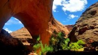
I was there the last weekend in May last year, and the weather was perfect. Hot in the dessert and warm in the gulch. I wished I had brought a sweatshirt for sleeping, but I wasn't miserably cold. Of course, weather can be different each year.
 
Hello,

I am planning a 3 day, 2 night trip to Coyote Gulch at the end of the month. I will be entering through the crack in the wall and exiting through Jacob Hamblin. I was wondering about info in regards to weather conditions at that time of the month and what exactly the mileage from crack in the wall to the exit at JHA. Also, places to see. I've heard about ancient Indian ruins and a place called black lagoon to go swimming. Any information would be greatly appreciated! Thank you!
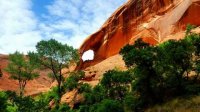
The black lagoon is stagnant, we jumped and got right out. Down from the lagoon, a few miles, is a waterfall. You can't swim in it. But when we were there it was the perfect amount to lay in half in the water half out and stayed perfect warm.
 
The black lagoon is stagnant, we jumped and got right out. Down from the lagoon, a few miles, is a waterfall. You can't swim in it. But when we were there it was the perfect amount to lay in half in the water half out and stayed perfect warm.

Thank you all for the posts. One more question, does hole in the wall road end at crack in the wall TH or does it keep going? Also, I plan on having a car at crack in the wall where we start and another at the water tank where we will exit but if I can't get my friends car how far is it from the 2 in case we have to walk back down the road?
 
Thank you all for the posts. One more question, does hole in the wall road end at crack in the wall TH or does it keep going? Also, I plan on having a car at crack in the wall where we start and another at the water tank where we will exit but if I can't get my friends car how far is it from the 2 in case we have to walk back down the road?
Oh I'm not quite sure. We did a round trip from Hurricane Wash (which I enjoyed). I believe crack in the wall starts from the Fortymile Ridge Trailhead, but I don't if the road dead ends there.
 
Thank you all for the posts. One more question, does hole in the wall road end at crack in the wall TH or does it keep going? Also, I plan on having a car at crack in the wall where we start and another at the water tank where we will exit but if I can't get my friends car how far is it from the 2 in case we have to walk back down the road?

The Fortymile Ridge Road dead-ends at the Crack-in-the-Wall Trailhead. The Hole-in-the-Rock Road continues on past the Fortymile Ridge Road.

If I remember correctly, the distance between the water tank and the end of the road was about 2 miles. I left my vehicle at the water tank and hiked to the end of the road when I did the hike.
 
Just hiked Coyote Gulch 2 days ago.

It is 2.6 miles from the Crack in the Wall trailhead to the water tanks. The short side road up to the water tanks is in very rough condition and only suited for high clearance vehicles.

Despite what you may have read elsewhere, a fully loaded pack WILL NOT fit through the crack....and I don't mean while you are wearing it. You will have to lower it by rope from above. Take at least 50' of rope with you. I read trip reports from others who said you can push your pack ahead of you through the crack...BS! This is only possible if 1) it's a day pack, 2) you take most of your gear out of it, which then means making multiple trips. Navigating the crack is not as simple as walking through it; it is challenging, especially if you are trying to push gear ahead of you. Fortunately for me, two guys at the top help me pull my pack up. I only had thin cord that luckily held. I was carrying an Osprey Atmos AG.

Going out by Jacob Hamblin should be easier than coming in that way. It will be a crawl up the steep slope. I came in that way. I ended up lowering my pack into the canyon thanks to the assistance of someone I met at the trailhead.

Lastly, watch out for the ravens. After I made it to the canyon floor, I set my pack down to scout out a campsite. When I returned, my food bag was dragged out of my pack and nearly all of my food gone. One guy told me he saw a raven flying by with a CLIF Bar in its mouth. My food was in my top pocket--the birds unzipped it. I later learned that a couple I met down canyon had hung their food at their campsite before day hiking to the Escalante also had their food bag ravaged and were forced to leave a day early.
 
Nice intel, @mapper. And welcome to BCP. Crazy about the ravens. You should check out the Chesler Park ravens thread that is active right now.

I've never heard anyone say you can fit a loaded pack through the crack. I couldn't even fit through the crack without one. You can get away with less rope if you lower from the lowest spot on the ledge, right before that narrowest and longest part of the crack. The rest of it is fine for packs. And paracord works great. No need to carry actual rope. That stuff is usually meant to hold up to 300 lbs. I always keep 50' of it in my pack.
 
Wow that is crazy about the ravens !Reminds me of the ones at Camp Pendleton that eat MRE'S in the dumpsters all day and look as big as cats. Thanks for the info I was going to bring a rope about 25 feet long but instead will use paracord.
 
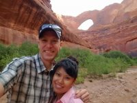
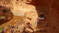
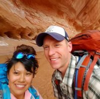
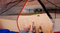
Had a great time! Thanks for everyone's help! Our 3rd person ended up not showing so we ended up doing a loop hike parking at the water tank and walking to the crack in the wall then climbing up Jacob Hamblin. The first day we saw Stevens Arch and finding a great camping spot on a cliff overlooking the water. The second day we hiked all the way up to Jacob Hamblin. We camped out at the alcove just before the big arch. Hiked out the next morning. Besides Havasu falls this is the best trip I have been on so far! I plan on more trips to southern Utah in the future. Maybe Grand Gulch, Cedar Mesa, or fish and owl creek. Thank you all again for the assistance!
 
Awesome! Did you by any chance get a GPS track of your cross country walk from Jacob Hamblin back to the car?
I am planning a weekend where we will drive from Salt Lake at 2pm on Friday which puts us at the water tanks (fourth mile ridge?) by 9pm. We will camp there, then Saturday morning, hike to crack in the wall, down to Coyote, all the way up Coyote to Jacob Hamblin, camp at JH and then hike back to the car Sunday morning.

Was the cross country after exiting JH difficult to follow back to the car?
 
Back
Top