AbinadiWitness
Member
- Joined
- Oct 25, 2017
- Messages
- 33
***New to BackcountryPost - This is the first of several posts of favorite trips I've taken in the recent past that I think will be helpful or of interest to others here. Eventually I'll be current with my posts and only new stuff will show up here. Enjoy! ") ***
***
Each year I try and plan at least one out of state multi-day trip into one of the premier mountain areas of the western United States; some years I have been privileged to be able to schedule multiple such trips in various states and so experience a broader range of the many treasures this area of the world has to offer. 2016 is such a year and this trip, to the Grenadier Range of Colorado, was the first of several nearly-consecutive trips I would take during my travels.
I invited a number of others to come with me, of my strong-hiking friends, and got a couple of people who actually joined in, Ambrose (with whom I had hiked before on a number of occasions) and Josh (with whom I was somewhat familiar from the online hiking community he, Ambrose, and I are part of, but with whom I had not, hitherto, hiked). According to arrangements we all met early Tuesday morning and, after loading all our gear into my car, we set out on the 6-7 hour drive to Colorado.
We stopped a few times along the way for food and such, but soon made it out to what we thought was the trailhead at Molas Pass, high up the "Million Dollar Highway" beyond Silverton, CO. We got our packs out and stuff put together ready to hit the trail, took some pictures of the peaks we could see from this vantage point, etc., only to discover, before we headed down the trail that this wasn't really the right place to start! We then spent the next 30+ minutes driving up and down the same section of road trying to reconcile our written directions with the maps we had with what we were actually seeing...suffice it to say, the directions didn't line up with the road signs we passed...
Eventually we discovered that the correct turnoff for starting the hike was marked with a smaller brown road sign stating "Molas Lake Molas Trail". After re-putting together our stuff a bit we (finally) set off down the trail, excited for the adventures that, doubtless, were ahead of us along the way.
***Each year I try and plan at least one out of state multi-day trip into one of the premier mountain areas of the western United States; some years I have been privileged to be able to schedule multiple such trips in various states and so experience a broader range of the many treasures this area of the world has to offer. 2016 is such a year and this trip, to the Grenadier Range of Colorado, was the first of several nearly-consecutive trips I would take during my travels.
I invited a number of others to come with me, of my strong-hiking friends, and got a couple of people who actually joined in, Ambrose (with whom I had hiked before on a number of occasions) and Josh (with whom I was somewhat familiar from the online hiking community he, Ambrose, and I are part of, but with whom I had not, hitherto, hiked). According to arrangements we all met early Tuesday morning and, after loading all our gear into my car, we set out on the 6-7 hour drive to Colorado.
We stopped a few times along the way for food and such, but soon made it out to what we thought was the trailhead at Molas Pass, high up the "Million Dollar Highway" beyond Silverton, CO. We got our packs out and stuff put together ready to hit the trail, took some pictures of the peaks we could see from this vantage point, etc., only to discover, before we headed down the trail that this wasn't really the right place to start! We then spent the next 30+ minutes driving up and down the same section of road trying to reconcile our written directions with the maps we had with what we were actually seeing...suffice it to say, the directions didn't line up with the road signs we passed...
Eventually we discovered that the correct turnoff for starting the hike was marked with a smaller brown road sign stating "Molas Lake Molas Trail". After re-putting together our stuff a bit we (finally) set off down the trail, excited for the adventures that, doubtless, were ahead of us along the way.
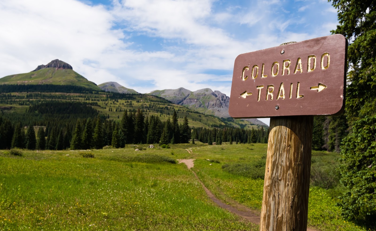
Trail sign indicating we were following the course of the Colorado Trail that is a section of the much larger Continental Divide Trail that runs from Mexico to Canada throughout the western reaches of North America.

Ambrose packing down the early stages of the trail.

Getting a little further into things...This is before the many switchbacks that lead you down to the Animas River from the upper reaches of the early trail.
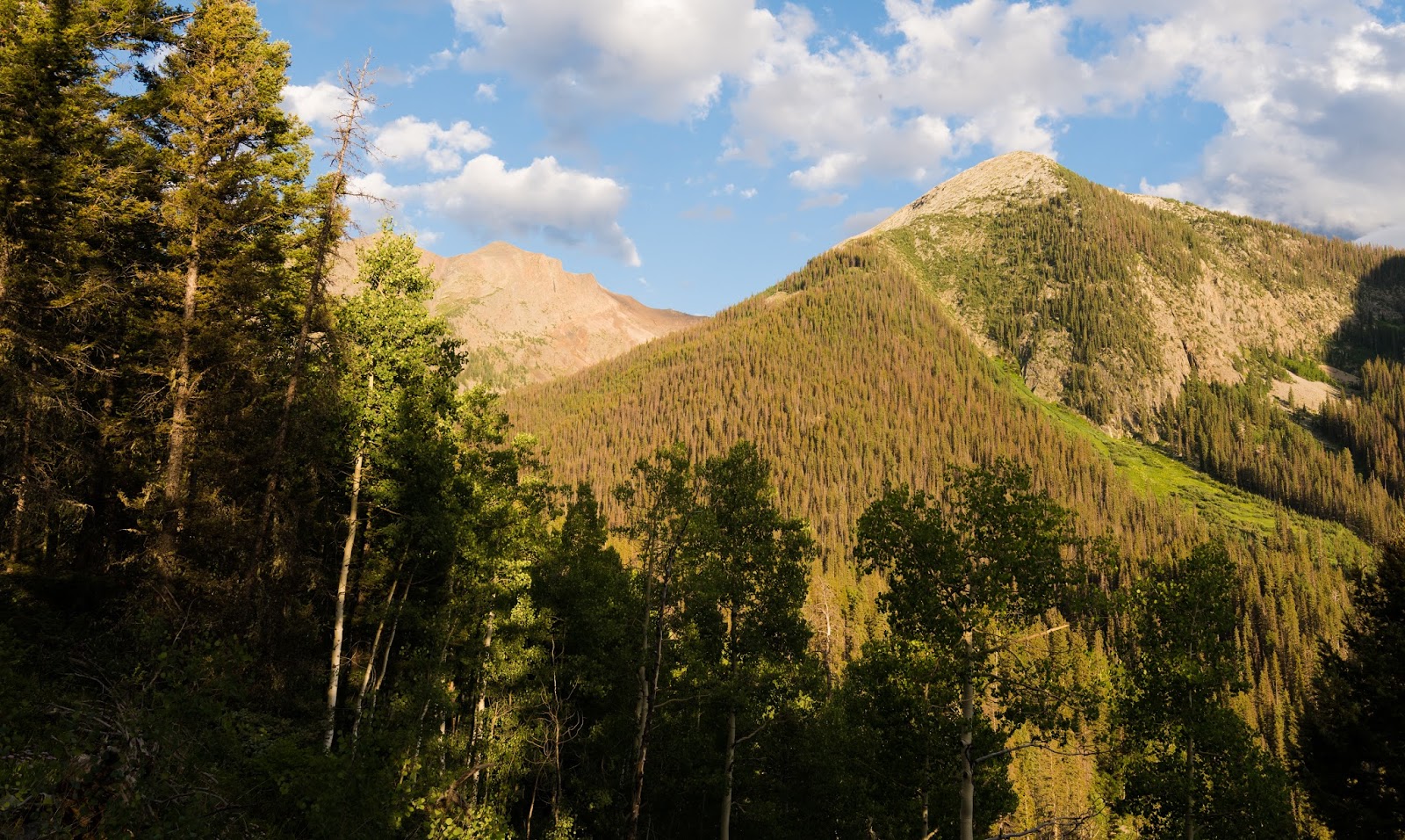
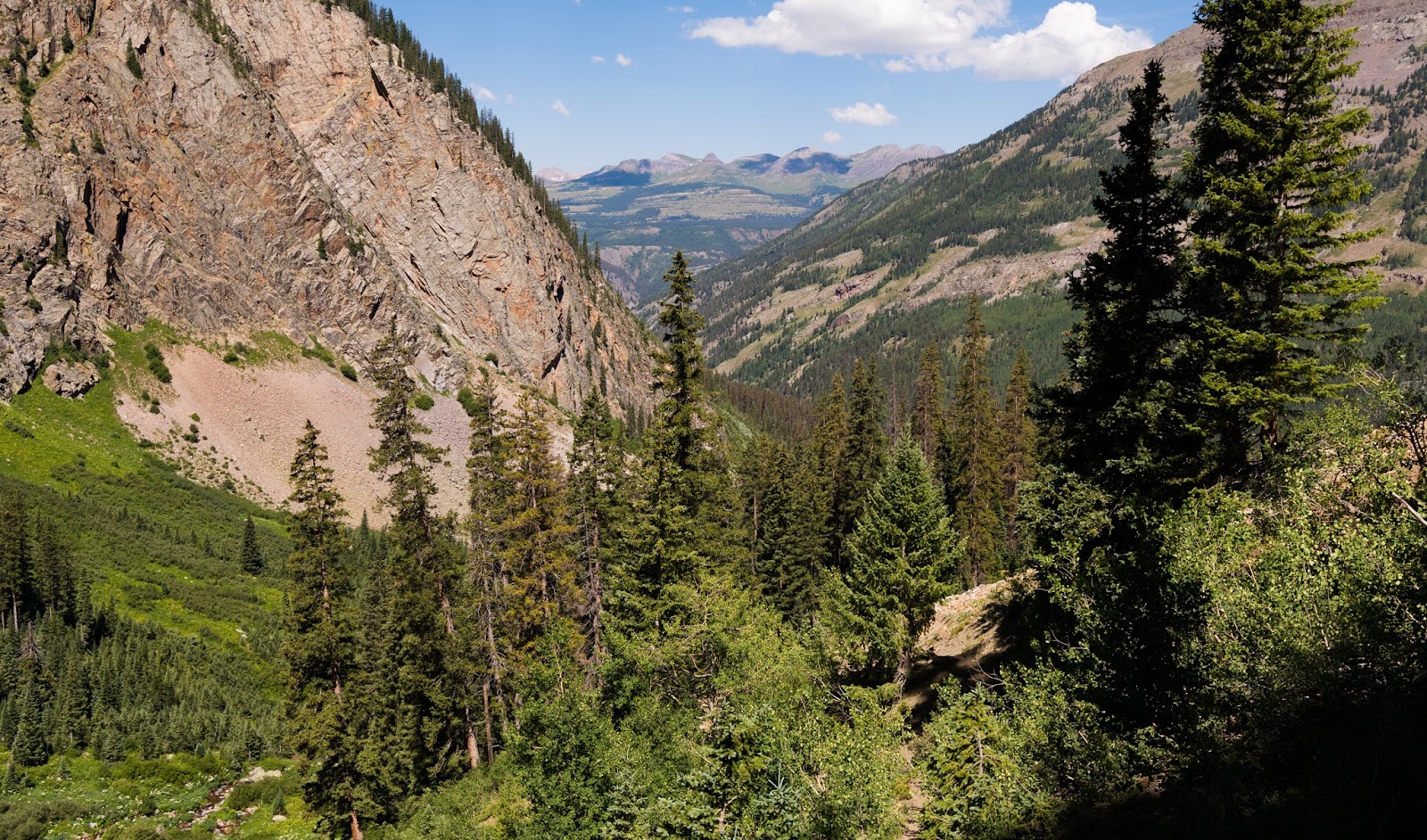
From the trailhead you follow a stretch of the Colorado Trail down to the Animas River; the trail is lovely and the view of the surrounding mountains is inspiring. At it's early stages the trail is pretty gentle, but soon it begins dropping rapidly via many switchbacks down the side of a canyon that the Animas River runs through - to start this hike from this point means losing 1,700+ feet of elevation right out of the gate. The trail begins about 10,900 feet and drops to just over 9,000 feet at the Animas. There's nothing, at this stage of the trail, that's really challenging and the views range everywhere from quite-open to fairly enclosed by trees (there are more trees blocking the view as you're switchbacking down to the Animas from the Molas Pass area).
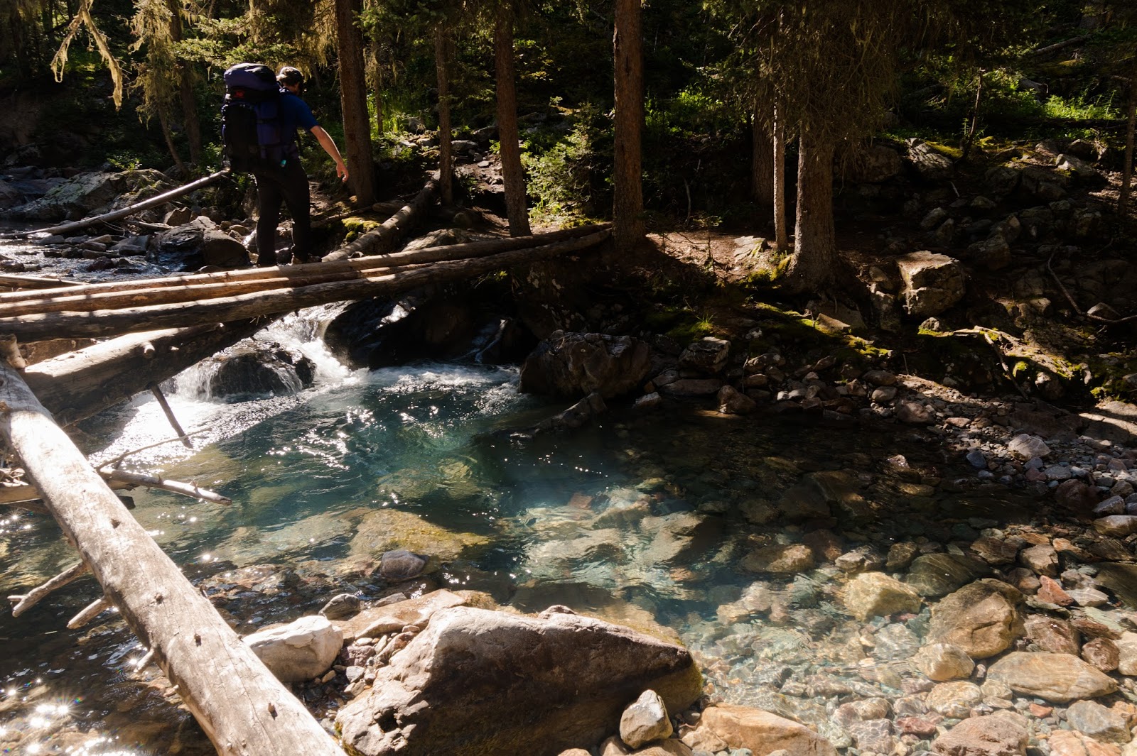
Once we made it to the Animas River we took a little break to grab a snack and rest for a moment; while we weren't really talking much about it, none of us were looking forward much to the inevitable prospect of hiking back up those 1,700+ feet and 3 or so miles back to the trailhead at the end of our trip...but we'd cross that proverbial bridge when we got there in a few more days...right now we'd just crossed the bridge over the Animas - a very finely constructed bridge with both metal and wood involved (certainly the most normal bridge we'd see for a while).
Once we made it to the Animas River we took a little break to grab a snack and rest for a moment; while we weren't really talking much about it, none of us were looking forward much to the inevitable prospect of hiking back up those 1,700+ feet and 3 or so miles back to the trailhead at the end of our trip...but we'd cross that proverbial bridge when we got there in a few more days...right now we'd just crossed the bridge over the Animas - a very finely constructed bridge with both metal and wood involved (certainly the most normal bridge we'd see for a while).

The Animas River.
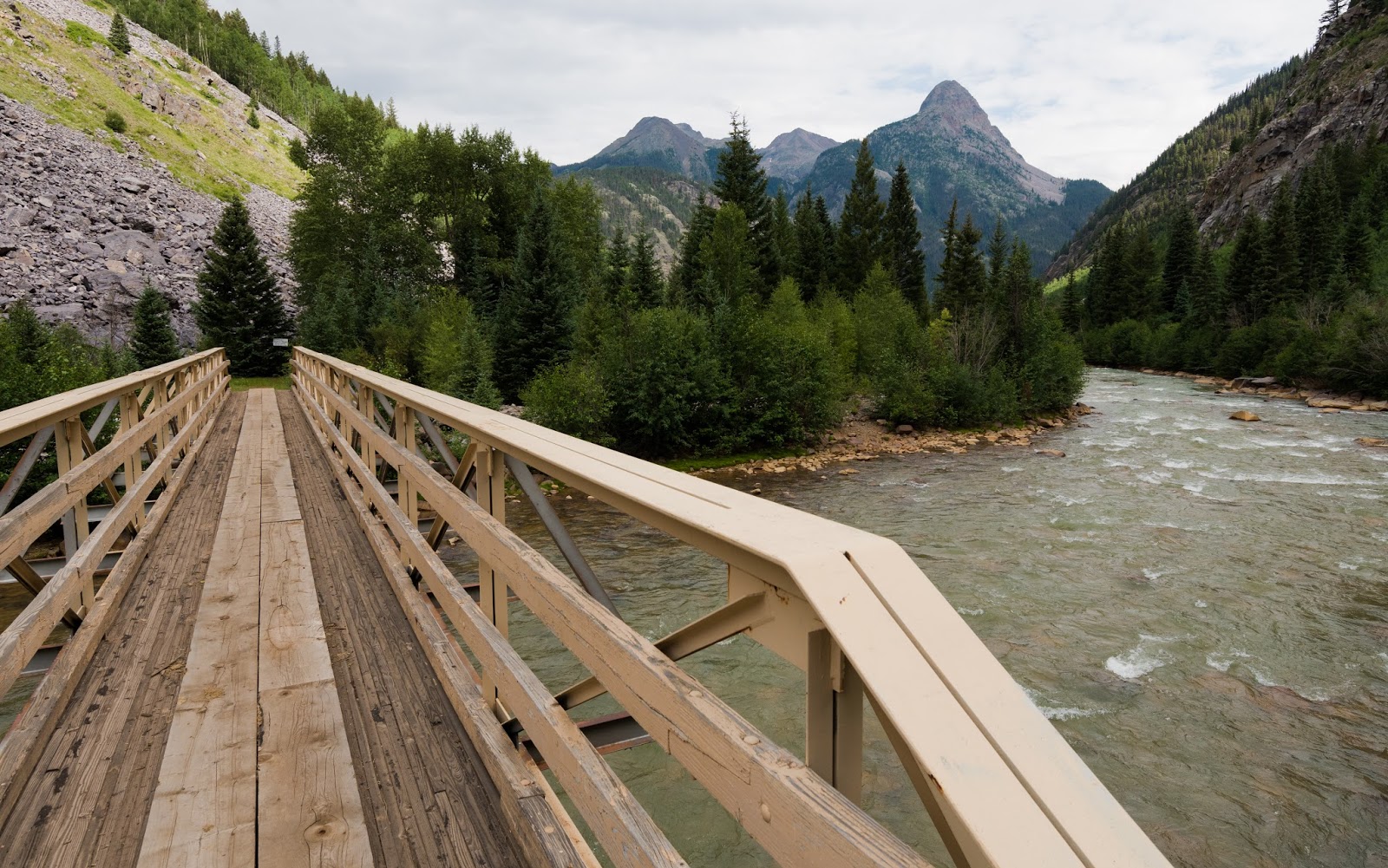
The Animas River and the fine bridge that crosses it.
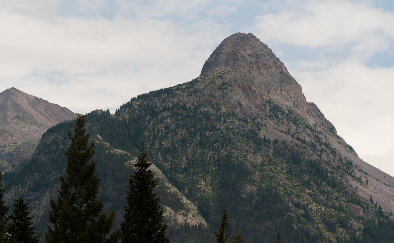
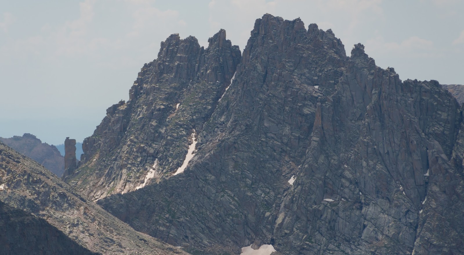
The dramatic profile of Mount Garfield rising steeply up from the Animas River area.
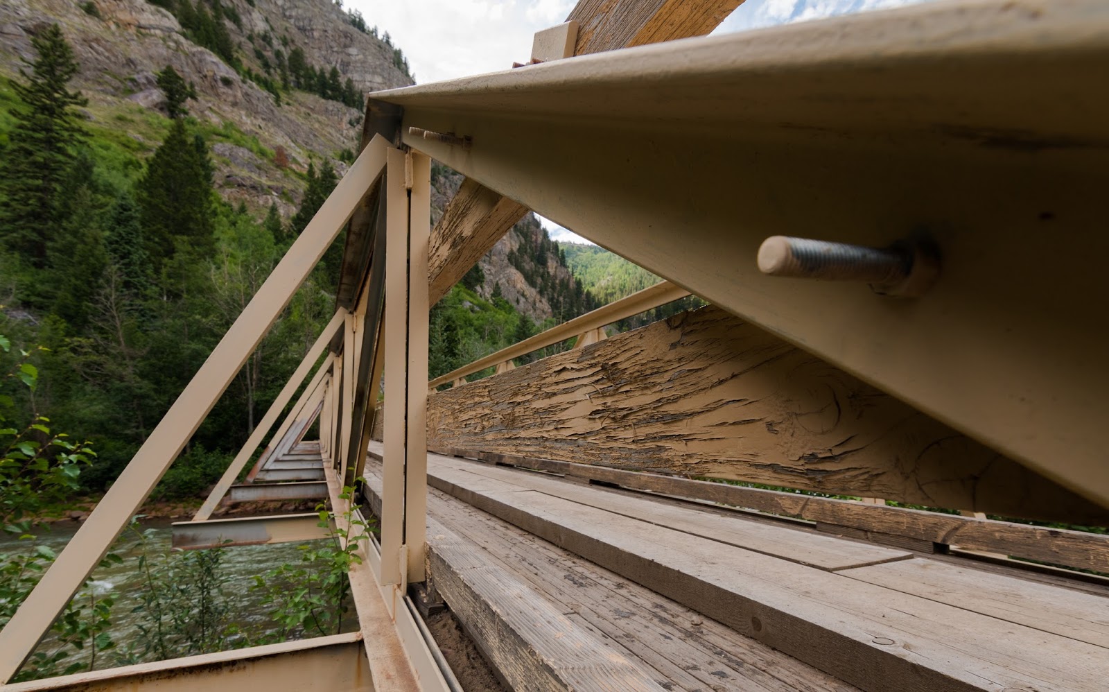
Triangles over the Animas.
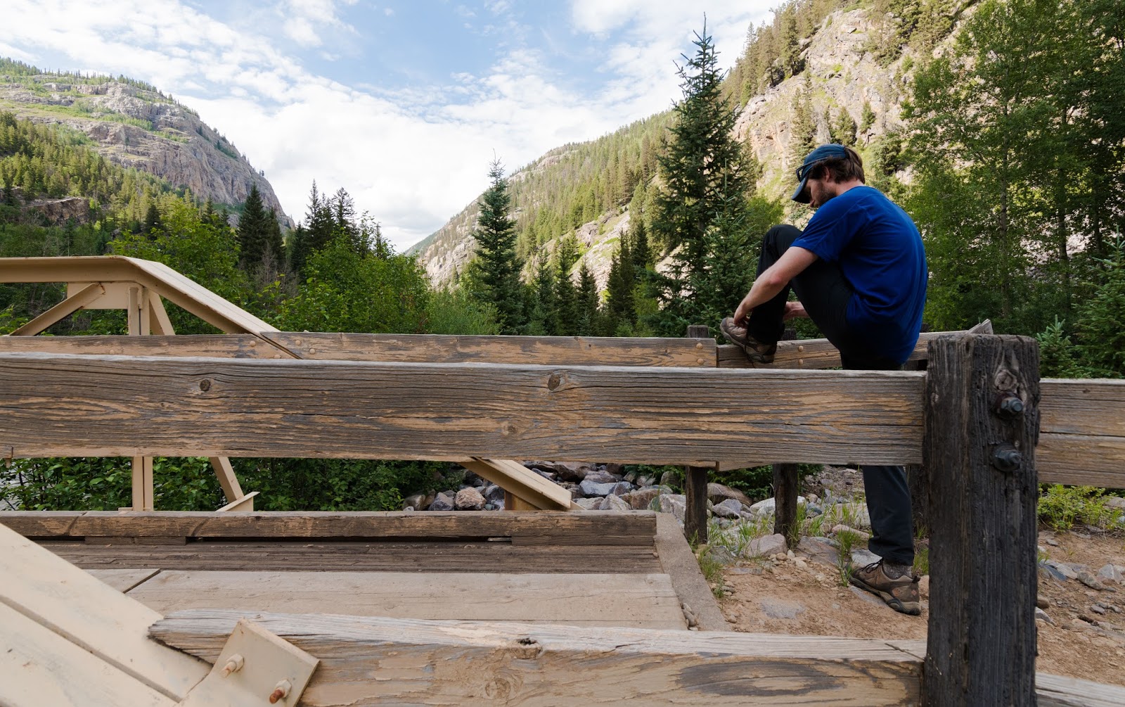
Ambrose tightening up a shoelace while we take a break at the crossing of the Animas.
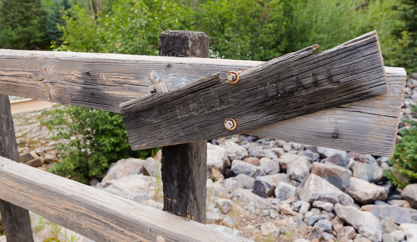
Molas Trail - remember, the start for this hike is "Molas Lake Molas Trail" - we got thrown for that because the actual signage on the road didn't match the directions we had in print, costing us valuable time at the outset of the trip.

Gettin' into it...
It's always an interesting sight when you're looking at big peaks in the distance and realizing they peaks you're aiming for will take you even higher than the ones you can see ahead...but such was the case with us here...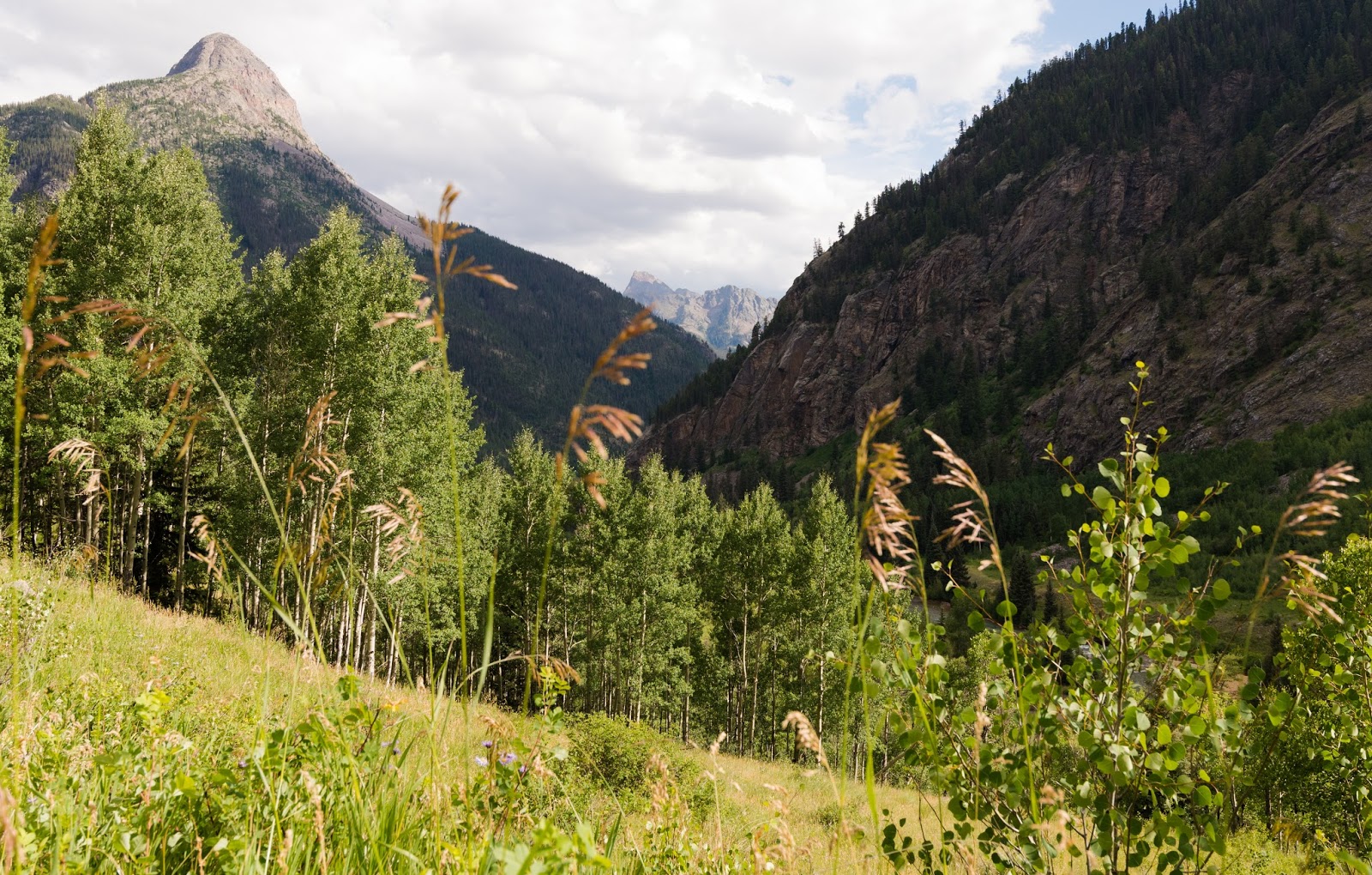
Mount Garfield rises majestically on the left here; we're also treated to a glimpse of the incredibly rugged (though not impressively named) Pigeon Peak (13,972 feet) in the distance. In later days we'd have the joy of a far better view of Pigeon Peak from the summit of Arrow Peak.
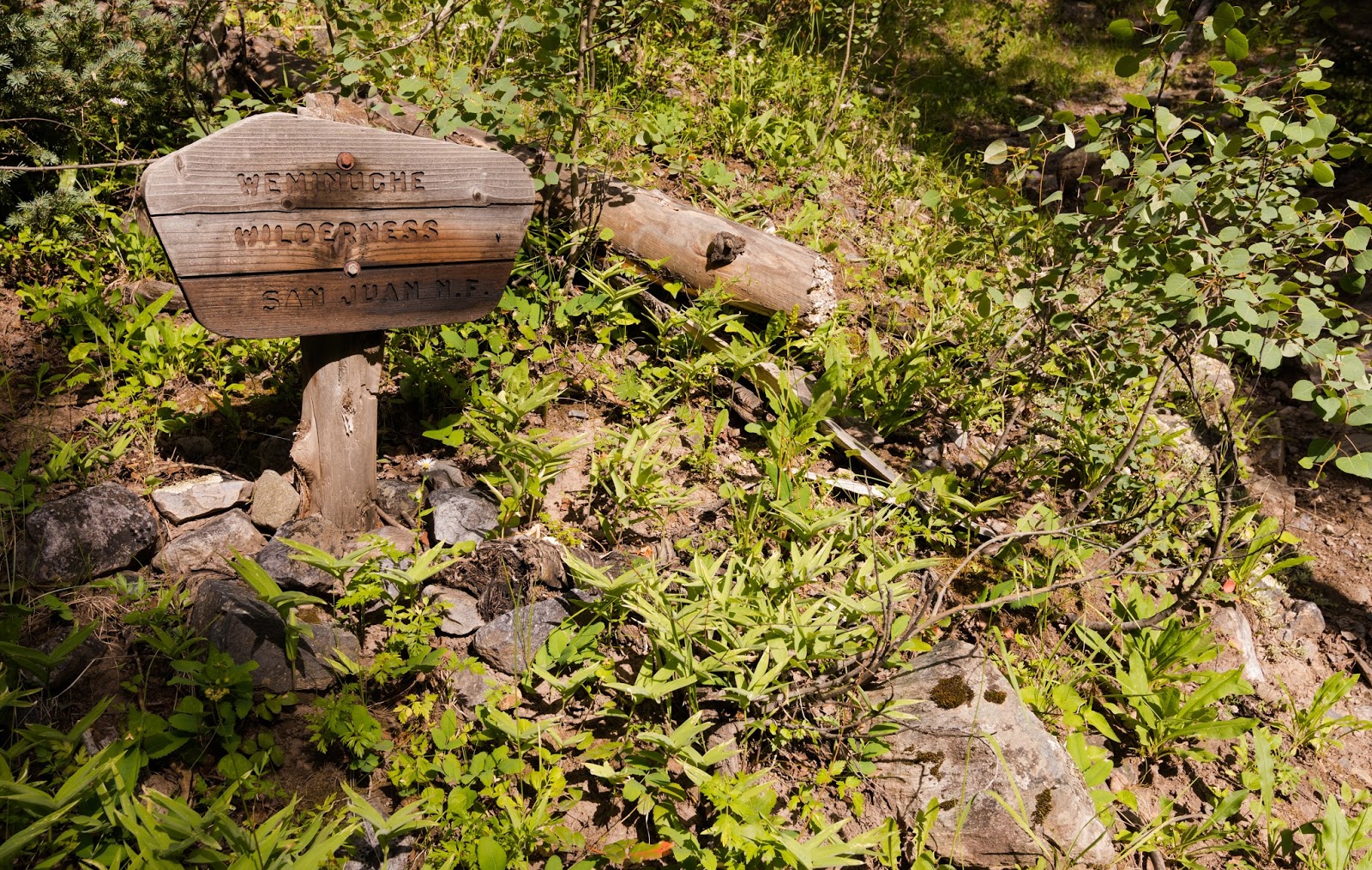
Entering the boundaries of the Weminuche Wilderness area. Exciting times ahead...

Ambrose toiling up a section of the trail on the way in to the beaver ponds.
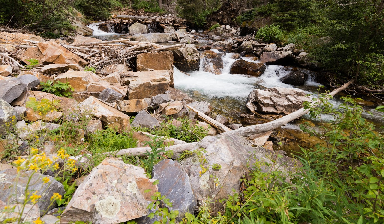
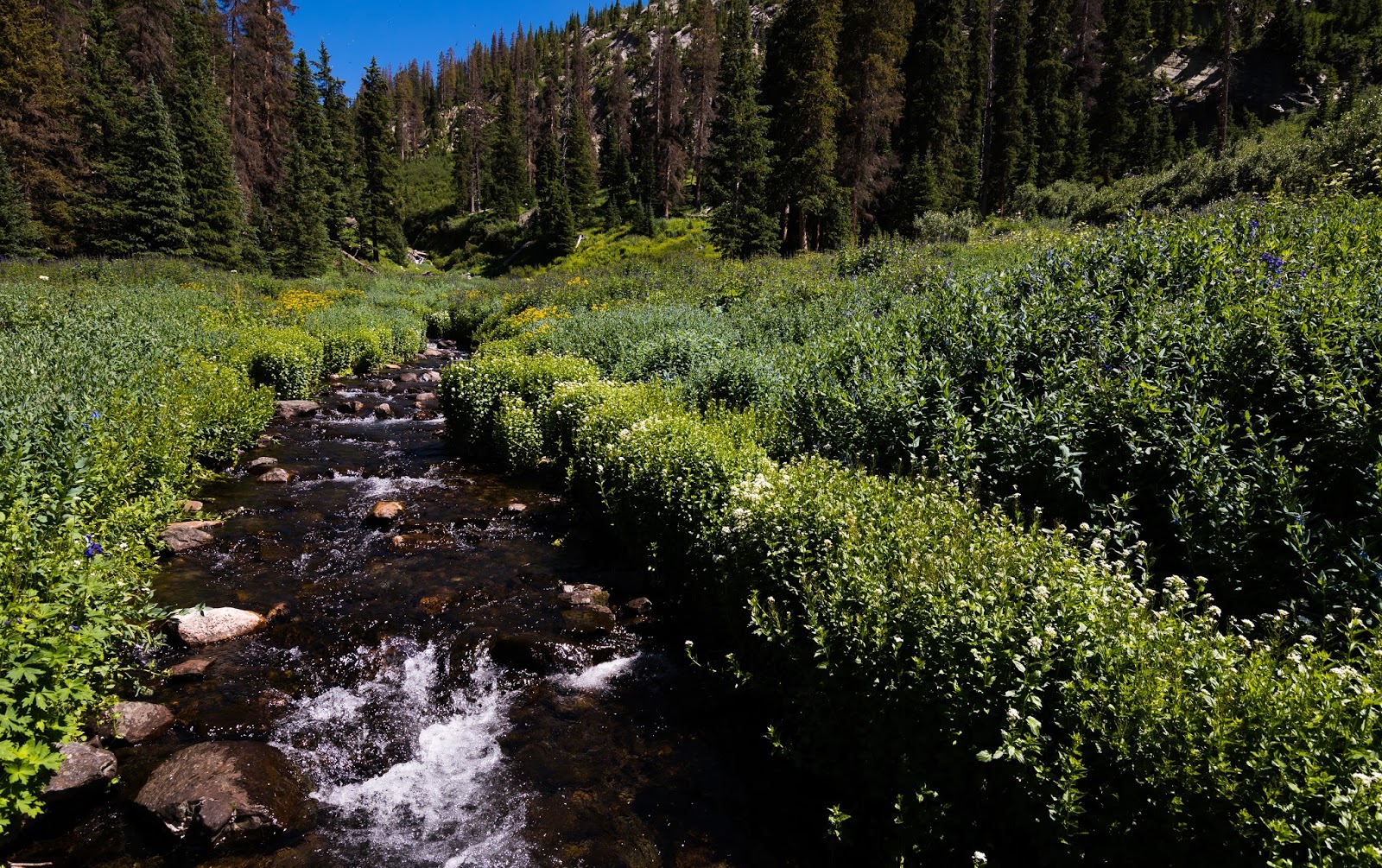
Flowing water was a pretty consistent theme of this hike; not a lot of time away from rivers, streams, creeks, etc., at any point, which is nice for multiple reasons.
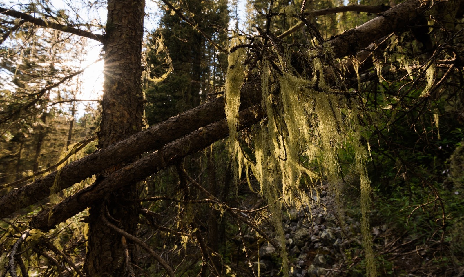
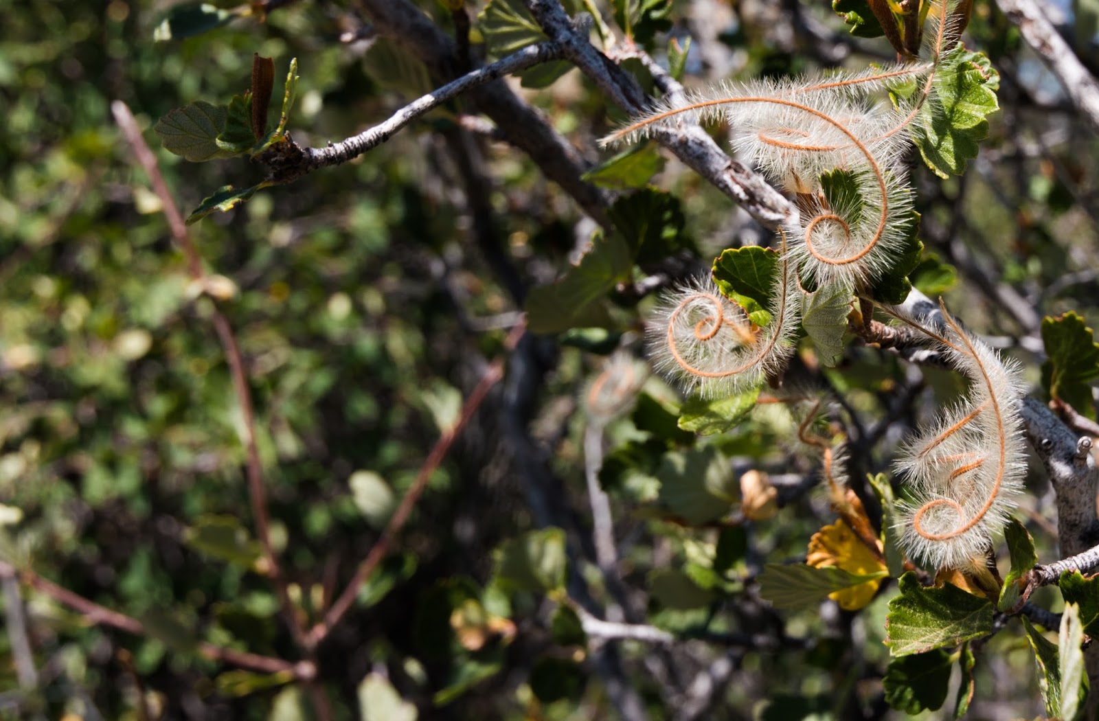
I don't know what this is exactly, but it is, visually, very similar to the Spanish moss I know and love that adorns many of the trees back home in Florida; I haven't seen anything like this out west before...it is very dry to the touch, more like a coarse thin piece of yarn woven intricately together than vegetation would be expected to feel...
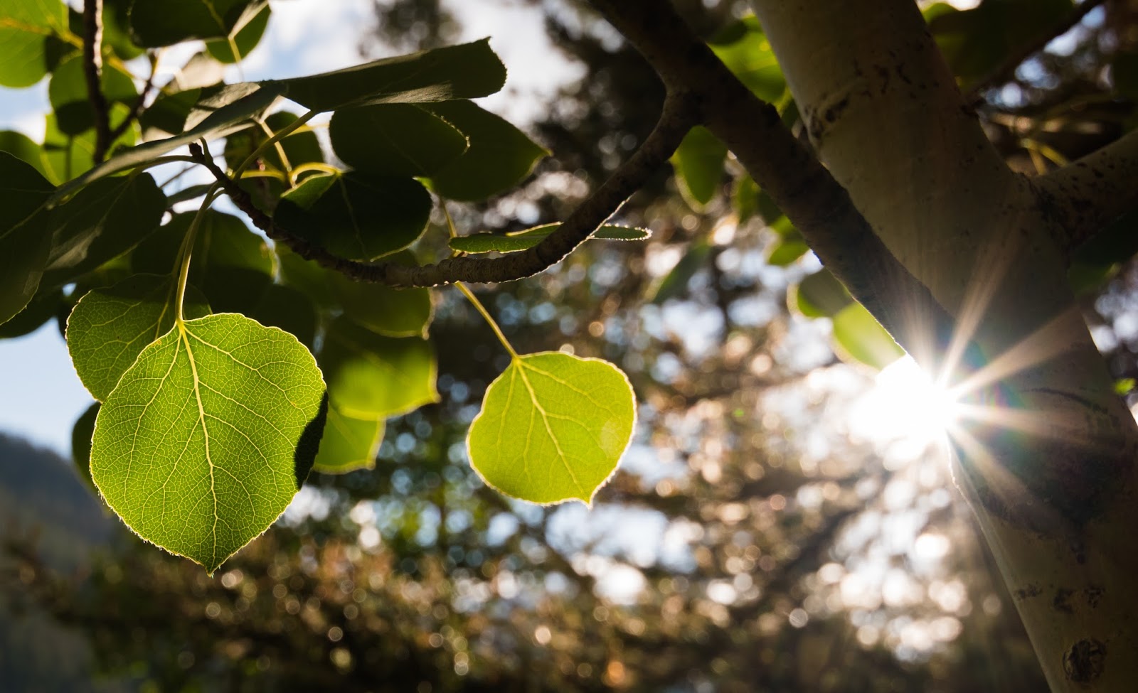
Beautifully back-lit aspen leaves on the way to the beaver ponds...

We're well out in the woods now; it was a joy then, as it usually is, to find ourselves in the midst of such vast, wild country as this...among other things, it's views like the one you see here - big and circumspectly wild - that lead me to love backpacking trips, despite their various rigors and inconveniences.
Apparently someone uses the same type of mark cut into the trees here as is frequently employed in the thickly-forested parts of the High Uintas...I wonder if this is a more significant symbol than what I'm presently aware of?
Fine views of the surrounding countryside under the golden light of early evening...
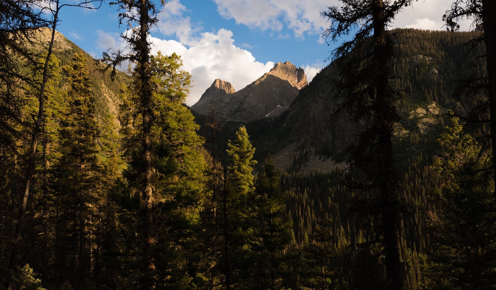
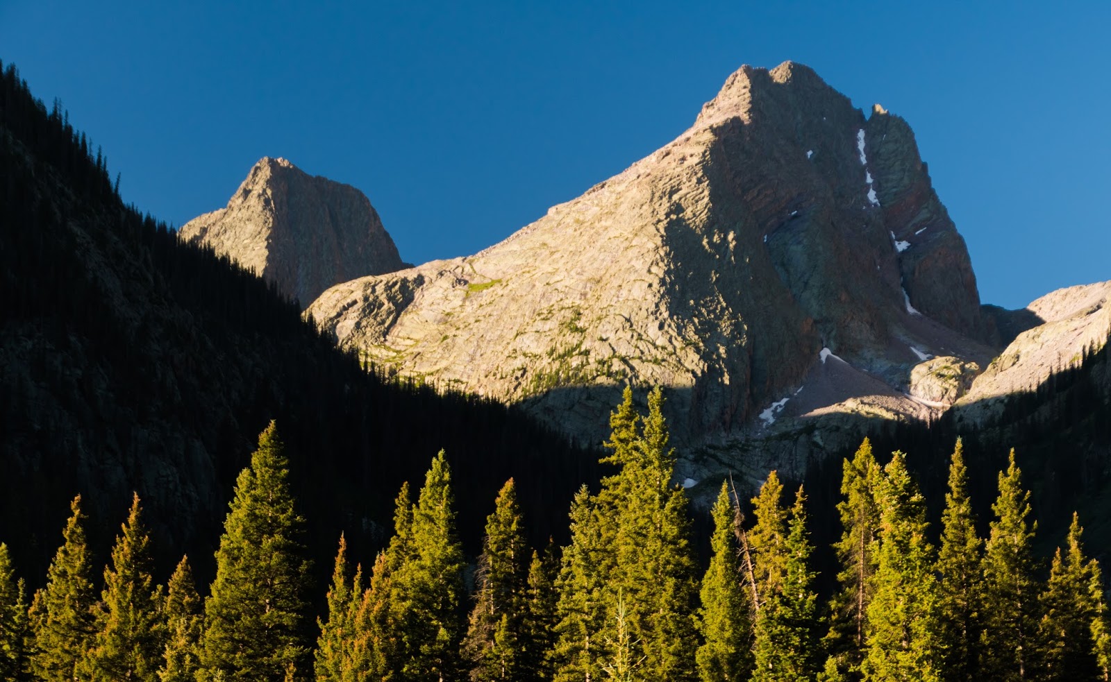
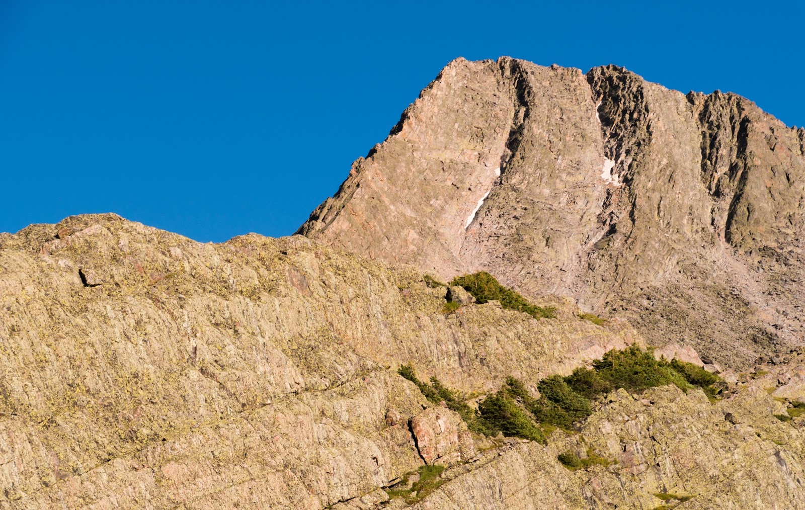
Here's our first quality view of Vestal and Arrow Peaks (13,808 feet) together - stunningly rugged! We'd be making our high camp near the base of those giants...What a treat to see them in such good light conditions!
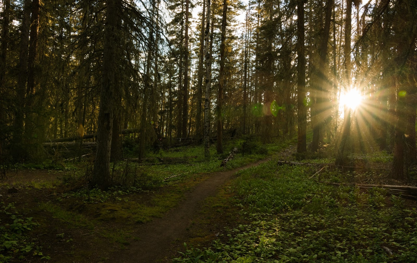
The evening sun breaks beautifully through a thick pine forest...
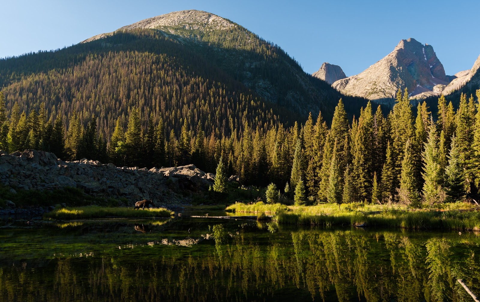
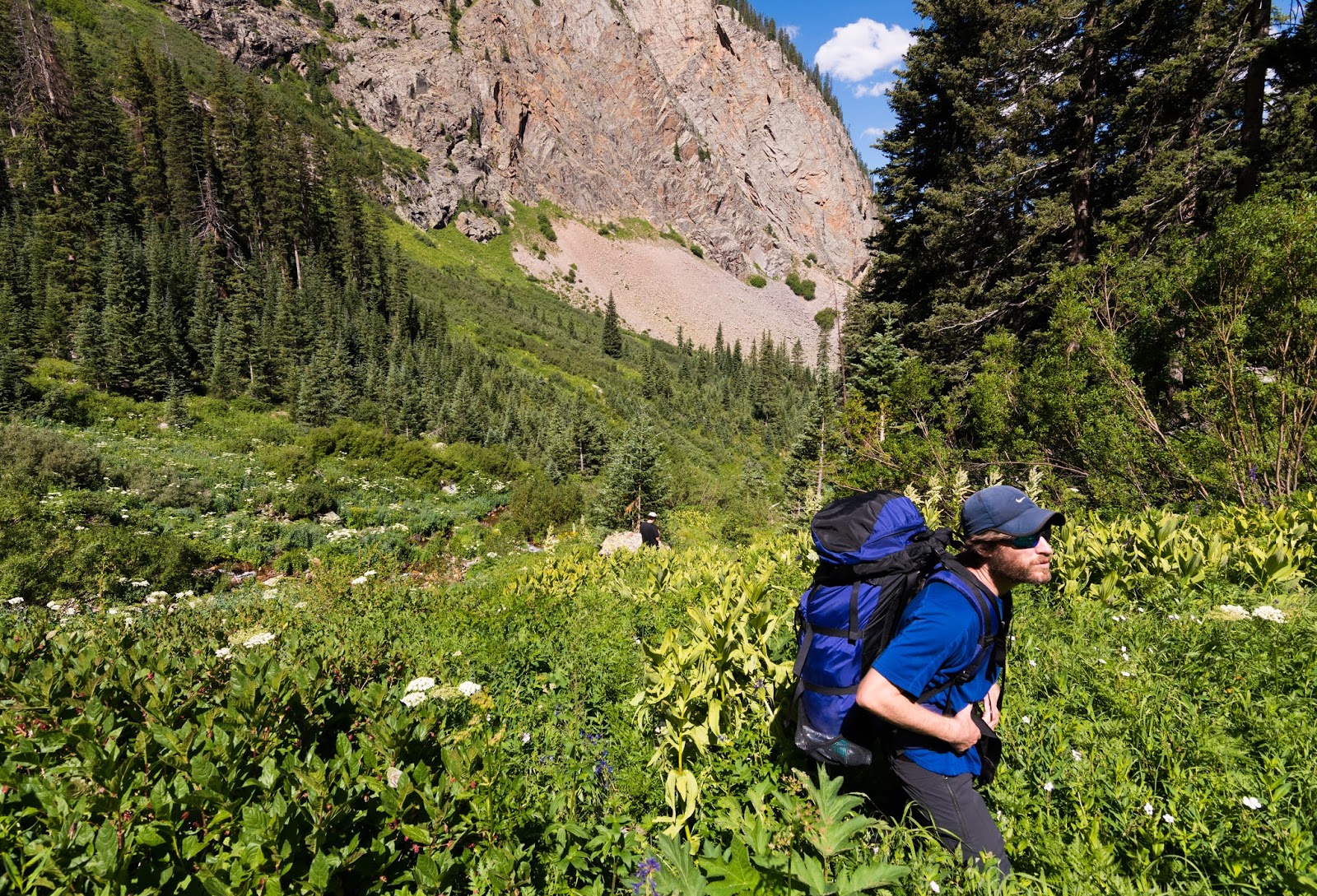
I won't go into intimate detail on the trail at this stage, but there's plenty of ups-and-downs along the way; we joked that the trail couldn't quite make up it's mind whether we were ascending or descending...on the whole we were ascending, since we'd dropped to just over 9,000 feet and were ultimately aiming for a high camp at 11,300 feet or so in Vestal Basin...but we knew we wouldn't likely get there that evening, so we decided to aim for the popular beaver ponds about three miles beyond the Elk Park Trailhead for our first night's stay in the wilds.
We made it to the beaver ponds just about sunset time, having caught - somewhere along the way - some small sneak peaks of the highest peaks in the area (where we were ultimately aiming) through gaps in the lower, though still tall, surrounding peaks - and that was exciting. The views of Arrow and Vestal Peaks reflected in the beaver ponds were fantastic. After a bit of hunting we found a couple of acceptable sites and scattered out a little bit around the ponds. Ambrose found a cool spot of flat area surrounded by boulders just above the lakes and Josh and I found spots west of the ponds a bit that were just fine and well-sheltered by large trees. Surprisingly, the bugs weren't bad here despite the large quantities of water about. By the way - the water flowing out of these beaver ponds was cold - exceptionally cold, even for high mountain standards! If I remember right, the beaver ponds are about 10,000 feet up but the water here was substantially colder than what we later found in the high basin at 11,300-ish feet...not sure why, but we all thought it was about the coldest backcountry water we'd come across in the summer.
We made it to the beaver ponds just about sunset time, having caught - somewhere along the way - some small sneak peaks of the highest peaks in the area (where we were ultimately aiming) through gaps in the lower, though still tall, surrounding peaks - and that was exciting. The views of Arrow and Vestal Peaks reflected in the beaver ponds were fantastic. After a bit of hunting we found a couple of acceptable sites and scattered out a little bit around the ponds. Ambrose found a cool spot of flat area surrounded by boulders just above the lakes and Josh and I found spots west of the ponds a bit that were just fine and well-sheltered by large trees. Surprisingly, the bugs weren't bad here despite the large quantities of water about. By the way - the water flowing out of these beaver ponds was cold - exceptionally cold, even for high mountain standards! If I remember right, the beaver ponds are about 10,000 feet up but the water here was substantially colder than what we later found in the high basin at 11,300-ish feet...not sure why, but we all thought it was about the coldest backcountry water we'd come across in the summer.
Jaw-dropping views from the beaver ponds, where we were blessed enough to arrive just as the sunset was getting into its "fire light" phase. What a treat!
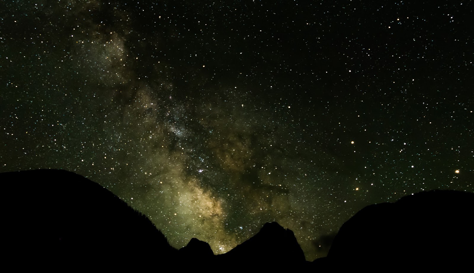
The Milky Way and a night sky full of stars arches over the silhouetted outlines of Vestal and Arrow Peaks during the night we made camp at the beaver ponds.
Overnight it was surprisingly warm, considering our higher elevation; we didn't even get chilly till about 2:00 AM and we all enjoyed a good night's rest.
The morning found things beautifully still - the beaver pond's surfaces were almost like sheets of glass...until some ducks flew in and mangled the perfect reflection a bit...I spent some time taking various sunrise pictures (gotta catch that outstanding light while it lasts) and enjoyed the great surprise of a large cow moose who wandered into the beaver ponds to eat the bright green algae growing on the rocks underwater - and, additionally amazing, the cow was shortly after followed by not one, but two calves! For the better part of an hour we watched the moose at fairly close range as they wandered in and out and through the ponds. I caught some nice pictures throughout the morning, including some more abstract/impressionistic stuff via reflections on the surprisingly still beaver ponds which were only occasionally ruffled by the movements of the moose or ducks.
The morning found things beautifully still - the beaver pond's surfaces were almost like sheets of glass...until some ducks flew in and mangled the perfect reflection a bit...I spent some time taking various sunrise pictures (gotta catch that outstanding light while it lasts) and enjoyed the great surprise of a large cow moose who wandered into the beaver ponds to eat the bright green algae growing on the rocks underwater - and, additionally amazing, the cow was shortly after followed by not one, but two calves! For the better part of an hour we watched the moose at fairly close range as they wandered in and out and through the ponds. I caught some nice pictures throughout the morning, including some more abstract/impressionistic stuff via reflections on the surprisingly still beaver ponds which were only occasionally ruffled by the movements of the moose or ducks.

Beautiful morning light bursts across the tops of a thick pine forest on the east side of the beaver ponds.
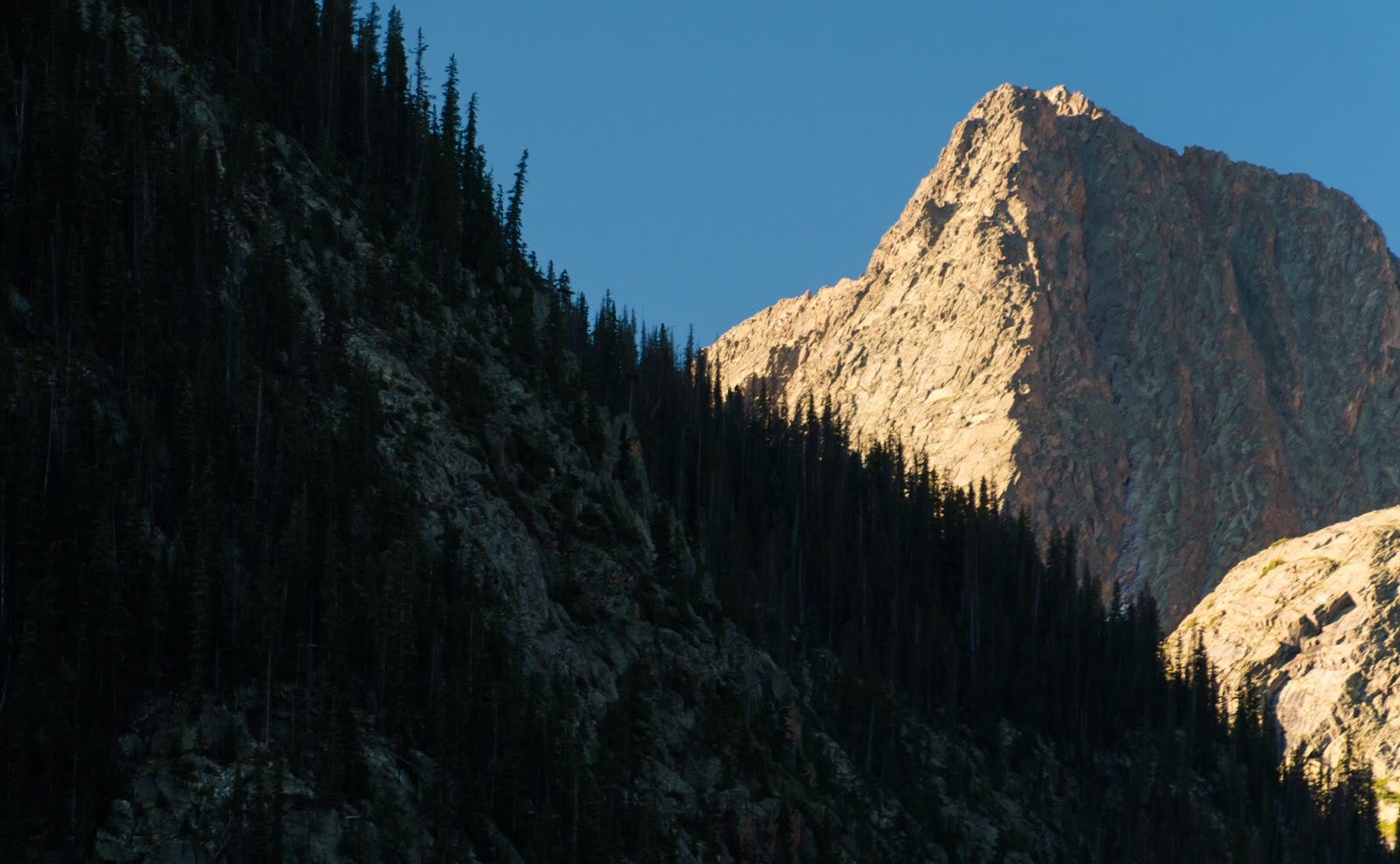
Dramatic lighting illuminates the upper reaches of Vestal Peak's epic Wham Ridge route (seen here as the part of the ridge where the light meets the shadow); as seen from the Beaver Ponds.

A little impressionism via an inverted tree reflection in the gently troubled water of the beaver ponds.
This is actually an inverted reflection shot of Arrow and Vestal Peaks; those familiar with the area would recognize that Vestal Peak sits on the left side of Arrow Peak and that Arrow is in the right foreground...it was too good a reflection to pass up the opportunity to get a little creative, though.
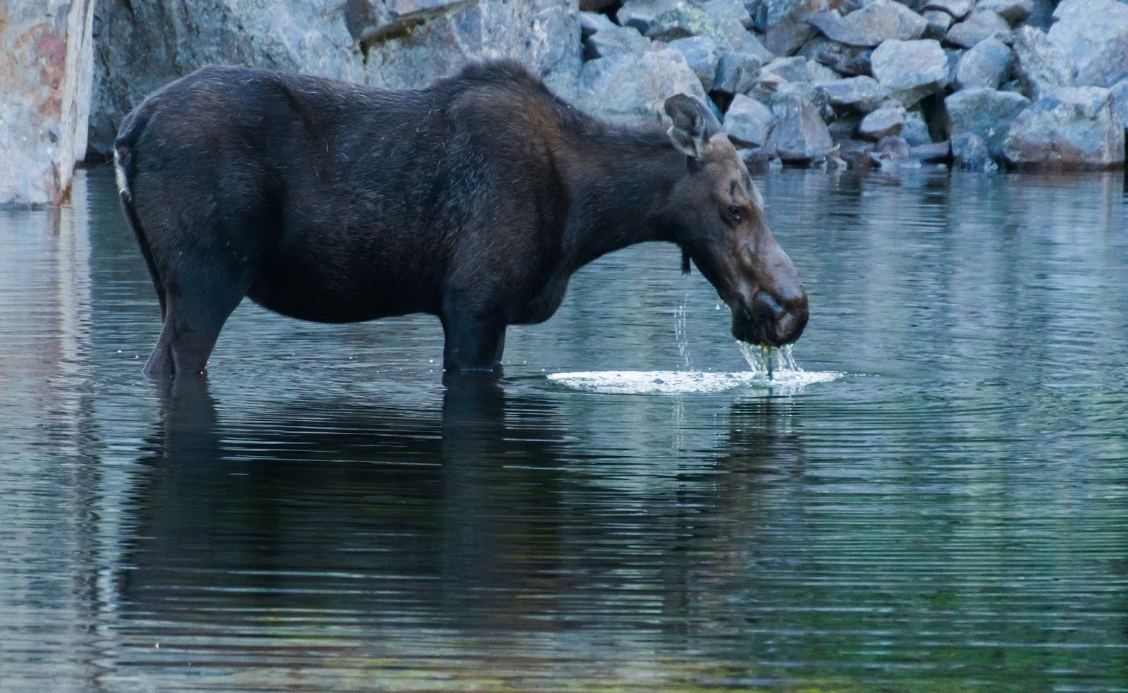
Momma moose.
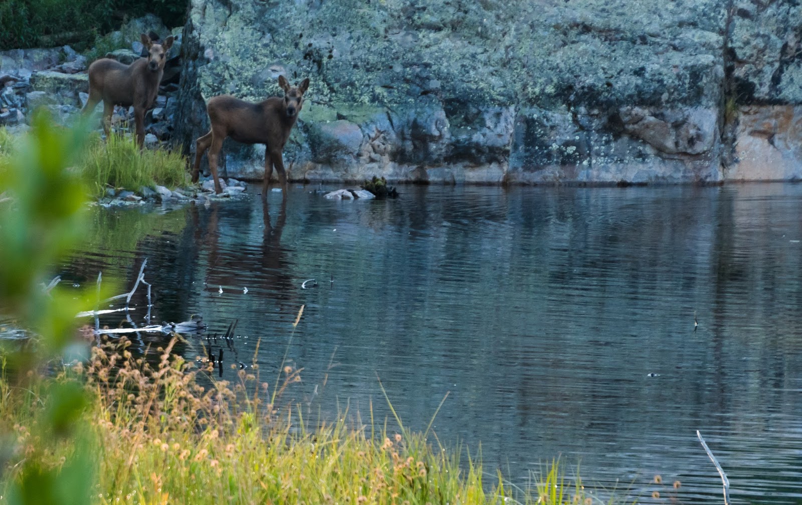
Baby moose...yes, that's plural...
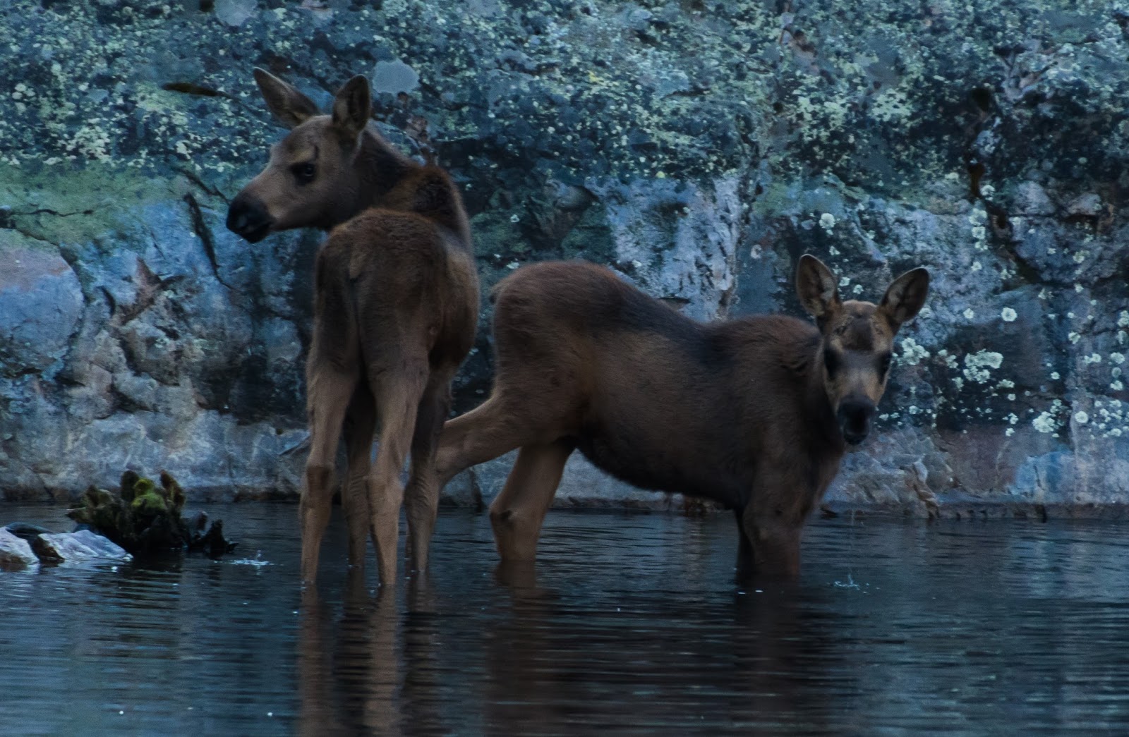
Baby moose close-up.
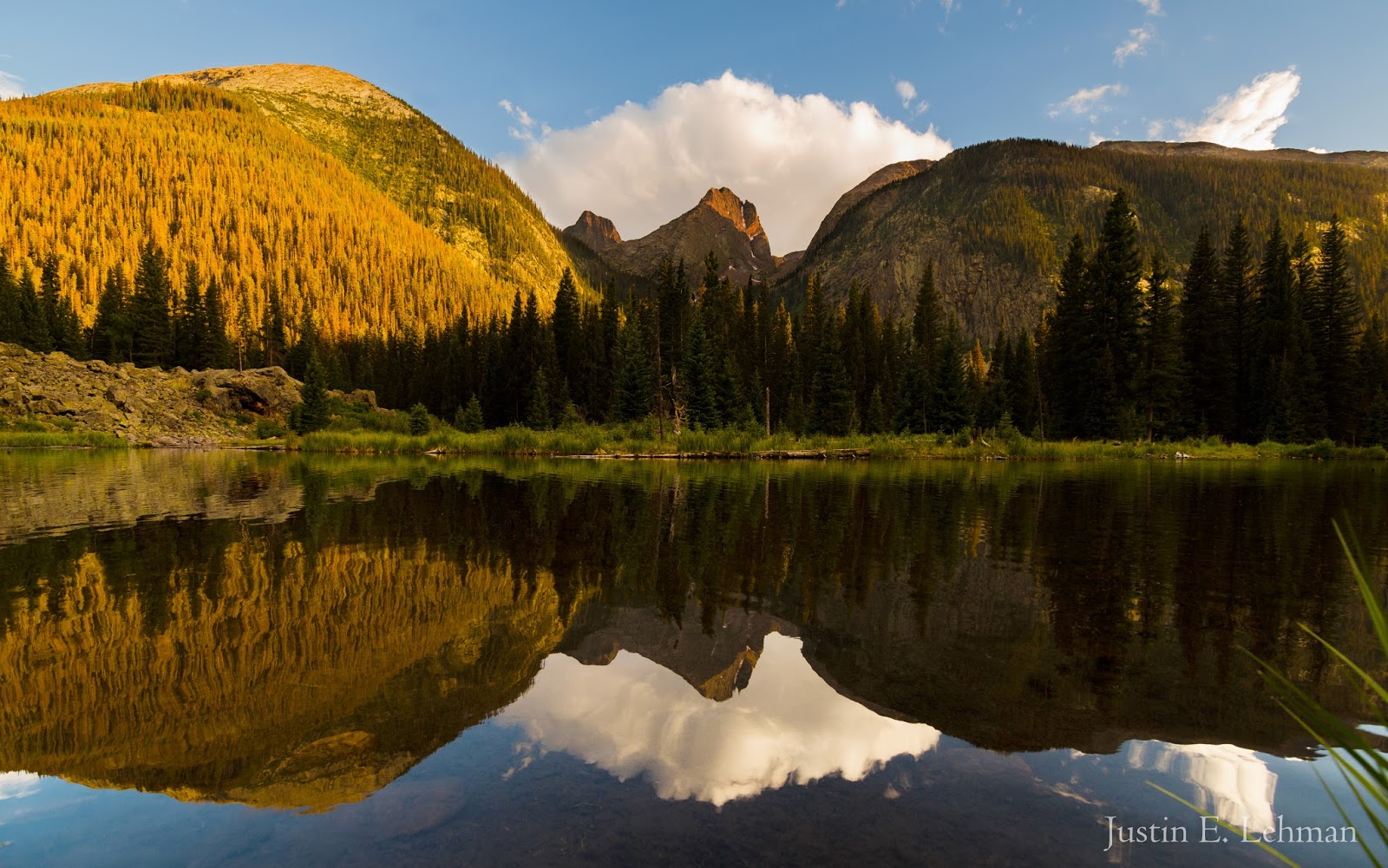
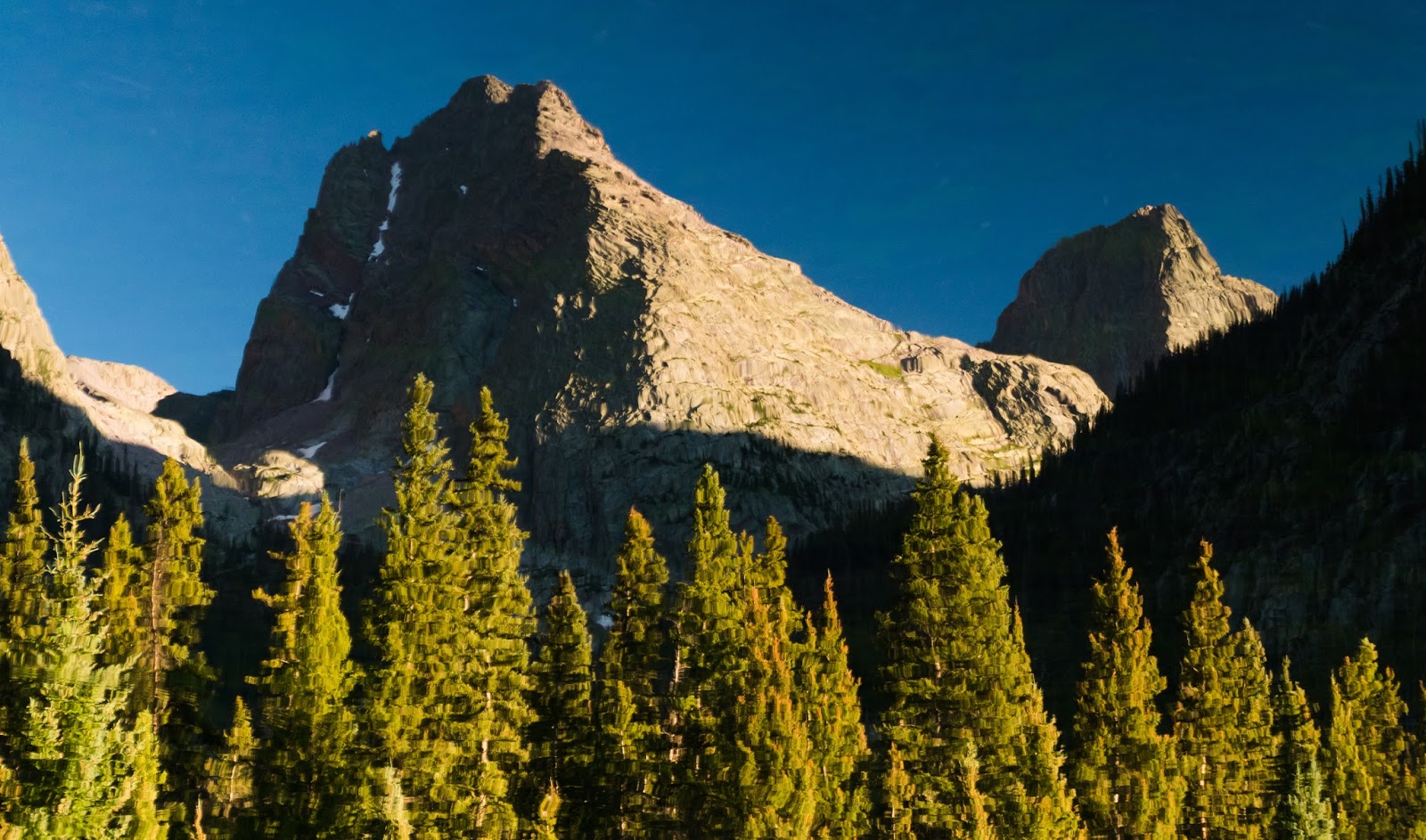
Here's the natural orientation of Vestal and Arrow Peaks as seen from the beaver ponds. Such neat looking peaks!
Can you see the moose toward the lower left? Not a bad spot to have breakfast for her or us, eh?
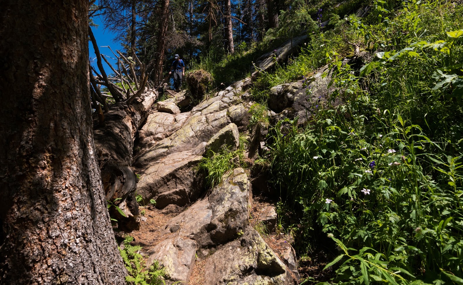
Ambrose carefully crosses the large stream on the single log...I would later cross the same way...You can get an idea of how relatively narrow that log was...it was narrow, but much more solid than the three thinner logs laying across it...Josh somehow rock-hopped across the stream somewhere to the right of the logs and (I think) just barely avoided getting his feet wet...still not sure how he managed that with all his gear on...
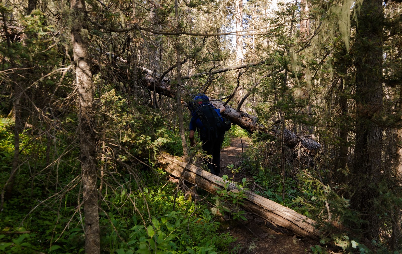
Ambrose negotiating deadfall on the way up to Vestal Basin...multiply this by about 100+ times and you'll have an idea of the actual amount of deadfall you deal with on this trail...fun times?

Taking a little moment in some shade as we continue to work toward our planned high camp in Vestal Basin...
Ambrose continues up the trail, about to scout ahead a bit...we weren't able to find the trail here (and for good reason, we'd wandered off of it! We had to go up a steep, somewhat unpleasant gully to regain the trail that had gone around this stuff...the junction we missed is specifically warned of in the summitpost.org notes on this trail up to Vestal Basin...we just collectively missed it. If you look close you can see Josh near a rock taking a break...he was hurting quite a bit on the ascent to the basin...
Deep in the nice, wild country...
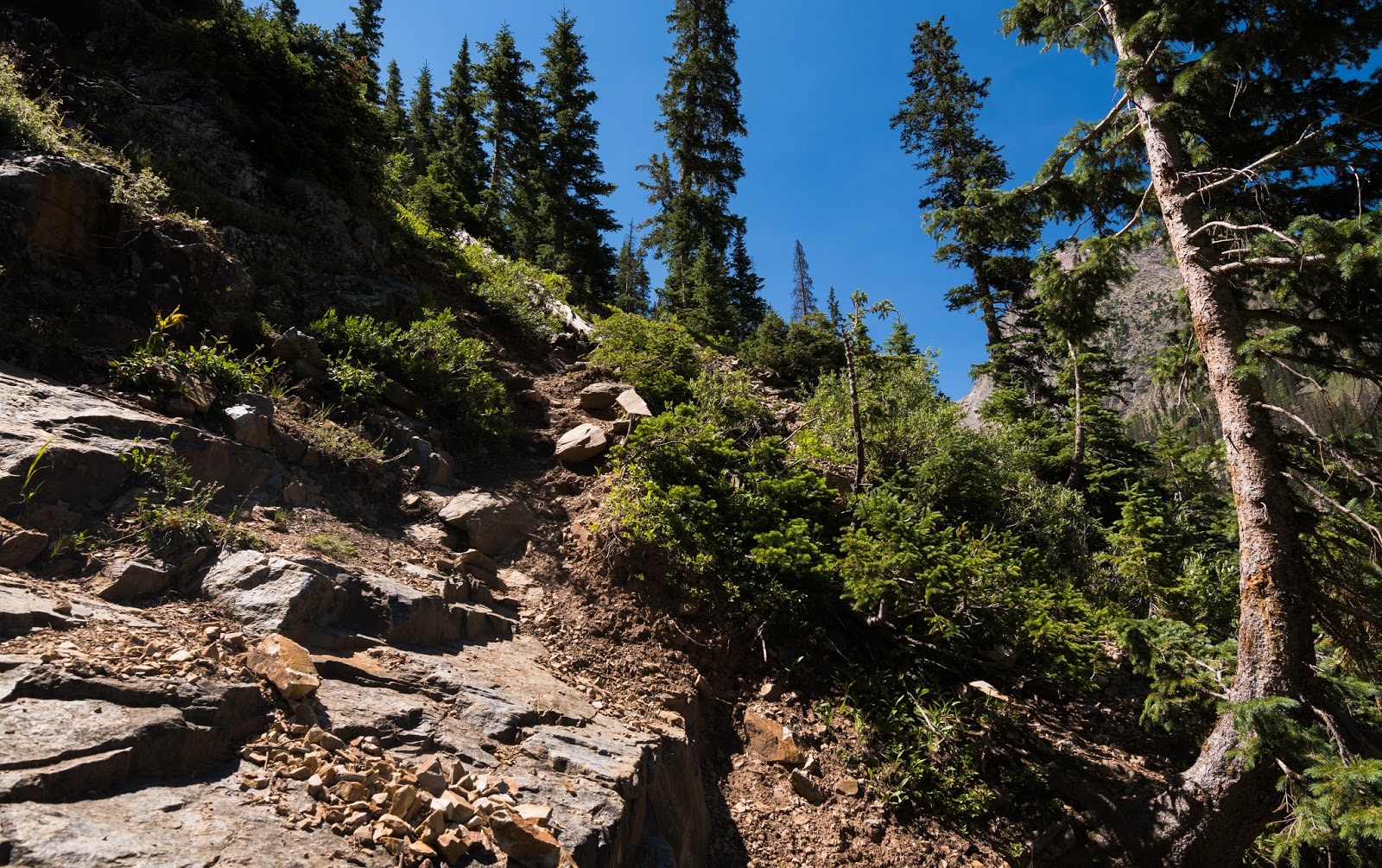
Steep trail ahead...plenty of this ahead and behind us at this point...
Amrbose preparing to come down a rocky stretch of the trail as we near Vestal Basin...
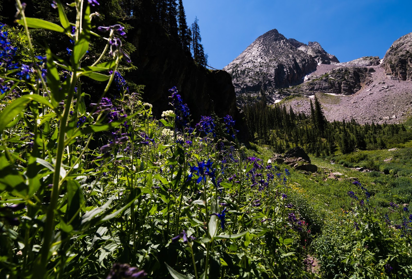
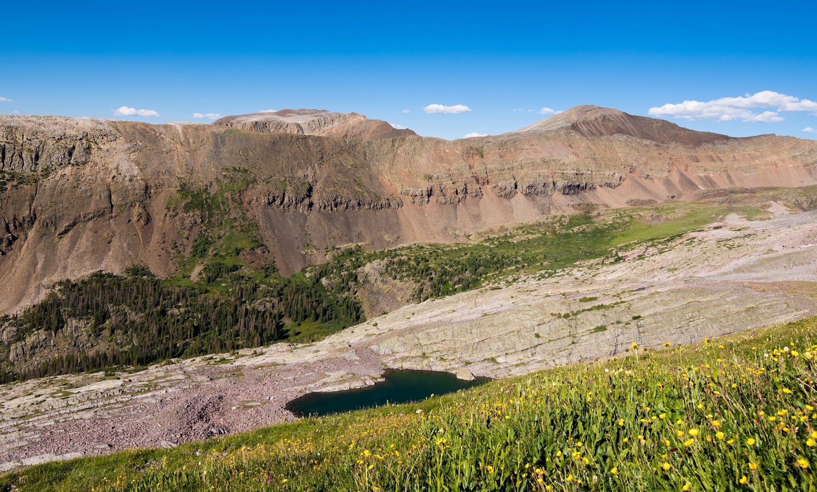
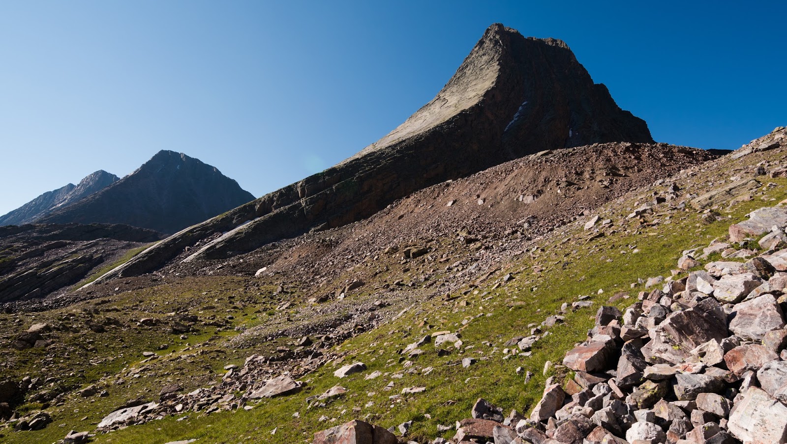
Nice view of Arrow Peak's western edge and some purple wildflowers from near the western end of Vestal Basin.
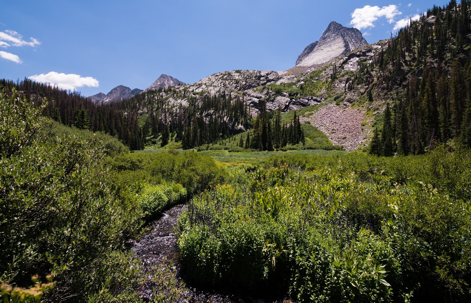
Here's the view of Vestal Creek that runs through Vestal Basin beneath Vestal Peak (upper right) and a glimpse of the Trinities in the distance.
Vestal Creek - our water source during our time in Vestal Basin.
We were fortunate, arriving to the basin on a Wednesday afternoon, to have our pick of just about anywhere we wanted. We camped in the central meadow in direct sight of Vestal Peaks dramatically curving northern slope.
I haven't mentioned it up till now, but Josh had a mild case of something that seemed like it might be elevation sickness right out of the gate; when we stayed at the beaver ponds we hoped he'd feel better after a night's rest, but he didn't...we were, accordingly, progressing along at a slower than average pace because it was harder for him to do much of anything exceptionally vigorous, which most of this hike necessarily was...
I haven't mentioned it up till now, but Josh had a mild case of something that seemed like it might be elevation sickness right out of the gate; when we stayed at the beaver ponds we hoped he'd feel better after a night's rest, but he didn't...we were, accordingly, progressing along at a slower than average pace because it was harder for him to do much of anything exceptionally vigorous, which most of this hike necessarily was...
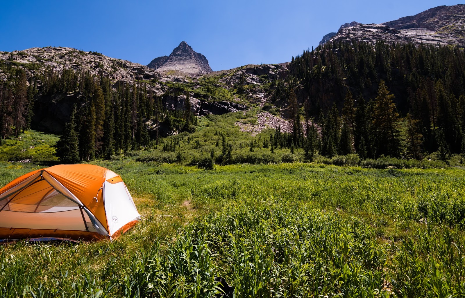
My tent and the view I enjoyed from it in Vestal Basin. Mighty fine...yes, indeed...
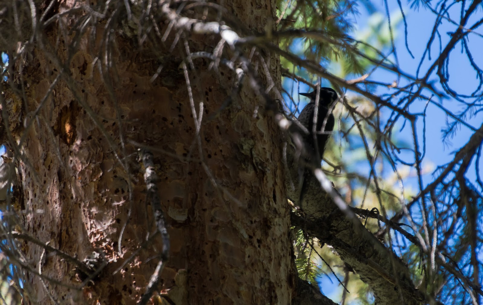
There were a lot of woodpeckers we heard along the way on this trip. This was the only one I caught a picture of...way up high in a stand of trees in Vestal Basin.
Ambrose nearing the top of the 800-or-so foot rise that leads from the lower meadows to the higher meadow...
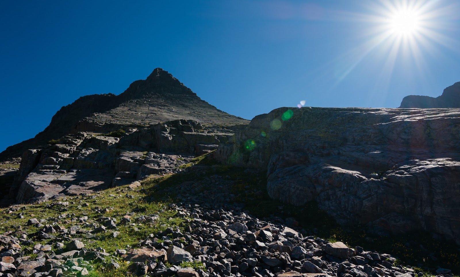
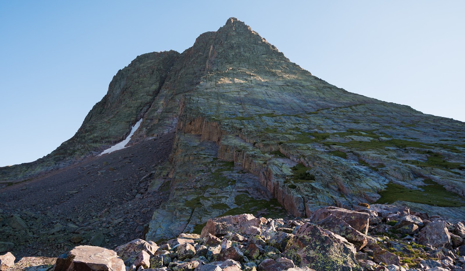
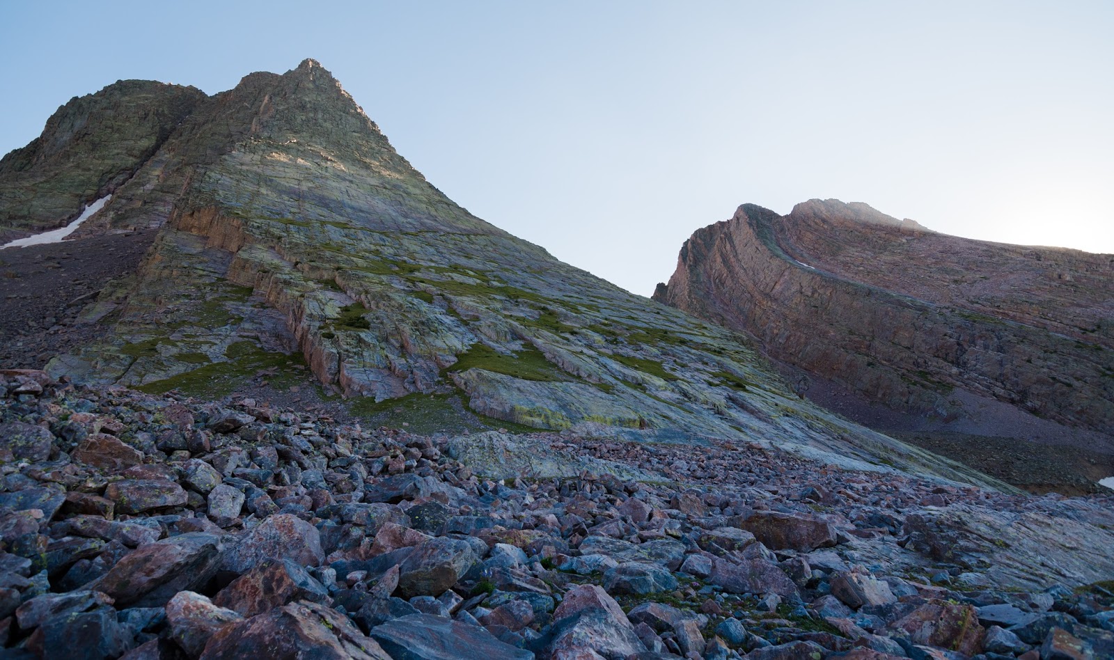
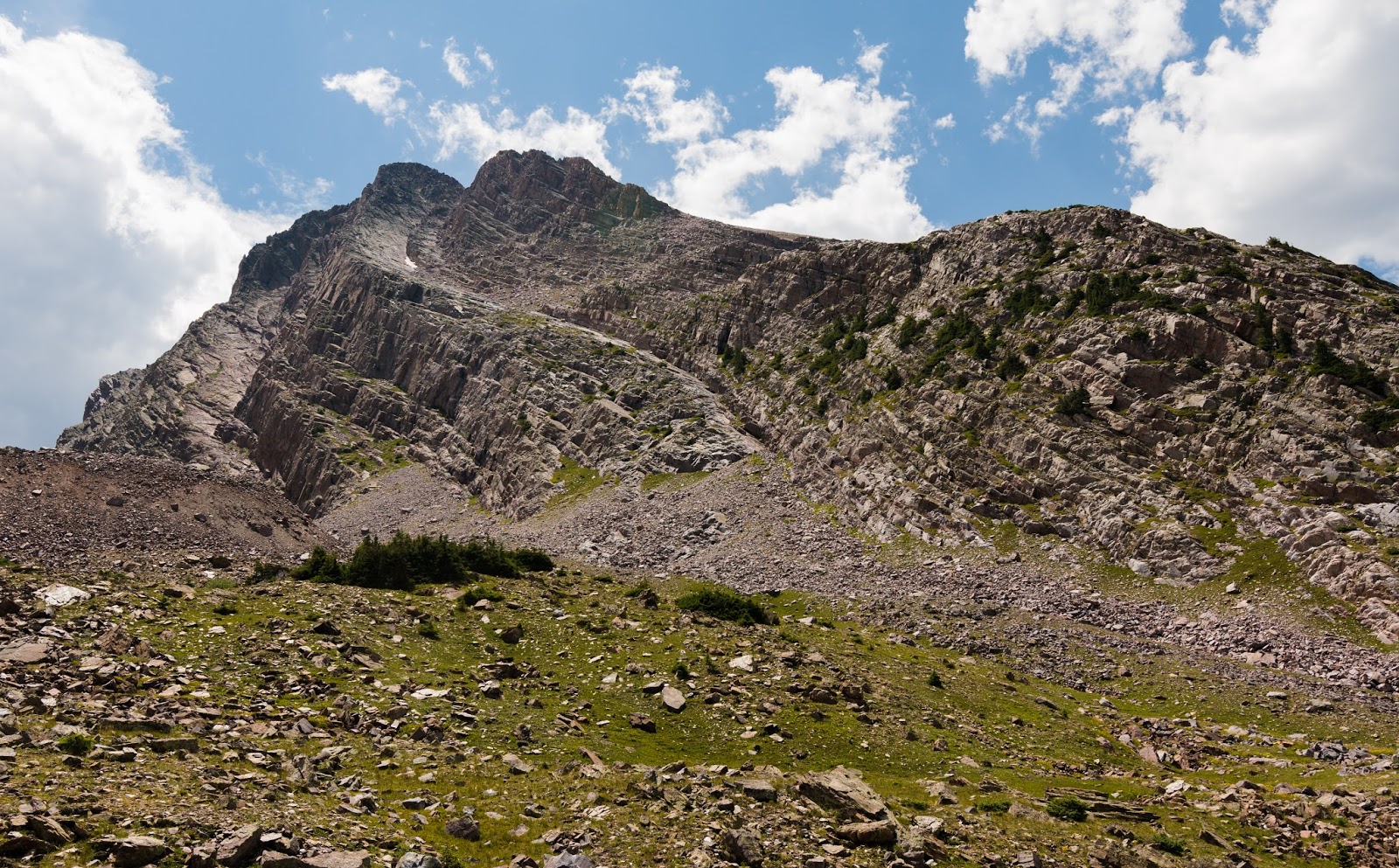
We made it up to the high meadow area...it's not so much a meadow as a boulder field, but there are some meadow-ish parts, so I'll call this area about 800 feet above the lower meadows the upper meadows - the area up above treeline, about 12,000 feet elevation, and immediately below (and to the north of) the area between Vestal and Arrow Peaks. Vestal Peak makes for a most striking sight - far more so from this vantage point than it does from the lower meadows, though it is striking from that lower perspective as well...
Part of our original intent in coming up here was also to put eyes on the route we'd be following the next day up Arrow, and potentially Vestal Peak as well, and to examine some of the areas further east around the Trinities, etc., and we were able to easily gather the desired data and make sure we knew where to aim in the morning and such for our planned ascent of Arrow Peak.
Part of our original intent in coming up here was also to put eyes on the route we'd be following the next day up Arrow, and potentially Vestal Peak as well, and to examine some of the areas further east around the Trinities, etc., and we were able to easily gather the desired data and make sure we knew where to aim in the morning and such for our planned ascent of Arrow Peak.
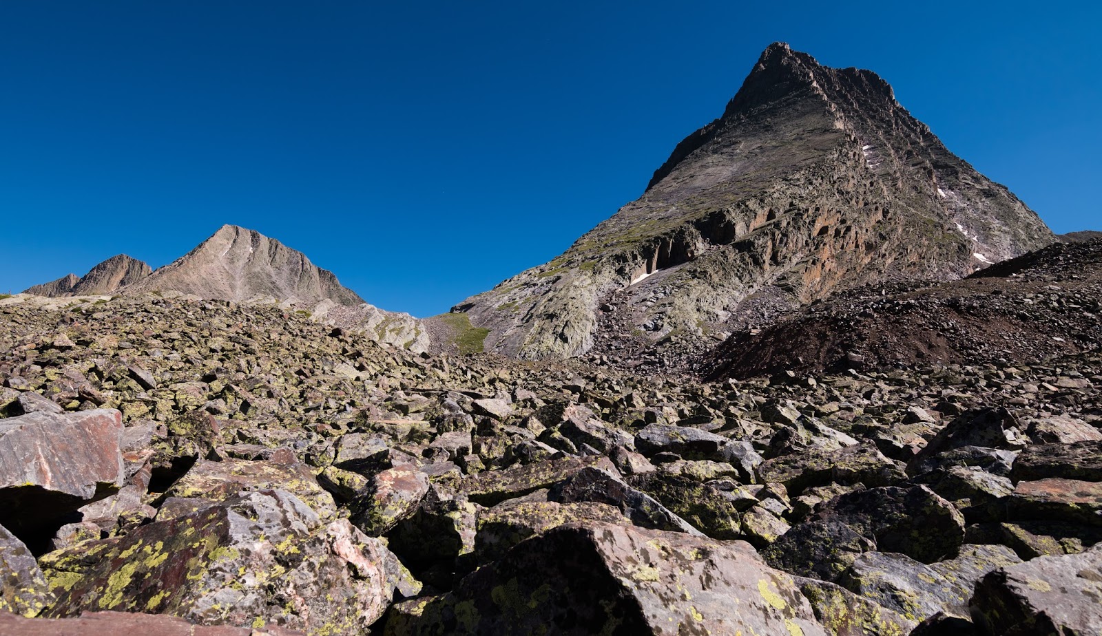
The rapturous view from the high meadow/boulder field...Vestal Peak on the right, the Trinities stretching off to the left in the distance...
Sunburst over Arrow Peak.
Sunburst over Vestal Peak's western edge...

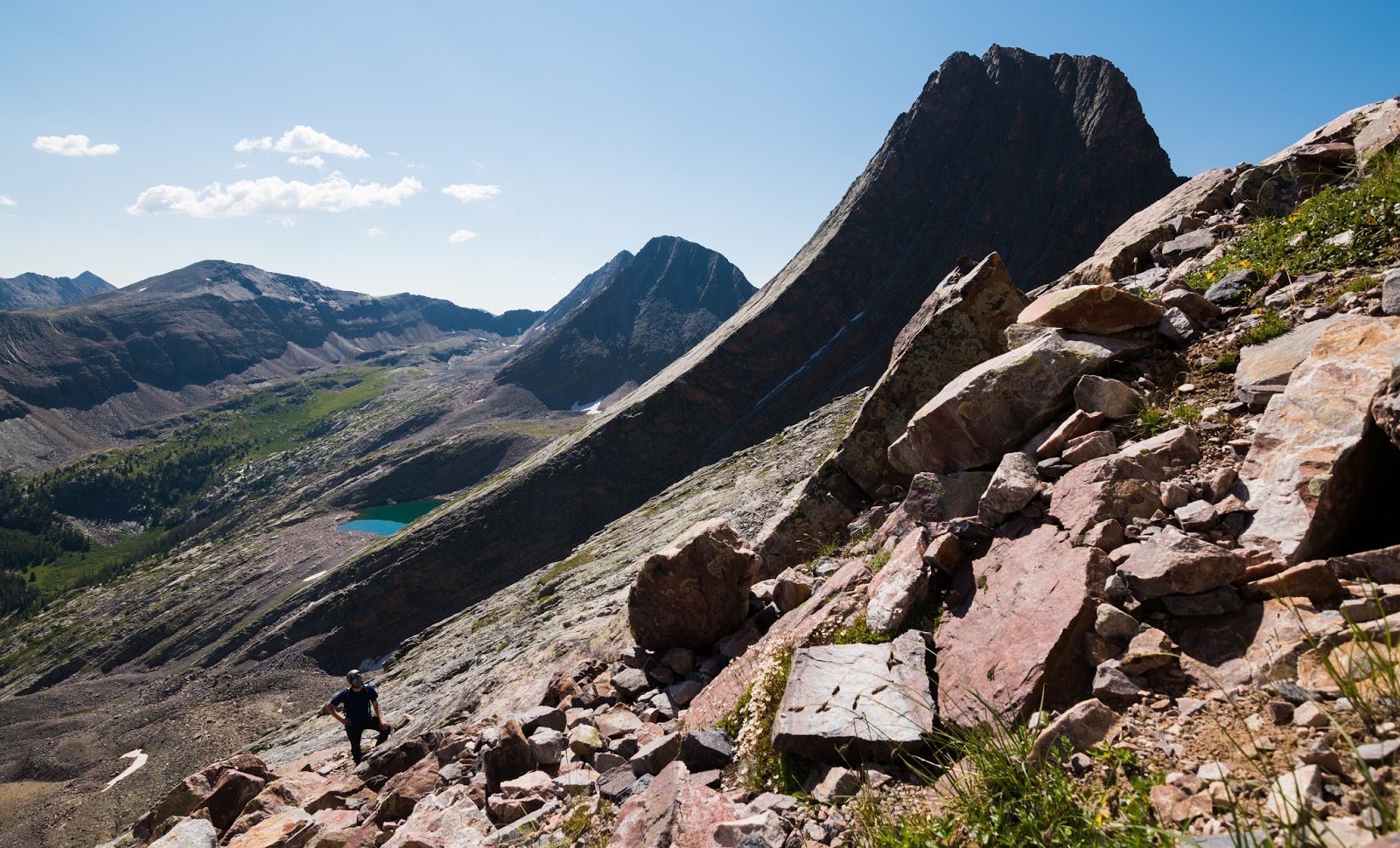
Looking out at West Trinity (13,765 feet) and the lovely Vestal Lake from somewhere on the lower northwest slabs of Vestal Peak.
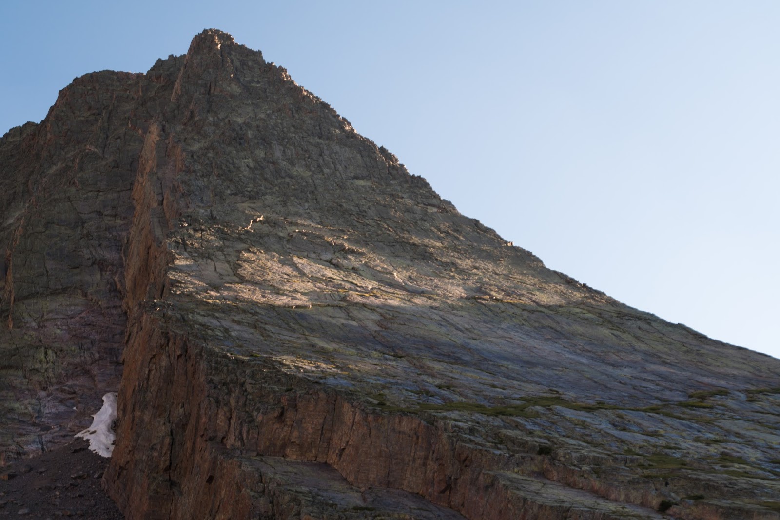
After we'd looked around this area we decided we wanted to hike up the north face of Vestal Peak a ways, possibly up to the beginning of the slabby rock that comprises the epic Wham Ridge and more difficult Center Shift routes on that peak. We were able to get up about 400 vertical feet from the higher meadows when we hit the end of the intermittent grass patches amid the slabs of lower Vestal Peak and we just sat there for a while enjoying the views from about 12,400 feet up and the almost surreal perspective of Vestal Peak's north face and its Wham Ridge route - one of the few technical mountaineering routes I'd like to do someday - though I'd likely hire out a guiding service to lead me up the route, since I'm a capable scrambler, but only a novice climber at best.
From our vantage point at the start of the Wham Ridge route on Vestal Peak we had a great view of Vestal Lake below and soon were making our way back down the grass and slabs of lower Vestal Peak and on through a brief stretch of largely stable boulders to the western and northern stretches of Vestal Lake.
From our vantage point at the start of the Wham Ridge route on Vestal Peak we had a great view of Vestal Lake below and soon were making our way back down the grass and slabs of lower Vestal Peak and on through a brief stretch of largely stable boulders to the western and northern stretches of Vestal Lake.

Lower slabs on Vestal Peak's northwest slopes.
Looking up at Vestal Peak's infamous Wham Ridge route from the route's starting point.
Looking down over Vestal Basin and Vestal Lake from Vestal Peak's lower slabs.
West Trinity rising above the wildflowers on Vestal Peak's lower slabs.
Another shot of Wham Ridge on Vestal Peak.
Another shot of West Trinity from Vestal Peak's lower slabs.
Neat rock warping on the opposite side of Vestal Basin.
Ambrose looking up at Wham Ridge...a technical climbing route we'd both like to do one day...
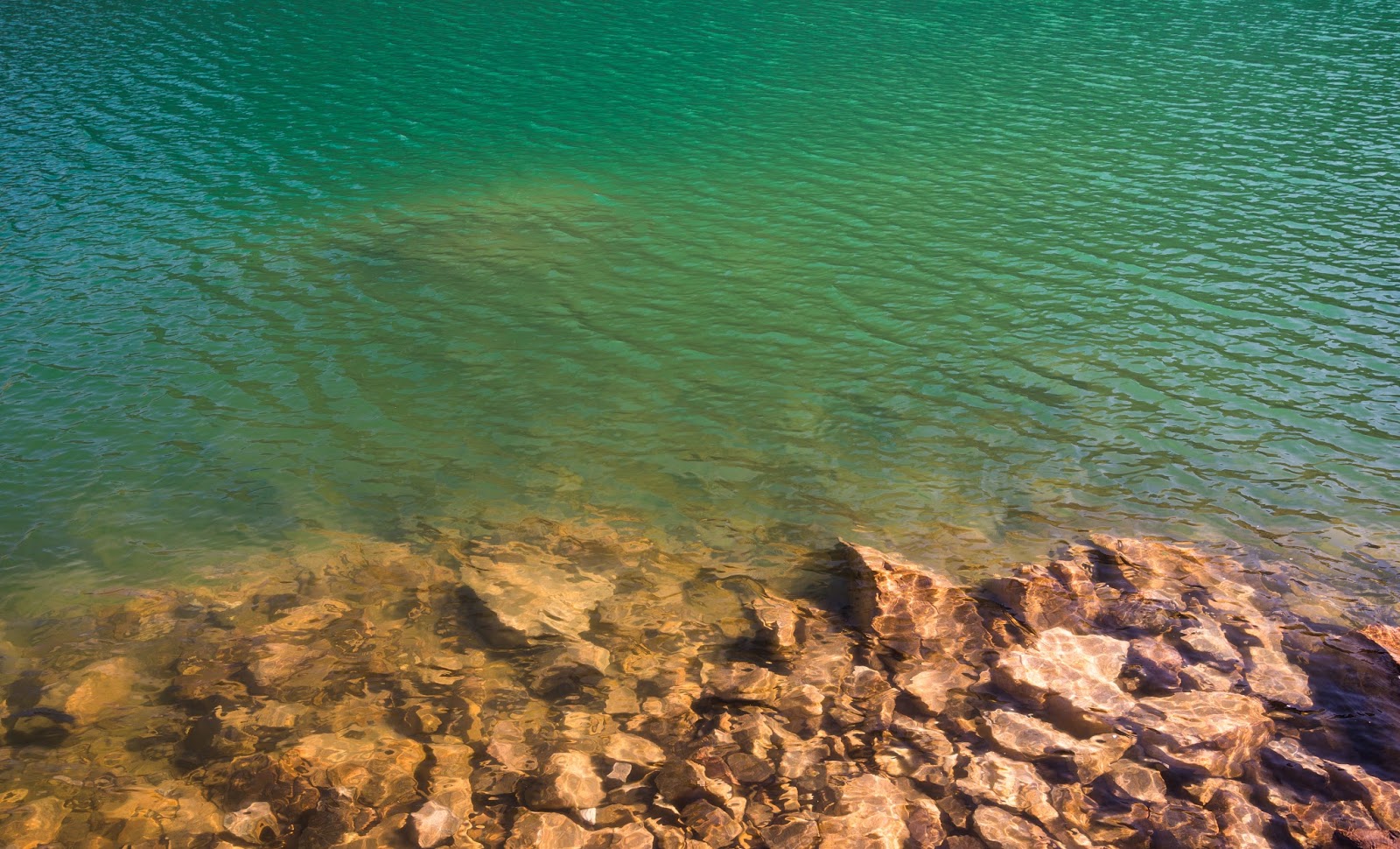
Vestal Lake detail.
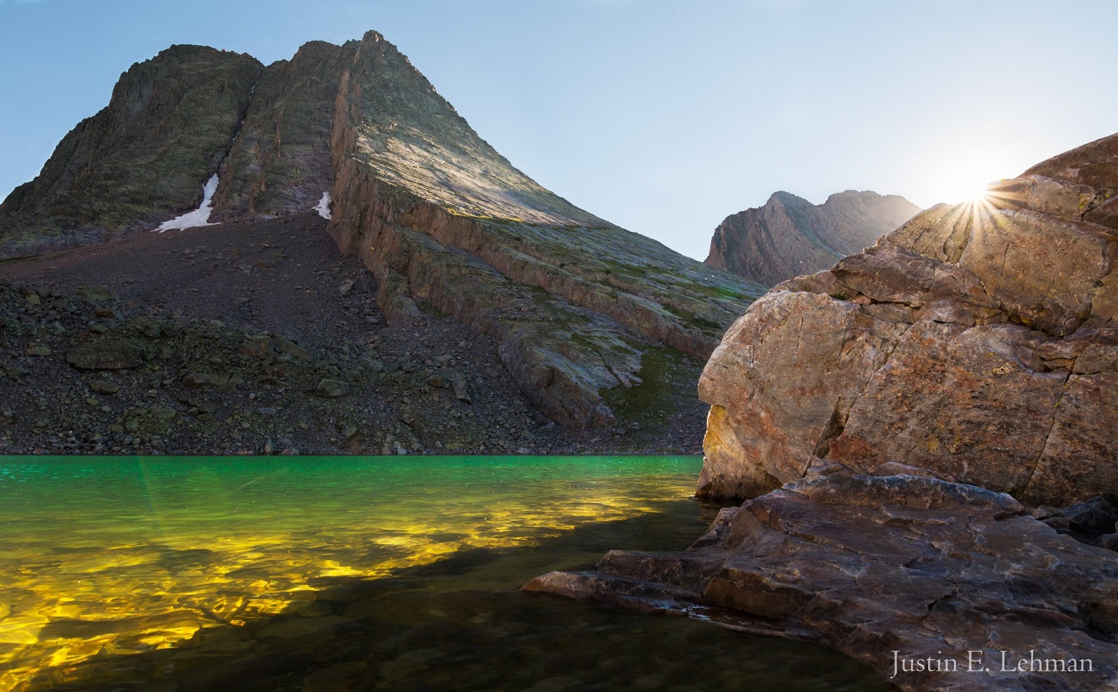
My favorite shot from the trip: Vestal Peak accented by the setting sun, the upper edges of Arrow Peak in the distance, a little sunburst, and the crystal waters of Vestal Lake aglow beneath it all...simply sublime to see...
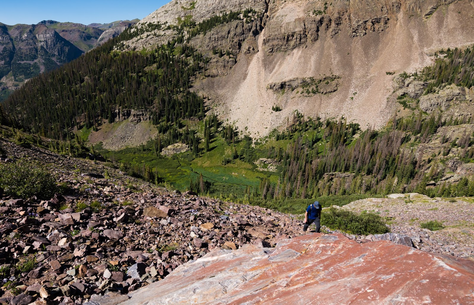
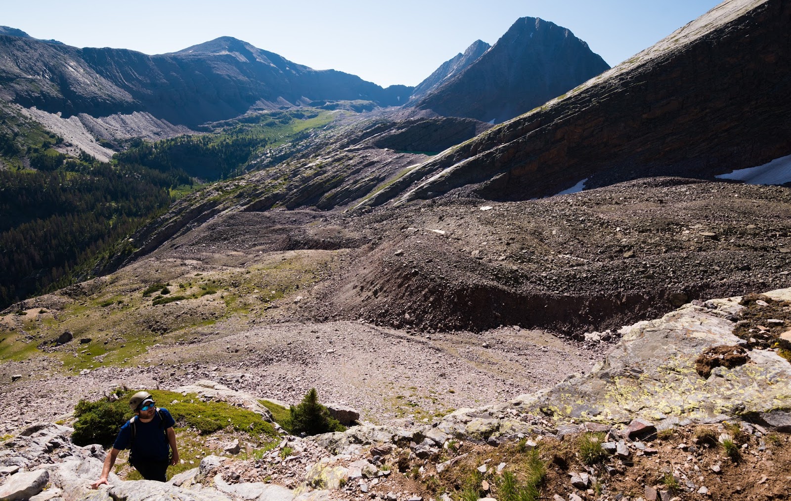
We made it back down the steep trail around the time the sunset was beginning; as noted before, the descent from the high meadows to the lower meadows at 11,300 feet above sea level on that steep trail with loose material on it was surprisingly straightforward and a much more pleasant trip than what it looked like it would be - and that was nice. Soon we were in the lower meadows making dinner and heading for bed in anticipation of our ascent up Arrow Peak. Josh still wasn't feeling well, despite taking it easy that day in the lower meadows; we all hoped he'd be feeling up to summiting the next day...
One thing I will mention is the odd fact, when we were there at least, that the worst area for mosquitoes of the entire trip was in the lower meadows. I have never used so much bug spray (98% deet, by the way) and put it on everything from head to toe just to keep the things at bay, with multiple reapplications throughout the day...they weren't present (at all) in the upper meadows at 12,000 feet and up that Ambrose or I noticed, they weren't even bad below the lower meadows, like on the ascent from the beaver ponds, or the other trail areas prior to that...we didn't understand why they were so thick there, but they were an irritation; marinating ourselves in bug spray kept things manageable, but there were certainly far more mosquitoes up there than any of us expected...times ten or so...
One thing I will mention is the odd fact, when we were there at least, that the worst area for mosquitoes of the entire trip was in the lower meadows. I have never used so much bug spray (98% deet, by the way) and put it on everything from head to toe just to keep the things at bay, with multiple reapplications throughout the day...they weren't present (at all) in the upper meadows at 12,000 feet and up that Ambrose or I noticed, they weren't even bad below the lower meadows, like on the ascent from the beaver ponds, or the other trail areas prior to that...we didn't understand why they were so thick there, but they were an irritation; marinating ourselves in bug spray kept things manageable, but there were certainly far more mosquitoes up there than any of us expected...times ten or so...
Zoom-shot on West Trinity from near Vestal Lake.
Zoom-shot of Vestal Peak's north face; Wham Ridge runs (generally) up the right side here.
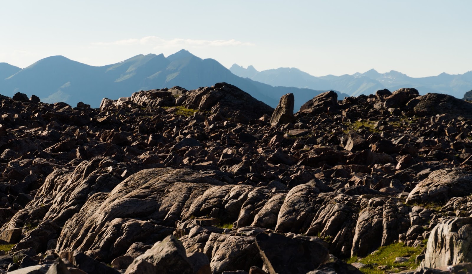
Views of distant mountains around us...
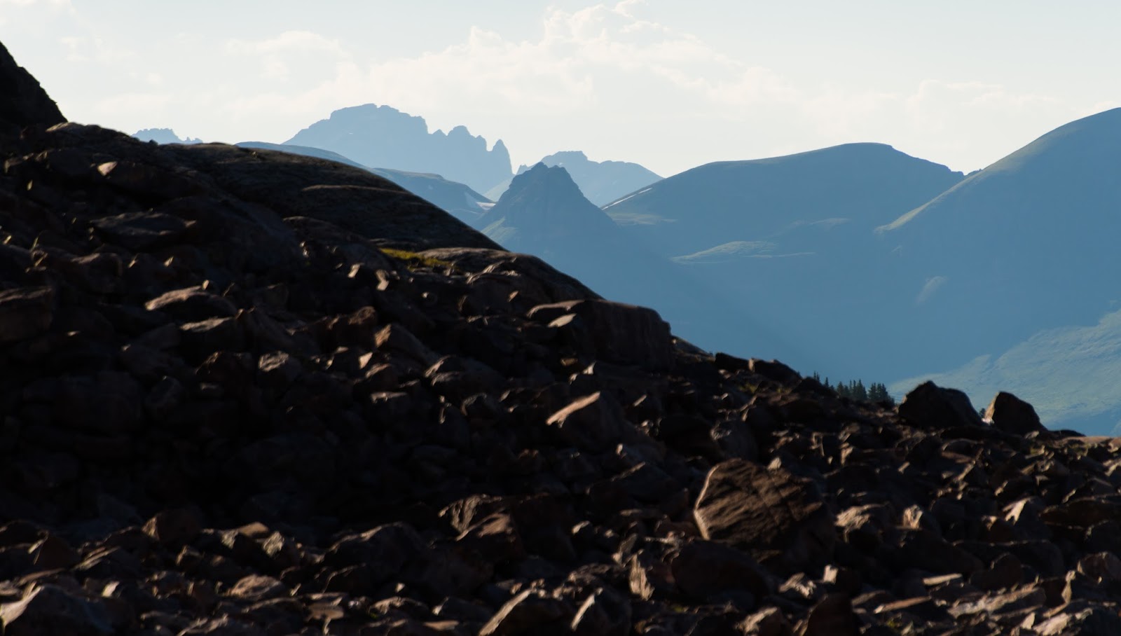
Views of distant mountains around us...
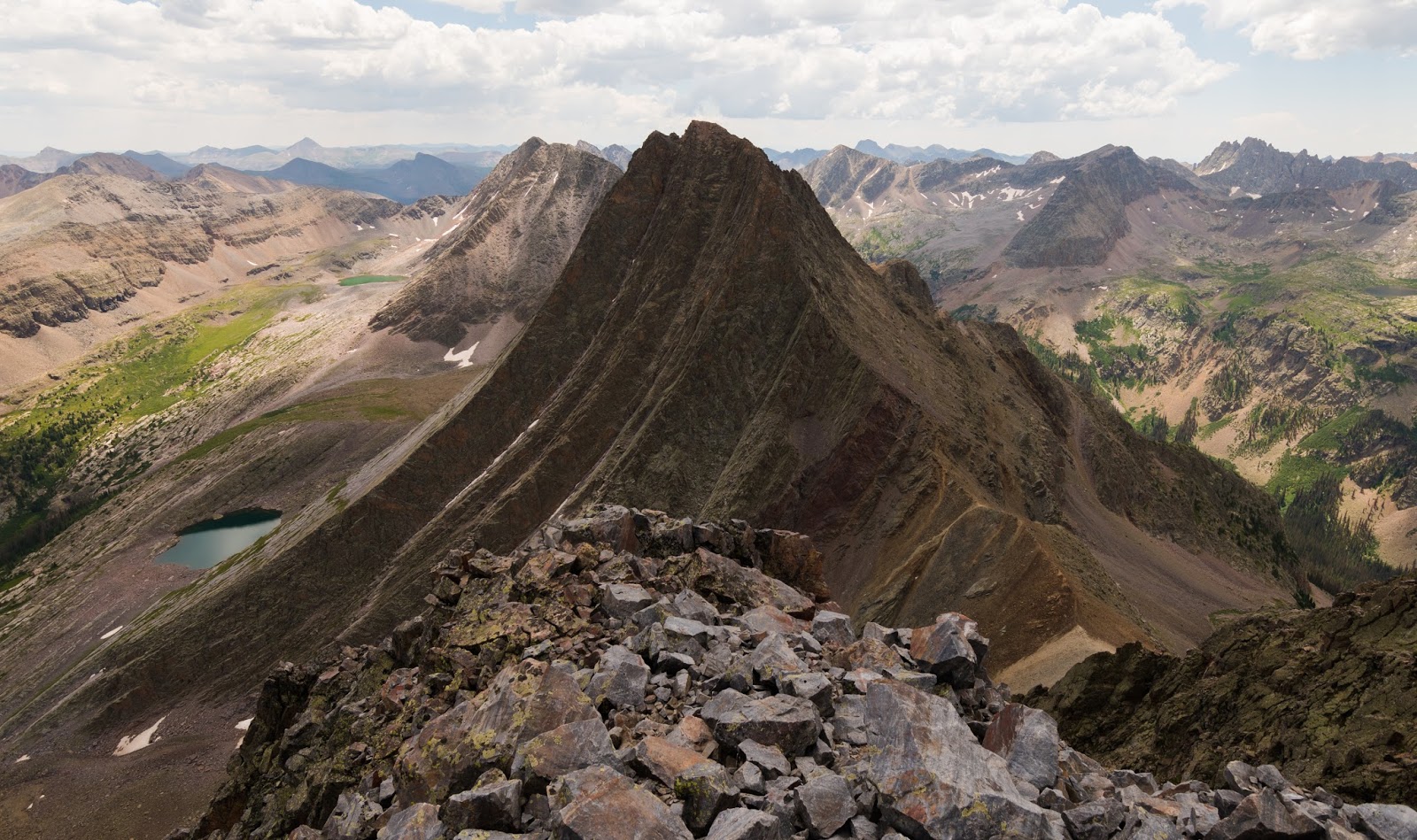
Vestal Peak wide-shot.
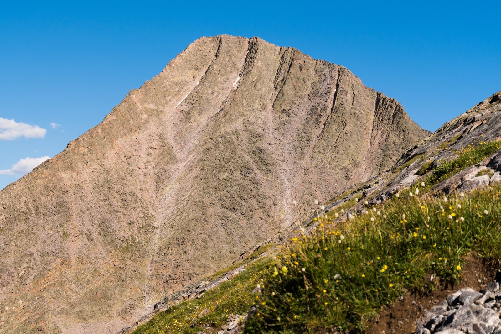
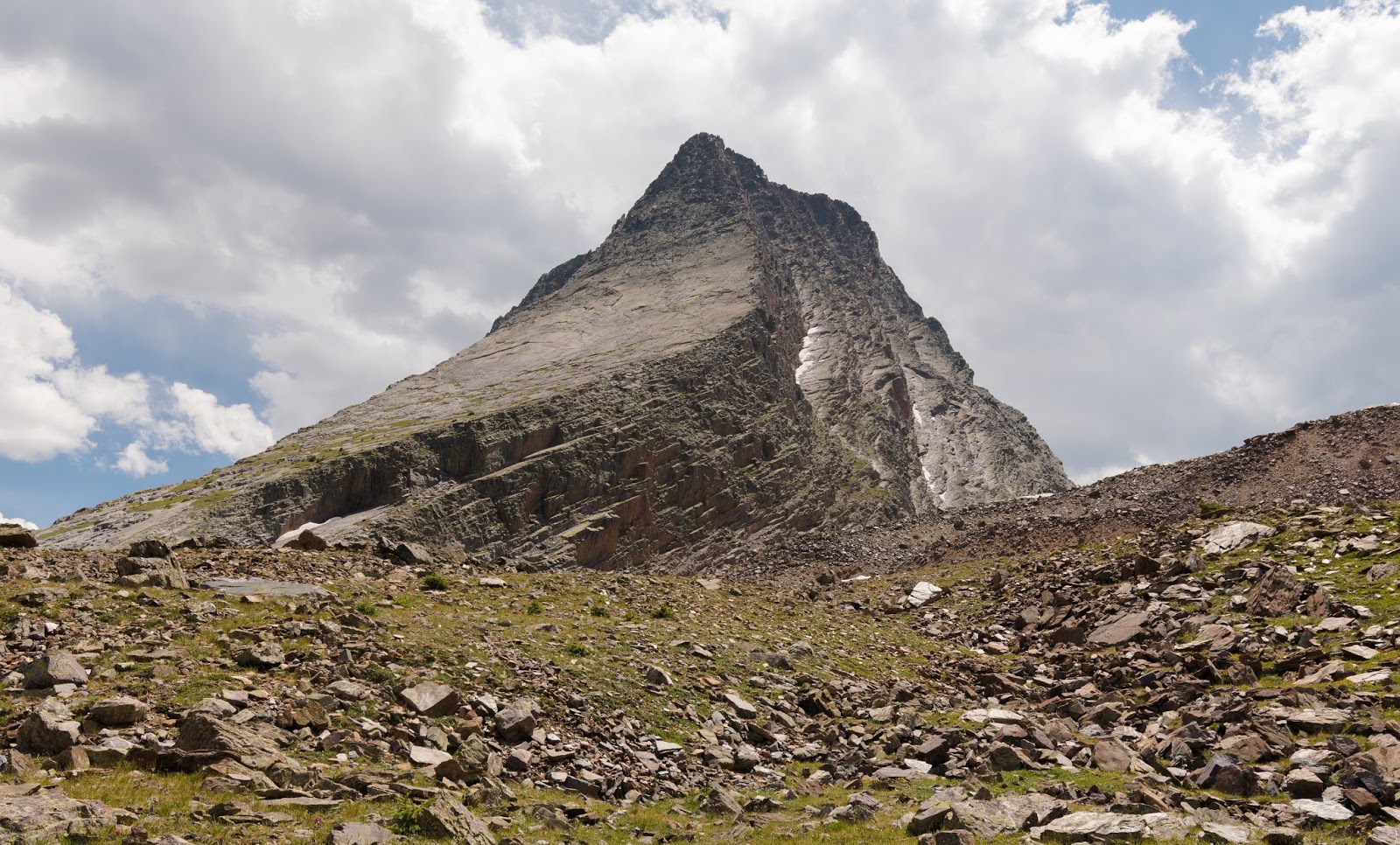
Vestal Peak (L) and Arrow Peak (R); we would ascend Arrow Peak the next morning via its northwest slabs route.
Vestal Peak's shadow against West Trinity.

One last view of Vestal and Arrow Peaks from somewhere lower between the two.
As many times as I saw the profile of Vestal Peak on this trip it still stunned me in each instance...just under 14,000 feet tall and one of the most dramatically shaped peaks I've ever seen...very cool to spend time around...
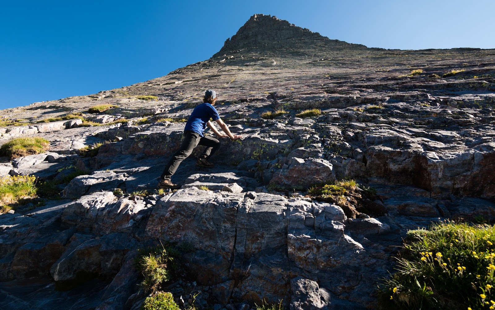
The starting point for the ramp ascent is obvious. Having seen the route from partway up Vestal's north face the day before we knew it would be somewhat steep at the outset and would get very steep near the end...Ambrose and I approached this peak with the attitude of "let's see if we can get to the top, but if it starts getting too hairy farther up we'll turn back and call it good". As it happened, Arrow Peak proved to be one of the most exciting single-peak ascents either of us had done anywhere; Ambrose even compared the ascent of Arrow Peak to the blissfully enjoyable scramble up Idaho's state highpoint, Borah Peak (12,662 feet) via the Chicken-out Ridge Route and following, thereafter the high ridge that runs up to the summit - and that, for those of you that haven't done it yet, is exceptionally high praise, since when Ambrose, I, and several others did Borah Peak in later 2015 we almost universally agreed it was, perhaps, the finest scramble we had ever done.
One of the interesting things about Arrow Peak is the variety of terrain. Early on you're ascending steep slabs either by just "frictioning up" (which means walking right up the angled slabs by way of the traction you get from your shoes, if you've got grippy enough soles and enough confidence in that grip then this isn't a bad call); sometimes the slabs are quite smooth, sometimes there are cracks and other surface features you can wedge your foot into, grab on to, or otherwise press against on the ascent.
One of the interesting things about Arrow Peak is the variety of terrain. Early on you're ascending steep slabs either by just "frictioning up" (which means walking right up the angled slabs by way of the traction you get from your shoes, if you've got grippy enough soles and enough confidence in that grip then this isn't a bad call); sometimes the slabs are quite smooth, sometimes there are cracks and other surface features you can wedge your foot into, grab on to, or otherwise press against on the ascent.
Ambrose working up Arrow Peak's lower slabs while overlooking the lower reaches of Vestal Peak and the Trinities beyond...
Getting higher up Arrow Peak's slabs with Vestal Peak and the Trinities rising dramatically behind...
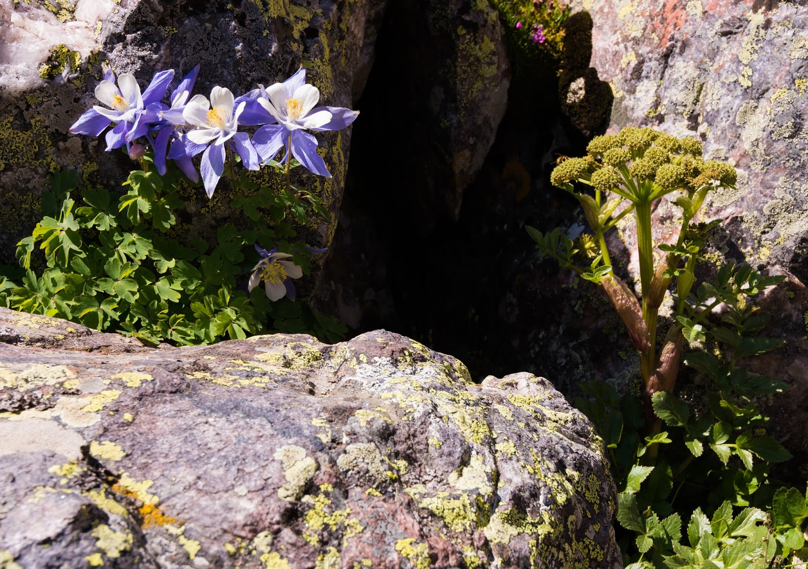
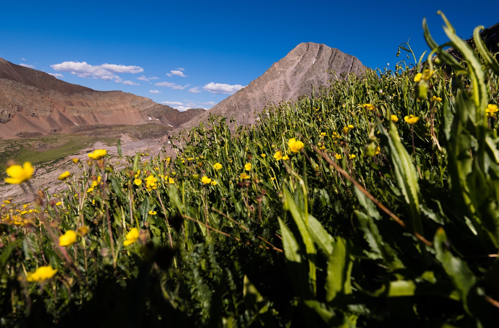
Colorado's state flower, the lovely columbine.
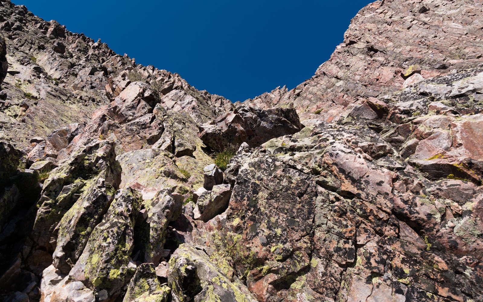
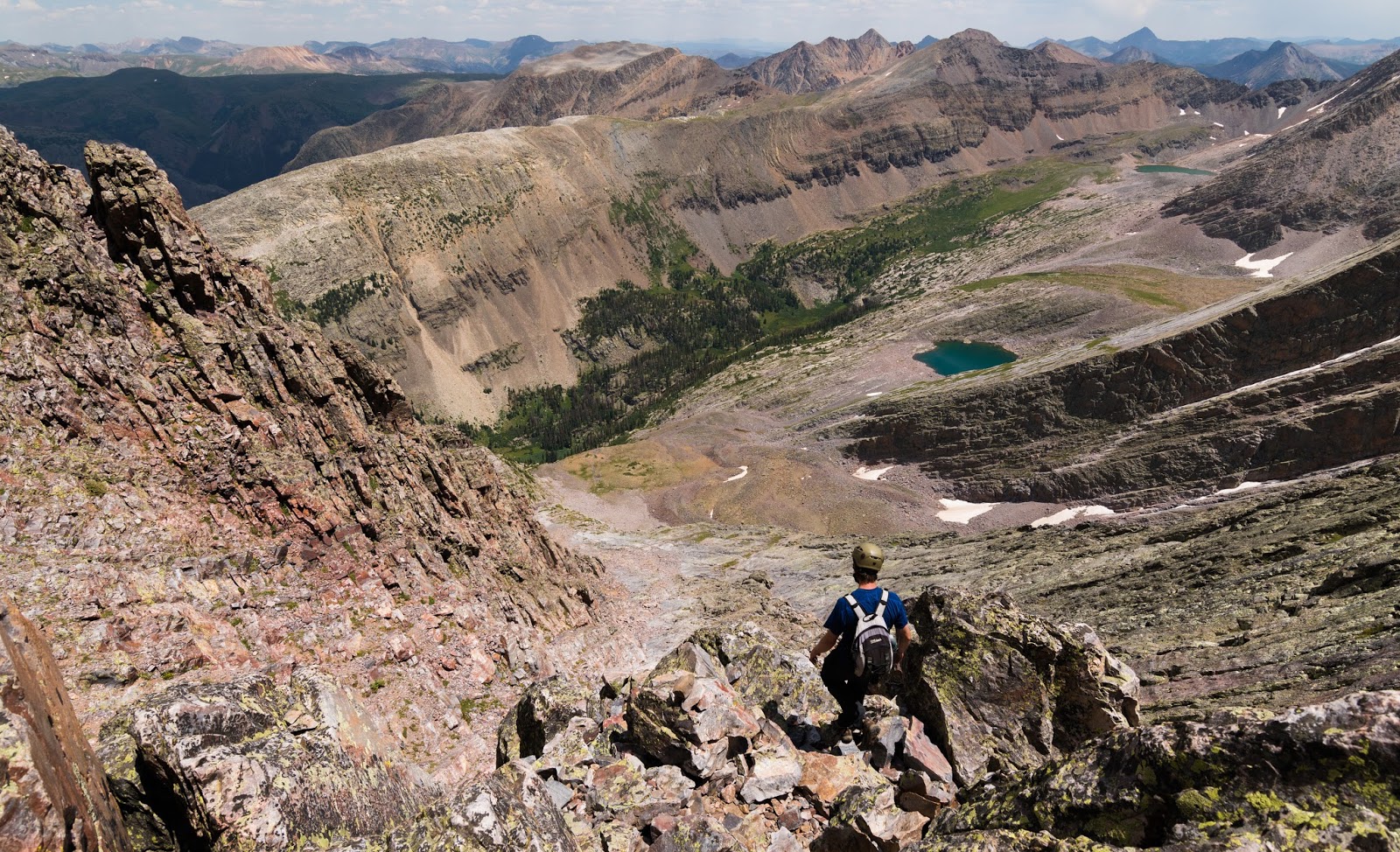
The further up you go on Arrow Peak the more exciting the scrambling becomes...there's a nice ridge up there, followed by some very steep scrambling with exposure in the upper stretches - some fun route-finding up there, with a fair degree of route-choices that could work and can make the route easier or more challenging, as desired.
I will mention, because it's a little deceiving from the ascent path, that the true summit is somewhat left of line you go up, so somewhere near what looks like the top you have to bear left (south at this point) to make the final ascent - this is well up the "middle ramp" you ought to have gained long before if you've been following the summitpost.org (or other similar) directions up to this point. Interestingly, most of the scrambling here is not on an exposed ridge, though there is a decent stretch of that as one gets higher up the "middle ramp", but the route is still frequently exposed to varying degrees (not much-to pretty severely) because of the interesting physical structure of this peak. Ambrose and I both remarked that, near its summit, Arrow Peak seems just about as steep as Vestal's stunning north face; they're certainly very similar in angle and that means this is not a peak to try to find out if you're comfortable with scrambling if you haven't got a number of other peaks under your belt already - there's some legitimate challenges here that are great if you're prepared but could quickly get you into trouble if you're not well-experienced when you start your ascent.
I will mention, because it's a little deceiving from the ascent path, that the true summit is somewhat left of line you go up, so somewhere near what looks like the top you have to bear left (south at this point) to make the final ascent - this is well up the "middle ramp" you ought to have gained long before if you've been following the summitpost.org (or other similar) directions up to this point. Interestingly, most of the scrambling here is not on an exposed ridge, though there is a decent stretch of that as one gets higher up the "middle ramp", but the route is still frequently exposed to varying degrees (not much-to pretty severely) because of the interesting physical structure of this peak. Ambrose and I both remarked that, near its summit, Arrow Peak seems just about as steep as Vestal's stunning north face; they're certainly very similar in angle and that means this is not a peak to try to find out if you're comfortable with scrambling if you haven't got a number of other peaks under your belt already - there's some legitimate challenges here that are great if you're prepared but could quickly get you into trouble if you're not well-experienced when you start your ascent.
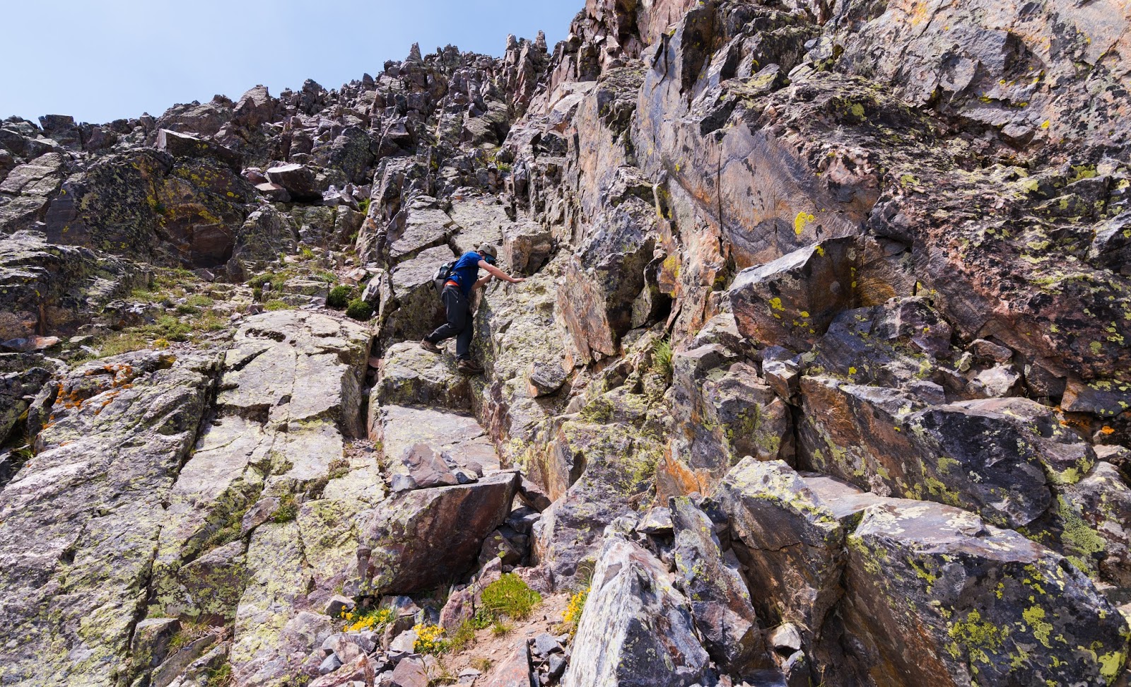
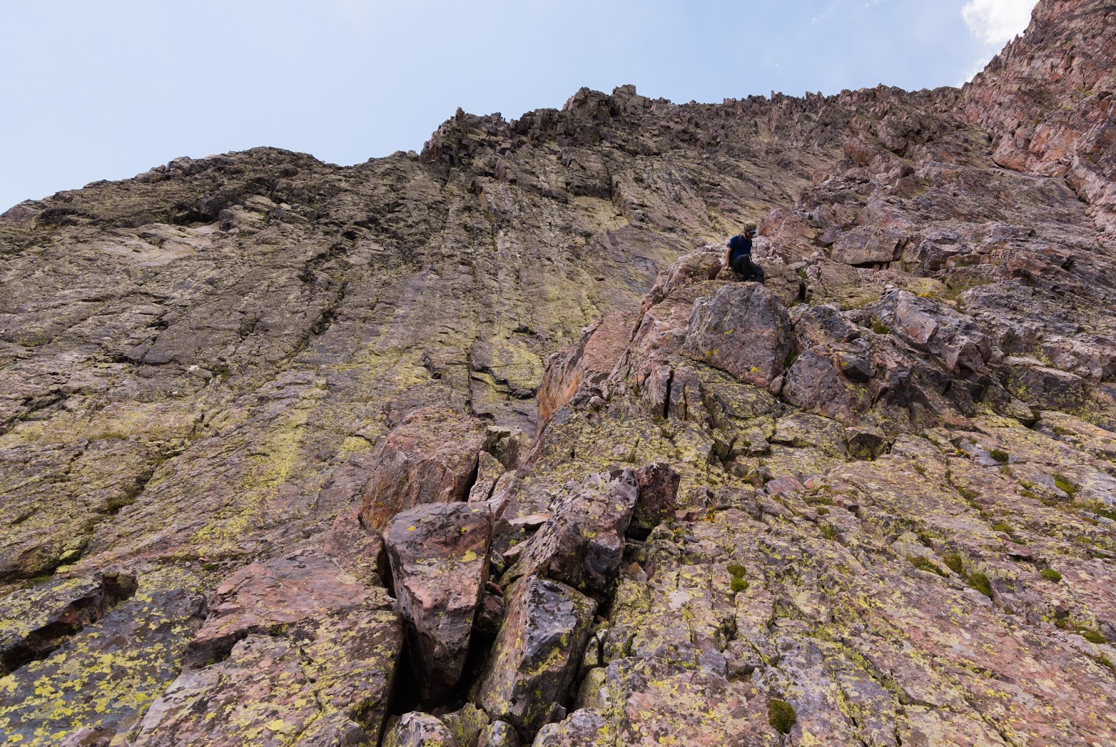
Ambrose negotiating more challenging terrain higher up on Arrow Peak.
Plenty of challenging terrain still to come before the summit...
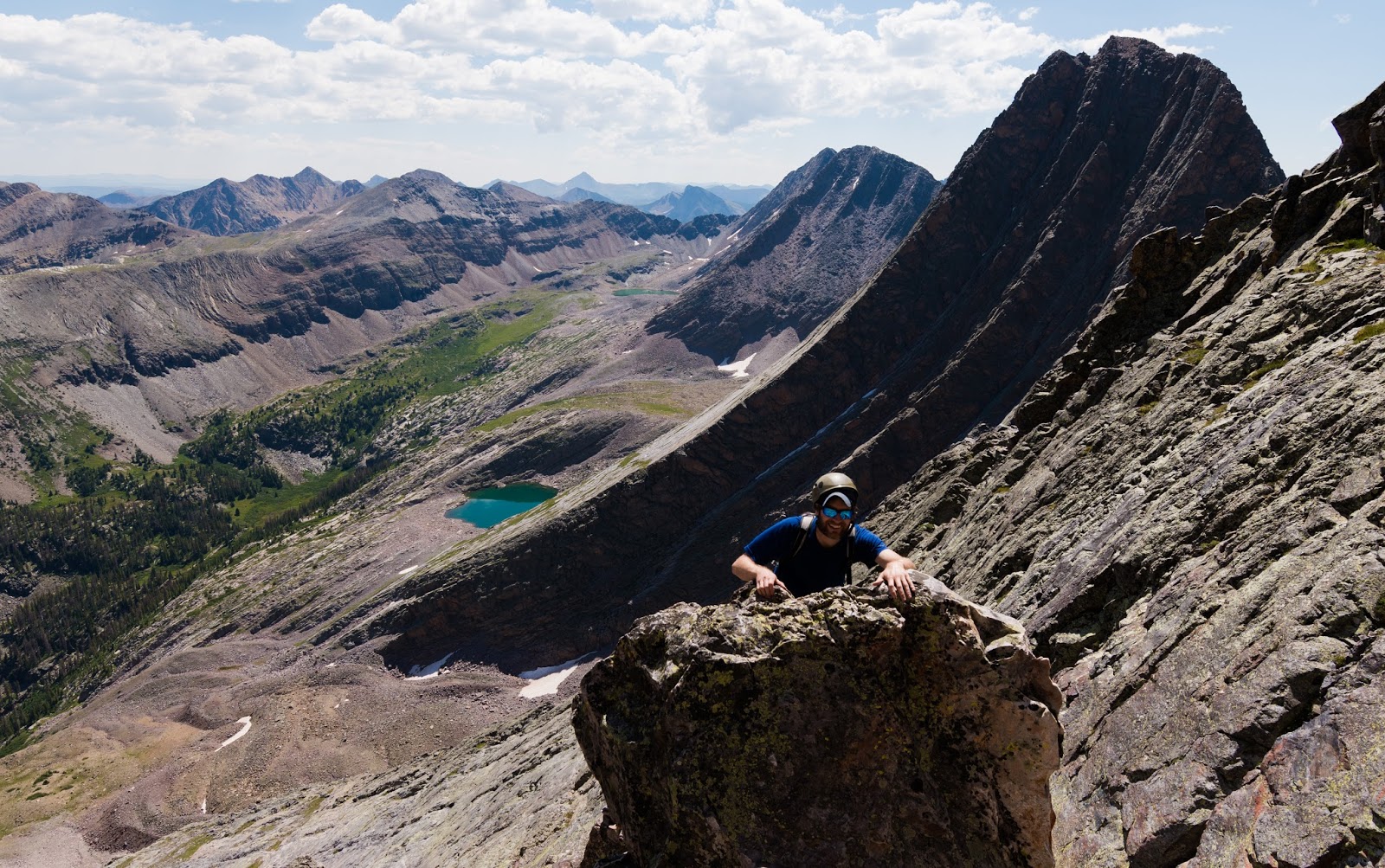
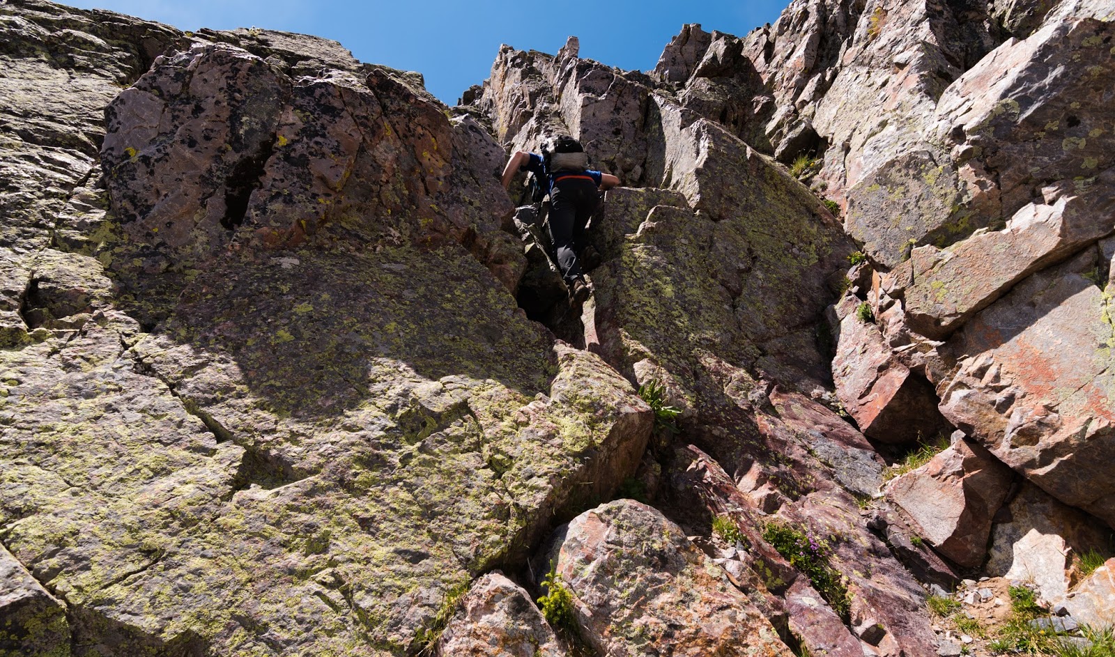
Ambrose topping out on a boulder at the end of a ridge we ascended on the way up Arrow Peak.
This picture gives you an idea of how steep the route gets along the upper reaches of Arrow Peak...
After a bunch of exciting scrambling and a few route-finding problems solved we found ourselves on the summit of Arrow Peak and were rewarded with one of the finest summit views I have ever had the privilege of beholding...
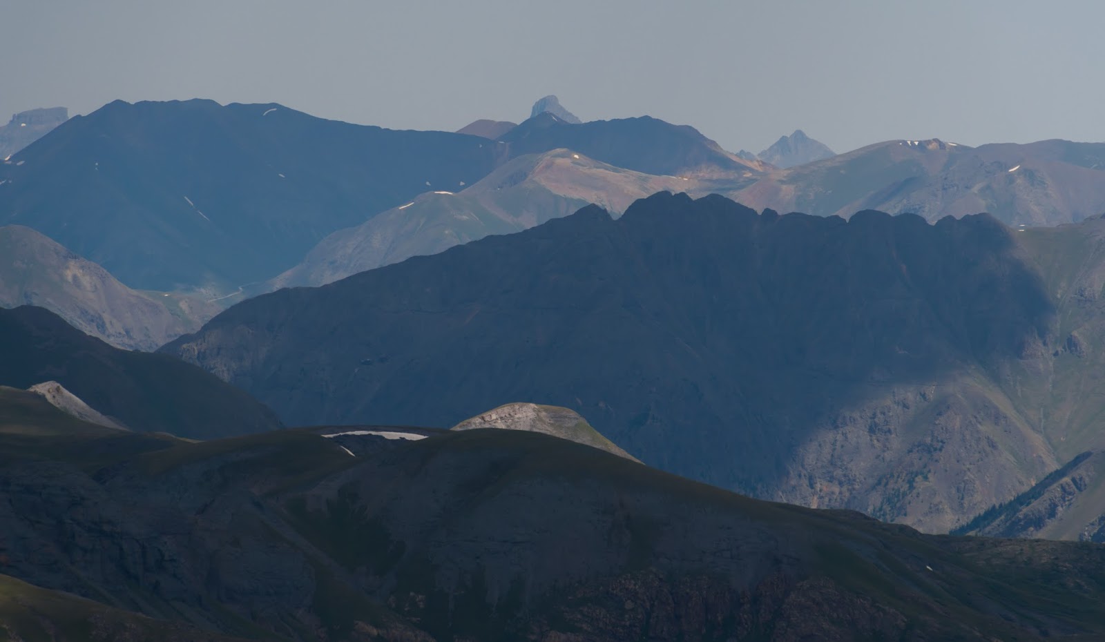
To the south were epic views of the truly stunning Needle Mountains - certainly one of the most rugged mountain areas in the lower 48 states...it was neat to see these peaks personally I had, hitherto, only seen online in various articles - Pigeon Peak (13,972 feet) and Jagged (13,824 feet) were, among a whole line of exceptionally rugged peaks and mountains, themselves stand-out peaks.
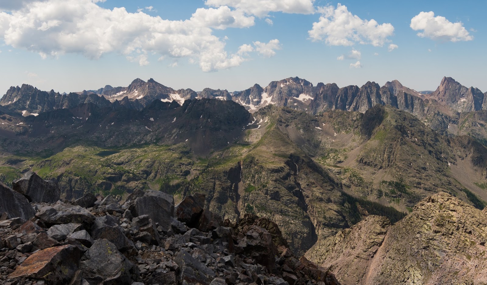
Looking around, from Arrow's summit, we had almost a complete 360-degree view that was comprised of mountain after mountain, stretching off into the distance, and many of them were very rugged, though none more so than those of the aforementioned Needle Mountains to the south of us. For lovers of mountains and mountainous areas the summit of Arrow Peak is pure bliss, not only for the joy of the exciting ascent successfully completed but for the almost paradisaical vistas that meet you there...
As you can both imagine and see here, there were plenty of pictures taken from Arrow's summit - after all, being from Utah, it's not every day you get up to 13,811 feet (this was the elevation measured from both my separate GPS unit and the on-the-phone mapping application I was using, though the internet has Arrow Peak represented at 13,803 feet...regardless, we were somewhere over 13,800 feet and that's substantially higher than Kings Peak, Utah's highest point, at 13,528 feet)!
To the south were epic views of the truly stunning Needle Mountains - certainly one of the most rugged mountain areas in the lower 48 states...it was neat to see these peaks personally I had, hitherto, only seen online in various articles - Pigeon Peak (13,972 feet) and Jagged (13,824 feet) were, among a whole line of exceptionally rugged peaks and mountains, themselves stand-out peaks.
Looking around, from Arrow's summit, we had almost a complete 360-degree view that was comprised of mountain after mountain, stretching off into the distance, and many of them were very rugged, though none more so than those of the aforementioned Needle Mountains to the south of us. For lovers of mountains and mountainous areas the summit of Arrow Peak is pure bliss, not only for the joy of the exciting ascent successfully completed but for the almost paradisaical vistas that meet you there...
As you can both imagine and see here, there were plenty of pictures taken from Arrow's summit - after all, being from Utah, it's not every day you get up to 13,811 feet (this was the elevation measured from both my separate GPS unit and the on-the-phone mapping application I was using, though the internet has Arrow Peak represented at 13,803 feet...regardless, we were somewhere over 13,800 feet and that's substantially higher than Kings Peak, Utah's highest point, at 13,528 feet)!
Arrow Peak's summit view, looking south to the jaw-droppingly rugged Needle Range.
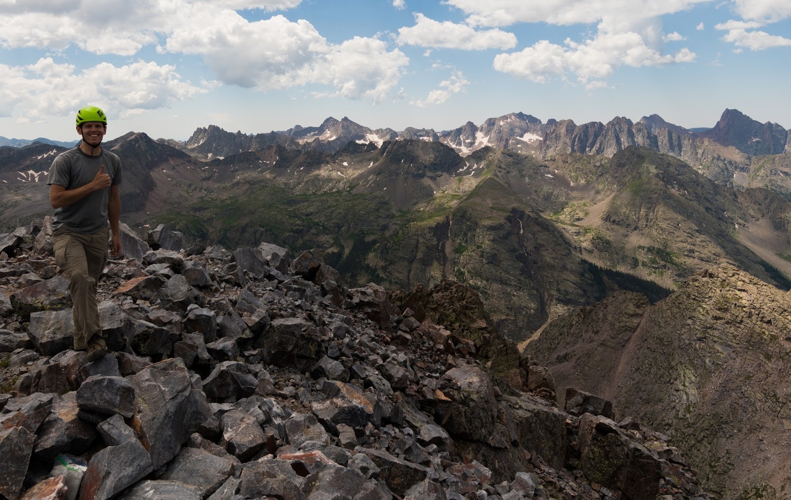
Me, on the summit of Arrow Peak (13,808 feet above sea level)!
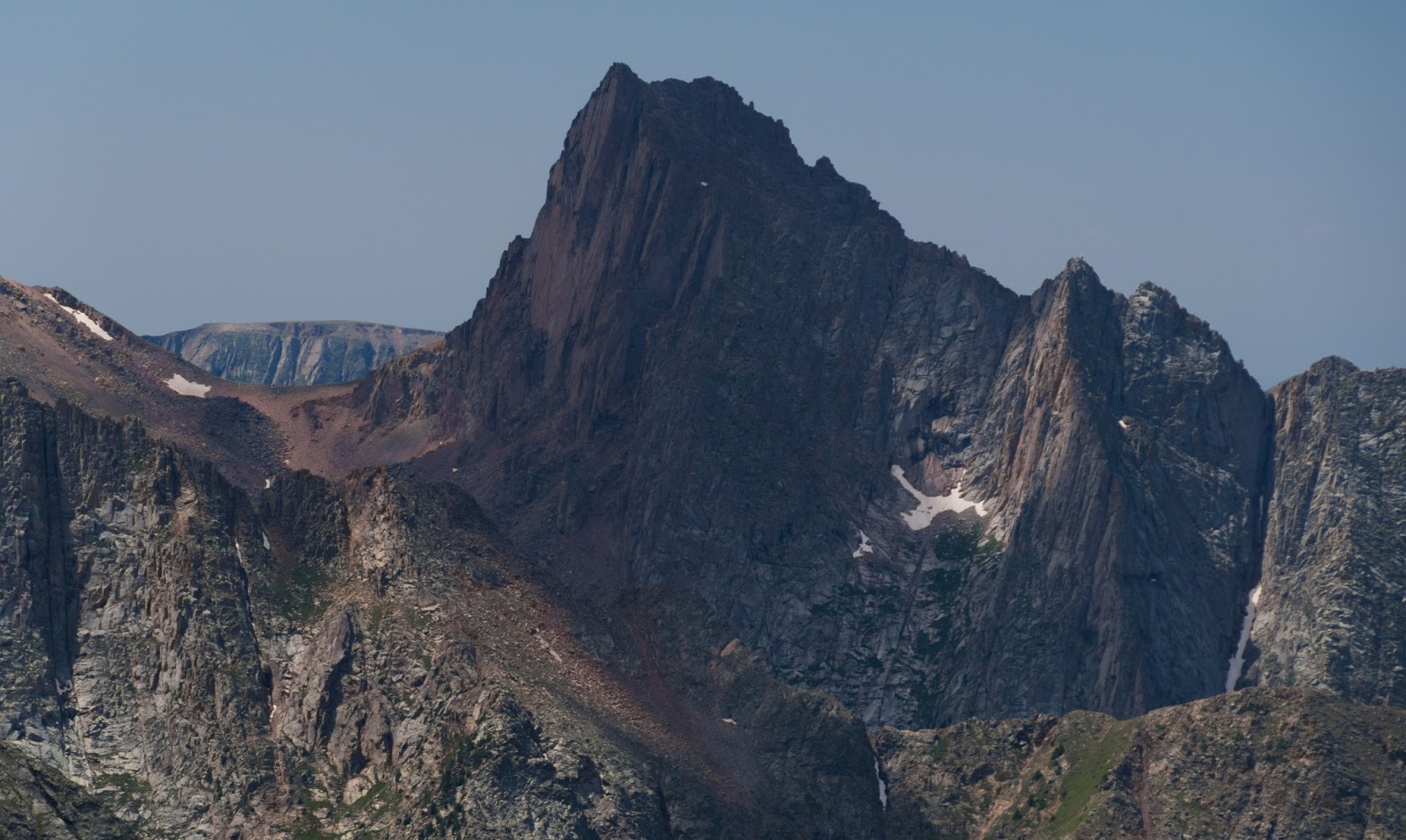
Aesthetically spectacular but less-awesomely named Pigeon Peak (13,972 feet).

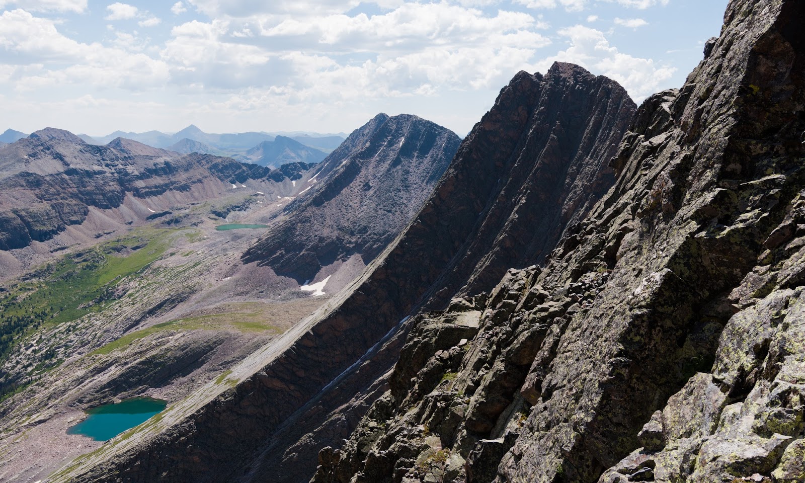
Various peaks seen from the summit of Arrow Peak.

Various peaks seen from the summit of Arrow Peak.
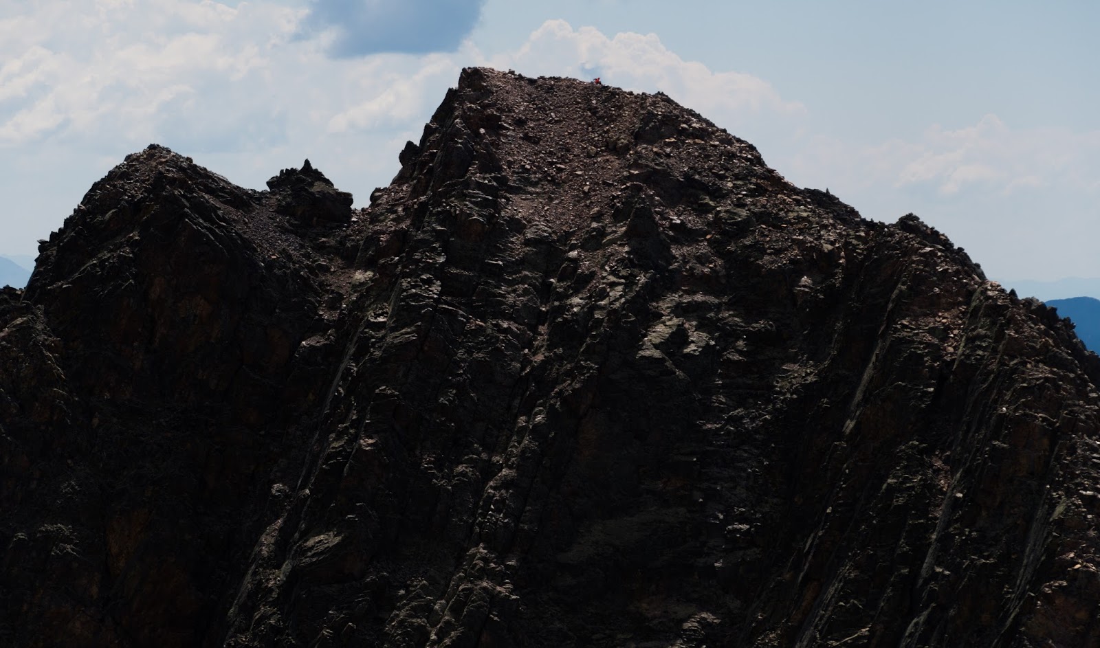
Vestal Peak's summit, as seen from Arrow Peak's summit. Can you see the hiker in the orange jacket there?
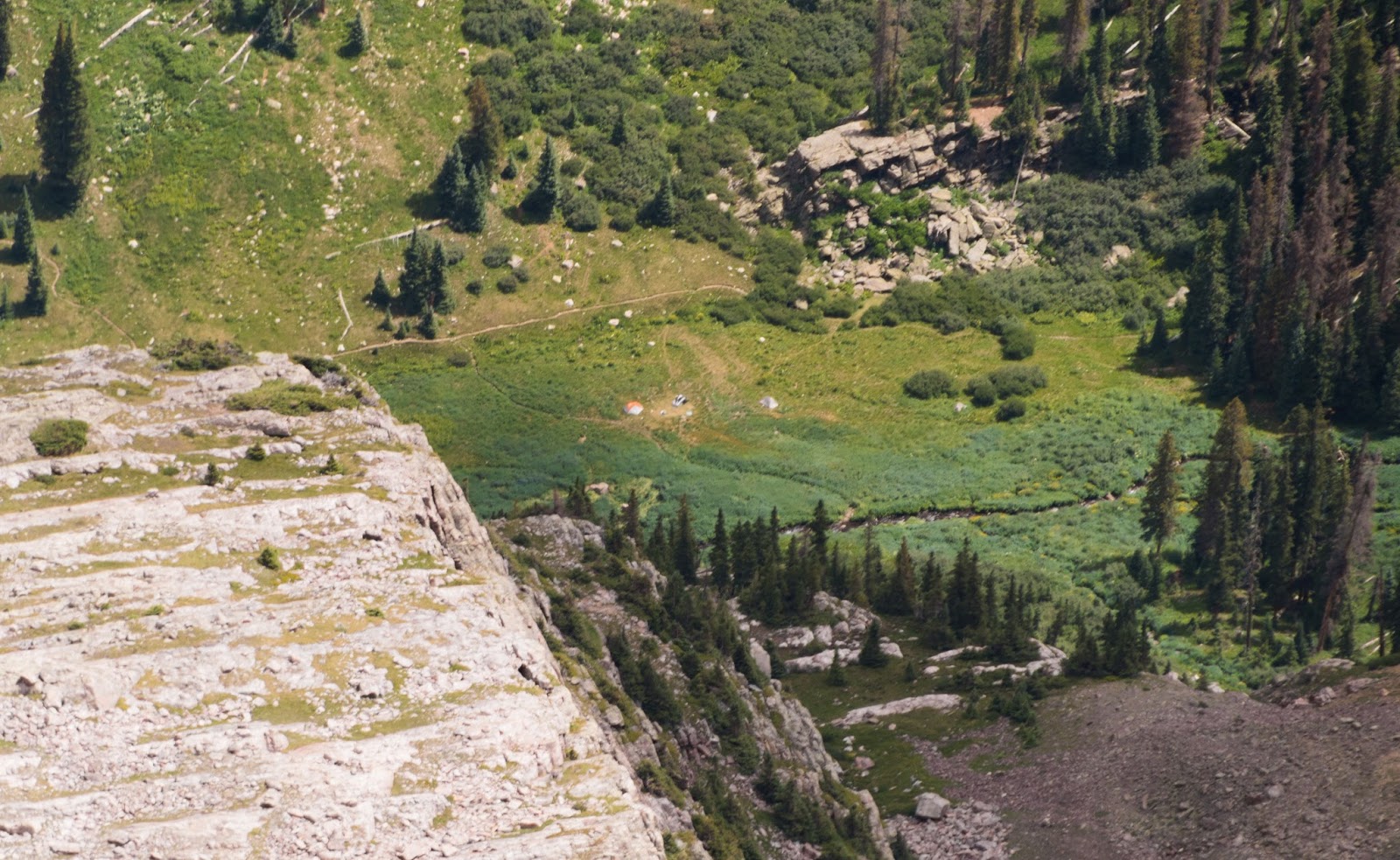
Zoomed-shot of out campsite far below in Vestal Basin.
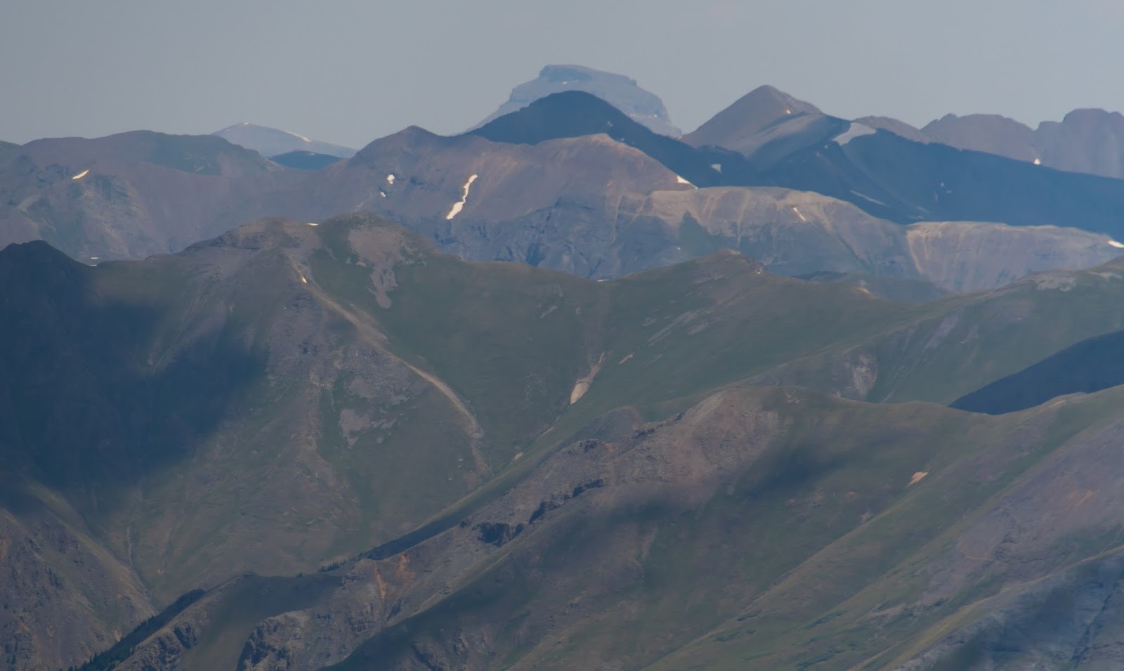
Wetterhorn Peak (14,016 feet) of the San Juan Range rises in the slightly-hazy distance...I summited Wetterhorn Peak last year as part of a trip I did to Colorado (http://peakwalker.blogspot.com/2015/08/san-juan-range-adventure-11-15-august.html).
Uncompahgre Peak (14,314 feet) is the highpoint of the San Juan Range, the only mountain area in the lower 48 states to have more area "above treeline" than Utah's High Uintas Wilderness.
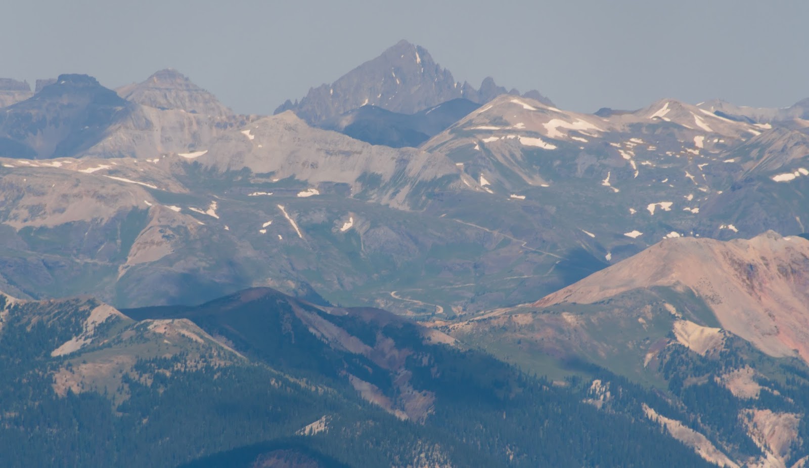
Mount Sneffels (14,150 feet), which I attempted last year via its southwest ridge but got stopped by an impassable cliff...I'll try it again one day...
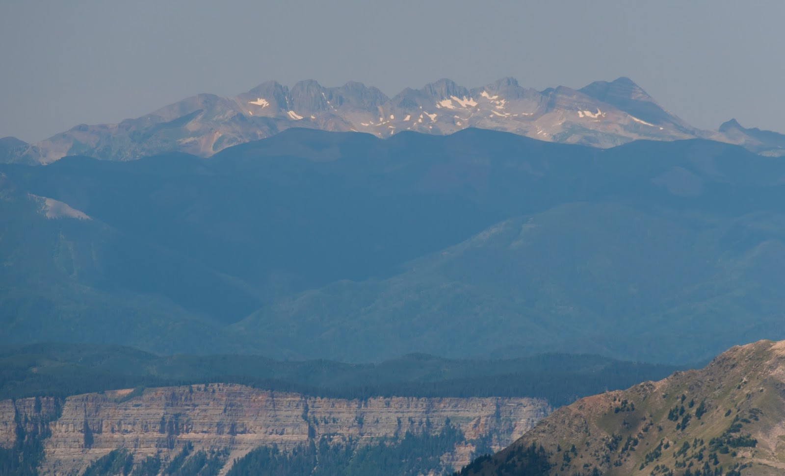
Not sure what mountains these are, but they lie southwest of the San Juans and appear to be a significant range in Colorado.
Jagged Mountain (13,824 feet) is named with impressive accuracy and is one of the most dangerous peaks in Colorado; the easiest route to the top gets into low class 5 terrain and much of the approach that is on class 3-4 terrain is on very steep ground with loose rock and gravel...for me, this is one to admire from the ground...certainly a stunner to see!
Looking west from Arrow Peak's summit over Vestal Peak, the Trinities, and a landscape full of mountains...

Ambrose taking in the views to the east...
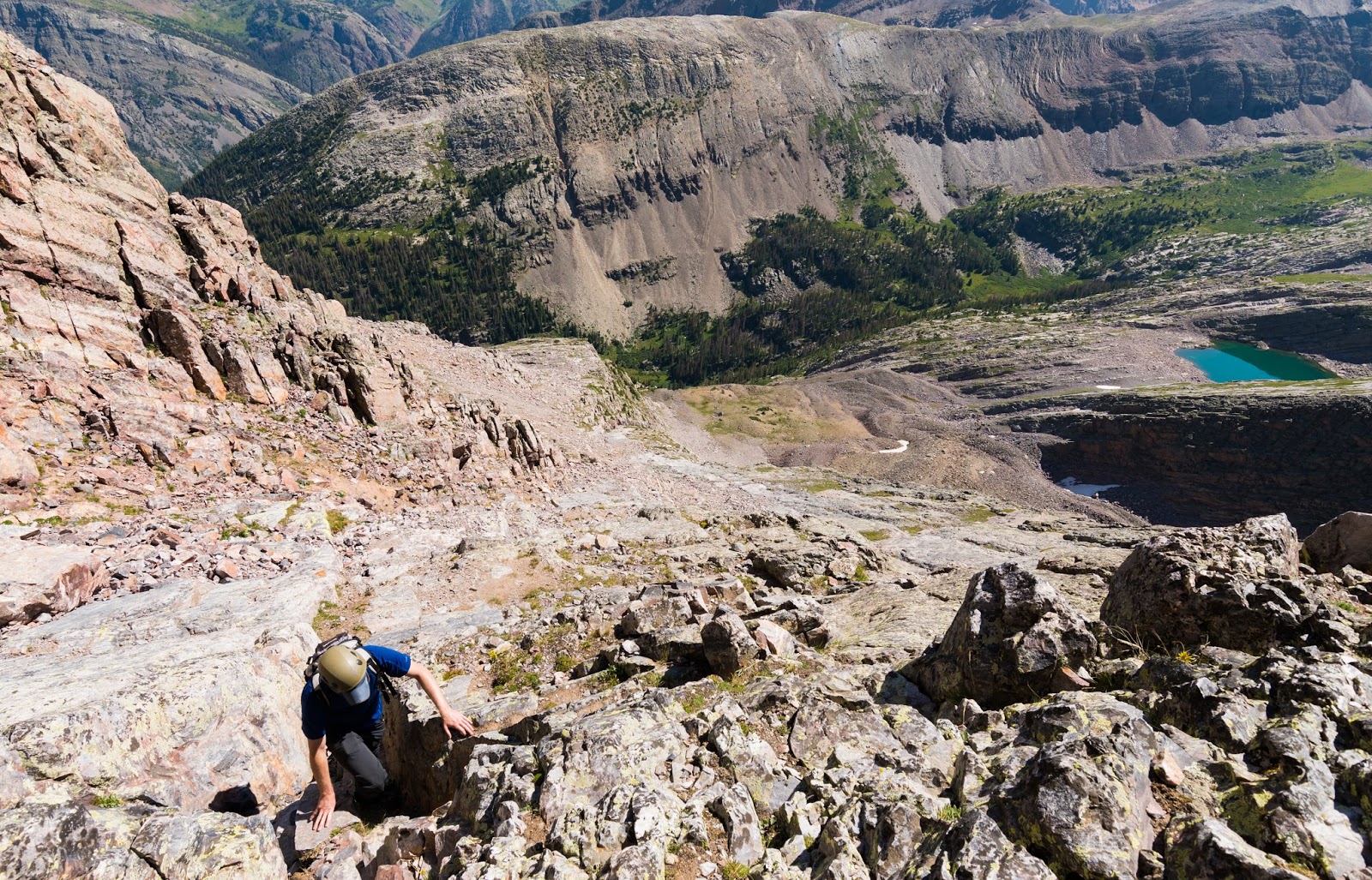
After taking all the pictures we wanted and soaking in the breathtaking experience of the place we began our careful descent down (generally) the same route we ascended. I won't say too much about the descent except to say I've never done a scrambling descent where I felt so frequently the need to turn and "face-in" to the rock because of the difficulty of various moves that were required; definitely a challenge, but the rock it, for the most part, quite good, though there is some loose rock to be aware of and, obviously, cautious on when moving through those patches...
We made a safe descent, and I got some nice pictures of Ambrose on the route to give a little perspective to the area and the wild (literally and figuratively so) beauty you find there.
We made a safe descent, and I got some nice pictures of Ambrose on the route to give a little perspective to the area and the wild (literally and figuratively so) beauty you find there.
Ambrose descending some of the challenging terrain on Arrow Peak's upper section...
Ambrose descending some of the challenging terrain on Arrow Peak's upper section...
Ambrose descending some of the challenging terrain on Arrow Peak's upper section...
Ambrose descending some of the challenging terrain on Arrow Peak's upper section...
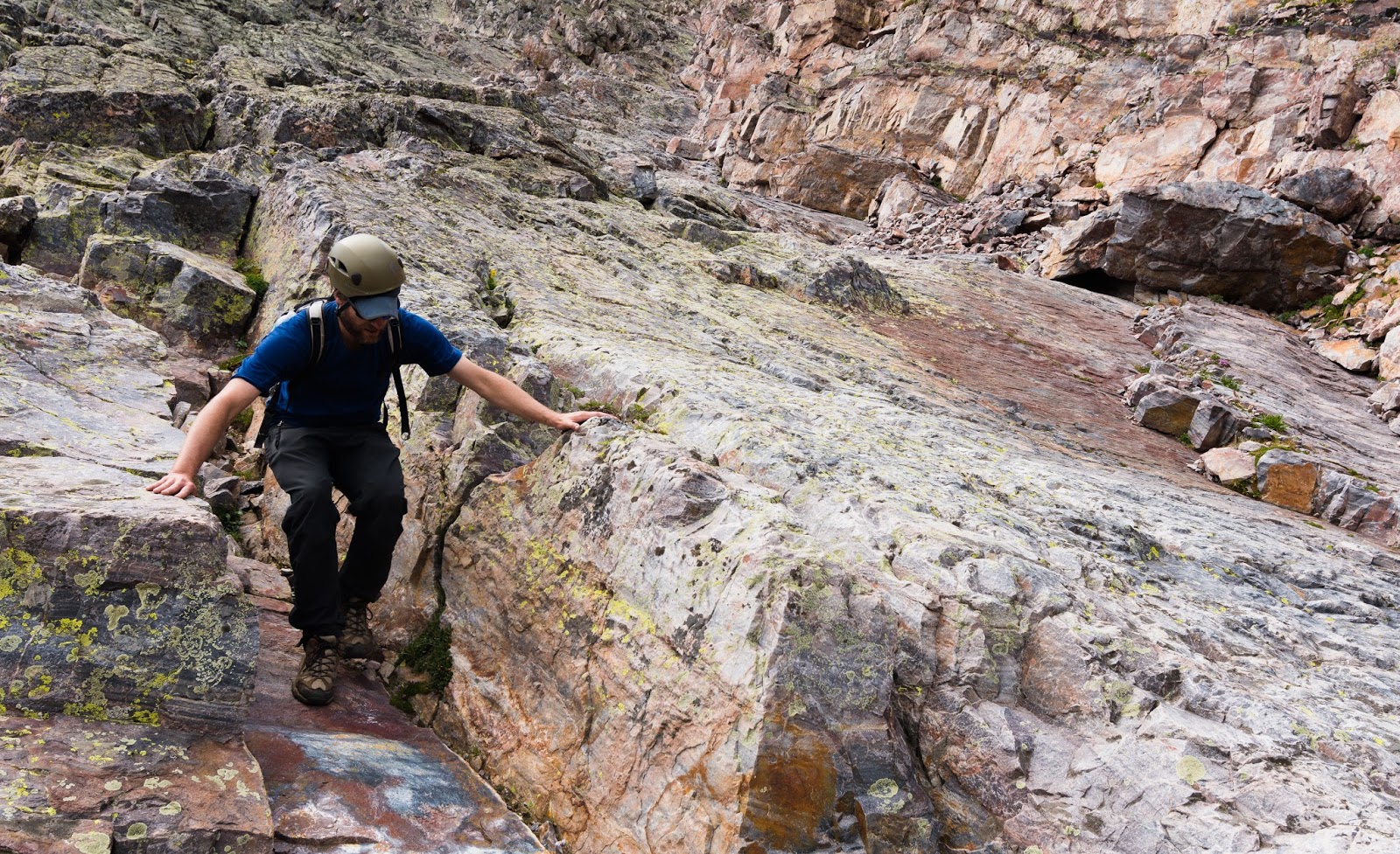
Ambrose descending some of the challenging terrain on Arrow Peak's upper section...
We both had a blast; however, we our ascent and descent, though not slow, had taken more time than expected and the clouds had built quite a bit since we started and looked like the potential for some stormy weather was not afar off...We decided not to attempt a summit of Vestal Peak, agreeing that we'd likely return at some point to take on the Wham Ridge route in coming years...Also we considered that Josh was still feeling bad and, at this point, figured he had some mild elevation sickness and that we needed to pack out of the area early (we had planned on being out and up here till Saturday and it was now only Thursday afternoon)...but Josh had taken time out of his life for an adventure and we wanted to see if packing out of the high country and finding somewhere lower to sleep might recharge his physical batteries and allow us to maybe pick up a San Juan Range 14er as a day trip before heading home on Saturday (I suggested the fantastic Wetterhorn Peak as a potential suitor for this scenario; here's a link to my trip report of that amazing peak and some surrounding areas from 2015 - http://peakwalker.blogspot.com/2015/08/san-juan-range-adventure-11-15-august.html).
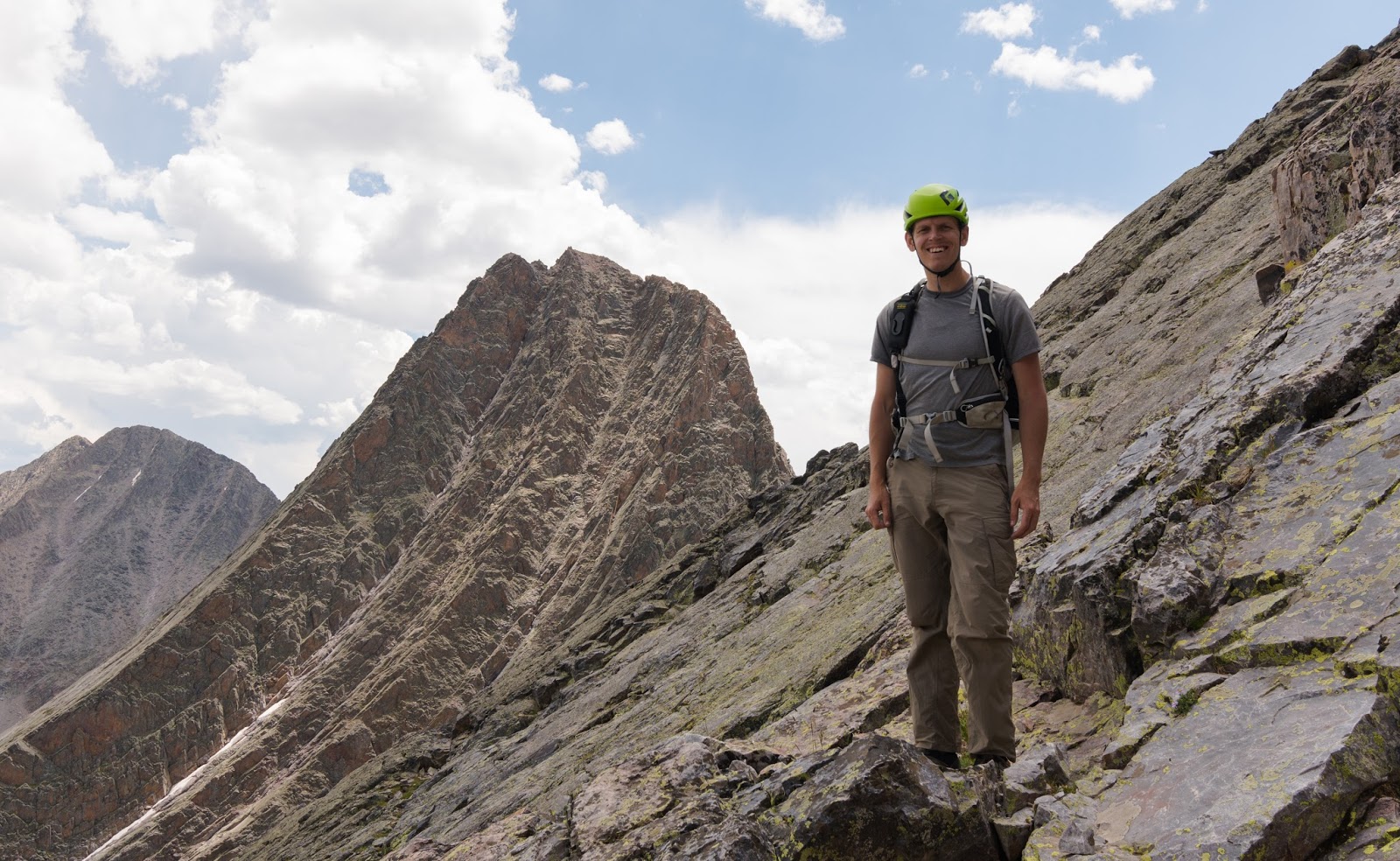
Me, somewhere on the upper slabs of Arrow Peak with Vestal Peak rising up awesomely behind me.
One more shot of Vestal Peak after we'd made it safely down Arrow Peak's exciting and challenging route.
One last shot of Arrow Peak and the route we'd taken up the northwest slabs. What a great peak!
After we'd made it back to camp we pitched the idea to Josh who said he'd be fine either way, but eventually went along with the idea of descending to sleep somewhere lower to give him a chance to feel better - since that hadn't occurred after about a day and a half's rest thus far...
One other thing to mention was that it was atypically warm in the lower meadows at 11,300 feet...we all expected daytime highs in the 70's or so but the daytime highs were in the mid-80's - certainly warmer than any of us had experienced before at these elevations...Ambrose and I had found consistently cool temperatures over 12,000 feet and expectedly cooler temperatures near and on the summit of Arrow Peak at just a bit under 14,000 feet, but the lower meadows, despite being quite high in elevation themselves were consistently warm during the daytime hours - though it did get cold enough to frost over the ground and tents in the night up there...This high temperature in the lower meadows was a mystery to us until we got back into cell service and found out the day time high was over 100 degrees in the valley each day...then things made a bit of sense, since it's usually about 20-30 degrees cooler up at 11,000+ feet than it is nearer to 5,000 feet above sea level.
Anyway, it was early afternoon when we'd made it back to camp, had a nice lunch, and broken camp in preparation for our hike out. Since Josh still wasn't feeling well we weren't sure how far we'd make it out that day, but we decided to see if we could make it to the car and get into a lower place that night to sleep. We had about 10 miles of trail with all its literal ups and downs before us. We were willing to make camp at the beaver ponds again if need be, but that was only if things were going roughly at that point.
Our plans in place and our packs on our backs we set off down the trail, which was, as almost always in the mountains, easier to follow out than it was to follow in...
***I didn't take any pictures on the hike out (until the next day) partly because the lighting wasn't good enough to justify re-taking shots of stuff I'd captured on the way out when we experienced some very fine lighting, and partly because I wanted to make the best time possible on the long, fairly arduous trek out***
Some of the abundant deadfall was a bit more of a challenge to get over or under this time since we now had to deal with the opposite slope of the trail, the ground we were stepping onto over or under the log was frequently lower now, requiring a bigger, more awkward step to cross...nothing too terrible, but the frequent repetition of crossing deadfall (fallen trees) on the way down to the beaver ponds adds up as the miles do.
Having not taken an unfortunate (and unintentional) detour on the ascent that cost us some time and unnecessary effort, we happily avoided that and were able to follow the trail all the way down to the beaver ponds, which we reached unexpectedly quickly. We had taken a number of breaks on the way down but had been keeping a good pace while moving. Still feeling okay to proceed from the beaver ponds we did so, knowing the trail was generally easier...though there were still a fair amount of ups and downs (literal elevation gains and losses) on the way trending generally down to the Animas River, which would then put us at the base of an 1,800-ish foot vertical gain with a few miles remaining until the parking lot.
Heading out from the beaver ponds was mostly quick, though we did take a number of brief resting breaks along the way. There is, all along this trail, a fair amount of elevation gain and loss, and everything is at least 8,800 feet or higher, so that adds a bit to the strain of things. Ambrose and I had already gone up and down a major peak that day and Josh hadn't been in good shape since the trip began, so we were plenty happy to take those occasional breaks.
After a lot of doing, and as the last light of day failed, we made it to the Animas River and the bridge we'd crossed days earlier on our way out...before us was the last major obstacle of nearly 2,000 vertical feet of ascent. Josh was feeling pretty terribly at this point, I wasn't feeling too well myself but was doing better than he was...Ambrose seemed to be doing well, all things considered. After some debate, we chose to "go for broke" and press on to the cars...though we knew the ascent would be slow...and slow it was...Josh threw up three times over the course of the ascent, and I threw up once...Ambrose "missed out" on that party...After many rests and a number of various unpleasantries we reached the cars at last...the journey out seeming much longer than it actually was in the darkness. One beautiful part of the ascent was the spectacular night sky of this relatively remote area - the Mily Way was clearly visible and the moonrise didn't occur till nearly 2:00 AM, so the sky was about as dark as could be at this point - and that's always a treat in remote places.
We decided, rather than finding a lower elevation campsite we would try and find a motel with openings and split a room and the cost of an overnight stay betwixt the three of us. We had to call a lot of places (it was after midnight at this point since it took us a full 3+ hours to make the ascent from the Animas to the trailhead/car). We had good cell signal in Silverton, a small resort town in the mountains, and were able to find a place in Montrose - about an hour and a half distant from where we were, but that was the only potential lead. After a long drive (I actually traded places with Ambrose since I was a bit drowsy and he drove to the motel with Josh and I helping him stay awake after a while). I'll also mention here that the drive from Ouray out to the Molas Pass area is a gorgeous drive, but definitely not one to make when you're drowsy...lots of curvy road and large drop-offs...Anyway, we made it safely and after our first attempt didn't turn out a usable vacancy we got a referral to a hotel with an adequate room just a few miles further into town in Montrose - it was now about 3:00 AM. We got checked in to the hotel, parked the car, and went upstairs and crashed...what a day!
The next morning everyone was pretty beat down still (though feeling significantly improved from the night before), so (after enjoying the free breakfast offered by the motel we were at) we bagged the idea of pressing on to any 14ers while we were still out there...I suggested, as an interesting alternative, going on a mostly-driving tour of Black Canyon of the Gunnison National Park, which I had discovered was in the area last year on my trip through these parts to other peaks. We agreed on that and, after picking up some Gatorades and such at a local gas station we were on our way, with the Black Canyon only about a half hour away.
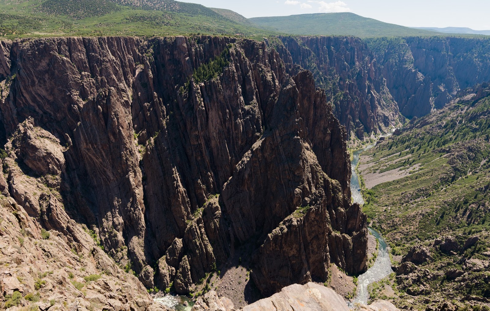
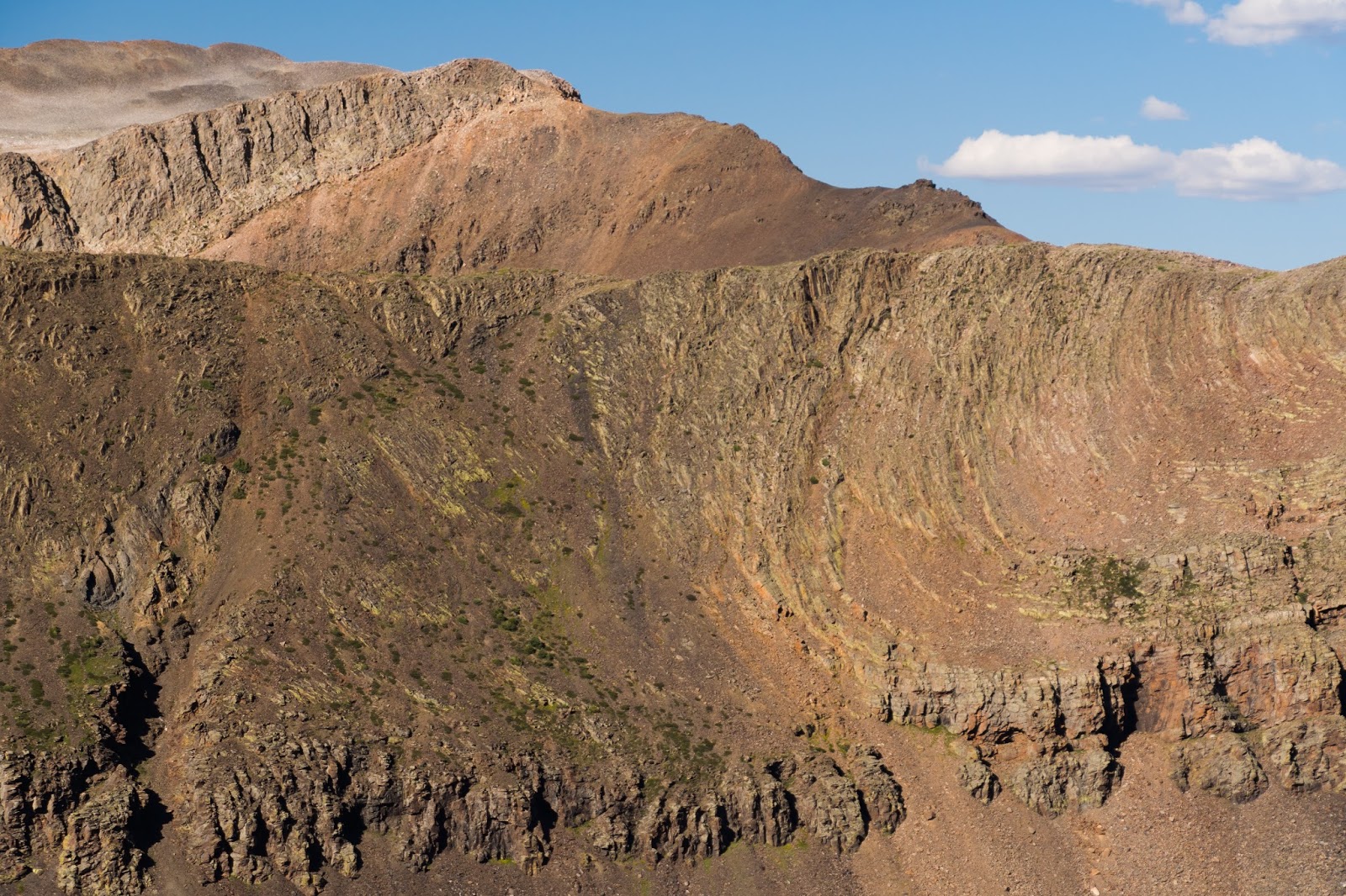
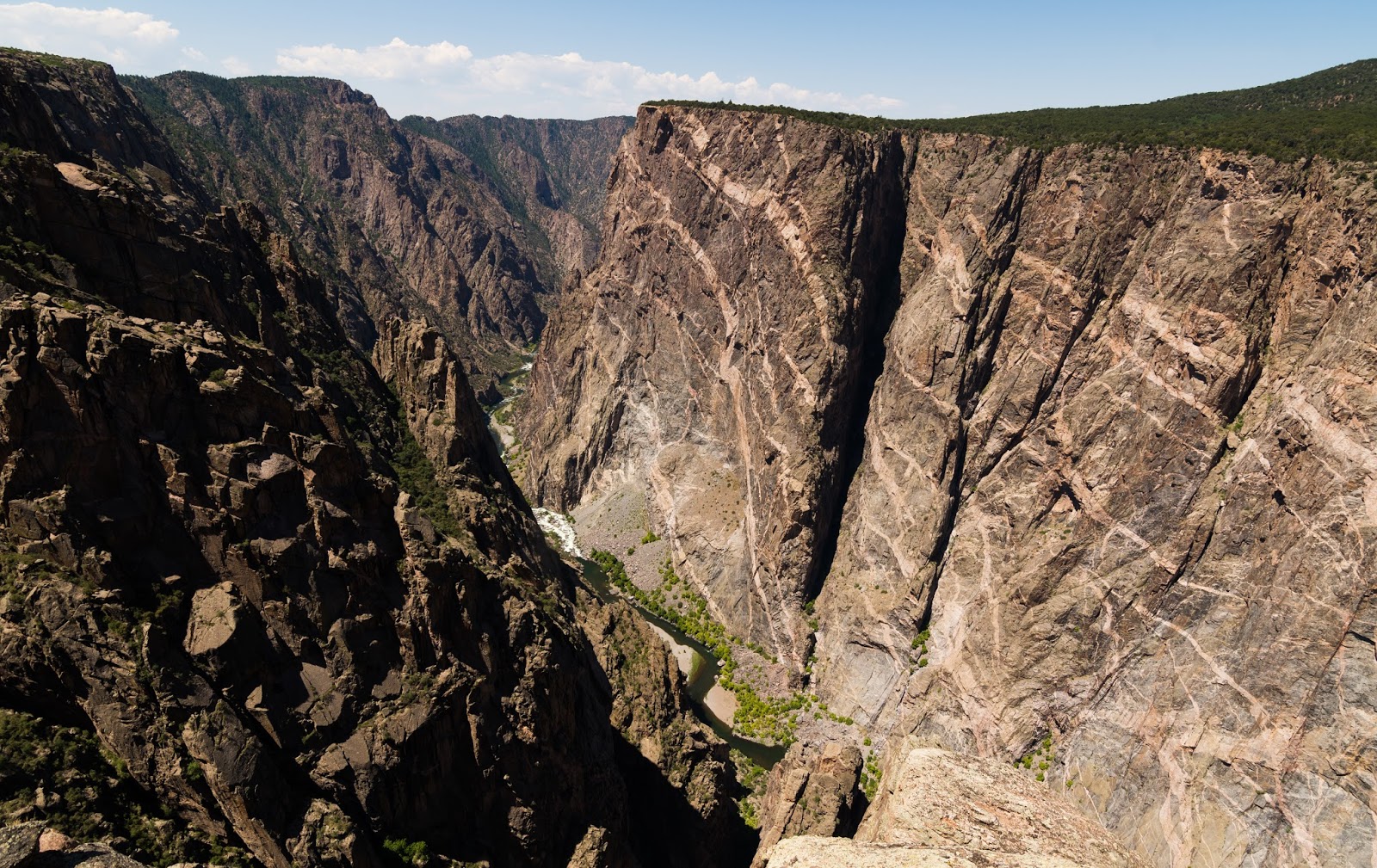
Views from Black Canyon of the Gunnison National Park.
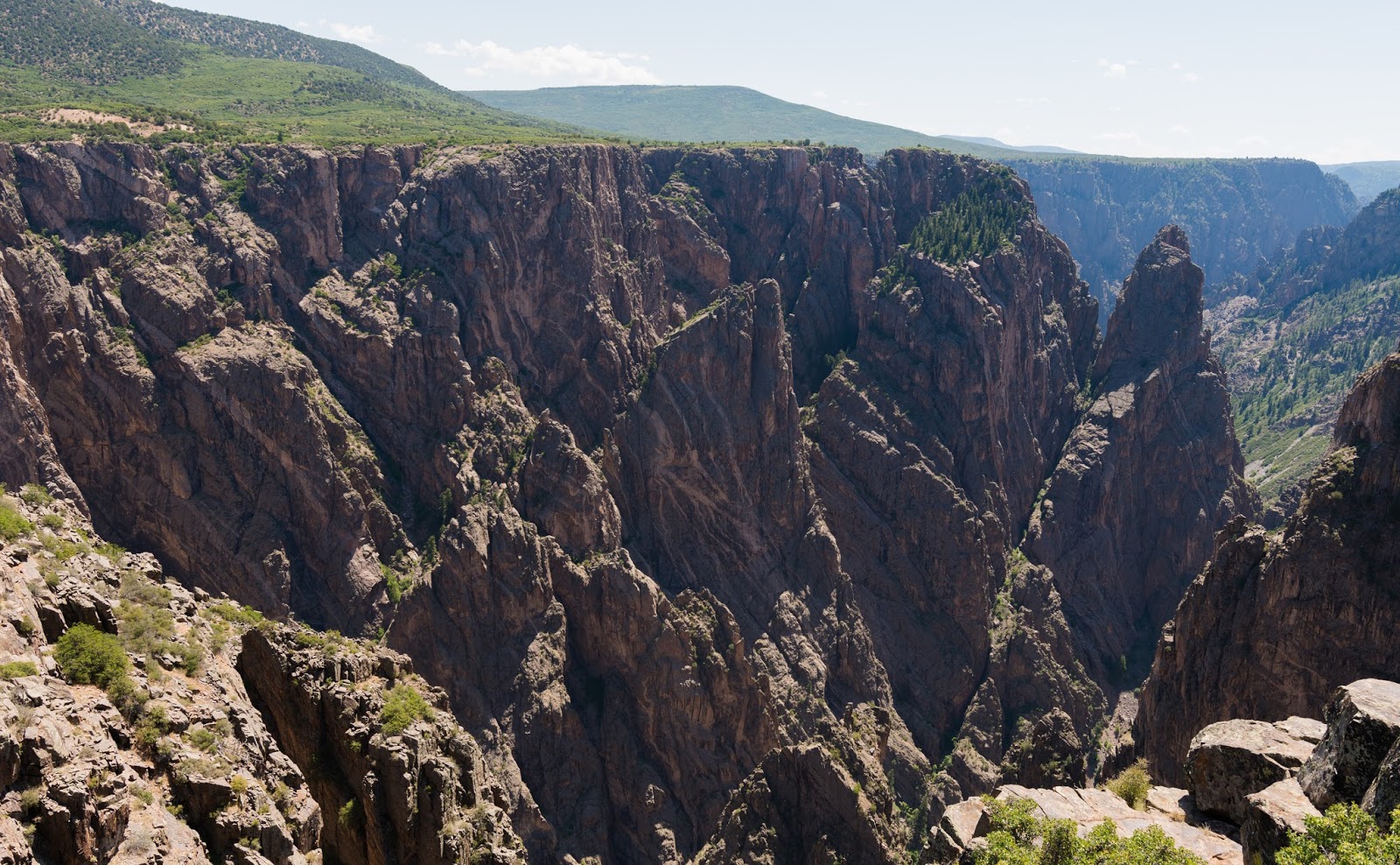
Views from Black Canyon of the Gunnison National Park.
Views from Black Canyon of the Gunnison National Park.
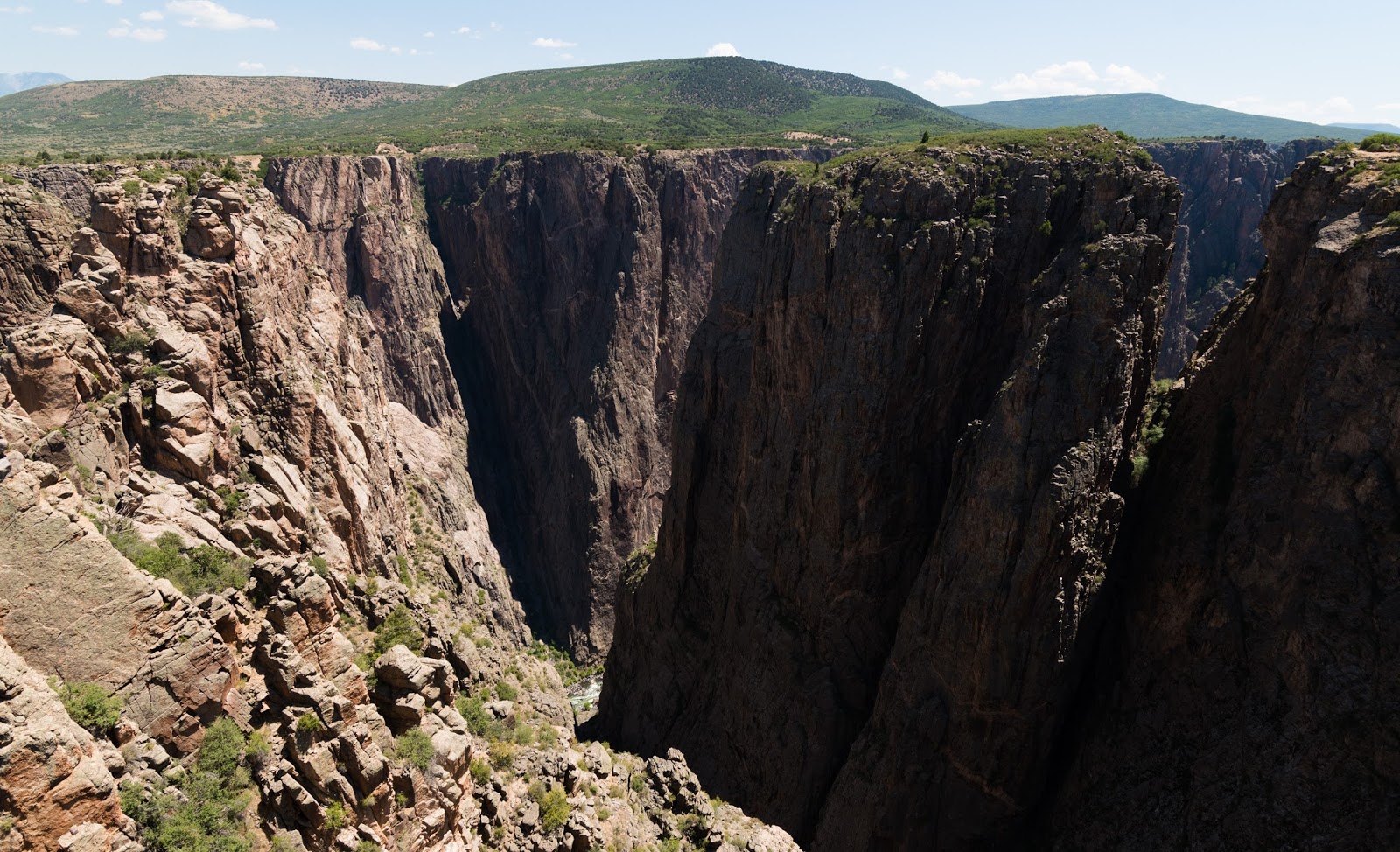
Views from Black Canyon of the Gunnison National Park.
The Painted Wall - Colorado's tallest cliff at 2,300 feet tall!
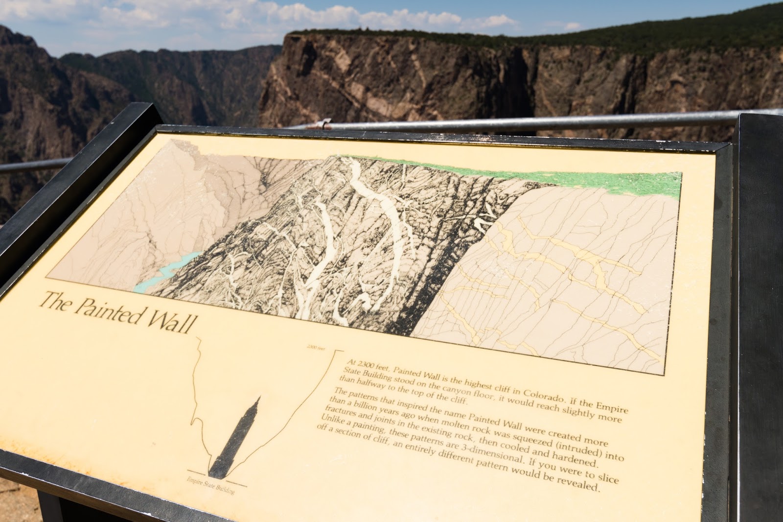
Informative sign at the Painted Wall.
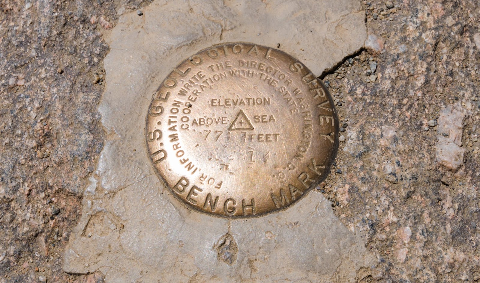
Benchmark near the Painted Wall.
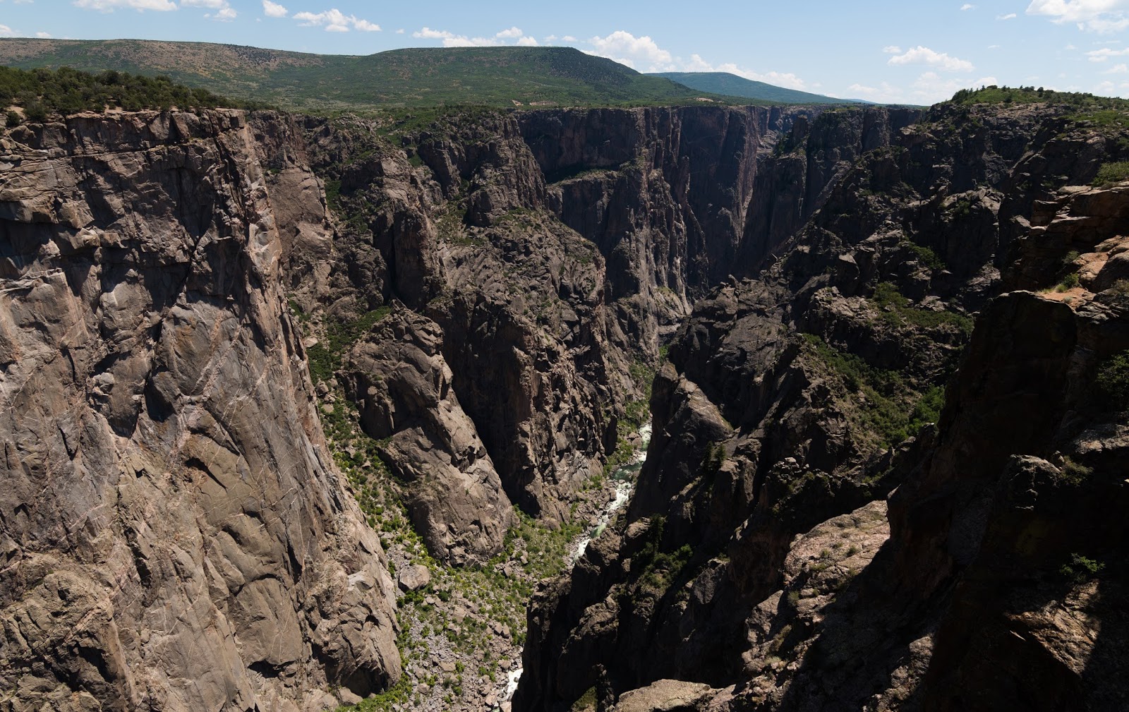
Views from Black Canyon of the Gunnison National Park.
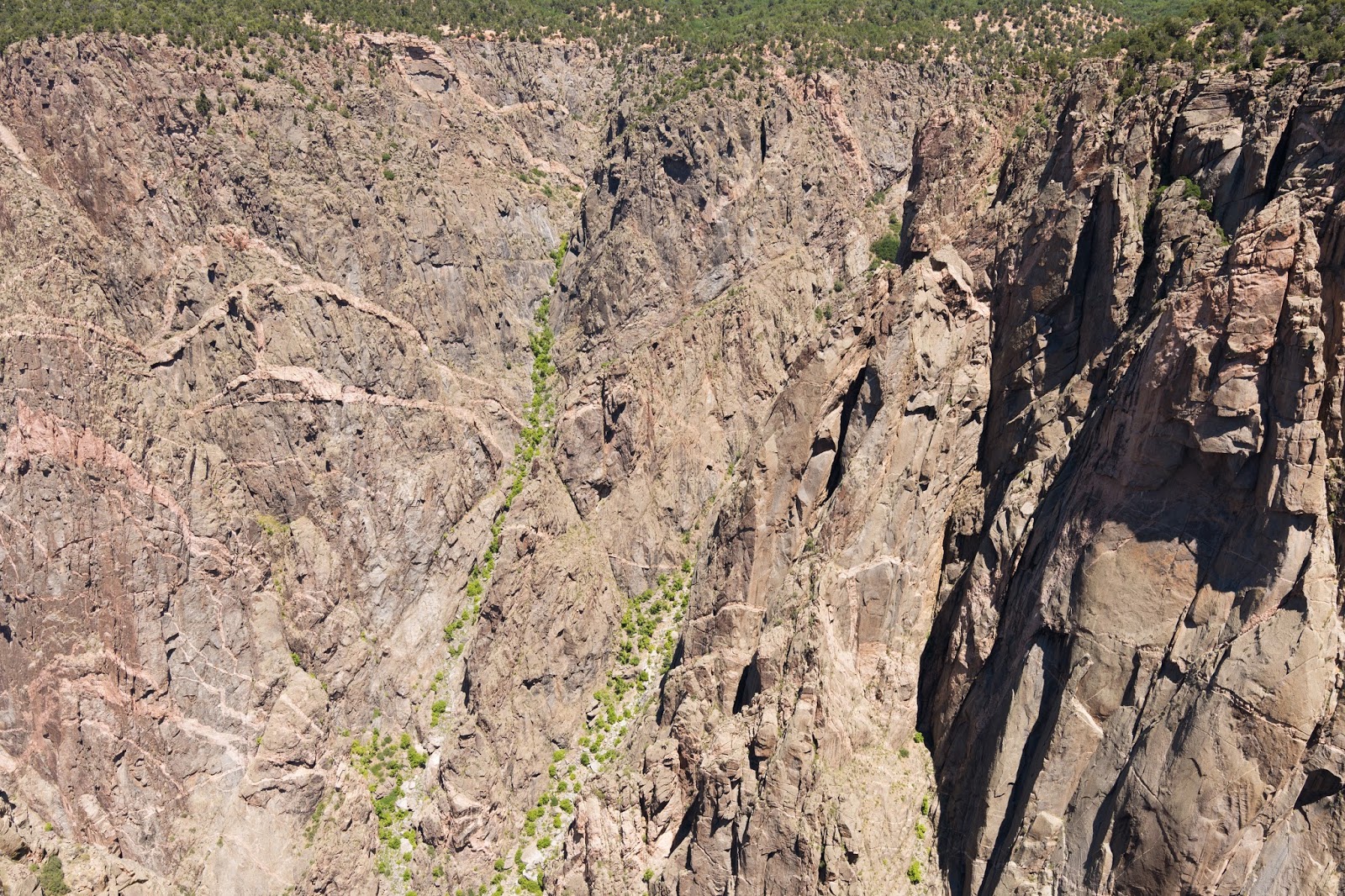
Views from Black Canyon of the Gunnison National Park.
We enjoyed our time in Black Canyon of the Gunnison National Park and the guys were as impressed as I was at the ruggedness there. We also saw the tallest cliff in Colorado, which was pretty neat. The only real downsides to being at the canyon when we were were the harsh midday light that doesn't make for very good pictures, and the heat of the day that was more intense down at the canyon which is about 7,000 - 8,000 feet above sea level...Still, we stopped at most of the stops and did a number of short little quasi-hikes to various scenic viewpoints along the way.
Eventually we had seen what we wanted to see and started the long drive home. I drove from Montrose to Grand Junction and then Josh took over the driving the rest of the way back home.
Eventually we had seen what we wanted to see and started the long drive home. I drove from Montrose to Grand Junction and then Josh took over the driving the rest of the way back home.
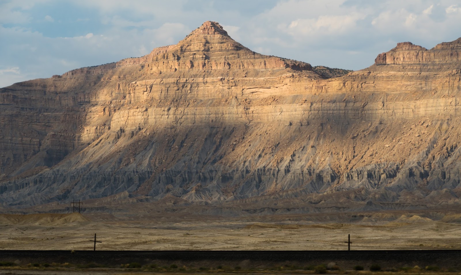
Neat lighting on some impressive cliffs back in the Utah desert on the drive home...
Some quick shots at an interesting rest stop somewhere in Spanish Fork Canyon.
Some quick shots at an interesting rest stop somewhere in Spanish Fork Canyon.

A little dirty-window impressionism on the drive home...