Udink
Still right here.
- Joined
- Jan 17, 2012
- Messages
- 1,748
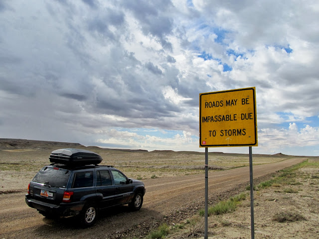
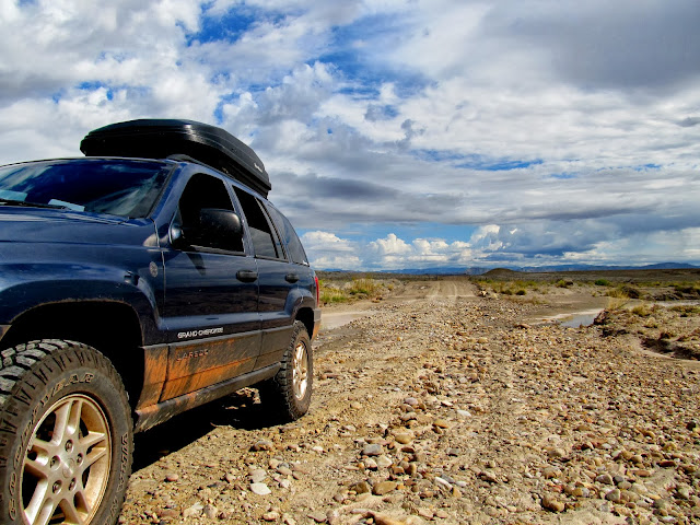
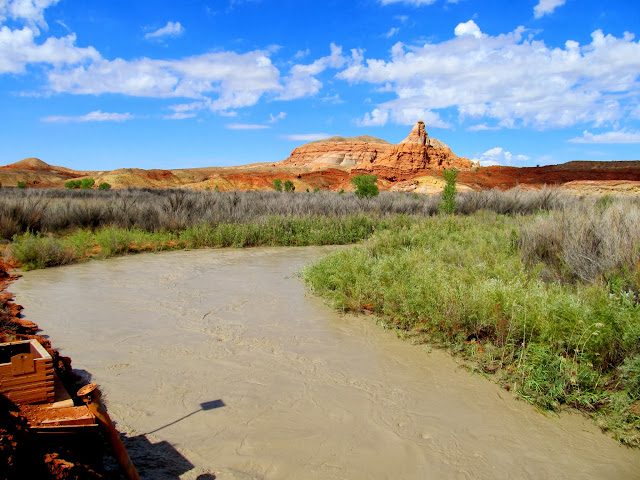
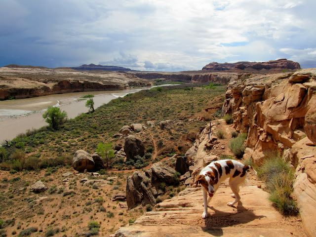
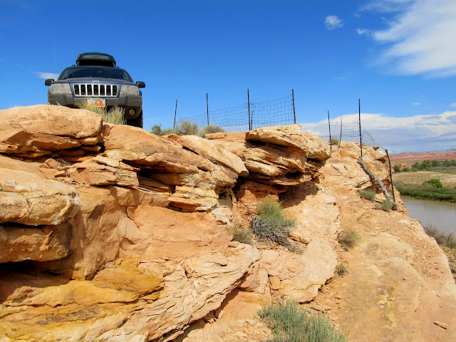
At the risk of being shut down by heavy rain or washed-out roads, I took the pups for an overnighter in the San Rafael Desert. There were storm clouds visible as I hit the gravel road outside of Green River but the sky cleared up as I made my way south. Ninemile Wash wasn't flowing as I'd expected and I only encountered one small washout in the road that was easily passable. I parked near the end of the road on Keg Point where there was already a rental Jeep Patriot, whose tracks I'd followed in from Green River. As I was readying myself and the dogs for a hike the vehicle's occupant approached from the direction of Colonnade Arch. He was, I assume based on his accent, German. We conversed about where he'd hiked and where I was planning on hiking. He had a printout with photos and GPS coordinates for the points of interest in the area, one of which was the Dragon Teeth formation that I was hoping to find on this trip. I'd gotten coordinates for the rock from @Nick and didn't know they were already available online. It would have helped to know that the formation is also called Crocodile Rock (no doubt after the Elton John song). The guy was justifiably concerned with getting back to town before any possible rain storms hit and he hurried away quickly after our brief conversation. He would be the only person I'd see until getting back to the pavement the next evening.
Seeing a storm on the horizon while passing this sign wasn't comforting
Ninemile Wash crossing
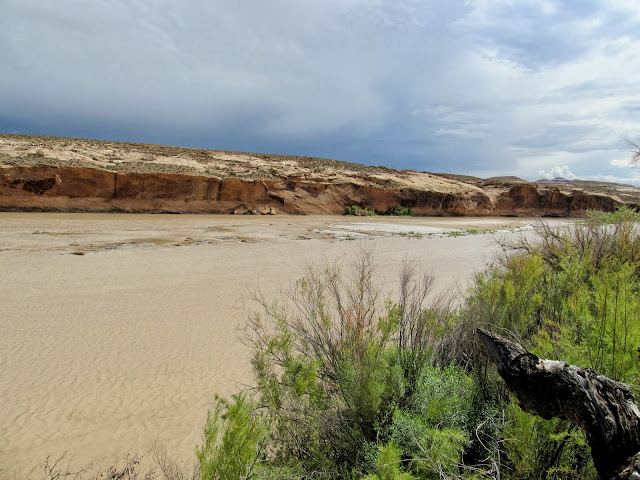
San Rafael River running high and silty
The worst washout I encountered, which wasn't bad at all
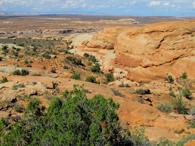
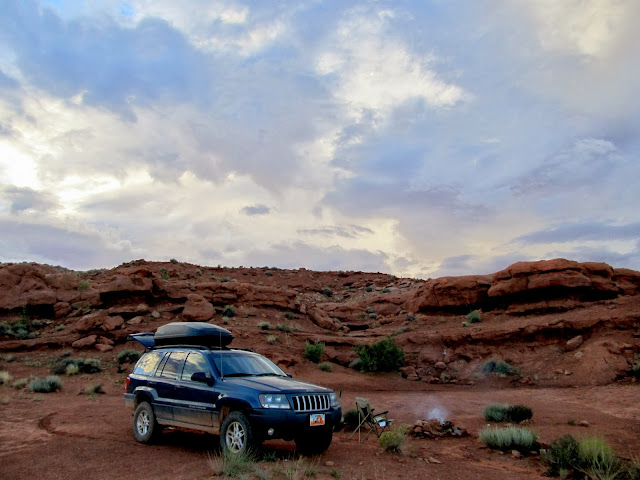
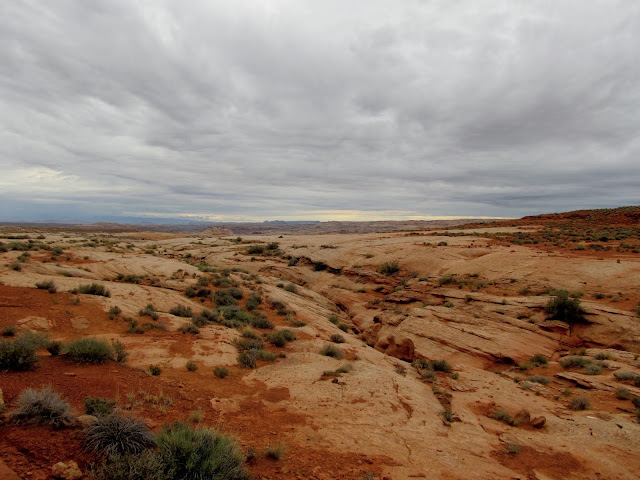
Parked on the slickrock for the start of a hike
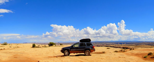
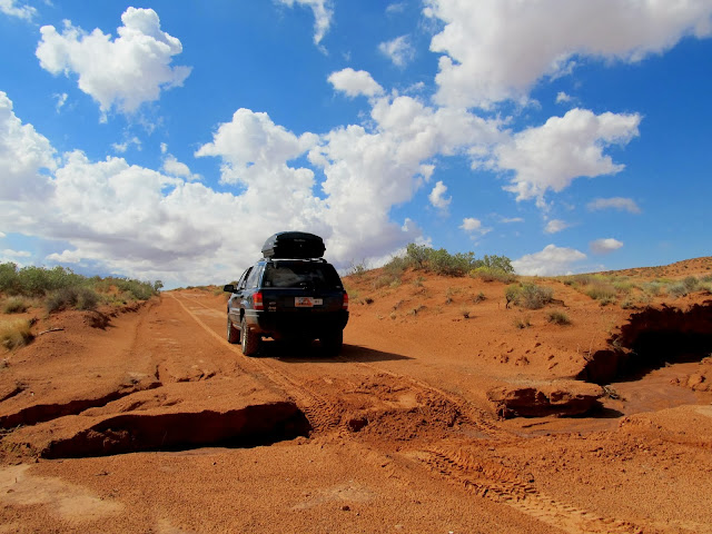
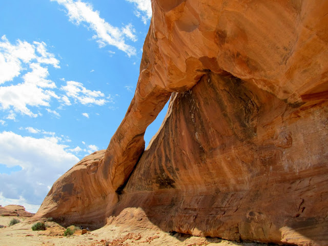
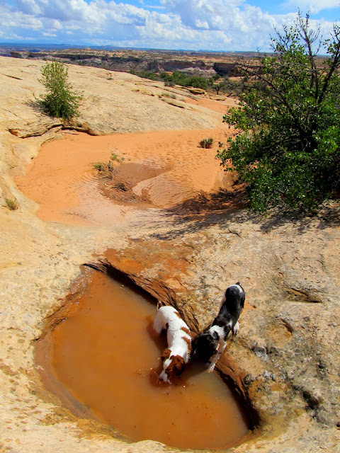
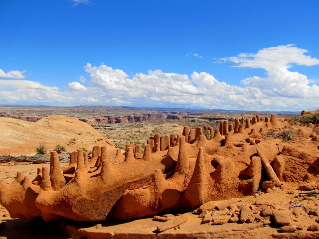
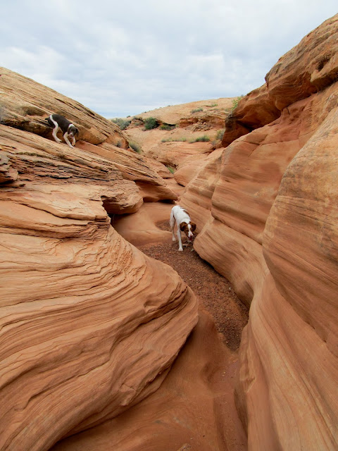
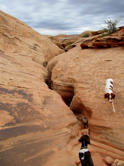
I started hiking with the dogs leashed up but soon let them off once I made sure there was plenty of water in potholes for them to drink. They could exert themselves to their content without depleting the 5-liter supply of liquids in my pack. My objective was to find two natural arches that I hadn't seen on my previous trips to the area, and to find the Dragon Teeth formation. After a short hike I arrived at the first and larger of the two arches, and just around the corner I found the second pothole arch. I approached the coordinates for the Dragon Teeth from downhill and knew I'd find it easily when I spotted a few broken shafts of sandstone. I started climbing the slickrock toward the coordinates but got sidetracked by a small cave/alcove. Inside there was soot on the ceiling and a lot of animal bones, many of them charred, but no other solid signs of Indian habitation nearby. Up the hill farther I found the Dragon Teeth exactly where Nick's coordinates pointed me. There were a lot of broken "teeth" on the ground, but I also noticed that the more erosion-resistant teeth extended deeper into the base sandstone, meaning they'll continue weathering out of the rock even after being broken off.
Boulder and Torrey as we begin hiking
Natural arch
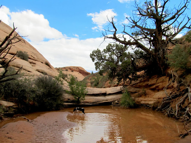
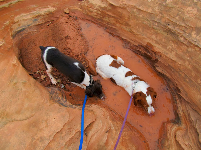
Torrey and Boulder drinking from a pothole
Pothole arch
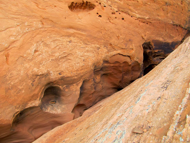
Small cave/alcove
View out of the cave/alcove
Dragon's Teeth
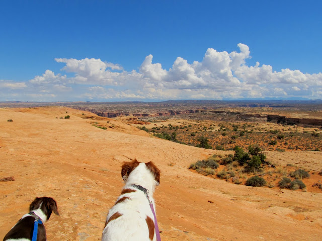
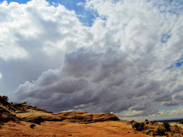
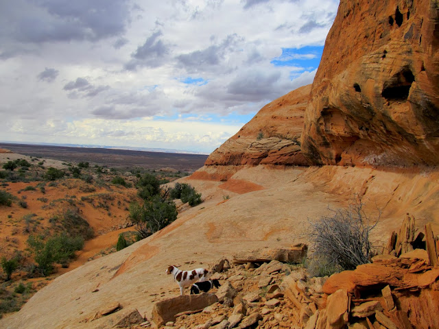
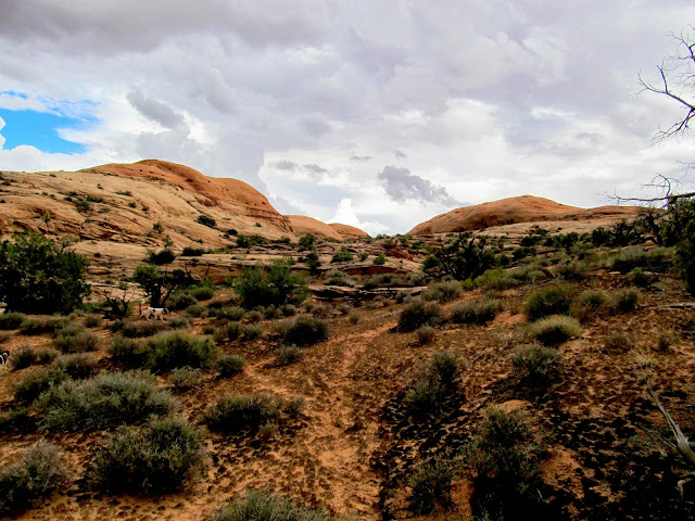
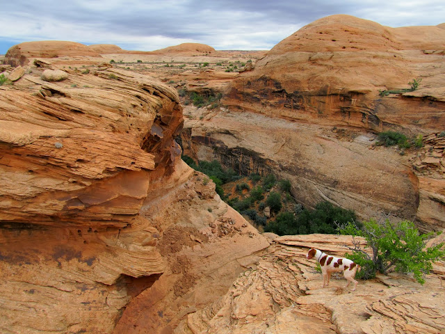
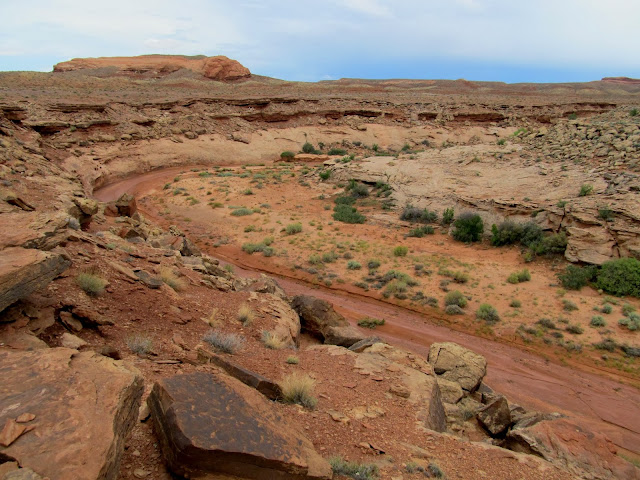
Having found what I was looking for, I headed northwest to explore closer to Keg Spring Canyon. I followed the base of a low ridge of sandstone looking for Indian writings and alcoves that might hold something of interest. As I descended toward Keg Spring Canyon I found pools of water and an alcove with soot on the ceiling that was probably occupied at one point, all while the sky was darkening. I reached the rim of the canyon just as the lightning strikes got too close for comfort. It was time to find some shelter, and I took a different route away from the canyon rim toward Colonnade Arch. I was hoping to find an alcove to shelter in but there was nothing suitable as I made my way uphill to the southeast. The rain started and I hurriedly donned a poncho, which the wind whipped around quite a bit but it kept my pack and camera dry. I got to the top of the ridge along Keg Point and I was still a mile from the Jeep while Colonnade Arch was only a quarter-mile away. Easy choice, there.
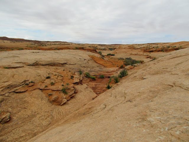
My objective was to check out this line of slickrock leading toward Keg Spring Canyon
Darker clouds moving in
The dogs as we explored the slickrock
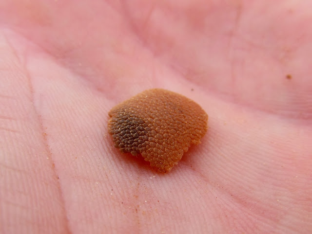
Red-spotted toad
Boulder in a pool
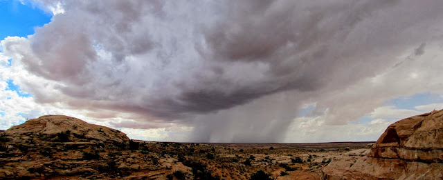
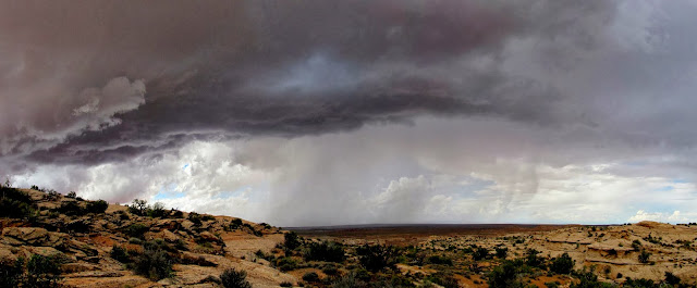
Rain storm moving across the San Rafael Desert
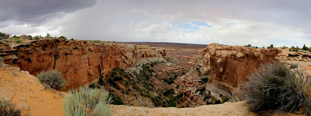
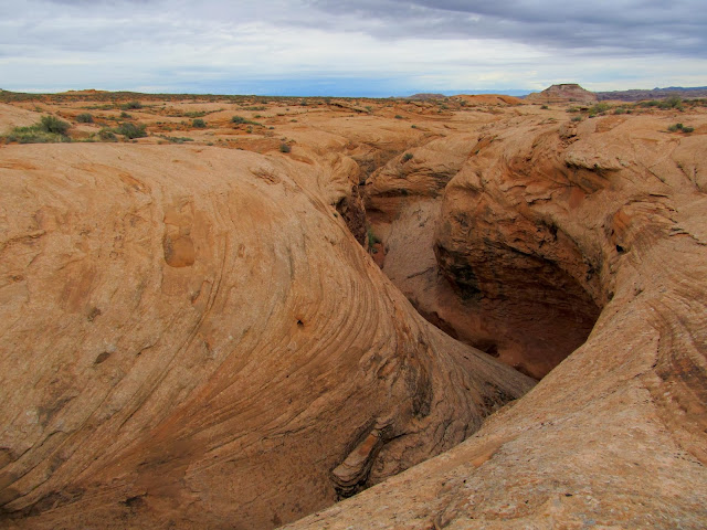
Keg Spring Canyon
View up toward Keg Point
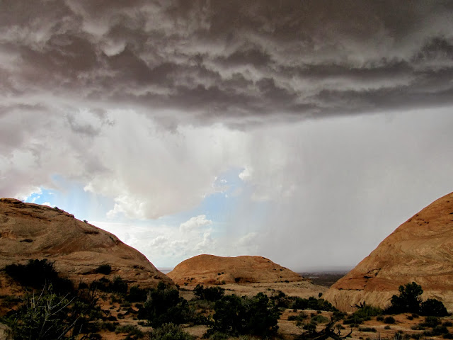
Storm almost overhead--time to find shelter!
Wet slickrock across Keg Spring Canyon
Dark storm clouds overhead
The dogs and I reached Colonnade and I removed all my gear to let things dry out. We relaxed there, well sheltered from the rain and wind and lightning. The dogs even curled up and slept while I sat on a rock and enjoyed the show going on outside. After about 30 minutes the sky cleared up overhead as the storm moved across Labyrinth Canyon. A rainbow appeared and patches of light played on the sandstone to the east. I loaded up and made an uneventful trek across the flat top of the ridge back to the Jeep, then drove a short distance and started setting up camp. Torrey and Boulder explored around camp while I got a small fire going and ate dinner. I spent the rest of the evening reading a book by the red glow of my headlamp and taking photos of the lightning storm passing far off in the distance to the east. It looked like Moab was getting hammered. I slept in the back of the Jeep with the dogs so there was a minimum of fuss getting beds set up. I expected rain during the night but it never came.
Inside Colonnade Arch where I sheltered from the storm
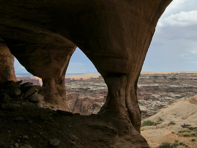
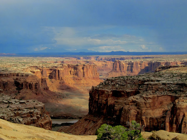
Looking down Twomile Canyon beyond to Labyrinth Canyon
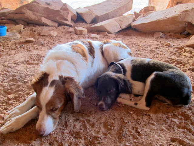
Torrey and Boulder resting under Colonnade Arch
Rainbow across the Green River
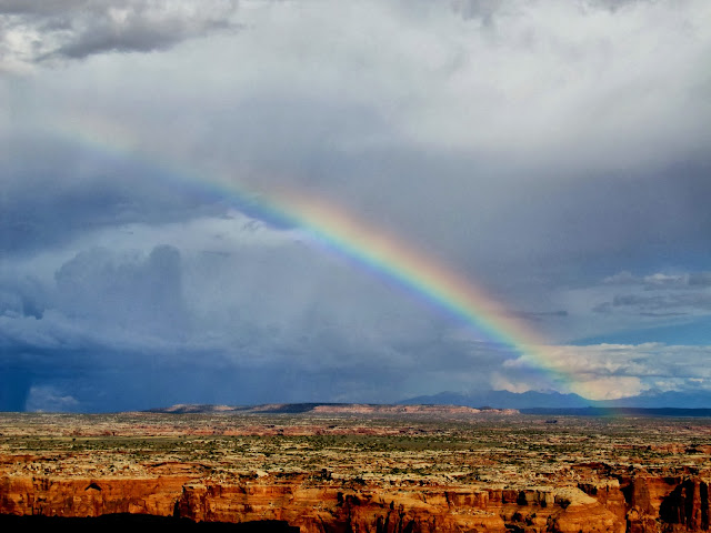
Colonnade Arch and rainbow
View toward the Maze district of Canyonlands
Gettin' the fire going
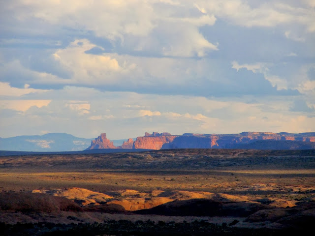
Thunderhead to the south and Cleopatra's Chair on the horizon
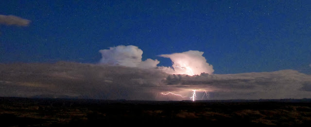
Lightning south of Moab
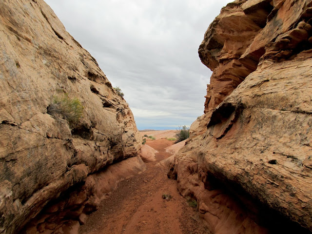
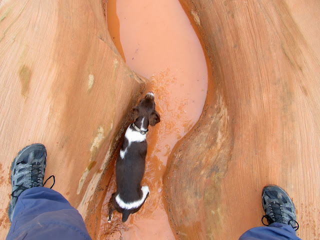
With heavy cloud cover and the longer nights of the approaching fall, I slept in later than I'm accustomed to while camping--at around 7:45 I was out of bed and preparing a quick breakfast and coffee. Torrey had been fine all of the previous day but in the morning I noticed a slight limp as she walked. I hoped she'd be fine as her joints loosened up while we hiked. I packed up what few items needed to be stowed and drove around to one of the upper tributaries of Keg Spring Canyon that had caught my eye on an earlier trip. After a short approach hike I was at the start of the canyon where it formed a shallow slot. The canyon alternated between small slots and wider, sandy sections as it dropped toward Keg Spring. There was a spot where the watercourse made a couple of tight turns as it dropped down a dryfall and I could see no way to get into the canyon below the dryfall. The canyon deepened and the walls where sheer as far as I could see downstream, so I followed the rim hoping to find a place to drop back in and then follow the canyon up to the bottom of the dryfall--I didn't want to leave any of the canyon unexplored. Less than ten minutes after leaving the watercourse I noticed that Boulder was limping. I checked her out and found something stuck to her paw, and only after I pulled it off did I realize it was part of her pad. She'd gotten a blister while scrambling on the slickrock and the layer of skin on the blister tore off. I knew that would end any more major hiking for the day since I didn't want to risk having to carry one or both dogs a long distance. I reversed course and took it slow and easy back to the Jeep.
Sunrise over the La Sals

Start of a hike in one of the forks of Keg Spring Canyon
Dogs in the kiddie slot
End of the short narrows section
Boulder doing it the hard way
Impassable slot below the dryfall
Wider canyon below the slot
A piece of Boulder's pad that came off, signaling time to turn around
Pups getting a drink
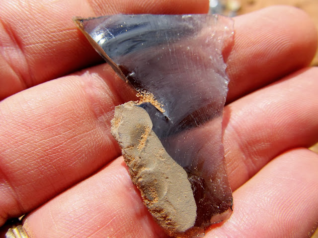
I drove around to the lower end of the tributary canyon near where it drains into the main Keg Spring Canyon and hiked a short distance to the tributary's end. On a previous trip I'd seen from below where the tributary ends in a hanging canyon above the larger canyon, and now from above I could see that there was a tight and twisty slot before the drop. There was still more than half a mile of the canyon between where I'd turned around and here that would remain unexplored this day. Nearby I stopped to look for obsidian at a place I'd visited earlier this year. It's amazing to me that Native Americans worked obsidian into arrowheads here even though the nearest source for the rock is well over 100 miles away. I found a few large, rough pieces of obsidian and a lot of tiny flakes. Obviously somebody had made a lot of projectile points here.
Lower part of the canyon that I'd been in earlier
Another impassible slot
Here the canyon drains into the main fork of Keg Spring Canyon
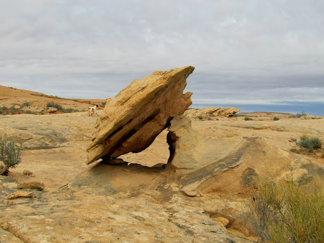
Fallen balanced rock
Obsidian
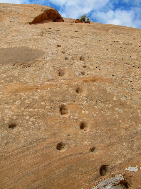
I learned that climbing up moki steps is easy, while climbing down is terrifying
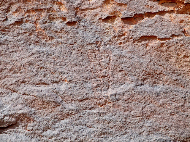
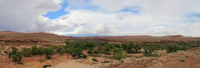
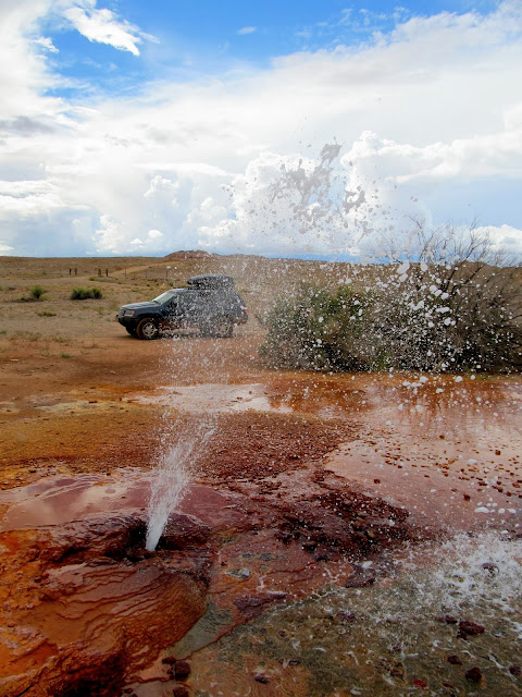
Eventually I drove to the main road and started for home, making a few brief stops on the way. I visited Grocery Rock, a place Alan had mentioned to me that had a lot of names carved into it from the 1930s through the 1950s. I took a side road that I'd never driven but looked interesting. My map showed that it ended at the Green River less than two miles away. The road led to the top of a stock trail that was blasted out of a cliff, and the flat area along the river below the cliffs is called Bull Bottom. The stock trail itself was very interesting, though it's difficult to imagine any livestock using it. I'd guess it was mostly used for sheep because I don't think cattle would be willing or able to traverse it. I walked along the bottom of the cliffs searching for old cowboy names and was surprised to find a few petroglyphs instead. I only explored about 1,000' of the cliffs but there's much more that I'll probably explore another time when I don't have crippled dogs with me. I made two more quick stops on the way home, one at the confluence of Moonshine Wash and the San Rafael River, and another at Chaffin Ranch Geyser where I found it gurgling and spitting. I was only slightly disappointed that I made it back to civilization without being washed away by rain or hampered by bad roads.
There were big puddles in the road that weren't there the previous day
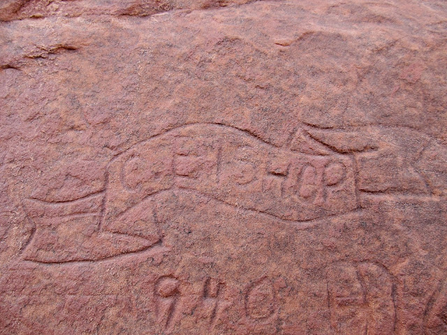
C. Bishop is all fancy
Old stock trail blasted out of the cliff that leads to Bull Bottom
View up the stock trail
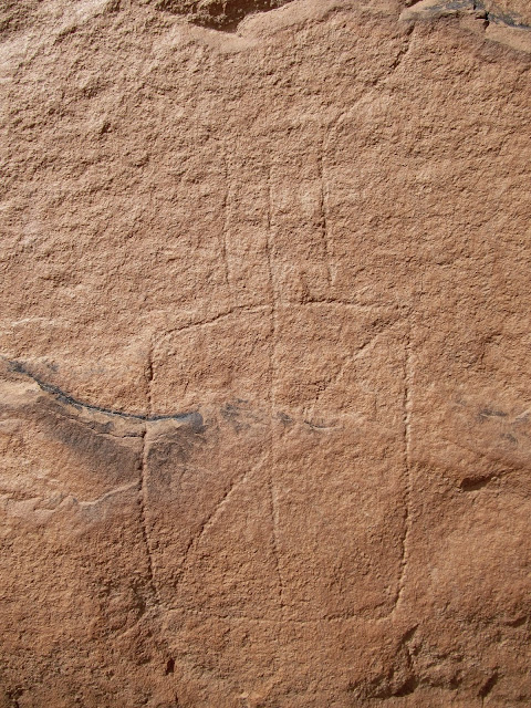
Small, faint petroglyph about 15' up a cliff
Green River at Bull Bottom
Petroglyph at Bull Bottom
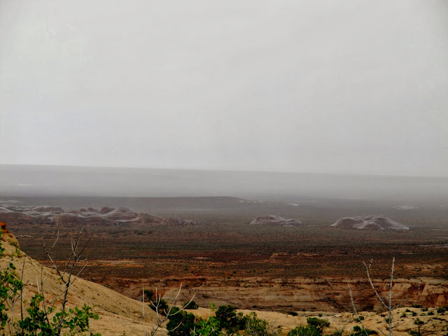
Lower Moonshine Wash
Panorama of the Moonshine Wash and San Rafael River confluence
Chaffin Ranch Geyser
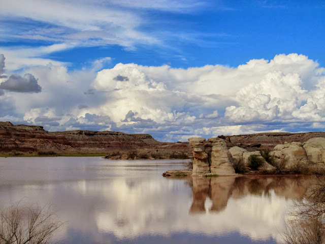
Horse Bench Reservoir
Full photo gallery:
https://picasaweb.google.com/Dennis.Udink/ColonnadeKegSpringBullBottom
[parsehtml]<iframe width="640" height="480" frameborder="0" scrolling="no" marginheight="0" marginwidth="0" src="https://maps.google.com/maps?q=http:%2F%2Fudink.org%2Fgeo%2FColonnadeKegSpringBullBottom.kmz&hl=en&sll=39.60063,-110.806334&sspn=0.076582,0.169086&t=h&ie=UTF8&ll=38.756225,-110.154419&spn=0.514039,0.877533&z=10&output=embed"></iframe><br /><small><a href="https://maps.google.com/maps?q=http:%2F%2Fudink.org%2Fgeo%2FColonnadeKegSpringBullBottom.kmz&hl=en&sll=39.60063,-110.806334&sspn=0.076582,0.169086&t=h&ie=UTF8&ll=38.756225,-110.154419&spn=0.514039,0.877533&z=10&source=embed" style="color:#0000FF;text-align:left">View Larger Map</a></small>[/parsehtml]http://udink.org/geo/ColonnadeKegSpringBullBottom.kmz
Featured image for home page:

Seeing a storm on the horizon while passing this sign wasn't comforting
Ninemile Wash crossing
San Rafael River running high and silty
The worst washout I encountered, which wasn't bad at all
Parked on the slickrock for the start of a hike
I started hiking with the dogs leashed up but soon let them off once I made sure there was plenty of water in potholes for them to drink. They could exert themselves to their content without depleting the 5-liter supply of liquids in my pack. My objective was to find two natural arches that I hadn't seen on my previous trips to the area, and to find the Dragon Teeth formation. After a short hike I arrived at the first and larger of the two arches, and just around the corner I found the second pothole arch. I approached the coordinates for the Dragon Teeth from downhill and knew I'd find it easily when I spotted a few broken shafts of sandstone. I started climbing the slickrock toward the coordinates but got sidetracked by a small cave/alcove. Inside there was soot on the ceiling and a lot of animal bones, many of them charred, but no other solid signs of Indian habitation nearby. Up the hill farther I found the Dragon Teeth exactly where Nick's coordinates pointed me. There were a lot of broken "teeth" on the ground, but I also noticed that the more erosion-resistant teeth extended deeper into the base sandstone, meaning they'll continue weathering out of the rock even after being broken off.
Boulder and Torrey as we begin hiking
Natural arch
Torrey and Boulder drinking from a pothole
Pothole arch
Small cave/alcove
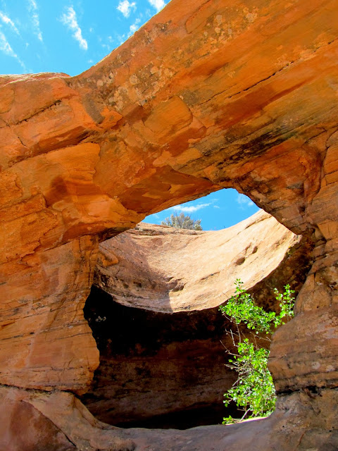
View out of the cave/alcove
Dragon's Teeth
Having found what I was looking for, I headed northwest to explore closer to Keg Spring Canyon. I followed the base of a low ridge of sandstone looking for Indian writings and alcoves that might hold something of interest. As I descended toward Keg Spring Canyon I found pools of water and an alcove with soot on the ceiling that was probably occupied at one point, all while the sky was darkening. I reached the rim of the canyon just as the lightning strikes got too close for comfort. It was time to find some shelter, and I took a different route away from the canyon rim toward Colonnade Arch. I was hoping to find an alcove to shelter in but there was nothing suitable as I made my way uphill to the southeast. The rain started and I hurriedly donned a poncho, which the wind whipped around quite a bit but it kept my pack and camera dry. I got to the top of the ridge along Keg Point and I was still a mile from the Jeep while Colonnade Arch was only a quarter-mile away. Easy choice, there.
My objective was to check out this line of slickrock leading toward Keg Spring Canyon
Darker clouds moving in
The dogs as we explored the slickrock
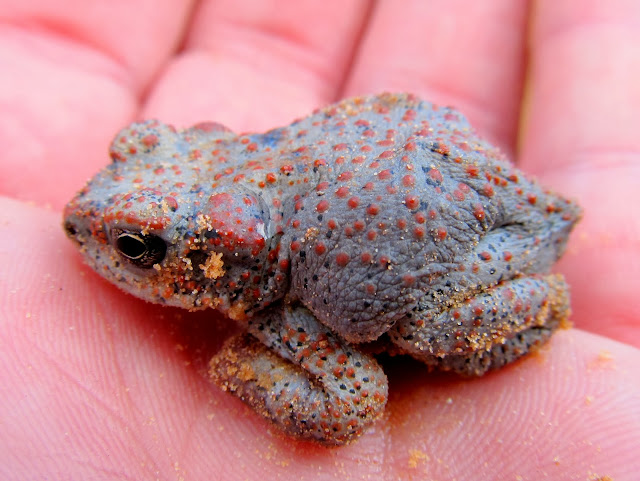
Red-spotted toad
Boulder in a pool
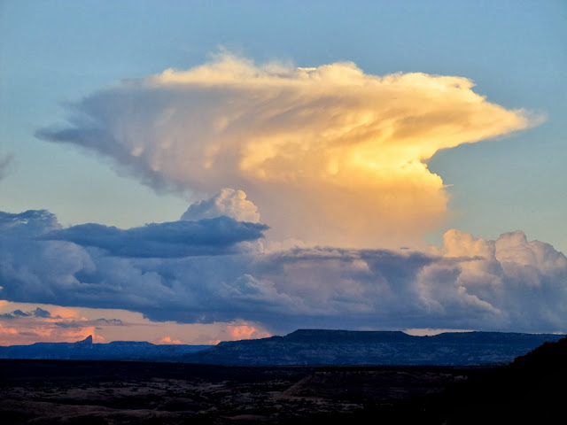
Rain storm moving across the San Rafael Desert
Keg Spring Canyon
View up toward Keg Point
Storm almost overhead--time to find shelter!
Wet slickrock across Keg Spring Canyon
Dark storm clouds overhead
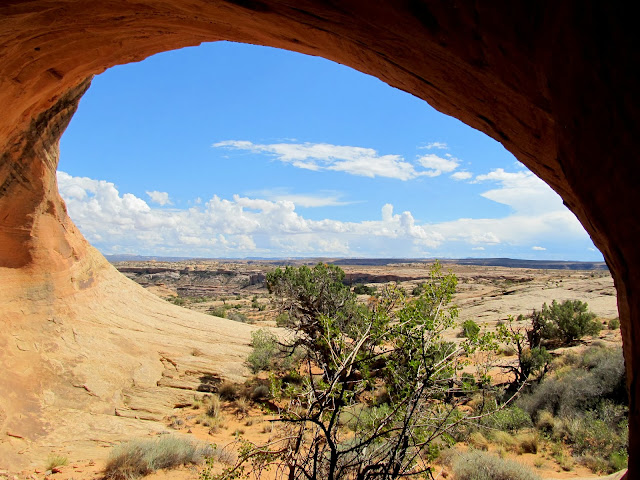
The dogs and I reached Colonnade and I removed all my gear to let things dry out. We relaxed there, well sheltered from the rain and wind and lightning. The dogs even curled up and slept while I sat on a rock and enjoyed the show going on outside. After about 30 minutes the sky cleared up overhead as the storm moved across Labyrinth Canyon. A rainbow appeared and patches of light played on the sandstone to the east. I loaded up and made an uneventful trek across the flat top of the ridge back to the Jeep, then drove a short distance and started setting up camp. Torrey and Boulder explored around camp while I got a small fire going and ate dinner. I spent the rest of the evening reading a book by the red glow of my headlamp and taking photos of the lightning storm passing far off in the distance to the east. It looked like Moab was getting hammered. I slept in the back of the Jeep with the dogs so there was a minimum of fuss getting beds set up. I expected rain during the night but it never came.
Inside Colonnade Arch where I sheltered from the storm
Looking down Twomile Canyon beyond to Labyrinth Canyon
Torrey and Boulder resting under Colonnade Arch
Rainbow across the Green River
Colonnade Arch and rainbow
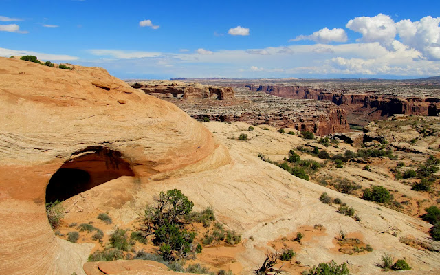
View toward the Maze district of Canyonlands
Gettin' the fire going
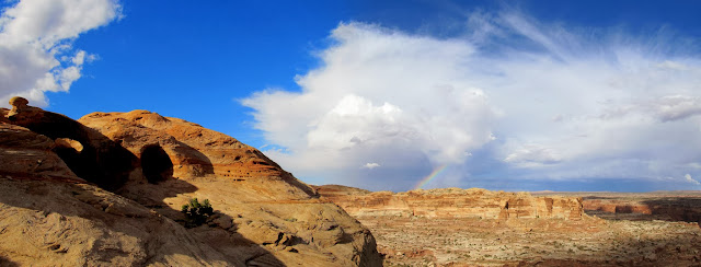
Thunderhead to the south and Cleopatra's Chair on the horizon
Lightning south of Moab
With heavy cloud cover and the longer nights of the approaching fall, I slept in later than I'm accustomed to while camping--at around 7:45 I was out of bed and preparing a quick breakfast and coffee. Torrey had been fine all of the previous day but in the morning I noticed a slight limp as she walked. I hoped she'd be fine as her joints loosened up while we hiked. I packed up what few items needed to be stowed and drove around to one of the upper tributaries of Keg Spring Canyon that had caught my eye on an earlier trip. After a short approach hike I was at the start of the canyon where it formed a shallow slot. The canyon alternated between small slots and wider, sandy sections as it dropped toward Keg Spring. There was a spot where the watercourse made a couple of tight turns as it dropped down a dryfall and I could see no way to get into the canyon below the dryfall. The canyon deepened and the walls where sheer as far as I could see downstream, so I followed the rim hoping to find a place to drop back in and then follow the canyon up to the bottom of the dryfall--I didn't want to leave any of the canyon unexplored. Less than ten minutes after leaving the watercourse I noticed that Boulder was limping. I checked her out and found something stuck to her paw, and only after I pulled it off did I realize it was part of her pad. She'd gotten a blister while scrambling on the slickrock and the layer of skin on the blister tore off. I knew that would end any more major hiking for the day since I didn't want to risk having to carry one or both dogs a long distance. I reversed course and took it slow and easy back to the Jeep.
Sunrise over the La Sals
Start of a hike in one of the forks of Keg Spring Canyon
Dogs in the kiddie slot
End of the short narrows section
Boulder doing it the hard way
Impassable slot below the dryfall
Wider canyon below the slot
A piece of Boulder's pad that came off, signaling time to turn around
Pups getting a drink
I drove around to the lower end of the tributary canyon near where it drains into the main Keg Spring Canyon and hiked a short distance to the tributary's end. On a previous trip I'd seen from below where the tributary ends in a hanging canyon above the larger canyon, and now from above I could see that there was a tight and twisty slot before the drop. There was still more than half a mile of the canyon between where I'd turned around and here that would remain unexplored this day. Nearby I stopped to look for obsidian at a place I'd visited earlier this year. It's amazing to me that Native Americans worked obsidian into arrowheads here even though the nearest source for the rock is well over 100 miles away. I found a few large, rough pieces of obsidian and a lot of tiny flakes. Obviously somebody had made a lot of projectile points here.
Lower part of the canyon that I'd been in earlier
Another impassible slot
Here the canyon drains into the main fork of Keg Spring Canyon
Fallen balanced rock
Obsidian
I learned that climbing up moki steps is easy, while climbing down is terrifying
Eventually I drove to the main road and started for home, making a few brief stops on the way. I visited Grocery Rock, a place Alan had mentioned to me that had a lot of names carved into it from the 1930s through the 1950s. I took a side road that I'd never driven but looked interesting. My map showed that it ended at the Green River less than two miles away. The road led to the top of a stock trail that was blasted out of a cliff, and the flat area along the river below the cliffs is called Bull Bottom. The stock trail itself was very interesting, though it's difficult to imagine any livestock using it. I'd guess it was mostly used for sheep because I don't think cattle would be willing or able to traverse it. I walked along the bottom of the cliffs searching for old cowboy names and was surprised to find a few petroglyphs instead. I only explored about 1,000' of the cliffs but there's much more that I'll probably explore another time when I don't have crippled dogs with me. I made two more quick stops on the way home, one at the confluence of Moonshine Wash and the San Rafael River, and another at Chaffin Ranch Geyser where I found it gurgling and spitting. I was only slightly disappointed that I made it back to civilization without being washed away by rain or hampered by bad roads.
There were big puddles in the road that weren't there the previous day
C. Bishop is all fancy
Old stock trail blasted out of the cliff that leads to Bull Bottom
View up the stock trail
Small, faint petroglyph about 15' up a cliff
Green River at Bull Bottom
Petroglyph at Bull Bottom
Lower Moonshine Wash
Panorama of the Moonshine Wash and San Rafael River confluence
Chaffin Ranch Geyser
Horse Bench Reservoir
Full photo gallery:
https://picasaweb.google.com/Dennis.Udink/ColonnadeKegSpringBullBottom
[parsehtml]<iframe width="640" height="480" frameborder="0" scrolling="no" marginheight="0" marginwidth="0" src="https://maps.google.com/maps?q=http:%2F%2Fudink.org%2Fgeo%2FColonnadeKegSpringBullBottom.kmz&hl=en&sll=39.60063,-110.806334&sspn=0.076582,0.169086&t=h&ie=UTF8&ll=38.756225,-110.154419&spn=0.514039,0.877533&z=10&output=embed"></iframe><br /><small><a href="https://maps.google.com/maps?q=http:%2F%2Fudink.org%2Fgeo%2FColonnadeKegSpringBullBottom.kmz&hl=en&sll=39.60063,-110.806334&sspn=0.076582,0.169086&t=h&ie=UTF8&ll=38.756225,-110.154419&spn=0.514039,0.877533&z=10&source=embed" style="color:#0000FF;text-align:left">View Larger Map</a></small>[/parsehtml]http://udink.org/geo/ColonnadeKegSpringBullBottom.kmz
Featured image for home page:
")