IntrepidXJ
ADVENTR
- Joined
- Jan 17, 2012
- Messages
- 3,488
Tuesday, December 30, 2014
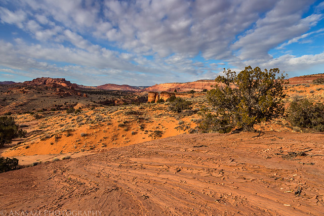
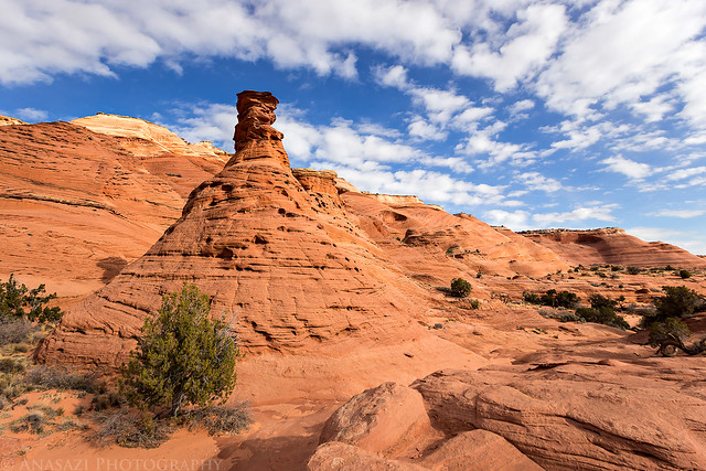
After taking a long loop hike through Coyote Buttes North on Monday we decided to try and make today an easier day. I had never been to Cobra Arch before and thought it might make for a nice easy hike to an interesting arch. We made it to the Middle Trail trailhead on the West Clark Bench shortly after sunrise and were soon descending The Dive on our cross-country hike to Cobra Arch.
View to the southwest over Buckskin Gulch towards Steamboat Rock, Coyote Buttes and Top Rock as we descended The Dive.
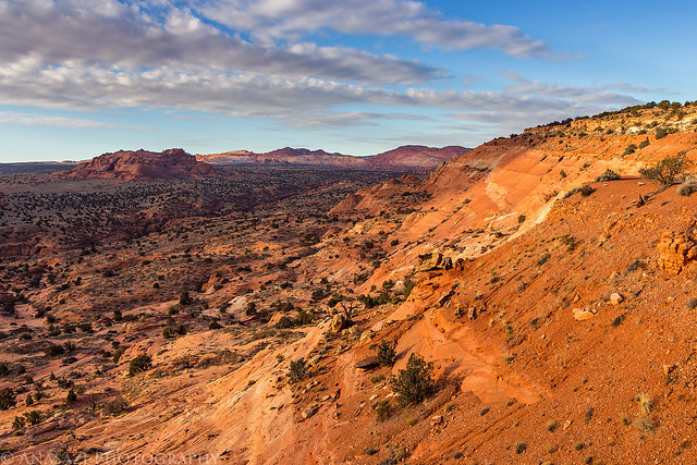
The Dive by IntrepidXJ, on Flickr
Coyote Buttes View by IntrepidXJ, on Flickr
Nice light on Steamboat Rock.
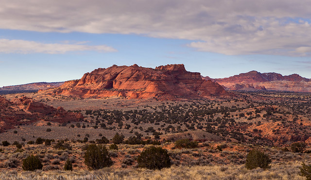
Steamboat Rock by IntrepidXJ, on Flickr
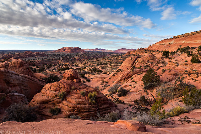
We had some nice light and clouds as we hiked across the desert this morning. The temperature was pretty comfortable, too.
Wash Crossing by IntrepidXJ, on Flickr
Nice Clouds by IntrepidXJ, on Flickr
Sandstone Scenery by IntrepidXJ, on Flickr
Around the Point by IntrepidXJ, on Flickr
Almost There by IntrepidXJ, on Flickr
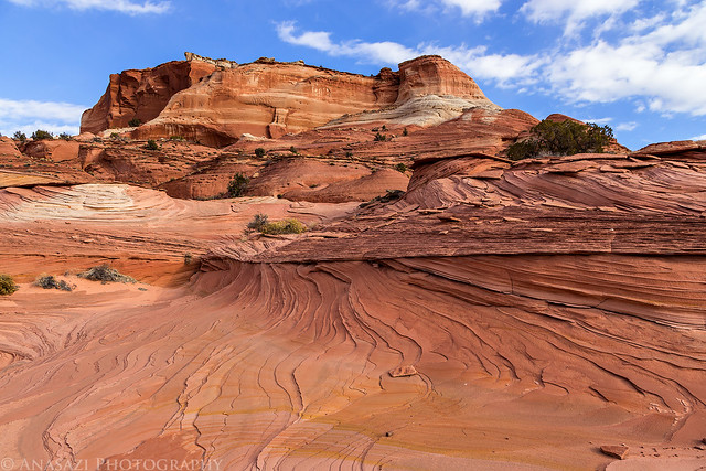
After a couple of miles hiking along the base of The Dive, we reached the impressive Cobra Arch. Luckily, the nice clouds stuck around a little longer so I could get a few photos. On our hike back from the arch, the sky would turn completely overcast and stay that way for the rest of the day.
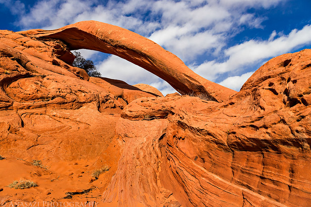
Cobra Arch by IntrepidXJ, on Flickr
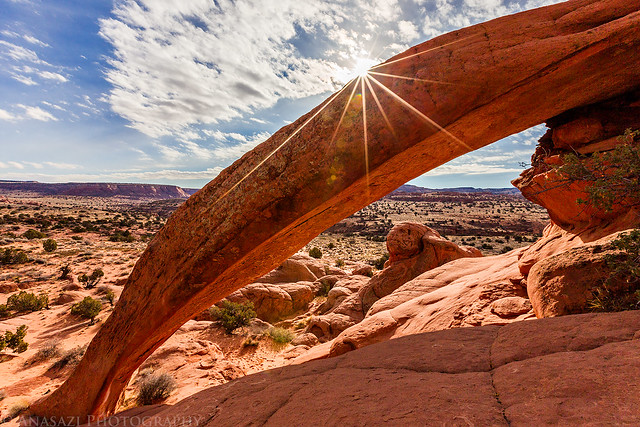
Cobra Arch Sunburst by IntrepidXJ, on Flickr
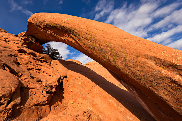
Close Cobra by IntrepidXJ, on Flickr
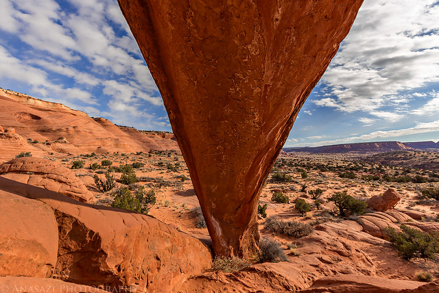
Under by IntrepidXJ, on Flickr
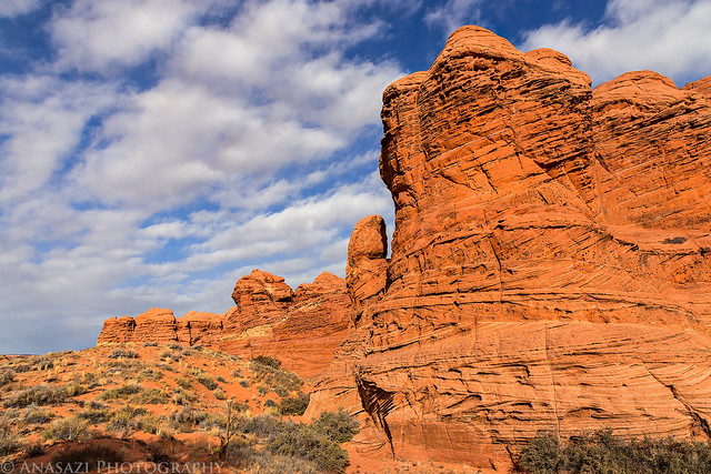
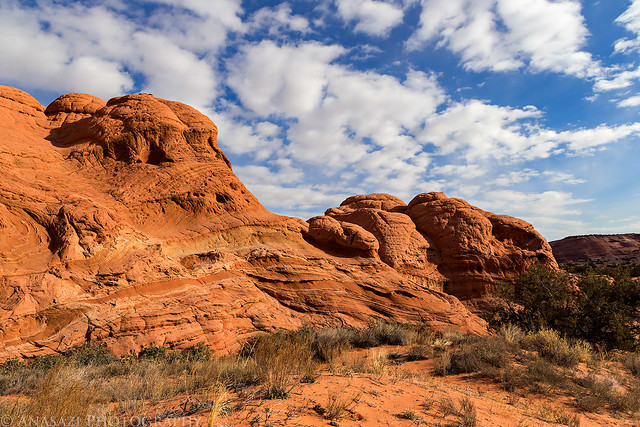
Before hiking back to the trailhead, we explored the area around the arch a little.
Hoodoo View by IntrepidXJ, on Flickr
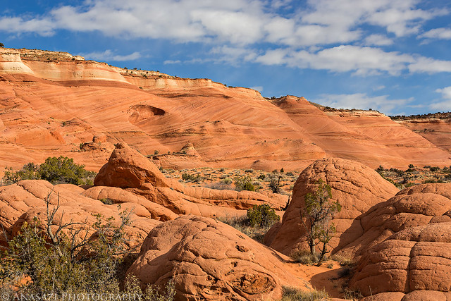
Domes by IntrepidXJ, on Flickr
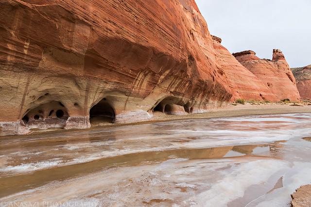
After the hike, we drove over to an overlook of the Paria River Canyon and had a little lunch. It was still early in the day, so we decided to drive around to the White House trailhead and hike down the Paria River to visit a panel of petroglyphs. I was hoping we wouldn't have to cross the river too many times in order to reach them, but it turned out that would have to cross it quite a few times. Much of the river was iced over, but you would break through the ice with each step. Luckily, if you picked a good place to cross, the water underneath wasn't too deep and the ice you broke through would help keep you out of the water. This method, combined with waterproof boots, allowed us to keep our feet dry on the hike.
A frozen Paria River.
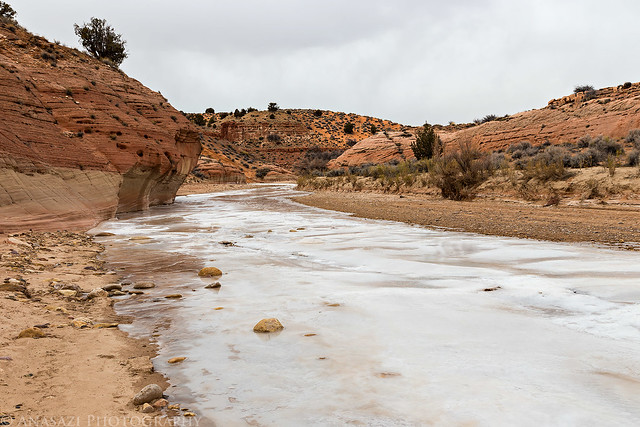
River of Ice by IntrepidXJ, on Flickr
Our path of destruction at each point we crossed the river.
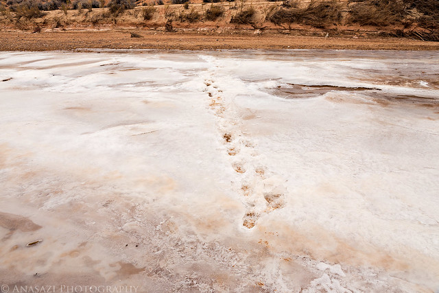
Paria Crossing by IntrepidXJ, on Flickr
Paria Ice by IntrepidXJ, on Flickr
There were a lot of petroglyphs in the large alcove we visited, but most of them were very faint and hard to see.

Faint Petroglyphs by IntrepidXJ, on Flickr

Paria Panel by IntrepidXJ, on Flickr
Nice varnish on the canyon wall here.

Stains by IntrepidXJ, on Flickr
After visiting the petroglyphs, we returned the way we had come and then drove back to Page for dinner and to relax for the rest of the evening.
>> Cobra Arch Photo Gallery
>> The Original Trip Report on ADVENTR.CO
Featured image for home page:

After taking a long loop hike through Coyote Buttes North on Monday we decided to try and make today an easier day. I had never been to Cobra Arch before and thought it might make for a nice easy hike to an interesting arch. We made it to the Middle Trail trailhead on the West Clark Bench shortly after sunrise and were soon descending The Dive on our cross-country hike to Cobra Arch.
View to the southwest over Buckskin Gulch towards Steamboat Rock, Coyote Buttes and Top Rock as we descended The Dive.
The Dive by IntrepidXJ, on Flickr
Coyote Buttes View by IntrepidXJ, on Flickr
Nice light on Steamboat Rock.
Steamboat Rock by IntrepidXJ, on Flickr
We had some nice light and clouds as we hiked across the desert this morning. The temperature was pretty comfortable, too.
Wash Crossing by IntrepidXJ, on Flickr
Nice Clouds by IntrepidXJ, on Flickr
Sandstone Scenery by IntrepidXJ, on Flickr
Around the Point by IntrepidXJ, on Flickr
Almost There by IntrepidXJ, on Flickr
After a couple of miles hiking along the base of The Dive, we reached the impressive Cobra Arch. Luckily, the nice clouds stuck around a little longer so I could get a few photos. On our hike back from the arch, the sky would turn completely overcast and stay that way for the rest of the day.
Cobra Arch by IntrepidXJ, on Flickr
Cobra Arch Sunburst by IntrepidXJ, on Flickr
Close Cobra by IntrepidXJ, on Flickr
Under by IntrepidXJ, on Flickr
Before hiking back to the trailhead, we explored the area around the arch a little.
Hoodoo View by IntrepidXJ, on Flickr
Domes by IntrepidXJ, on Flickr
After the hike, we drove over to an overlook of the Paria River Canyon and had a little lunch. It was still early in the day, so we decided to drive around to the White House trailhead and hike down the Paria River to visit a panel of petroglyphs. I was hoping we wouldn't have to cross the river too many times in order to reach them, but it turned out that would have to cross it quite a few times. Much of the river was iced over, but you would break through the ice with each step. Luckily, if you picked a good place to cross, the water underneath wasn't too deep and the ice you broke through would help keep you out of the water. This method, combined with waterproof boots, allowed us to keep our feet dry on the hike.
A frozen Paria River.
River of Ice by IntrepidXJ, on Flickr
Our path of destruction at each point we crossed the river.
Paria Crossing by IntrepidXJ, on Flickr
Paria Ice by IntrepidXJ, on Flickr
There were a lot of petroglyphs in the large alcove we visited, but most of them were very faint and hard to see.
Faint Petroglyphs by IntrepidXJ, on Flickr
Paria Panel by IntrepidXJ, on Flickr
Nice varnish on the canyon wall here.
Stains by IntrepidXJ, on Flickr
After visiting the petroglyphs, we returned the way we had come and then drove back to Page for dinner and to relax for the rest of the evening.
>> Cobra Arch Photo Gallery
>> The Original Trip Report on ADVENTR.CO
Featured image for home page: