Clear Creek (Northern Winds)

Jackson

I ❤️ GYE
.
Joined
May 31, 2015
Messages
3,064
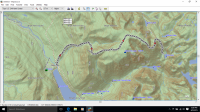
I'm planning a trip to the Winds soon, but the problem is that I'll probably only have two nights that I can spend there. I was thinking of starting at Green River Lakes and hiking up Clear Creek to one of the lakes up there. I know the trail basically ends at the natural bridge, and I was wondering how hard of a bushwhack it is up beyond that and if the camping at Clear Lake, Faler Lake, or elsewhere is good. I mapped it on CalTopo, and I know the distance and elevation gain aren't bad, but there's no way to really tell how sections of that last stretch will be. Anyone have any experience around there? Or better suggestions on what to do with just 2 nights to spend out there?
 

Mike K

Member
Joined
Jul 6, 2012
Messages
859
I don't have much in the way of suggestions but I've wanted to check out those lakes, too (Clear, Faler, Slide, etc). I thought it'd be cool to take a packraft to paddle to the other side of Clear Lake and also try to do some paddling on the Green River and Green River Lakes while in the area. Also, it'd be cool make a loop out of Clear and Slide lakes if it's doable. (I haven't looked at the map so I don't even know how feasible it would be).

I'll be curious to see what kind of info and advice you get from others.

Oh...one last idea...have you checked it out on Google Earth (or other imagery)? Maybe that would give you an idea of the terrain in the area you're wondering about.
 

Jackson

I ❤️ GYE
.
Joined
May 31, 2015
Messages
3,064
Packrafting around that area sounds awesome! I need to get a packraft soon.

Yeah, I've looked on Google Earth. That's usually my go-to when I first scout out an area. It makes it seem like it's pretty steep on the sides of the creek in a few places, so that's why I wondered about getting up there.

I was looking on Google Earth at places a ways up the Green River a month or two ago and was looking at ascending Wells Creek. I read around on the Internet and learned there's a part of it that's a class 5 climb to get up. I never would've realized that from looking at the map, so I want to make sure there's nothing like that before I actually go to this one! Haha.
 

Mike K

Member
Joined
Jul 6, 2012
Messages
859
Oh! I have a picture or video of that crux spot going up Wells Creek! If you go later in the season it's not an issue...you just have to leap across the creek and you're done. It's a wee bit exposed if I remember correctly but no too bad. I'll see if I can dig up a TR or picture for you...

I'll have to check out the imagery you're talking about for Clear Creek. How far below the lake does it start looking iffy/steep?
 
Last edited:

Bob

Trailmaster
Joined
Mar 3, 2013
Messages
3,740
There is a better trail up the side of Osborne, kinda follows the old fence line to the draw to the north of Geen river lake...east of the campground....end up on top and you ridge walk to the divide north of Faler. I'd stay out of the canyon..thick, and the climb to Faler is loose and steep.
 

Jackson

I ❤️ GYE
.
Joined
May 31, 2015
Messages
3,064
There is a better trail up the side of Osborne, kinda follows the old fence line to the draw to the north of Geen river lake...east of the campground....end up on top and you ridge walk to the divide north of Faler. I'd stay out of the canyon..thick, and the climb to Faler is loose and steep.

I'm not sure I see that super clearly on the map. Does it pretty much just start at the campground and go up the side of Osborne? It doesn't follow any drainages, right?
 

Bob

Trailmaster
Joined
Mar 3, 2013
Messages
3,740
There is a draw just east of the campground at the outlet of Green Lake....Trail goes up the ridge on the north side of Mill Creek (drainage coming off of Osborne), about halfway up then crosses over at about 9800ft towards a saddle to the south that's about 10600ft. Then up to the east across the top to a point just north of Faler lake and makes a hook back north on a knife ridge down to the old trail to Faler lk. Or you can go around on the Roaring Fork trail....

Osborne.png
 
Last edited:

Jackson

I ❤️ GYE
.
Joined
May 31, 2015
Messages
3,064
Thanks so much @Bob. That's really helpful. Have you also been to Clear Lake? Which one is preferable for camping?
 

OldBill

Member
Joined
Aug 18, 2015
Messages
328
Bob's ideas are good. I've tried twice to bushwhack up the Clear Ck downfall. It's very easy to become impaled on a sharp broken branch. I lost the trail in my one attempt over Osbourne. There are a lot of side trails and by the time I corrected a huge thunderstorm was developing. You don't want to be caught up there in that. The Roaring Fk trail was long, with some downfall and mostly easily followed. But, that area was burned a few years back so I don't know what it's like now. You can call the Great Outdoor Shop to see if anyone's been up there. It's on my short list for this year.
 

Jackson

I ❤️ GYE
.
Joined
May 31, 2015
Messages
3,064
Thanks for the post, @OldBill. Really helpful. Looking at it on Google Earth, I wouldn't have ever known about how tough it can be to go up Clear Creek without spending the time exploring it myself.
 

OldBill

Member
Joined
Aug 18, 2015
Messages
328
Look forward to your trip report. Headed out shortly after Labor Day myself. Depending on what you like, you might want to consider the classic Island L./Titcomb hike or something less crowded like Bald Mtn basin or Cook Lakes or near Big Slide. There's usually more griz activity nearer Green R Lakes because of all the cattle.
 

Jackson

I ❤️ GYE
.
Joined
May 31, 2015
Messages
3,064
Yeah, I've been looking at hikes from Elkhart Park as well, like Cook Lakes and Titcomb. I figure Titcomb Basin is a bit far for just 2 nights (correct me if that's wrong), at least given that I haven't backpacked too much this Summer. I'll have to read up on Bald Mountain Basin and Big Slide, though. Not too familiar with those.

I hope to see a grizz near GRL sometime. Just from a distance for maybe 5-10 seconds, though. Haha.
 

OldBill

Member
Joined
Aug 18, 2015
Messages
328
Getting to Titcomb in 1 day can indeed be tough w/o serious conditioning or the advantage of youth. At 58, living at sea-level, after acclimating a few days I can make it to Island L or the Big Water Slide in a day. But my pace is slowing. Anyway, anyplace around GRL is great. If you do use Roaring Fk, the last 500' to Native is steep and happens at the end of a long day. Had confirmation from others to avoid path to Clear L. There probably is a way in, but I'm guessing residents keep it hidden.
 

Jackson

I ❤️ GYE
.
Joined
May 31, 2015
Messages
3,064
Thanks so much for the info @OldBill. You sure know your stuff. In the interest of saving time driving, I'm probably going to save GRL for next year and do something from Elkhart Park, which makes me kinda sad. The option that seems best to me is doing a lollipop loop going by Pole Creek Lakes, up over Lester Pass and coming back down by Little Seneca and out.
 

OldBill

Member
Joined
Aug 18, 2015
Messages
328
I'm sure you'll have fun if the weather cooperates. If you have 2 nights/3 days, consider camping at Cook Lakes. Off the main path, great views, good campsites. Give yourself plenty of time to go over Lester. You might want to camp at Island L night 2 since there aren't good sites until you hit Ekland or Miller/Sweeney. Not a bad trip at all. Plenty of fishing opportunities too.
 
Similar threads
Thread starter Title Forum Replies Date
Bushwacker West Clear Creek Ruin Trip Planning 6
Blake Merrell Clear Creek Reservoir On The Water 6
Bob West Clear Creek Ruins Backpacking 7
Bob Cathedral of the Desert, Clear Creek - Top Access Resource Discussions 5
slc_dan Mogollon Rims-West Clear Creek Trip Planning 0
A Wind Rivers: Clear Lake, Faler Lake and Roaring Fork General Discussion 7
lostlandscapes Clear Lake, Wind River Range Trip Planning 1
IntrepidXJ Clear Lake & Ice Lake Basin Backpacking 12
Gretchen Millward Trachyte Creek via Woodruff Canyon, April 2023 Backpacking 2
I Slough Creek - Yellowstone June 5 & 6 Meet Up (Members Only) 19
scatman City Creek Loop - April 23, 2023 Hiking & Camping 8
F Thorofare/South Boundary/Wolverine Creek Trip Planning 2
scatman Rescue Creek - Yellowstone National Park Meet Up (Members Only) 18
Janice When might road to Salt Creek TH be ok? Trip Planning 23
BobFink Yellowstone South Entrance to Fox Creek via Basin Creek Cutoff - Labor Day 2022 Trip Reports 4
Janice Professor Creek / Mary Jane Canyon - mid April? Trip Planning 0
scatman North Ridge of City Creek Canyon - February 4, 2023 Hiking & Camping 17
MikeP Exploring/Calf Creek Trip Planning 24
scatman South Ridge of City Creek Canyon - January 28, 2023 Hiking & Camping 4
travel2walk Gros Ventre Wilderness: Granite Creek, West Fork Crystal Creek, Crystal Creek, & Swift Creek - June 2021 Backpacking 8
slieb Lower Muddy Creek in Winter? Trip Planning 7
scatman A Yellowstone Love Story (Bog Creek Euphoria) - September 12, 2022 Backpacking 28
NorthwestWanderer Backpacking Grand Teton National Park : Fossil Pass,Fox Creek Pass,Indian Lake,Alaska Basin,Hurricane Pass,Ice Floe Lake,& Snowdrift Lake Backpacking 19
TractorDoc Yellowstone's Wrangler Lake, Bog Creek, Joseph's Coat Springs, Broad Creek, Wapiti Lake, Hot Springs Basin, and Pelican Valley. The Second Half. Backpacking 15
TractorDoc Yellowstone's Wrangler Lake, Bog Creek, Joseph's Coat Springs, Broad Creek, Wapiti Lake, Hot Springs Basin, and Pelican Valley. Part One of Two. Backpacking 61
scatman Pacific Creek, Moss Lake and Gravel Lake - Teton Wilderness - October 7, 2022 Backpacking 32
TractorDoc Yellowstone's Hayden Valley, Trout Creek, Beach Lake, and Arnica Creek Meadows. September 11, 2022. Hiking & Camping 7
scatman Trout Creek and the Headwaters of Alum Creek - September 11, 2022 Hiking & Camping 17
R Wind River Range: Green River Lakes/Clarks Trail/Porcupine Creek Trail Trip Planning 3
Janice Salt Creek plus... Trip Planning 17
Gretchen Millward Trachyte Creek, April – May 2022 Backpacking 3
XID_AZ Kanab Creek Wilderness - Sowats Canyon - Mountain Sheep Spring Trip Planning 6
balzaccom McGee Creek--Fire (smoke) Rain, Winded and rockslides... Trip Reports 0
John Goering Tobacco Root Mountains South Meadow Creek Off Road 1
SteveR Bull Creek Hills, Alberta Hiking & Camping 5
T Salt Creek this weekend Trip Planning 1
TeamJenkins17 Red Tops/Needle Creek Drainage Info Trip Planning 0
M Kannah Creek Basin loop, Grand Junction CO Backpacking 6
WhozWutz Montezuma Creek Rd Trip Planning 1
The Trout Whisperer Non kilt wearin’ version of th Gneiss Creek Expedition part 3… Backpacking 0
The Trout Whisperer Non kilt wearin’ version of th Gneiss Creek trip, part 2, Backpacking 4
The Trout Whisperer Non kilt wearin’ version of th Gneiss Creek Expedition part 1 Backpacking 4
Gretchen Millward Trachyte Creek, Oct. 2021 Backpacking 8
scatman Foothill Follies Part 2 - Black Mountain Ridge and City Creek Canyon Loop - November 11, 2021 Hiking & Camping 6
RyanP Coyote Gulch to Halls Creek via Steven's Canyon and the Baker Route (car/key swap) Meet Up (Members Only) 8
TractorDoc Yellowstone's Shoshone Lake, Ouzel Creek, and Three Rivers Junction -- September 13-16 2021 Backpacking 62
Gretchen Millward Trachyte Creek conditions/water Trip Planning 0
scatman Gneiss Creek Part 2 - Yellowstone National Park - September 18, 2021 Hiking & Camping 0
TeamJenkins17 Looking for info on Clark Creek drainage/Pierpont Pass into Hidden Basin in the Washakie Wilderness Trip Planning 5
wsp_scott Honey Creek (Big South Fork) Backpacking 9

Similar threads

Don't like ads? Become a BCP Supporting Member and kiss them all goodbye. Click here for more info.

Top