kerkphil
aka Skeptocles
- Joined
- Sep 27, 2012
- Messages
- 15
I got back from hiking the Chute of Muddy Creek last night a little after midnight. I left on Friday afternoon with three students from my Econ 581 class at BYU: T.J. Canann, Chase Coleman, and Huang Ruidi. Ruidi and I drove our 4WDs down. We went via I-15, through Scipio to Salina and then along I-70 to the Temple Mountain Road turnoff at milepost 131. We camped that night at the Hidden Splendor Airfield which was the end of our hike on Saturday. We had several hundred people for company as the Utah Wilderness Alliance was having a "Roundup" there this weekend.
The plan was to start hiking at 8:00 a.m., but with sleeping in a half hour and then leaving the knee brace at camp and having to go back for it, we didn't actually hit the trail until 9:15. We finished up the hike around 6:00 p.m. without any real troubles along the way. The water was running around eight cubic feet per second at the gauge in Emery the days before, so levels were pretty low in the chute most of the way. It was ankle or calf deep most of the time. The deepest we hit in some of the pools was a few inches above waist deep.
The weather was perfect. Highs were in the eighties, low for the night in the upper forties. The water was cold in the pools in the chute, but not numbingly cold; rather refreshing actually.
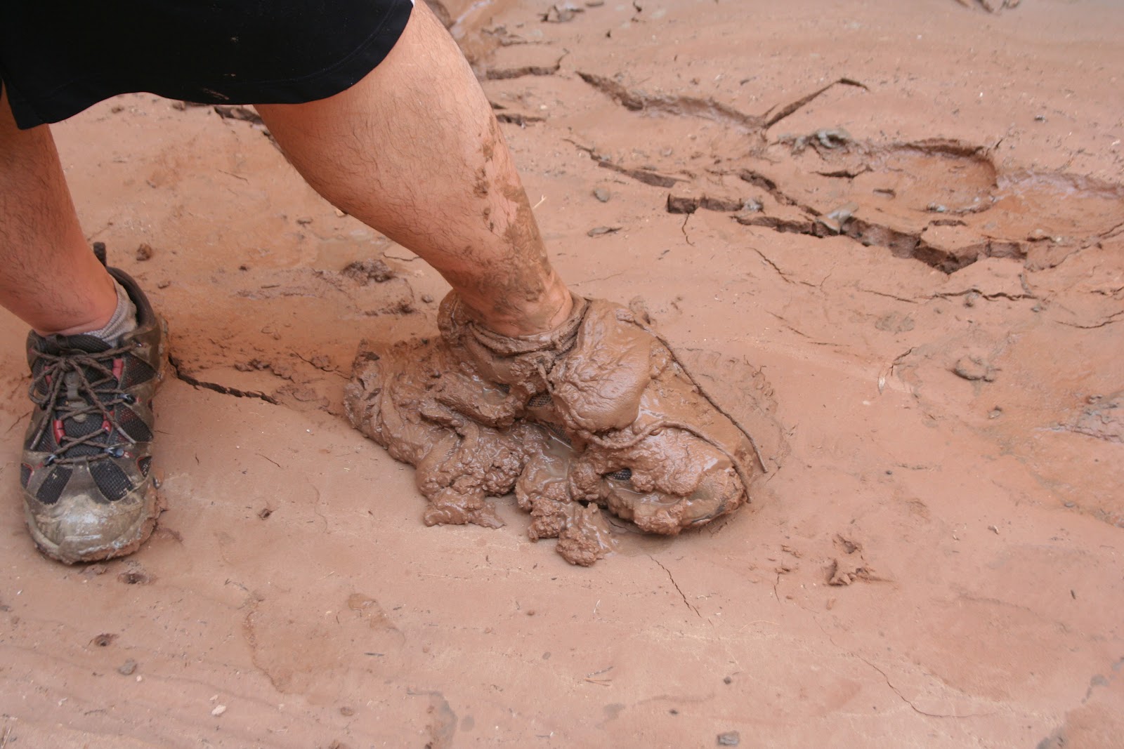
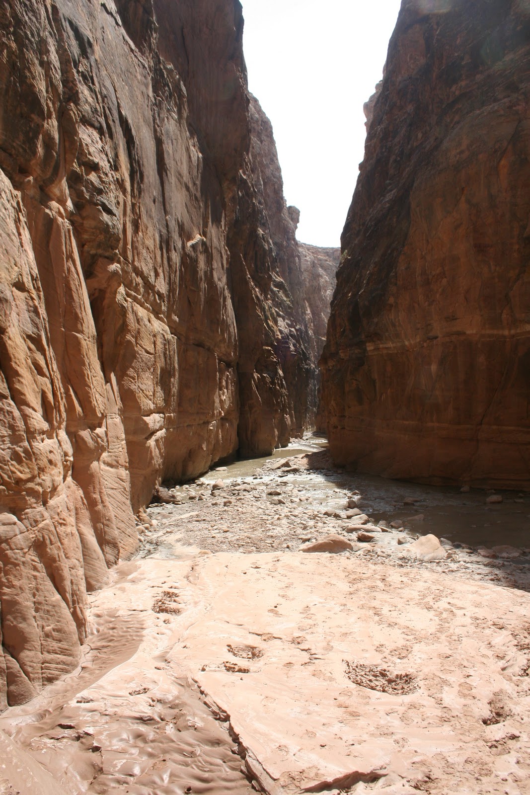
Muddy Creek is well named. In many places the banks and the stream are covered in several inches of thick black sticky mud. In some places the mud was several feet deep. It gets a bit slippery as well, but you learn to deal with it. The water is also saturated with alkali chemicals - when the water dries it leaves behind a white residue that looks like laundry detergent. This makes that water a milky grey and also makes judging the depth difficult. Calm water can mean a deep pool, but it can also be quite shallow. The best places to walk are where the water has small ripples indicating its shallow with small rocks or sand and not mud.
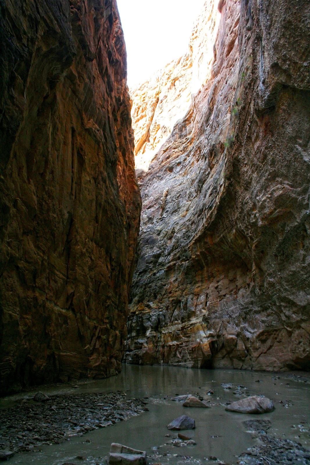
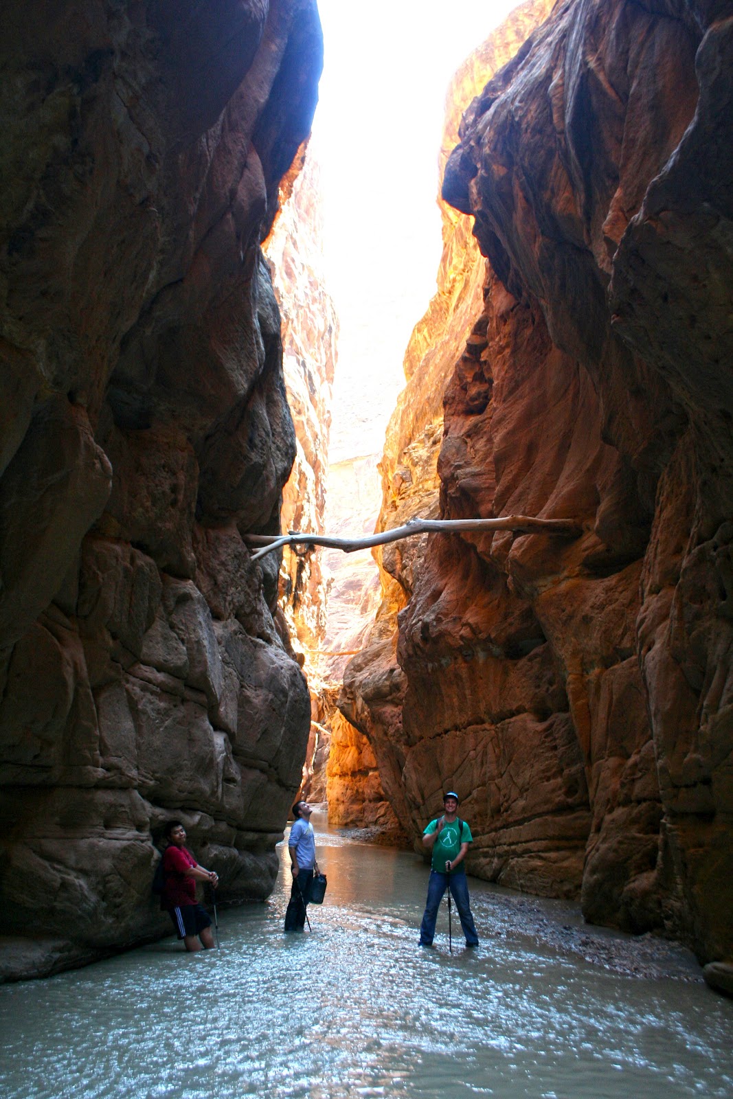
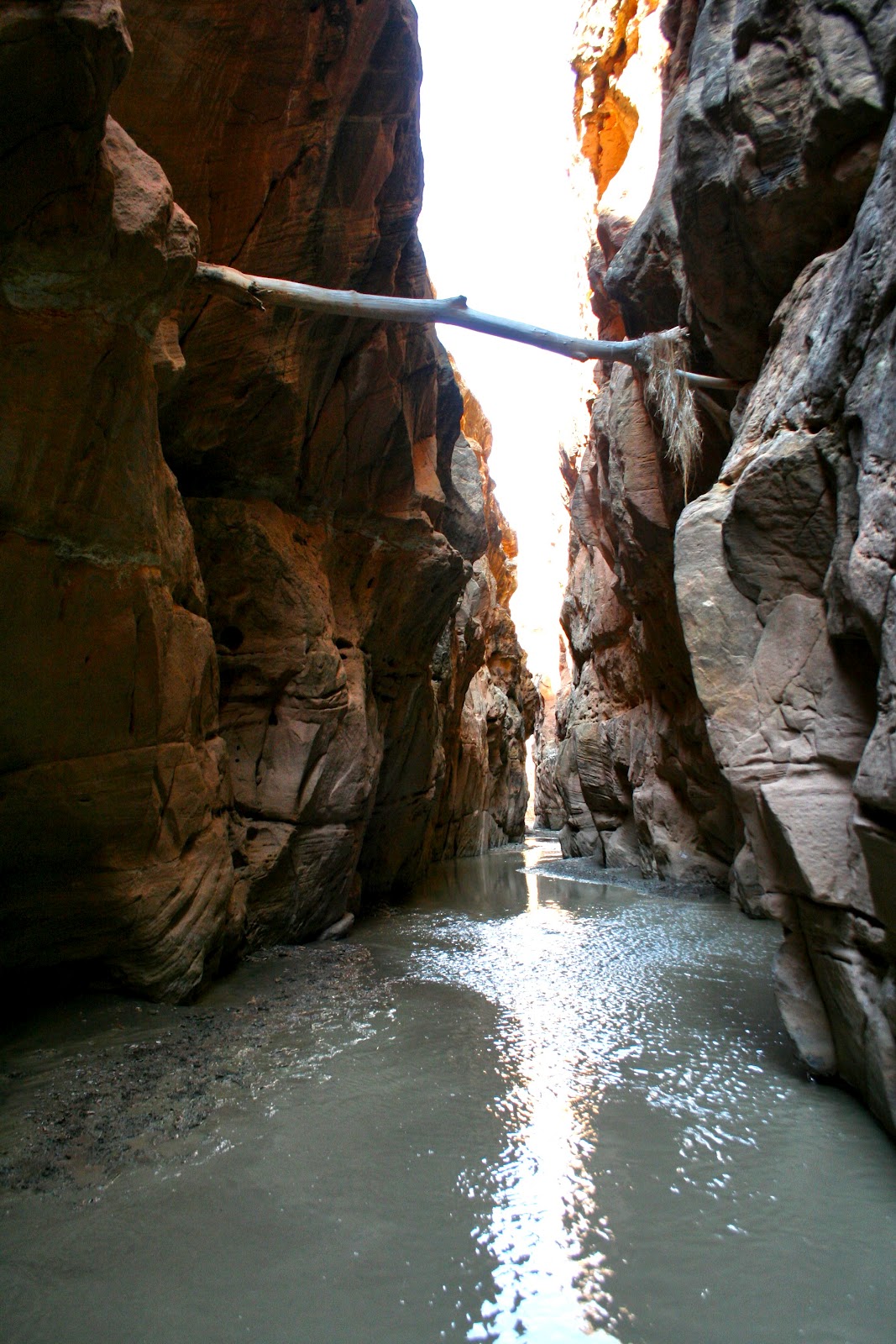
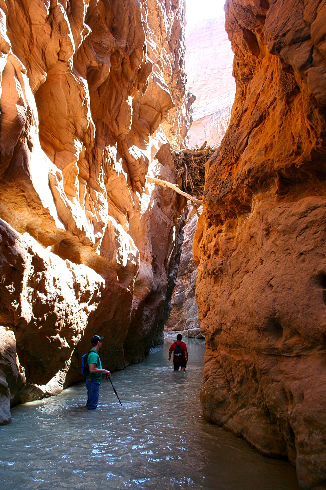
The first three miles and last five miles or so of the hike are through fairly wide canyons with ample room on the banks to walk. You can avoid out a great deal of walking if you cut across the banks where the river loops. Walking is generally easier on that solid ground or even on loose sand than it is in the river with the mud and rocks to slow you down. After about three miles the canyon begins to narrow and you enter the upper set of narrows. These are very impressive, though shorter than the set further down. You are walking in the river almost constantly in the narrows and there are often knee-deep or deeper pools to cross. Some of these pools, particularly in the lower narrows are a hundred yards long or longer.
I slipped in one of these pools and dunked my camera, but only for a second and it seems to have survived OK. My iPhone was in my pants pocket in double layers of ziplock bag, but it got wet any way. It was dead on the trip home, but revived after a night in a tub of rice. At least it revived enough to download the photos, videos and GPS waypoints from the trip. The verdict is still out on its long-run health.
After between a half mile and a mile, the first narrows end and the canyon opens up a bit. A half hour of hiking brings you gradually into the lower narrows or the Chute proper. This section goes on for several miles and like the section above it can be slow going in places. The scenery is simply stunning, however, and if you take your time and enjoy the walk and the views it is simply delightful.
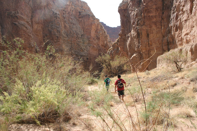
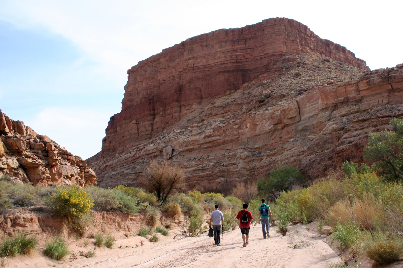
Eventually the chute ends, however and you are left with a long five-mile trudge though the canyon to the Hidden Splendor Airfield. This was least appealing part of the trip as the excellent scenery was over (though the canyon is still pretty) and I was low on water and on energy at this point.
We got back to our campsite around 6:00 p.m.and then drove back to Tomsich Butte to pick up Ruidi's SUV. We made it almost all the way to I-70 before I got a flat tire. It took us almost an hour to change it because of problems with dirt around the lug nuts and a bent cotter pin holding the spare tire release in place. We made it into Green River at 9:00 just in time to grab sandwiches at Subway before they closed. We we in Provo around 11:30 and I got home just after midnight.
I am exhausted and sore, but I loved this hike!

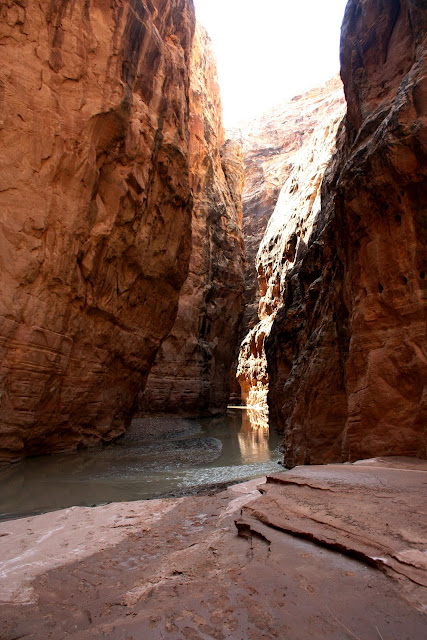
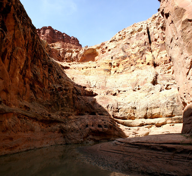
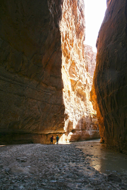
Near the Start of the Hike

One Reason it's Called Muddy Creek
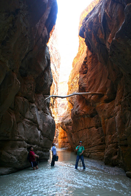
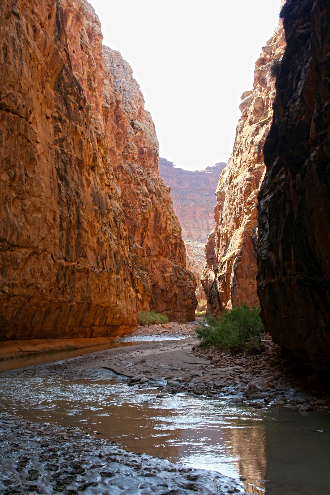
In the Upper Chute
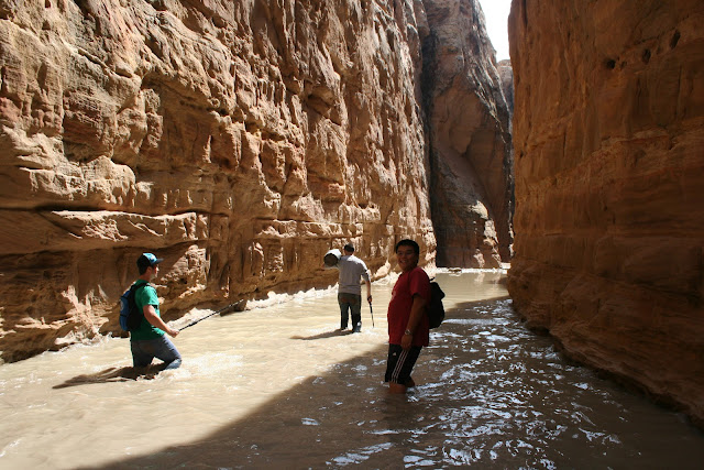
Hiking Pools in the Upper Narrow
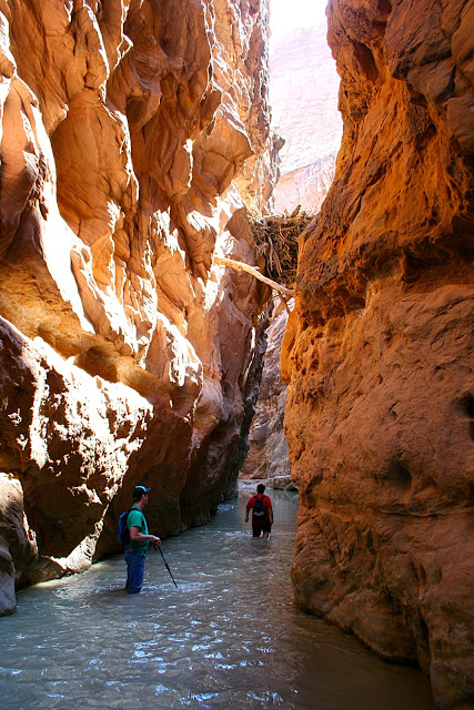
Exit from the Upper Narrow
Hiking between Narrows Sections
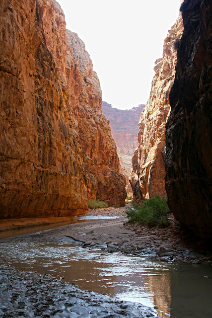
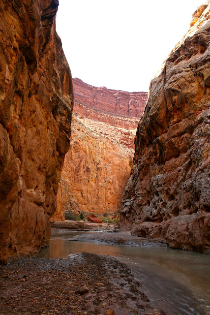
Entering the Lower Chute
In the Lower Chute

Ruidi Stepped in a Bad Spot
Wider Spot in the Lower Chute

Looking Downstream from the Confluence with Music Canyon
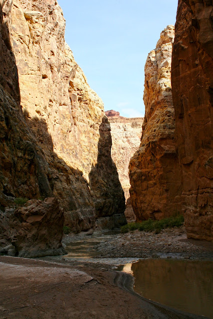
In the Lower Chute

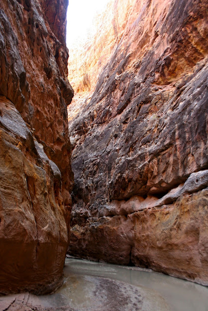
Lower Chute
Deep in the Lower Chute
Just Upstream from the Logjam in the Narrowest Part of the Chute

Same spot Looking Upstream
Passing the Logjam
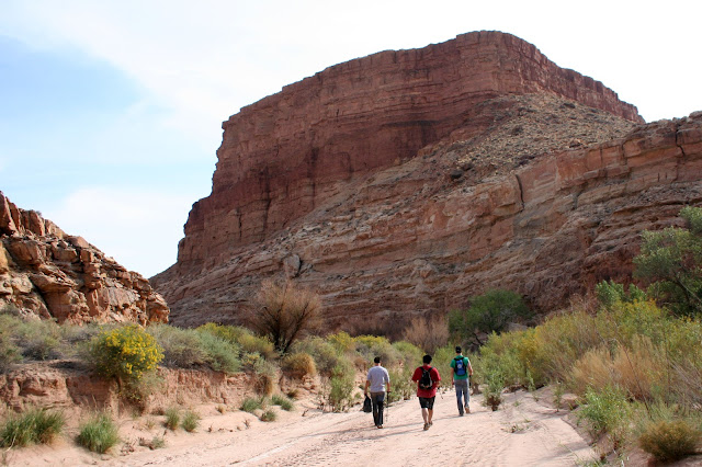
The Long Hike Out
Geotagged versions of these photos and others are viewable at my Panoramio account.
Other descriptions of this hike:
from Climb-Utah.com
from Utahwild.com
Slot Canyons of the American Southwest
Featured image for home page:

The plan was to start hiking at 8:00 a.m., but with sleeping in a half hour and then leaving the knee brace at camp and having to go back for it, we didn't actually hit the trail until 9:15. We finished up the hike around 6:00 p.m. without any real troubles along the way. The water was running around eight cubic feet per second at the gauge in Emery the days before, so levels were pretty low in the chute most of the way. It was ankle or calf deep most of the time. The deepest we hit in some of the pools was a few inches above waist deep.
The weather was perfect. Highs were in the eighties, low for the night in the upper forties. The water was cold in the pools in the chute, but not numbingly cold; rather refreshing actually.
Muddy Creek is well named. In many places the banks and the stream are covered in several inches of thick black sticky mud. In some places the mud was several feet deep. It gets a bit slippery as well, but you learn to deal with it. The water is also saturated with alkali chemicals - when the water dries it leaves behind a white residue that looks like laundry detergent. This makes that water a milky grey and also makes judging the depth difficult. Calm water can mean a deep pool, but it can also be quite shallow. The best places to walk are where the water has small ripples indicating its shallow with small rocks or sand and not mud.
The first three miles and last five miles or so of the hike are through fairly wide canyons with ample room on the banks to walk. You can avoid out a great deal of walking if you cut across the banks where the river loops. Walking is generally easier on that solid ground or even on loose sand than it is in the river with the mud and rocks to slow you down. After about three miles the canyon begins to narrow and you enter the upper set of narrows. These are very impressive, though shorter than the set further down. You are walking in the river almost constantly in the narrows and there are often knee-deep or deeper pools to cross. Some of these pools, particularly in the lower narrows are a hundred yards long or longer.
I slipped in one of these pools and dunked my camera, but only for a second and it seems to have survived OK. My iPhone was in my pants pocket in double layers of ziplock bag, but it got wet any way. It was dead on the trip home, but revived after a night in a tub of rice. At least it revived enough to download the photos, videos and GPS waypoints from the trip. The verdict is still out on its long-run health.
After between a half mile and a mile, the first narrows end and the canyon opens up a bit. A half hour of hiking brings you gradually into the lower narrows or the Chute proper. This section goes on for several miles and like the section above it can be slow going in places. The scenery is simply stunning, however, and if you take your time and enjoy the walk and the views it is simply delightful.
Eventually the chute ends, however and you are left with a long five-mile trudge though the canyon to the Hidden Splendor Airfield. This was least appealing part of the trip as the excellent scenery was over (though the canyon is still pretty) and I was low on water and on energy at this point.
We got back to our campsite around 6:00 p.m.and then drove back to Tomsich Butte to pick up Ruidi's SUV. We made it almost all the way to I-70 before I got a flat tire. It took us almost an hour to change it because of problems with dirt around the lug nuts and a bent cotter pin holding the spare tire release in place. We made it into Green River at 9:00 just in time to grab sandwiches at Subway before they closed. We we in Provo around 11:30 and I got home just after midnight.
I am exhausted and sore, but I loved this hike!
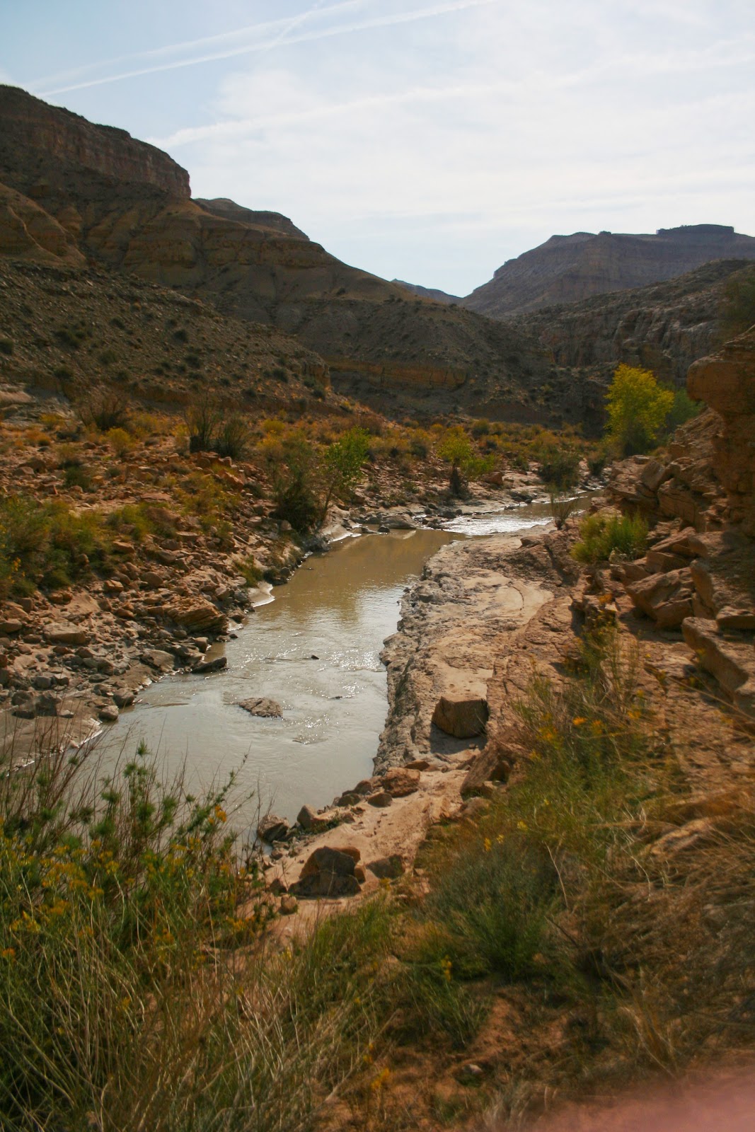
Near the Start of the Hike
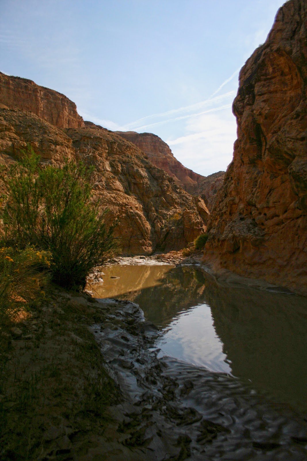
One Reason it's Called Muddy Creek

In the Upper Chute

Hiking Pools in the Upper Narrow
Exit from the Upper Narrow

Hiking between Narrows Sections

Entering the Lower Chute

In the Lower Chute
Ruidi Stepped in a Bad Spot

Wider Spot in the Lower Chute
Looking Downstream from the Confluence with Music Canyon

In the Lower Chute
Lower Chute

Deep in the Lower Chute
Just Upstream from the Logjam in the Narrowest Part of the Chute
Same spot Looking Upstream
Passing the Logjam
The Long Hike Out
Geotagged versions of these photos and others are viewable at my Panoramio account.
Other descriptions of this hike:
from Climb-Utah.com
from Utahwild.com
Slot Canyons of the American Southwest
Featured image for home page:
")