kwc
Member
- Joined
- Mar 31, 2016
- Messages
- 1,051
After a long 13 hour drive from Fairbanks to Skagway, my son (Patrick) and I bunked at the Skagway Home Hostel for the night, looking forward to the beginning of our hike the next morning. We were up and about pretty early the next day, found a small coffee shop/bakery for some breakfast, then stopped at the Parks Canada Visitor Center to pick up our trail permits (yup, Parks Canada has a Chilkoot Trail VC in Skagway, right across the street from the US Nat'l Park Service Visitor Center), check out the trail message board (trail conditions, bears, etc), and listen to a short safety speech by the Canadian Warden (Park Rangers in the states, Wardens in Canada). After that we flagged down the local shuttle driver (the infamous Dyea Dave, quite a character indeed), arranged for our ride to the trailhead, threw our packs into his van, and walked back to the hostel ... at the hostel we met two guys who had just completed the trail the day before and they gave us some tips about climbing the Golden Staircase ("keep to the left") and some of the campgrounds. After our brief chat, we walked back to the center of town and Dyea Dave picked us up, along with two other guys who were going to be hiking the trail. Dyea Dave gave us a running narrative about life in Skagway (locals being chased out by outside interests) all the way to the trailhead (10 miles from Skagway, near the abandoned town of Dyea). We unloaded our packs, took some pics, and we were off onto the trail by 9:30am.
Day 1: Trailhead to Sheep Camp 12 miles.
The trail immediately climbed up a moderately steep hill, over roots and rocks, before slowly returning to the valley floor and the river (which we would follow all the way to the pass). It was cloudy, and humid ... this was typical northwest Pacific rainforest for sure! The trail crossed several streams as it wound up the valley, and the trail alternated between gravel and dirt ... and some occasional boardwalks in wet areas. We made it to Finnegan's Point (4.5 miles) and stopped for a break along the river, we also checked out the small campground there. Then we moved on ... the trail continued its slow climb alongside the river, through dry sections and then wet sections (mostly covered by boardwalks) ... in some spots the trail climbed up above the river and into some pretty lush vegetation, then back down again to the river ... and then we arrived at Canyon City (about mile 7.5), where we stopped for some lunch. It had begun to sprinkle but we were able to find a dry picnic table under a tree near the cooking cabin (it was too humid to stay inside the cabin). After our lunch we filtered some water and pushed on. The trail climbed up higher onto the side of the ridge, we could hear the river rushing below but seldom saw it through all the thick vegetation. Sometimes the trail was on bare rock, similar to some Adirondack trails, and at other times we were on dirt, roots, and rocks. We ran into a Park Service trail crew (3 guys) who were replacing a small bridge, and talked with them for a short while. Soon after that we walked into Pleasant Camp, which didn't seem very pleasant, and it was deserted ... we stopped only to read a couple of the interpretive signs there. It wasn't much longer until we ended up at our destination, Sheep Camp, mile 11.75. Many of the campsites were already taken but we managed to find a dry one under a tree, pitched our tent and explored the area. Sheep Camp has two cooking tents (canvas tents) and metal lockers for food storage. It began to rain off and on ... nothing too hard but combined with the humidity it was tough to even think of keeping dry! After exploring a bit we fixed supper outside of the cooking tent ... at 7pm the Park Service ranger showed up for a short 'ranger talk' ... mostly about the trail ahead, what to expect, etc. The ranger was pretty funny, and told us that he'd be hiking up to the pass the next day too. (the ranger stays in a cabin about .7 miles farther up the trail ... he is the ONLY park ranger on the American side of the trail). After cleaning up and such we ended up going to sleep shortly after 9pm.
Day 2: Sheep Camp to Happy Camp 8 miles
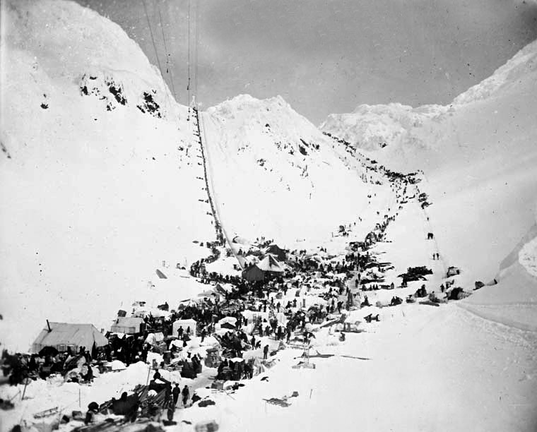
We were up and on the trail by 8:30am ... and the trail immediately began to change in character. We were gaining elevation with almost every step and the trees began to thin out a bit and get shorter ... now we could clearly see the canyon walls and the many waterfalls dropping down from the glaciers above. We could see several of the glaciers now ... all hanging high on the tops of the canyon walls. It was still cloudy, but not raining at all. We were dripping wet though, the humidity was still there! The trail emerged from the trees and bushes to follow the fast moving river quite closely, and the trail was now a series of climbs over talus piles ... and we could see up the valley to the pass now. Soon we reached the Scales ... this is where the Gold Rush people had all of their goods weighed before going over the pass; packers would then charge them so much per pound to carry their things up the staircase to the pass ... when the tramway was built the Scales continued to serve as the weigh station for goods being loaded onto the tramway and up over the pass. We were much closer to the Staircase now! We filtered some water here, took a break, and explored a bit (lots of old metal, old shoes, and bones scattered about here). Then we pushed on for the Staircase. All vegetation disappears here and we started climbing up rocks ... lots and lots of rocks. We stuck to the left side as we began to climb, the rocks were smaller and easier to climb ... and then the trail (at this point it's really not a 'trail' ... you're following a 'route', guided by occasional red poles sticking out of the rocks to help you stay in the right direction) gets quite steep ... 30% grade or higher now! This lasts about a half mile, and you're climbing up on your hands and feet now (and knees for us short people). The we reached the first false summit, the 'trail' dips slightly and crosses a short stretch of snow, then climbs up again over more rocks ... another false summit, more snow to cross, the finally the real summit! We could see the Canadian flag waving in the near distance at the Warden's cabin ... the 'trail' starts down now, following metal red-flagged poles down through a snow field to the cabin ... we reached the cabin and warming hut ... dropped our packs inside the hut and ate some lunch ... the clouds were beginning to thin out now and blue sky and sunshine was appearing before us! There was a sign outside the Warden's cabin saying that the Warden was on patrol to Lindemann (some 9 miles away). Temp at the summit was about 46 degrees. This spot also has the privy with the best view ever ... you can look right down the valley from it, simply amazing! After about a 1/2 hour rest we began to move on, heading down more snowfields and towards the shore of Crater Lake ... which we would follow for quite a while. The trail left the snow after a while and crossed bare rock and gravel ... there were alpine plants all around us as we hiked on ... and lots of streams flowing down the hillsides into the lake, we had lots of rock hopping in this section. More snowfields to cross ... in fact, lots of snow to cross, and it was getting sunnier as we walked on. There was a breeze to our backs which felt good and kept any mosquitoes away. The lake ends and turns into a river, and we continue to walk across rock and gravel and snowfields. The snowfields on the trail slowly end and we can see the Cooking Cabin at Happy Camp ahead of us. We come into the campground and drop our packs, looking around to see what's there. We find a nice sheltered campsite, set up our tent, hang our damp clothes (from yesterday) on the trees to dry in the sunshine, and wander down to the river's edge, settling down for an afternoon nap in the warming sun. It really felt great. Slowly more and more people began to arrive, familiar faces from Sheep Camp and trail earlier today. After eating dinner out on the rocks outside the Cooking Cabin, we explored a bit, watched the sun slowly go behind the mountains, and then went to the tent and fell asleep.
Day 3: Sheep Camp to Bare Loon Lake 8.5 miles
We slept a little bit later today knowing that we didn't have so far to go ... woke up to blue sunny skies and a bit of a breeze, so it was a bit chilly. The wind was to our backs so that was good ... and refreshing because after about a 1/2 miles we began to climb steadily up a series of switchbacks to near the top of the ridge, overlooking another lake. The trail was a mix of gravel and rock, and a bunch of ups and downs. The views were awesome. After about 2 miles we dropped down off the ridge where the lake ended, crossed the river (lakes are all connected by rivers), and stopped to filter some water at this spot, which was another campground, Deep Lake. It was a very pleasant stop ... and the vegetation was beginning to change again once we got past the small campground area. We met the Warden just past the campground ... he checked to see if we had our permits and told us abuot some bear activity at Lake Lindemann. We were now following the river, but the river was dropping into a deep gorge (full of rapids!), and we were up on the ridge ... the trail slowly descended along the gorge rim as the river/gorge descended to Lindemann Lake ... this walk was very pleasant, through a mix of pines ... generally a gravelly trail, sometimes a bit scary because there was quite a steep dropoff into the gorge in several places! After about 2.5 miles we reached the campgrounds at Lindemann Lake ... we stopped at the cooking cabin in the lower campground and ate some lunch ... soaking up the sun while using the trees as windblocks in the ever constant wind. There were artifacts lying everywhere here ... after lunch we stopped at the interpretive exhibit (housed in a large tent) which had a lot of old photos and newspaper articles about the Gold Rush (1897-1898) ... at this particular spot there was a tent city of nearly 5000 inhabitants, along with saloons, stores, and sawmills (they built boats here for the remainder of the trip). We left the area a while later, crossed a bridge over the river and we were soon up on the ridge overlooking the campsites, and it was hard to believe that a hundred or so years ago this place was full of people! From this point on the ridge we followed the trail over bare rock and gravel, going up and down, sometimes in the pines, sometimes in wetter areas on small bridges or wide boardwalks. We didn't always see the lake, but when we did it was amazing to see how long this lake is! This trail continued on for about 3 miles and we came upon our next campground at Bare Loon Lake. This is a smaller campground, and has no Cooking shelter or food locker/vault, only a tall food hanging bar. By this time the skies were beginning to cloud over. We found a nice campsite down near the lake, set up camp, and explored a bit. There was one loon out in the lake, but he/she was pretty quiet, especially compared to the group at Cedar Lakes in early June! The campground slowly filled up as the late afternoon turned into evening ... we spent some time chatting with some of our fellow hikers on the rocks overlooking the lake. The skies became totally clouded over by evening and it looked as if it would rain for sure. And it did overnight, although not that hard.
Day 4: Bare Loon Lake to Bennett 4 miles
We were awakened early by the sounds of other campers getting up ... it had rained in the night and many were breaking camp early to beat any further rain. Some were also going to hike out to the highway at Log Cabin, a hike of about 8 miles, where they had rides waiting. We took our time breaking camp ... the skies continued to look threatening. Soon we were off ... the trail goes up slightly and moves closer to Lake LIndemann, wandering every once in a while away from that lake and passing by small ponds and meadows. We were still hiking under pines, but hiking under the pines doesn't mean hiking under a complete forest canopy ... there is plenty of space between the trees, and we soon longed for a more complete cover as the rain began. It was a slow drizzle at first, then a steadier rain. It didn't take long for us to be soaked ... the trail gets about a mile or so from Bennett and begins to get sandy. We passed by an active trapper's cabin ... very "romantic" looking but when we opened the door to peak inside, wow, what a mess!! Anyhow, we continued on in the rain ... because the sand was wet it was a little easier to walk on than if it had been dry (like at the beach). We could no longer see the lake and soon we could hear rushing water ... this was the One Mile Rapids which led into Lake Bennett. The train tracks soon appeared off to our right, and the trail skirted those tracks for a while before descending into the Lake Bennett campground. During the Gold Rush this was also a bustling town, but all that remains is an old wooden church (covered with an elaborate sprinkler system) and the train station. Lake Bennett stretched out before us ... and the wind was blowing pretty good now, but fortunately the rain was letting up a bit. We reached the train station, which was all locked up, but we were able to change into drier clothes under the station's overhanging roof. We had a bit of a wait for the train to arrive ... and slowly others began to appear from the trail. Before too long there were nearly 45 hikers there, all waiting for the train to take them back to Skagway. Lots of talk about the trail, comparisons of experiences, and a game of twister played by a group of women (eight in total) who had hiked the trail. The train arrived an hour early so everyone was able to hop onto a railroad car and relax ... finally the train began to move at 1pm ... it was a three hour ride back into Skagway, but very entertaining (both the passengers and the scenery!). By the time we arrived in Skagway the sun was trying to shine ... and after being cleared by customs we snagged our packs, walked to our car, back to some shops in town, then hit the road for Whitehorse in the Yukon, where we spent a relaxing evening/night at a nice little bed and breakfast (with an awesome hot tub) ... at the b&b we met a 60 yr old retired Ontario schoolteacher who told us all about her adventures in the western provinces of Canada ... it was quite a lot of fun and she was trying to talk us into some things to try next year. The following morning we did some shopping in Whitehorse and then hit the road for the 11 hour trip back to Fairbanks.
The scenery is stunning along the trail ... and despite the fact that there were probably 30-40 people on the trail at a time, we hardly saw a soul until a campground. The lakes on the Canadian side are aquamarine ... especially Lake Lindemann, which was almost green I thought! The Canadian campgrounds and facilities (cooking shelters, privies) were better than on the American side ... we were amazed at the number of old artifacts still remaining along the trail, especially in the summit area (including a huge engine which powered one of the trams).
Skagway is a bit on the tacky side ... definitely catering to the cruise ships that visit (there were four of these huge vessels docked there ... and because it's a deep water port, they can dock very close to the town!) ... and Skagway is fairly small ... and cloudy most of the time (however it's in a rain shadow and only gets 22 inches of rain a yr, 39 inches of snow). We talked with other hikers who said that Haines in much nicer ... but of course, there's no Chilkoot trail there!
__________________
Once a year, go some where you've never been before.
Day 1: Trailhead to Sheep Camp 12 miles.
The trail immediately climbed up a moderately steep hill, over roots and rocks, before slowly returning to the valley floor and the river (which we would follow all the way to the pass). It was cloudy, and humid ... this was typical northwest Pacific rainforest for sure! The trail crossed several streams as it wound up the valley, and the trail alternated between gravel and dirt ... and some occasional boardwalks in wet areas. We made it to Finnegan's Point (4.5 miles) and stopped for a break along the river, we also checked out the small campground there. Then we moved on ... the trail continued its slow climb alongside the river, through dry sections and then wet sections (mostly covered by boardwalks) ... in some spots the trail climbed up above the river and into some pretty lush vegetation, then back down again to the river ... and then we arrived at Canyon City (about mile 7.5), where we stopped for some lunch. It had begun to sprinkle but we were able to find a dry picnic table under a tree near the cooking cabin (it was too humid to stay inside the cabin). After our lunch we filtered some water and pushed on. The trail climbed up higher onto the side of the ridge, we could hear the river rushing below but seldom saw it through all the thick vegetation. Sometimes the trail was on bare rock, similar to some Adirondack trails, and at other times we were on dirt, roots, and rocks. We ran into a Park Service trail crew (3 guys) who were replacing a small bridge, and talked with them for a short while. Soon after that we walked into Pleasant Camp, which didn't seem very pleasant, and it was deserted ... we stopped only to read a couple of the interpretive signs there. It wasn't much longer until we ended up at our destination, Sheep Camp, mile 11.75. Many of the campsites were already taken but we managed to find a dry one under a tree, pitched our tent and explored the area. Sheep Camp has two cooking tents (canvas tents) and metal lockers for food storage. It began to rain off and on ... nothing too hard but combined with the humidity it was tough to even think of keeping dry! After exploring a bit we fixed supper outside of the cooking tent ... at 7pm the Park Service ranger showed up for a short 'ranger talk' ... mostly about the trail ahead, what to expect, etc. The ranger was pretty funny, and told us that he'd be hiking up to the pass the next day too. (the ranger stays in a cabin about .7 miles farther up the trail ... he is the ONLY park ranger on the American side of the trail). After cleaning up and such we ended up going to sleep shortly after 9pm.
Day 2: Sheep Camp to Happy Camp 8 miles
We were up and on the trail by 8:30am ... and the trail immediately began to change in character. We were gaining elevation with almost every step and the trees began to thin out a bit and get shorter ... now we could clearly see the canyon walls and the many waterfalls dropping down from the glaciers above. We could see several of the glaciers now ... all hanging high on the tops of the canyon walls. It was still cloudy, but not raining at all. We were dripping wet though, the humidity was still there! The trail emerged from the trees and bushes to follow the fast moving river quite closely, and the trail was now a series of climbs over talus piles ... and we could see up the valley to the pass now. Soon we reached the Scales ... this is where the Gold Rush people had all of their goods weighed before going over the pass; packers would then charge them so much per pound to carry their things up the staircase to the pass ... when the tramway was built the Scales continued to serve as the weigh station for goods being loaded onto the tramway and up over the pass. We were much closer to the Staircase now! We filtered some water here, took a break, and explored a bit (lots of old metal, old shoes, and bones scattered about here). Then we pushed on for the Staircase. All vegetation disappears here and we started climbing up rocks ... lots and lots of rocks. We stuck to the left side as we began to climb, the rocks were smaller and easier to climb ... and then the trail (at this point it's really not a 'trail' ... you're following a 'route', guided by occasional red poles sticking out of the rocks to help you stay in the right direction) gets quite steep ... 30% grade or higher now! This lasts about a half mile, and you're climbing up on your hands and feet now (and knees for us short people). The we reached the first false summit, the 'trail' dips slightly and crosses a short stretch of snow, then climbs up again over more rocks ... another false summit, more snow to cross, the finally the real summit! We could see the Canadian flag waving in the near distance at the Warden's cabin ... the 'trail' starts down now, following metal red-flagged poles down through a snow field to the cabin ... we reached the cabin and warming hut ... dropped our packs inside the hut and ate some lunch ... the clouds were beginning to thin out now and blue sky and sunshine was appearing before us! There was a sign outside the Warden's cabin saying that the Warden was on patrol to Lindemann (some 9 miles away). Temp at the summit was about 46 degrees. This spot also has the privy with the best view ever ... you can look right down the valley from it, simply amazing! After about a 1/2 hour rest we began to move on, heading down more snowfields and towards the shore of Crater Lake ... which we would follow for quite a while. The trail left the snow after a while and crossed bare rock and gravel ... there were alpine plants all around us as we hiked on ... and lots of streams flowing down the hillsides into the lake, we had lots of rock hopping in this section. More snowfields to cross ... in fact, lots of snow to cross, and it was getting sunnier as we walked on. There was a breeze to our backs which felt good and kept any mosquitoes away. The lake ends and turns into a river, and we continue to walk across rock and gravel and snowfields. The snowfields on the trail slowly end and we can see the Cooking Cabin at Happy Camp ahead of us. We come into the campground and drop our packs, looking around to see what's there. We find a nice sheltered campsite, set up our tent, hang our damp clothes (from yesterday) on the trees to dry in the sunshine, and wander down to the river's edge, settling down for an afternoon nap in the warming sun. It really felt great. Slowly more and more people began to arrive, familiar faces from Sheep Camp and trail earlier today. After eating dinner out on the rocks outside the Cooking Cabin, we explored a bit, watched the sun slowly go behind the mountains, and then went to the tent and fell asleep.
Day 3: Sheep Camp to Bare Loon Lake 8.5 miles
We slept a little bit later today knowing that we didn't have so far to go ... woke up to blue sunny skies and a bit of a breeze, so it was a bit chilly. The wind was to our backs so that was good ... and refreshing because after about a 1/2 miles we began to climb steadily up a series of switchbacks to near the top of the ridge, overlooking another lake. The trail was a mix of gravel and rock, and a bunch of ups and downs. The views were awesome. After about 2 miles we dropped down off the ridge where the lake ended, crossed the river (lakes are all connected by rivers), and stopped to filter some water at this spot, which was another campground, Deep Lake. It was a very pleasant stop ... and the vegetation was beginning to change again once we got past the small campground area. We met the Warden just past the campground ... he checked to see if we had our permits and told us abuot some bear activity at Lake Lindemann. We were now following the river, but the river was dropping into a deep gorge (full of rapids!), and we were up on the ridge ... the trail slowly descended along the gorge rim as the river/gorge descended to Lindemann Lake ... this walk was very pleasant, through a mix of pines ... generally a gravelly trail, sometimes a bit scary because there was quite a steep dropoff into the gorge in several places! After about 2.5 miles we reached the campgrounds at Lindemann Lake ... we stopped at the cooking cabin in the lower campground and ate some lunch ... soaking up the sun while using the trees as windblocks in the ever constant wind. There were artifacts lying everywhere here ... after lunch we stopped at the interpretive exhibit (housed in a large tent) which had a lot of old photos and newspaper articles about the Gold Rush (1897-1898) ... at this particular spot there was a tent city of nearly 5000 inhabitants, along with saloons, stores, and sawmills (they built boats here for the remainder of the trip). We left the area a while later, crossed a bridge over the river and we were soon up on the ridge overlooking the campsites, and it was hard to believe that a hundred or so years ago this place was full of people! From this point on the ridge we followed the trail over bare rock and gravel, going up and down, sometimes in the pines, sometimes in wetter areas on small bridges or wide boardwalks. We didn't always see the lake, but when we did it was amazing to see how long this lake is! This trail continued on for about 3 miles and we came upon our next campground at Bare Loon Lake. This is a smaller campground, and has no Cooking shelter or food locker/vault, only a tall food hanging bar. By this time the skies were beginning to cloud over. We found a nice campsite down near the lake, set up camp, and explored a bit. There was one loon out in the lake, but he/she was pretty quiet, especially compared to the group at Cedar Lakes in early June! The campground slowly filled up as the late afternoon turned into evening ... we spent some time chatting with some of our fellow hikers on the rocks overlooking the lake. The skies became totally clouded over by evening and it looked as if it would rain for sure. And it did overnight, although not that hard.
Day 4: Bare Loon Lake to Bennett 4 miles
We were awakened early by the sounds of other campers getting up ... it had rained in the night and many were breaking camp early to beat any further rain. Some were also going to hike out to the highway at Log Cabin, a hike of about 8 miles, where they had rides waiting. We took our time breaking camp ... the skies continued to look threatening. Soon we were off ... the trail goes up slightly and moves closer to Lake LIndemann, wandering every once in a while away from that lake and passing by small ponds and meadows. We were still hiking under pines, but hiking under the pines doesn't mean hiking under a complete forest canopy ... there is plenty of space between the trees, and we soon longed for a more complete cover as the rain began. It was a slow drizzle at first, then a steadier rain. It didn't take long for us to be soaked ... the trail gets about a mile or so from Bennett and begins to get sandy. We passed by an active trapper's cabin ... very "romantic" looking but when we opened the door to peak inside, wow, what a mess!! Anyhow, we continued on in the rain ... because the sand was wet it was a little easier to walk on than if it had been dry (like at the beach). We could no longer see the lake and soon we could hear rushing water ... this was the One Mile Rapids which led into Lake Bennett. The train tracks soon appeared off to our right, and the trail skirted those tracks for a while before descending into the Lake Bennett campground. During the Gold Rush this was also a bustling town, but all that remains is an old wooden church (covered with an elaborate sprinkler system) and the train station. Lake Bennett stretched out before us ... and the wind was blowing pretty good now, but fortunately the rain was letting up a bit. We reached the train station, which was all locked up, but we were able to change into drier clothes under the station's overhanging roof. We had a bit of a wait for the train to arrive ... and slowly others began to appear from the trail. Before too long there were nearly 45 hikers there, all waiting for the train to take them back to Skagway. Lots of talk about the trail, comparisons of experiences, and a game of twister played by a group of women (eight in total) who had hiked the trail. The train arrived an hour early so everyone was able to hop onto a railroad car and relax ... finally the train began to move at 1pm ... it was a three hour ride back into Skagway, but very entertaining (both the passengers and the scenery!). By the time we arrived in Skagway the sun was trying to shine ... and after being cleared by customs we snagged our packs, walked to our car, back to some shops in town, then hit the road for Whitehorse in the Yukon, where we spent a relaxing evening/night at a nice little bed and breakfast (with an awesome hot tub) ... at the b&b we met a 60 yr old retired Ontario schoolteacher who told us all about her adventures in the western provinces of Canada ... it was quite a lot of fun and she was trying to talk us into some things to try next year. The following morning we did some shopping in Whitehorse and then hit the road for the 11 hour trip back to Fairbanks.
The scenery is stunning along the trail ... and despite the fact that there were probably 30-40 people on the trail at a time, we hardly saw a soul until a campground. The lakes on the Canadian side are aquamarine ... especially Lake Lindemann, which was almost green I thought! The Canadian campgrounds and facilities (cooking shelters, privies) were better than on the American side ... we were amazed at the number of old artifacts still remaining along the trail, especially in the summit area (including a huge engine which powered one of the trams).
Skagway is a bit on the tacky side ... definitely catering to the cruise ships that visit (there were four of these huge vessels docked there ... and because it's a deep water port, they can dock very close to the town!) ... and Skagway is fairly small ... and cloudy most of the time (however it's in a rain shadow and only gets 22 inches of rain a yr, 39 inches of snow). We talked with other hikers who said that Haines in much nicer ... but of course, there's no Chilkoot trail there!
__________________
Once a year, go some where you've never been before.