AbinadiWitness
Member
- Joined
- Oct 25, 2017
- Messages
- 33
***Part 1 of 2 of my second multi-day backpacking trip to Colorado in summer 2017; check out Part 2 for the rest of the adventure.***
Originally this trip was supposed to be an epic "thru-style-hike" (starting and ending at very different places) in Idaho's Sawtooth Range. I had, over the course of months, laboriously researched the Sawtooths, studied the routes, and in a number of cases forged my own route plans across trackless wilderness there. My plan aimed to get into both some of the most remote and most rugged country that range has to offer and was definitely deeply-set into the "ambitious" territory...Such was our plan...but then the highest snow year in over three decades happened and, with it, tremendous amounts of deadfall (fallen trees) along with generally exceptionally high creek and rivers. The route I planned required many river/creek crossings (of various degrees of difficulty) and substantial off-trail navigation...with the objective hazards arising from this truly exceptional snow year I, once again, had to make the decision to alter my original designs and move to a different area. When I was reconsidering my options, I thought of a place I'd long-desired to go to - Chicago Basin in SW Colorado, in the Needles Range.
Originally this trip was supposed to be an epic "thru-style-hike" (starting and ending at very different places) in Idaho's Sawtooth Range. I had, over the course of months, laboriously researched the Sawtooths, studied the routes, and in a number of cases forged my own route plans across trackless wilderness there. My plan aimed to get into both some of the most remote and most rugged country that range has to offer and was definitely deeply-set into the "ambitious" territory...Such was our plan...but then the highest snow year in over three decades happened and, with it, tremendous amounts of deadfall (fallen trees) along with generally exceptionally high creek and rivers. The route I planned required many river/creek crossings (of various degrees of difficulty) and substantial off-trail navigation...with the objective hazards arising from this truly exceptional snow year I, once again, had to make the decision to alter my original designs and move to a different area. When I was reconsidering my options, I thought of a place I'd long-desired to go to - Chicago Basin in SW Colorado, in the Needles Range.
Mount Eolus! (14,085 feet above sea level) This peak was high on my dream list of peaks to climb...We took aim at it this trip; read on to see what happened here and lots more!
")
I'd just been in Colorado on a glorious trip two weeks before this, but the more southern location of the range (even though the peaks are far higher than those we'd be pursuing in the Sawtooth Range) meant an almost entirely snow-free experience and only minimal (if any) logistical issues with overt challenge from stream/river crossings and negotiating extensive deadfall...Now, those who know me know I'm not one to shy away from a good challenge, but the route I planned in Idaho was very challenging under good/normal circumstances, and the area was way outside of normal for this time of year...The plus side of this equation is that I already have a fully-detailed peakbagging-centric trip mapped out in detail for both the Wind River Range and the Sawtooth Range that I plan to use in future years. Since I've never been to the Sawtooth Range before that's currently my number one destination for 2018's big trip(s). Not sure if I'll add the Wind River Range in there or not for next year, but I'll definitely be pursuing my planned Wind River route at some point in the future. There are lots of places across the west that are calling out to me for deep backpacking trips...time will tell where I'll go...but, for now, on to the detail of this wonderful trip to Colorado to climb more big peaks!
At the outset, I'll mention it was my pleasure to be joined on this lovely endeavor by my excellent amigo, Dave, who'd done a crazy whirlwind -style trip (what he's come to call "Justin Lehman style trip") to come climb Mount Sneffels on the last trip and then had driven home right after hiking out...Dave was a great hiking companion to have along on this trip, because he's a strong, driven hiker who's not afraid of hard things and who enjoys challenging scrambling and route-finding as well.
We left for Colorado on a Sunday afternoon, after our mutual Church responsibilities were complete for the day - I believe we were on the road by about 4:00 PM. Our plan for the first day was just to get to the Purgatory Trailhead, make some simple camp there, and then be up early and spend the next day completing the long hike in to where we'd establish our base camp for the trip.
On the way down we stopped briefly so I could take a picture of a rainbow that was happening at about the same place as the one I saw on my first Colorado trip two weeks previous; this one wasn't as vivid as the previous one, but I did find it interesting that there were storms at the same stretch of road with a large visible rainbow as well - that's not especially common in Utah.
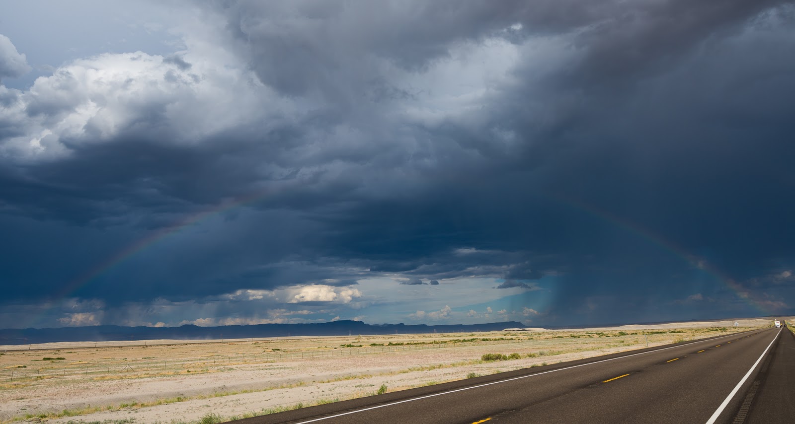
Another rainbow - just like two weeks before on my way to Colorado, and along the same stretch of road!

Beautiful skies at our "campground" at Purgatory Flats.
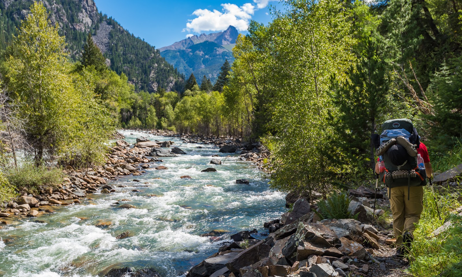
Perhaps a bit of data on the Purgatory Flat Trailhead approach to Chicago Basin is in order...first of all, if you're looking for the easy way to get to Chicago Basin this is not that way. Purgatory Flat Trailhead requires you to do an advertised 14 - 15 mile approach to get to Chicago Basin (we tracked 16.5 miles one way to our camping spot); also the route requires over 4,000 feet of elevation gain, all under heavy packs...This would be - at this point - both Dave and my longest backpacking approach to an area and, of course, we were planning to complete the approach in a single day...I mean, was there ever really any other option?
Originally Dave and I were both not entirely sure if we were excited about the approach from the Purgatory Flat TH (I'll shorten this name for most of the rest...but the more we thought about it, and the glory of achievement that attends such ambitious endeavors, we became more excited about taking on the long, much-less-frequented approach from Purgatory up to Chicago Basin.
We were up before sunrise the morning after our improvised parking lot camp, tearing down tents and consolidating our gear from out of the semi-dishevelled mess that was my car on the way down there. Soon enough we were on our way.
One of the joys of the Purgatory approach is that you lose many hundreds of feet almost right out of the gate relatively steeply...which means that the return at the end of our journey through this area would involve a steep rise of many hundreds of feet at the end of a long mileage day...we were not especially excited about that, but took it as "part of the ride" of choosing to make this particular approach.
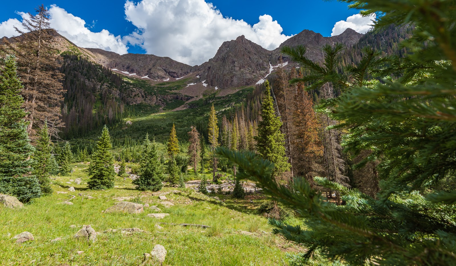
After dropping down a good long ways through fairly thickly-forested terrain we came to generally more open views, including some through large meadows that were lovely.
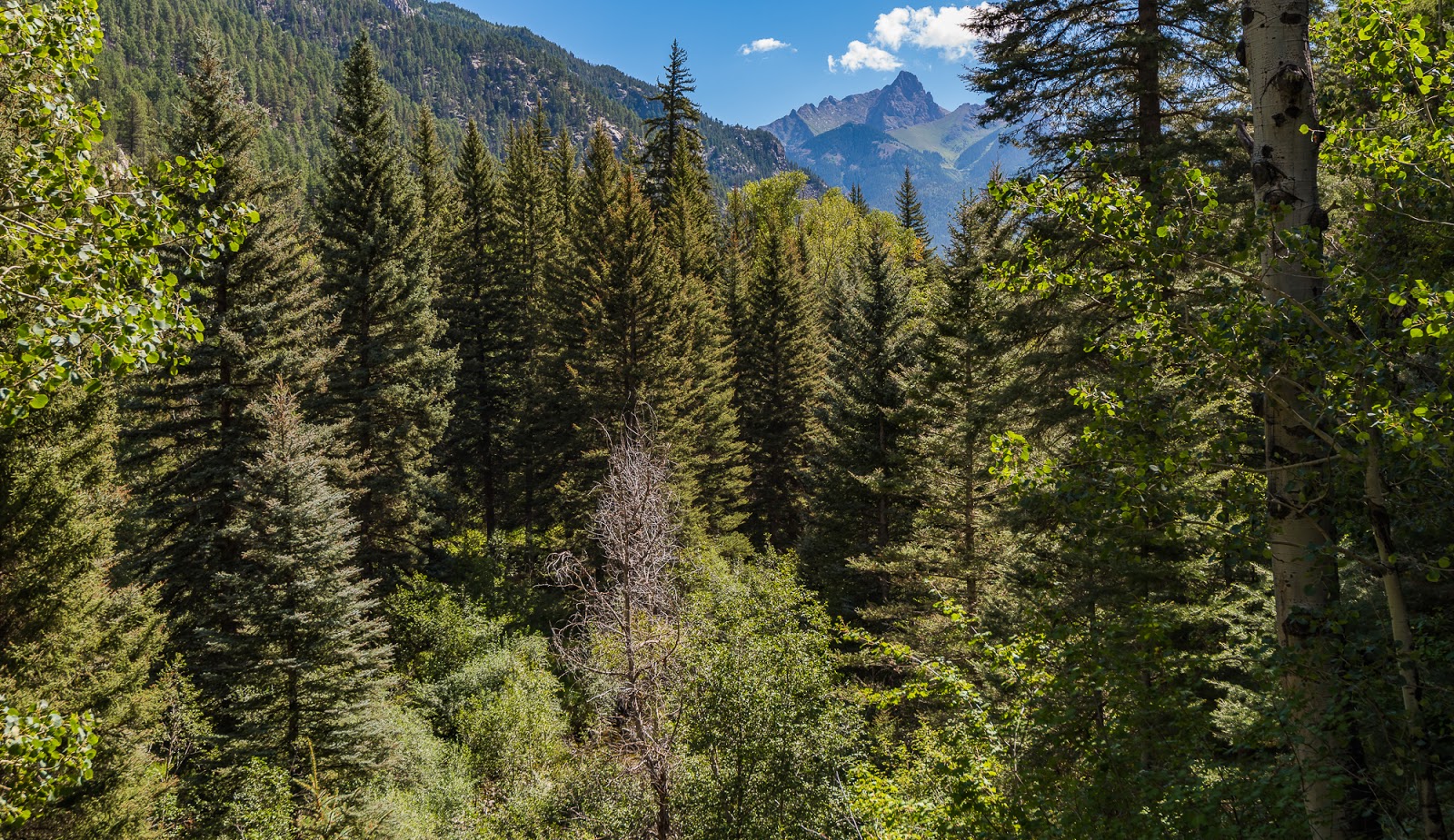
On the whole, the approach along the Purgatory Trail is largely forested; this is not the approach to take if you want consistently expansive views of the area...now, that's not to imply this approach is lacking in beauty, as that is certainly not the case, but the views are "closed-in" by trees, canyons, etc., at various times.
The Purgatory Trail approach, as one of its virtues, does an excellent job at teasingly building anticipation of the more rugged areas to come by disclosing occasional glimpses of distantly towering rugged peaks, but then quickly concealing those views again...the more panoramic views that come occasionally don't last very long but the hints get stronger as you grow of what you're in for. Generally speaking, the views don't become significantly more rugged (i.e. similar to what you'll see in Chicago Basin) until after you've completed the nine to ten miles to the Needle Creek trail junction near where most people start this trek.
Originally Dave and I were both not entirely sure if we were excited about the approach from the Purgatory Flat TH (I'll shorten this name for most of the rest...but the more we thought about it, and the glory of achievement that attends such ambitious endeavors, we became more excited about taking on the long, much-less-frequented approach from Purgatory up to Chicago Basin.
We were up before sunrise the morning after our improvised parking lot camp, tearing down tents and consolidating our gear from out of the semi-dishevelled mess that was my car on the way down there. Soon enough we were on our way.
One of the joys of the Purgatory approach is that you lose many hundreds of feet almost right out of the gate relatively steeply...which means that the return at the end of our journey through this area would involve a steep rise of many hundreds of feet at the end of a long mileage day...we were not especially excited about that, but took it as "part of the ride" of choosing to make this particular approach.
After dropping down a good long ways through fairly thickly-forested terrain we came to generally more open views, including some through large meadows that were lovely.
On the whole, the approach along the Purgatory Trail is largely forested; this is not the approach to take if you want consistently expansive views of the area...now, that's not to imply this approach is lacking in beauty, as that is certainly not the case, but the views are "closed-in" by trees, canyons, etc., at various times.
The Purgatory Trail approach, as one of its virtues, does an excellent job at teasingly building anticipation of the more rugged areas to come by disclosing occasional glimpses of distantly towering rugged peaks, but then quickly concealing those views again...the more panoramic views that come occasionally don't last very long but the hints get stronger as you grow of what you're in for. Generally speaking, the views don't become significantly more rugged (i.e. similar to what you'll see in Chicago Basin) until after you've completed the nine to ten miles to the Needle Creek trail junction near where most people start this trek.

Dave contemplates the way ahead as we continue to lose elevation on the early stages of the Purgatory Trail.

Marching along under full-packs above Cascade Creek.

Occasional glimpses of massive and rugged peaks in the distance enticed us onward...

This stretch of trail reminded me a lot of the forest up by Bryce Canyon National Park or near the North Rim of the Grand Canyon - very enjoyable.
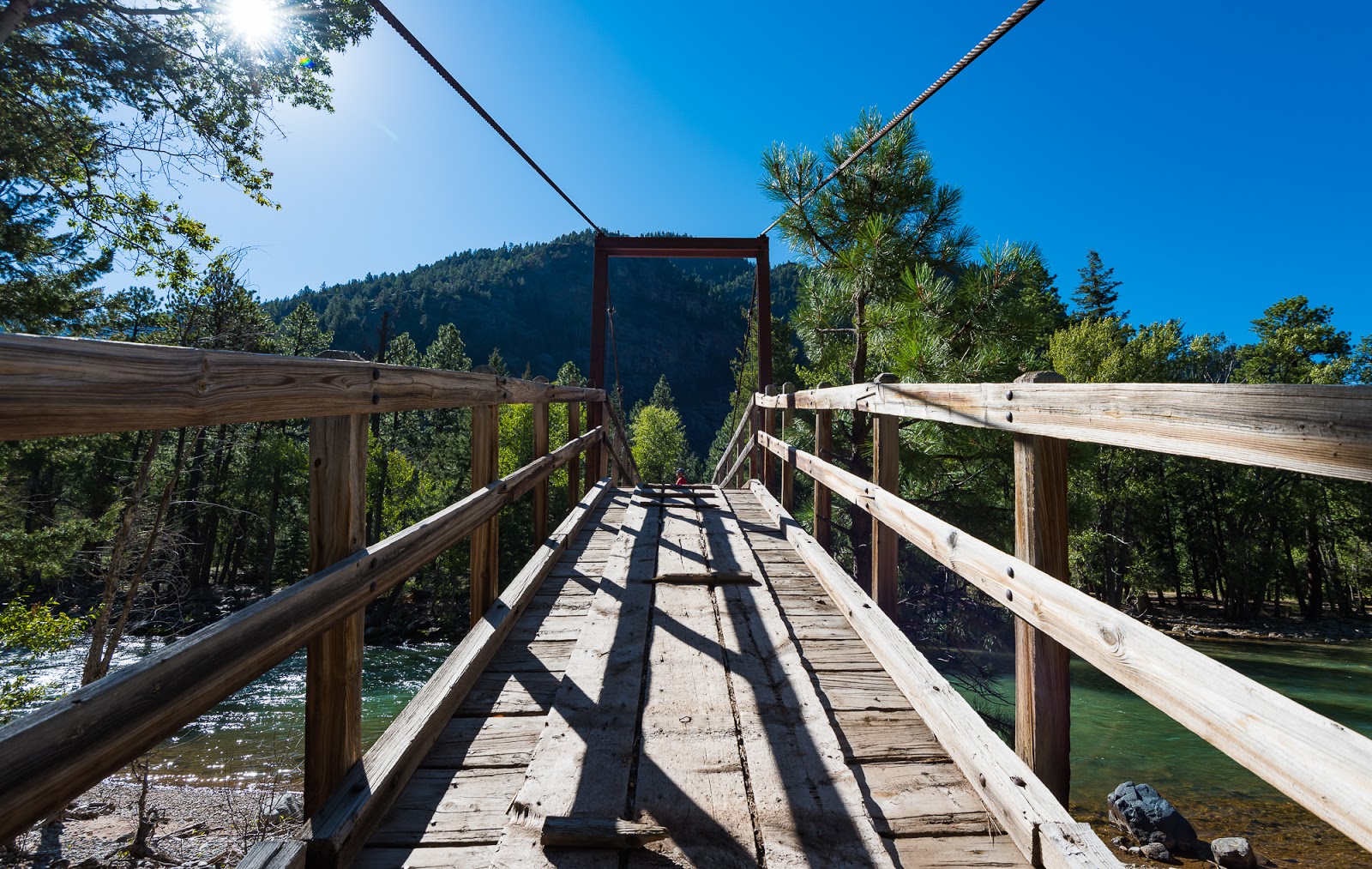
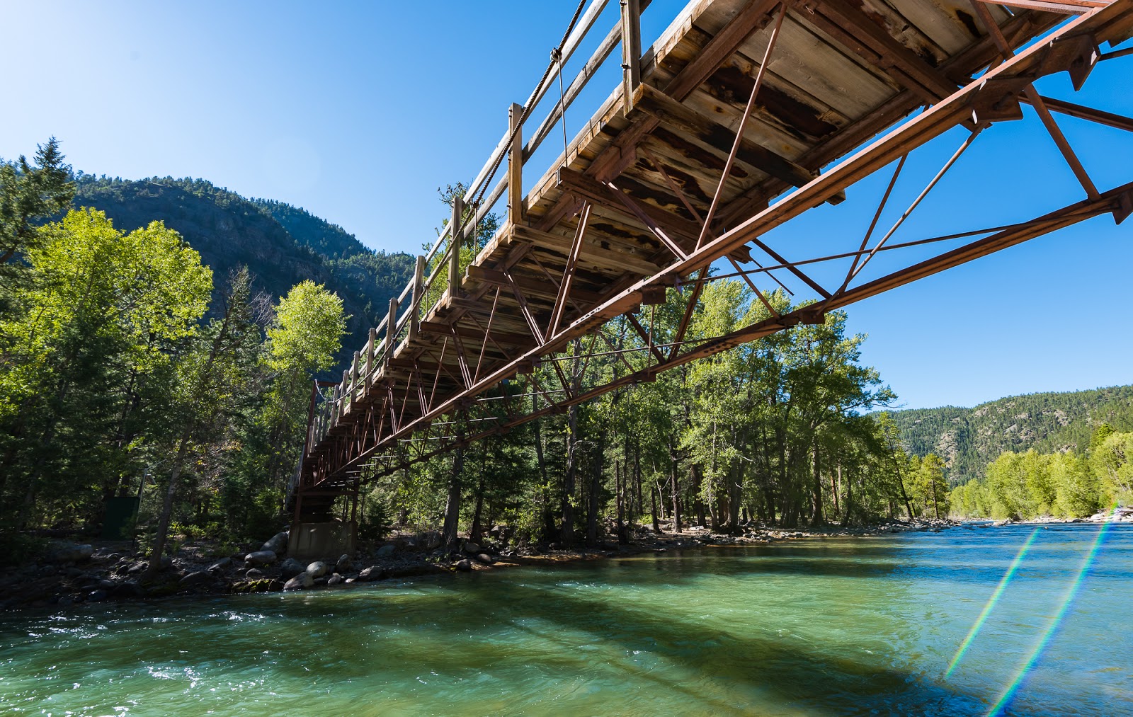
Finally! The bridge over the Animas River! Still plenty of miles to go before we hit our destination, but it's always nice to hit a substantial landmark.
An alternate perspective on the bridge across the Animas River.

Looking down the Animas River from the bridge.

Me, on the bridge over the Animas River. (Photo by Dave)

The next bunch of miles would look generally like this, with some variation when the forest would close in or when the terrain would occasionally open up again and tease us with views of what waited for us at the end of this lengthy trail.

More nice open forest with great big pines around; again, very reminiscent of the high pine forests around Bryce Canyon/the North Rim of the Grand Canyon. I love wandering through forests like this...they have a special character all their own.
Much of the approach along the Purgatory Trail follows flowing water - though the flowing water is not always accessible. The initial descent from the trailhead soon leads you near Cascade Creek, which you follow for a good long while until you eventually meet the Animas River, which you follow, essentially, until you reach the Needle Creek junction that leads to you last six miles or so of approach (and most of your elevation gain) up to Chicago Basin. We didn't carry too much water with us, but it seemed effective to have access to a couple of liters at a time for us, since the trail approaches the water relatively frequently, but there are also times where the creeks or rivers are practically inaccessible, being far below the trail (sometimes hundreds of feet below the trail). To us there seemed plenty of opportunities to refill our water, as long as we took advantage of "topping off" our supplies when creek/river access presented itself; as a general rule this is a good guide if you're looking to limit your carried water weight as we were on this lengthy approach.
Eventually we had our first encounter with the famous Durango-Silverton Narrow-gauge Railroad train that carries the vast majority of people who visit the area. The train ride is very scenic, and I plan on taking that ride some day, but we decided against it in favor of the additional challenge the Purgatory Trail approach would provide/require of us - that's right, we made the hike harder than it had to be...Why? We enjoy testing ourselves a bit now and again, and the struggle and the strain presents its own opportunities for learning unique lessons about the environment one travels through as well as lessons about yourself as traveler in such circumstances that the ease of the train would deny you. I imagine the train ride has its own unique perspectives and associated lessons, but we opted for the road, or in this case, trail, less traveled and it was a good time indeed. We encountered the train several times through the day on our approach to the Needle Creek junction; interestingly enough, we only saw the train moving toward the Needle Creek Junction (from Durango to Silverton, I presume), but we heard it moving the opposite way...never saw it moving the opposite way, so we're not sure, based on our observations alone, how the train moved back and forth between destinations...happily, such knowledge (or lack thereof) didn't reduce the difficulty or the pleasure of our approach along the trail.
Eventually we had our first encounter with the famous Durango-Silverton Narrow-gauge Railroad train that carries the vast majority of people who visit the area. The train ride is very scenic, and I plan on taking that ride some day, but we decided against it in favor of the additional challenge the Purgatory Trail approach would provide/require of us - that's right, we made the hike harder than it had to be...Why? We enjoy testing ourselves a bit now and again, and the struggle and the strain presents its own opportunities for learning unique lessons about the environment one travels through as well as lessons about yourself as traveler in such circumstances that the ease of the train would deny you. I imagine the train ride has its own unique perspectives and associated lessons, but we opted for the road, or in this case, trail, less traveled and it was a good time indeed. We encountered the train several times through the day on our approach to the Needle Creek junction; interestingly enough, we only saw the train moving toward the Needle Creek Junction (from Durango to Silverton, I presume), but we heard it moving the opposite way...never saw it moving the opposite way, so we're not sure, based on our observations alone, how the train moved back and forth between destinations...happily, such knowledge (or lack thereof) didn't reduce the difficulty or the pleasure of our approach along the trail.

One of our several sightings of the famous Durango-Silverton Narrow-Gauge Railroad train sightings. Most people that come to the area take this (the easy way)...Dave and I refused that on this adventure in favor of a grittier experience. I'll take the train someday, though - it looks like a nice (even if overpriced) ride.
Big peaks gradually getting closer...

Neat growth on a tree branch. I saw this stuff for the first time last year while backpacking through the neighboring Grenadier Range in Colorado; reminds me a bit of the Spanish moss I saw a lot growing up in south Florida.

Probably the grandest view along the Purgatory Flats approach on the way up to Needle creek...though the best is yet to come, my friends...
Dave continues up the particularly glorious section of trail as we continue marching along toward Chicago Basin.

Neat bug that took up temporary residence on one of Dave's gloves on the end of one of his trekking poles while Dave was applying some preventative blister aid nearby.
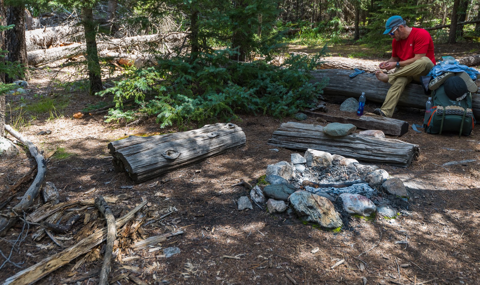
Dave treating a hotspot before it gets too hot...

We saw a good number of these very vivid and visually interesting mushrooms along the way; in fact, we saw many different varieties of mushrooms on our trip here, but these kind were Dave and I's mutual favorites to see.
After a number of hours (and nearly 1,000 feet of collective elevation; not sure how much elevation loss, but there's plenty of up and down on the Purgatory Trail before you hit the Needle Creek junction) we finally crossed the bridge leading to the junction for Needle Creek. From this point on we'd be accomplishing the vast majority of all our elevation gain for the remainder of this day hike in. Remember, at this stage we're hauling our fully-loaded packs, and we're already nine to ten miles and about 1,000 vertical feet into this adventure...so, not necessarily fresh, but certainly with plenty of fight left in us.

Finally made the Needle Creek bridge! Now the real fun begins - already having come about nine to ten miles in, we now have about six miles ahead of us and over 3,000 feet of elevation to gain - and our packs weigh just about as much now as they did when we put them on in the morning...

Weminuche Wilderness sign! Made excellent memories here in 2016 while backpacking in the Grenadier Range with other friends. Good to be back!

I wanted to show a bit of how aggressive Needle Creek is - it's a very strong flowing creek. To get this shot I had to climb down the creek bank and hop across some large boulders more into the middle of the creek and perch carefully above this six to eight foot drop as the water cascaded around me. Worth it.

Rock-hopping out into the middle of Needle Creek to get a cool angle of the rushing water. Getting out to this rock was a bit more exciting than it looks from this angle, but not too bad.
(Photo by Dave)
Me, about to cross a nice footbridge along the way up to Chicago Basin. (Photo by Dave)

Another perspective on Needle Creek from higher up on a nice footbridge that's been constructed up there.

Our occasional views of big, rugged peaks around us are growing more frequent and consistent as we continue our steep ascent toward Chicago Basin.

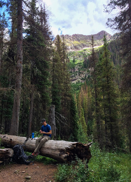
One of many mutually-agreeable breathers that were taken along the way. We were both definitely feeling our daily mileage at this point, but not totally wiped out either.
Me, resting on a conveniently placed fallen tree near the trail as we were hiking toward Chicago Basin; notice how my feet don't touch the ground here - it was a big tree! (Photo by Dave)

More views along the trail as we draw nearer to Chicago Basin.
We passed plenty of people on the approach, especially after hitting the Needle Creek junction. We didn't run into the anticipated "hordes of people", but we did see far more than who we'd seen along the way. We - largely - had the Purgatory Trail to ourselves, but passed a lot of people descending from Chicago Basin, and a decent number of people ascending. Dave and I are pretty quick hikers, even under heavy packs we were making good time.
The quality of the forest changes on the way up to Chicago Basin from the Needle Creek junction; assumedly the changes observed in the woods were incident to the relatively rapid increase in elevation coincidental with our forward progress.
The closer you get to Chicago Basin the more rugged the terrain is that reveals itself. As you begin to get into "the basin proper" the trees begin to open up more and you get more consistently expansive views. The lower part of Chicago Basin is quite lovely, with big peaks bordering on three sides. The especially rugged views are reserved for the upper areas around Twin Lakes (a little over 12,000 feet up, whereas our campsite was a little over 11,000 feet up). We decided to hike about as far up into the basin as we could (you're not allowed to camp above a certain point on the higher end of the basin (again, somewhere just a little over 11,000 feet up); since we were establishing a base camp and would be completing the same approach over multiple days to get all the peaks climbed we were aiming for we wanted to be as close to where we'd be going as we could get. The hike in, even just coming from the Needle Creek junction (where most start) is fairly arduous, so a lot of hikers had chosen to make their camps much closer to the part of the basin you intially come to, so there was room and to spare at the upper end where we were aiming.
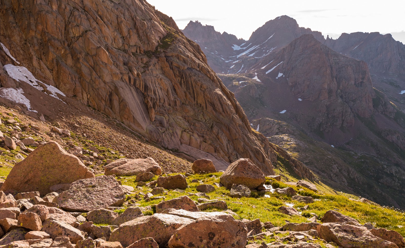
The glorious entrance into the main part of Chicago Basin - this is some of the reason why we put in these long miles!

Views around Chicago Basin...

Dave, demonstrating the correct open-mouthed awe one should experience upon coming into Chicago Basin for the first time...
We picked out a nice site, set up camp, and then I wandered around and took pictures of the evening light and sunset conditions. Turns out this basin isn't fantastic for evening or morning photography from down within the basin itself. If you were to get up into the higher elevations and ridgelines there'd be a number of stunning opportunties. Despite the lighting conditions not being ideal for capturing the full range of the sunset (sunrise later proved to be similar from these vantage points) I still loved the views and the lighting was beautiful, even if it wasn't all that I'd hoped to see. We saw some mountain goats in the area, which are quite common out here - more so than in any other place I've been hitherto.
We ended up setting up camp rapidly because of an approaching afternoon storm, and we hid in our tents for a while and enjoyed a nice nap after the long hike in. After the rain stopped and we woke up we made dinner and I wandered around to do some photography in the evening light. I found the early evening light more lovely than the late sunset light from this vantage; the general topography tends to pinch most of the light off before things get too fiery down near our camp, but I still caught some nice views.
We ended up setting up camp rapidly because of an approaching afternoon storm, and we hid in our tents for a while and enjoyed a nice nap after the long hike in. After the rain stopped and we woke up we made dinner and I wandered around to do some photography in the evening light. I found the early evening light more lovely than the late sunset light from this vantage; the general topography tends to pinch most of the light off before things get too fiery down near our camp, but I still caught some nice views.

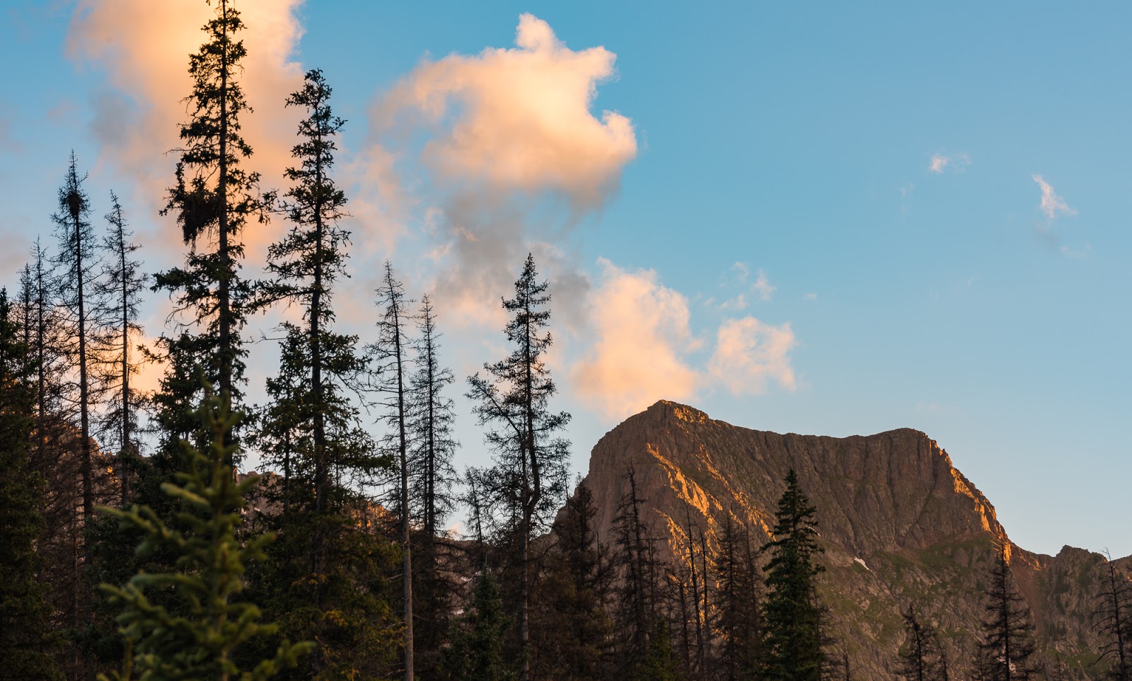
Evening light on big peaks around Chicago Basin on our first evening up there...

Evening light on big peaks around Chicago Basin on our first evening up there...

Evening light on big peaks around Chicago Basin on our first evening up there...Turns out Windom Peak, one of our planned 14ers, is just right of upper-center here. We didn't positively identify Windom from down in our camp until after we'd summited it, even though it's quite easy to pick out from the upper basin area/other 14er summits around it. The other 14ers we were aiming to summit on this trip weren't really visible from our camp in Chicago Basin.

Nice evening light in Chicago Basin.

Glorious views from our campsite in Chicago Basin.

I took some long-exposure shots of Needle Creek as it flows through Chicago Basin...

I took some long-exposure shots of Needle Creek as it flows through Chicago Basin...

I took some long-exposure shots of Needle Creek as it flows through Chicago Basin...
A little later-sunset light on an interesting peak along the edge of Chicago Basin.

Fiery clouds above the peaks, but everything else in shadow before the light can get really good on these aspects of the mountains. Still a lovely view.
We ended up getting into bed fairly early and falling to sleep pretty rapidly - a thing not surprising, considering how we'd clocked 16.5 miles of hiking from the trailhead to our campsite with over 4,000 feet of elevation gain under full packs - definitely a solid day!
The following morning we were up early and on trail before the sun was up. The area around Twin Lakes (which would provide, perhaps, the most spectacular camping in the area) is closed off to camping, assumedly due to prior overuse. As a result of the closure of the upper area to camping, we opted to camp as high up in the basin as we could (which we did a pretty good job of), but we still had about a 1,200 foot elevation gain just to get up into the Twin Lakes area from our camp. We knew, in addition to making this approach on this day, we'd have the pleasure of making this approach the following day as well - and perhaps again thereafter if we (for some reason like weather, etc.) weren't able to hit all the peaks we had planned. The approach hike is lovely - first passing through some brief patches of thicker forested terrain before rising through more open terrain.
The elevation gain is pretty steep through this section - but there are more and less steep sections. There are also a couple of minor stream crossings but these are not problematic. There are a lot of stone steps on this trail, where large, flat rocks have been set into the trail to assist you as you climb; neither Dave nor I had ever dealt with so many intentionally-set stones and we both expressed interest in learning more about the history of this trail - someone (and likely someones) have put a lot of work into this trail's development through the years.

Beautiful morning light on rugged peaks above Chicago Basin.

Me, checking out the scenery on the way up to the Twin Lakes area. (Photo by Dave)

Dave makes the steep climb up from our campsite toward the Twin Lakes area in the midst of amazing country...

Dave makes the steep climb up from our campsite toward the Twin Lakes area in the midst of amazing country...

Twin Lakes easily lives up to its reputation as a spectacular area. Wow!

Dave refuels himself as the mountain goats come by to check us out as we wander through their terrain.

Mountain goats near Twin Lakes.

Mountain goats near Twin Lakes.
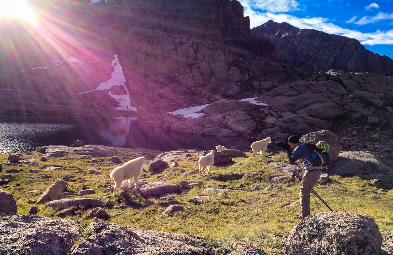
Taking pictures of the mountain goats at Twin Lakes under the beautiful morning light.
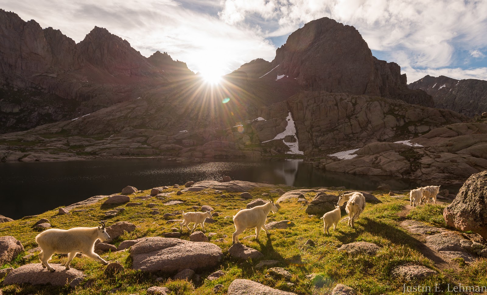
Mountain goats near Twin Lakes.

Mountain goats near Twin Lakes.

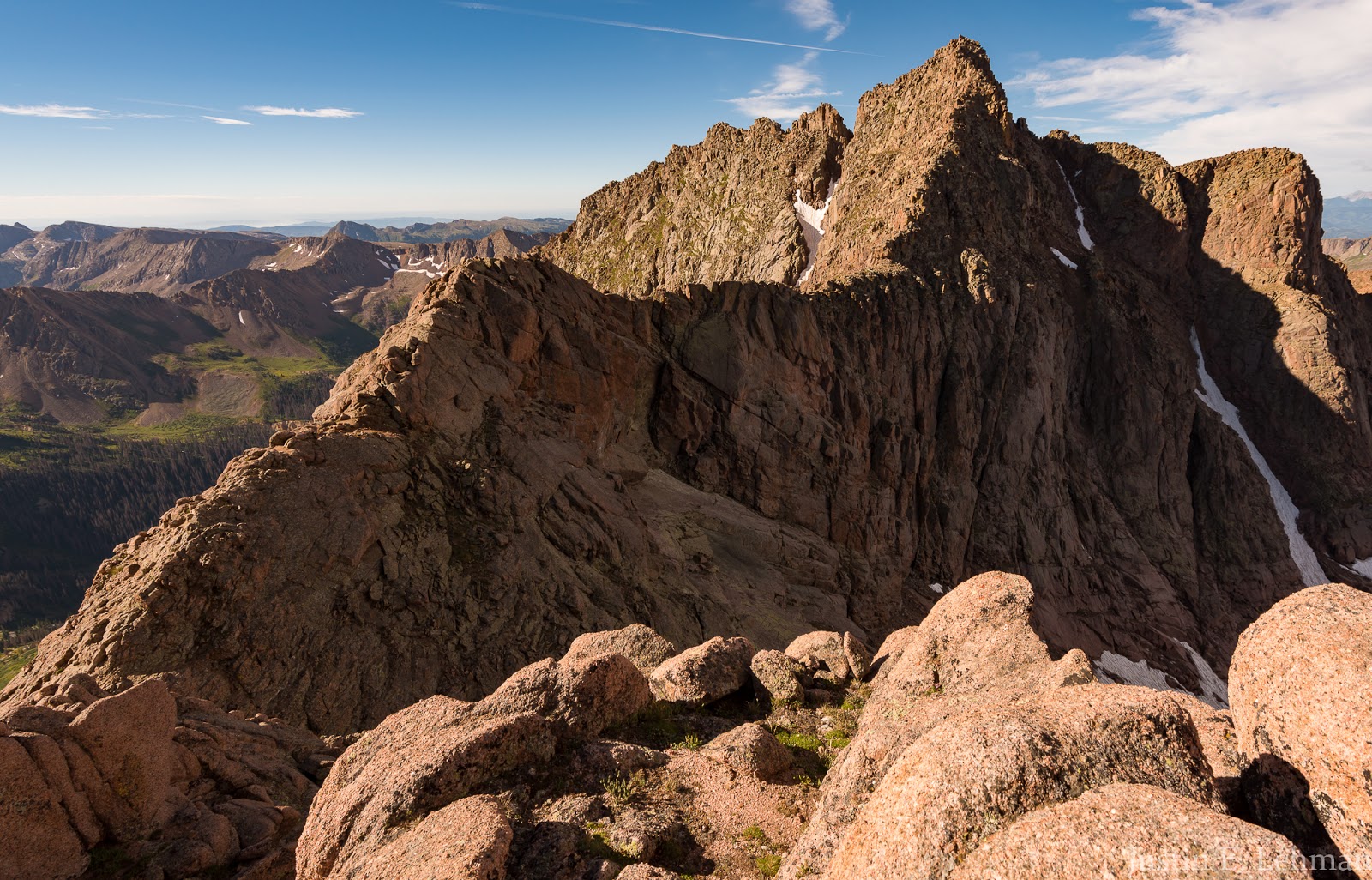
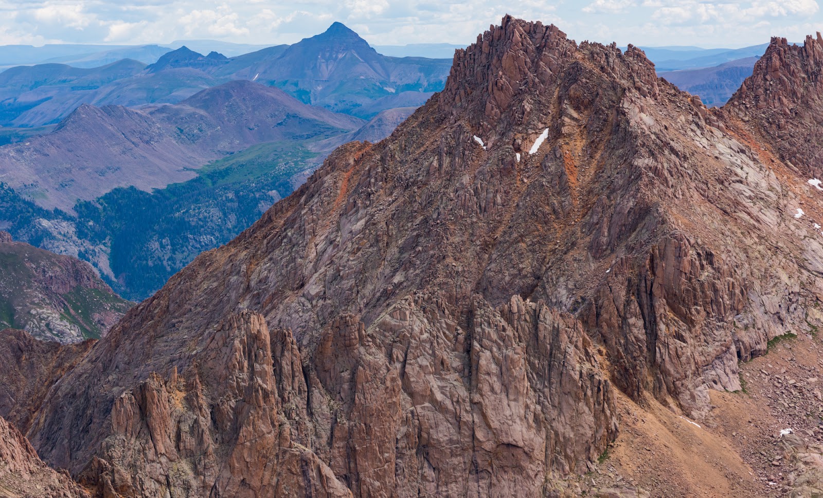
Heading up toward Mount Eolus from the Twin Lakes area. The actual summit of Mount Eolus is the high point just to the right of a deep notch seen here about upper-center.

It's a rare privilege to participate in an official Dave mountain selfie, but here one is, on the way up to Mount Eolus and North Eolus.
Looking back towards Twin Lakes as we continue to approach Mount Eolus. Windom Peak is the prominent peak visible a bit right of upper-center, while the infamous Sunlight Spire is visible just left of upper-center in the distance.

Believe it or not, there really is a good trail right through this boulder field... (Photo by Dave)
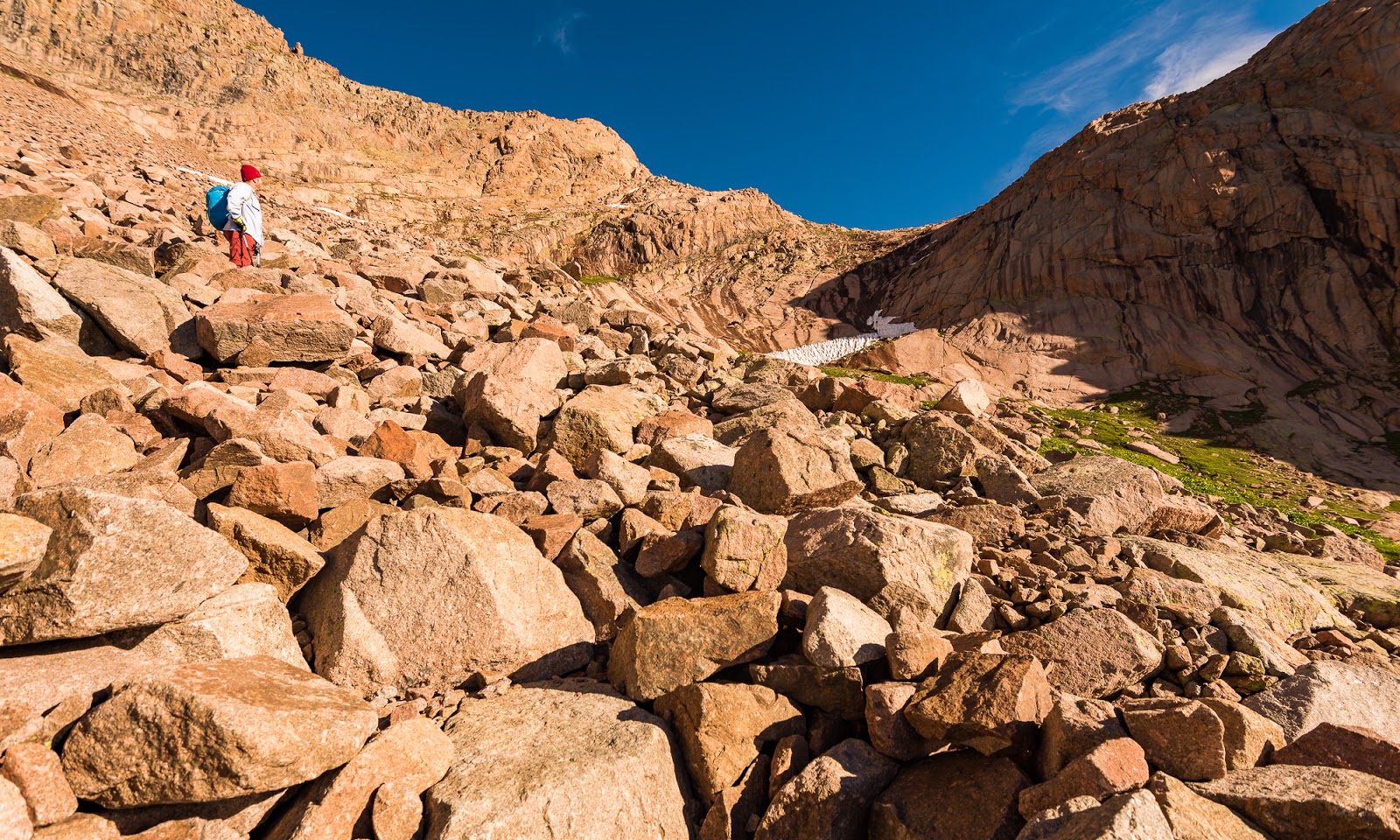
Believe it or not, there's excellent trail that goes right through the midst of all this talus. We're aiming for that high saddle toward the upper-right; just have to move forward and upward across a system of sloping ledges to get there...
For various reasons we ended up hiking North Eolus first; this change was likely instigated by the fact that Dave made it to the high saddle well before I did. I'll mention that this day I wasn't feeling great - I was running at about 60% normal capacity and so was dragging up the slopes slower than normal by a good margin. I had a slight edge of nausea, but things didn't feel rough enough to warrant turning around, so I just kept slogging on, but everything we did today, despite being excellent in quality, was attended with this general lower level of energy on my part. As it took me a while to reach the saddle, Dave decided to complete the relatively quick scramble up North Eolus while waiting for me, so I looked around and saw him up there, then scrambled on up North Eolus myself.
Having ascended North Eolus now, I can say the scrambling is entertaining enough to warrant an ascent if you're already there (I don't know that the ascent is long enough to warrant coming to the area just for North Eolus); the real rewards of climbing North Eolus are the stellar views of Mount Eolus across the way - absolutely stunning! On the approach toward Mount Eolus the peak doesn't look all that impressive, but from North Eolus is has an outstanding profile - with the notorious catwalk section of the route extending toward a prominent ridge that runs up the peak to the summit...definitely an eye-catcher from this vantage point! To me, the views of Mount Eolus alone justify climbing North Eolus (and Dave seemed to agree with that assessment), so having some fun scrambling and light route-finding along the way is just an added treat.
Having ascended North Eolus now, I can say the scrambling is entertaining enough to warrant an ascent if you're already there (I don't know that the ascent is long enough to warrant coming to the area just for North Eolus); the real rewards of climbing North Eolus are the stellar views of Mount Eolus across the way - absolutely stunning! On the approach toward Mount Eolus the peak doesn't look all that impressive, but from North Eolus is has an outstanding profile - with the notorious catwalk section of the route extending toward a prominent ridge that runs up the peak to the summit...definitely an eye-catcher from this vantage point! To me, the views of Mount Eolus alone justify climbing North Eolus (and Dave seemed to agree with that assessment), so having some fun scrambling and light route-finding along the way is just an added treat.
The jaw-dropping, "worth-it-just-for-the-view", perspective on Mount Eolus from somewhere on the slopes of North Eolus...If that doesn't get you fired up to go get on that summit I don't know what will!

Me, topping out on North Eolus. (Photo by Dave)

North Eolus summit benchmark.

Looking across at Mount Eolus from the top of North Eolus. Such a sweet peak!
Vestal and Arrow Peaks jut up in the distance beyond some of North Eolus' summit rocks. I had the privilege of summiting the stunning and exciting Arrow Peak (the pointy one in the upper left) last year. Still one of the most excellent summits I've ever done.
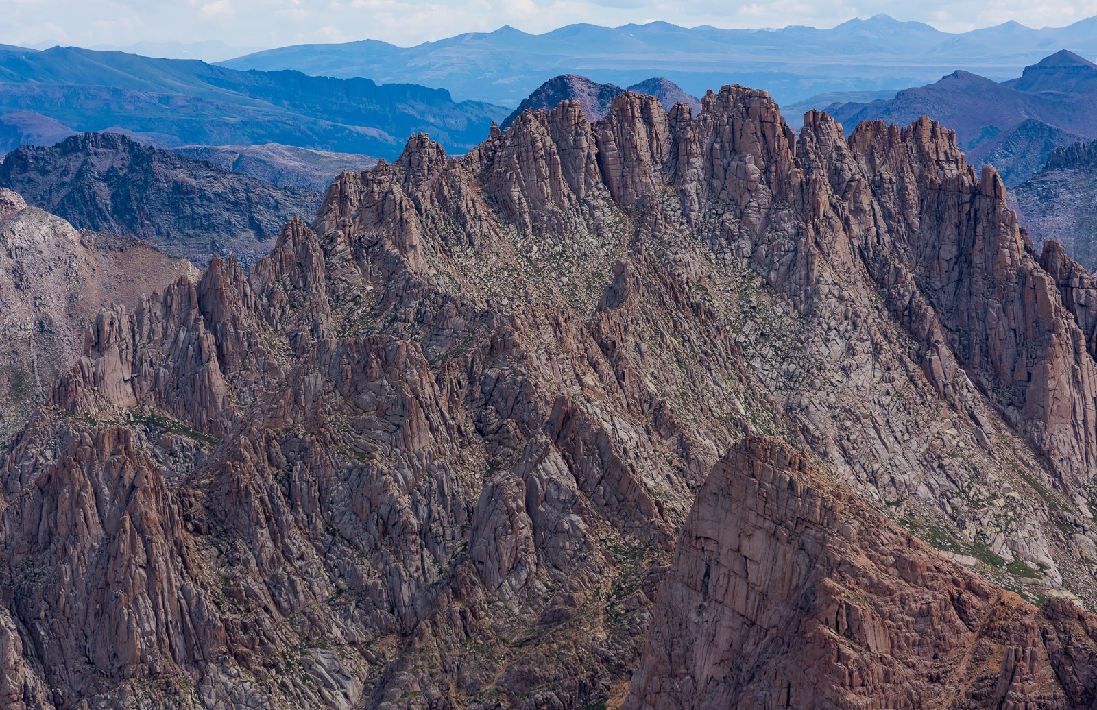
Jagged Mountain, one of the most notoriously dangerous mountains in Colorado.

More rugged terrain in the Needles Range, plus views stretching across the Grenadiers and the San Juans in the distance as well.
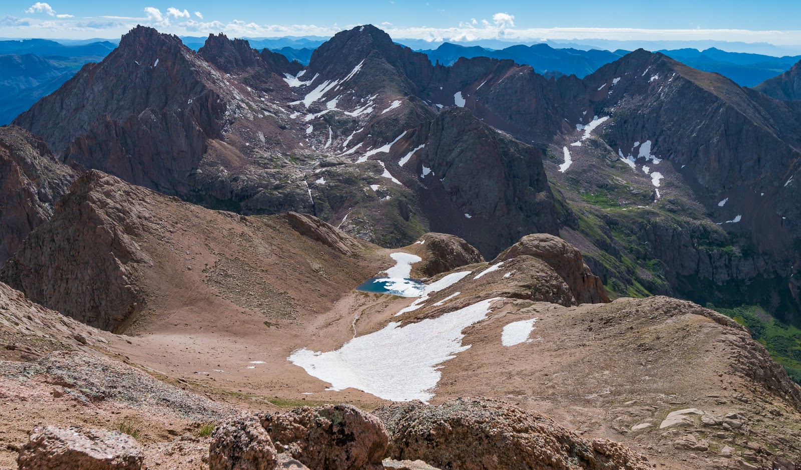
Looking across a high basin with a neat partially-frozen tarn in it and beyond to Sunlight Peak (upper-left) and Windom Peak (just left of upper-center), which we'd be aiming for the next day, weather permitting....
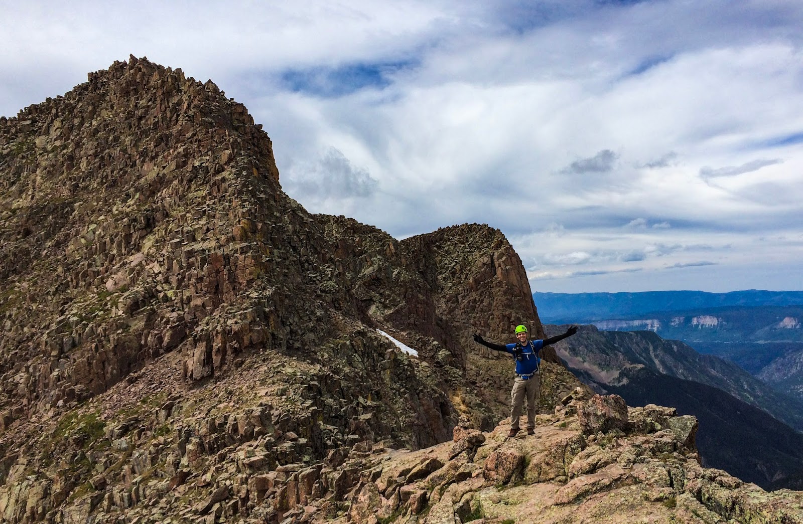
Me, atop North Eolus (14,045 feet)!

Dave was kind enough to take a picture of me with the ever-lovely Mount Eolus behind while we were up on North Eolus.
If you look close you can see Dave near the left (beginning) of the famous catwalk section of Mount Eolus. (Photo by Dave)

A hiker scrambles up North Eolus' slabby slopes (near the upper left).
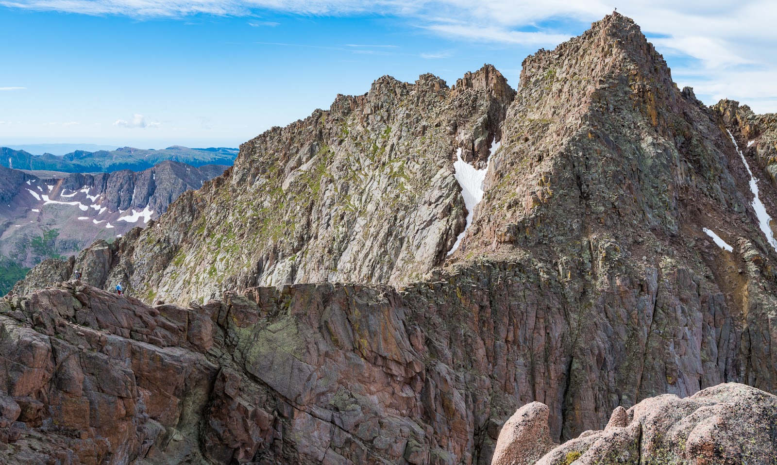
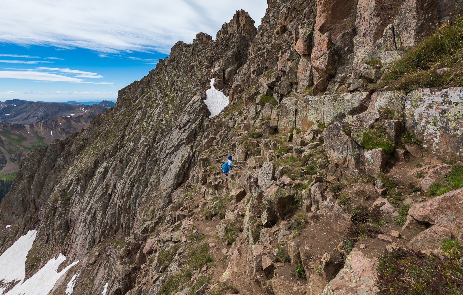
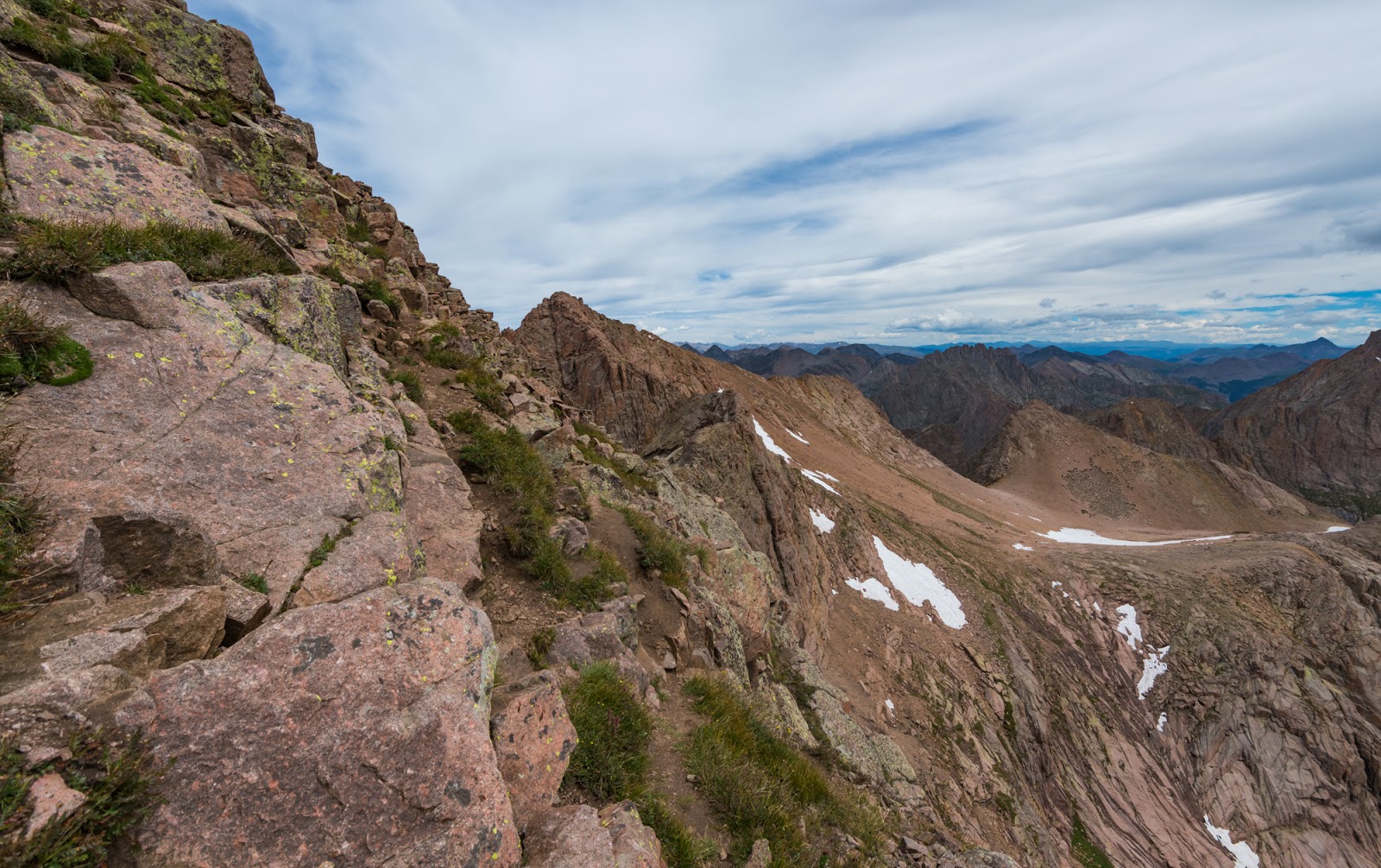
The ascent of Mount Eolus begins with a crossing of the catwalk, a relatively narrow section of ridge that leads to the main summit block. Some people describe the catwalk as being very exposed, and, in some respects it is, the drop-off to the right (as you head toward Mount Eolus) is severe, while the left side is less-so it's still not a place you'd like to take a tumble off of...Really, much of the ridge is 10 -15 feet across at the crest, so the feeling isn't really exposed - at least in Dave's and my view - but that's a very subjective assessment of things at best. Anyway, there's some light scrambling required at a few spots along the catwalk but most of it was just a mildly exposed walk-across route - still fun, but not challenging. There are a few spots where the ridge narrows, but they are the exception rather than the rule.

Me, near the start of the catwalk on Mount Eolus. (Photo by Dave)

This was one of the few sections of the catwalk on Mount Eolus that required any scrambling; most of it is exposed but really just a "walk-across" route. (Photo by Dave)
More shots of Dave on the catwalk as we work toward Mount Eolus...

Dave caught this epic view of me walking across the catwalk to Mount Eolus. Sunlight Peak is right behind me and Windom Peak is right of upper-center here.

More shots of Dave on the catwalk as we work toward Mount Eolus...
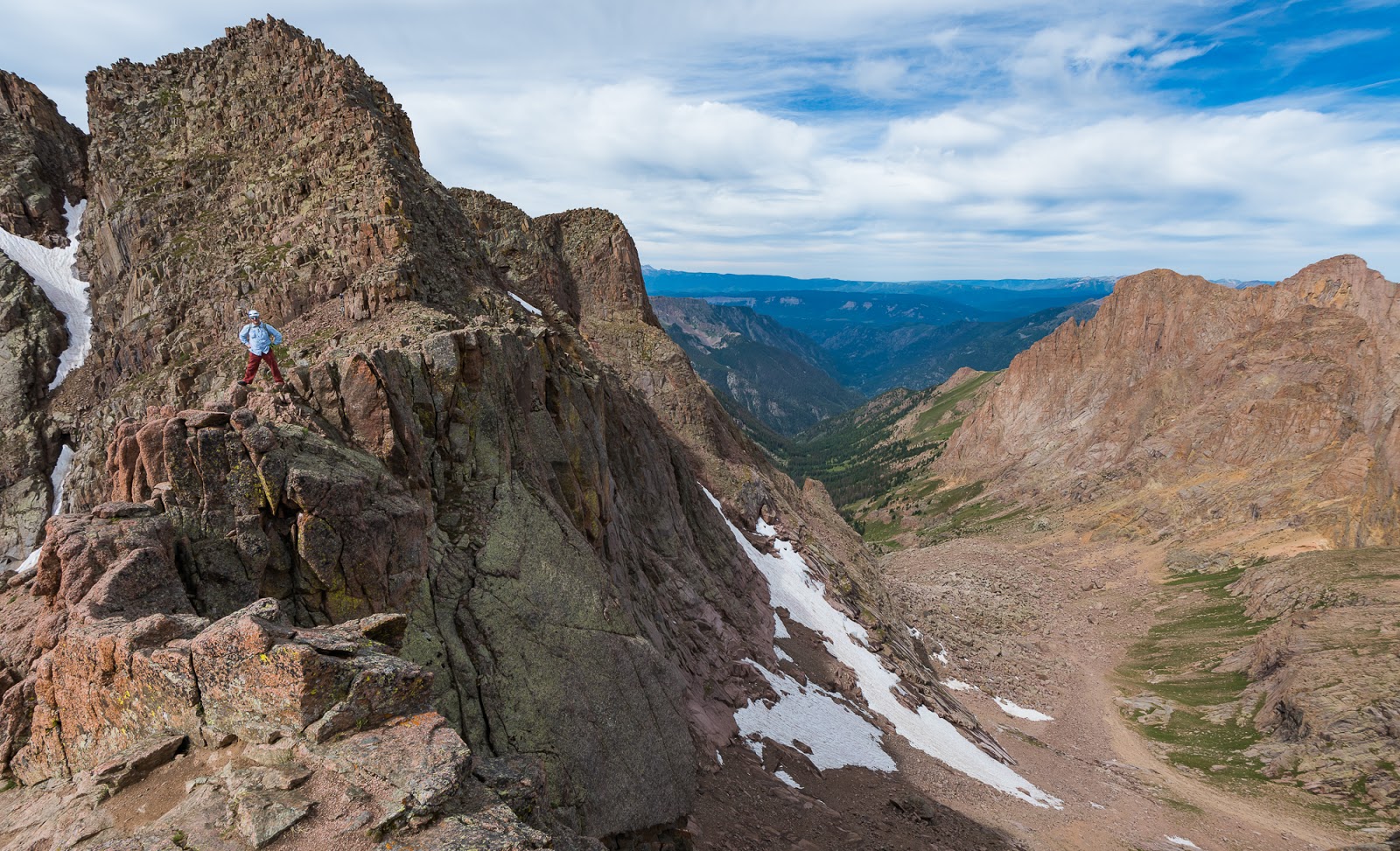
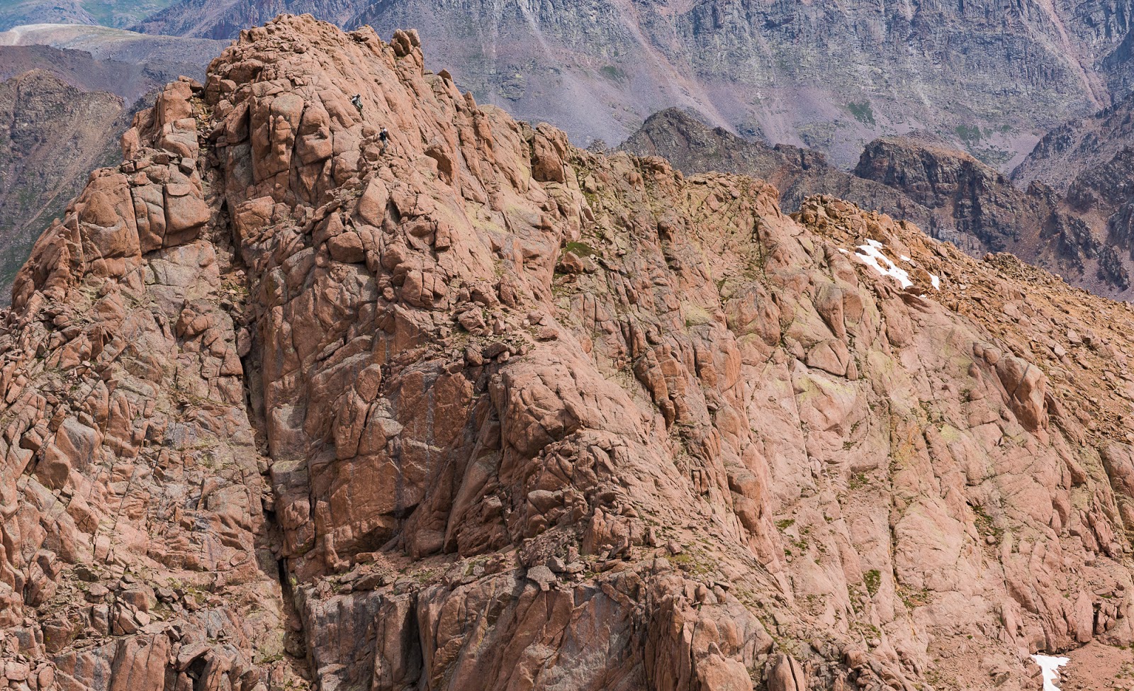
Here's an up-close view of what navigating the face of Mount Eolus is like; there is exposure there, but not what I'd consider severe. Still, the drop-off to Dave's left (in this perspective) does go down hundreds of steep, rocky feet - a fall would likely be quite injurious, if not fatal. It's hard to get an idea of the scale involved here on Mount Eolus from afar, but you're navigating big blocky shelves. Dave is a little over six feet tall, if that gives you even more for a point of reference. Fun stuff, but cautious going. As a route-finding time, generally following the grassy areas toward the middle/left of the face before the deep notch on the ridgeline will keep you on pretty good terrain. The closer you get to the ridge that meets the Mount Eolus-end of the catwalk, the more difficult and exposed the scrambling required will be.

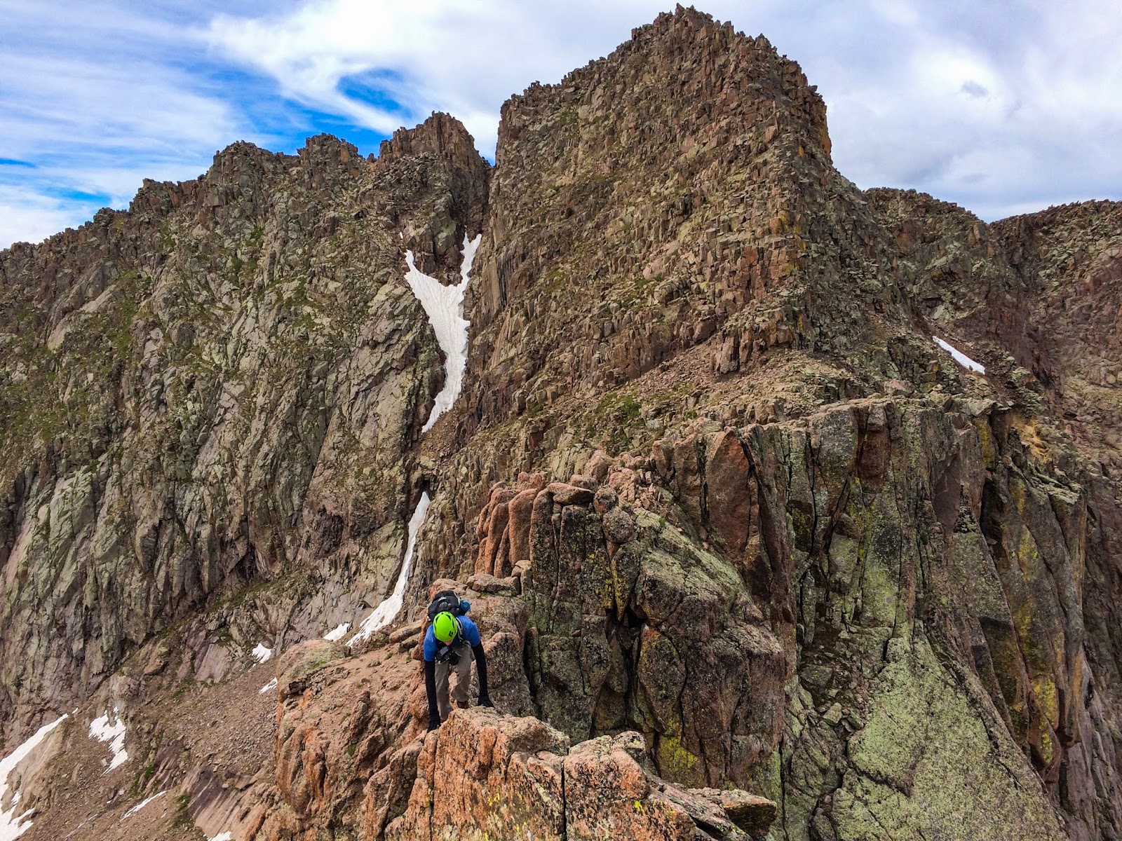
Dave demonstrates one of the more interesting scrambling moves on our ascent of Mount Eolus's face. Steep stuff here!
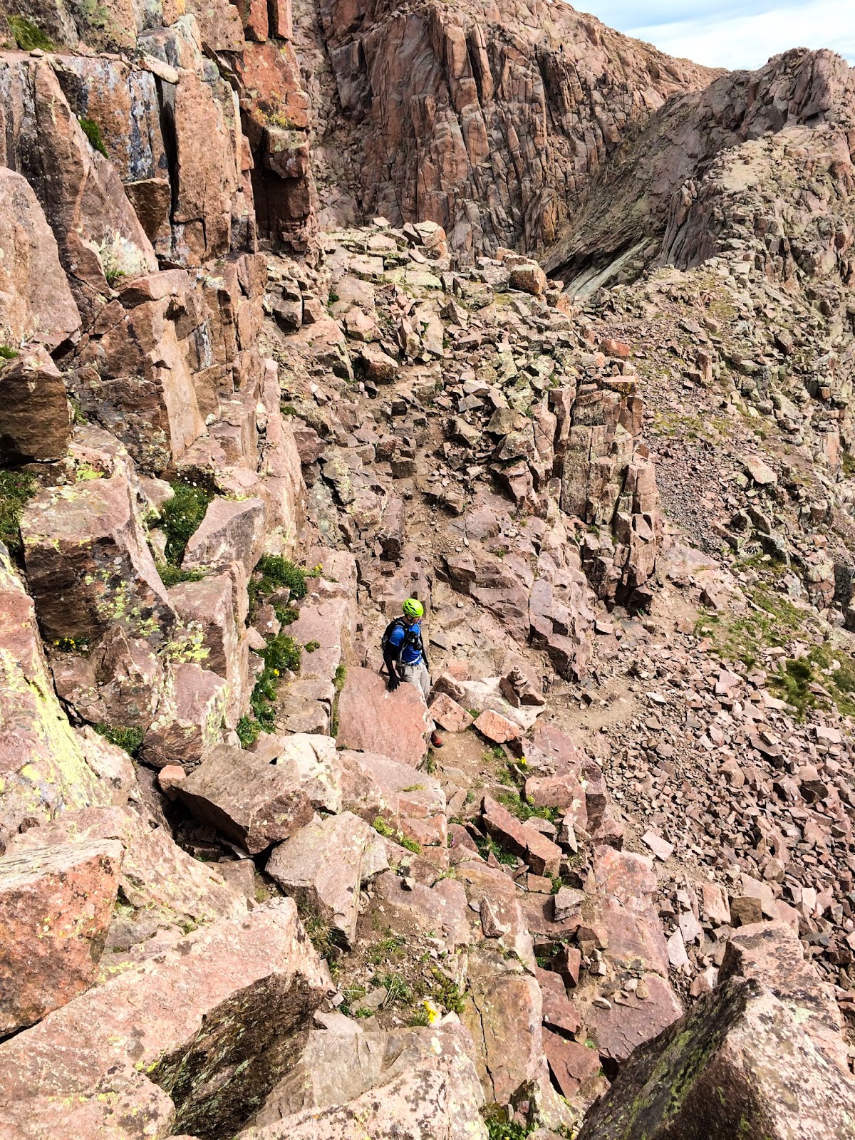
Me, scrambling big blocks on Mount Eolus' steep face. (Photo by Dave)

Me, scrambling big blocks on Mount Eolus' steep face. (Photo by Dave)

Traversing the summit ridge of Mount Eolus. (Photo by Dave)

Me, between taking pictures, on the summit of Mount Eolus. (Photo by Dave)
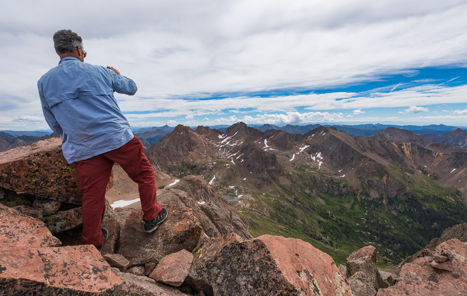
Dave catching some of the views from the summit of Mount Eolus.

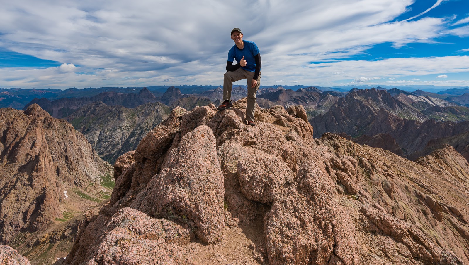
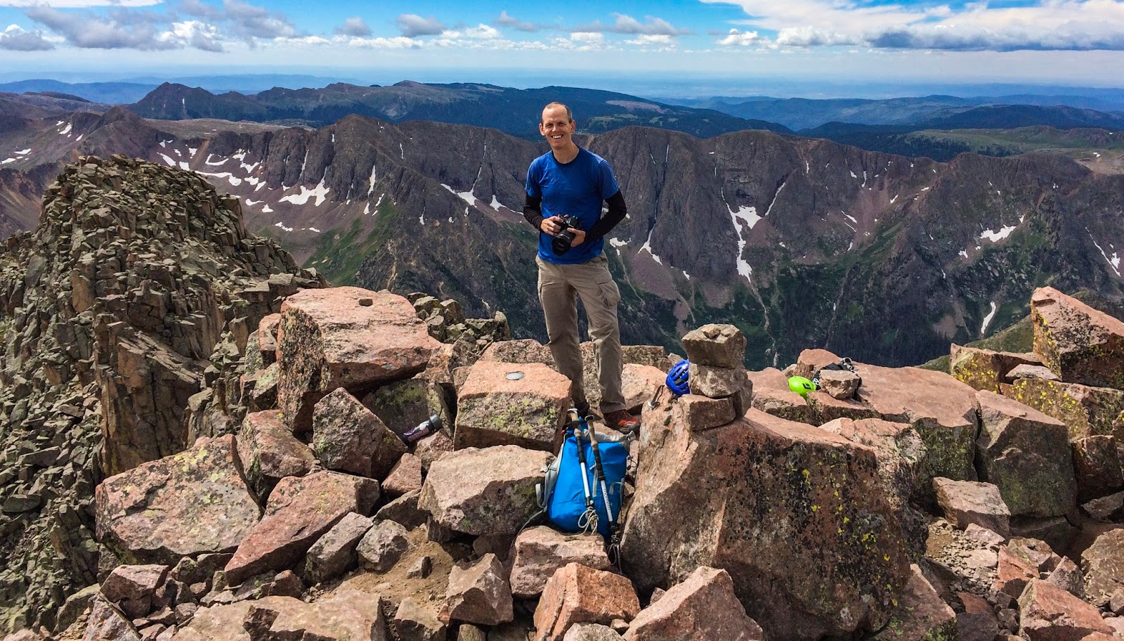
I've been dreaming of standing on this summit for a couple of years - finally here! Mount Eolus summit (14,085 feet)!
(Photo by Dave, using my camera here)
To Dave and my eyes this spot seemed to be the highest point on Mount Eolus' rugged summit...It's actually pretty exposed right where I'm standing. You'll notice my left foot is angled a bit oddly because of how slanted that block is. Between my left foot and my right foot is a gap just a little narrower than how wide apart my feet are, and just to the right of me (in this image) is a very large drop-off. A fall here would be...ill-advised...Makes for a great summit shot if you'll make sure your footing is sure first, though! (Photo by Dave with my camera again)

Mount Eolus summit panorama.

Mount Aeolus Benchmark, showing the original Greek spelling of the name. Cool to find!
Dave took a picture of me while I was looking for shots from the top of Mount Eolus.
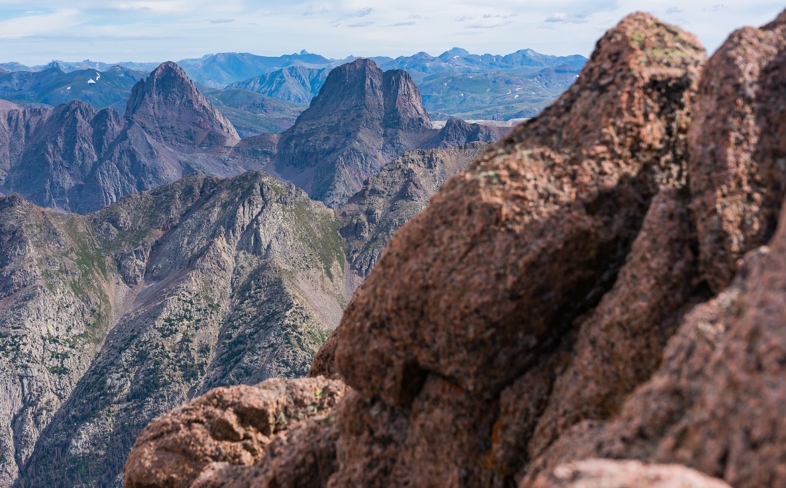
Another view of Jagged Mountain looking appropriately jaggedy in the distance...The rounded-looking peak in the lower right foreground is called Knife Point and is far more rugged looking from other angles than what it seems here.
North Eolus, as seen from Mount Eolus. Notice the two descending hikers near the summit for scale.
Another perspective on Vestal and Arrow Peaks in the Grenadier Range.
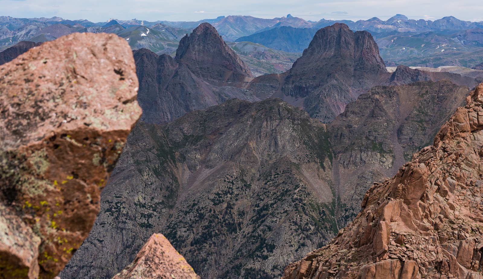
Really enjoyed this catch - Wetterhorn Peak framed up in between Arrow and Vestal Peaks, with Uncompahgre Peak just visible in the upper right corner; there are more notable peaks in this view than those, but those are the ones I was focused on when I framed the shot.
If you look at the larger version of this shot it's probably the most descriptive shot I have of just how exposed the summit block of Sunlight Peak is - you can see it here,and more easily once you've zoomed in. More on Sunlight and Windom Peaks in the "Part 2" of this post...

The infamous Sunlight Spire is visible here (top center). In Colorado there is a list of peaks called "The Centennials", referring to the 100 tallest peaks in the state. Sunlight Spire is one of the most challenging peaks on that list because of its technical summit block, which requires one to surmount that spire in the middle - which is much larger than it appears to be in this shot. Neat to see, fun not to have to climb.

Sweet views of Windom Peak, which we hoped to summit the next day.

Neat terrain and a trail that goes up another pass out of Chicago Basin.

Mountain, mountains, mountains everywhere. Mount Sneffels, which I climbed via the sweet SW Ridge route two weeks before this trip, is visible as the dark pyramidal mass in the top left (It's not really that dark, it's shadowed in clouds).

Looking back up steep terrain on the face of Mount Eolus that we'd scrambled down as we continued our descent.
I wanted to show, again, how steep the face of Mount Eolus is; you can see why if you slipped the fall would likely be fatal. The terrain is not especially perilous, though there is interesting scrambling to be had now and again along the way, but the face is steep enough that a fall would likely send you tumbling a long way down before something stopped you. As is usually the case we just try to avoid falling off the mountain altogether.
Me, coming back across the catwalk after summiting Mount Eolus. (Photo by Dave)
Me, coming back across the catwalk after summiting Mount Eolus. (Photo by Dave)

Me, coming back across the catwalk after summiting Mount Eolus. (Photo by Dave)
Along the way, we'd spotted a lovely partially-frozen tarn off across a hanging basin below Mount Eolus and North Eolus (more in line with North Eolus) so we decided to go check that out while we were already up high. We had finished both peaks in pretty good time, notwithstanding my slower movement on the whole, and as we had no other major objectives for the day we opted to do a little exploring.
As we neared the saddle between Mount Eolus and North Eolus, at the end of the catwalk, another hiker who's path we'd crossed a number of times (who also approached from the Purgatory Flats TH the same day we did) asked us if we'd left trekking poles at the saddle...I responded that I had. This other hiker, Gallagher by name, then related the sad tale about how he'd seen something moving across the slope - he thought it was a marmot, but it was too long to be a marmot...He soon realized it was a marmot, but that it was dragging a trekking pole across the slopes! Gallagher looked around some for the pole but couldn't find it anywhere...I found my remaining pole at the saddle where I'd left it with bite-marks out of the cork and foam padding near the top...Well...I'd commited one of the classic blunders - the first, is never get involved in a land war in Asia, but only slightly less: never lay your trekking poles on the ground when marmots are where you are! Alas...but I still had one good, working (if lightly-nibbled) pole, which would be much appreciated the following day on various steep, loose terrain...
As we neared the saddle between Mount Eolus and North Eolus, at the end of the catwalk, another hiker who's path we'd crossed a number of times (who also approached from the Purgatory Flats TH the same day we did) asked us if we'd left trekking poles at the saddle...I responded that I had. This other hiker, Gallagher by name, then related the sad tale about how he'd seen something moving across the slope - he thought it was a marmot, but it was too long to be a marmot...He soon realized it was a marmot, but that it was dragging a trekking pole across the slopes! Gallagher looked around some for the pole but couldn't find it anywhere...I found my remaining pole at the saddle where I'd left it with bite-marks out of the cork and foam padding near the top...Well...I'd commited one of the classic blunders - the first, is never get involved in a land war in Asia, but only slightly less: never lay your trekking poles on the ground when marmots are where you are! Alas...but I still had one good, working (if lightly-nibbled) pole, which would be much appreciated the following day on various steep, loose terrain...

Neat views of the partially-frozen tarn I enticed Dave to join me in exploring after we'd finished our descent of Mount Eolus. I still wasn't feeling very good at this point (I was very drained of energy with just a twinge of nausea through our hiking on this particular day) but the tarn was interesting enough to warrant a closer look. How often do you get to look at a tarn (small mountain lake) that has large chunks of ice floating in it while you're hiking in the American southwest in mid-August?

Snowfield near that partially frozen tarn; you can see Dave in the distance ahead. Since I was still not feeling great

Neat snow patterns at the edge of the partially frozen tarn.
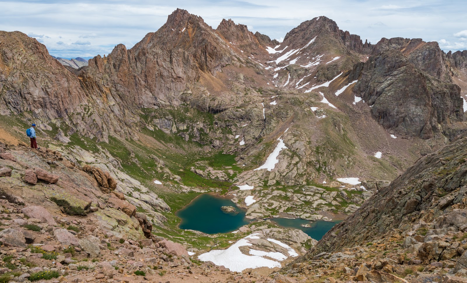
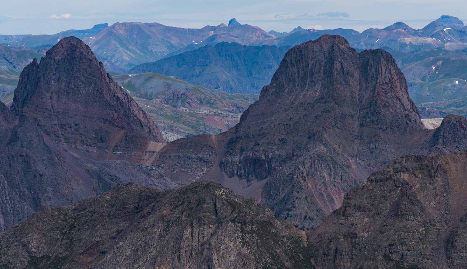
Incredible views over the Twin Lakes area. Sunlight Peak, Sunlight Spire, and Windom Peak all figure prominently in this view (Sunlight is on the left and Windom on the Right with the Spire in between). Dave helps give a sense of scale in this beautifully expansive view.

Zoom shots of Twin Lakes far below.
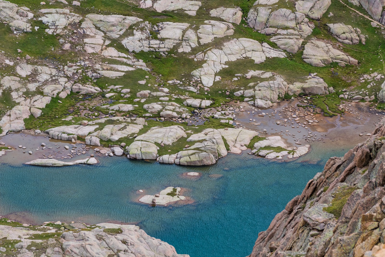
Zoom shots of Twin Lakes far below.

Detail shot of Sunlight Peak from our little overlook above the partially-frozen tarn. The summit block (Sunlight Peak is famous for its challenging summit) is the highpoint visible on the edge of the jagged cliffs as the high point on top.

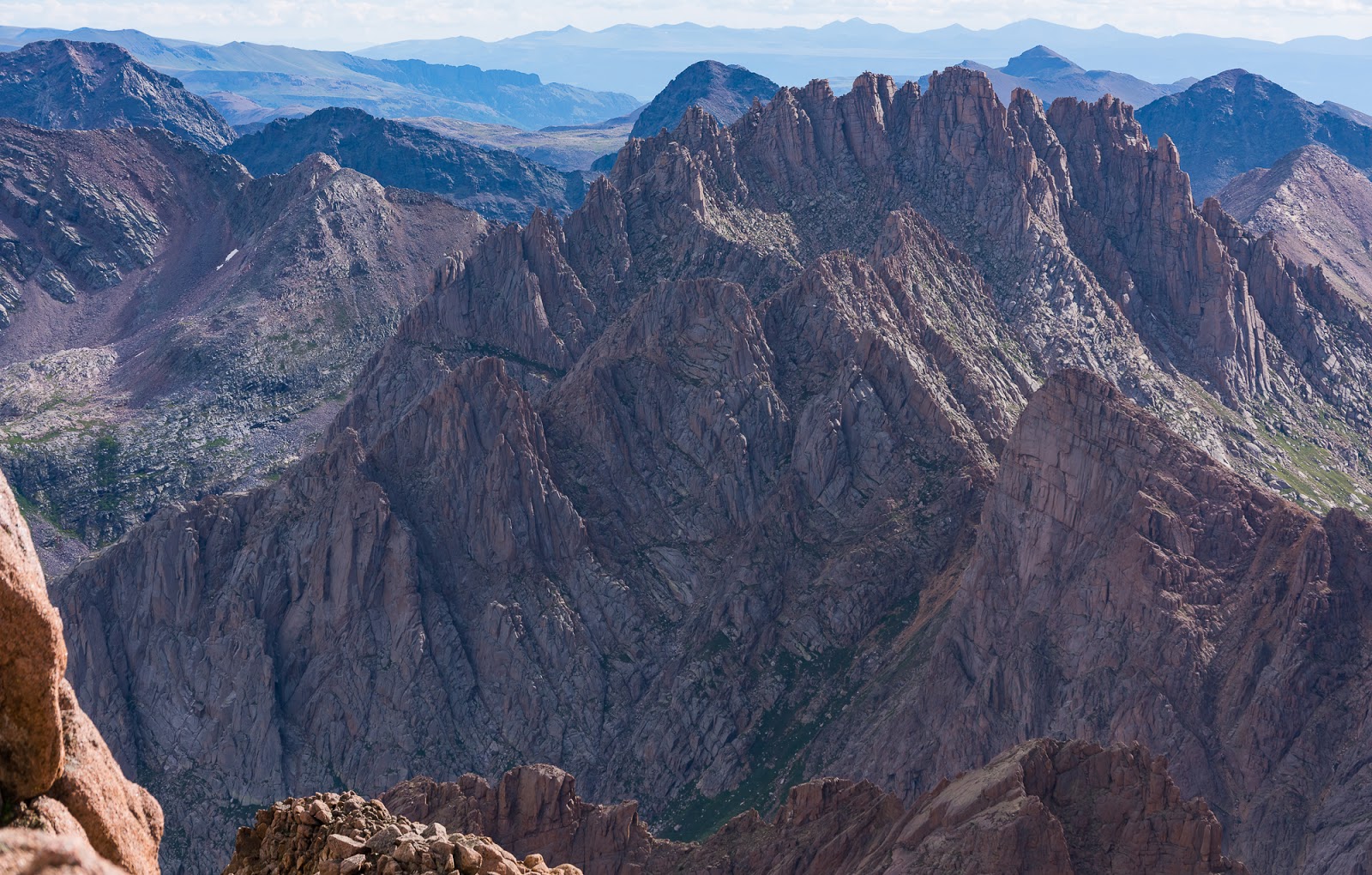
Neat views over very rugged terrain; seen from our little overlook above the partially-frozen tarn.

Neat views over very rugged terrain; seen from our little overlook above the partially-frozen tarn.

Neat views over very rugged terrain; seen from our little overlook above the partially-frozen tarn.
Neat views over very rugged terrain; seen from our little overlook above the partially-frozen tarn.

Little bird hopping around on the snowfield around the partially-frozen tarn; this same snowfield runs into the tarn itself as well.
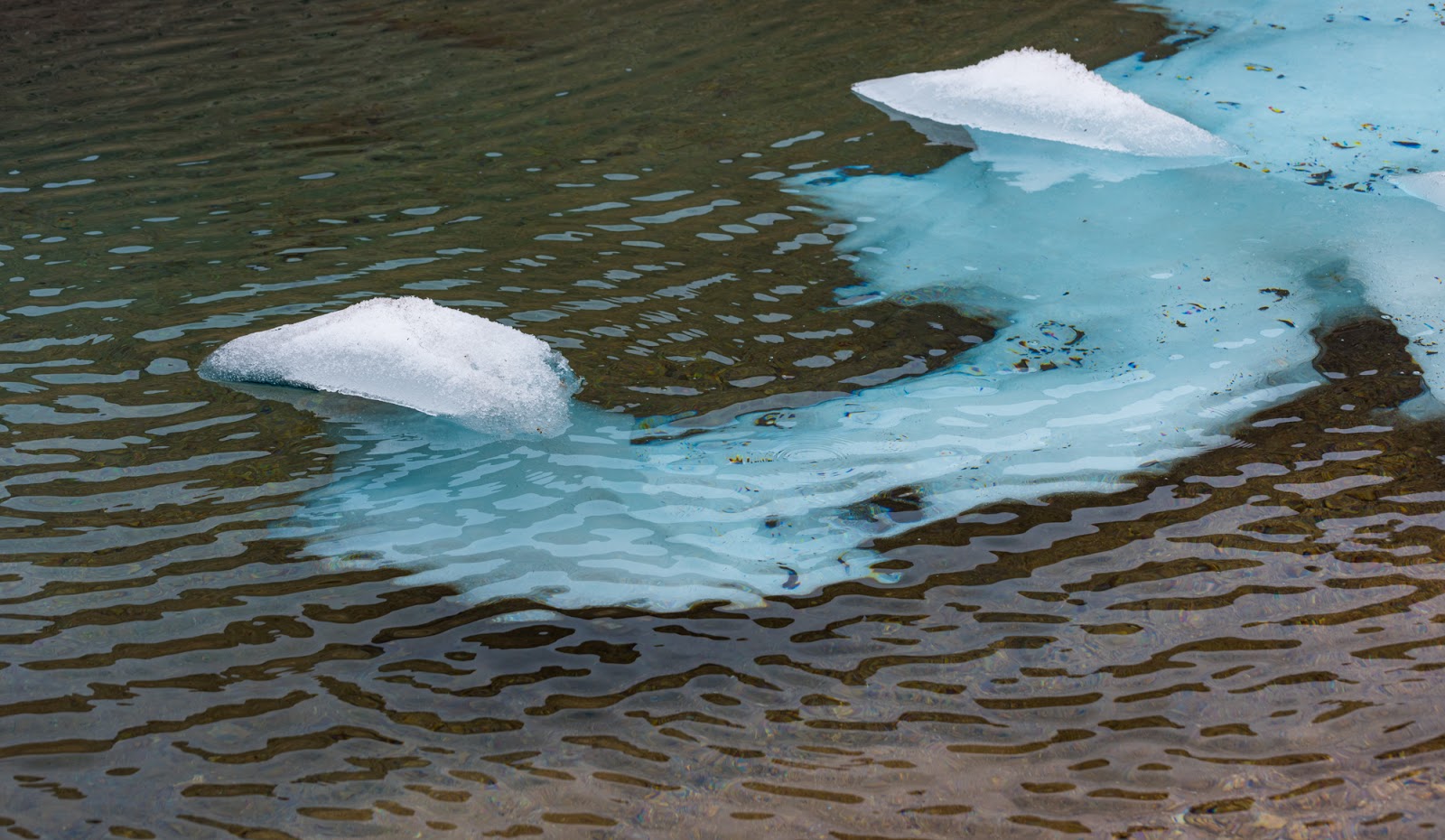
Detail from the large snowfield that extended out into the partially-frozen tarn. This curved piece of ice is probably about six feet long.

Another detail view of the top of Sunlight Peak over part of the snowfield above the partially-frozen tarn.

Detail shot of the surface of the partially frozen tarn. These are big chunks of ice; maybe 10 - 15 feet across. While we were there, Dave and I took to calling this place San Juan Summer Ice Lake, after a lake called Summer Ice Lake located high up in the depths of Wyoming's Wind River Range.

Dave and I both enjoyed how Arrow and Vestal Peaks were both framed up nicely here.
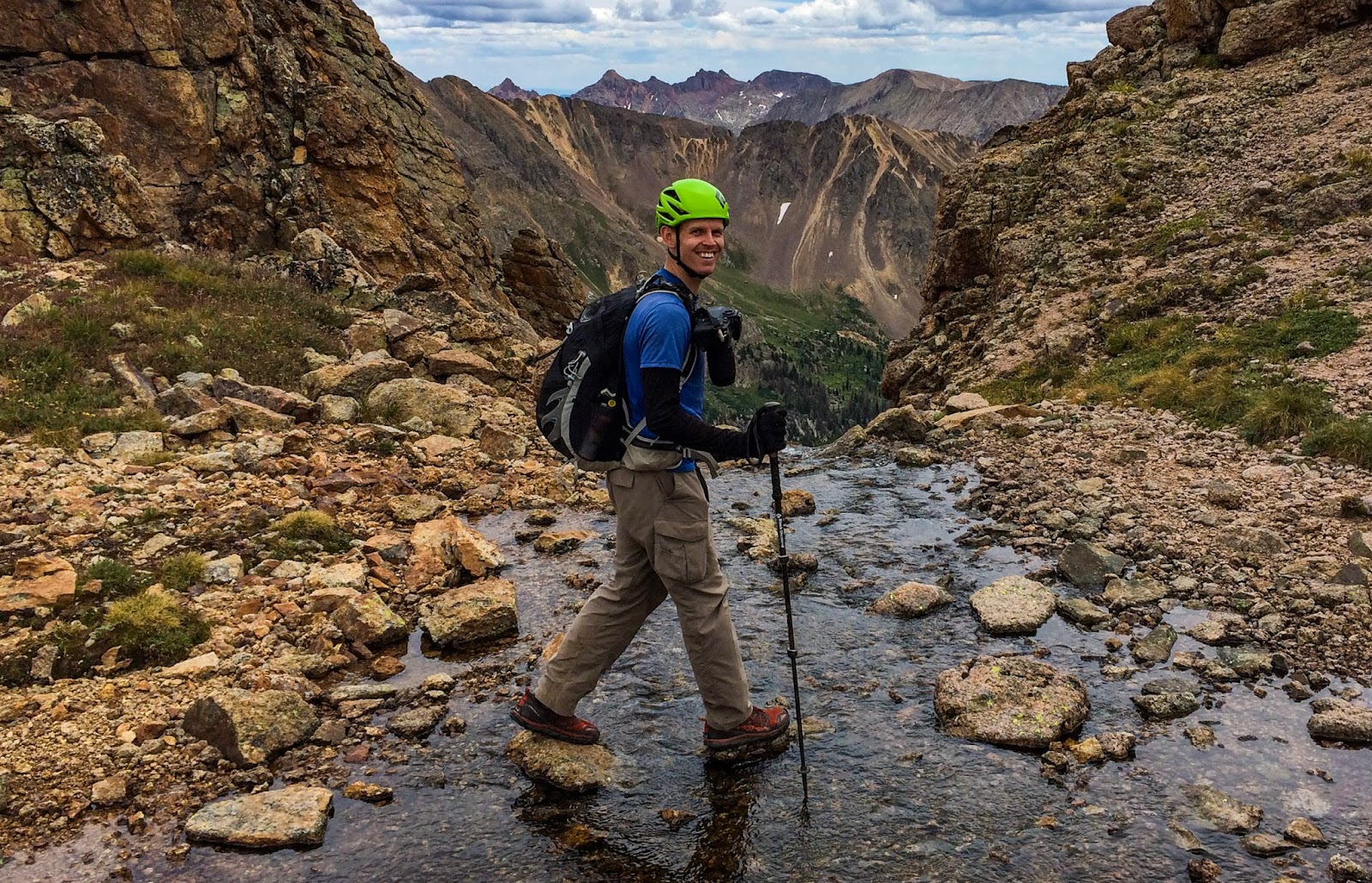
As I was walking across this stream that was flowing out of the partially-frozen tarn Dave yelled for me to wait, so I paused mid-stride, while he took this picture at this lovely viewpoint. Through that notch to my left the terrain drops steeply down several hundred feet as the stream becomes a multi-terraced cascade that eventually flows down into the Twin Lakes area.

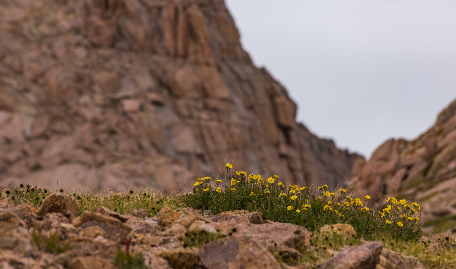
Neat perspective of the incredibly rugged Jagged Mountain (13,830 feet), seen here through blooming wildflowers.

Detail shot of Mount Eolus' steep, blocky face, which we had ascended just earlier today. Complicated terrain. Generally following the grassy areas up the middle and to the left from there is a good idea for the ascent.
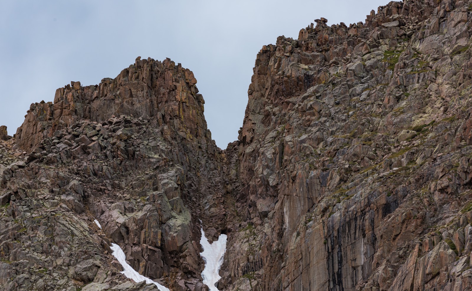
Deep notch near the summit of Mount Eolus - maybe 40 - 50 feet deep or more.

Nice wildflowers we passed through on the way down from the Mount Eolus area.

Dave's picture of me just after I took the picture above.

Dave tries to sneak up on a marmot for a photo opp...
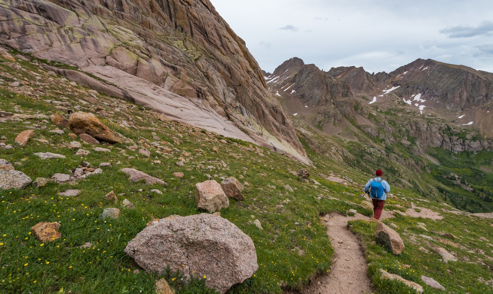
Dave descends toward Twin Lakes through beautiful country.

Neat waterfall and resulting streamlet seen on the way down to Twin Lakes.

Gorgeous views on the way down to Twin Lakes from the Mount Eolus area.

The mountain goats were waiting for us when we got down to Twin Lakes...but not as many as we ran into in the morning...

Dave photographing me while I photograph the mountain goats.

The mountain goats were waiting for us when we got down to Twin Lakes...but not as many as we ran into in the morning...
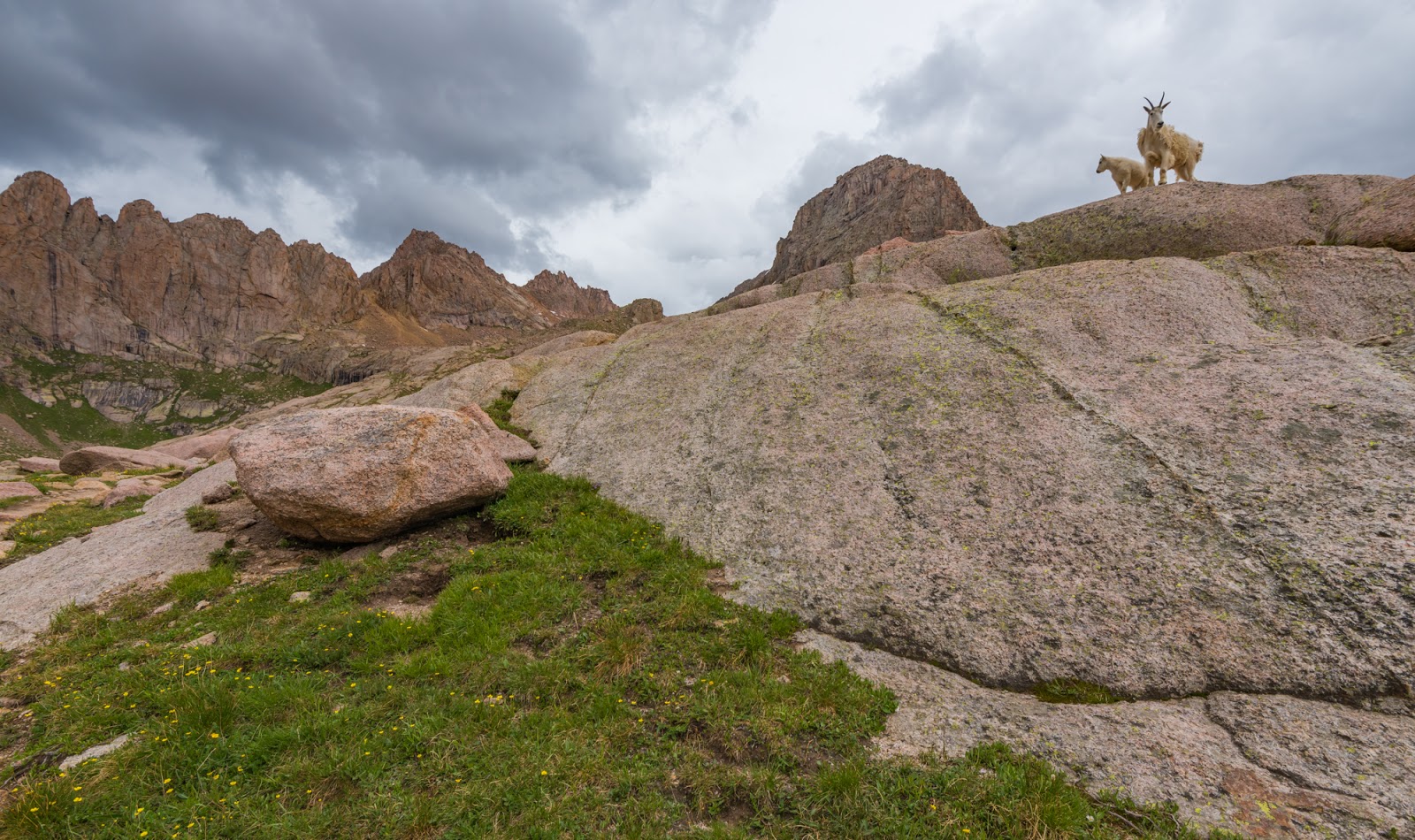
The mountain goats were waiting for us when we got down to Twin Lakes...but not as many as we ran into in the morning...

The mountain goats were waiting for us when we got down to Twin Lakes...but not as many as we ran into in the morning...

I came across this glorious (and very large) dead tree laying down in a meadow below Twin Lakes but above Chicago Basin; this tree was at least fifty feet long...

Evening light in Chicago basin, seen from our lovely campsite the same day we climbed North Eolus and Mount Eolus, etc. This was, in part, basically the view we had while making and eating our dinner. Glorious!
***Jump to Part 2 to get the rest of the adventure!
***