HomerJ
Member
- Joined
- Jan 19, 2012
- Messages
- 1,199
June 10, 2010
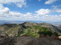
Last weekend I decided to tackle Cherry Peak (9764' elevation). I've wanted to climb it ever since seeing it from Mt Naomi 3 years ago.
Here's the view from Mt Naomi of Cherry Peak
I decided to hike up High Creek so that I could also go by High Creek Lake on the way. It was a lot tougher (steeper) than I expected. The trail is 6.4 miles one way and climbs about 3800', with 2000' of that being climbed in the last 2 miles!
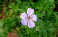
High Creek is very very pretty!! There were wild flowers everywhere and everything was so green! It sprinkled for a few minutes early on.
Along the way I passed two different groups of backpackers who both had camped last night at the beaver ponds. I have heard of people camping at high creek lake and was surprised that neither of these groups had. I later decided that these people were smart as the trail got much steeper after the beaver ponds and that I wouldn't want to pack my gear up to high creek lake.
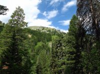
First glimpse of Cherry Peak!
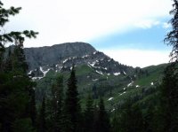
After a few miles of hiking the trail opens up into a very nice meadow with a few beaver ponds. There are two small waterfalls around the beaver ponds that I didn't know about that added to the trip! I'm going to have to go back up and get pictures of them with my tri-pod! I was able to rest my camera on a rock for the one waterfall so I could blur the water.
View of Cherry Peak from beaver pond
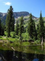
The first waterfall I encountered! This was across the meadow on the opposite side as the trail. I think this one is seasonal.
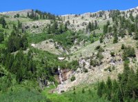
Just gorgeous up here!
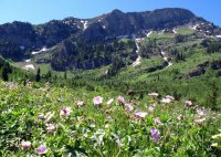
2nd waterfall. I didn't have my tripod so I had to rest the camera on a rock to get this shot. The trail goes right past this one.
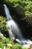
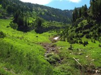
After the 2nd water fall the trail really starts to climb! This is looking up the draw. Everything is green green green!
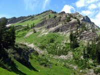
View of Cherry Peak!
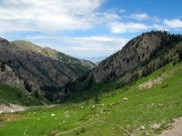
Looking back down where I'd just came from!
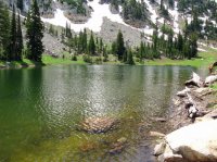
It had taken a little longer than I expected, probably due to taking photos and sucking air climbing, but I finally made it to High Creek Lake!
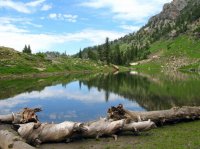
I had taken two liters of water and had drank one by the time I reached High Creek Lake. I still had to climb up to the shoulder above High Creek Lake, cross over the south face of Cherry Peak, and then up the ridge to the top (about 1.5 miles and another 1000' elevation). I knew I would probably run out of water at that rate on my way back down if I continued on to Cherry Peak. I decided I would be fine as there are many springs along the way that I could drink out of without too much worry of getting sick if it came down to it. So I headed on!
View of Cherry Peak from the shoulder above High Creek Lake. Not knowing for sure if I could scramble up the closer/steeper ridge I headed for the far saddle (small spot of snow).
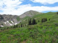
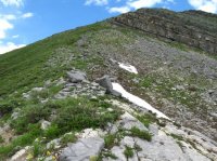
Having reached the far ridge/saddle all I had left was this scramble up to the top!
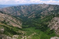
I finally made it to the top!!!!! WOW, what a hike and WHAT A VIEW!!!! The view from the top of Cherry Peak is very pretty. You could see forever! I think it's the best view in all of Cache Valley. This is looking west down Cheery Creek.
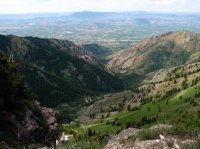
Looking north into High Creek. It's about 2500' down to the meadow/beaver ponds below!
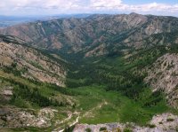
Mt Naomi from Cheery Peak
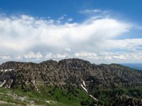
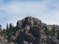
Zoomed in, you can barely make out 3 people on top of Mt Naomi
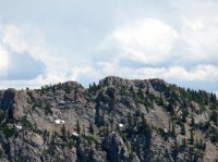
Digital zoom to see hikers on Mt Naomi
After spending about 30-40 mins on top I headed back down the way I had came up. I ended up running out of water with about 4.5 miles left to the trail head, which was sooner than I thought I would run out, but I was doing fine. I ended up dunking my hat in the beaver ponds and pouring it over my head. WOW, was that water cold!!! I think there is a spring there.
Coming down I could feel my knee starting to hurt (hikers knee), so I pulled out my knee brace and put it on. I had to go slow (especially on the steep stuff) and rest a lot. I made it down fine with my knee hurting only a few times and it never hurt afterwords like it had so many times in the past from hiking long/steep hikes.
ibenick did this hike a few years before. His report is on his blog and can be found here. I highly recommend checking it out as he went up the steeper ridge to the top of Cherry Peak and down Cherry Creek making a sweet loop that I would love to do one day!
Featured image for slideshow:
Last weekend I decided to tackle Cherry Peak (9764' elevation). I've wanted to climb it ever since seeing it from Mt Naomi 3 years ago.
Here's the view from Mt Naomi of Cherry Peak

I decided to hike up High Creek so that I could also go by High Creek Lake on the way. It was a lot tougher (steeper) than I expected. The trail is 6.4 miles one way and climbs about 3800', with 2000' of that being climbed in the last 2 miles!
High Creek is very very pretty!! There were wild flowers everywhere and everything was so green! It sprinkled for a few minutes early on.

Along the way I passed two different groups of backpackers who both had camped last night at the beaver ponds. I have heard of people camping at high creek lake and was surprised that neither of these groups had. I later decided that these people were smart as the trail got much steeper after the beaver ponds and that I wouldn't want to pack my gear up to high creek lake.

First glimpse of Cherry Peak!

After a few miles of hiking the trail opens up into a very nice meadow with a few beaver ponds. There are two small waterfalls around the beaver ponds that I didn't know about that added to the trip! I'm going to have to go back up and get pictures of them with my tri-pod! I was able to rest my camera on a rock for the one waterfall so I could blur the water.
View of Cherry Peak from beaver pond

The first waterfall I encountered! This was across the meadow on the opposite side as the trail. I think this one is seasonal.

Just gorgeous up here!

2nd waterfall. I didn't have my tripod so I had to rest the camera on a rock to get this shot. The trail goes right past this one.

After the 2nd water fall the trail really starts to climb! This is looking up the draw. Everything is green green green!

View of Cherry Peak!

Looking back down where I'd just came from!

It had taken a little longer than I expected, probably due to taking photos and sucking air climbing, but I finally made it to High Creek Lake!


I had taken two liters of water and had drank one by the time I reached High Creek Lake. I still had to climb up to the shoulder above High Creek Lake, cross over the south face of Cherry Peak, and then up the ridge to the top (about 1.5 miles and another 1000' elevation). I knew I would probably run out of water at that rate on my way back down if I continued on to Cherry Peak. I decided I would be fine as there are many springs along the way that I could drink out of without too much worry of getting sick if it came down to it. So I headed on!
View of Cherry Peak from the shoulder above High Creek Lake. Not knowing for sure if I could scramble up the closer/steeper ridge I headed for the far saddle (small spot of snow).

Having reached the far ridge/saddle all I had left was this scramble up to the top!

I finally made it to the top!!!!! WOW, what a hike and WHAT A VIEW!!!! The view from the top of Cherry Peak is very pretty. You could see forever! I think it's the best view in all of Cache Valley. This is looking west down Cheery Creek.

Looking north into High Creek. It's about 2500' down to the meadow/beaver ponds below!

Mt Naomi from Cheery Peak

Zoomed in, you can barely make out 3 people on top of Mt Naomi

Digital zoom to see hikers on Mt Naomi

After spending about 30-40 mins on top I headed back down the way I had came up. I ended up running out of water with about 4.5 miles left to the trail head, which was sooner than I thought I would run out, but I was doing fine. I ended up dunking my hat in the beaver ponds and pouring it over my head. WOW, was that water cold!!!
 I think there is a spring there.
Coming down I could feel my knee starting to hurt (hikers knee), so I pulled out my knee brace and put it on. I had to go slow (especially on the steep stuff) and rest a lot. I made it down fine with my knee hurting only a few times and it never hurt afterwords like it had so many times in the past from hiking long/steep hikes.
ibenick did this hike a few years before. His report is on his blog and can be found here. I highly recommend checking it out as he went up the steeper ridge to the top of Cherry Peak and down Cherry Creek making a sweet loop that I would love to do one day!
Featured image for slideshow:

