Deadeye008
Hambone
- Joined
- Jan 18, 2012
- Messages
- 742
Trip report from last January to Cedar Mesa area.
A buddy and I went down to the Cedar Mesa Area for a few days this past weekend. We ended up hitting upper South Mule Canyon and a few places along Comb Ridge. Weather was excellent with highs right around 50 and nightly lows in the teens. The Friday we got there we hit upper South Mule Canyon first. We didn't want to have to hike all the way up and back from the mouth of the canyon so we entered up higher. It ws a heck of a scramble down in the canyon because of all the ice. We were literally sliding down the canyon side in some spots. Wish I would have brought my crampons! On the way out we actually found some rock cairns when we were about half way up the side of the canyon and followed those out. We had to find a different route out since we were unable to climb up the area we had entered because of the ice. Here are some pics of the ruins we visited down there.
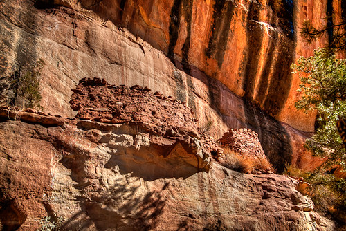
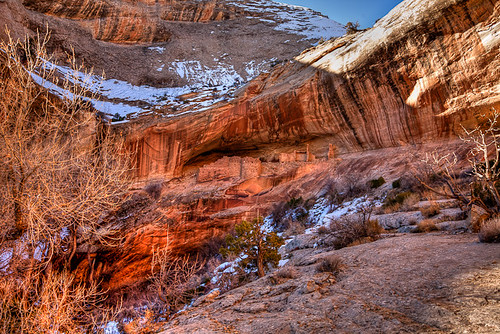
I have seen this ruin called Wall Ruin and Cliffhanger Ruin. Not sure of the official name. Here it is as seen from the rim of the canyon. Notice the 2 poles sticking out of the cliff face above the structure on the right. There is part of this structure which appears to be a room of sorts just to the right of the upper pole. It is inaccessable though. Makes me wonder if the original structure was 3 stories tall or if there was some other way to access that upper room via a ladder or something.
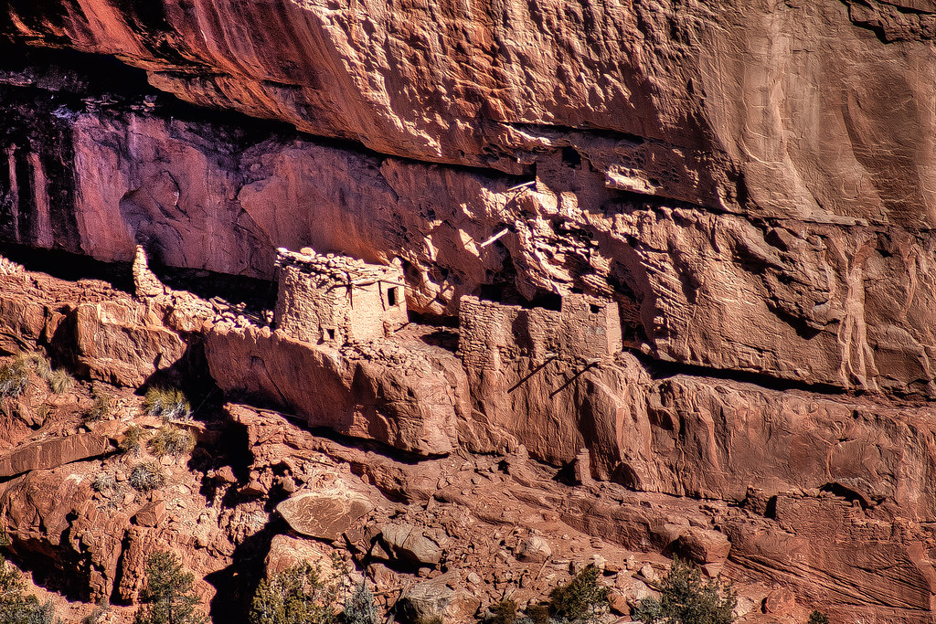
Upper South Mule Canyon Ruin by Deadeye008, on Flickr
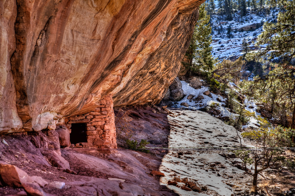
2 more pics of the site. First one is below the site and second one is up on the platform of the site. Notice how the wall of the structure aligns perfectly with the cliff edge.

View from below by Deadeye008, on Flickr
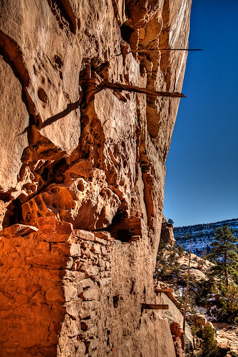
View South from up on the platform by Deadeye008, on Flickr
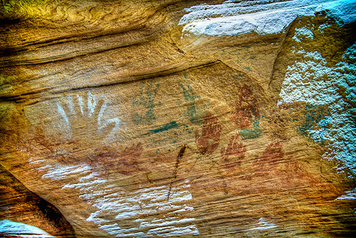
The next few pics are of the structure on the left. Notice the hand/finger prints on the wall and also the completely intact roof. I believe the hole in the roof was the access point to the upper room of the structure when it was more complete.

Lower portal by Deadeye008, on Flickr
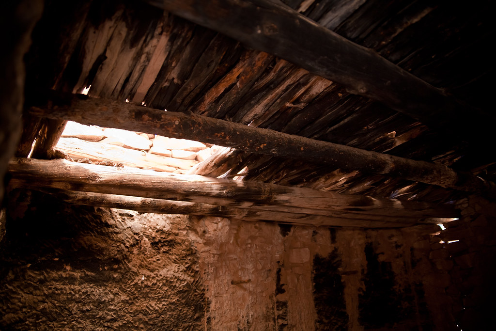
Roof access by Deadeye008, on Flickr
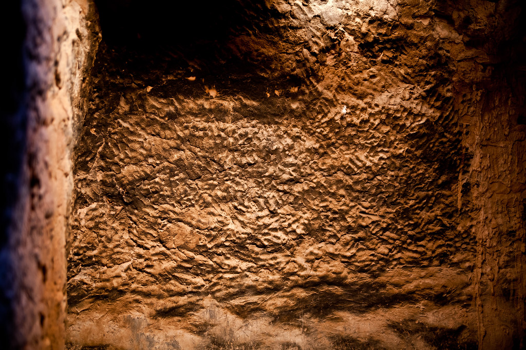
Interior wall by Deadeye008, on Flickr

On platform looking North by Deadeye008, on Flickr
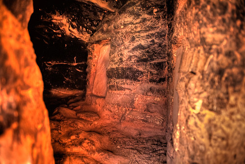
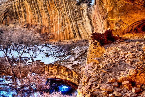
This shot is looking at the structure on the right. The wall on the right side of this pic is the wall that sits flush with the cliff edge. Notice the T shaped door and the stone door cover sitting beside it. The stone door was split in half and was used to cover an inner chamberI believe. Also at the end of the corridor, on the left side there is another T shaped door that leads to more chambers that are located inside the cliff face. The second shot is looking inside the T shaped door that leads into the cliff face. Notice the 2 stone doors covering the entrances to the two visible entrances. There is also another chamber door above the chamber on the right side of the pic. This place was one of the best preserved site I have been to. Simply amazing!
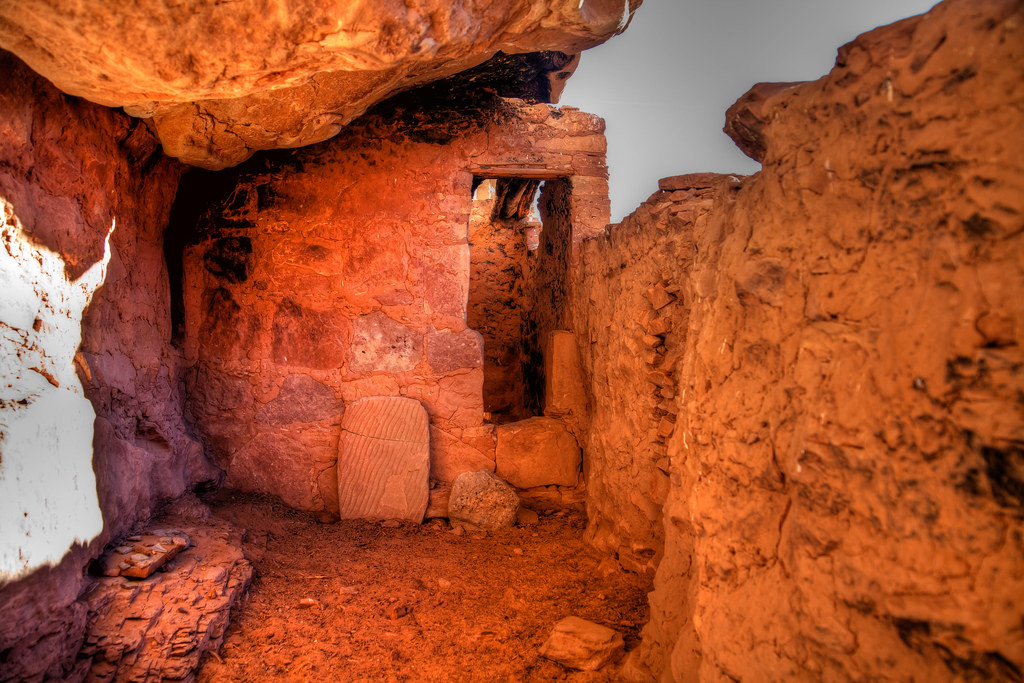
"T" doorway by Deadeye008, on Flickr
Interior room by Deadeye008, on Flickr
Here is a shot of a ruin just down canyon from the previous ruin. Also a shot of a nearby grainery and some very faint glyphs.
Looking up by Deadeye008, on Flickr
Grainary in Upper South Mule Canyon by Deadeye008, on Flickr
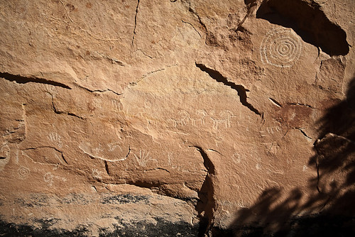
Spiral + other glyphs by Deadeye008, on Flickr
The next place we visited was Manarch's Cave. Here are some shots of it and the surrounding rock art.
Monarch's Cave by Deadeye008, on Flickr
Monarch's Cave by Deadeye008, on Flickr
Negative print by Deadeye008, on Flickr
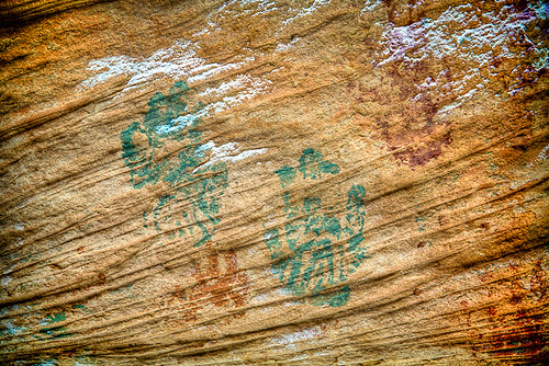
Green hands by Deadeye008, on Flickr
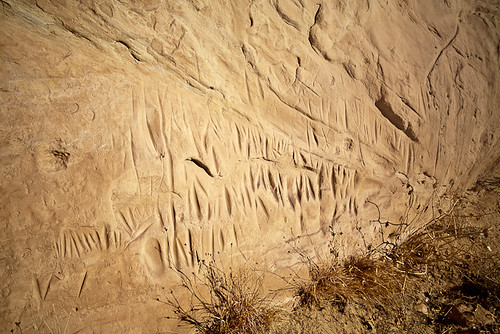
Sharpening area? near Monarch's cave by Deadeye008, on Flickr
This is a picture of a knot in the doorway entering Monarch's Cave. This knot has been tied for over 700yrs!
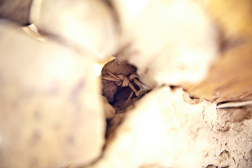
Knot @ Monarch's Cave by Deadeye008, on Flickr
Last is a picture I took at dawn in Butler Wash.
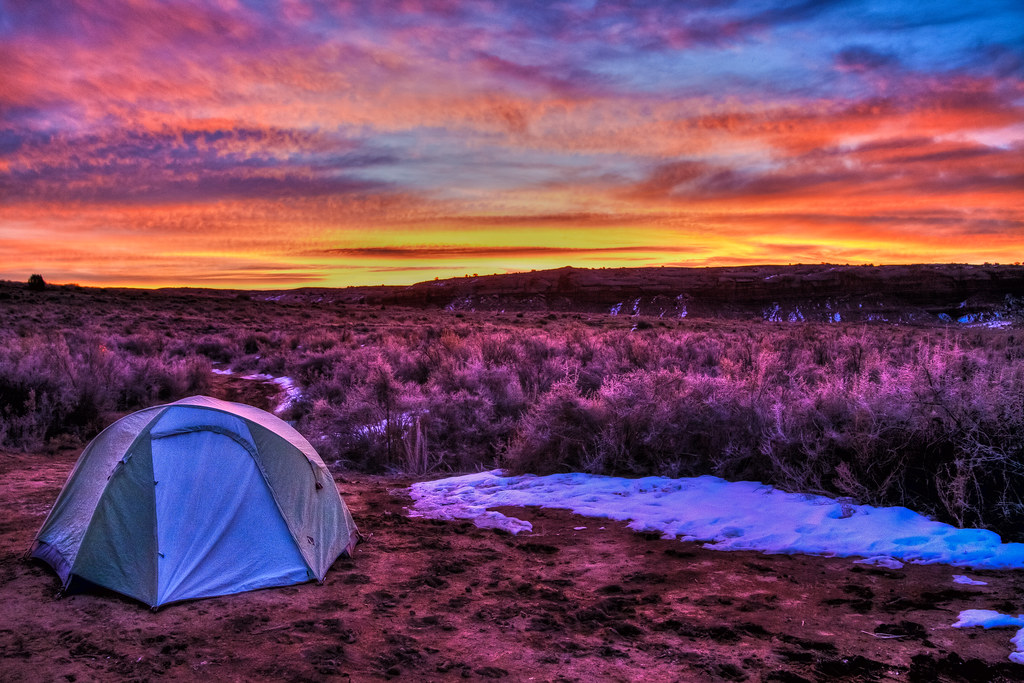
Sunrise in Butler Wash by Deadeye008, on Flickr
A buddy and I went down to the Cedar Mesa Area for a few days this past weekend. We ended up hitting upper South Mule Canyon and a few places along Comb Ridge. Weather was excellent with highs right around 50 and nightly lows in the teens. The Friday we got there we hit upper South Mule Canyon first. We didn't want to have to hike all the way up and back from the mouth of the canyon so we entered up higher. It ws a heck of a scramble down in the canyon because of all the ice. We were literally sliding down the canyon side in some spots. Wish I would have brought my crampons! On the way out we actually found some rock cairns when we were about half way up the side of the canyon and followed those out. We had to find a different route out since we were unable to climb up the area we had entered because of the ice. Here are some pics of the ruins we visited down there.
I have seen this ruin called Wall Ruin and Cliffhanger Ruin. Not sure of the official name. Here it is as seen from the rim of the canyon. Notice the 2 poles sticking out of the cliff face above the structure on the right. There is part of this structure which appears to be a room of sorts just to the right of the upper pole. It is inaccessable though. Makes me wonder if the original structure was 3 stories tall or if there was some other way to access that upper room via a ladder or something.
Upper South Mule Canyon Ruin by Deadeye008, on Flickr
2 more pics of the site. First one is below the site and second one is up on the platform of the site. Notice how the wall of the structure aligns perfectly with the cliff edge.
View from below by Deadeye008, on Flickr
View South from up on the platform by Deadeye008, on Flickr
The next few pics are of the structure on the left. Notice the hand/finger prints on the wall and also the completely intact roof. I believe the hole in the roof was the access point to the upper room of the structure when it was more complete.
Lower portal by Deadeye008, on Flickr
Roof access by Deadeye008, on Flickr
Interior wall by Deadeye008, on Flickr
On platform looking North by Deadeye008, on Flickr
This shot is looking at the structure on the right. The wall on the right side of this pic is the wall that sits flush with the cliff edge. Notice the T shaped door and the stone door cover sitting beside it. The stone door was split in half and was used to cover an inner chamberI believe. Also at the end of the corridor, on the left side there is another T shaped door that leads to more chambers that are located inside the cliff face. The second shot is looking inside the T shaped door that leads into the cliff face. Notice the 2 stone doors covering the entrances to the two visible entrances. There is also another chamber door above the chamber on the right side of the pic. This place was one of the best preserved site I have been to. Simply amazing!
"T" doorway by Deadeye008, on Flickr
Interior room by Deadeye008, on Flickr
Here is a shot of a ruin just down canyon from the previous ruin. Also a shot of a nearby grainery and some very faint glyphs.
Looking up by Deadeye008, on Flickr
Grainary in Upper South Mule Canyon by Deadeye008, on Flickr
Spiral + other glyphs by Deadeye008, on Flickr
The next place we visited was Manarch's Cave. Here are some shots of it and the surrounding rock art.
Monarch's Cave by Deadeye008, on Flickr
Monarch's Cave by Deadeye008, on Flickr
Negative print by Deadeye008, on Flickr
Green hands by Deadeye008, on Flickr
Sharpening area? near Monarch's cave by Deadeye008, on Flickr
This is a picture of a knot in the doorway entering Monarch's Cave. This knot has been tied for over 700yrs!
Knot @ Monarch's Cave by Deadeye008, on Flickr
Last is a picture I took at dawn in Butler Wash.
Sunrise in Butler Wash by Deadeye008, on Flickr
