- Joined
- May 5, 2012
- Messages
- 1,731
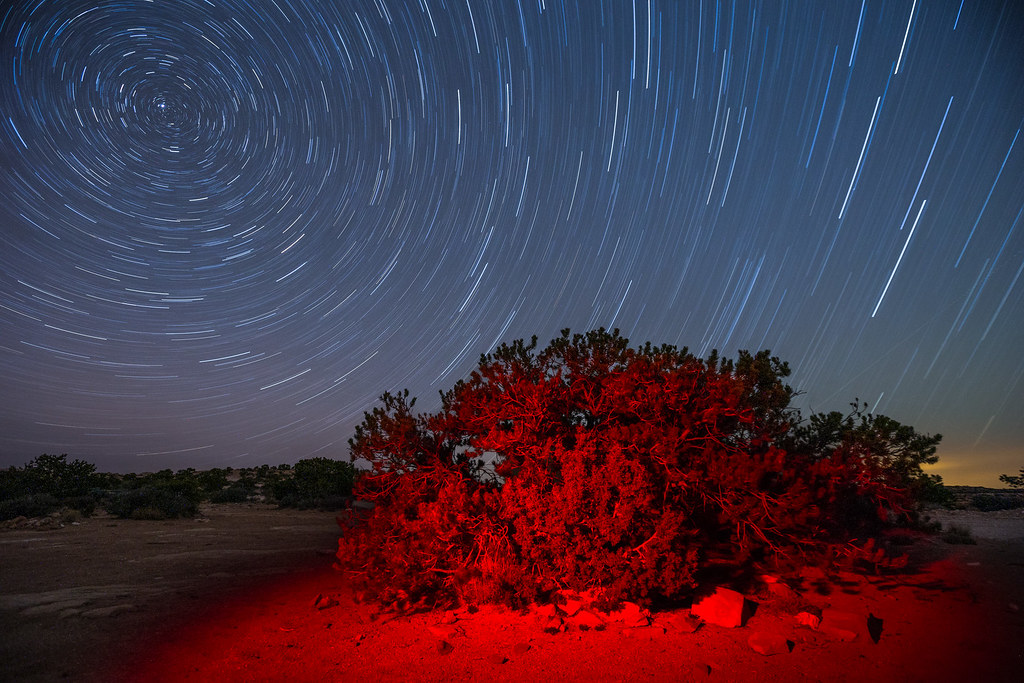
Taking care of unfinished business — weather had spoiled plans for a winter visit to Cedar Mesa at the conclusion of my wagon trip around the White Rim. So when temperatures started creeping up from their freezing lows in February, I set out south once again.

Finding a camping spot along the Colorado isn't quite as challenging during the offseason. I rolled into Kings Bottom at about 1 a.m. On the short walk to the restroom cold gusts cut through my clothing. They carried away any intention I had for taking night sky shots. Into the bedroll I went in the back of the car.
I woke before dawn to continue the drive south. The river slid along in silence under the waning moon.

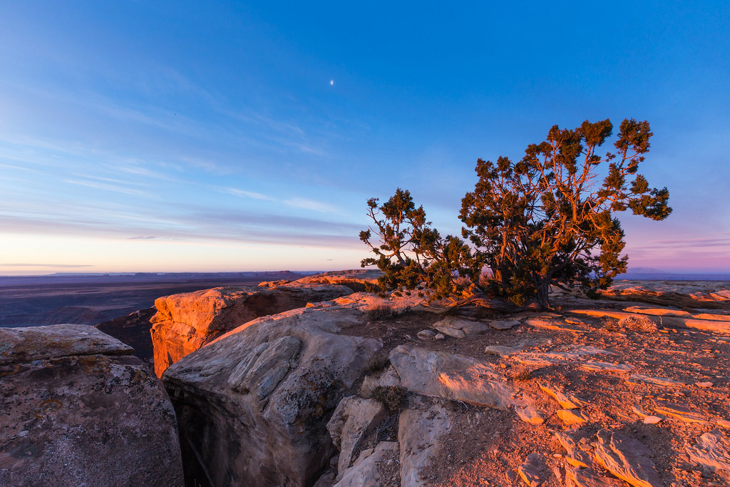
Scooting out of the campground before sunrise, I encountered some other early risers.

The La Sals were still coated in a suit of winter snow so early in the season.

My apologies to the BLM ranger who passed by me on the way into Moab. He wouldn't find a fee envelope from me at the campground. I didn't feel compelled to pay for a site that I inhabited for all of six hours and never set a tent pole down upon.
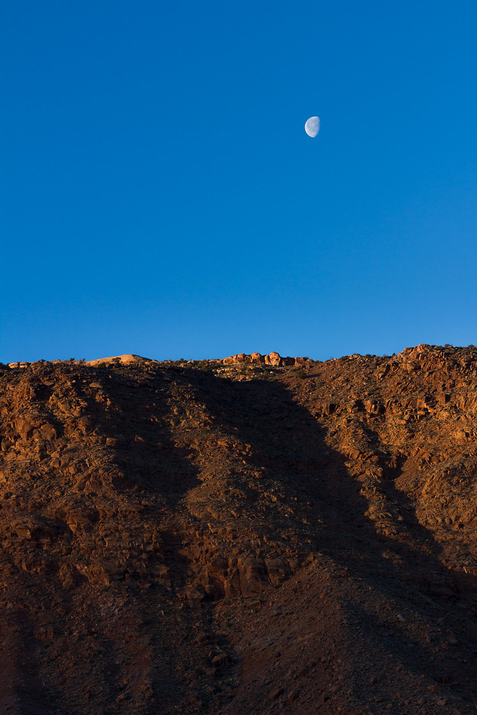 Moab Moonrise by ashergrey, on Flickr
The Needles called my name on the drive south but I had other intentions. Dry snow sat in little drifts across Highway 191 on Peters Canyon on the way to Monticello, a reminder that even in the desert winter has its way.
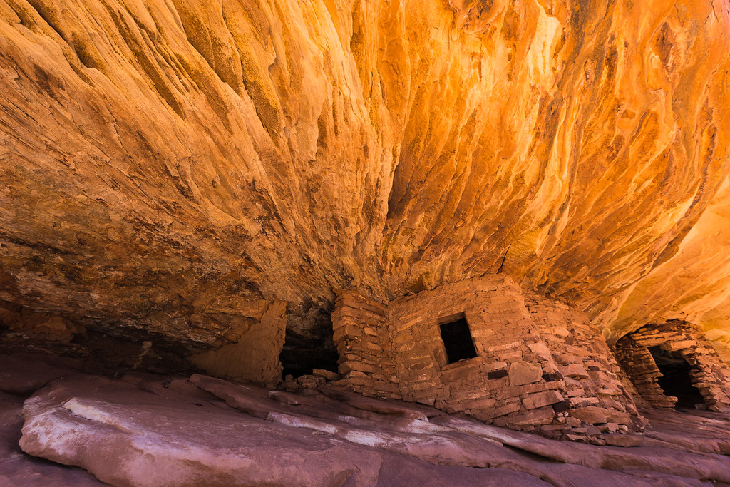 House on Fire by ashergrey, on Flickr
Made the first stop at mid-morning. Another photographer was at work when I ambled up to House on Fire. His reflectors fluttered in the wind as he scuttled between them and several off-camera flashes. I stood aside, giving him the consideration of first-come, first served. We chatted a bit about gear while he shot his fill. He talked trash on his 6D, saying it sucked at autofocusing.
"Funny, mine's been fine so far."
When he at last started breaking down his elaborate set-up, I stepped in and started shooting. There were a couple of token frames from the tripod, then I went hand-held. He watched me with a curious eye as I went flat on my back, pointing the camera up and into the ruin.
"Not going for the typical composition, are you?"
"Nah," I said. Why would I want the exact same shot as everyone else? Joke's on me though, I'm sure. He'll probably be shooting magazine covers while I'm still happy for 100+ views on Flickr.
The photographer and I walked back to the trailhead together, discussing techniques and equipment along the way.
At one point I spread out a paper map to give him a better sense of the local landmarks. He really had no idea where anything else on the mesa sat, nor how to get there. I started telling him about cool places to go, then thought better of leading him into trouble with his rental sedan.
He was a really nice guy though and happily offered to give me a lighter when I mentioned I'd forgot to bring one. In exchange, I allowed him to make a call on my Skycall Satellite phone. Turns out he'd left his credit card at a motel in Moab and needed to make sure a friend could get it for him. Considering he was from Maryland and out for an entire month, being without finances seemed a serious problem.
We parted ways as I headed deeper into Cedar Mesa. House on Fire's a bit cliche but it was a nice warm-up for the rest of the trip. I'd have much better shots to come.

Next up: Moon House.
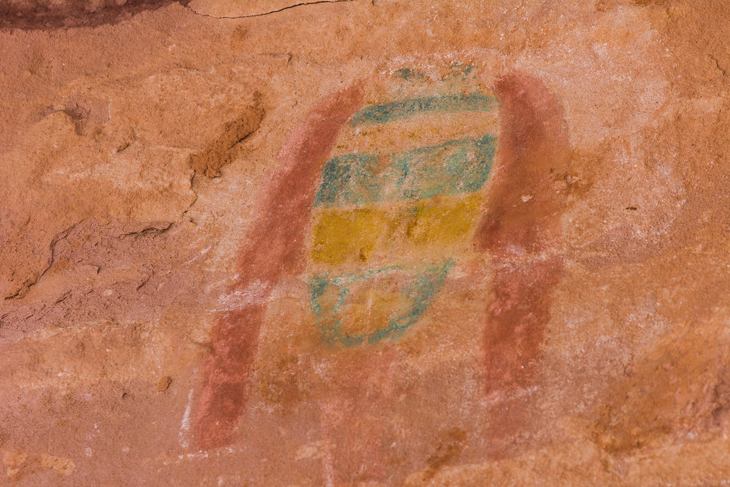
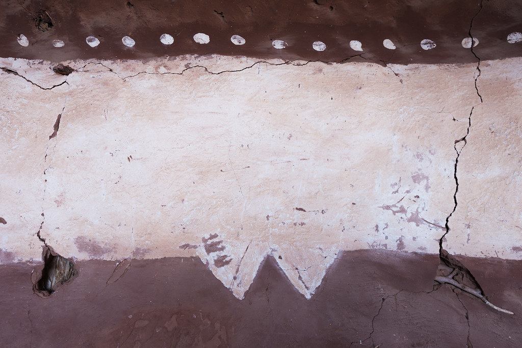 Moon House Painting by ashergrey, on Flickr

March starts the restrictive spring permit season on Cedar Mesa and Moon House has even more limits than most of the other areas.

I'd hoped to avoid the hassle by slipping in at the end of the more permissive winter season. This strategy did not disappoint.

The ammo-can register at Moon House showed only one other visitor so far in 2014 — the BLM site steward.

Certainly others had come and gone without signing the register, but it still felt good to be ahead of the crowds.

The afternoon stretched on as I wandered up and down the broad south-facing ledge of McCloyd Canyon.

I'm sure it's a fascinating place to visit even when others are around but I can attest to the fact that having it all to one's self feels practically spiritual.

Sitting on the rock, listening to the wind as the winter sun warms clammy skin and hunger gnaws at the stomach helped me identify in some small way with the people who once called these canyons home.

The daylight started to fail as I climbed back out of McCloyd.
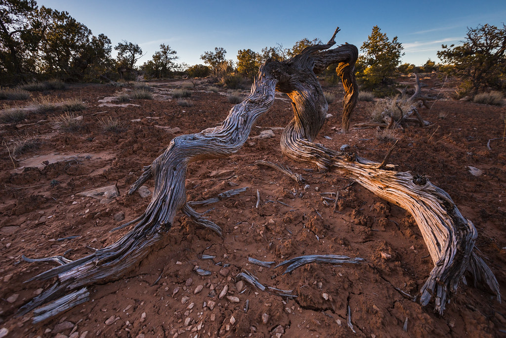 Twisted by ashergrey, on Flickr

I drove back to 261 under cover of darkness. A choice presented itself at the pavement. Where to spend the night? I planned to hike the Sheiks/Bullet loop on Friday so a logical choice seemed heading that direction. But the idea of shooting sunrise at Muley Point also proved tempting.
 Red Cedar by ashergrey, on Flickr
Muley won out, and it's a good thing.
Stars were out when I arrived. A surprising number of lights also shone from the horizon looking into the Mexican Hat and the Navajo Nation. The 1,000-foot drop down to the Johns Canyon road was invisible under the dark of night.
I settled into the back of the car again.
The moon brought me awake shortly before sunrise. Even without my glasses I could see out the window that the sunrise had potential. Dressing in a frantic tangle of twisted cloth, I spilled out of the car into sub-freezing temperatures and shivered my way along the cliff edge.
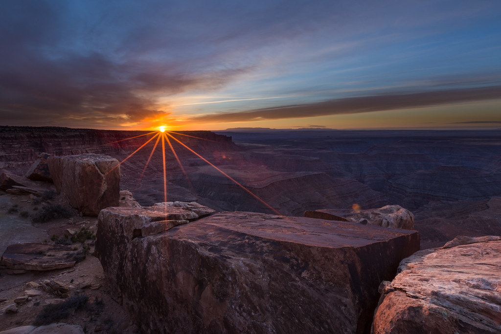 San Juan Sunrise by ashergrey, on Flickr
Golden light poured over the landscape as I fumbled with two cameras, trying to capture as much of it as possible.
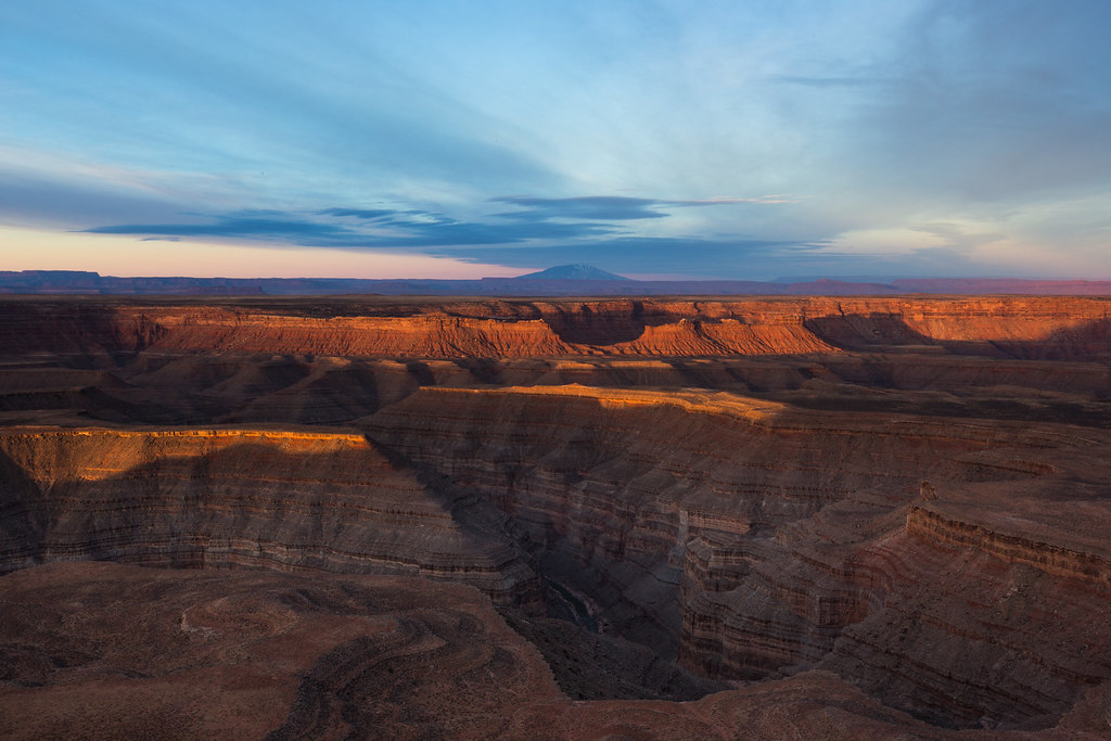 Gorge of the San Juan by ashergrey, on Flickr
I had the 6D with ultra-wide angle on the tripod while hand-holding the T2i with tele. The cold wind burned my hands. I kept pushing them into gloves, only to bite the gloves off again in order to tweak settings to the changing light.
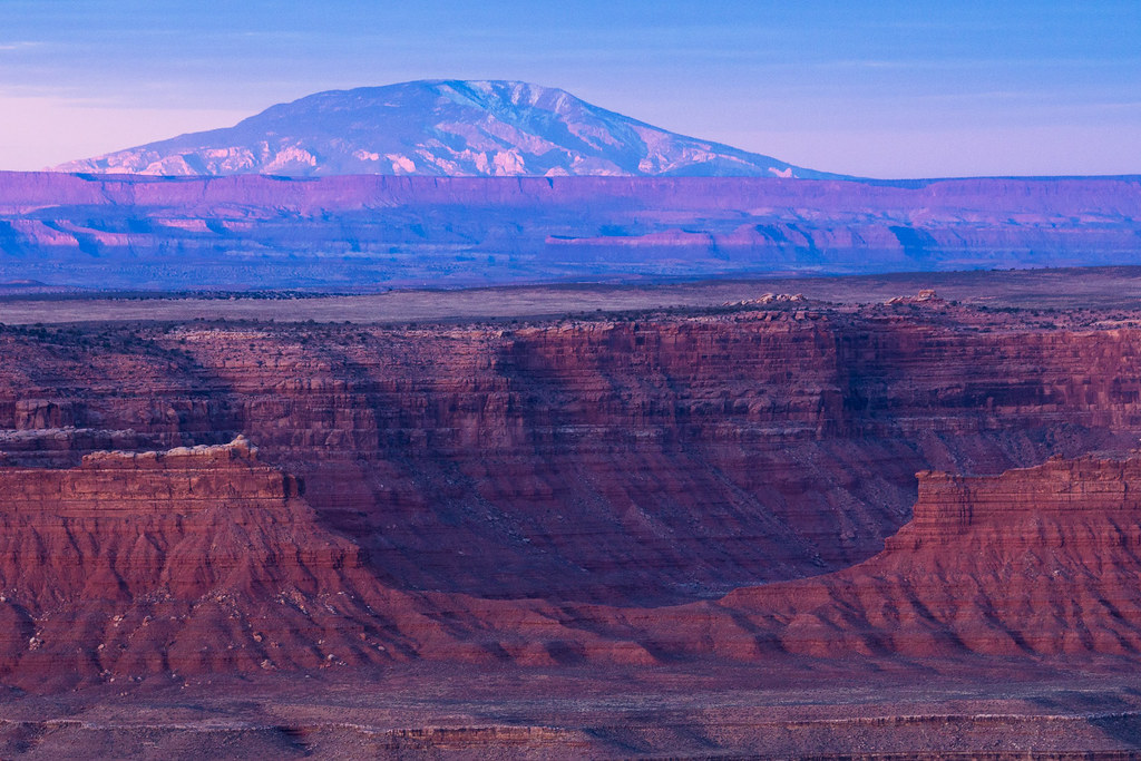 Compression by ashergrey, on Flickr
By the time the light started to flatten about 15 minutes later I could no longer flex my fingers. Still, the pictures captured seemed worth the pain.
 Muley Point Cedar by ashergrey, on Flickr
The sun went behind clouds and the landscaped turned gray.

Onward to the north, where I found a truck with nice camper shell sitting at the Bullet Canyon trailhead. My old wagon rattled by, breaking the morning stillness. I arrived at the Sheik trailhead to find it deserted. The registered showed it had seen only light visitation so far in the year.
Here I debated my options — try to day hike the whole loop or load up for an overnight in Grand Gulch. The prospect of lugging extra gear didn't seem all too inviting, but I'd have to push the pace in order to complete the circuit with the shortened winter daylight.
Light and fast won out over slow and heavy. Before departing I tanked up on water, then stuffed a liter Nalgene bottle into my pack. Normally I carry way too much water weight when hiking in the desert as a means of insurance. Here, I rationalized that I could depend on refilling at Green Mask spring.

Not knowing exactly what to expect in the dryfalls, I was happy to find them mostly ice-free.

The steep descent in Sheiks made my knees really appreciate this well-known view into Grand Gulch.

That meant Green Mask was just around the corner.
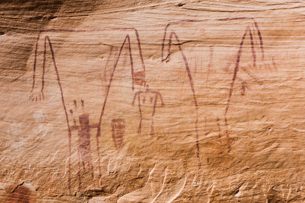
 Green Mask by ashergrey, on Flickr
Green Mask impressed me more than perhaps any other rock art panel I've ever visited. It's not the most stunning or even the best-preserved set of markings but there's a certain mystical allure to it.

It's plain to see why ancient peoples came to this spot — reliable water. What an amazing site it must have been before being looted and excavated.

People lived and chronicled their experiences here.
 Breech by ashergrey, on Flickr
I drank up and refilled my water reserves at Green Mask before pushing into Grand Gulch proper. Then, a short way down canyon, I turned up Bullet.

Around Jailhouse I started hearing voices. An adult couple were clearing out from the ruin as I arrived. We exchanged hellos. They'd come down Bullet and were turning back.

I told them I'd come down Sheiks. They mentioned considering that option but deciding against it.


The afternoon light felt pretty harsh so I tried to stick to the shadows.

Then a short hop over to Perfect Kiva. That site felt pretty sanitized to me so I hardly shot anything there.

The afternoon stretched on as I pounded out the miles in Bullet. This was my inaugural hike in a new set of hiking shoes and my toes were starting to feel it.
My water and food expired. When I reached this little icefall I briefly tried gathering the dripping water before growing impatient and pushing on up canyon.
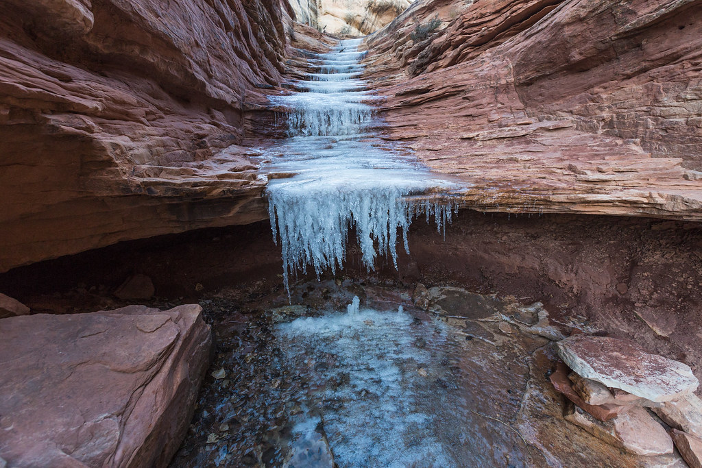 Bullet Canyon Icefall by ashergrey, on Flickr
The sunlight failed as I exited the canyon. Out came the headlamp. At the Bullet Canyon trailhead I learned the couple I'd met earlier down at Jailhouse were the owners of the camper that I'd seen that morning. I'd nipped at their heels on the hike out and they were just starting dinner as I walked past their camp.
We chatted a bit more. They offered a beer and I politely requested water instead. The dusk grew deeper and I felt pressure to get moving. The couple apologized for not being able to drive me back to my car. My exhausted legs secretly wished that they would have done just that.
I started the three-mile push to my car. The temperature plunged, forcing me to pull out my insulation layers. Before long I'd sweated through them. My best efforts to ration out the water offered to me at the trailhead failed. The empty plastic bottle bulged my pocket.
Fogged breath floated in the beam of the headlamp. My aching feet protested each step on the road. Daydreams of warm soup and sweet cookies at the car filled my head. How much father? I dared not check the GPS for fear it would be a good distance away still. But a nagging doubt told me I should have reached an intersection.
Then, glancing up at the sky, I noticed something odd. Constellations were not where the should have been. The road I was walking headed north. So why is Polaris over there?
"Oh no. No, no, no."
Fishing my phone from its pocket, I tapped open the GPS app. Its track confirmed my fear — I'd taken the wrong road out of the Bullet Canyon trailhead in the dark and had walked east toward the highway. A mile the wrong way meant two just to get back to the point where I'd made the mistake. That meant three miles back to my car was actually five.
With no one to blame but myself and no energy left to fuel the rage, my feet turned 180 degrees and started back the way they'd come.
Walking was an act of will. Parched, freezing and famished, I finally arrived back at the car. The stunning blanket of stars overhead should have ignited my imagination. Instead, I hardly noticed them. With the car's heater blasting over the sound of a rumbly idle, I stripped out of sweat-soaked clothing. The 20-mile day had sapped my will to even cook up that warm soup I'd dreamed of on the long walk. I ate a handful of corn chips, felt sick and decided not to eat any more.
Tired muscles tightened through the night. On Saturday morning I woke early for an obligation, stretching and cursing the cold. Then, with one hand un-gloved, I placed an early morning call to the KSL Outdoors Radio show.
[PARSEHTML]<audio controls><source src="https://dl.dropboxusercontent.com/u/3847512/Cedar_Mesa_call.mp3">Your browser does not support HTML5.</audio>[/PARSEHTML]I had two days free but barely energy for one. Still, I'd come all this way and wanted to see some some. So I made a stop at the Citadel. Photography conditions were terrible with clear skies and intense sun.
 Citadel in Winter Sun by ashergrey, on Flickr
My tired legs made scrambling around on slickrock feel more treacherous than it should have.

Rather than return the way I'd come, I opted for the scenic route through Hanksville.
 Highway 95 by ashergrey, on Flickr
That meant a glimpse of the sad state of affairs at Hite. The Colorado was running in its channel below the SR 95 bridge and the ramp at Hite ended in a mud flat. Time will tell if Lake Powell returns to this low level again in the near future.
 Hite and Dry by ashergrey, on Flickr
The sun set as I arrived back in Salt Lake, reminding me that the sublimity of such scenes is enhanced by the solitude of the desert. That feeling I described at Moon House of connection with people long-since dead… this is its opposite.

Featured image for home page:

Finding a camping spot along the Colorado isn't quite as challenging during the offseason. I rolled into Kings Bottom at about 1 a.m. On the short walk to the restroom cold gusts cut through my clothing. They carried away any intention I had for taking night sky shots. Into the bedroll I went in the back of the car.
I woke before dawn to continue the drive south. The river slid along in silence under the waning moon.
Scooting out of the campground before sunrise, I encountered some other early risers.
The La Sals were still coated in a suit of winter snow so early in the season.
My apologies to the BLM ranger who passed by me on the way into Moab. He wouldn't find a fee envelope from me at the campground. I didn't feel compelled to pay for a site that I inhabited for all of six hours and never set a tent pole down upon.
Moab Moonrise by ashergrey, on FlickrThe Needles called my name on the drive south but I had other intentions. Dry snow sat in little drifts across Highway 191 on Peters Canyon on the way to Monticello, a reminder that even in the desert winter has its way.
House on Fire by ashergrey, on FlickrMade the first stop at mid-morning. Another photographer was at work when I ambled up to House on Fire. His reflectors fluttered in the wind as he scuttled between them and several off-camera flashes. I stood aside, giving him the consideration of first-come, first served. We chatted a bit about gear while he shot his fill. He talked trash on his 6D, saying it sucked at autofocusing.
"Funny, mine's been fine so far."
When he at last started breaking down his elaborate set-up, I stepped in and started shooting. There were a couple of token frames from the tripod, then I went hand-held. He watched me with a curious eye as I went flat on my back, pointing the camera up and into the ruin.
"Not going for the typical composition, are you?"
"Nah," I said. Why would I want the exact same shot as everyone else? Joke's on me though, I'm sure. He'll probably be shooting magazine covers while I'm still happy for 100+ views on Flickr.
The photographer and I walked back to the trailhead together, discussing techniques and equipment along the way.
At one point I spread out a paper map to give him a better sense of the local landmarks. He really had no idea where anything else on the mesa sat, nor how to get there. I started telling him about cool places to go, then thought better of leading him into trouble with his rental sedan.
He was a really nice guy though and happily offered to give me a lighter when I mentioned I'd forgot to bring one. In exchange, I allowed him to make a call on my Skycall Satellite phone. Turns out he'd left his credit card at a motel in Moab and needed to make sure a friend could get it for him. Considering he was from Maryland and out for an entire month, being without finances seemed a serious problem.
We parted ways as I headed deeper into Cedar Mesa. House on Fire's a bit cliche but it was a nice warm-up for the rest of the trip. I'd have much better shots to come.
Next up: Moon House.
Moon House Painting by ashergrey, on FlickrMarch starts the restrictive spring permit season on Cedar Mesa and Moon House has even more limits than most of the other areas.
I'd hoped to avoid the hassle by slipping in at the end of the more permissive winter season. This strategy did not disappoint.
The ammo-can register at Moon House showed only one other visitor so far in 2014 — the BLM site steward.
Certainly others had come and gone without signing the register, but it still felt good to be ahead of the crowds.
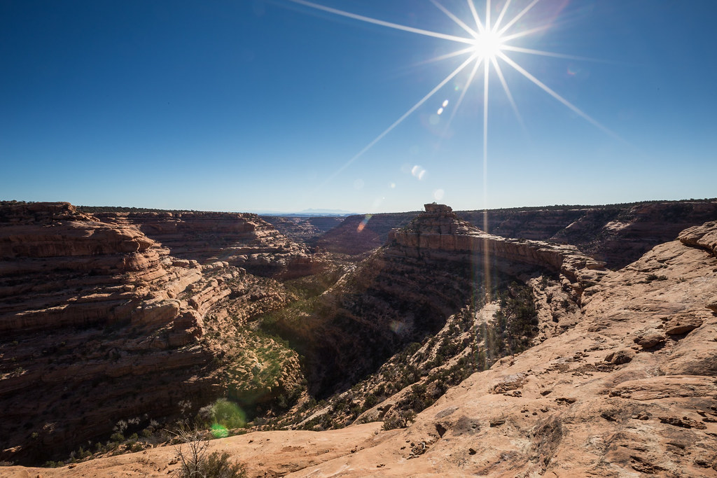
The afternoon stretched on as I wandered up and down the broad south-facing ledge of McCloyd Canyon.
I'm sure it's a fascinating place to visit even when others are around but I can attest to the fact that having it all to one's self feels practically spiritual.
Sitting on the rock, listening to the wind as the winter sun warms clammy skin and hunger gnaws at the stomach helped me identify in some small way with the people who once called these canyons home.
The daylight started to fail as I climbed back out of McCloyd.
Twisted by ashergrey, on FlickrI drove back to 261 under cover of darkness. A choice presented itself at the pavement. Where to spend the night? I planned to hike the Sheiks/Bullet loop on Friday so a logical choice seemed heading that direction. But the idea of shooting sunrise at Muley Point also proved tempting.
Red Cedar by ashergrey, on FlickrMuley won out, and it's a good thing.
Stars were out when I arrived. A surprising number of lights also shone from the horizon looking into the Mexican Hat and the Navajo Nation. The 1,000-foot drop down to the Johns Canyon road was invisible under the dark of night.
I settled into the back of the car again.
The moon brought me awake shortly before sunrise. Even without my glasses I could see out the window that the sunrise had potential. Dressing in a frantic tangle of twisted cloth, I spilled out of the car into sub-freezing temperatures and shivered my way along the cliff edge.
San Juan Sunrise by ashergrey, on FlickrGolden light poured over the landscape as I fumbled with two cameras, trying to capture as much of it as possible.
Gorge of the San Juan by ashergrey, on FlickrI had the 6D with ultra-wide angle on the tripod while hand-holding the T2i with tele. The cold wind burned my hands. I kept pushing them into gloves, only to bite the gloves off again in order to tweak settings to the changing light.
Compression by ashergrey, on FlickrBy the time the light started to flatten about 15 minutes later I could no longer flex my fingers. Still, the pictures captured seemed worth the pain.
Muley Point Cedar by ashergrey, on FlickrThe sun went behind clouds and the landscaped turned gray.
Onward to the north, where I found a truck with nice camper shell sitting at the Bullet Canyon trailhead. My old wagon rattled by, breaking the morning stillness. I arrived at the Sheik trailhead to find it deserted. The registered showed it had seen only light visitation so far in the year.
Here I debated my options — try to day hike the whole loop or load up for an overnight in Grand Gulch. The prospect of lugging extra gear didn't seem all too inviting, but I'd have to push the pace in order to complete the circuit with the shortened winter daylight.
Light and fast won out over slow and heavy. Before departing I tanked up on water, then stuffed a liter Nalgene bottle into my pack. Normally I carry way too much water weight when hiking in the desert as a means of insurance. Here, I rationalized that I could depend on refilling at Green Mask spring.
Not knowing exactly what to expect in the dryfalls, I was happy to find them mostly ice-free.
The steep descent in Sheiks made my knees really appreciate this well-known view into Grand Gulch.
That meant Green Mask was just around the corner.
Green Mask by ashergrey, on FlickrGreen Mask impressed me more than perhaps any other rock art panel I've ever visited. It's not the most stunning or even the best-preserved set of markings but there's a certain mystical allure to it.
It's plain to see why ancient peoples came to this spot — reliable water. What an amazing site it must have been before being looted and excavated.
People lived and chronicled their experiences here.
Breech by ashergrey, on FlickrI drank up and refilled my water reserves at Green Mask before pushing into Grand Gulch proper. Then, a short way down canyon, I turned up Bullet.
Around Jailhouse I started hearing voices. An adult couple were clearing out from the ruin as I arrived. We exchanged hellos. They'd come down Bullet and were turning back.
I told them I'd come down Sheiks. They mentioned considering that option but deciding against it.
The afternoon light felt pretty harsh so I tried to stick to the shadows.
Then a short hop over to Perfect Kiva. That site felt pretty sanitized to me so I hardly shot anything there.
The afternoon stretched on as I pounded out the miles in Bullet. This was my inaugural hike in a new set of hiking shoes and my toes were starting to feel it.
My water and food expired. When I reached this little icefall I briefly tried gathering the dripping water before growing impatient and pushing on up canyon.
Bullet Canyon Icefall by ashergrey, on FlickrThe sunlight failed as I exited the canyon. Out came the headlamp. At the Bullet Canyon trailhead I learned the couple I'd met earlier down at Jailhouse were the owners of the camper that I'd seen that morning. I'd nipped at their heels on the hike out and they were just starting dinner as I walked past their camp.
We chatted a bit more. They offered a beer and I politely requested water instead. The dusk grew deeper and I felt pressure to get moving. The couple apologized for not being able to drive me back to my car. My exhausted legs secretly wished that they would have done just that.
I started the three-mile push to my car. The temperature plunged, forcing me to pull out my insulation layers. Before long I'd sweated through them. My best efforts to ration out the water offered to me at the trailhead failed. The empty plastic bottle bulged my pocket.
Fogged breath floated in the beam of the headlamp. My aching feet protested each step on the road. Daydreams of warm soup and sweet cookies at the car filled my head. How much father? I dared not check the GPS for fear it would be a good distance away still. But a nagging doubt told me I should have reached an intersection.
Then, glancing up at the sky, I noticed something odd. Constellations were not where the should have been. The road I was walking headed north. So why is Polaris over there?
"Oh no. No, no, no."
Fishing my phone from its pocket, I tapped open the GPS app. Its track confirmed my fear — I'd taken the wrong road out of the Bullet Canyon trailhead in the dark and had walked east toward the highway. A mile the wrong way meant two just to get back to the point where I'd made the mistake. That meant three miles back to my car was actually five.
With no one to blame but myself and no energy left to fuel the rage, my feet turned 180 degrees and started back the way they'd come.
Walking was an act of will. Parched, freezing and famished, I finally arrived back at the car. The stunning blanket of stars overhead should have ignited my imagination. Instead, I hardly noticed them. With the car's heater blasting over the sound of a rumbly idle, I stripped out of sweat-soaked clothing. The 20-mile day had sapped my will to even cook up that warm soup I'd dreamed of on the long walk. I ate a handful of corn chips, felt sick and decided not to eat any more.
Tired muscles tightened through the night. On Saturday morning I woke early for an obligation, stretching and cursing the cold. Then, with one hand un-gloved, I placed an early morning call to the KSL Outdoors Radio show.
[PARSEHTML]<audio controls><source src="https://dl.dropboxusercontent.com/u/3847512/Cedar_Mesa_call.mp3">Your browser does not support HTML5.</audio>[/PARSEHTML]I had two days free but barely energy for one. Still, I'd come all this way and wanted to see some some. So I made a stop at the Citadel. Photography conditions were terrible with clear skies and intense sun.
Citadel in Winter Sun by ashergrey, on FlickrMy tired legs made scrambling around on slickrock feel more treacherous than it should have.
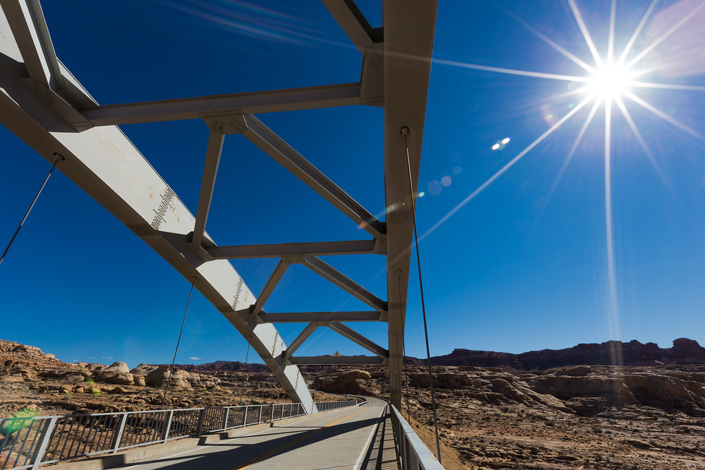
Rather than return the way I'd come, I opted for the scenic route through Hanksville.
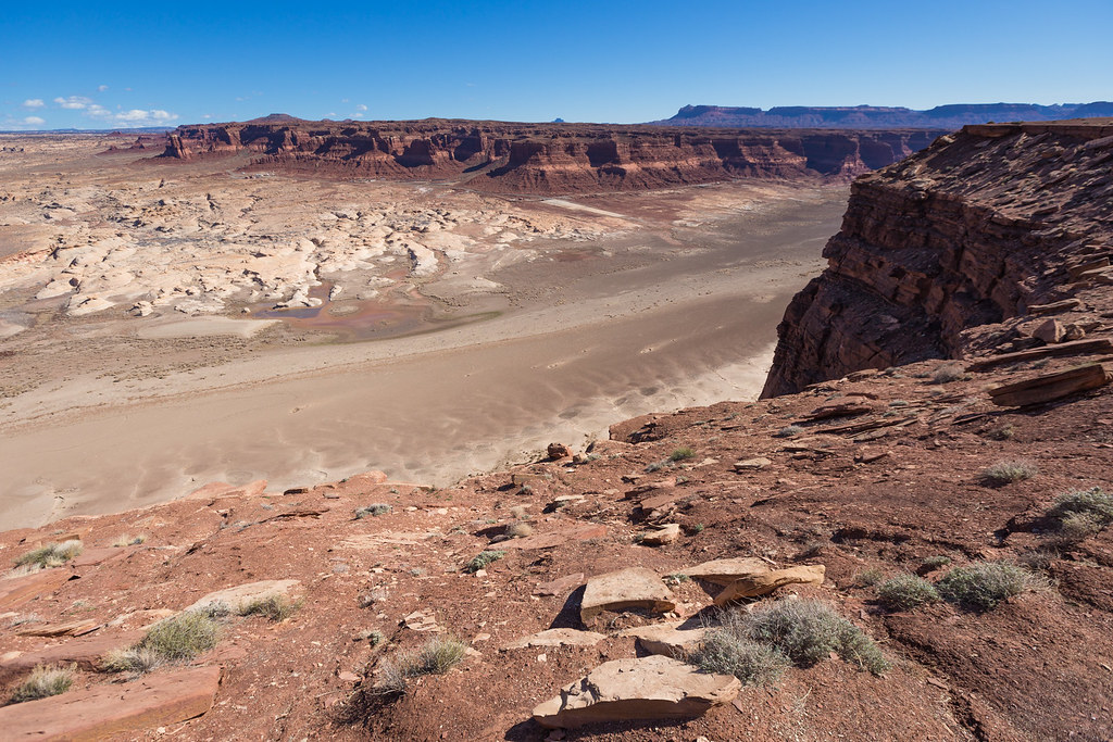
Highway 95 by ashergrey, on FlickrThat meant a glimpse of the sad state of affairs at Hite. The Colorado was running in its channel below the SR 95 bridge and the ramp at Hite ended in a mud flat. Time will tell if Lake Powell returns to this low level again in the near future.
Hite and Dry by ashergrey, on FlickrThe sun set as I arrived back in Salt Lake, reminding me that the sublimity of such scenes is enhanced by the solitude of the desert. That feeling I described at Moon House of connection with people long-since dead… this is its opposite.
Featured image for home page: