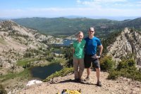
- Joined
- Aug 9, 2007
- Messages
- 12,956
Here's another trip report from my summer of hiking for a living. Whenever I'd plan out my trails, I would try to plan hikes where I could knock out more than one trail guide at a time. This one was a perfect one for that, but was also one of the worst reminders of the year that my knee was kaput.
The route started in Albion Basin in Little Cottonwood Canyon at the Catherine Pass trailhead. From there I hiked up to Catherine Pass, then up to Sunset Peak, then down through the Brighton Lakes where Audra picked me up. A great little point-to-point if you have someone who doesn't mind dropping you off and picking you up.
Not 5 minutes after getting dropped off, and only a short distance up the trail, it started to rain. I took shelter for a few and continued on over the wet rocks. The wildflowers were looking awesome. This was on August 10th.
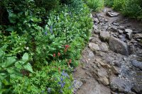
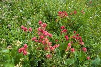
As I climbed toward Catherin Pass, the clouds broke and offered some fine views.
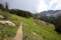
My only complaint was all the ski resort junk strewn about the otherwise beautiful area. I'm specifically miffed with Alta for painting a bunch of their ski lift poles white rather than the green that most resorts do. I mean, really Alta?!
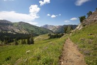
Approaching Catherine Pass
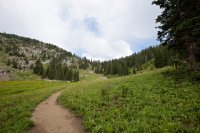
The trail sign on top of Catherine Pass. I met a couple of ladies who were wondering how much farther it was to Lake Catherine. They had come up from the Brighton Lakes side of the pass so I kindly pointed out that Lake Catherine was right below them and they had already passed it. They were totally let down by this news as someone along the trail had told them the view from there was going to be fantastic. In my opinion, the view from Catherine Pass is pretty darn good, but to each their own, I guess.
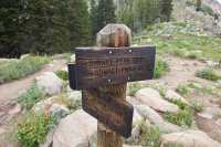
I wasn't sure yet if I was going to tie Sunset Peak into the route. My knee had been problematic and the weather was iffy, so I sat down and took a break and thought it over. I knew it was only about a third of a mile, but it looked so far away.
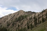
But I went for it anyway. This was definitely my favorite part of the hike.
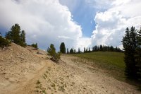
The trail wraps around the backside of the small peak before Sunset before traversing the ridge to Sunset Peak.
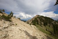
Looking back at Catherine Pass along the way.
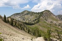
I loved the final stretch of trail to the peak. Narrow, steep and great views. Good stuff.
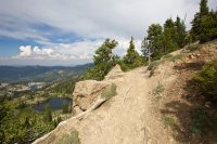
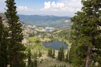
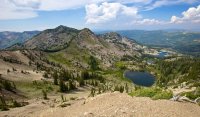
All three of the Brighton Lakes as seen from the top of Sunset Peak.
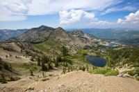
Looking back at the route from Catherine Pass to Sunset Peak.
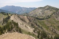
After a quick break on the peak, I raced back down toward Brighton Lakes making quick stops at each of them.
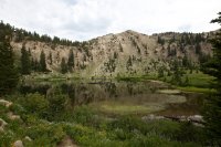
Lake Mary was definitely the most interesting of the three.
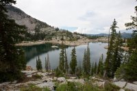
Sadly she isn't all natural though.
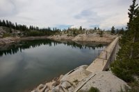
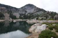
I'd seen a fair amount of people, but nothing like I saw from Lake Mary on down to Brighton Resort. Lake Mary itself was crawling with people swimming and cliff jumping. Pretty ridiculous that even on a busy Sunday in August, there are no resources allocated to ticketing those rule breaking asshats. For those that don't know, swimming is strictly forbidden in the SLC watershed lakes like this, but it seems to be rarely enforced. You're not allowed to bring your pup on the trail either, even if you pick up after them.
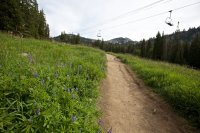
The final stretch runs down through the slopes at Brighton. Pretty, but I like my mountains sans-ski clutter. This was definitely amongst my favorite 'work hikes' this summer, but I think I'll go back to leaving the Wasatch for the masses next year.
Featured image for home page:
The route started in Albion Basin in Little Cottonwood Canyon at the Catherine Pass trailhead. From there I hiked up to Catherine Pass, then up to Sunset Peak, then down through the Brighton Lakes where Audra picked me up. A great little point-to-point if you have someone who doesn't mind dropping you off and picking you up.
Not 5 minutes after getting dropped off, and only a short distance up the trail, it started to rain. I took shelter for a few and continued on over the wet rocks. The wildflowers were looking awesome. This was on August 10th.


As I climbed toward Catherin Pass, the clouds broke and offered some fine views.

My only complaint was all the ski resort junk strewn about the otherwise beautiful area. I'm specifically miffed with Alta for painting a bunch of their ski lift poles white rather than the green that most resorts do. I mean, really Alta?!

Approaching Catherine Pass

The trail sign on top of Catherine Pass. I met a couple of ladies who were wondering how much farther it was to Lake Catherine. They had come up from the Brighton Lakes side of the pass so I kindly pointed out that Lake Catherine was right below them and they had already passed it. They were totally let down by this news as someone along the trail had told them the view from there was going to be fantastic. In my opinion, the view from Catherine Pass is pretty darn good, but to each their own, I guess.

I wasn't sure yet if I was going to tie Sunset Peak into the route. My knee had been problematic and the weather was iffy, so I sat down and took a break and thought it over. I knew it was only about a third of a mile, but it looked so far away.

But I went for it anyway. This was definitely my favorite part of the hike.

The trail wraps around the backside of the small peak before Sunset before traversing the ridge to Sunset Peak.

Looking back at Catherine Pass along the way.

I loved the final stretch of trail to the peak. Narrow, steep and great views. Good stuff.


All three of the Brighton Lakes as seen from the top of Sunset Peak.

Looking back at the route from Catherine Pass to Sunset Peak.

After a quick break on the peak, I raced back down toward Brighton Lakes making quick stops at each of them.

Lake Mary was definitely the most interesting of the three.

Sadly she isn't all natural though.

I'd seen a fair amount of people, but nothing like I saw from Lake Mary on down to Brighton Resort. Lake Mary itself was crawling with people swimming and cliff jumping. Pretty ridiculous that even on a busy Sunday in August, there are no resources allocated to ticketing those rule breaking asshats. For those that don't know, swimming is strictly forbidden in the SLC watershed lakes like this, but it seems to be rarely enforced. You're not allowed to bring your pup on the trail either, even if you pick up after them.

The final stretch runs down through the slopes at Brighton. Pretty, but I like my mountains sans-ski clutter. This was definitely amongst my favorite 'work hikes' this summer, but I think I'll go back to leaving the Wasatch for the masses next year.

Featured image for home page:


