- Joined
- May 5, 2012
- Messages
- 1,732
With the exception of Canyonlands' Maze District, Capitol Reef National Park provides the best solitude of any national park in Utah. The north and south sections of the park are accessible only by miles of dirt (or in some cases mud or sand) road.
The proposed and perhaps inevitable paving of the Burr Trail will likely cause ruinous changes to the south end within our lifetimes. But of all sections of Capitol Reef it's the north end, highlighted by Cathedral Valley, that holds the best promise of remaining pristine.
The Hartnett/Caineville loop route runs through 60 miles of high desert behind the Waterpocket Fold, through the Bentonite Hills, across the Hartnett and below the Caineville Reef. Along the way it crosses countless washes, traverses the Fremont River and passes by the seeps and spring that bring life to the arid badlands.

I headed down from Salt Lake City after work on a Friday night. My original plan had been to explore some of the canyons in the Middle Desert Wash area, but I realized about the time I was passing through Loa that my hiking shoes were still at home. The only footwear for this trip was a pair of slick-soled, low-rise Vans… not exactly the most sturdy or grippy shoes for scrambling over sandstone or trudging through sand. So this ended up being more of a car tour with light hiking, instead of an off-trail exploration.
Arriving at the Fremont River crossing on the Hartnett Road after dark, I popped the rear hatch on the wagon, rolled my bedding out and relaxed. The camera ran two hours of night sky exposures before the half moon came up and lit the landscape.
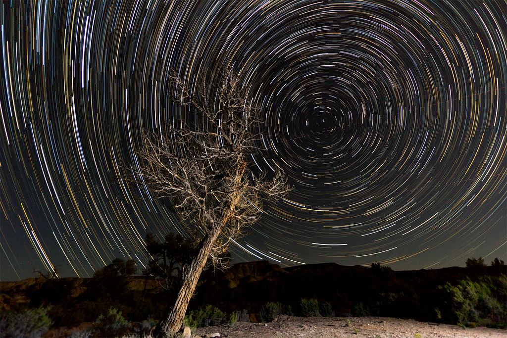
Trails Near the Hartnett Road by ashergrey, on Flickr
Temperatures overnight were mild. I woke with the sun on Saturday and went right to work on the crossing. Earlier high flows had washed away much of the sandy bank, leaving a two-foot step down to river level. The silty water was cold, about ankle-deep at the most shallow and calf-deep at its worst. No problem for the wagon.
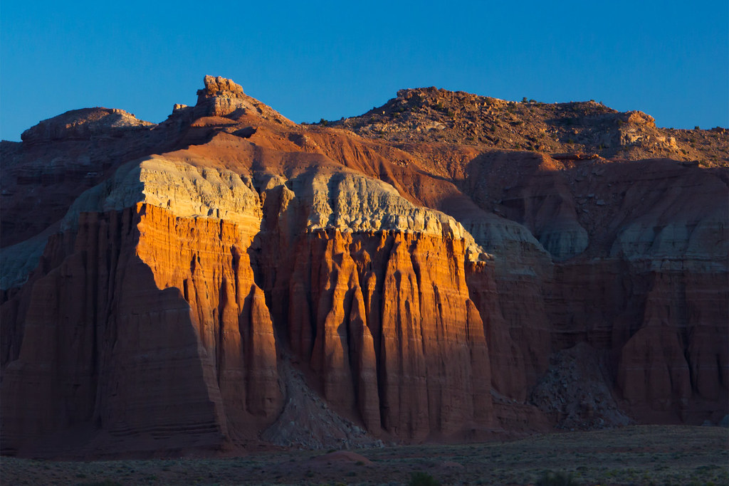
The morning light cast long shadows as I crawled into the Bentonite Hills, taking frequent photo breaks.
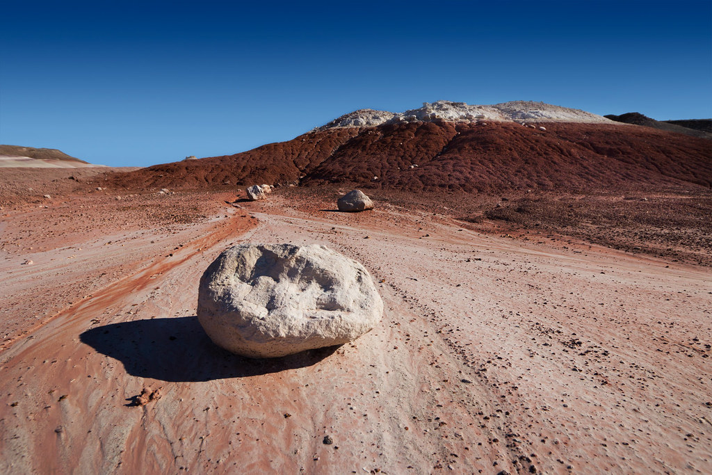
Bentonite by ashergrey, on Flickr


This old truck sits right off the road, next to a spring and buried to the axles in dried mud.


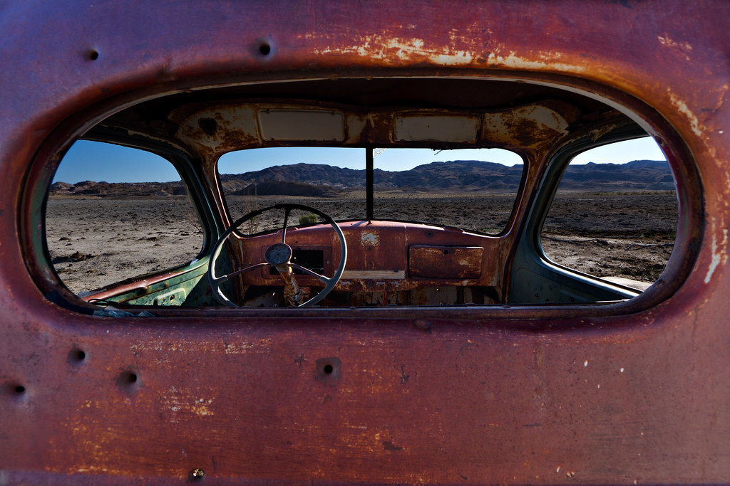
View from the Backseat by ashergrey, on Flickr
Continuing on, I arrived at the South Desert Overlook as those morning shadows were shortening. The heat of the day was building but not yet oppressive. Before heading down the trail into the South Desert, I chowed on some cereal. In my haste to get moving that morning, I'd skipped breakfast.
The highlight of the South Desert Overlook is visible right from the parking area — Jailhouse Rock sticks up from the desert floor. A lightly-traveled trail works its way down the cliffs to the lowlands, which are scattered with igneous rock washed down from the higher plateaus.
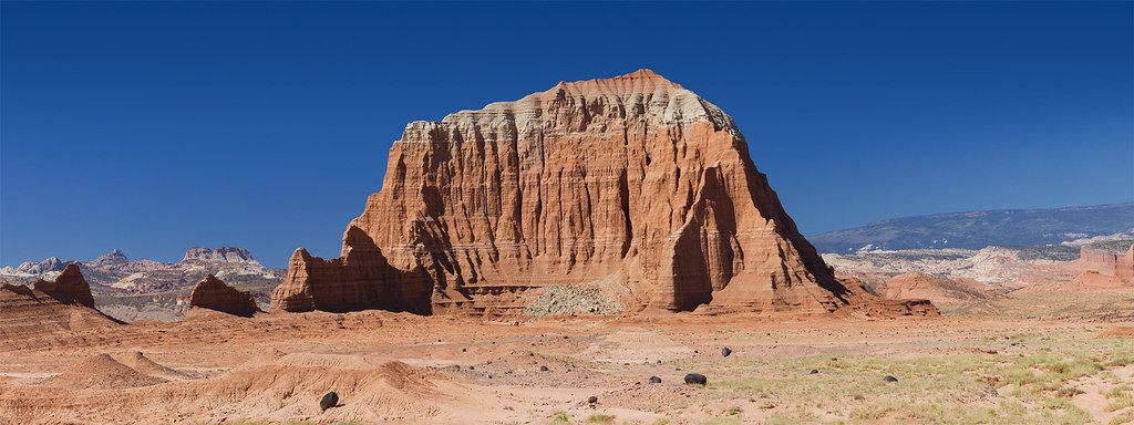
Jailhouse Rock panorama by ashergrey, on Flickr


There is very little in the way of vegetation here. What grass and brush exists seems stunted by the exposure, lack of moisture and incessant sun. The effects of erosion, in both the short and long term, are readily apparent. Little lizards scampered around the trail.
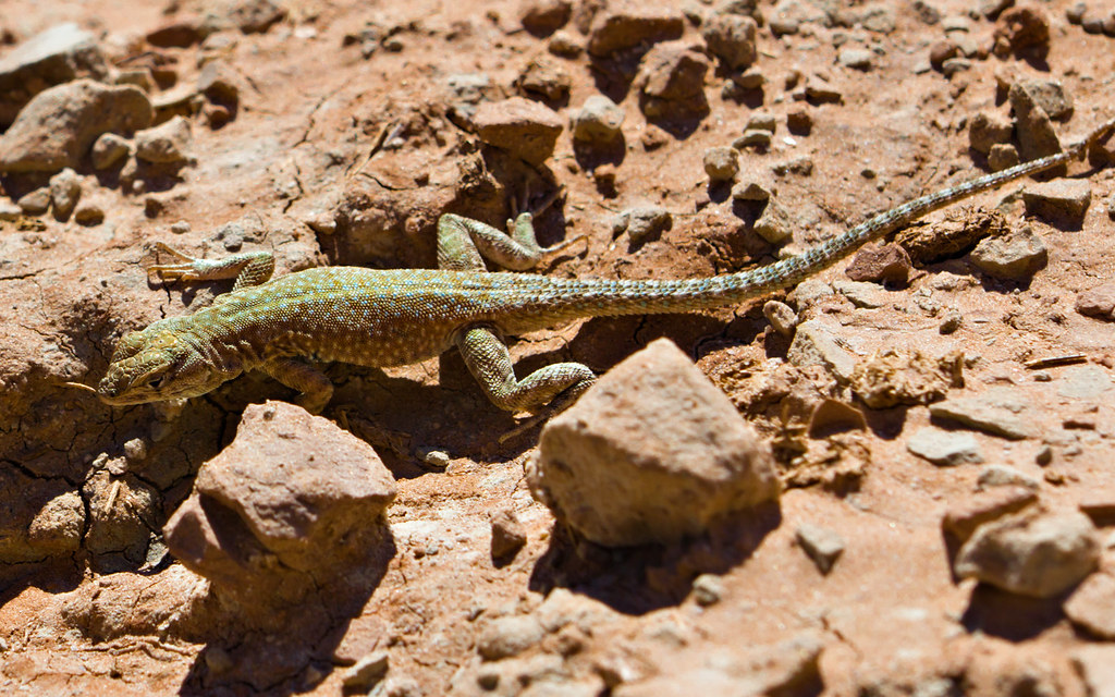
Spots by ashergrey, on Flickr
After wandering a bit on the hardpan, I headed back up to the car… enjoying all the while the sense of aloneness. Not a single other vehicle shared the parking space.

The backcountry of Capitol Reef is the antithesis of what's become of Arches. And while the Highway 24 corridor of Capitol Reef does get a lot of deserved attention, I can't help but smile when I see these modest park boundary markers on the less-traveled routes.

You don't see the rental RV, highway cruiser crowd in front of these signs... snapping pictures to boast of visiting a park they've only driven through. These signs don't sit on concrete slabs and if the desert decided to reclaim the space, it could do so with one or two good storms.
Back to the report… the road becomes more rough as it ascends toward the Upper South Desert overlook, crossing rockier terrain. Here I passed the first of only three vehicles I would see on the entire loop — a federal government truck, either BLM of NPS. Stopping at the Upper Cathedral Valley overlook, I walked out onto the bluffs, enjoying the cool breeze. There were very nearly no clouds in the sky, only a few wisps pushing up over Thousand Lake Mountain to the south-west.
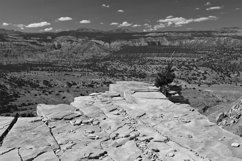
On the Edge by ashergrey, on Flickr
I lunched at the picnic table here before pushing on. Driving through the Cathedral Valley Campground, I spotted no visitors. Then, it was on down the rocky switchbacks into Upper Cathedral Valley proper. From the road, I could spy the high outcropping from which I'd been photographing.
The red arrow indicates the spot where I shot the above photo. The brink seemed even more intimidating from below. Going over the edge there would certainly prove fatal.

Once down the slope, I made the obligatory stop at the Morrell Cabin. It's a short walk off the road to the cabin, which is much more visitor-friendly than the Larson and Fife cabins in the Kolob Canyons of Zion or the Wolfe Cabin at Arches. It's even more natural than the Behunin Cabin or Fruita Schoolhouse in Capitol Reef. I say this because it is open. You can walk inside (though I wouldn't advise doing so given the amount of rodent droppings and the danger they pose of hantavirus).
Squint your eyes and you can imagine cattle ranchers still coming back here at dusk, roping up their horses and cooking dinner. It is less than a century removed from active use, yet speaks to an age that is now beyond our comprehension.
I found this hat as it is pictured here... either left as an oversight or as a favor to some wanderer who might come along seeking respite.

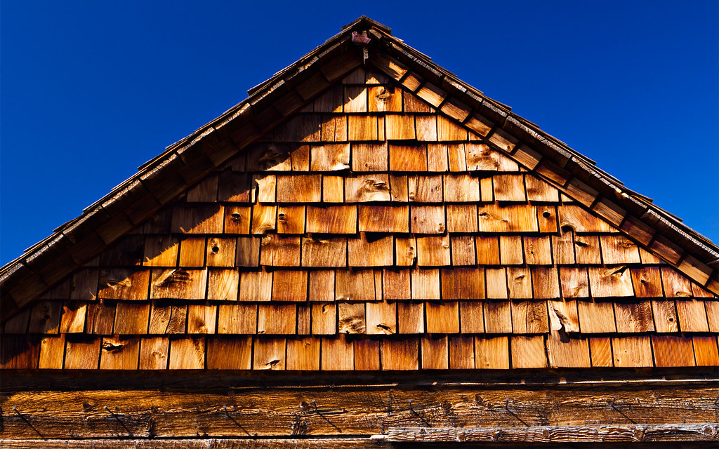
Shingles by ashergrey, on Flickr
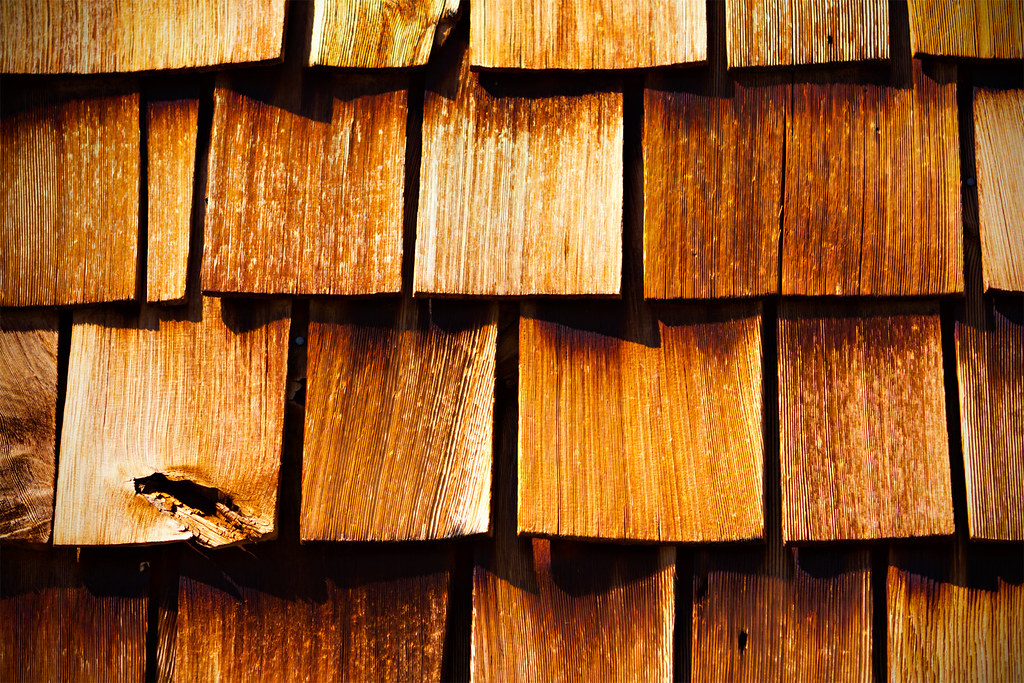
Shingles by ashergrey, on Flickr
Outside the cabin, I chased around this little rabbit. He allowed me to come fairly close, I imagine because in the hot desert one doesn't expend energy until it's absolutely necessary.

Nearby, a roughly one-mile trail runs along a bench below Needle and Cathedral Mountains, providing spectacular views. Just after starting on the trail I saw the second of three vehicles on the loop — a pickup truck that rolled down the dirt road but did not stop. It was out of sight and mind in short order.
Needle Mountain by ashergrey, on Flickr

It was now late afternoon and the heat had come on. I made leisurely time on the trail, stopping often to shoot photos or just admire the landscape. Once back at the car I cranked the A/C and headed for the Gypsum Sinkhole. There isn't much special to see or show about the sinkhole, but I did catch some amazing light on the rocks while passing the Wall of Jericho.
Last Light of Day Near the Gypsum Sinkhole by ashergrey, on Flickr
I arrived at the Temples of the Sun and Moon around dusk and set up for some night sky photography. I knew the moon would rise at about 12:45 a.m., so I could squeeze in a few solid hours of star trails before losing the darkness. I played around a bit with off-camera flash to provide some illumination on the Temple of the Moon for this three-hour star trail.
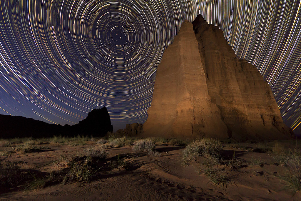
Temple of the Moon by ashergrey, on Flickr
And here it is animated (click through to Youtube for the full-quality version... it's much better than the embedded one).
Settling in for another night in the back of the wagon, I enjoyed the thought of having so many uninhabited acres to myself. In the morning I rose before daylight and drove over to Temple of the Sun, then set up to shoot the morning light as it appeared on the monoliths.


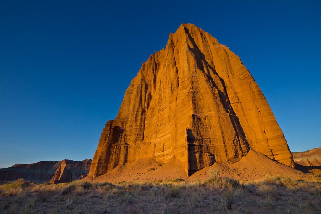
Temple of the Sun by ashergrey, on Flickr
Once satisfied, and with the last of my three camera batteries running on empty, I set out on the return drive home. Of course, this meant first completing the loop by returning to SR 24. However, along the way I encountered road conditions that were worse than those I'd seen up to that point. Several of the washes on the Caineville Wash Road were in rough shape, with entry and exit banks made steep by flash flooding. I had to pick some interesting lines with the wagon and nearly bogged down in the mud at one spot.
The worst of the trouble though came at one of the very few culverts on the road. Half of the road had collapsed for maybe 20 feet. If I couldn't get around it, the obstruction would mean a looooooong trip back along the loop. This would stretch my fuel supply and perhaps leave me stranded. The remaining section of road was too narrow to negotiate.

I could see other vehicles had managed to avoid the washout by diverting down into the wash, then climbing back up to the road along a narrow strip of rock. But while this would be no trouble for a Jeep, I had to consider my approach carefully in the wagon. Lacking a locker or low-range, I wondered whether or not the AWD would be able to make the climb. Thankfully, it performed the task admirably.
The third and final vehicle I encountered on the loop was a crossover SUV headed up the Caineville Wash Road just below the washout. It had California plates and a young-looking driver and passenger, both of whom appeared awed by the odd landscape surrounding them. I considered flagging them down and warning of the washout… but decided to let them tackle the problem without my interference.
So all told, I managed to have every overlook, hike and point of interest in the north part of the park entirely to myself over a very mild weekend. The day after I left, rain showers moved in and by 48 hours later the north section of Capitol Reef received nearly an inch of rain. All of the countless sandy washes likely flowed… and the long sections of the loop road that run along wash bottoms were surely impassible.
[PARSEHTML]<iframe src="http://www.mappingsupport.com/p/gmap4.php?q=http://dl.dropbox.com/u/3847512/GPS/Cathedral_Valley.kml&t=t4" frameborder="0" marginheight="0" scrolling="no" width="900" height="600"></iframe><br><br>[/PARSEHTML]
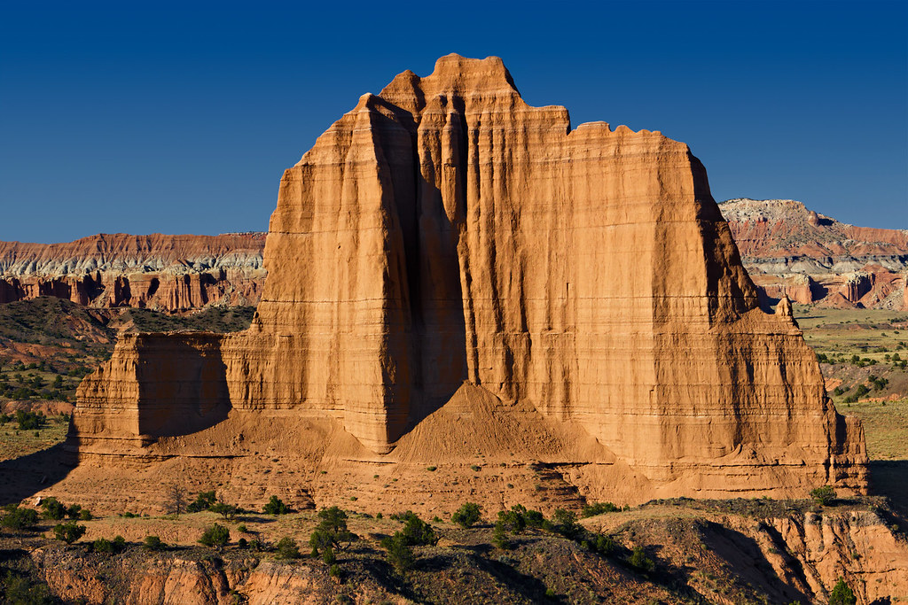
Featured image for home page:

The proposed and perhaps inevitable paving of the Burr Trail will likely cause ruinous changes to the south end within our lifetimes. But of all sections of Capitol Reef it's the north end, highlighted by Cathedral Valley, that holds the best promise of remaining pristine.
The Hartnett/Caineville loop route runs through 60 miles of high desert behind the Waterpocket Fold, through the Bentonite Hills, across the Hartnett and below the Caineville Reef. Along the way it crosses countless washes, traverses the Fremont River and passes by the seeps and spring that bring life to the arid badlands.
I headed down from Salt Lake City after work on a Friday night. My original plan had been to explore some of the canyons in the Middle Desert Wash area, but I realized about the time I was passing through Loa that my hiking shoes were still at home. The only footwear for this trip was a pair of slick-soled, low-rise Vans… not exactly the most sturdy or grippy shoes for scrambling over sandstone or trudging through sand. So this ended up being more of a car tour with light hiking, instead of an off-trail exploration.
Arriving at the Fremont River crossing on the Hartnett Road after dark, I popped the rear hatch on the wagon, rolled my bedding out and relaxed. The camera ran two hours of night sky exposures before the half moon came up and lit the landscape.
Trails Near the Hartnett Road by ashergrey, on Flickr
Temperatures overnight were mild. I woke with the sun on Saturday and went right to work on the crossing. Earlier high flows had washed away much of the sandy bank, leaving a two-foot step down to river level. The silty water was cold, about ankle-deep at the most shallow and calf-deep at its worst. No problem for the wagon.
The morning light cast long shadows as I crawled into the Bentonite Hills, taking frequent photo breaks.
Bentonite by ashergrey, on Flickr
This old truck sits right off the road, next to a spring and buried to the axles in dried mud.
View from the Backseat by ashergrey, on Flickr
Continuing on, I arrived at the South Desert Overlook as those morning shadows were shortening. The heat of the day was building but not yet oppressive. Before heading down the trail into the South Desert, I chowed on some cereal. In my haste to get moving that morning, I'd skipped breakfast.
The highlight of the South Desert Overlook is visible right from the parking area — Jailhouse Rock sticks up from the desert floor. A lightly-traveled trail works its way down the cliffs to the lowlands, which are scattered with igneous rock washed down from the higher plateaus.
Jailhouse Rock panorama by ashergrey, on Flickr
There is very little in the way of vegetation here. What grass and brush exists seems stunted by the exposure, lack of moisture and incessant sun. The effects of erosion, in both the short and long term, are readily apparent. Little lizards scampered around the trail.
Spots by ashergrey, on Flickr
After wandering a bit on the hardpan, I headed back up to the car… enjoying all the while the sense of aloneness. Not a single other vehicle shared the parking space.
The backcountry of Capitol Reef is the antithesis of what's become of Arches. And while the Highway 24 corridor of Capitol Reef does get a lot of deserved attention, I can't help but smile when I see these modest park boundary markers on the less-traveled routes.
You don't see the rental RV, highway cruiser crowd in front of these signs... snapping pictures to boast of visiting a park they've only driven through. These signs don't sit on concrete slabs and if the desert decided to reclaim the space, it could do so with one or two good storms.
Back to the report… the road becomes more rough as it ascends toward the Upper South Desert overlook, crossing rockier terrain. Here I passed the first of only three vehicles I would see on the entire loop — a federal government truck, either BLM of NPS. Stopping at the Upper Cathedral Valley overlook, I walked out onto the bluffs, enjoying the cool breeze. There were very nearly no clouds in the sky, only a few wisps pushing up over Thousand Lake Mountain to the south-west.
On the Edge by ashergrey, on Flickr
I lunched at the picnic table here before pushing on. Driving through the Cathedral Valley Campground, I spotted no visitors. Then, it was on down the rocky switchbacks into Upper Cathedral Valley proper. From the road, I could spy the high outcropping from which I'd been photographing.
The red arrow indicates the spot where I shot the above photo. The brink seemed even more intimidating from below. Going over the edge there would certainly prove fatal.
Once down the slope, I made the obligatory stop at the Morrell Cabin. It's a short walk off the road to the cabin, which is much more visitor-friendly than the Larson and Fife cabins in the Kolob Canyons of Zion or the Wolfe Cabin at Arches. It's even more natural than the Behunin Cabin or Fruita Schoolhouse in Capitol Reef. I say this because it is open. You can walk inside (though I wouldn't advise doing so given the amount of rodent droppings and the danger they pose of hantavirus).
Squint your eyes and you can imagine cattle ranchers still coming back here at dusk, roping up their horses and cooking dinner. It is less than a century removed from active use, yet speaks to an age that is now beyond our comprehension.
I found this hat as it is pictured here... either left as an oversight or as a favor to some wanderer who might come along seeking respite.
Shingles by ashergrey, on Flickr
Shingles by ashergrey, on Flickr
Outside the cabin, I chased around this little rabbit. He allowed me to come fairly close, I imagine because in the hot desert one doesn't expend energy until it's absolutely necessary.
Nearby, a roughly one-mile trail runs along a bench below Needle and Cathedral Mountains, providing spectacular views. Just after starting on the trail I saw the second of three vehicles on the loop — a pickup truck that rolled down the dirt road but did not stop. It was out of sight and mind in short order.
Needle Mountain by ashergrey, on Flickr
It was now late afternoon and the heat had come on. I made leisurely time on the trail, stopping often to shoot photos or just admire the landscape. Once back at the car I cranked the A/C and headed for the Gypsum Sinkhole. There isn't much special to see or show about the sinkhole, but I did catch some amazing light on the rocks while passing the Wall of Jericho.
Last Light of Day Near the Gypsum Sinkhole by ashergrey, on Flickr
I arrived at the Temples of the Sun and Moon around dusk and set up for some night sky photography. I knew the moon would rise at about 12:45 a.m., so I could squeeze in a few solid hours of star trails before losing the darkness. I played around a bit with off-camera flash to provide some illumination on the Temple of the Moon for this three-hour star trail.
Temple of the Moon by ashergrey, on Flickr
And here it is animated (click through to Youtube for the full-quality version... it's much better than the embedded one).
Settling in for another night in the back of the wagon, I enjoyed the thought of having so many uninhabited acres to myself. In the morning I rose before daylight and drove over to Temple of the Sun, then set up to shoot the morning light as it appeared on the monoliths.
Temple of the Sun by ashergrey, on Flickr
Once satisfied, and with the last of my three camera batteries running on empty, I set out on the return drive home. Of course, this meant first completing the loop by returning to SR 24. However, along the way I encountered road conditions that were worse than those I'd seen up to that point. Several of the washes on the Caineville Wash Road were in rough shape, with entry and exit banks made steep by flash flooding. I had to pick some interesting lines with the wagon and nearly bogged down in the mud at one spot.
The worst of the trouble though came at one of the very few culverts on the road. Half of the road had collapsed for maybe 20 feet. If I couldn't get around it, the obstruction would mean a looooooong trip back along the loop. This would stretch my fuel supply and perhaps leave me stranded. The remaining section of road was too narrow to negotiate.
I could see other vehicles had managed to avoid the washout by diverting down into the wash, then climbing back up to the road along a narrow strip of rock. But while this would be no trouble for a Jeep, I had to consider my approach carefully in the wagon. Lacking a locker or low-range, I wondered whether or not the AWD would be able to make the climb. Thankfully, it performed the task admirably.
The third and final vehicle I encountered on the loop was a crossover SUV headed up the Caineville Wash Road just below the washout. It had California plates and a young-looking driver and passenger, both of whom appeared awed by the odd landscape surrounding them. I considered flagging them down and warning of the washout… but decided to let them tackle the problem without my interference.
So all told, I managed to have every overlook, hike and point of interest in the north part of the park entirely to myself over a very mild weekend. The day after I left, rain showers moved in and by 48 hours later the north section of Capitol Reef received nearly an inch of rain. All of the countless sandy washes likely flowed… and the long sections of the loop road that run along wash bottoms were surely impassible.
[PARSEHTML]<iframe src="http://www.mappingsupport.com/p/gmap4.php?q=http://dl.dropbox.com/u/3847512/GPS/Cathedral_Valley.kml&t=t4" frameborder="0" marginheight="0" scrolling="no" width="900" height="600"></iframe><br><br>[/PARSEHTML]
Featured image for home page:
")
 (My company is Fremont River Software, half the checks I get spell it Freemont, drives me nuts!)
") JK
JK