barl0w
I slay white dragons, adventure, and take photos
- Joined
- Jan 20, 2012
- Messages
- 163
As many of you know, the barl0w family went down to CRNP for the Memorial Day Weekend, and thanks to all of those who helped with the trip planning. Every bit helped, so thank you again!
As school let out on Friday, and as fast as we could get the canine to grandma's house for dog sitting, we left for Torrey, UT, and roughed it at the Day's Inn. This would serve as our home-base, as beds and free breakfast were at the top of the family's list for our first adventure out this year.
First-things-first: we hit the indoor pool and relaxed afterwards. It was windy down in Torrey, and actually quite chilly (after arriving back on Monday we saw the new snow on Timpanogos)!
On Saturday, the wind hadn't let up at all. While at the Visitor's Center (VC), we learned the weather wasn't going to let up and it might even rain. So, we watched the free movie, and picked up our Jr. Ranger material. It happened to be great timing, as a geology presentation was scheduled perfectly. So, the kids joined the ranger program and worked on their Jr. Ranger books.
Soon after, we left the VC in search of Petroglyphs, and went straight for the Petroglyph Panel on Hwy 24:
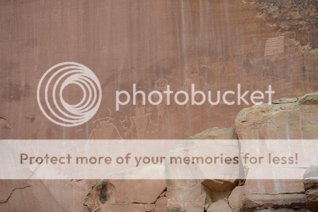
The best ones were the one-eyed alien coming out of the sheep's butt, and the rabbit coming out of the hat!
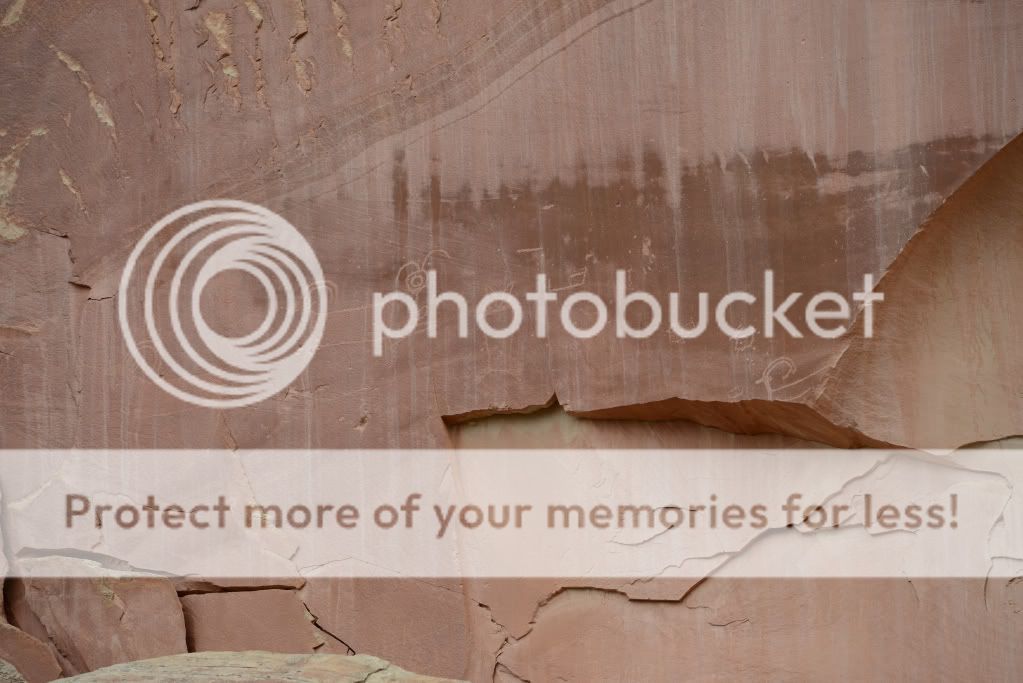
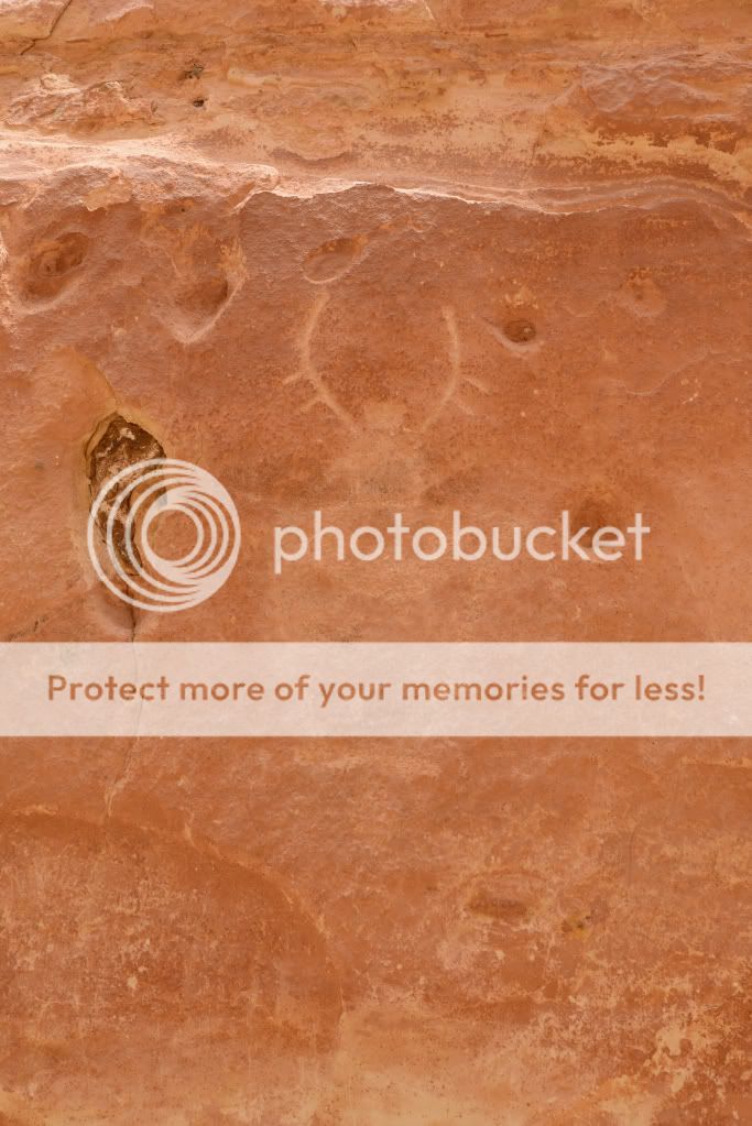
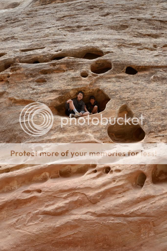
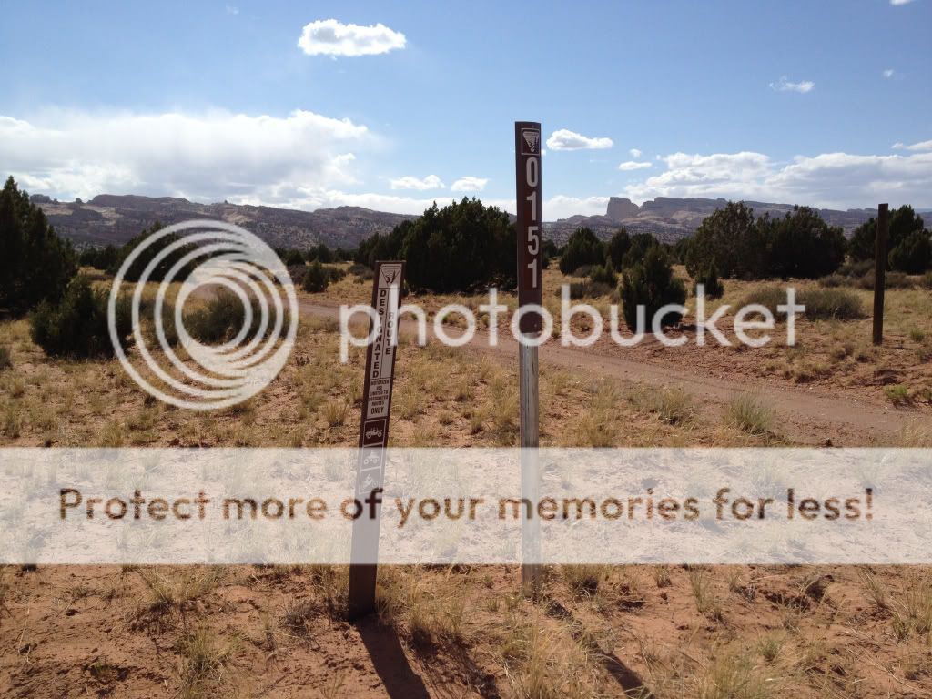
The next published panel of petroglyphs was at Capitol Wash. It was also a simple hike (flat) to get the family in the mood despite the weather. After paying the $4.00 fee at the self service fee station we arrived at the TH around 30 mins later. Well, it was so windy and chilly at the TH, that the girls decided to wait in the car. Boy, did they miss out!
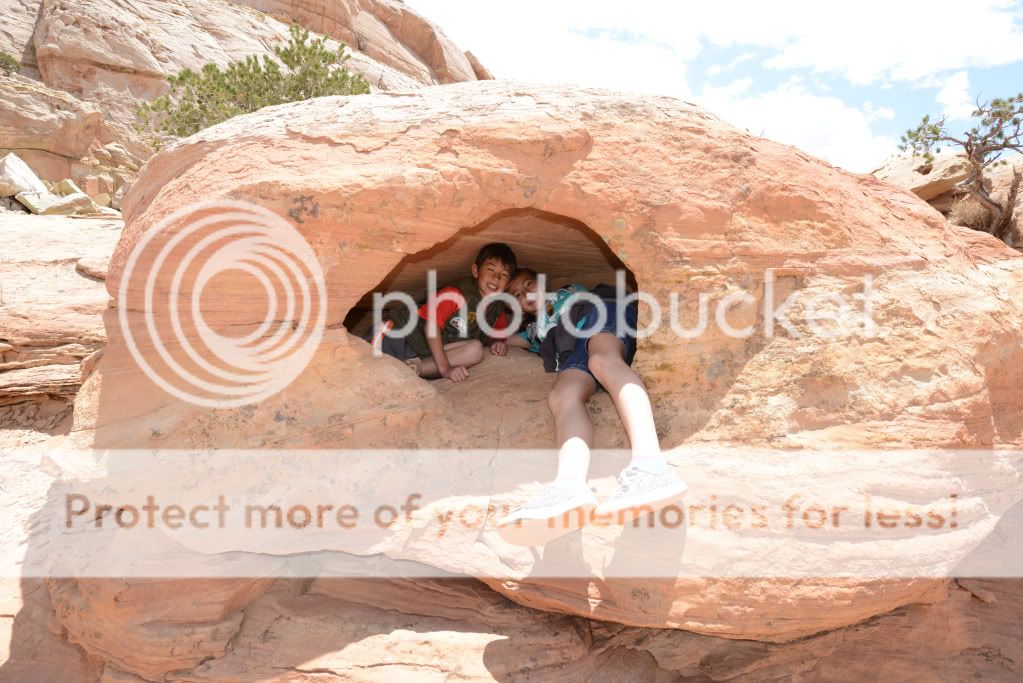
Near the first 2-300 yards of the hike, we saw more petroglyphs (hard to miss when there's a sign pointing them out), and a sweet cavity in the rock the boys climbed into:
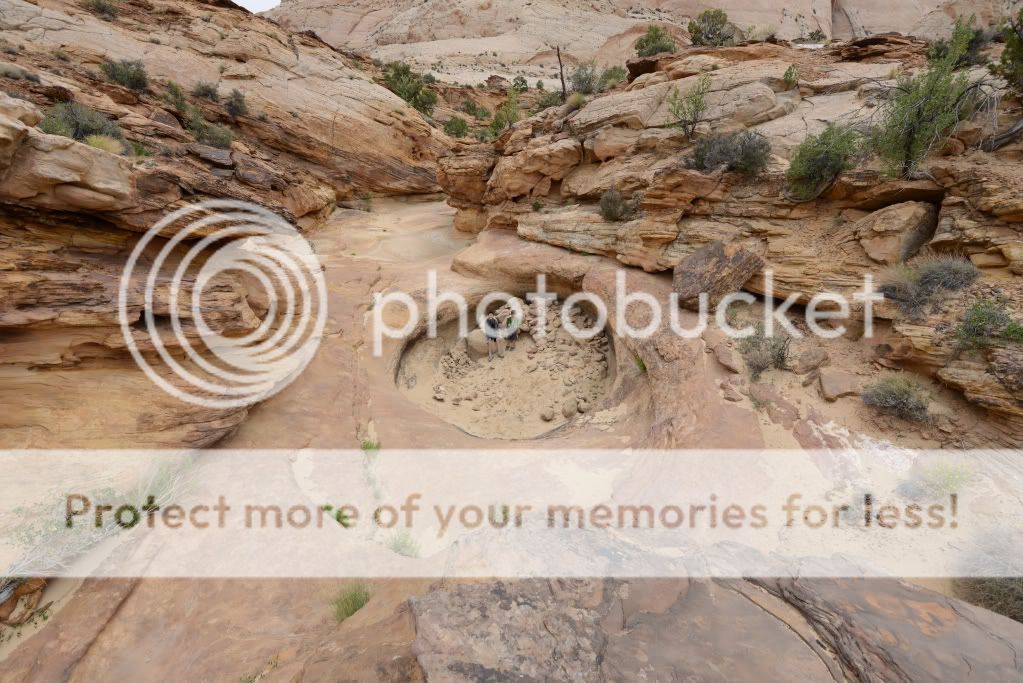
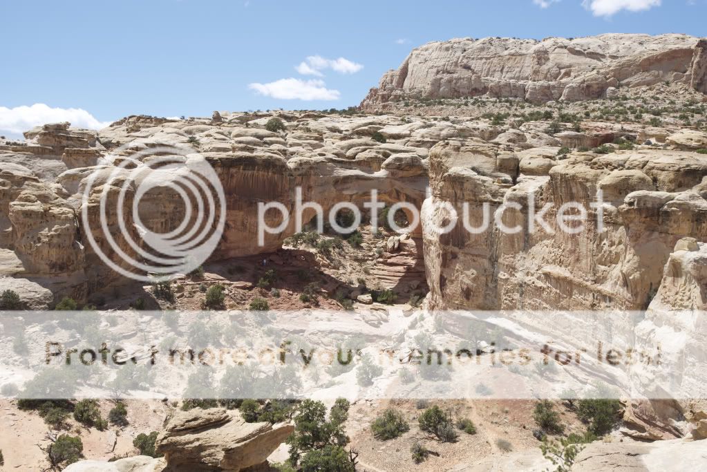
Down a mile or so from the entrance were the Water Tanks. Silly me, I thought it would be a literal water tank perhaps the pioneers built. Well, these were the coolest tanks w/out water that I've seen:
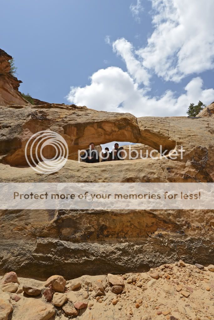
There was one even a third one with an arch:
Good thing the Mrs. wasn't there to tell us not to jump down.
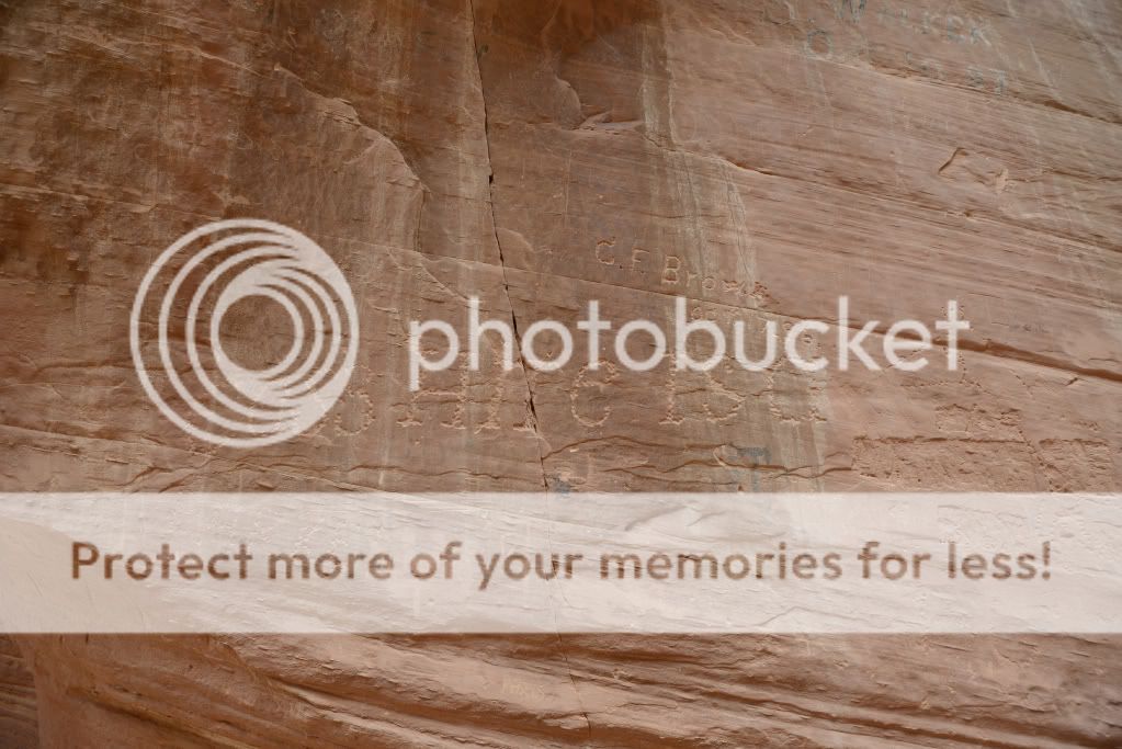
On the way back, we took another look at the Pioneer Registry (between the petroglyphs and Water Tanks):
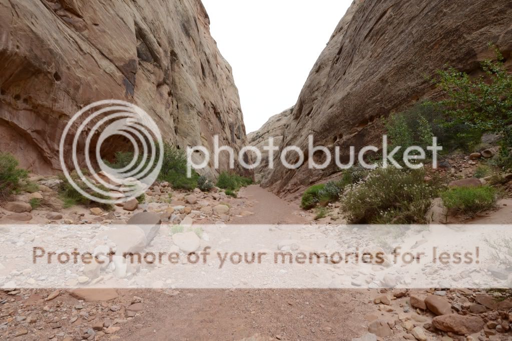
And made our way back out:
It was the afternoon by then, and the threat of rain had seemed to subside. I took the opportunity to drive over to Burro Wash along Notom-Bullfrog Road.
When we arrived I approached some guys that had just come out. They told me it was 2 miles to the start of the narrows, which was a bummer - as I know that was a bit more than our mood was ready for. So, we went exploring (an easy) 4x4 style and found a really nice trailhead that not only got us closer to Pleasant Creek, but that had some super-awesome free camping spots. The last camping spot reminded me of the one we stayed at a week earlier down in Zion (thanks Nick!).
Here's a map, and a photo: http://bit.ly/Kb90Ne
We went as far back as the road took us, and ended up about 1 mile away from Pleasant Creek and probably 1.5 miles away from Burro Wash. Although I intended to lead the family on a hike to Burro Wash, I ended up taking us into Pleasant Creek. We scared some cows on the way, hiked along a dry wash, and then hit Pleasant Creek and hiked a ways in. When the kids started getting hungry, we turned around and got back to the car, following the GPS track back.
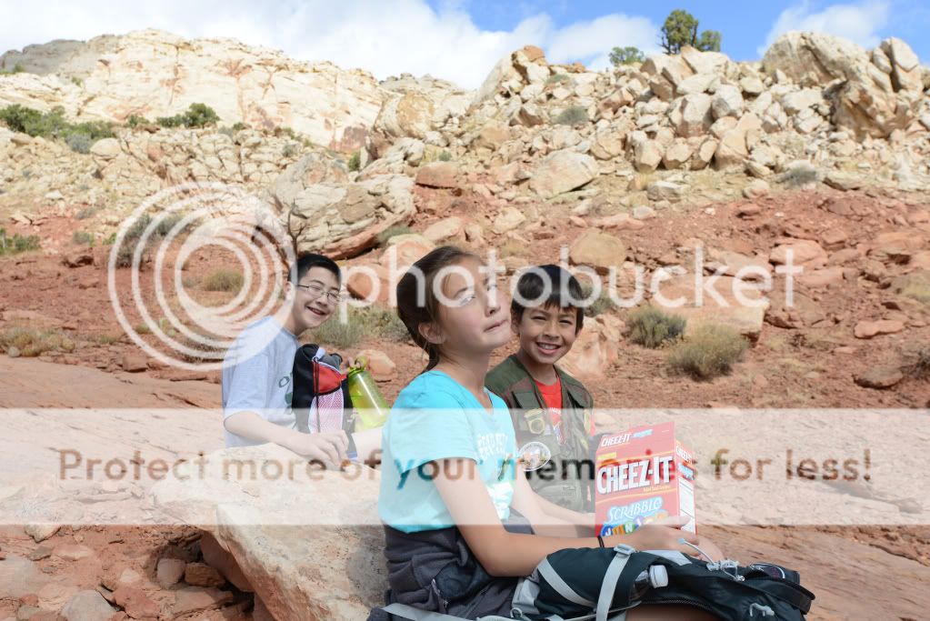
That night, I planned a bit better as I heard from the troops that they wanted a more challenging and well-defined-trail of a hike. Navajo Knobs sounded like it would be a perfect fit, and so we went straight there after hitting the ranger station where the kids turned in their Jr Ranger books for their badges.
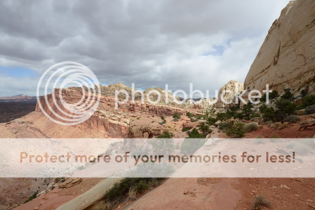
Now, the Navajo Knobs hike is a fantastic hike. A great slope most of the way, a well made-out trail, lots of lizards to chase, stones to rest on, and the views are just incredible. This is a definite must-do.
Here's our GPS track: http://bit.ly/LdxgdV. The hike was recorded at being 9.31 miles, 3.5 hrs., and had an ascent of 2,377 ft.
Hickman Bridge from along the trail:
A fun shelter for the kids:
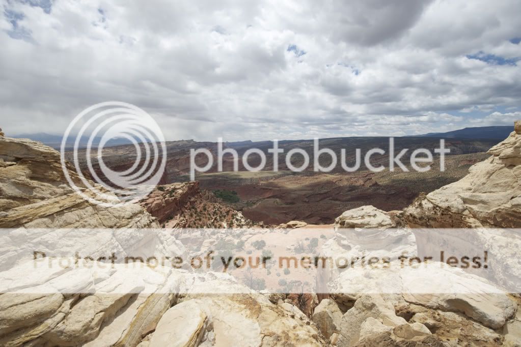
The views:
Some of the trail that leads you along the cliff (totally safe distance):
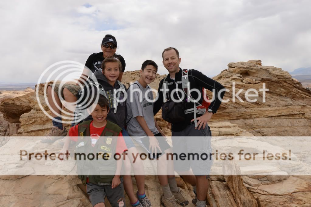
And fun stuff like breaks and then the top of the 'Knobs':
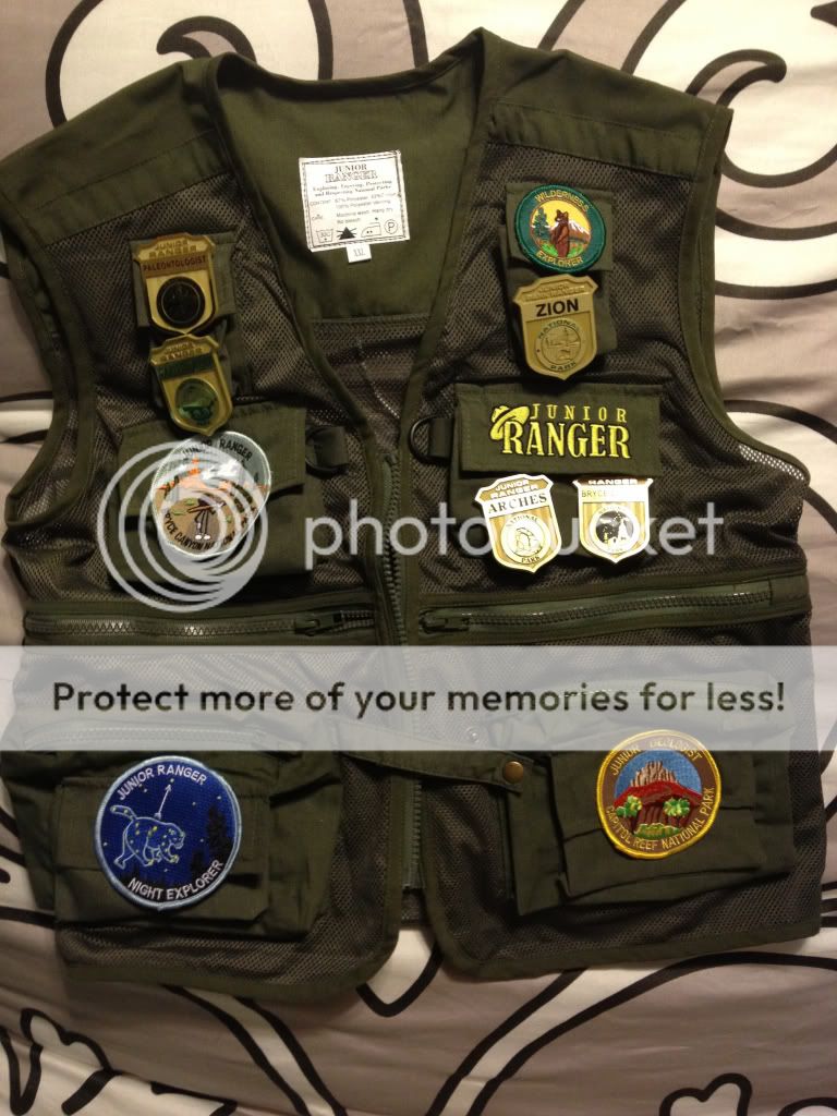
Again, such a great hike. Seeing the Hickman Bridge along the way confirmed that it would be a nice place for star trails too. Afterwards we hit the Visitor's Center again to pick up the other 2-3 books the kids could work on, and visited the Ripple Rock Nature Center to earn the Junior Geologist patch. The kids loved the programs, and felt great accomplishing such a hike.
Patches and Badges:
I knew that Sunday night was going to be my last effort to get out and do star trails. Hickman Bridge looked awesome, and so I took the ladies with me on the short 1 mile hike to the bridge with our headlamps and camera stuff, while the boys wanted to stay and watch the Food Network or something. The hike was quite easy, and at 10 pm we were the only ones on the trail and at the bridge. Here's 40 x 30 sec photos StarStax'd and one photo with the bridge illuminated by our headlamps combined together. I already posted this in the Star Trail thread, so I apologize for the repeat:
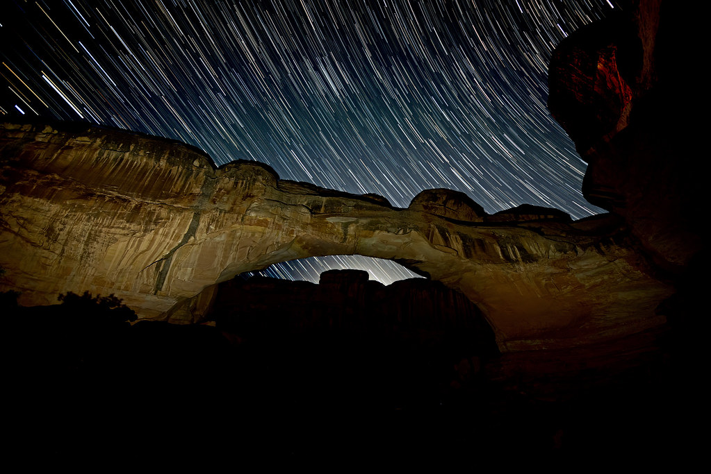
Hickman Bridge by Scott Barlow, on Flickr
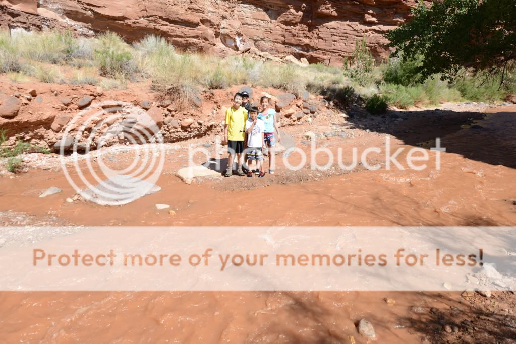
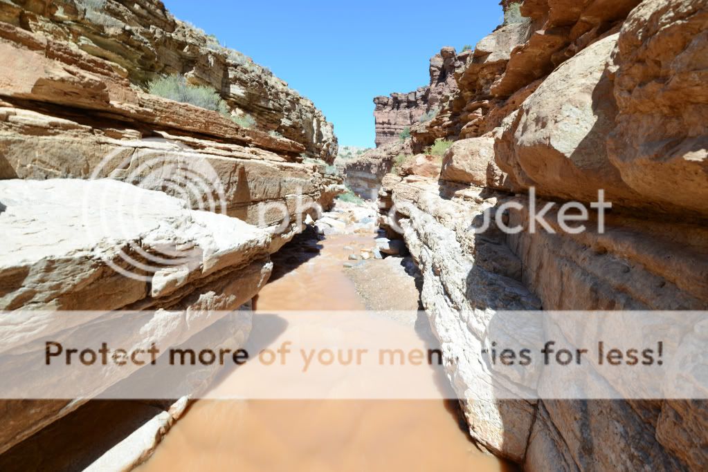
On Monday, our last day, the weather was gorgeous. The wind had finally calmed down, the skies cleared. It was pretty warm! It was the perfect opportunity to hike Sulpher Creek from the bottom-up!
For the first 30 mins of the hike, the water felt chilly. But that didn't stop us from skipping rocks, looking for lizards, and splashing in the river.
Hiking along I got the group together for a pose:
After 30 mins, we arrived at the first waterfall:
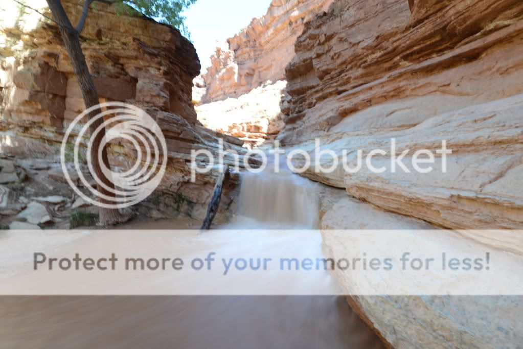
Right after taking photos above the first waterfall, we turned back:
During the hike out, the water seemed to warm up, and the kids were happy until the end, and even asking when we'll be coming back to visit the rest of the park.
I have a feeling that we really didn't scratch the surface of seeing most of the cool places in the park. Sure we ate pie, bought salsa from the country store, saw petroglyphs, hiked and took photos. So with that, we looking forward to visiting again possibly later in 2012.
Featured image for home page:

As school let out on Friday, and as fast as we could get the canine to grandma's house for dog sitting, we left for Torrey, UT, and roughed it at the Day's Inn. This would serve as our home-base, as beds and free breakfast were at the top of the family's list for our first adventure out this year.
First-things-first: we hit the indoor pool and relaxed afterwards. It was windy down in Torrey, and actually quite chilly (after arriving back on Monday we saw the new snow on Timpanogos)!
On Saturday, the wind hadn't let up at all. While at the Visitor's Center (VC), we learned the weather wasn't going to let up and it might even rain. So, we watched the free movie, and picked up our Jr. Ranger material. It happened to be great timing, as a geology presentation was scheduled perfectly. So, the kids joined the ranger program and worked on their Jr. Ranger books.
Soon after, we left the VC in search of Petroglyphs, and went straight for the Petroglyph Panel on Hwy 24:
The best ones were the one-eyed alien coming out of the sheep's butt, and the rabbit coming out of the hat!
The next published panel of petroglyphs was at Capitol Wash. It was also a simple hike (flat) to get the family in the mood despite the weather. After paying the $4.00 fee at the self service fee station we arrived at the TH around 30 mins later. Well, it was so windy and chilly at the TH, that the girls decided to wait in the car. Boy, did they miss out!
Near the first 2-300 yards of the hike, we saw more petroglyphs (hard to miss when there's a sign pointing them out), and a sweet cavity in the rock the boys climbed into:
Down a mile or so from the entrance were the Water Tanks. Silly me, I thought it would be a literal water tank perhaps the pioneers built. Well, these were the coolest tanks w/out water that I've seen:
There was one even a third one with an arch:
Good thing the Mrs. wasn't there to tell us not to jump down.
On the way back, we took another look at the Pioneer Registry (between the petroglyphs and Water Tanks):
And made our way back out:
It was the afternoon by then, and the threat of rain had seemed to subside. I took the opportunity to drive over to Burro Wash along Notom-Bullfrog Road.
When we arrived I approached some guys that had just come out. They told me it was 2 miles to the start of the narrows, which was a bummer - as I know that was a bit more than our mood was ready for. So, we went exploring (an easy) 4x4 style and found a really nice trailhead that not only got us closer to Pleasant Creek, but that had some super-awesome free camping spots. The last camping spot reminded me of the one we stayed at a week earlier down in Zion (thanks Nick!).
Here's a map, and a photo: http://bit.ly/Kb90Ne
We went as far back as the road took us, and ended up about 1 mile away from Pleasant Creek and probably 1.5 miles away from Burro Wash. Although I intended to lead the family on a hike to Burro Wash, I ended up taking us into Pleasant Creek. We scared some cows on the way, hiked along a dry wash, and then hit Pleasant Creek and hiked a ways in. When the kids started getting hungry, we turned around and got back to the car, following the GPS track back.
That night, I planned a bit better as I heard from the troops that they wanted a more challenging and well-defined-trail of a hike. Navajo Knobs sounded like it would be a perfect fit, and so we went straight there after hitting the ranger station where the kids turned in their Jr Ranger books for their badges.
Now, the Navajo Knobs hike is a fantastic hike. A great slope most of the way, a well made-out trail, lots of lizards to chase, stones to rest on, and the views are just incredible. This is a definite must-do.
Here's our GPS track: http://bit.ly/LdxgdV. The hike was recorded at being 9.31 miles, 3.5 hrs., and had an ascent of 2,377 ft.
Hickman Bridge from along the trail:
A fun shelter for the kids:
The views:
Some of the trail that leads you along the cliff (totally safe distance):
And fun stuff like breaks and then the top of the 'Knobs':
Again, such a great hike. Seeing the Hickman Bridge along the way confirmed that it would be a nice place for star trails too. Afterwards we hit the Visitor's Center again to pick up the other 2-3 books the kids could work on, and visited the Ripple Rock Nature Center to earn the Junior Geologist patch. The kids loved the programs, and felt great accomplishing such a hike.
Patches and Badges:
I knew that Sunday night was going to be my last effort to get out and do star trails. Hickman Bridge looked awesome, and so I took the ladies with me on the short 1 mile hike to the bridge with our headlamps and camera stuff, while the boys wanted to stay and watch the Food Network or something. The hike was quite easy, and at 10 pm we were the only ones on the trail and at the bridge. Here's 40 x 30 sec photos StarStax'd and one photo with the bridge illuminated by our headlamps combined together. I already posted this in the Star Trail thread, so I apologize for the repeat:
Hickman Bridge by Scott Barlow, on Flickr
On Monday, our last day, the weather was gorgeous. The wind had finally calmed down, the skies cleared. It was pretty warm! It was the perfect opportunity to hike Sulpher Creek from the bottom-up!
For the first 30 mins of the hike, the water felt chilly. But that didn't stop us from skipping rocks, looking for lizards, and splashing in the river.
Hiking along I got the group together for a pose:
After 30 mins, we arrived at the first waterfall:
Right after taking photos above the first waterfall, we turned back:
During the hike out, the water seemed to warm up, and the kids were happy until the end, and even asking when we'll be coming back to visit the rest of the park.
I have a feeling that we really didn't scratch the surface of seeing most of the cool places in the park. Sure we ate pie, bought salsa from the country store, saw petroglyphs, hiked and took photos. So with that, we looking forward to visiting again possibly later in 2012.
Featured image for home page:
") Capitol Reef has a lot to offer.
Capitol Reef has a lot to offer.