- Joined
- Dec 2, 2019
- Messages
- 183
After my 5-day hike in Capitol Reef National Park in 2023, which followed established park trails and well-known backcountry routes between Chimney Rock and Burro Wash, I was then hoping to design a slightly more ambitious adventure which would take me to both the northern and southern sections of the park, that I was less familiar with. I contacted the park Rangers to enquire about my plans, and they were very helpful in giving me useful advice, as well as the go-ahead to attempt my hike.
It was still necessary for me to visit the Visitor Center to officially apply for, and pick up my backpacking permit. I was slightly surprised when the young Ranger at the desk almost choked on his coffee, when I asked for a 12 day permit. This was 'very unusual', he croaked. After showing him my email communication with his colleagues, and giving him a detailed map of my route, he was very helpful and encouraging about my plans, and I was quickly on my way, permit in hand.
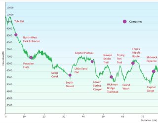
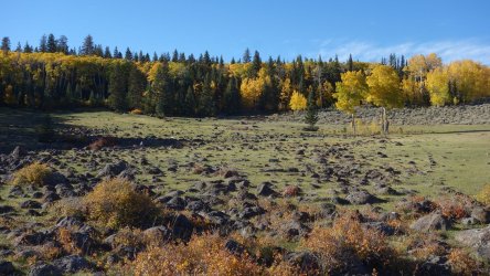
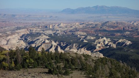
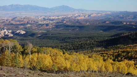
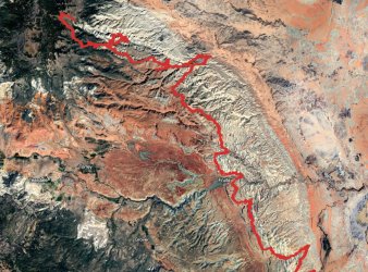
I intended to start my hike at Tub Flat in the Thousand Lake Mountain area, a few miles from the North-West entrance to the park at Paradise Flats, as this was the most realistic location for a local outfitter from Torrey to drop me off. I would be starting at an altitude of almost 10,000 feet, initially descending to the National Park entrance at 7,800 feet. The other plus-point of Tub Flat was the glorious afternoon views along a large portion of the Waterpocket Fold. From this splendid viewpoint, I could literally trace the first 60 or so miles of my hike as the Fold stretched south. I spent a couple of hours taking in the views, before heading down through the forest, filled with golden aspens, towards the park itself.
Tub Flat at almost 10,000 feet in elevation
.
.
View looking East from Tub Flat of Deep Creek, Paradise Flats, Capitol Plateau, South Desert, with the Henry Mountains in the distance
.
.
View looking South-East along the Waterpocket Fold, and the first 60+ miles of my hike
.
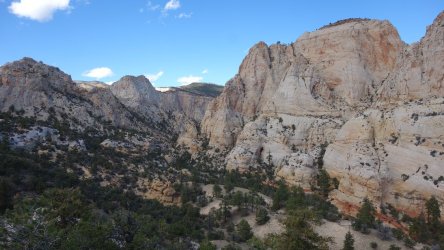
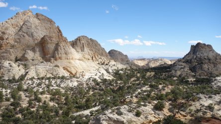
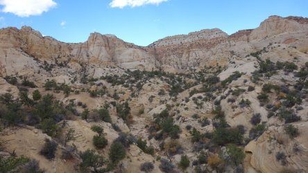
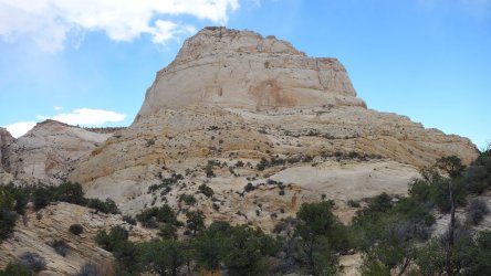
I hadn't really been aware of, or read much about, the upper Deep Creek area in the North-West portion of Capitol Reef until quite recently, but when I had a closer look via satellite imaging, it seemed as though it could be wonderfully scenic. I spent most of my second day exploring the upper reaches of Deep Creek, and it was just as picturesque as I had hoped, with towering, white and orange cliffs and huge sandstone formations. It is a truly spectacular part of the park. The only downside of this area are the large meadows of 'jumping' cactus, that are almost impossible to avoid.
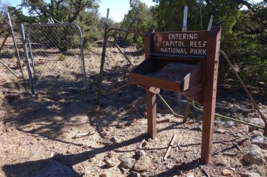
The National Park North-Western entrance
.
.
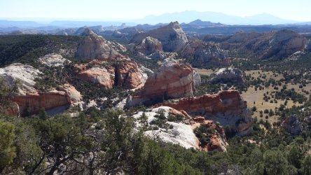
Descending towards Paradise Flats
.
.
View to the west, over the southern fork of Deep Creek
.
.
View to the east, over the southern fork of Deep Creek
.
.
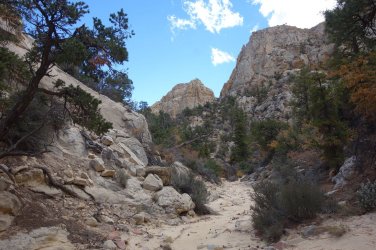
Hiking along the northern fork of Deep Creek
.
.
Deep Creek cliffs
.
.
Deep Creek dome
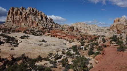
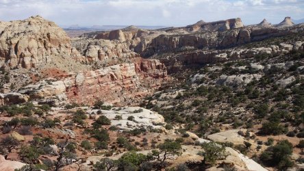
The next day, after exploring scenic Paradise Flats, and enjoying searching for possible architectural sites, I then set off across the plateau to attempt to find a route down into the lower reaches of Deep Creek. From satellite imaging, I had discerned some game trails that appeared to weave their way from the higher ground, towards the canyon below. Slightly surprisingly, the game trail was much more distinctive than I had imagined, and it turned out to be a relatively straightforward task to follow it all the way around the cliffs, before it dropped gently into the Deep Creek drainage. After encountering a couple of large cairns on the final descent, I was beginning to wonder whether the 'game trail' was in fact more pronounced because of human foot traffic over the years. It was confusing, because I have read very little about hikers crossing this particular area.
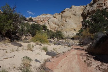
From my research, I was confident that I would find water in the nearby Water Canyon, and after hiking along the drainage for about 1 mile, I found the predicted flow of water I had hoped for. I was then able to fill up my bladders, since I would now have a couple of waterless days ahead. The afternoon's walking through the scenic canyon of Deep Creek was wonderful, with no significant obstacles to negotiate. My goal was to reach Little Sand Flat, 500 feet above Deep Creek to the south-east. In advance, I had identified a couple of possible 'short-cuts' from the canyon, up to the this higher area. Encountering these short-cuts in person made me realise that they could be possible, but would require considerable effort with a full pack (especially one containing 6 litres of water !). I therefore resigned myself to the extra 2 mile hike through the drainage to reach the old jeep road that winds up to Little Sand Flat, from the canyon floor, in the lower reaches of the South Desert.
The National Park North-Western entrance

.
.
Descending towards Paradise Flats

.
.
View to the west, over the southern fork of Deep Creek

.
.
View to the east, over the southern fork of Deep Creek

.
.
Hiking along the northern fork of Deep Creek

.
.
Deep Creek cliffs

.
.
Deep Creek dome

The next day, after exploring scenic Paradise Flats, and enjoying searching for possible architectural sites, I then set off across the plateau to attempt to find a route down into the lower reaches of Deep Creek. From satellite imaging, I had discerned some game trails that appeared to weave their way from the higher ground, towards the canyon below. Slightly surprisingly, the game trail was much more distinctive than I had imagined, and it turned out to be a relatively straightforward task to follow it all the way around the cliffs, before it dropped gently into the Deep Creek drainage. After encountering a couple of large cairns on the final descent, I was beginning to wonder whether the 'game trail' was in fact more pronounced because of human foot traffic over the years. It was confusing, because I have read very little about hikers crossing this particular area.
From my research, I was confident that I would find water in the nearby Water Canyon, and after hiking along the drainage for about 1 mile, I found the predicted flow of water I had hoped for. I was then able to fill up my bladders, since I would now have a couple of waterless days ahead. The afternoon's walking through the scenic canyon of Deep Creek was wonderful, with no significant obstacles to negotiate. My goal was to reach Little Sand Flat, 500 feet above Deep Creek to the south-east. In advance, I had identified a couple of possible 'short-cuts' from the canyon, up to the this higher area. Encountering these short-cuts in person made me realise that they could be possible, but would require considerable effort with a full pack (especially one containing 6 litres of water !). I therefore resigned myself to the extra 2 mile hike through the drainage to reach the old jeep road that winds up to Little Sand Flat, from the canyon floor, in the lower reaches of the South Desert.
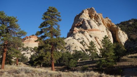
Paradise Flats
.
.
Ancient Wonders
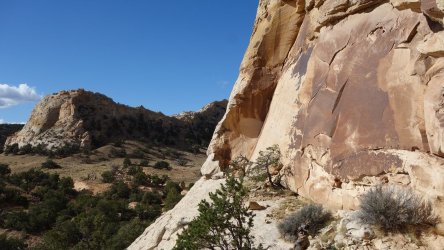
.
.
Distinctive Dome
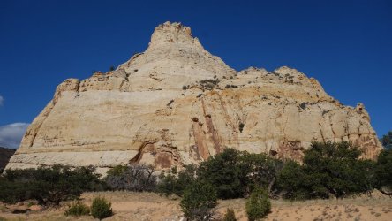
.
.
Colorful Formations
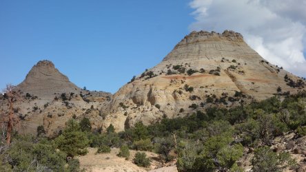
.
.
Heading across Paradise Flats, searching for a route into Deep Creek
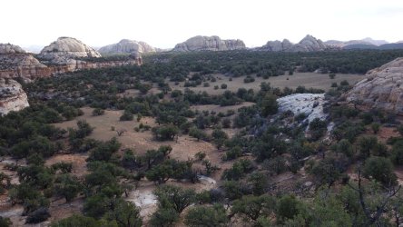
.
.
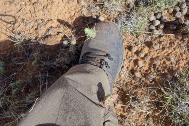
Those pesky cactus
.
.
Tracing the game trails around the high cliffs
.
.
Working my way towards the descent into Deep Creek
.
.
Hiking along Deep Creek
.
.
The softer cliff-bands of the South Desert
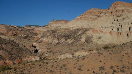
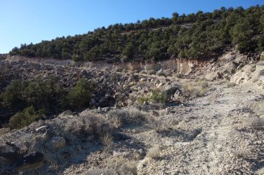
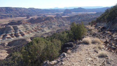
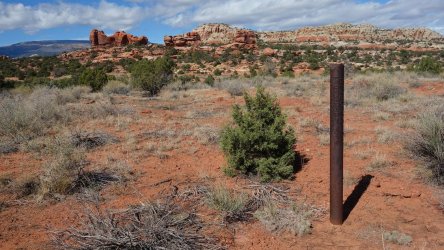
The old road starts relatively gently and the walking towards Little Sand Flat, on the following day, was very easy. Later on, the route winds its way through some rather tortuous narrow canyons and one can't help but marvel at the engineering skill and determination of the road crew in the 1950s who constructed the road. It is certainly a great bonus for the hiker to be able to reach the higher benches of this area using this old thoroughfare; looking around, as one ascends, we are now entering some very rough and tough terrain. This is a wonderfully scenic walk, with jaw-dropping views of the Deep Creek drainage to the west, and Temple Rock and Jailhouse Rock to the north-east. A metal mining claim marker indicates the end of the jeep road.
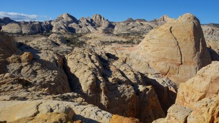
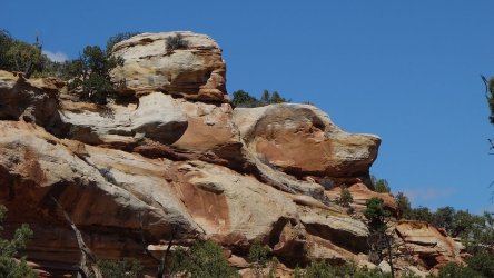
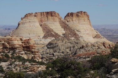
The 4WD road has taken us up some 1,400 feet, from the edge of the South Desert, to an isolated high plateau, at over 7,000 feet in elevation. I was aware of Jamal Green's (@Jammer ) exploration of this area, and had some useful route information of his to follow. However, I hadn't quite been prepared for just how gloriously wild and untamed the 'Capitol Plateau' was. Despite the challenging terrain, this is a wonderfully scenic area, with seemingly endless tremendous views of arches, buttes, domes, hoodoos, and high cliffs. There was one very distinctive double-butte that I observed in the distance on several occasions, that I really liked. It may already have a local name, but I termed it 'Nelly's Smokestacks' And, 'Beagle Rock' was another that made me smile.
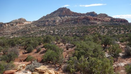
Progress was slow, and a lot of patience was required, but the walking across this fantastic wilderness was very enjoyable. I eventually found my way towards a steep, narrow drainage that conveniently bypasses Horseshoe Mesa (and the Capitol/Capital* Peak !), which towers overhead. After encountering a couple of random cairns, at the exit of the gully, I was then able to scramble back up to the high plateau, and then easily continue onwards, towards the final descent into Lower Spring Canyon. I set up camp with glorious views of several of the iconic features that tower magnificently over the central, most-visited part of the park: Capitol Dome, Navajo Dome, and Pectol's Pyramid.
*The first Topo map to name this peak was published in 1952, when it was called 'Capitol'. In the 2001 version of the map, it is labelled 'Capital'. I suspect the later renaming was a map-maker's (or an auto-spell-check ) error.
The 4WD road has taken us up some 1,400 feet, from the edge of the South Desert, to an isolated high plateau, at over 7,000 feet in elevation. I was aware of Jamal Green's (@Jammer ) exploration of this area, and had some useful route information of his to follow. However, I hadn't quite been prepared for just how gloriously wild and untamed the 'Capitol Plateau' was. Despite the challenging terrain, this is a wonderfully scenic area, with seemingly endless tremendous views of arches, buttes, domes, hoodoos, and high cliffs. There was one very distinctive double-butte that I observed in the distance on several occasions, that I really liked. It may already have a local name, but I termed it 'Nelly's Smokestacks'
Progress was slow, and a lot of patience was required, but the walking across this fantastic wilderness was very enjoyable. I eventually found my way towards a steep, narrow drainage that conveniently bypasses Horseshoe Mesa (and the Capitol/Capital* Peak !), which towers overhead. After encountering a couple of random cairns, at the exit of the gully, I was then able to scramble back up to the high plateau, and then easily continue onwards, towards the final descent into Lower Spring Canyon. I set up camp with glorious views of several of the iconic features that tower magnificently over the central, most-visited part of the park: Capitol Dome, Navajo Dome, and Pectol's Pyramid.
*The first Topo map to name this peak was published in 1952, when it was called 'Capitol'. In the 2001 version of the map, it is labelled 'Capital'. I suspect the later renaming was a map-maker's (or an auto-spell-check
Old jeep road ascends from the edge of the South Desert towards Little Sand Flat and the Capitol Plateau
.
.
View to the North-East of Temple Rock and Jailhouse Rock in the South Desert
.
.
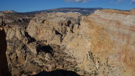
Approaching Little Sand Flat with views of the sandstone wonderland above the Deep Creek drainage
.
.
Looking down into Deep Creek, with Thousand Lake Mountain in the far distance
.
.
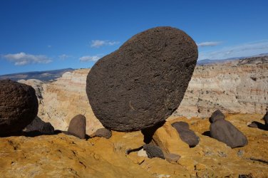
A remarkable balanced rock
.
.
The end of the road, and the mining claim
.
.
Travelling across the Capitol Plateau, with Horseshoe Mesa and the Capitol peak in the distance. My route would skirt around this mesa, on the far-right of the picture.
.
.
Beagle Rock !
.
.
Nelly's Smokestacks !
.
.
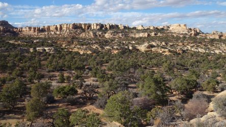
Heading east across the Capitol Plateau
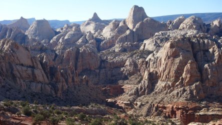
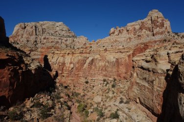
Jamal had documented a steep gully descent into Lower Spring Canyon from the Capitol Plateau, but I had noticed a longer route, which seemed to slope more gently towards the drainage. This turned out to be a very straightforward walk, and it was just a case of following a series of long sloping sandstone slabs (almost) all the way down into Spring Canyon. I say 'almost' because the final 100 yards is over a loose, gravelly slope. I obviously relaxed too soon descending this final section; I stepped on a small protruding ledge that broke off under my boot, and sent me hurtling forward, head-over-heels, banging my head and knee on the rocks below. I was fine, but felt a bit stupid falling over on the very last section of the descent.
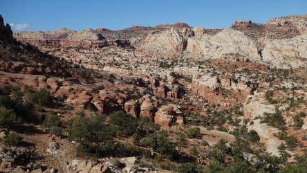
On my hike from Chimney Rock to Burro Wash in 2023, I had found a steep but manageable ascent out of Spring Canyon to the south; this route eventually linking up with the Navajo Knobs Trail. I had read about an alternative ascent that started further downcanyon, and decided to give it a try. This turned out to be quite challenging, with a couple of 'close to dangerous' sections, although I think it would be more straightforward without a full pack to carry. In any case, I struggled through and was able to successfully reach the scenic 'Hidden Glen', and then intersect with the Navajo Knobs Trail soon after.
On my hike from Chimney Rock to Burro Wash in 2023, I had found a steep but manageable ascent out of Spring Canyon to the south; this route eventually linking up with the Navajo Knobs Trail. I had read about an alternative ascent that started further downcanyon, and decided to give it a try. This turned out to be quite challenging, with a couple of 'close to dangerous' sections, although I think it would be more straightforward without a full pack to carry. In any case, I struggled through and was able to successfully reach the scenic 'Hidden Glen', and then intersect with the Navajo Knobs Trail soon after.
Descending into Lower Spring Canyon from the Capitol Plateau
.
.
Overlooking Lower Spring Canyon
.
.
Traversing the Hidden Glen above Spring Canyon, en route to intersect with the Navajo Knobs Trail
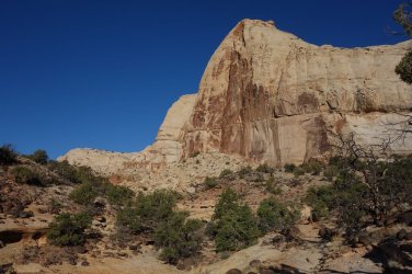
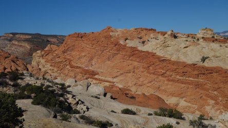
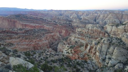
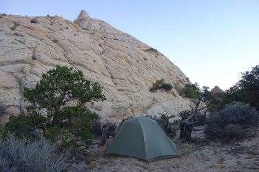
After previously negotiating the rougher areas of the Capitol Plateau, walking along the maintained Navajo Knobs and Frying Pan Trails the following day felt like a real luxury, although encountering fellow tourists again, after several days of complete solitude, was a little disconcerting. I was running a little behind schedule, and didn't start my hike up the Fern's Nipple Route until the afternoon. This turned out to be a mistake because I was running quite low on energy when I reached the tricky upper section, where there is a dry-fall to negotiate using some hiker-made steps. I have negotiated this obstacle several times in the past, but today it was a real mental and physical struggle to ascend for some reason. I was just tired, after a long hot day, I think. I made it, in the end, and thankfully was able to find a stunning campsite, directly under Fern's Nipple, with glorious evening views across the entire northern section of the park.
Navajo Knobs Trail
.
.
Frying Pan Trail
.
.
Looking north-west across the park from the approach to Fern's Nipple
.
.Campsite below Fern's Nipple
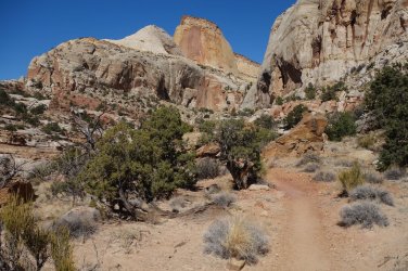
Much of the route south across the high plateau from Fern's Nipple is a huge area of 'jumping' cactus. However, on this occasion, I found the main sandy drainage across the plateau, which made progress much easier, although is less scenic than the higher 'cactus route'. After following the Golden Throne Trail, I was then down in Capitol Gorge.
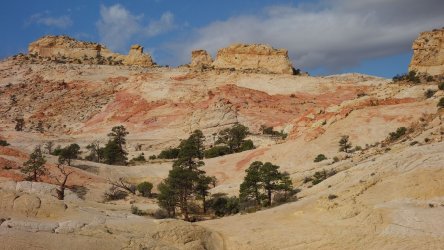
I had considered bypassing the glorious Slickrock Expanse south of this canyon, since I had visited it several times before, but decided against this, and made the long, slow detour up to this area in late afternoon. I was so glad I did because it offers unparalleled views of huge areas of colourful sandstone, but also some excellent camping opportunities amongst the lovely pine-tree groves. As I had hoped, even after a very dry summer, the pot holes on this area still had plenty of water.
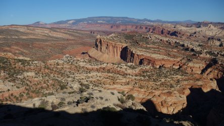
Looking north-west across the route completed so far from Thousand Lake Mountain
.
.
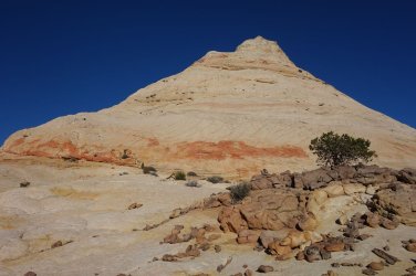
Southern flank of Fern's Nipple
.
.
Golden Throne Trail
.
.
Slickrock Expanse, high above Capitol Gorge and Pleasant Creek
It had been a fantastic first week of my hike, with lovely sunny weather every day; in fact, at times, I was beginning to wonder why I had packed full rain-gear at all. Things were to change !
 ...
...