Udink
Still right here.
- Joined
- Jan 17, 2012
- Messages
- 1,748
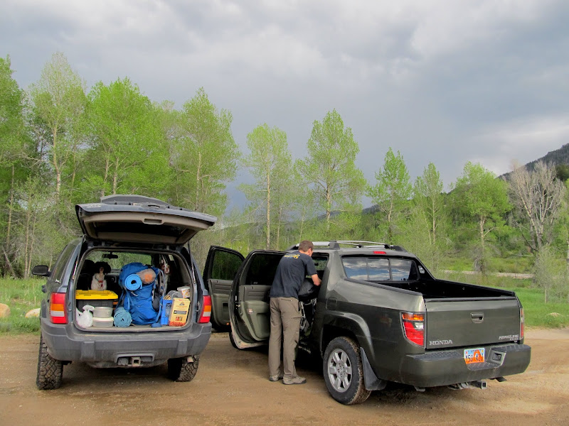
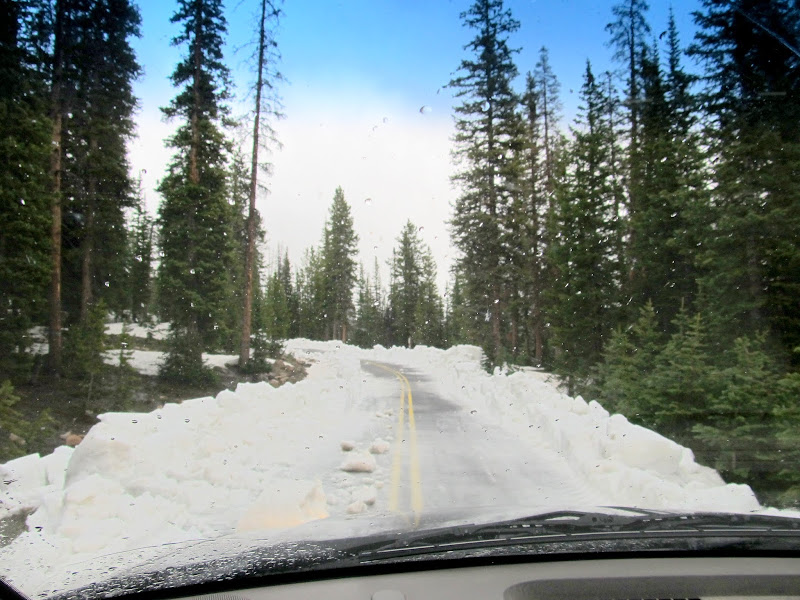
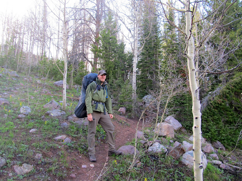
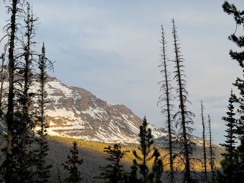
Unlike last year, I got a decent start to the mountain backpacking season this year. Conditions were about the same this year as the last, but I had someone to accompany me and share in the misery. Chris and I met in Kamas later than we'd planned, then drove a short distance up the Mirror Lake Highway and ditched his Ridgeline so we'd only have to pay the recreation fee for my Jeep. After loading his gear we climbed higher along the highway to scope out some potential backpacking spots. I had really hoped the Crystal Lake trailhead would be clear enough to begin hiking from there, but right at the turnoff there was a huge pile of snow blocking the road. It was clear beyond the snow pile, so I threw it in 4WD and went through the snow on the shallowest side. Eventually we caught up to a front-loader pushing snow off the road about 1/3-mile from the trailhead. Even if the road had been cleared to the TH, there was too much snow everywhere else to hike.
Transferring gear to the Jeep
Road to the Crystal Lake trailhead
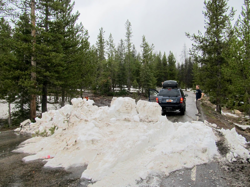
Road to the Crystal Lake trailhead
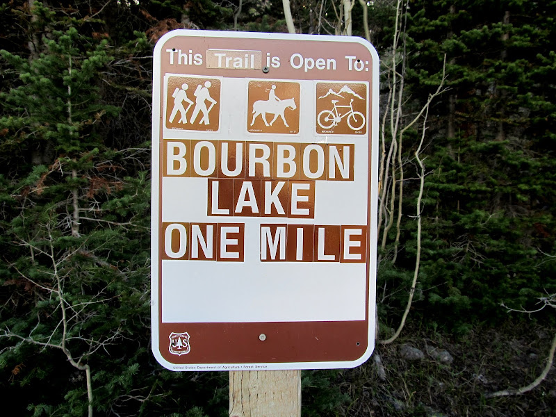
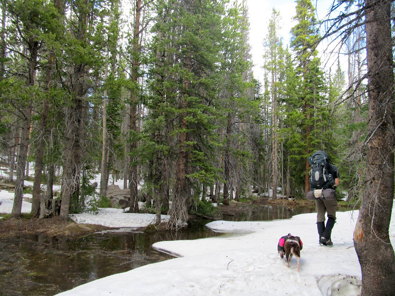
We continued north on the highway, over Bald Mountain Pass, and began descending the other side of the Uintas. Neither of us was very familiar with this side of the range and we were simply keeping an eye out for any trailhead that looked free enough from winter's grasp for us to hike. It was approaching 7PM when we saw the Bourbon Lake trailhead. Considering the late hour and relatively low snow level there, the one mile hike sounded perfect. A quick consult of the topo map on my GPS informed me that we'd have over 600' of elevation to gain before reaching the lake. The trail started out wet but free of snow, though we quickly found the snow line and continued above it.
Bourbon Lake trailhead
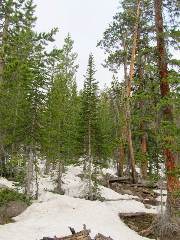
Bourbon Lake trail
Bourbon Lake trail
Bourbon Lake "trail"
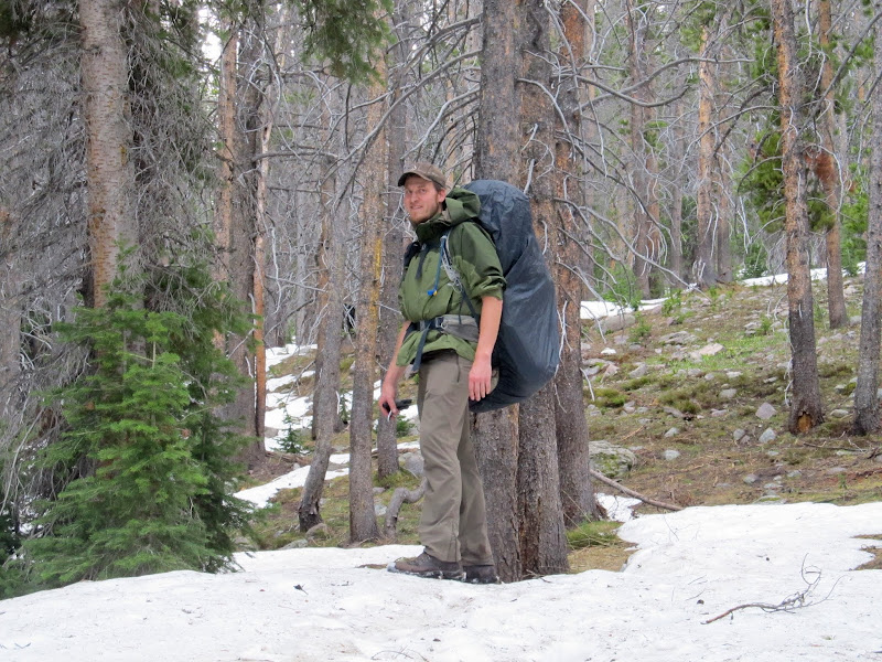
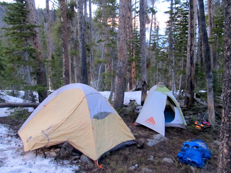
We eventually lost the trail to the deep snow. A steep slope loomed ahead and we tackled it head-on--I often sank up to my crotch but luckily Torrey and Boulder were able to mostly stay on top of the snow. Has I been solo on this trip, this hill probably would have had me second-guessing myself. At the top of the ridge we could barely see the iced-over lake through the trees. The snow looked deep in that direction so we walked away from the lake where there were a few patches of dry (though not very level) ground. We set up camp, built a fire, cooked dinner, and sipped some rum and whiskey near Bourbon Lake.
We lost the trail and ended up punching through the snow up this steep hill
Spotlighting below Hayden Peak
Camp near Bourbon Lake
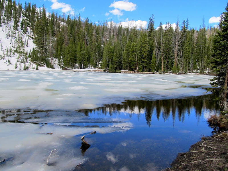
It was surprisingly warm at night. I could hear a strong wind high in the trees but it barely ruffled the tent. I even slept part of the night with my upper body hanging out of my 0-degree bag. I slept well until about 8AM when the dogs informed me that they could no longer stand being cooped up. We left the tent for a while and walked around camp, then crawled back in for a little more snoozing. Chris eventually rolled out of his tent and we lounged around camp a bit more. We hiked over to Bourbon Lake and found that there were actually a couple of good dry spots near the shore at which we could have camped. There was a geocache on the southwest side of the lake that required crossing the outlet stream to reach. Since Chris had better waterproof footwear than I, he went ahead to see if he could find the cache. He zeroed out on a steep hillside covered in deep snow--the cache was probably 10 or 20 feet below, as the tops of trees were sticking out of the snow there.
Bourbon Lake
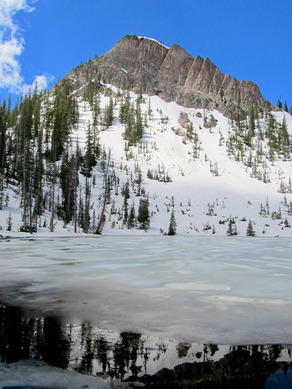
Bourbon Lake
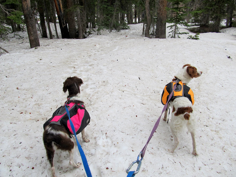
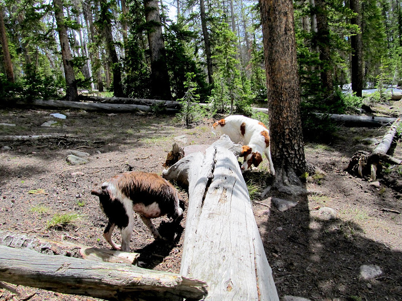
Boulder and Torrey sniffing around
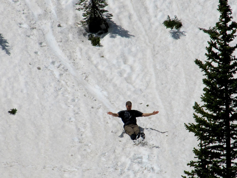
Chris on glissade
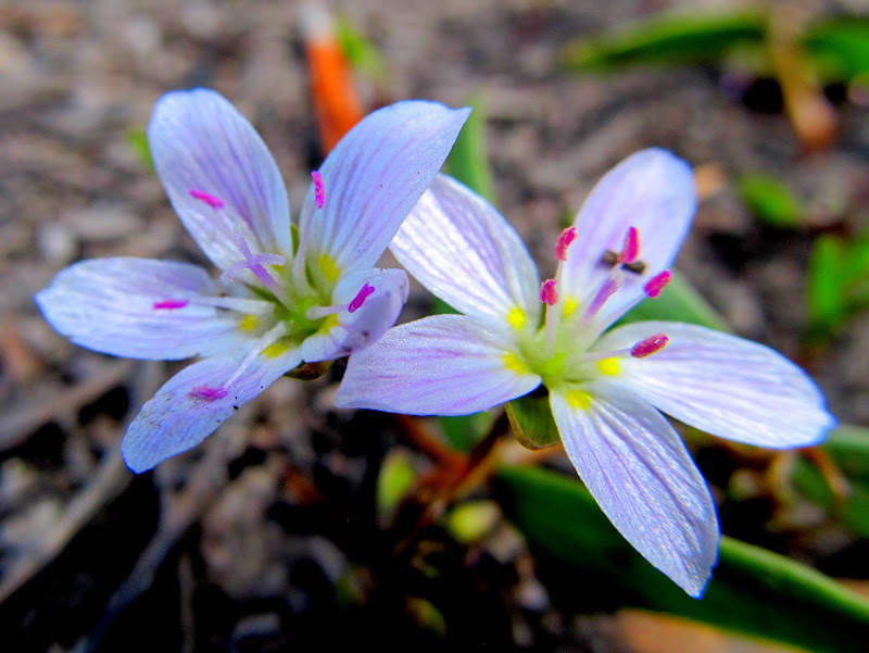
Tiny flowers
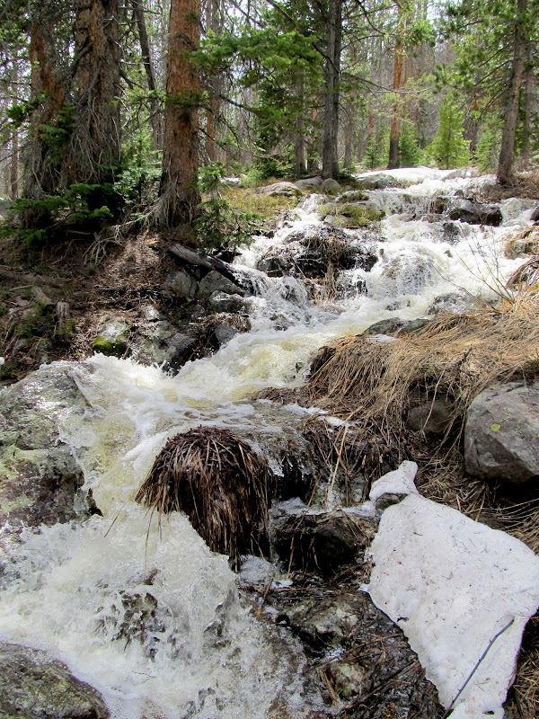
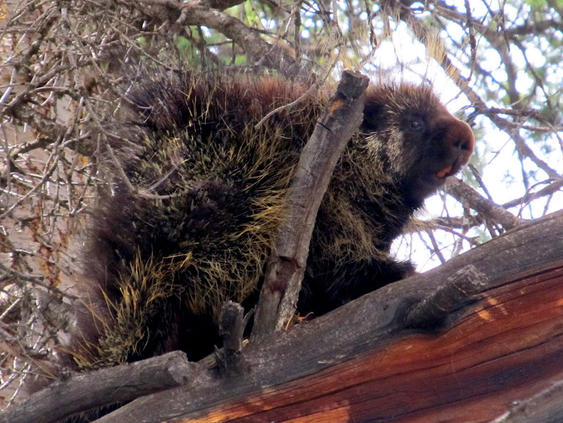
We hung out at the lake for a while longer before returning to camp and packing up. We found the top of the trail near the lake and tried following it back down to the highway. There was noticeably less snow than the previous evening, and some of the snow bridges over rivulets of runoff were now gone. I was stopped to take photos of a small series of falls near the trail when I noticed Chris gesturing down the trail, though I couldn't hear what he was saying over the roar of the creek. Eventually I realized he was pointing to a porcupine and I hurried to get leashes on the dogs. Had I not stopped at the falls I'm certain the dogs would have been leading the way down the trail and ended up with faces full of quills.
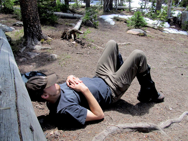
Nappy time
Hiking out
Falls along the trail
Porcupine that the dogs narrowly avoided a confrontation with
Hiking out
Hiking out
We got back to the Jeep and did some driving around, trying to decide on another place to pack into for the night. None of the lower elevation stuff looked all that good. We looked for a couple of geocaches then decided to just head home and call it a trip. I'm pretty sure that in a couple of weeks all the higher elevation trails will be clear, and I'm looking forward to several more backpacking trips this summer and fall.
Misleading sign
Ruins near an old sulfur mine
Full photo gallery: https://picasaweb.google.com/Dennis.Udink/BourbonLake
[parsehtml]<iframe width="800" height="600" frameborder="0" scrolling="no" marginheight="0" marginwidth="0" src="https://maps.google.com/maps?q=http:%2F%2Fudink.org%2Fgeo%2FBourbonLake.kmz&hl=en&sspn=0.082137,0.169086&t=h&ie=UTF8&ll=40.786228,-110.892198&spn=0.010089,0.021136&output=embed"></iframe><br /><small><a href="https://maps.google.com/maps?q=http:%2F%2Fudink.org%2Fgeo%2FBourbonLake.kmz&hl=en&sspn=0.082137,0.169086&t=h&ie=UTF8&ll=40.786228,-110.892198&spn=0.010089,0.021136&source=embed" style="color:#0000FF;text-align:left">View Larger Map</a></small>[/parsehtml]http://udink.org/geo/BourbonLake.kmz
Featured image for home page:

Transferring gear to the Jeep
Road to the Crystal Lake trailhead
Road to the Crystal Lake trailhead
We continued north on the highway, over Bald Mountain Pass, and began descending the other side of the Uintas. Neither of us was very familiar with this side of the range and we were simply keeping an eye out for any trailhead that looked free enough from winter's grasp for us to hike. It was approaching 7PM when we saw the Bourbon Lake trailhead. Considering the late hour and relatively low snow level there, the one mile hike sounded perfect. A quick consult of the topo map on my GPS informed me that we'd have over 600' of elevation to gain before reaching the lake. The trail started out wet but free of snow, though we quickly found the snow line and continued above it.
Bourbon Lake trailhead
Bourbon Lake trail
Bourbon Lake trail
Bourbon Lake "trail"
We eventually lost the trail to the deep snow. A steep slope loomed ahead and we tackled it head-on--I often sank up to my crotch but luckily Torrey and Boulder were able to mostly stay on top of the snow. Has I been solo on this trip, this hill probably would have had me second-guessing myself. At the top of the ridge we could barely see the iced-over lake through the trees. The snow looked deep in that direction so we walked away from the lake where there were a few patches of dry (though not very level) ground. We set up camp, built a fire, cooked dinner, and sipped some rum and whiskey near Bourbon Lake.
We lost the trail and ended up punching through the snow up this steep hill
Spotlighting below Hayden Peak
Camp near Bourbon Lake
It was surprisingly warm at night. I could hear a strong wind high in the trees but it barely ruffled the tent. I even slept part of the night with my upper body hanging out of my 0-degree bag. I slept well until about 8AM when the dogs informed me that they could no longer stand being cooped up. We left the tent for a while and walked around camp, then crawled back in for a little more snoozing. Chris eventually rolled out of his tent and we lounged around camp a bit more. We hiked over to Bourbon Lake and found that there were actually a couple of good dry spots near the shore at which we could have camped. There was a geocache on the southwest side of the lake that required crossing the outlet stream to reach. Since Chris had better waterproof footwear than I, he went ahead to see if he could find the cache. He zeroed out on a steep hillside covered in deep snow--the cache was probably 10 or 20 feet below, as the tops of trees were sticking out of the snow there.
Bourbon Lake
Bourbon Lake
Boulder and Torrey sniffing around
Chris on glissade
Tiny flowers
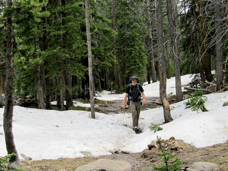
We hung out at the lake for a while longer before returning to camp and packing up. We found the top of the trail near the lake and tried following it back down to the highway. There was noticeably less snow than the previous evening, and some of the snow bridges over rivulets of runoff were now gone. I was stopped to take photos of a small series of falls near the trail when I noticed Chris gesturing down the trail, though I couldn't hear what he was saying over the roar of the creek. Eventually I realized he was pointing to a porcupine and I hurried to get leashes on the dogs. Had I not stopped at the falls I'm certain the dogs would have been leading the way down the trail and ended up with faces full of quills.
Nappy time
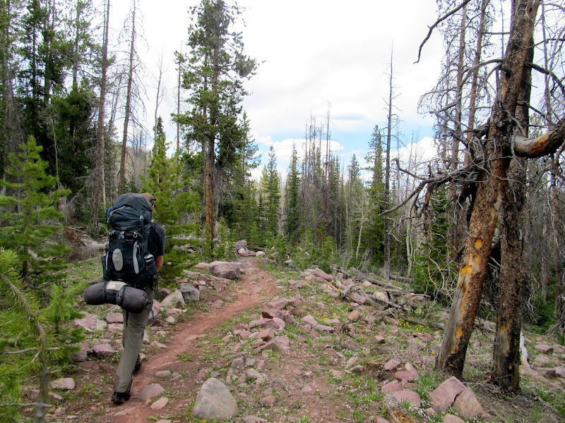
Hiking out
Falls along the trail
Porcupine that the dogs narrowly avoided a confrontation with
Hiking out
Hiking out
We got back to the Jeep and did some driving around, trying to decide on another place to pack into for the night. None of the lower elevation stuff looked all that good. We looked for a couple of geocaches then decided to just head home and call it a trip. I'm pretty sure that in a couple of weeks all the higher elevation trails will be clear, and I'm looking forward to several more backpacking trips this summer and fall.
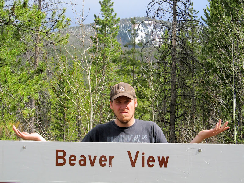
Misleading sign
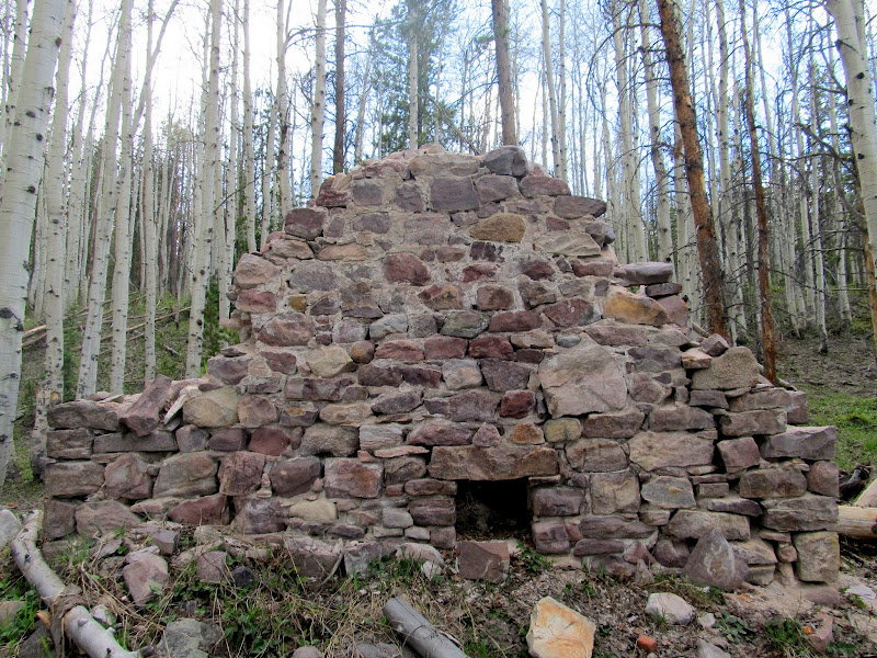
Ruins near an old sulfur mine
Full photo gallery: https://picasaweb.google.com/Dennis.Udink/BourbonLake
[parsehtml]<iframe width="800" height="600" frameborder="0" scrolling="no" marginheight="0" marginwidth="0" src="https://maps.google.com/maps?q=http:%2F%2Fudink.org%2Fgeo%2FBourbonLake.kmz&hl=en&sspn=0.082137,0.169086&t=h&ie=UTF8&ll=40.786228,-110.892198&spn=0.010089,0.021136&output=embed"></iframe><br /><small><a href="https://maps.google.com/maps?q=http:%2F%2Fudink.org%2Fgeo%2FBourbonLake.kmz&hl=en&sspn=0.082137,0.169086&t=h&ie=UTF8&ll=40.786228,-110.892198&spn=0.010089,0.021136&source=embed" style="color:#0000FF;text-align:left">View Larger Map</a></small>[/parsehtml]http://udink.org/geo/BourbonLake.kmz
Featured image for home page:
")