UP AGAINST THE WALL
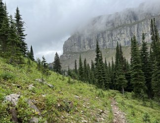
I woke to light rain on the morning of day 7. In between showers I managed to cook and eat breakfast and pack up. It rained off and on as I followed the trail up the Burnt Creek valley towards its headwaters at the base of the Chinese Wall. As I neared treeline, the trail began to veer to the northeast. Then I reached a junction with an obvious, but unmarked trail. I walked it for a few minutes, following it up the valley parallel to Burnt Creek. I suspect that it connects with the high route over to White River Pass, but I’m not sure.
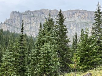
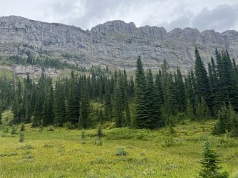
I returned to the Continental Divide Trail and resumed the climb towards the base of the Wall. I caught glimpses of the cliffs through the trees, which thinned rapidly as I climbed. There are numerous brushy meadows below the ridge separating the Burnt Creek headwaters from Moose Creek, but I didn’t see much in the way of campsites, probably due to the steep terrain. That’s a shame, because there are numerous small streams running down towards Burnt Creek. The base of the Wall in the headwaters of Moose Creek, between the base of Cliff Mountain and Salt Mountain, is closed to camping due to previous overuse. It looks like people camp in the meadows along the ridge just south of the official boundary. I had originally planned to camp in that area, but I scrapped that due to my route change. It was only mid-day, so I was more interested in finding a place for lunch.
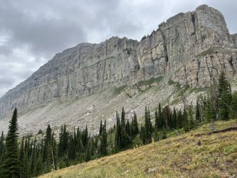
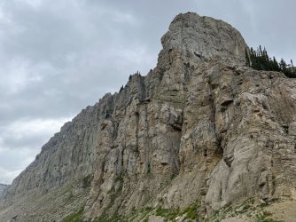
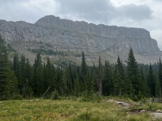
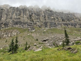
Instead of following the Continental Divide Trail down into the headquarters of Moose Creek, I picked up an obvious path heading up the ridge towards the base of Cliff Mountain. It led to an amazing spot at the very bottom of the Wall. The Wall curves back to the northwest and back to the southwest, so Cliff Mountain is one of the few places where you can see the length of it in each direction. The weather was overcast with occasional light rain, but the clouds were high enough that the views weren’t compromised. I found a place to sit and eat lunch and appreciate the scenery.
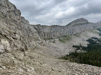
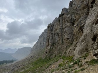
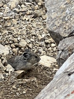
While I was eating, I played peek-a-boo with a curious Pika that mostly hid in the surrounding rocks.
I wasn’t in any hurry, so I lingered for an hour or so. Finally I heard voices, and it sounded like a group of backpackers was heading my way. I took that as my cue to head back down to the trail.
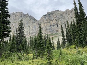
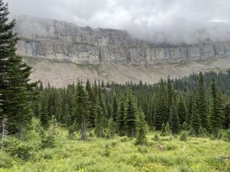
I returned to the CDT and followed it north, down into the headwaters of Moose Creek. After the descent, I enjoyed a couple of miles of strolling near the base of the Wall. I frequently crossed small streams, which was delightful. The slopes and gullies on the west side of the escarpment were mostly dry, but there was water everywhere on the east side. Apparently most of the rain and snow that falls on the escarpment percolates through the rock and emerges in countless springs.
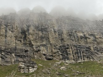
I passed through meadows and scattered trees, a thousand feet of stone soaring into the clouds above me. The clouds had descended, and the top of the Wall was no longer visible. In a way that made it more scenic, or at least more imposing.
Any doubts I may have harbored about the wisdom of flipping my route were long gone. Hiking the top of the Wall in those conditions would have been disappointing. And the thunderstorms the previous afternoon would have been terrifying, if not deadly.
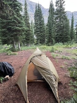
I reached the junction with the Moose Creek Trail, which descends east along Moose Creek. From there, I climbed to the ridge separating the Moose Creek drainage from Rock Creek. The camping closure ends at the top of that ridge, but I didn’t see any likely places to camp near the trail. I continued following the CDT north, descending into the Rock Creek drainage. At the end of the descent I found a large campsite - the first I’d seen since the south end of the camping closure below Cliff Mountain. It was only 4pm, but I decided to camp there anyway, for a couple of reasons. First, I wanted to spend a night below the Wall. After all, it was one of the highlights of the trip, and I didn’t want to rush past it. Also, my next goal was to camp on the summit of Bungalow Mountain, which was a reasonable day’s hike away. Hiking there that evening wasn’t realistic, but getting closer to it wouldn’t really be advantageous, either.
I set up camp and got water before the rain resumed. I enjoyed a late afternoon nap, and I made dinner late that evening after the rain stopped. Fortunately the rain was light, and my tent held up. I went to bed just before dusk, hoping for a good night’s sleep. It was interrupted a couple of hours later when a group of backpackers arrived and set up camp a couple dozen yards away. I was a bit annoyed – it’s generally bad etiquette to share a campsite without asking. On the other hand, I’m sure they didn’t want to wake me, and I wasn’t inclined to crawl out of the tent and talk to them. Also, I knew that if they were heading north they had just covered several miles where camping wasn’t allowed. Likewise, if they were heading south, they were at the last reasonable place to camp. So it’s hard to blame them for bad form. Fortunately they set up camp and quieted down quickly.
This trip has so many bailouts, you’d think it was paid for by the American taxpayers.
It rained off and on that night, but only lightly. It was damp and chilly early the next morning when I got up. I met my neighbors, and we chatted a bit while they were packing up. They were thru-hiking the Continental Divide Trail, heading north. They were a couple – or at least a guy and girl hiking together and sharing a single tent. Apparently they had met on the trail. Based on her accent, she must have been from Eastern Europe or Russia. He was from Florida, but had lived in Highlands, NC for a year or so.
They relayed one key piece of information. Before they had entered the south end of the Bob Marshall Wilderness they had stopped at a ranger station to check on trail conditions. Apparently there was a brand new wildfire that had begun shortly after I had started my trip. It was along the Spotted Bear River, and it had grown quickly. This was alarming, because I would have to pass through the Spotted Bear River valley the day after I camped on top of Bungalow Mountain. It was unavoidable – there was no reasonable route around it unless I skipped Bungalow Mountain altogether. The whole area was closed off to everyone except firefighters, and trying to go through there anyway would be potentially dangerous. The smoke alone would be a major problem.
What to do? I could hike to Bungalow Mountain, camp, and then backtrack to Larch Hill Pass and My Lake. I might have done that if the weather had been better. However, I’d already checked the forecast, which called for two more days of low clouds and rain, plus surprisingly cold temperatures. I wasn’t very motivated to go out of my way to camp on top of a mountain in the rain. In fact, I wasn’t very motivated to do anything. The other area that I was looking forward to visiting on this trip is the Trilobite Mountains, north of the Spotted Bear River. I hated to miss that part of the trip, but there was no reasonable way for me to get there, experience the area, and get back to my car in the time that I had left.
I spent some time considering my options over breakfast. What to do? I could wander around in the rain and kill time. I could hike out ahead of schedule and find somewhere else to spend a few days. Or I could hike out ahead of schedule and go home. That was painful to contemplate. I hardly ever bail out early on a trip. But…I was missing my son, and my wife. The remaining parts of the trip that I was most looking forward to were no longer attainable. And I was worried about the wound in my leg. There was still a small piece of wood in there, and I’m not a doctor, but I was pretty sure that it was infected. I didn’t really look any worse than it had a couple of days earlier, but it certainly didn’t look better, either. I knew that I should get it looked at as soon as possible.
I messaged my wife through the Garmin and asked her to check with American Airlines to see if I could change my flight from Sunday to late Wednesday or Thursday. She responded almost immediately. As expected, options were limited. An early morning departure on Thursday morning from Bozeman was the only reasonable option. I asked her to check the cost. Her reply came a little later, telling me that she had changed my flight and I was leaving Bozeman at 6am Thursday. She didn’t mention the cost. I had booked the original flight using frequent flier miles, so the only way to pay for the flight change was to use more miles. After I got home I found out that the cost was shockingly steep. It’s pretty depressing when you piss away your frequent flier miles – particularly when frequent flier miles are one of your most substantial assets.
GARGOYLES AND GNOMES
The change in plans solved my motivational crisis. I had work to do if I was going to be at the Bozeman airport at 4am on Thursday. I was so far off my original plan, I really wasn’t sure how long it would take me to get out of the wilderness. It was Sunday morning, so I was pretty confident that I could get out on Tuesday, Wednesday at the latest. Tuesday would be better though, as it would give me time for some post-hike overindulgence and hopefully a visit to Urgent Care to check out my leg. If not, I’d have to deal with that after I got home.
I studied the map over breakfast to determine the best exit route. There were only a couple of reasonable options, due to the fire along the Spotted Bear River. I could backtrack a couple of miles and descend along Moose Creek to the North Fork of the Sun River. However, that route would be considerably longer than simply going back the same way that I came in. Backtracking wasn’t very inspiring, but at least I knew what to expect.
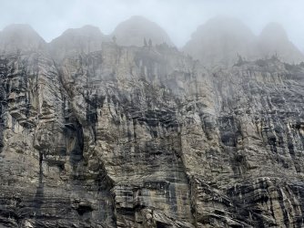
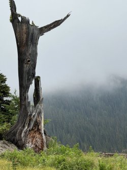
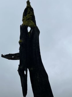
I packed up and resumed my hike on the Continental Divide Trail, heading north towards Larch Hill Pass and My Lake. It was a delightful morning, with heavy fog, swirling mist, and only a little bit of drizzle. The Wall loomed in and out of the fog above me. At one point I looked up and noticed a series of rock towers at the top of the Wall. They looked like gargoyles on a spooky medieval castle. I enjoyed every bit of my hike that morning, from the swirling fog along the Wall to the waves of clouds breaking on the distant mountains. I passed several dead, twisted, mossy trees that looked like gnomes hunched beside the trail.
A tedious climb led me towards Larch Hill Pass, but it ended at a junction. I continued following the CDT north from there, contouring below the ridge of Larch Hill. I passed into thicker forest, and after a couple of miles I descended to My Lake, where I’d camped on Tuesday night. I had lunch there before hiking back to Spotted Bear Pass and on down the CDT towards Rock Creek. The rain picked up that afternoon, and I stopped at the Rock Creek Ranger Station for a break from it. The rain eased up later that afternoon. I considered camping at Baldy Bear Creek, as the campsite there is a little nicer than Miners Creek, but I decided to continue on and knock out another mile and a half. The decision was a good one, as the Miners Creek campsite was available, and I found it rather cozy. I settled in and enjoyed a quiet evening.
TWO DAYS TO BOZEMAN
Monday morning started out overcast, but at least I didn’t have to make breakfast or pack up in the rain. The conditions suited the dark, jungle-like forest, too. I hiked back to Red Shale Creek, which was running higher after several rainy days. It had been a tough rock hop on the way in. On the way out I managed to soak one boot getting across.
The sun made a surprise appearance as I entered Gates Park. I had been expecting another rainy day, and the sudden sunshine brightened my mood. I hiked to the bridge over the North Fork Sun River, but instead of crossing I followed a side trail downstream to a large grassy campsite near a swimming hole. There wasn’t anyone around, so I unpacked my gear and spread it out to dry. I lounged there for awhile, enjoying the warmth and an early lunch.
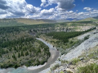
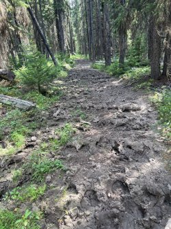
Afterwards I crossed the bridge and headed upstream on the East Side Trail. Before long I passed the junction with the Headquarters Creek Trail and entered new territory for the first time in a couple of days. This trail was nice initially, with some lovely views of the river and the surrounding mountains. However, it went to shit after I waded across Ray Creek. For a couple of miles I navigated a badly rutted trail. It looked like it had received heavy horse traffic when it was muddy, and the mud had dried into a tapestry of holes and ruts.
The trail did improve after I waded across Route Creek. The hike upstream along Route Creek was much more pleasant, and I enjoyed the best weather of the whole trip that afternoon. I continued up to Nesbit Creek, where I found a large, open camping area in a grassy meadow. There wasn’t anyone around, so I decided to spend my last evening there.
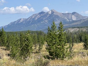
It was cold that night, and I overslept on Tuesday morning. I finally made it out of the tent at 7:30 and packed up for the hike out. It was sunny but chilly as I waded Route Creek twice before following Route Creek up towards Route Creek Pass. This stretch of trail featured some nice views back to the east. The pass has pleasant scenery, but the views weren’t overwhelming.
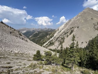
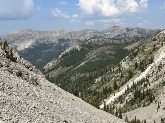
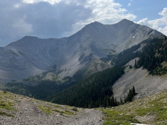
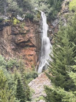
I followed a braided trail down from the pass into the headwaters of the Middle Fork Teton River. The highlight of this stretch of trail is a spectacular waterfall. I explored off trail to get a better look at it, and I ended up finding a perch on a rocky spine of rock with a great view. It wasn’t a comfortable spot, but I had lunch there anyway because of the scenery.
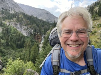
I returned to the trail and continued down the valley to Garners Gulch. I reached an unsigned junction and stopped to look at the map. I heard a stick break and looked up to see a black bear strolling across the trail to the right about 100’ away. He completely failed to notice me, and I wouldn’t have seen him if I hadn’t looked up. I decided to take the trail to the left, which turned out to be correct.
15 minutes later I spotted another bear just off the trail below me. I only got a brief glimpse of this one, but I think it may have been a grizzly based on its massive shoulders. It bolted before I could get a photo or even a good look at it.
I think it’s funny that I spent 10 days in the Bob Marshall Wilderness and saw 3 bears, but two of them were in the last mile or so.
I met two women and a dog dayhiking a few minutes later and warned them about the bears. They were the first people I’d seen in 2 days. From there, it took another 10 minutes to reach the Cave Mountain Campground, which was less than ½ full. It was late afternoon on Tuesday, and I needed to figure out where I would spend the next couple of nights.
I decided to camp at the campground that night, since I was already there. It’s a pretty nice campground, and only $10. However, there was no way that I was settling for another dehydrated meal. I found a campsite, set up my tent, and drove back to Choteau. There were two restaurants open in town, and I ended up at John Henry. I had a good burger, greasy fries, and a Moose Drool there. I spent some time searching online for a hotel near Bozeman for Wednesday night. There weren’t any free hotels (using points) available on the Priority Club website (Holiday Inn, etc), and prices were insane. The Motel 6 in Bozeman was $175! Luckily I was able to score a free night at the Hilton Garden Inn. Hooray! I picked up a 6 pack of Moose Drool at the store and headed back to the campground for the evening.
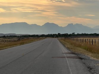
Sunset on the drive back to the Cave Mountain Campground
My dilemma the next morning was breakfast. There was no way that I was settling for oatmeal and instant coffee again. I drove back to Choteau and found my way to Copper Creek Coffee. I had a great breakfast burrito and lots of good coffee there before driving back to Bozeman. I picked up a sandwich for lunch, checked into the hotel, and headed to the closest Urgent Care. When the doctor came into the room she took one look at my leg and said “well that’s infected”. So that answered that question. She prescribed some antibiotics and gave me instructions for treating it. It healed nicely, but I’ll always have a scar to remind me of the bushwhack up to the top of the Chinese Wall.

Not where I wanted to end my trip
That evening I enjoyed a very good meal and a couple of beers at MAP Brewing. Then I headed back to the hotel, packed for my flight, and finished the rest of my Moose Drool. I went to bed early, but I slept poorly as always when I have to be at an airport at 4am.
I arrived at the Bozeman airport at 4am for my 6am flight. The place was nuts. Checking in wasn’t too bad, but the line for security was so long that it wasn’t really a line. It was just a huge mob of people that threatened to overflow the airport. There was no sort of organization, nor any sense for how long it would take. It was a good thing that I arrived 2 hours early, because I ended up having just enough time to grab a bagel and coffee before getting on the plane. The rest of the travel was smooth, and I made it home late that afternoon.
I hope to make it back to the Bob Marshall Wilderness again some day. I’d like to get to the areas that I missed out on this time, and I’d like another shot at traversing the top of the Chinese Wall.
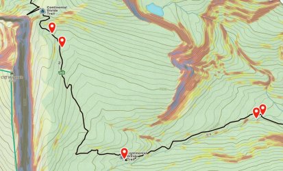
Day 7, morning. Campsite on Burnt Creek to the base of the Chinese Wall,
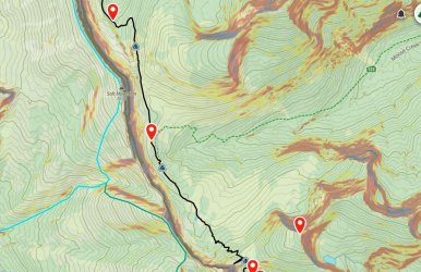
Day 7, afternoon, hiking north along the base of the Chinese Wall (route in black)
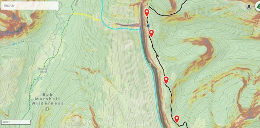
Day 8, morning. Base of the Chinese Wall back to My Lake,
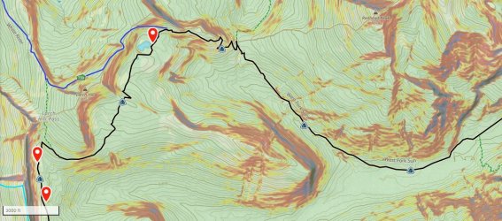
Day 9, morning. Back to My Lake and Rock Creek
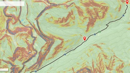
Day 8, afternoon. Back to the campsite at Miners Creek.
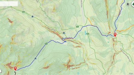
Day 9, morning. Back to Gates Park.
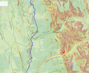
Day 9, afternoon. Upstream along the North Fork Sun River.
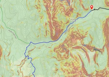
Day 9, evening. On to camp at Route Creek.

Day 9, afternoon. Upstream along the North Fork Sun River.

Day 9, evening. On to camp at Route Creek.
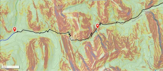
Day 10, morning. Over Route Creek Pass.
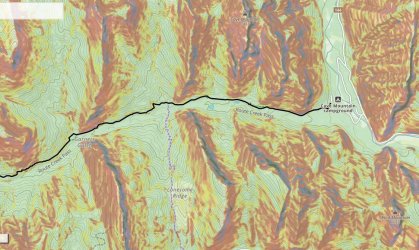
Day 10, afternoon. Exit at Cave Mountain Campground.

