In part 2, I bushwhacked and scrambled to the top of The Chinese Wall. I then got myself into a situation that wasn't quite a survival situation, but could have been with 1-2 more bad decisions. Later, I encountered a backpacker that was having a medical emergency. I called for help using my Garmin In Reach, and he was rescued by helicopter the next morning.
Route maps are at the end of the post.
In my pre-trip research, I’d read one trip report from a group that had climbed to the top of the Chinese Wall from the north. They had started from the White River Trail, leaving it around 6,200’ and bushwhacking south a considerable distance to bypass cliffs before heading up to the east. That route was one option I was considering. The other option was to continue down the White River Trail another 400 vertical feet, almost to the river, before bushwhacking up due east. Ultimately, I decided on the first option, since I knew that at least one other group had managed it. The other route was a complete unknown. In hindsight, I think it would have been better to stay on the trail longer. It would have added 400’ to the climb, but it would have required less bushwhacking. Of course, I don’t know how bad the bushwhacking would have been starting out closer to the river.
I got up at sunrise, but as usual I was slow breaking camp. That would come back to bite me.
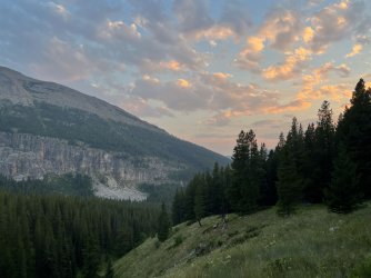
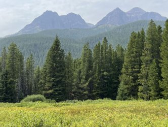
I broke camp at 8:30 and backtracked a short distance to the Larch Hill Trail. I followed this trail southwest towards Larch Hill Pass. This trail was quite scenic, with good views of My Lake below and several nice vistas of the mountains to the north. It was mostly easy walking, too. Later in the trip I hiked the section of the CDT that runs parallel to this trail down the slope to the east. That trail is mostly in the woods and is far less scenic than this one.
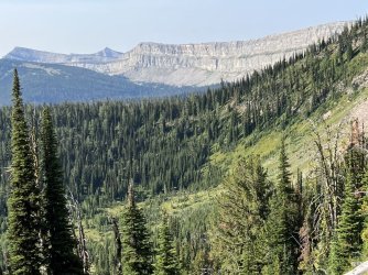
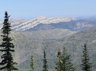
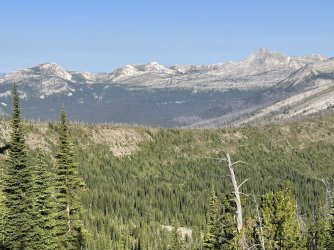
I reached the White River Trail a bit west of Larch Hill Pass. I stopped there for a short break, and I discovered that the electrical connection to my solar panel had broken off. I had broken the first one I had the previous summer in the same way. Unfortunately that cheap brand of solar panel just isn’t durable enough for an extended backpacking trip in rugged wilderness. This meant that I had no way to charge my phone except for the spare battery pack I’d brought, and I had no way to recharge the battery pack. I would need to be very conservative with my phone usage through the rest of the trip.
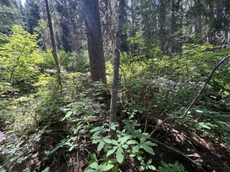
I began a long descent through burned forest. I eventually dropped down into living forest and noticed that the vegetation was THICK. It looked like I was in for a serious bushwhack.
I followed the trail until I reached a good point to leave it for my bushwhack south. Just starting out was tough, due to jungle-like vegetation and fallen trees. After a few minutes I reached a gully with a small stream. I had lunch there and filtered water. I carried almost 4 quarts from there to the top of the Wall. It wasn’t a great lunch spot, due to the thick vegetation and bugs, but it was a convenient place to tank up on water before I started my climb.
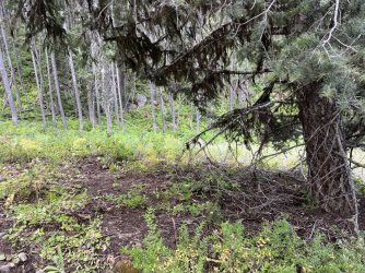
The bushwhack south was slow and tedious. My intention was to head south and climb gradually, as I wanted to pass below and west of a long band of cliffs that descend from the top of the wall to about 7,000’. That was the plan, but the reality was that I just tried to keep heading south by following the path of least resistance. The slope was heavily forested, but the biggest challenge was the frequent gullies. Each time I reached one, I found that the north side of the gully and the gully itself were relatively open, but the south side (north facing) was always a jungle. I imagine those north facing slopes hold snow longer and stay wetter than the rest of the surrounding area. Regardless, getting down into the gullies was usually pretty easy, but picking out an exit route was tough! Typically I would climb a bit parallel to the gully, in hopes of finding a better route on the opposite side. That almost always failed, though it did help me slowly gain elevation. After climbing a bit I would drop down into the gully and then crawl out the other side. Once I was beyond the gully, the woods would open up, and I would enjoy a brief stretch of easy walking – until I reached the next gully.
This whole slope is covered in huckleberry bushes. Those bushes were loaded with berries, but they weren’t ripe yet. That was lucky for me. I imagine that slope is covered in bears by mid-August.
I had just climbed out of the 136th gully since leaving the trail when I stepped in an unseen hole and stumbled. I fell on my side, but picked myself up quickly. I brushed myself off and took a few cautious steps to make sure I hadn’t injured my ankle or knee. Everything seemed ok, so I pressed on. A few minutes later I glanced down and saw blood on my left shin. Where did that come from?
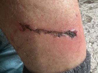
I found a boulder to sit on and inspected my leg. There was a long, jagged cut ending with a small piece of wood embedded in my leg. I got out my first aid supplies, which I carry on every hike but rarely use. I cleaned off the blood and dirt with filtered water. I then attempted to remove the imbedded wood using my pocket knife. That failed – in fact, all I managed to accomplish was to make it bleed more. I cleaned the wound again and then used hand sanitizer to sterilize it. I then applied Neosporin, put on a band aid, and resumed the hike.
A few hundred gullies later I finally passed below the cliffs. The bushwhacking was finally over. Now all I had to do was climb 1,200’ to the top of the wall. The slope was steep, but not unreasonable. The good news is that the slope was open, without any obstacles. The bad news is that the slope was open, without any shade. It was late afternoon on an unusually hot day, and I was climbing a west-facing slope.
Heat usually doesn’t bother me much, but this was brutal. There were a few trees scattered about, so I climbed from one to the next, resting in the shade of each one until I caught my breath. I was sweating so much, it felt like I was melting. Every drink of water seemed to come right out. The open slope did provide some really nice views west across the White River Valley to the next range of mountains, the Flathead Alps.
I climbed slowly in this fashion, gaining 50-100 vertical feet between brief rest breaks. I paralleled the line of cliffs running west from the top of the escarpment. I stayed a bit south of them though, as the walking was easier there. The walking was on flat, broken rock that crunched under my feet. Geology isn’t my strong point, but I think it was shale.
By the time that I reached the top of the Wall I was wrecked. I reached the top of the Wall at 47.72073, -113.16591. Part of me wanted to turn north and make a short jaunt to the top of a point with cliffs to the east and north. Tet route up to that point was also loose rock though, and it didn’t look pleasant. I was also so wiped out that doing anything extra seemed like a bad idea.
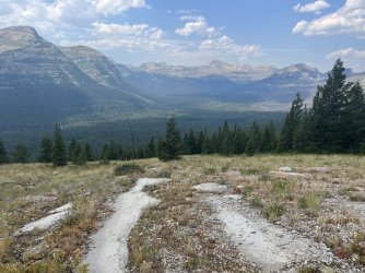
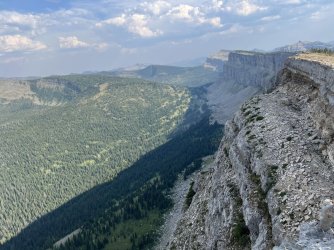
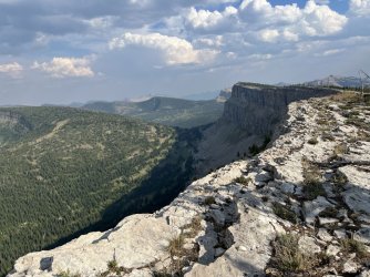
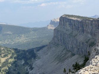
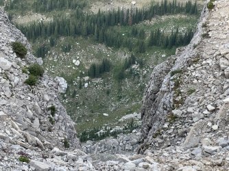
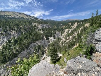
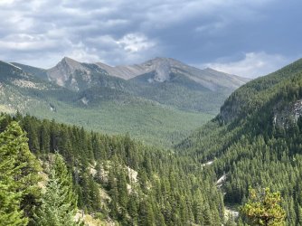
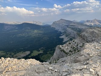
Instead, I paused to take in the view. I was at the brink of a 1,000 sheer cliff. Incredibly, I could clearly see the Continental Divide Trail passing through a meadow directly below. I looked east from the top of the Wall, back towards the Sawtooth Range where I had started my trip four days earlier. To the south, the Wall stretched away, impossibly far, into the hazy distance.
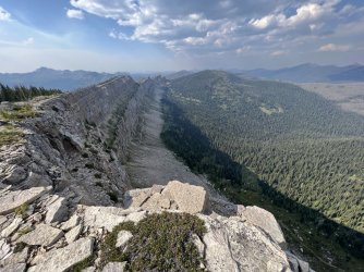
I started walking that way. My immediate goal was Salt Mountain, which is the highest point along the northern end of the Wall. Fortunately, the walking was pretty easy. The broken rock continued, but there weren’t any major obstacles. For a while I followed a narrow bench that parallels the crest about 10-15’ below the top. That bench put me a couple of feet from the brink of the cliffs. It was easy walking though, at least until the bench fizzled out at the edge of a vertical gully. I backtracked briefly from there before scrambling back up to the top.
Walking the crest was awesome, despite my exhaustion. The views were great, of course, but just being in such an incredible place was a magical experience.
My water bottle was in my right hip pocket, which was bad strategy. Since I was hiking south, my right pocket was directly in the sun. I realized my mistake when I took a drink and found that the water was actually hot. Hot enough that I could have made a nice cup of tea with it.
Although it was easy walking, I was way behind schedule. The bushwhacking early that afternoon had been slow, and the climb to the top of the wall wasn’t much faster. It was after 7pm when I finally reached the summit of Salt Mountain. That was not ideal, as I had some work to do to reach my intended campsite.
I was shooting for a small pond northwest and about 900’ below the summit of Cliff Mountain. Unfortunately, I couldn’t just descend directly to it. A short distance south of Salt Mountain was a big cliff that I would have to bypass to the west. The only realistic route would require heading southwest and descending about 800’. Then I would have to bushwhack south for a considerable distance to avoid more cliffs. Once past the steepest terrain, I could start climbing northeast up a forested valley towards the pond. That was my plan, as I didn’t really have any other options.
“The shoulder that I leaned on was carved out of stone
But when I'm done freezing I want to be alone
Left is where I always turn
Left is how I'm forced to learn
Left the route my walking takes
Left alone with my mistakes
Drop me off the Chinese Wall
And peel my fingers off the rim
I come unglued while in midair and land to reform
Limb by limb”
From “Limb by Limb” by Phish. Lyrics written by Jon Fishman, Scott Herman, and Trey Anastasio.
The descent was pretty quick and easy. As I headed down, I began to wonder if the gully at the bottom would have any water. Almost all of the gullies I had passed through earlier had been dry, but this one looked much more substantial on the map. If there was water down there, I might be able to camp near it. That was appealing, since it was pushing 8pm.
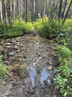
I found a dry streambed at the bottom. It obviously has water flowing through it seasonally, but that was already long gone. It was so dry it was actually dusty.
I followed the gully downstream, in an effort to pass another band of cliffs running northwest from the crest of the Wall. Eventually I left the streambed and started climbing south. However, I kept running into little bands of cliffs that weren’t apparent on the map. It was tough terrain, and I kept getting forced west and down, rather than south and up. It was slow going, too. By 9pm I was nowhere near the point where I could start up towards the pond. I’d never make it there before dark. Bushwhacking in the dark in Grizzly country wasn’t appealing. And was I even sure that there would be water in that pond? It was SO DRY. What if all of the water had evaporated? If that happened, my life could really be in danger. I had less than a quart of water left. Climbing back up to the top of the Wall the next day without water was not an option.
Pushing on, solo, in the dark, off trail, with only a little water left was just too risky. The correct decision was obvious, but painful. I needed to bail out.
Bailing out was the right call, but it was easier said than done. I was a long way from any trail. My top priority was finding water. The only possible water source near me was the dry gully I had hiked through earlier. I decided to return to it and follow it downstream. Surely I’d find water in it eventually. If not, that streambed leads to Cliff Creek and then the White River. My worst case scenario was a dry camp, with a long bushwhack to the river the next day.
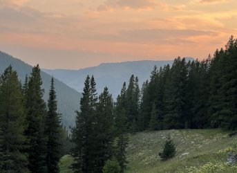
I dropped back down to the gully and followed it down”stream”. Luckily, most of the walking was pretty easy. Either I’d walk in the gully, or I’d follow the bank on one side or the other. The forest was pretty open, which was a nice change from the 712 jungle gullies I’d crossed earlier in the day. I even caught a pretty sunset as I walked. It would have been prettier from the top of the Wall, but at least I was getting closer to water with every step.
It was approaching dusk when I noticed that I was now walking roughly parallel to Cliff Creek. An actual creek! With a blue line on the map and everything. The streambed I was following would meet Cliff Creek eventually, but they ran parallel for a considerable distance. It was dusk, so I decided to head directly for it. I bushwhacked over the intervening ridge and headed back down.
I had high hopes, but they evaporated like, well, like a small stream in the Bob Marshall Wilderness in early August. This streambed was wider, and there were some muddy spots, but no actual water.
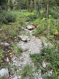
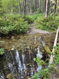
It wasn’t all bad news though. Shortly before reaching the creek I stumbled upon a trail. An actual trail! It wasn’t much of a trail, and it wasn’t on the map, but it was there. It was close to Cliff Creek, heading upstream and down. I followed it briefly upstream, and it disappeared. Downstream was more promising. I followed it all the way down to the confluence with the streambed I’d followed earlier, and a bit beyond. I found one tiny mudpuddle, but nothing potable. At that point I backtracked a short distance to where I’d first reached Cliff Creek. I decided on a dry camp there. There was a brushy but flat spot behind a tree for my tent, and I was exhausted. It was still quite a way to the White River, and I wasn’t sure if I’d be able to follow the faint trail at night with a headlamp.
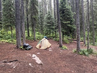
I ate two meal-sized Cliff bars for dinner, since I didn’t have enough water to cook. I had about a pint of water left, and I drank half of it before crawling into my tent. I was expecting a miserable night, but I actually slept fairly well, presumably due to exhaustion. Leg cramps did wake me a couple of times, but that was to be expected.
“Feelin' funny in my mind Lord, I believe I'm fixin' to die
Feelin' funny in my mind Lord, I believe I'm fixin' to die
Well I don't mind dyin' but I hate to leave my children cryin'
Well I'm walkin' kinda funny Lord, I believe I'm fixin' to die, fixin' to die
Yes I'm walkin' kinda funny Lord, I believe I'm fixin' to die
Fixin' to die, fixin' to die
Well I don't mind dyin' but I hate to leave my children cryin'”
From “Fixin’ to Die”, by Booker T Washington
I got up early the next morning. I had slept better than expected, probably due to sheer exhaustion. I thought that I would wake up parched over and over again, but that didn’t happen. Muscle cramps did hit once or twice, but that was to be expected. I still had about a cup of water in my bottle, which I finished off along with an energy bar while packing up. It was shady and cool on the west side of the Wall, but I knew that it wouldn’t last. I needed to find water before it got hot. I managed to get out of camp by 7:30, which is pretty good for me. Of course having no water for cooking breakfast sped up the process.
My original plan had been to follow the dry streambed down to the White River Trail, which wasn’t far from the White River. However, since I had stumbled on a faint trail the previous evening, I decided to follow it instead. For the most part it didn’t make any difference – the trail stayed quite close to the streambed most of the way. It basically followed the same route that I would have taken if the trail hadn’t been there.
I’m really curious about that trail. It isn’t on any map that I’ve ever seen. Where does it go in the other direction? I’m guessing Cliff Mountain on the Chinese Wall, or the pond below it, but that is just a guess. Although the trail is faint and unmaintained, it is distinct, and the lower part was fairly easy to follow. It could offer a relatively easy route to the top of the Wall – if it goes that far.
I made pretty good time following the trail. It only took a few minutes to reach the confluence with the dry stream I had initially descended the previous evening. From there I continued west towards the White River. I passed below some impressive cliffs to the south. Shortly after that, the trail left the streambed, which began to descend rapidly. The trail climbed onto the hillside above and maintained a relatively level course as the streambed dropped away. I was about 150’ above the level of the streambed when I heard a sound that was music to my ears – rushing water. Unfortunately the flowing water started once I was high above the creek. Getting down to it would require a very steep bushwhack. I resisted the urge to run for it and stayed on the trail. The GPS indicated that I was only a ¼ mile from the White River Trail. I continued to follow the trail, which wound around through a side drainage (dry) before descending steeply along a ridgeline.
The grade eventually eased, and a couple of minutes later I reached the White River Trail. That trail looked like a highway compared to what I had been following. There wasn’t a sign at the junction, but the side trail is distinct.
A short walk south on the White River Trail brought me back to Cliff Creek. Except that now it really was a creek. Was it ever! In fact, there were two wide channels of water separated by a small island. I dropped my pack and walked over to the island and back, just to revel in it. There was so much water, it was a little tricky getting across the stream with dry boots. It’s incredible that the water only started flowing about a ¼ mile upstream. I’m guessing that the rock in the area is porous, and most of the water flows below ground.
I found a small flat area next to the trail that was only a little brushy and settled in there. It was mid-morning – the perfect time for second breakfast! I started filtering water while boiling a pot of water for breakfast. I was just getting that process started when I heard a voice. I was so startled that I sloshed water all over myself.
I turned to see two guys walking down the White River Trail towards me. One was perhaps a little older than me, while the other was probably 20 years younger. They stopped to chat and introduced themselves. The older hiker was Tad, and his son was Devan. They were local, hailing from the Helena area. They had started out at the Benchmark Trailhead and were making a loop around the Wall. They had already walked the Continental Divide Trail along the base of the Wall to Larch Hill Pass, and they were in the process of looping back by way of the White River Trail and White River Pass. Tad wasn’t feeling well though. In fact, he had been so wiped out the previous day that they had taken the day off to give him a chance to rest and recover. He thought he had picked up the flu, or some other bug. He was feeling much better today, though he was still tired and weak.
We chatted a bit longer before they resumed their hike, heading south on the White River Trail. I enjoyed a bottle of fresh cold water, followed by a cup of coffee, a bowl of oatmeal, and an electrolyte drink. Those things had never seemed so exciting before!
While I was eating I contemplated my route from there. Until that point I had only been focused on getting to water and a trail. Now that I had accomplished that, I needed to decide where I was going.
I could head north on the White River Trail and continue on towards Bungalow Mountain. That would actually put me well ahead of schedule. My other option was to go south on the White River Trail, up to White River Pass, down to the Continental Divide Trail, and on to the base of the Wall. That would put me back on my route, and I would still be on schedule. I still wanted to walk the base of the Chinese Wall, so I decided to head that way.
For some reason, I never even considered turning around and going back up to the top of the Wall. Maybe next time…
I shuffled down the White River Trail, moving slowly due to sore muscles. Luckily, it was an easy stretch of trail. There were a few nice views of the White River, which runs through a minor canyon far below the trail. Needle Falls is down there somewhere, but I couldn’t get a view of it.
I hiked beyond the canyon, and the trail neared the river. I continued on towards the confluence of the White River and Molly Creek. Shortly before the confluence, I passed Billy Bob Thorton and his lady friend fishing. That was weird.
Near the confluence is a massive, semi-permanent horse camp. There is also a significant junction. The White River Trail continues downstream, toward the South Fork of the Flathead River. The Molly Creek Trail heads up Molly Creek towards White River Pass, at the south end of the Chinese Wall. Unfortunately, my route went that way.
I stopped at the river for lunch, got water, and washed clothes. Afterwards, I resumed my hike towards White River Pass. There are trails running all over the place near the horse camp. There were a few confusing junctions, but I eventually found my way out of horse city and started my climb. My dead legs protested, but my goal was to camp along the upper end of Molly Creek, west of White River Pass. That would put me in a good position to get over White River Pass on Friday morning, before the thunderstorms rolled in.
I had climbed almost 2,000 vertical feet when I caught up with Tad resting beside the trail. He was in rough shape. He had looked a little under the weather when we had met that morning, but now he looked terrible. He was walking like a zombie, and I wasn’t sure if he would be able to walk another step. We chatted briefly, and I found out that Devan had gone ahead to look for a campsite. We were close to where the trail and Molly Creek converge, which was the area that I had targeted as a likely place to camp.
Devan returned a couple of minutes later. He had found a campsite just a few minutes farther up the trail, where he had left his pack. He picked up Tad’s pack, and Tad fell in behind us. Apparently Devan had been going back and forth for some time, ferrying both packs up the mountain. It was all that Tad could do to continue walking, even without the pack.
We found the campsite a few minutes later, on the far side of Molly Creek. It was pretty small, but there was plenty of room for 3 tents. For some reason I suggested that we share the site. I’m not sure why – typically when I am solo I prefer to camp alone. In fact, I don’t think I’d ever suggested sharing a campsite with a stranger before. In this case, some vague instinct made me feel like it was the right thing to do. Also, I wasn’t sure if there were any other campsites below White River Pass. They agreed, and we all started setting up camp.
Tad was exhausted from the climb up from the White River. However, there was a lot more wrong than just fatigue. He had severe abdominal pain and a high fever. I’m not a doctor, but that didn’t sound like the flu or a cold to me. A few minutes later Tad mentioned that he had had an emergency appendectomy 3 weeks earlier. At his follow up appointment, his doctor had cleared him to go on this trip. Still, the appendectomy and the abdominal pain didn’t seem coincidental. Could there be an infection, or some other complication from the surgery? Tad also mentioned that the doctors had warned him that his Gall Bladder wasn’t healthy and would probably need to be removed at some point in the future. Could it be that?
Tad’s condition continued to deteriorate as the evening wore on. He took some heavy duty painkillers, but he seemed to get more benefit from antacids. He was also burping a lot. It was a strange combination of symptoms. Eventually he went to his tent and attempted to sleep, but the pain and bloating kept him awake.
Devan mentioned that they were due home the next evening. However, they were a day behind schedule due to Tad’s illness, and they were still 19 miles from their car. Neither of us thought that Tad would be able to hike over White River Pass and out to the trailhead the next day. In fact, it would take a remarkable improvement overnight for him to be capable of walking anywhere. They didn’t have any means to communicate with the outside world, either. We were a long way from the nearest cell phone tower.
I told Devan that I had a Garmin In-Reach, and that I could use it to call for a rescue if they wanted me to. He relayed that message to Tad. Tad was initially reluctant. However, as the evening progressed the pain increased. Eventually it became unbearable. Finally he conceded.
Devan asked me to press the SOS button. This was my first time using the emergency feature on the unit, but the process was simple. Over the course of the evening I had lengthy conversations by text message with 911, the County Sheriff's Office, and eventually Search and Rescue. They obtained our location from the Garmin, and I was able to provide more details and answer questions by text. Based on Tad’s symptoms, they felt that an emergency evacuation was needed. Unfortunately our campsite was down in a narrow canyon, and there wasn’t any place for a helicopter to land. They decided that they would have to drop a Medic down by rope and then bring him and Tad back up.
By this time it was nearly dusk, and they didn’t think they could get him safely in the dark. They decided to come first thing on Friday morning. I left my Garmin unit with Devan, as they planned to check in with him periodically that night. I didn’t get much sleep that night, between the anxiety of what was happening and hearing Tad’s frequent moans and cries.
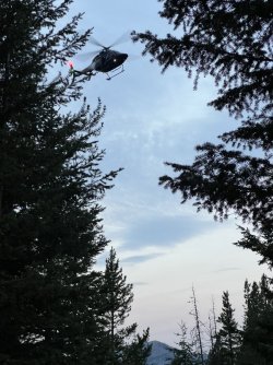
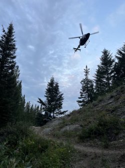
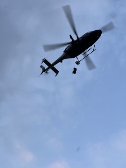
The helicopter arrived at 6:30 the next morning. The pilot did an impressive job of hovering between the narrow walls of the canyon. He stayed above the trail, which runs along an open hillside above the creek. A medic dropped down while Devan got his father in position. The medic secured Tad to him, and they were hoisted back up. Devan managed to talk them into coming back down to get Tad’s pack, since there was no way for him to hike out 19 miles with 2 packs. They were reluctant, probably because of the danger involved in hovering between the narrow canyon walls, but eventually agreed. They successfully retrieved the pack and took off for the nearest hospital. It was a wild thing to witness – they were in and out of there in only a matter of minutes. Tad would be in a hospital before we even broke camp.
Devan packed up quickly, as he had a long way to go. Once he got out, he would drive to the hospital. I wished him luck, and I asked him to text me and let me know how it all turned out. I knew I wouldn’t find out for another week though.
*****************************************************************************************************************************
I didn’t find out what happened to Tad until the end of my trip, but I’ll go out of order for the sake of wrapping up this part of the report. After I returned to civilization I received texts from Devan and Tad’s wife. Tad had been flown to a hospital in Kalispel, Montana. Apparently he had a ruptured ulcer that was leaking and filling his abdominal cavity with fluid. The doctor said that Tad only had a few hours to live. He wouldn't have survived if he hadn't been evacuated. +-
What is truly remarkable is that I shouldn't have encountered Tad and Devan at all. I was way off my intended route when we crossed paths. I should have been on top of the Chinese Wall when they were hiking down the White River Trail. And if I had gotten there just a few minutes later we would’ve missed each other. I would’ve seen their tents at Molly Creek that evening, but I certainly would’ve hiked on when I saw the occupied campsite. At the time I was bummed out about not finishing my hike across the top of The Wall, but ultimately those misadventures put me in position to help save someone's life.
I was exhausted from a lack of sleep, and I seriously considered going back to the tent. I had a little too much adrenaline though, after witnessing the helicopter rescue. Plus, I still needed to get over the pass before the afternoon thunderstorms rolled through.
I had coffee and oatmeal and packed up. While I was eating, I discovered that my lips were so chapped that they were actually bleeding. One of these days I’ll learn that lip balm works a lot better when it is applied in advance.
I started up the trail, and after a short distance I passed a faint side trail that crosses the creek. I’m guessing that it goes to another campsite. At that point the trail left the creek and started climbing. I climbed about 1,000’ in less than 2 miles before reaching a saddle below some impressive cliffs. At first I thought I was at White River Pass, but that was still a few minutes ahead. The area around the pass had nice scenery, but I don’t think it would be worthwhile destination by itself.
At the pass I met a solo hiker going the other way. We chatted briefly, and he mentioned that there is a high elevation route that follows the southern end of the Chinese Wall, connecting White River Pass with the CDT in the headwaters of Burnt Creek. That was intriguing, as it offered an alternate route that is shorter and more scenic. However, the route wasn’t on any maps that I’ve seen, and I didn’t know anything about it other than what that passing hiker mentioned. If I return to the area I’ll research that route, as it would be cool to follow the base of the Wall all the way to its southern end.
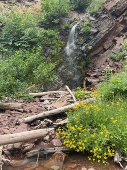
I descended into sparse forest on a trail that follows the hillside above Indian Creek. After a couple of miles from White River Pass I reached a tributary with a small waterfall. I stopped there for lunch and water.
I was sitting on a log next to the creek when I noticed a large ant walking along the log towards me. It was half black and half red, and it looked malicious. My initial instinct was to smash it, but I hesitated. I guess I was in a live and let live mood. Instead of smashing it, I flicked it into the water. Let’s torture it instead!
It floated downstream a short distance before catching itself on a squarish rock in the middle of the creek. It climbed up to the top and proceeded to explore every corner of it multiple times. I spent several minutes watching it try to find a way off that rock that didn’t require jumping into the water. There was no possible way, but it was very determined. Oddly, I began to feel some admiration for it. Finally I decided to rescue it. I made a bridge with a long, skinny stick from the top of the rock to shore. When the ant made its next pass, it immediately found the bridge, crossed it, and disappeared into the vegetation.
After lunch I continued down the Indian Creek Trail to the West Fork South Fork Sun River. I waded across and found a muddy campsite on the far side. I picked up the Continental Divide Trail and followed it north, upstream along the river. This stretch of trail is mostly in the woods, but there were a couple of nice views of the surrounding mountains from small meadows.
I stopped at Black Bear Gulch for a break and water. I had just filled my water bottle when I heard a noise. I looked up and saw a black bear sauntering down the trail towards me. It looked like he was browsing for huckleberries, which were beginning to ripen. When he saw me standing there he pivoted and raced back the way he came. Good bear.
I resumed my hike, heading north. After a couple of miles I waded across the river at Grizzly Gulch. That name gave me pause – after all, I’d just seen a black bear at Black Bear gulch. There were no grizzly sightings, and I continued upstream and met two female hikers heading the other way. They told me about a great campsite near the trail at the base of a small waterfall. That sounded great. I thanked them for the tip and headed that way.
Their description had been vague, and the location of the waterfall wasn’t apparent on the map. I hiked on, crossing the river two more times. I passed a lot of campsites, but I didn’t see any waterfalls. Eventually the trail left the river and began climbing up the Burnt Creek valley. Thunder began rumbling, and I hurried up the trail in search of the campsite, or any campsite, really. A few minutes later I rock hopped Burnt Creek right at the top of a small waterfall. Sure enough, there was a campsite just on the other side. I set up the tent quickly, stashed my food cannister, and got in the tent just as the storm hit.
I fastened my tent door with the broken zipper as much as I could with safety pins and paper clips. The safety pins worked better, but poked holes in the fabric. For extra protection, I hung my rain jacket across the doorway. My efforts were somewhat effective. The storm pounded me, with heavy rain and frequent lightning and thunder. I was glad that I was down in the woods, and not on top of the Chinese Wall! Luckily the storm passed quickly. I had a lot of drips and small puddles afterwards, but nothing major. Still, a sustained storm with hours of rain could be a real problem.
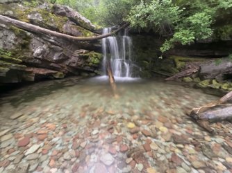
After the storm passed I mopped up the puddles and emerged from the tent. I scrambled down a short but steep path to the base of a lovely 10’ waterfall. The stream falls over a cliff sporting lush vegetation into a shallow pool filled with colorful rocks. It was a beautiful spot, and I spent an hour or so down there taking photos and enjoying the place. There are several more small waterfalls a short distance upstream, but well below the trail. I spent a little time exploring them that evening.
The next morning several groups of backpackers passed by on the trail, but every one of them passed right across the top of the waterfall without seeming to notice it. What a shame.
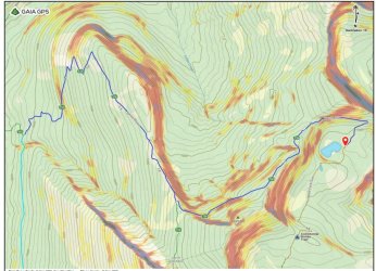
Day 4, morning. Trail (dark blue) from My Lake towards the White River, then bushwhacking (light blue, route approximate)
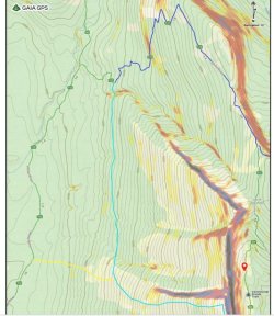
Day 4, afternoon. Light blue is my approximate route to the top of the Wall
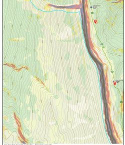
Day 4, evening, along the top of the Wall
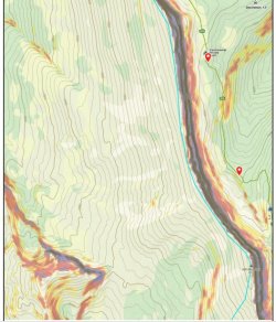
Day 4, evening, along the top of the Wall to Salt Mountain
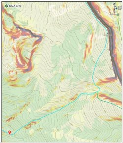
Day 5, late evening, from Salt Mountain to my unplanned campsite. Dark green was my planned route.
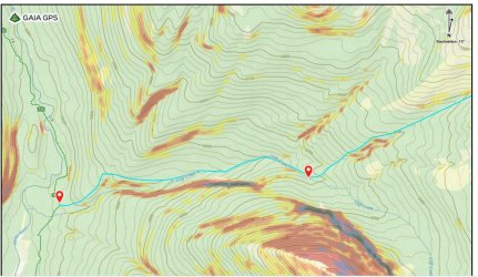
Day 5, morning. Bushwhacking downstream to the White River Trail
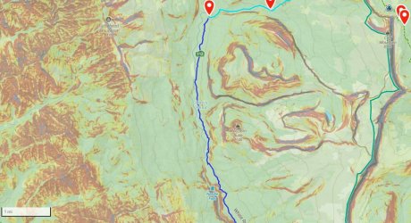
Day 5, late morning
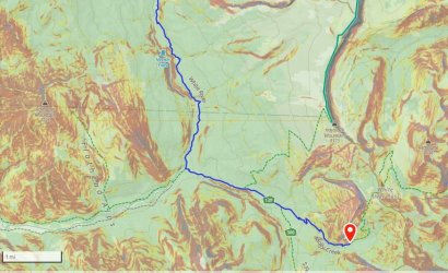
Day 5, afternoon. White River to a campsite on Molly Creek
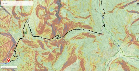
Day 6, morning
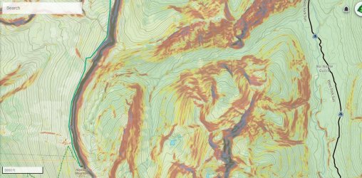
Day 6, afternoon
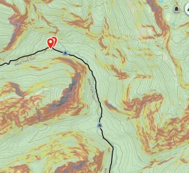
Day 6, late afternoon, to my campsite at a small waterfall on Burnt Creek
Route maps are at the end of the post.
PART TWO: THE WALL
In my pre-trip research, I’d read one trip report from a group that had climbed to the top of the Chinese Wall from the north. They had started from the White River Trail, leaving it around 6,200’ and bushwhacking south a considerable distance to bypass cliffs before heading up to the east. That route was one option I was considering. The other option was to continue down the White River Trail another 400 vertical feet, almost to the river, before bushwhacking up due east. Ultimately, I decided on the first option, since I knew that at least one other group had managed it. The other route was a complete unknown. In hindsight, I think it would have been better to stay on the trail longer. It would have added 400’ to the climb, but it would have required less bushwhacking. Of course, I don’t know how bad the bushwhacking would have been starting out closer to the river.
I got up at sunrise, but as usual I was slow breaking camp. That would come back to bite me.
I broke camp at 8:30 and backtracked a short distance to the Larch Hill Trail. I followed this trail southwest towards Larch Hill Pass. This trail was quite scenic, with good views of My Lake below and several nice vistas of the mountains to the north. It was mostly easy walking, too. Later in the trip I hiked the section of the CDT that runs parallel to this trail down the slope to the east. That trail is mostly in the woods and is far less scenic than this one.

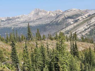
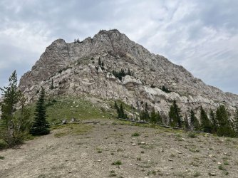
First view of The Chinese Wall

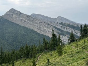
Another escarpment to the northwest

I reached the White River Trail a bit west of Larch Hill Pass. I stopped there for a short break, and I discovered that the electrical connection to my solar panel had broken off. I had broken the first one I had the previous summer in the same way. Unfortunately that cheap brand of solar panel just isn’t durable enough for an extended backpacking trip in rugged wilderness. This meant that I had no way to charge my phone except for the spare battery pack I’d brought, and I had no way to recharge the battery pack. I would need to be very conservative with my phone usage through the rest of the trip.
I began a long descent through burned forest. I eventually dropped down into living forest and noticed that the vegetation was THICK. It looked like I was in for a serious bushwhack.
I followed the trail until I reached a good point to leave it for my bushwhack south. Just starting out was tough, due to jungle-like vegetation and fallen trees. After a few minutes I reached a gully with a small stream. I had lunch there and filtered water. I carried almost 4 quarts from there to the top of the Wall. It wasn’t a great lunch spot, due to the thick vegetation and bugs, but it was a convenient place to tank up on water before I started my climb.
HOT WATER
The bushwhack south was slow and tedious. My intention was to head south and climb gradually, as I wanted to pass below and west of a long band of cliffs that descend from the top of the wall to about 7,000’. That was the plan, but the reality was that I just tried to keep heading south by following the path of least resistance. The slope was heavily forested, but the biggest challenge was the frequent gullies. Each time I reached one, I found that the north side of the gully and the gully itself were relatively open, but the south side (north facing) was always a jungle. I imagine those north facing slopes hold snow longer and stay wetter than the rest of the surrounding area. Regardless, getting down into the gullies was usually pretty easy, but picking out an exit route was tough! Typically I would climb a bit parallel to the gully, in hopes of finding a better route on the opposite side. That almost always failed, though it did help me slowly gain elevation. After climbing a bit I would drop down into the gully and then crawl out the other side. Once I was beyond the gully, the woods would open up, and I would enjoy a brief stretch of easy walking – until I reached the next gully.
This whole slope is covered in huckleberry bushes. Those bushes were loaded with berries, but they weren’t ripe yet. That was lucky for me. I imagine that slope is covered in bears by mid-August.
I had just climbed out of the 136th gully since leaving the trail when I stepped in an unseen hole and stumbled. I fell on my side, but picked myself up quickly. I brushed myself off and took a few cautious steps to make sure I hadn’t injured my ankle or knee. Everything seemed ok, so I pressed on. A few minutes later I glanced down and saw blood on my left shin. Where did that come from?
I found a boulder to sit on and inspected my leg. There was a long, jagged cut ending with a small piece of wood embedded in my leg. I got out my first aid supplies, which I carry on every hike but rarely use. I cleaned off the blood and dirt with filtered water. I then attempted to remove the imbedded wood using my pocket knife. That failed – in fact, all I managed to accomplish was to make it bleed more. I cleaned the wound again and then used hand sanitizer to sterilize it. I then applied Neosporin, put on a band aid, and resumed the hike.
A few hundred gullies later I finally passed below the cliffs. The bushwhacking was finally over. Now all I had to do was climb 1,200’ to the top of the wall. The slope was steep, but not unreasonable. The good news is that the slope was open, without any obstacles. The bad news is that the slope was open, without any shade. It was late afternoon on an unusually hot day, and I was climbing a west-facing slope.
Heat usually doesn’t bother me much, but this was brutal. There were a few trees scattered about, so I climbed from one to the next, resting in the shade of each one until I caught my breath. I was sweating so much, it felt like I was melting. Every drink of water seemed to come right out. The open slope did provide some really nice views west across the White River Valley to the next range of mountains, the Flathead Alps.
I climbed slowly in this fashion, gaining 50-100 vertical feet between brief rest breaks. I paralleled the line of cliffs running west from the top of the escarpment. I stayed a bit south of them though, as the walking was easier there. The walking was on flat, broken rock that crunched under my feet. Geology isn’t my strong point, but I think it was shale.
By the time that I reached the top of the Wall I was wrecked. I reached the top of the Wall at 47.72073, -113.16591. Part of me wanted to turn north and make a short jaunt to the top of a point with cliffs to the east and north. Tet route up to that point was also loose rock though, and it didn’t look pleasant. I was also so wiped out that doing anything extra seemed like a bad idea.
Instead, I paused to take in the view. I was at the brink of a 1,000 sheer cliff. Incredibly, I could clearly see the Continental Divide Trail passing through a meadow directly below. I looked east from the top of the Wall, back towards the Sawtooth Range where I had started my trip four days earlier. To the south, the Wall stretched away, impossibly far, into the hazy distance.
I started walking that way. My immediate goal was Salt Mountain, which is the highest point along the northern end of the Wall. Fortunately, the walking was pretty easy. The broken rock continued, but there weren’t any major obstacles. For a while I followed a narrow bench that parallels the crest about 10-15’ below the top. That bench put me a couple of feet from the brink of the cliffs. It was easy walking though, at least until the bench fizzled out at the edge of a vertical gully. I backtracked briefly from there before scrambling back up to the top.
Walking the crest was awesome, despite my exhaustion. The views were great, of course, but just being in such an incredible place was a magical experience.
My water bottle was in my right hip pocket, which was bad strategy. Since I was hiking south, my right pocket was directly in the sun. I realized my mistake when I took a drink and found that the water was actually hot. Hot enough that I could have made a nice cup of tea with it.
Although it was easy walking, I was way behind schedule. The bushwhacking early that afternoon had been slow, and the climb to the top of the wall wasn’t much faster. It was after 7pm when I finally reached the summit of Salt Mountain. That was not ideal, as I had some work to do to reach my intended campsite.

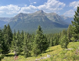
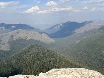
Parting view from the top of the Wall
I was shooting for a small pond northwest and about 900’ below the summit of Cliff Mountain. Unfortunately, I couldn’t just descend directly to it. A short distance south of Salt Mountain was a big cliff that I would have to bypass to the west. The only realistic route would require heading southwest and descending about 800’. Then I would have to bushwhack south for a considerable distance to avoid more cliffs. Once past the steepest terrain, I could start climbing northeast up a forested valley towards the pond. That was my plan, as I didn’t really have any other options.
LIMB BY LIMB
“The shoulder that I leaned on was carved out of stone
But when I'm done freezing I want to be alone
Left is where I always turn
Left is how I'm forced to learn
Left the route my walking takes
Left alone with my mistakes
Drop me off the Chinese Wall
And peel my fingers off the rim
I come unglued while in midair and land to reform
Limb by limb”
From “Limb by Limb” by Phish. Lyrics written by Jon Fishman, Scott Herman, and Trey Anastasio.
The descent was pretty quick and easy. As I headed down, I began to wonder if the gully at the bottom would have any water. Almost all of the gullies I had passed through earlier had been dry, but this one looked much more substantial on the map. If there was water down there, I might be able to camp near it. That was appealing, since it was pushing 8pm.
I found a dry streambed at the bottom. It obviously has water flowing through it seasonally, but that was already long gone. It was so dry it was actually dusty.
I followed the gully downstream, in an effort to pass another band of cliffs running northwest from the crest of the Wall. Eventually I left the streambed and started climbing south. However, I kept running into little bands of cliffs that weren’t apparent on the map. It was tough terrain, and I kept getting forced west and down, rather than south and up. It was slow going, too. By 9pm I was nowhere near the point where I could start up towards the pond. I’d never make it there before dark. Bushwhacking in the dark in Grizzly country wasn’t appealing. And was I even sure that there would be water in that pond? It was SO DRY. What if all of the water had evaporated? If that happened, my life could really be in danger. I had less than a quart of water left. Climbing back up to the top of the Wall the next day without water was not an option.
Pushing on, solo, in the dark, off trail, with only a little water left was just too risky. The correct decision was obvious, but painful. I needed to bail out.
Bailing out was the right call, but it was easier said than done. I was a long way from any trail. My top priority was finding water. The only possible water source near me was the dry gully I had hiked through earlier. I decided to return to it and follow it downstream. Surely I’d find water in it eventually. If not, that streambed leads to Cliff Creek and then the White River. My worst case scenario was a dry camp, with a long bushwhack to the river the next day.
I dropped back down to the gully and followed it down”stream”. Luckily, most of the walking was pretty easy. Either I’d walk in the gully, or I’d follow the bank on one side or the other. The forest was pretty open, which was a nice change from the 712 jungle gullies I’d crossed earlier in the day. I even caught a pretty sunset as I walked. It would have been prettier from the top of the Wall, but at least I was getting closer to water with every step.
It was approaching dusk when I noticed that I was now walking roughly parallel to Cliff Creek. An actual creek! With a blue line on the map and everything. The streambed I was following would meet Cliff Creek eventually, but they ran parallel for a considerable distance. It was dusk, so I decided to head directly for it. I bushwhacked over the intervening ridge and headed back down.
I had high hopes, but they evaporated like, well, like a small stream in the Bob Marshall Wilderness in early August. This streambed was wider, and there were some muddy spots, but no actual water.
It wasn’t all bad news though. Shortly before reaching the creek I stumbled upon a trail. An actual trail! It wasn’t much of a trail, and it wasn’t on the map, but it was there. It was close to Cliff Creek, heading upstream and down. I followed it briefly upstream, and it disappeared. Downstream was more promising. I followed it all the way down to the confluence with the streambed I’d followed earlier, and a bit beyond. I found one tiny mudpuddle, but nothing potable. At that point I backtracked a short distance to where I’d first reached Cliff Creek. I decided on a dry camp there. There was a brushy but flat spot behind a tree for my tent, and I was exhausted. It was still quite a way to the White River, and I wasn’t sure if I’d be able to follow the faint trail at night with a headlamp.
I ate two meal-sized Cliff bars for dinner, since I didn’t have enough water to cook. I had about a pint of water left, and I drank half of it before crawling into my tent. I was expecting a miserable night, but I actually slept fairly well, presumably due to exhaustion. Leg cramps did wake me a couple of times, but that was to be expected.
DYIN’ MAN
“Feelin' funny in my mind Lord, I believe I'm fixin' to die
Feelin' funny in my mind Lord, I believe I'm fixin' to die
Well I don't mind dyin' but I hate to leave my children cryin'
Well I'm walkin' kinda funny Lord, I believe I'm fixin' to die, fixin' to die
Yes I'm walkin' kinda funny Lord, I believe I'm fixin' to die
Fixin' to die, fixin' to die
Well I don't mind dyin' but I hate to leave my children cryin'”
From “Fixin’ to Die”, by Booker T Washington
I got up early the next morning. I had slept better than expected, probably due to sheer exhaustion. I thought that I would wake up parched over and over again, but that didn’t happen. Muscle cramps did hit once or twice, but that was to be expected. I still had about a cup of water in my bottle, which I finished off along with an energy bar while packing up. It was shady and cool on the west side of the Wall, but I knew that it wouldn’t last. I needed to find water before it got hot. I managed to get out of camp by 7:30, which is pretty good for me. Of course having no water for cooking breakfast sped up the process.
My original plan had been to follow the dry streambed down to the White River Trail, which wasn’t far from the White River. However, since I had stumbled on a faint trail the previous evening, I decided to follow it instead. For the most part it didn’t make any difference – the trail stayed quite close to the streambed most of the way. It basically followed the same route that I would have taken if the trail hadn’t been there.
I’m really curious about that trail. It isn’t on any map that I’ve ever seen. Where does it go in the other direction? I’m guessing Cliff Mountain on the Chinese Wall, or the pond below it, but that is just a guess. Although the trail is faint and unmaintained, it is distinct, and the lower part was fairly easy to follow. It could offer a relatively easy route to the top of the Wall – if it goes that far.
I made pretty good time following the trail. It only took a few minutes to reach the confluence with the dry stream I had initially descended the previous evening. From there I continued west towards the White River. I passed below some impressive cliffs to the south. Shortly after that, the trail left the streambed, which began to descend rapidly. The trail climbed onto the hillside above and maintained a relatively level course as the streambed dropped away. I was about 150’ above the level of the streambed when I heard a sound that was music to my ears – rushing water. Unfortunately the flowing water started once I was high above the creek. Getting down to it would require a very steep bushwhack. I resisted the urge to run for it and stayed on the trail. The GPS indicated that I was only a ¼ mile from the White River Trail. I continued to follow the trail, which wound around through a side drainage (dry) before descending steeply along a ridgeline.
The grade eventually eased, and a couple of minutes later I reached the White River Trail. That trail looked like a highway compared to what I had been following. There wasn’t a sign at the junction, but the side trail is distinct.
A short walk south on the White River Trail brought me back to Cliff Creek. Except that now it really was a creek. Was it ever! In fact, there were two wide channels of water separated by a small island. I dropped my pack and walked over to the island and back, just to revel in it. There was so much water, it was a little tricky getting across the stream with dry boots. It’s incredible that the water only started flowing about a ¼ mile upstream. I’m guessing that the rock in the area is porous, and most of the water flows below ground.
I found a small flat area next to the trail that was only a little brushy and settled in there. It was mid-morning – the perfect time for second breakfast! I started filtering water while boiling a pot of water for breakfast. I was just getting that process started when I heard a voice. I was so startled that I sloshed water all over myself.
I turned to see two guys walking down the White River Trail towards me. One was perhaps a little older than me, while the other was probably 20 years younger. They stopped to chat and introduced themselves. The older hiker was Tad, and his son was Devan. They were local, hailing from the Helena area. They had started out at the Benchmark Trailhead and were making a loop around the Wall. They had already walked the Continental Divide Trail along the base of the Wall to Larch Hill Pass, and they were in the process of looping back by way of the White River Trail and White River Pass. Tad wasn’t feeling well though. In fact, he had been so wiped out the previous day that they had taken the day off to give him a chance to rest and recover. He thought he had picked up the flu, or some other bug. He was feeling much better today, though he was still tired and weak.
We chatted a bit longer before they resumed their hike, heading south on the White River Trail. I enjoyed a bottle of fresh cold water, followed by a cup of coffee, a bowl of oatmeal, and an electrolyte drink. Those things had never seemed so exciting before!
While I was eating I contemplated my route from there. Until that point I had only been focused on getting to water and a trail. Now that I had accomplished that, I needed to decide where I was going.
I could head north on the White River Trail and continue on towards Bungalow Mountain. That would actually put me well ahead of schedule. My other option was to go south on the White River Trail, up to White River Pass, down to the Continental Divide Trail, and on to the base of the Wall. That would put me back on my route, and I would still be on schedule. I still wanted to walk the base of the Chinese Wall, so I decided to head that way.
For some reason, I never even considered turning around and going back up to the top of the Wall. Maybe next time…
I shuffled down the White River Trail, moving slowly due to sore muscles. Luckily, it was an easy stretch of trail. There were a few nice views of the White River, which runs through a minor canyon far below the trail. Needle Falls is down there somewhere, but I couldn’t get a view of it.
I hiked beyond the canyon, and the trail neared the river. I continued on towards the confluence of the White River and Molly Creek. Shortly before the confluence, I passed Billy Bob Thorton and his lady friend fishing. That was weird.
Near the confluence is a massive, semi-permanent horse camp. There is also a significant junction. The White River Trail continues downstream, toward the South Fork of the Flathead River. The Molly Creek Trail heads up Molly Creek towards White River Pass, at the south end of the Chinese Wall. Unfortunately, my route went that way.
I stopped at the river for lunch, got water, and washed clothes. Afterwards, I resumed my hike towards White River Pass. There are trails running all over the place near the horse camp. There were a few confusing junctions, but I eventually found my way out of horse city and started my climb. My dead legs protested, but my goal was to camp along the upper end of Molly Creek, west of White River Pass. That would put me in a good position to get over White River Pass on Friday morning, before the thunderstorms rolled in.
I had climbed almost 2,000 vertical feet when I caught up with Tad resting beside the trail. He was in rough shape. He had looked a little under the weather when we had met that morning, but now he looked terrible. He was walking like a zombie, and I wasn’t sure if he would be able to walk another step. We chatted briefly, and I found out that Devan had gone ahead to look for a campsite. We were close to where the trail and Molly Creek converge, which was the area that I had targeted as a likely place to camp.
Devan returned a couple of minutes later. He had found a campsite just a few minutes farther up the trail, where he had left his pack. He picked up Tad’s pack, and Tad fell in behind us. Apparently Devan had been going back and forth for some time, ferrying both packs up the mountain. It was all that Tad could do to continue walking, even without the pack.
We found the campsite a few minutes later, on the far side of Molly Creek. It was pretty small, but there was plenty of room for 3 tents. For some reason I suggested that we share the site. I’m not sure why – typically when I am solo I prefer to camp alone. In fact, I don’t think I’d ever suggested sharing a campsite with a stranger before. In this case, some vague instinct made me feel like it was the right thing to do. Also, I wasn’t sure if there were any other campsites below White River Pass. They agreed, and we all started setting up camp.
Tad was exhausted from the climb up from the White River. However, there was a lot more wrong than just fatigue. He had severe abdominal pain and a high fever. I’m not a doctor, but that didn’t sound like the flu or a cold to me. A few minutes later Tad mentioned that he had had an emergency appendectomy 3 weeks earlier. At his follow up appointment, his doctor had cleared him to go on this trip. Still, the appendectomy and the abdominal pain didn’t seem coincidental. Could there be an infection, or some other complication from the surgery? Tad also mentioned that the doctors had warned him that his Gall Bladder wasn’t healthy and would probably need to be removed at some point in the future. Could it be that?
Tad’s condition continued to deteriorate as the evening wore on. He took some heavy duty painkillers, but he seemed to get more benefit from antacids. He was also burping a lot. It was a strange combination of symptoms. Eventually he went to his tent and attempted to sleep, but the pain and bloating kept him awake.
Devan mentioned that they were due home the next evening. However, they were a day behind schedule due to Tad’s illness, and they were still 19 miles from their car. Neither of us thought that Tad would be able to hike over White River Pass and out to the trailhead the next day. In fact, it would take a remarkable improvement overnight for him to be capable of walking anywhere. They didn’t have any means to communicate with the outside world, either. We were a long way from the nearest cell phone tower.
I told Devan that I had a Garmin In-Reach, and that I could use it to call for a rescue if they wanted me to. He relayed that message to Tad. Tad was initially reluctant. However, as the evening progressed the pain increased. Eventually it became unbearable. Finally he conceded.
HELP ON THE WAY
Devan asked me to press the SOS button. This was my first time using the emergency feature on the unit, but the process was simple. Over the course of the evening I had lengthy conversations by text message with 911, the County Sheriff's Office, and eventually Search and Rescue. They obtained our location from the Garmin, and I was able to provide more details and answer questions by text. Based on Tad’s symptoms, they felt that an emergency evacuation was needed. Unfortunately our campsite was down in a narrow canyon, and there wasn’t any place for a helicopter to land. They decided that they would have to drop a Medic down by rope and then bring him and Tad back up.
By this time it was nearly dusk, and they didn’t think they could get him safely in the dark. They decided to come first thing on Friday morning. I left my Garmin unit with Devan, as they planned to check in with him periodically that night. I didn’t get much sleep that night, between the anxiety of what was happening and hearing Tad’s frequent moans and cries.
The helicopter arrived at 6:30 the next morning. The pilot did an impressive job of hovering between the narrow walls of the canyon. He stayed above the trail, which runs along an open hillside above the creek. A medic dropped down while Devan got his father in position. The medic secured Tad to him, and they were hoisted back up. Devan managed to talk them into coming back down to get Tad’s pack, since there was no way for him to hike out 19 miles with 2 packs. They were reluctant, probably because of the danger involved in hovering between the narrow canyon walls, but eventually agreed. They successfully retrieved the pack and took off for the nearest hospital. It was a wild thing to witness – they were in and out of there in only a matter of minutes. Tad would be in a hospital before we even broke camp.
Devan packed up quickly, as he had a long way to go. Once he got out, he would drive to the hospital. I wished him luck, and I asked him to text me and let me know how it all turned out. I knew I wouldn’t find out for another week though.
*****************************************************************************************************************************
I didn’t find out what happened to Tad until the end of my trip, but I’ll go out of order for the sake of wrapping up this part of the report. After I returned to civilization I received texts from Devan and Tad’s wife. Tad had been flown to a hospital in Kalispel, Montana. Apparently he had a ruptured ulcer that was leaking and filling his abdominal cavity with fluid. The doctor said that Tad only had a few hours to live. He wouldn't have survived if he hadn't been evacuated. +-
What is truly remarkable is that I shouldn't have encountered Tad and Devan at all. I was way off my intended route when we crossed paths. I should have been on top of the Chinese Wall when they were hiking down the White River Trail. And if I had gotten there just a few minutes later we would’ve missed each other. I would’ve seen their tents at Molly Creek that evening, but I certainly would’ve hiked on when I saw the occupied campsite. At the time I was bummed out about not finishing my hike across the top of The Wall, but ultimately those misadventures put me in position to help save someone's life.
LET IT BLEED
I was exhausted from a lack of sleep, and I seriously considered going back to the tent. I had a little too much adrenaline though, after witnessing the helicopter rescue. Plus, I still needed to get over the pass before the afternoon thunderstorms rolled through.
I had coffee and oatmeal and packed up. While I was eating, I discovered that my lips were so chapped that they were actually bleeding. One of these days I’ll learn that lip balm works a lot better when it is applied in advance.
I started up the trail, and after a short distance I passed a faint side trail that crosses the creek. I’m guessing that it goes to another campsite. At that point the trail left the creek and started climbing. I climbed about 1,000’ in less than 2 miles before reaching a saddle below some impressive cliffs. At first I thought I was at White River Pass, but that was still a few minutes ahead. The area around the pass had nice scenery, but I don’t think it would be worthwhile destination by itself.
At the pass I met a solo hiker going the other way. We chatted briefly, and he mentioned that there is a high elevation route that follows the southern end of the Chinese Wall, connecting White River Pass with the CDT in the headwaters of Burnt Creek. That was intriguing, as it offered an alternate route that is shorter and more scenic. However, the route wasn’t on any maps that I’ve seen, and I didn’t know anything about it other than what that passing hiker mentioned. If I return to the area I’ll research that route, as it would be cool to follow the base of the Wall all the way to its southern end.
Two different trails descend from White River Pass. One is steep and direct, while the other makes a long switchback to the north. I believe the unmapped high route to the headwaters of Burnt Creek leaves from that switchback. I went that way, thinking that it would be more scenic, but the views were modest in the overcast conditions.
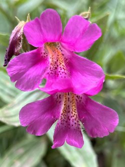
Purple monkeyflowers

Purple monkeyflowers
I descended into sparse forest on a trail that follows the hillside above Indian Creek. After a couple of miles from White River Pass I reached a tributary with a small waterfall. I stopped there for lunch and water.

I was sitting on a log next to the creek when I noticed a large ant walking along the log towards me. It was half black and half red, and it looked malicious. My initial instinct was to smash it, but I hesitated. I guess I was in a live and let live mood. Instead of smashing it, I flicked it into the water. Let’s torture it instead!
It floated downstream a short distance before catching itself on a squarish rock in the middle of the creek. It climbed up to the top and proceeded to explore every corner of it multiple times. I spent several minutes watching it try to find a way off that rock that didn’t require jumping into the water. There was no possible way, but it was very determined. Oddly, I began to feel some admiration for it. Finally I decided to rescue it. I made a bridge with a long, skinny stick from the top of the rock to shore. When the ant made its next pass, it immediately found the bridge, crossed it, and disappeared into the vegetation.
After lunch I continued down the Indian Creek Trail to the West Fork South Fork Sun River. I waded across and found a muddy campsite on the far side. I picked up the Continental Divide Trail and followed it north, upstream along the river. This stretch of trail is mostly in the woods, but there were a couple of nice views of the surrounding mountains from small meadows.
I stopped at Black Bear Gulch for a break and water. I had just filled my water bottle when I heard a noise. I looked up and saw a black bear sauntering down the trail towards me. It looked like he was browsing for huckleberries, which were beginning to ripen. When he saw me standing there he pivoted and raced back the way he came. Good bear.
I resumed my hike, heading north. After a couple of miles I waded across the river at Grizzly Gulch. That name gave me pause – after all, I’d just seen a black bear at Black Bear gulch. There were no grizzly sightings, and I continued upstream and met two female hikers heading the other way. They told me about a great campsite near the trail at the base of a small waterfall. That sounded great. I thanked them for the tip and headed that way.
Their description had been vague, and the location of the waterfall wasn’t apparent on the map. I hiked on, crossing the river two more times. I passed a lot of campsites, but I didn’t see any waterfalls. Eventually the trail left the river and began climbing up the Burnt Creek valley. Thunder began rumbling, and I hurried up the trail in search of the campsite, or any campsite, really. A few minutes later I rock hopped Burnt Creek right at the top of a small waterfall. Sure enough, there was a campsite just on the other side. I set up the tent quickly, stashed my food cannister, and got in the tent just as the storm hit.
I fastened my tent door with the broken zipper as much as I could with safety pins and paper clips. The safety pins worked better, but poked holes in the fabric. For extra protection, I hung my rain jacket across the doorway. My efforts were somewhat effective. The storm pounded me, with heavy rain and frequent lightning and thunder. I was glad that I was down in the woods, and not on top of the Chinese Wall! Luckily the storm passed quickly. I had a lot of drips and small puddles afterwards, but nothing major. Still, a sustained storm with hours of rain could be a real problem.
After the storm passed I mopped up the puddles and emerged from the tent. I scrambled down a short but steep path to the base of a lovely 10’ waterfall. The stream falls over a cliff sporting lush vegetation into a shallow pool filled with colorful rocks. It was a beautiful spot, and I spent an hour or so down there taking photos and enjoying the place. There are several more small waterfalls a short distance upstream, but well below the trail. I spent a little time exploring them that evening.
The next morning several groups of backpackers passed by on the trail, but every one of them passed right across the top of the waterfall without seeming to notice it. What a shame.

Day 4, morning. Trail (dark blue) from My Lake towards the White River, then bushwhacking (light blue, route approximate)

Day 4, afternoon. Light blue is my approximate route to the top of the Wall

Day 4, evening, along the top of the Wall

Day 4, evening, along the top of the Wall to Salt Mountain

Day 5, late evening, from Salt Mountain to my unplanned campsite. Dark green was my planned route.

Day 5, morning. Bushwhacking downstream to the White River Trail

Day 5, late morning

Day 5, afternoon. White River to a campsite on Molly Creek

Day 6, morning

Day 6, afternoon

Day 6, late afternoon, to my campsite at a small waterfall on Burnt Creek

