Udink
Still right here.
- Joined
- Jan 17, 2012
- Messages
- 1,748
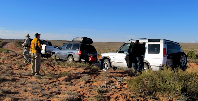
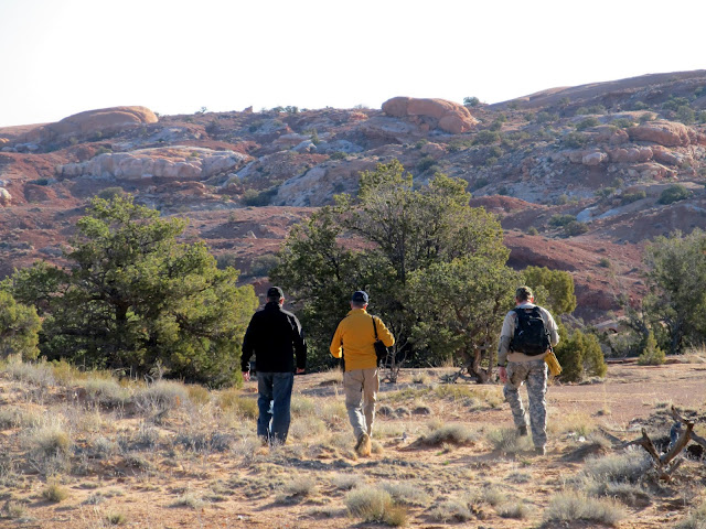
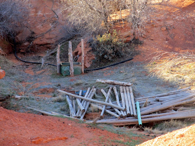
After my long weekend in southern Utah, I took a relaxing break at home for a weekend and then set out for another three-day weekend and did some tough but rewarding hikes in the southern Horseshoe Canyon area. Day one consisted of two hikes: Bluejohn Spring and the Millard Canyon Trail, for a combined total of seven miles. Alan rode with me in the Jeep and we were joined by Mike and Layne in a Land Rover for the drive from Price. We met Wade close to the start of the hike. We parked on the side of the road on Robbers Roost Flats and hiked east to Bluejohn Spring, where we were fairly certain we'd find some old cowboy names etched into the sandstone. It was about a mile across flat desert to the spring, which is in Bluejohn Canyon just above the start of the famous slot canyon. The spring itself was pretty weak with just a tiny trickle that dried up after a short distance.
Parked on Robber's Roost Flats for a hike to Bluejohn Spring
Hiking to Bluejohn Spring
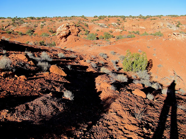
My shadow along a horse/burro trail to Bluejohn Spring
Pine poles and a small trough
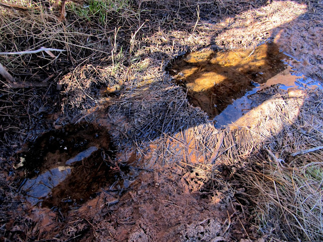
Bluejohn Spring
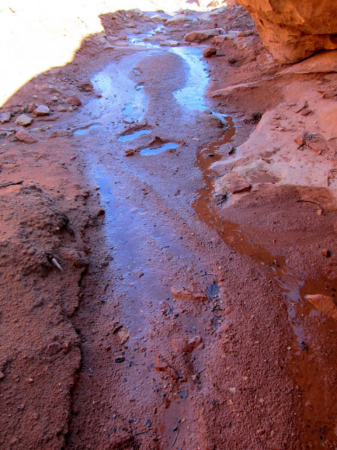
A smaller seep below Bluejohn Spring
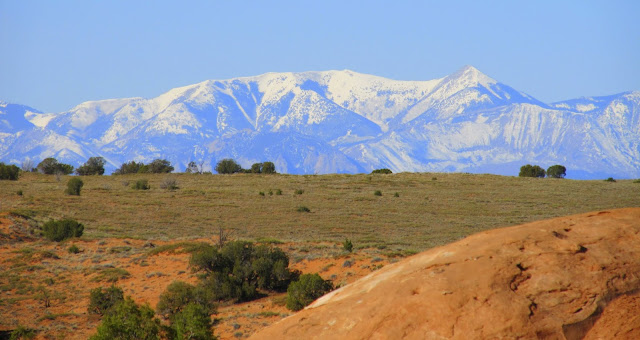
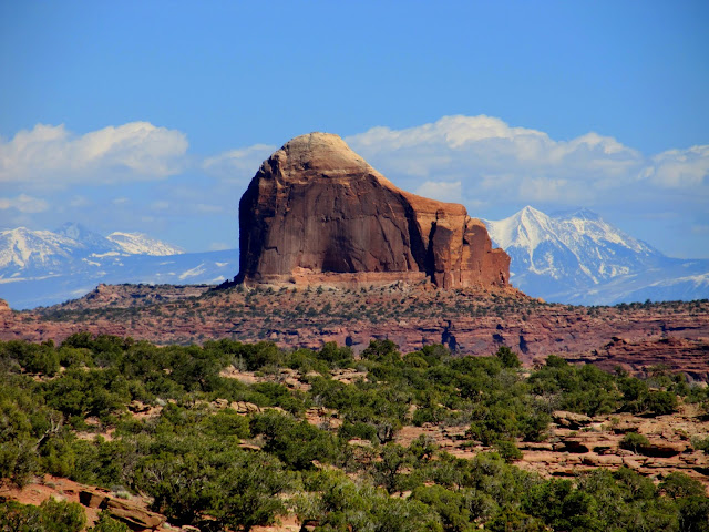
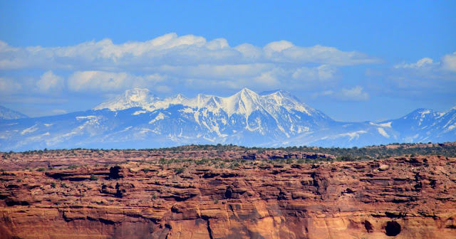
Beautiful snow-capped Henry Mountains
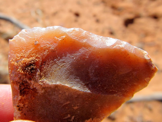
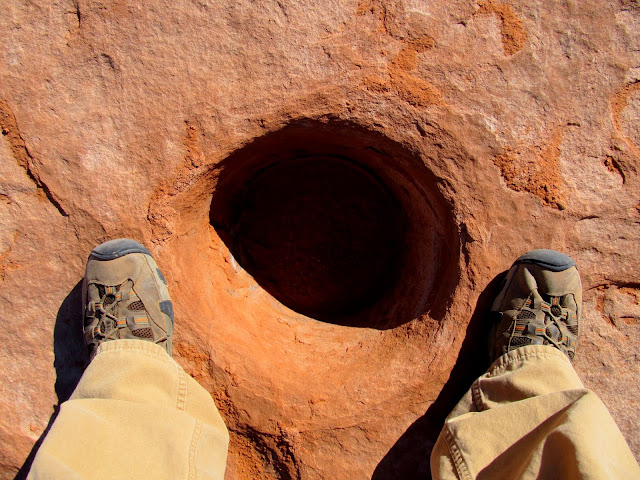
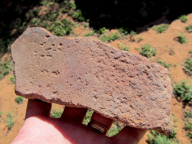
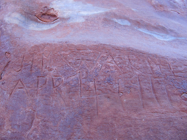
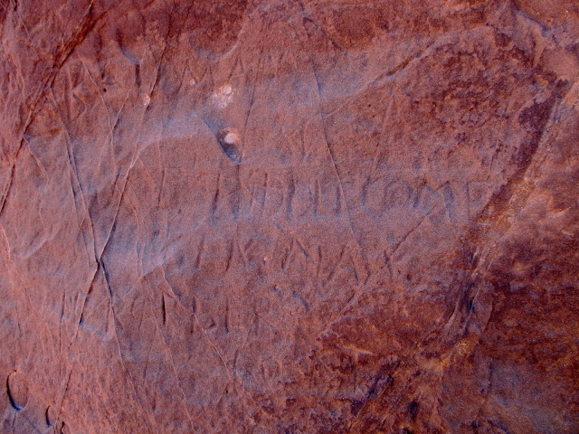
We did find some inscriptions, including Jim Warner 1917, E.D. Leavitt, Joe Biddlecome, and one that I couldn't make out from the late 1800s. There was also a lot of Indian sign around. Unfortunately there was no rock art, but there was some lithic scatter all over and one spot with a huge concentration of chert flakes. On top of a cliff above the spring I found a deep, circular hole that looked man-made, and right next to the spring was a mano (used for grinding grain).
Worked piece of chert from a huge discard pile at Bluejohn Spring
Above Bluejohn Spring
Possibly man-made hole in the ledges above Bluejohn Spring
Mano at Bluejohn Spring
Jim Warner inscription from April 4, 1917
Faded inscriptions, including one from Joe Biddlecome
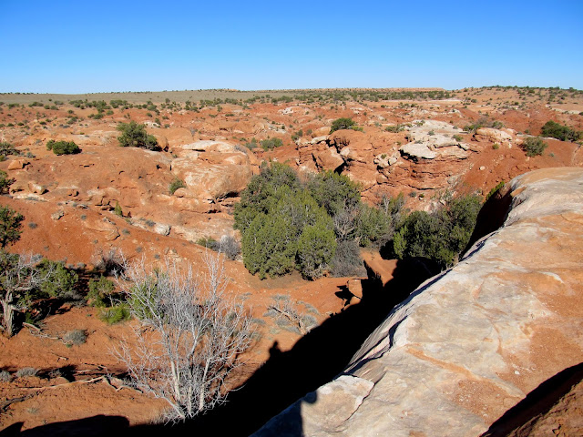
View down Bluejohn Canyon toward the start of the slot canyon
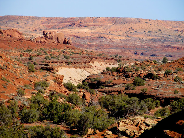
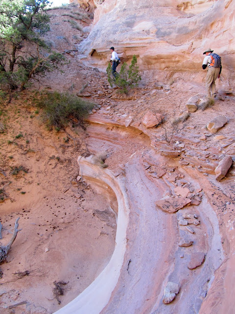
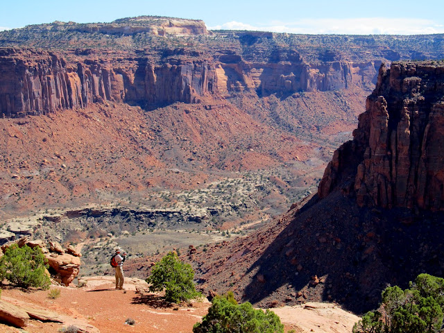
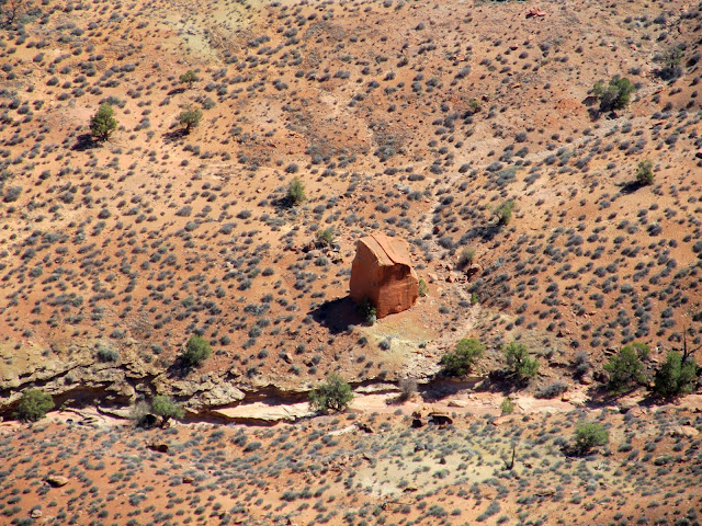
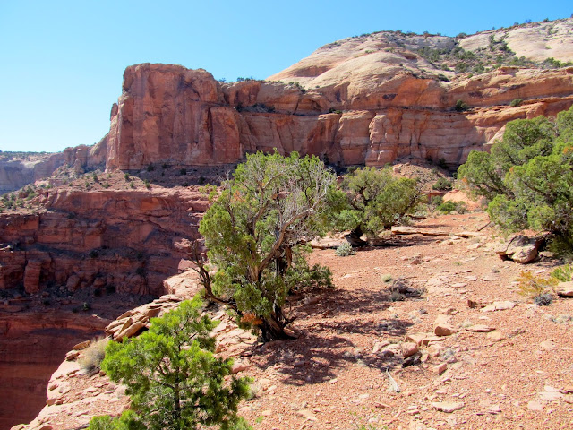
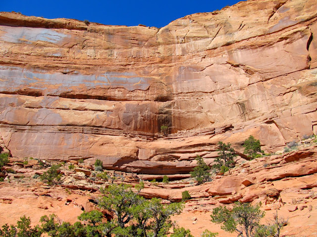
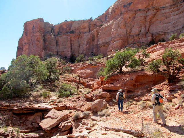
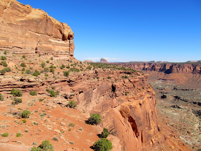
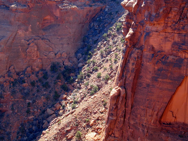
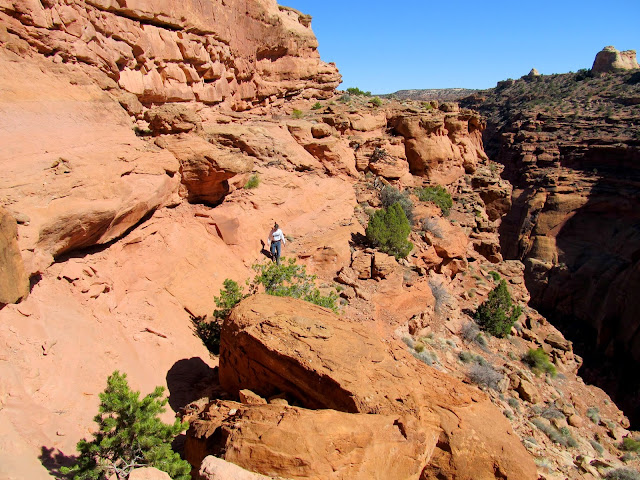
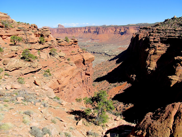
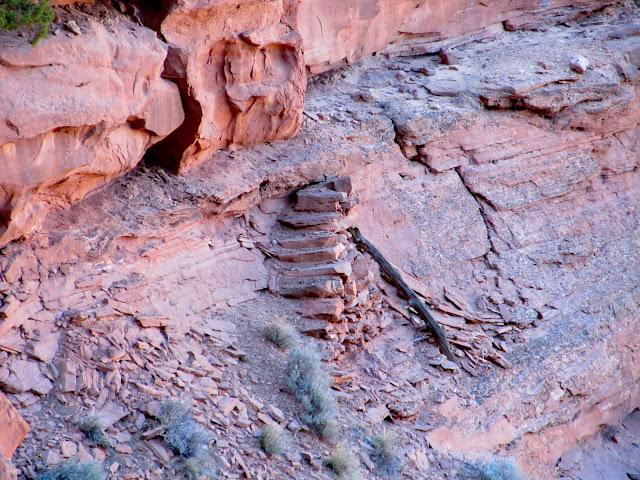
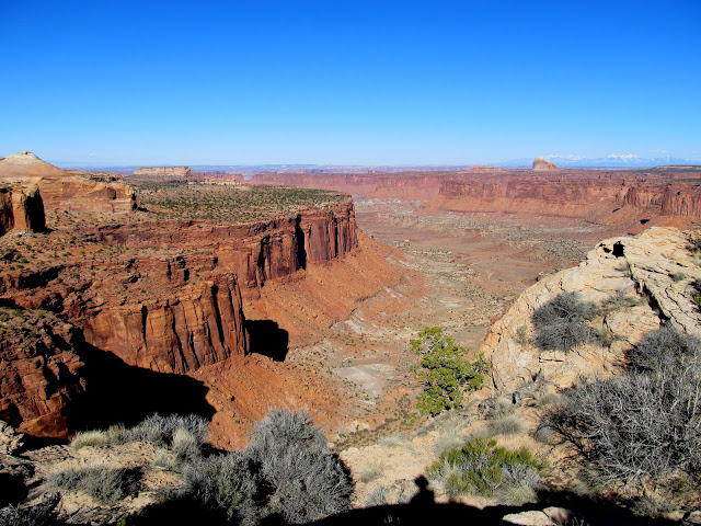
We hiked back to the vehicles then drove to our camp spot on the east side of Twin Corral Flats, near the rim of French Spring Fork. Paul had a lot farther to drive, coming from northern Utah, and he met us at camp before we set out for an afternoon hike. Our goal was to use the Millard Canyon Trail (also called Outlaw Trail) to drop below the Orange Cliffs (also referred to as "Under the Ledge"). There are relatively few breaks in the Orange Cliffs and most of them were used to get livestock from the high plateaus into the valleys and canyons of what is now Canyonlands National Park and Glen Canyon National Recreation Area. The hike started out with a gentle descent until reaching a cliff band. Once below the cliff band our route turned south and followed a shelf between two very tall cliff bands. The shelf was narrow in places and wider in others, and we saw signs of a constructed stock trail in a few spots. Eventually we came to a spot where a steep, long, rocky talus slope penetrates the lower cliff band and leads down into Millard Canyon.
Near the start of the Millard Canyon Trail (aka Outlaw Trail) hike, with Cleopatra's Chair on the right
Part of a difficult-to-photograph Ned Chaffin inscription
Traversing around a dryfall
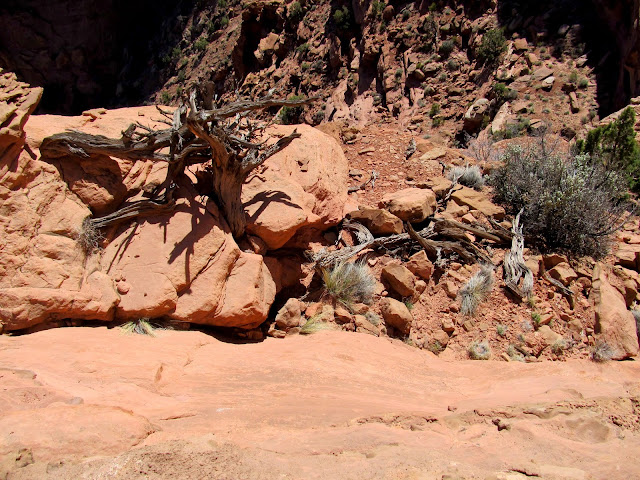
Above Millard Canyon
A large boulder below that was our destination
One of the easy parts of the trail
Cliffs looming above
Millard Canyon Trail
View back along the Millard Canyon Trail
Cleo's Chair
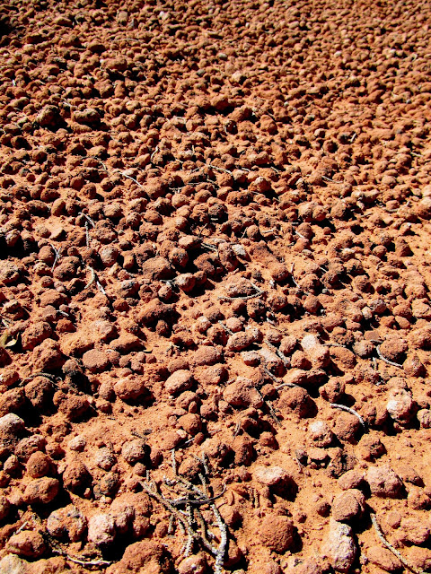
Thousands of small concretions
First glimpse of the steep, rocky descent into Millard Canyon
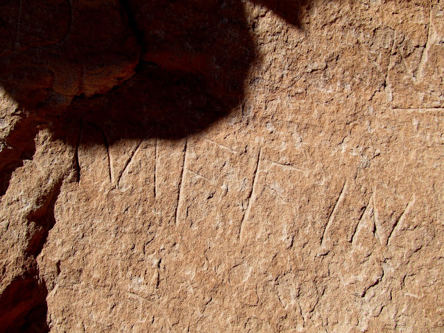
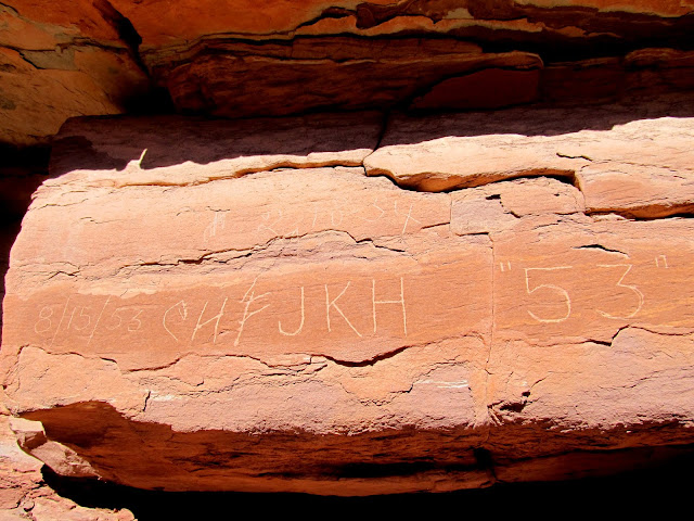
Inscriptions from 1953 and 1954
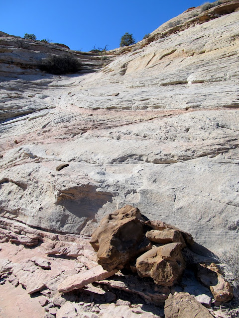
Constructed part of the trail below
Millard Canyon Trail
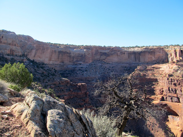
Millard Canyon
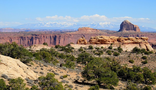
The La Sal Mountains over Millard Canyon
Upon seeing the talus slope, nobody except Wade wanted to venture lower into the canyon (I was saving my legs for the following day's hike). He'd read about a large boulder there with cowboy inscriptions on it, so he dropped his pack and scrambled down to check it out. Alan waited at the top of the slope for Wade while the rest of us made our way further along the shelf toward the southern exit point. I stopped a few times while climbing back up the ledges to look for Wade and saw him jogging down in the canyon. Paul and I hiked out together while Layne and Mike went ahead. We got back to the road and had to hike just over a mile back to the Jeep, and we met Layne and Mike as they were driving back toward camp. They offered us a ride to the Jeep but it was so close that we chose to keep walking. We hopped in the Jeep and drove back down the road, and only had to wait a few minutes before Wade and Alan appeared over the ridge leading up from Millard Canyon. From there we drove back to camp and hit the sack early so we could be rested for the next day's long hike.
Constructed steps
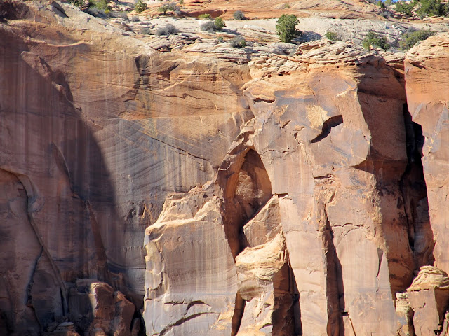
Natural arch
View of a portion of the trail between cliff bands that we traversed
Climb out of the south side of the Millard Canyon Trail
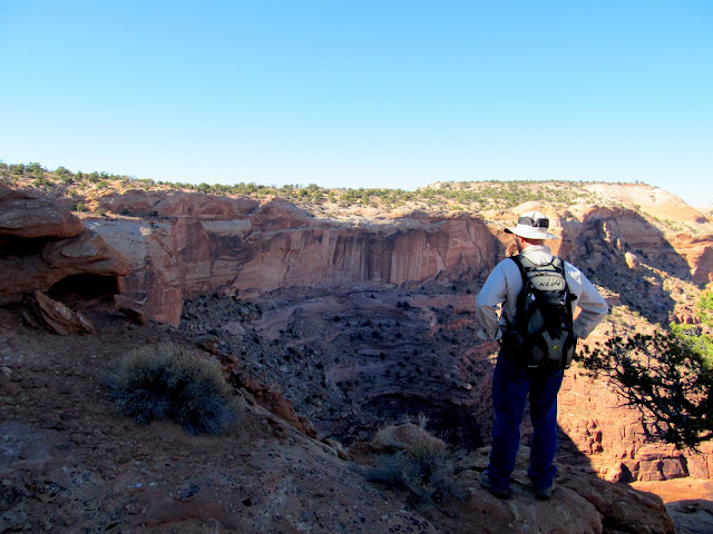
Paul taking in the view after the climb out
Millard Canyon
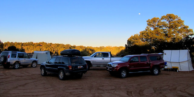
Our camp on the east side of Twin Corral Flats and near the rim of French Spring Fork
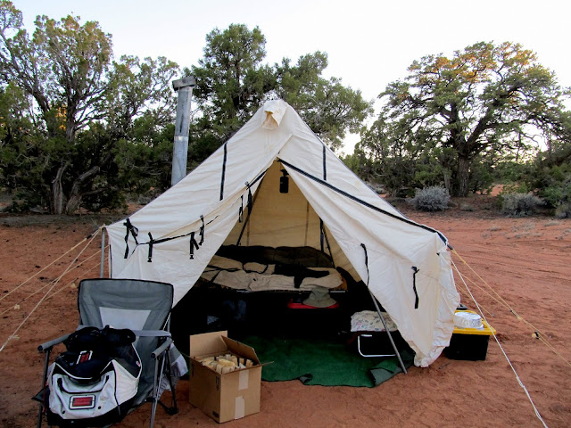
Wade's camp setup
Full photo gallery: https://picasaweb.google.com/Dennis.Udink/BluejohnSpringAndMillardCanyonTrail
[parsehtml]<iframe width="640" height="480" frameborder="0" scrolling="no" marginheight="0" marginwidth="0" src="https://maps.google.com/maps?q=http:%2F%2Fudink.org%2Fgeo%2FBluejohnSpringAndMillardCanyonTrail.kmz&hl=en&sspn=0.082137,0.169086&t=h&ie=UTF8&ll=38.305485,-110.221164&spn=0.114259,0.156253&output=embed"></iframe><br /><small><a href="https://maps.google.com/maps?q=http:%2F%2Fudink.org%2Fgeo%2FBluejohnSpringAndMillardCanyonTrail.kmz&hl=en&sspn=0.082137,0.169086&t=h&ie=UTF8&ll=38.305485,-110.221164&spn=0.114259,0.156253&source=embed" style="color:#0000FF;text-align:left">View Larger Map</a></small>[/parsehtml]http://udink.org/geo/BluejohnSpringAndMillardCanyonTrail.kmz
Parked on Robber's Roost Flats for a hike to Bluejohn Spring
Hiking to Bluejohn Spring
My shadow along a horse/burro trail to Bluejohn Spring
Pine poles and a small trough
Bluejohn Spring
A smaller seep below Bluejohn Spring
Beautiful snow-capped Henry Mountains
We did find some inscriptions, including Jim Warner 1917, E.D. Leavitt, Joe Biddlecome, and one that I couldn't make out from the late 1800s. There was also a lot of Indian sign around. Unfortunately there was no rock art, but there was some lithic scatter all over and one spot with a huge concentration of chert flakes. On top of a cliff above the spring I found a deep, circular hole that looked man-made, and right next to the spring was a mano (used for grinding grain).
Worked piece of chert from a huge discard pile at Bluejohn Spring
Above Bluejohn Spring
Possibly man-made hole in the ledges above Bluejohn Spring
Mano at Bluejohn Spring
Jim Warner inscription from April 4, 1917
Faded inscriptions, including one from Joe Biddlecome
View down Bluejohn Canyon toward the start of the slot canyon
We hiked back to the vehicles then drove to our camp spot on the east side of Twin Corral Flats, near the rim of French Spring Fork. Paul had a lot farther to drive, coming from northern Utah, and he met us at camp before we set out for an afternoon hike. Our goal was to use the Millard Canyon Trail (also called Outlaw Trail) to drop below the Orange Cliffs (also referred to as "Under the Ledge"). There are relatively few breaks in the Orange Cliffs and most of them were used to get livestock from the high plateaus into the valleys and canyons of what is now Canyonlands National Park and Glen Canyon National Recreation Area. The hike started out with a gentle descent until reaching a cliff band. Once below the cliff band our route turned south and followed a shelf between two very tall cliff bands. The shelf was narrow in places and wider in others, and we saw signs of a constructed stock trail in a few spots. Eventually we came to a spot where a steep, long, rocky talus slope penetrates the lower cliff band and leads down into Millard Canyon.
Near the start of the Millard Canyon Trail (aka Outlaw Trail) hike, with Cleopatra's Chair on the right
Part of a difficult-to-photograph Ned Chaffin inscription
Traversing around a dryfall
Above Millard Canyon
A large boulder below that was our destination
One of the easy parts of the trail
Cliffs looming above
Millard Canyon Trail
View back along the Millard Canyon Trail
Cleo's Chair
Thousands of small concretions
First glimpse of the steep, rocky descent into Millard Canyon
Inscriptions from 1953 and 1954
Constructed part of the trail below
Millard Canyon Trail
Millard Canyon
The La Sal Mountains over Millard Canyon
Upon seeing the talus slope, nobody except Wade wanted to venture lower into the canyon (I was saving my legs for the following day's hike). He'd read about a large boulder there with cowboy inscriptions on it, so he dropped his pack and scrambled down to check it out. Alan waited at the top of the slope for Wade while the rest of us made our way further along the shelf toward the southern exit point. I stopped a few times while climbing back up the ledges to look for Wade and saw him jogging down in the canyon. Paul and I hiked out together while Layne and Mike went ahead. We got back to the road and had to hike just over a mile back to the Jeep, and we met Layne and Mike as they were driving back toward camp. They offered us a ride to the Jeep but it was so close that we chose to keep walking. We hopped in the Jeep and drove back down the road, and only had to wait a few minutes before Wade and Alan appeared over the ridge leading up from Millard Canyon. From there we drove back to camp and hit the sack early so we could be rested for the next day's long hike.
Constructed steps
Natural arch
View of a portion of the trail between cliff bands that we traversed
Climb out of the south side of the Millard Canyon Trail
Paul taking in the view after the climb out
Millard Canyon
Our camp on the east side of Twin Corral Flats and near the rim of French Spring Fork
Wade's camp setup
Full photo gallery: https://picasaweb.google.com/Dennis.Udink/BluejohnSpringAndMillardCanyonTrail
[parsehtml]<iframe width="640" height="480" frameborder="0" scrolling="no" marginheight="0" marginwidth="0" src="https://maps.google.com/maps?q=http:%2F%2Fudink.org%2Fgeo%2FBluejohnSpringAndMillardCanyonTrail.kmz&hl=en&sspn=0.082137,0.169086&t=h&ie=UTF8&ll=38.305485,-110.221164&spn=0.114259,0.156253&output=embed"></iframe><br /><small><a href="https://maps.google.com/maps?q=http:%2F%2Fudink.org%2Fgeo%2FBluejohnSpringAndMillardCanyonTrail.kmz&hl=en&sspn=0.082137,0.169086&t=h&ie=UTF8&ll=38.305485,-110.221164&spn=0.114259,0.156253&source=embed" style="color:#0000FF;text-align:left">View Larger Map</a></small>[/parsehtml]http://udink.org/geo/BluejohnSpringAndMillardCanyonTrail.kmz