- Joined
- Oct 30, 2016
- Messages
- 991
Saturday I drove out to Lost Creek Wilderness for the first backpacking trip of the year. This area of Colorado has pretty much melted out making the higher elevations accessible, and hiking around the peaks is a big part of the reason I moved here. I think mountains are extra magical for a born flatlander.
The destination was the summit of Bison Peak at 12,432ft. I called the local ranger district and was told to expect post-holing from 10,000 feet up but a comment on 14ers from just a few days earlier put the lie to that. Not much snow left until within a few hundred yards of the summit itself. In fact I didn't see any snow at all until one small patch over 11,000.
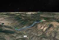
I arrived at the Ute Creek Trailhead about 10:30 and snagged one of the last two spots available in the parking lot. Jimmy John's in the backpack and an apple at hand, I was hyped to hit the trail.
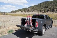
Two things I've learned so far in my short time as a Colorado resident. Expect to smell dope at the trailheads and expect everyone to think they're dog is the exception to the leash laws. While I laced up someone pulled in to the last spot and commenced with some pre-hike baking, and I may have seen two or three leashed dogs out of probably 15-20 total out on the trails.
The pot doesn't bother me at all. As a dog lover, most of the unleashed dogs don't bother me either (except when they charge at me or my pooch) though it would be nice if people would simply play by the rules. I would see no wildlife on this trip with one exception, and I'm pretty sure all the dogs running around are a big reason for that.
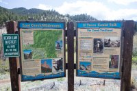
The trail starts with a bridge crossing of a stream, and then heads east through some open meadows before bending northeast in to the woods. After that first quarter mile or so, it's a constant and unrelenting ascent to the peak. 4000 feet of elevation gain over six miles. As I type this two days after getting back, my quads and calves are still incredibly sore.

After a mile and a half of the trail following alongside Ute Creek you cross the boundary in to the wilderness area. Half a mile past this point the trail crosses the creek and that's it for available water.
Aspens were blooming and things generally greening up. A fair amount of deadfall along the trail but most had been cut and pushed out of the way.
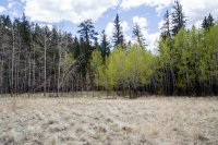
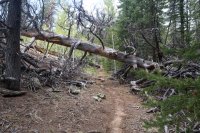
Onward and upward. Trees begin to thin out. Beautiful vistas at hand every time you stop to catch your breath.
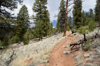
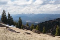
Around 11,200 feet Ute Creek Trail terminates at the Brookside McCurdy trail. Heading east at this point starts the final push through a series of switchbacks to the peak itself. Bison Peak is seen directly above the Brookside McCurdy trail marker.
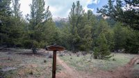
Upon gaining the peak, you find yourself on a mile/mile and a half wide plateau dotted with fantastical granite boulders and views of endless mountain ranges in every direction. The summit lies across a shallow saddle about another mile or so north.
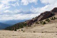
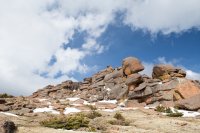
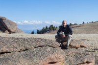
To understand the size of these improbable piles of boulders, I'm standing in the lower right corner of the picture below.
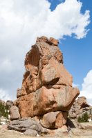
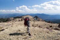
I could now see the summit itself. It was about 4:00 when I made it on to the plateau, and the few remaining day hikers had left. I love the sense of isolation when you stand surrounded by the immensity of the wilderness with no sound but the wind.
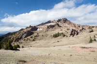
About 45 minutes later I stood on top of the summit in gusty, cold winds under dark clouds.


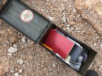
Box with register books and other odds and ends (including some bud, lol).
Mission accomplished, I headed back down to find a place out of the wind to set up camp. I passed two other guys camping very near to the summit. Those were the last folks I'd see until half way back to my truck the next day.
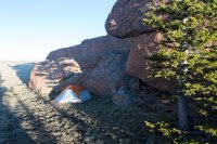
A small alcove surrounded by boulders made a great spot to pitch the tent and fire up some dinner. Another freeze-dried bag of flavored salt - yum!
I took a nap for an hour or so, and then got back up to snap some sunset pictures.
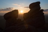
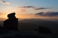
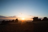
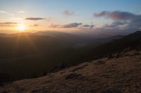
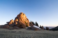
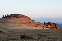
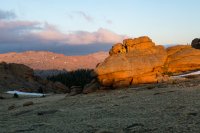
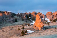
After that I climbed back in the tent for the night. Tossed and turned a fair amount at first, and I could hear/feel my heart thumping a bit faster than usual. Eventually exhaustion won out and I was down until my bladder decided it was time to get up at 2am. This happened to be the time I had read the moon would set and I wanted to try and snag some night shots, but when I staggered out of the tent in to the freezing cold there she was blazing away brightly above me with no apparent intention of diving behind the horizon any time soon. I left the rodents some salt and went back to sleep.
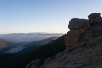
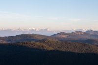
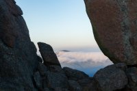
5:30am and I was up again to capture the other good light of the day.
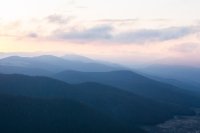
Here's Pikes Peak in the distance.
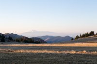
Clouds draped over the surrounding hills.
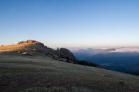
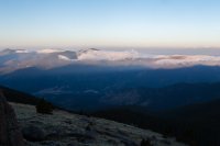
As the sun climbed further in to the sky, I had a quick breakfast and packed up. I saw a small herd of elk running through the forest on the way down, but it was an otherwise uneventful trip back to the truck.
Beautiful place to visit. A very challenging hike with a big payoff at the end. For my first 'real' Colorado hike, I couldn't have been happier.
If you'd like to see more there's a half hour video of the trip with more eye-candy on youtube:
The destination was the summit of Bison Peak at 12,432ft. I called the local ranger district and was told to expect post-holing from 10,000 feet up but a comment on 14ers from just a few days earlier put the lie to that. Not much snow left until within a few hundred yards of the summit itself. In fact I didn't see any snow at all until one small patch over 11,000.

I arrived at the Ute Creek Trailhead about 10:30 and snagged one of the last two spots available in the parking lot. Jimmy John's in the backpack and an apple at hand, I was hyped to hit the trail.

Two things I've learned so far in my short time as a Colorado resident. Expect to smell dope at the trailheads and expect everyone to think they're dog is the exception to the leash laws. While I laced up someone pulled in to the last spot and commenced with some pre-hike baking, and I may have seen two or three leashed dogs out of probably 15-20 total out on the trails.
The pot doesn't bother me at all. As a dog lover, most of the unleashed dogs don't bother me either (except when they charge at me or my pooch) though it would be nice if people would simply play by the rules. I would see no wildlife on this trip with one exception, and I'm pretty sure all the dogs running around are a big reason for that.

The trail starts with a bridge crossing of a stream, and then heads east through some open meadows before bending northeast in to the woods. After that first quarter mile or so, it's a constant and unrelenting ascent to the peak. 4000 feet of elevation gain over six miles. As I type this two days after getting back, my quads and calves are still incredibly sore.
After a mile and a half of the trail following alongside Ute Creek you cross the boundary in to the wilderness area. Half a mile past this point the trail crosses the creek and that's it for available water.
Aspens were blooming and things generally greening up. A fair amount of deadfall along the trail but most had been cut and pushed out of the way.


Onward and upward. Trees begin to thin out. Beautiful vistas at hand every time you stop to catch your breath.


Around 11,200 feet Ute Creek Trail terminates at the Brookside McCurdy trail. Heading east at this point starts the final push through a series of switchbacks to the peak itself. Bison Peak is seen directly above the Brookside McCurdy trail marker.

Upon gaining the peak, you find yourself on a mile/mile and a half wide plateau dotted with fantastical granite boulders and views of endless mountain ranges in every direction. The summit lies across a shallow saddle about another mile or so north.


To understand the size of these improbable piles of boulders, I'm standing in the lower right corner of the picture below.

I could now see the summit itself. It was about 4:00 when I made it on to the plateau, and the few remaining day hikers had left. I love the sense of isolation when you stand surrounded by the immensity of the wilderness with no sound but the wind.

About 45 minutes later I stood on top of the summit in gusty, cold winds under dark clouds.
Box with register books and other odds and ends (including some bud, lol).

Mission accomplished, I headed back down to find a place out of the wind to set up camp. I passed two other guys camping very near to the summit. Those were the last folks I'd see until half way back to my truck the next day.

A small alcove surrounded by boulders made a great spot to pitch the tent and fire up some dinner. Another freeze-dried bag of flavored salt - yum!


I took a nap for an hour or so, and then got back up to snap some sunset pictures.


After that I climbed back in the tent for the night. Tossed and turned a fair amount at first, and I could hear/feel my heart thumping a bit faster than usual. Eventually exhaustion won out and I was down until my bladder decided it was time to get up at 2am. This happened to be the time I had read the moon would set and I wanted to try and snag some night shots, but when I staggered out of the tent in to the freezing cold there she was blazing away brightly above me with no apparent intention of diving behind the horizon any time soon. I left the rodents some salt and went back to sleep.
5:30am and I was up again to capture the other good light of the day.
Here's Pikes Peak in the distance.

Clouds draped over the surrounding hills.


As the sun climbed further in to the sky, I had a quick breakfast and packed up. I saw a small herd of elk running through the forest on the way down, but it was an otherwise uneventful trip back to the truck.
Beautiful place to visit. A very challenging hike with a big payoff at the end. For my first 'real' Colorado hike, I couldn't have been happier.
If you'd like to see more there's a half hour video of the trip with more eye-candy on youtube:
Last edited:

