- Joined
- May 31, 2015
- Messages
- 3,304
September 29 - October 3, 2023
This is the fourth year in a row we've done this sort of trip at the end of September/beginning of October, hence the thread title. The route was a little different this time since we wanted to see the Pitchstone Plateau and some other areas, and also because, for the first time, we didn't manage to get a site near Dunanda Falls.
There were four of us: Andrew, Steve, Alex, and myself. It would be a 4-nighter, and our route was the Pitchstone Plateau to Union Falls and Scout Pool, over to Bechler Meadow, up Bechler Canyon, past Douglas Knob, down to Shoshone Geyser Basin, then back out along the Firehole to Lonestar trailhead.
The weather for the trip was looking fairly iffy, but we were down for pretty much anything short of a blizzard. It turned out being fairly manageable for the time we were out.
Andrew stayed at my place the night before, and we drove down in separate vehicles, dropped my car off at the Lonestar trailhead, and drove from there to the Pitchstone Plateau trailhead/turnout. It was a pretty, sunny day. All the better to get us sweating immediately on the steep climb from road.
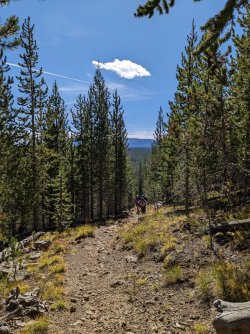
Topping out on the initial climb.
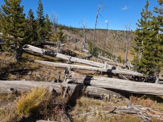
Slopes of the Pitchstone Plateau
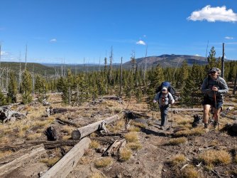
About to where it mostly leveled off, trees thinned out a bit.
It was surprising to us how quickly the trail thinned out and was close to nonexistent for much of the plateau. I guess it's not an enticing day hike, and most people probably don't backpack it. Their loss!
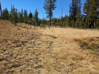
The trail is the depression in the grass.
We reached Phantom Fumarole a little before mid afternoon and had a late lunch. Cool spot.
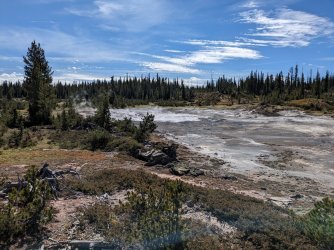
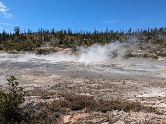
On we went to camp.
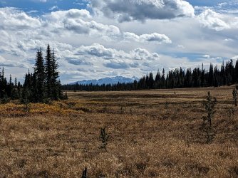
Nice distant views of the Tetons from where the camp site was.
We got set up and enjoyed the rest of the day. It was interesting that there was no spot that was clearly where people always set up, since most Yellowstone sites do.
We unsurprisingly saw no one all day, and the other camp site across the way was not occupied. Water at the spring was better than I expected given what I've read from others, but it had a notable sulfur scent.
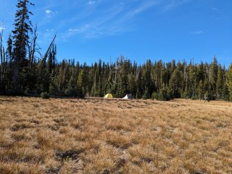
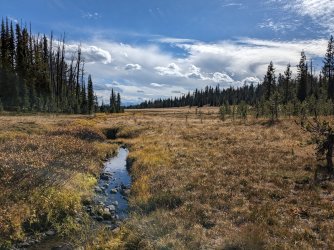
This night seemed to be one of the colder ones. We had a nice fire and then went to bed.
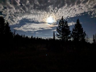
Messing with the night mode on my pixel camera.
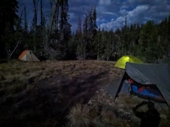
Bedtime.
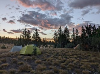
It was a beautiful sunrise the next morning.
Our original plan for the second day was to follow the trail off the Pitchstone Plateau and then hook up with what's marked as the "Old Marysville Road" trail to Mountain Ash Creek, up to Union Falls and Scout Spring. The distance for that was going to be somewhere in the 16-17 mile range. Andrew had been wondering a while about cutting some distance by going off trail down Mountain Ash Creek from the Plateau, and we had talked about it a bit before the trip. We had both read @TheMountainRabbit's report from last year where he did the same thing in reverse, so we discussed a bit more as we covered the first miles of the day and decided to go for it. It would save us around 6 miles and, if it went without much difficulty, would be a much more efficient way to see Union Falls and Scout Spring.
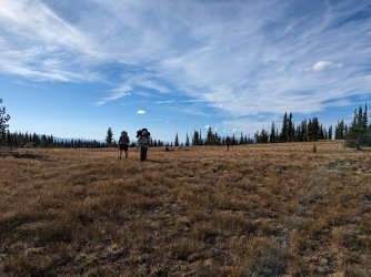
Making our way along the trail. This stretch was just following cairns from point to point. There was no distinguishable trail at all.
We saw a massive mule buck and a pine marten as we walked that morning. Really cool sightings. The pine marten kept running ahead and stopping, and we saw it a few times.
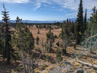
Ascending a little rise. Cool to see Jackson Lake in the background.
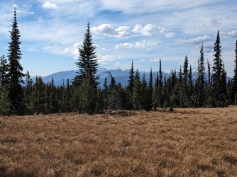
Got closer to the Tetons.
We reached the beginning of Mountain Ash Creek according to the map, and we headed down. There was no water in the creek for a decent while.
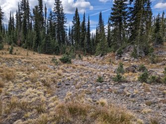
Down we go.
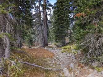
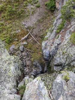
Got a little cliffy in places, but there was always a good bypass.
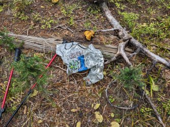
Mylar balloons suck. Of course there was one back here where people almost never go. We were #1 and packed it out.
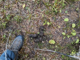
Big, old bear poop.
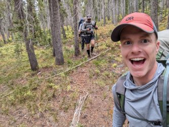
Andrew diligently checking the GPS to make sure we didn't get pulled too far down the wrong drainage. A lot of the walking was fairly clear like this.
We stayed on course pretty well. I took us a little too far down one little drainage, but we got back on track.
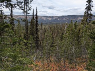
Looking across the upper Mountain Ash Creek drainage before getting into the brush ahead.
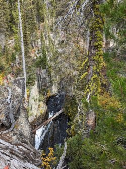
Confusing perspective of a precipitous drop to an interesting waterfall.
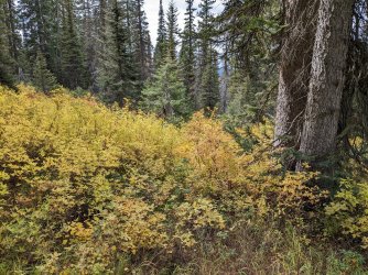
Some of the walk, especially as we got lower, looked like this, with water running through the brush and making things tricky.
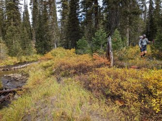
Almost done with the off trail bit. We crossed the creek right here.
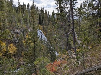
Union falls coming into view. Impossible to capture the scale of this one. Such a cool waterfall.
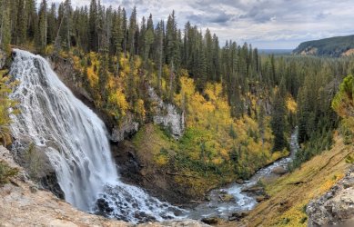
Panorama of Union Falls. We likely wouldn't have walked far enough up for this view had we just taken the longer route and not gone down Mountain Ash Creek.
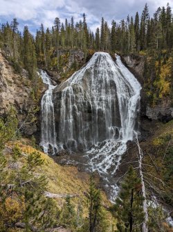
The classic view of the falls.
We went from there down to Scout Spring. There was a couple there when we arrived, and they were just leaving. Perfect. It was sunny and pretty warm, so it was just right for getting into the water. It would not be all that pleasant if it were cold out. I failed to take pictures of the rest of this day, so the next three are Andrew's.
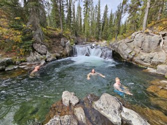
Scout
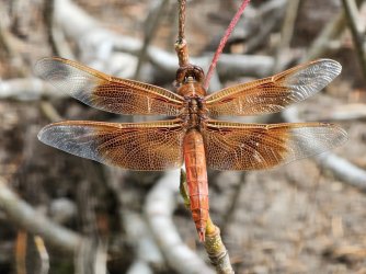
Cool dragonfly at Scout.
We went to camp after that. We talked with a ranger outside the patrol cabin just up the trail from our site, then we got set up and settled. Warmer night that night, and nice and dry.
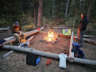
The weather deteriorated a bit the next day. We had about 15 miles to cover.
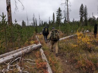
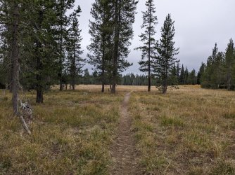
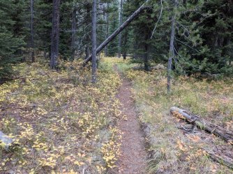
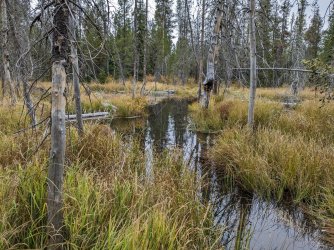
Serious beaver action in this spot. You can see in this one and the next one that the NPS has put in those wire cage things to keep the stream flowing, but it doesn't seem to be helping much. This was a sketchy bit where most of us got our feet wet.
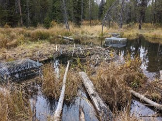
We walked along the top of the beaver dam here. I did not like it. The water on either side was quite deep. The pro move would have been to put on wading shoes and go upstream a bit to where it was shallower. Oh well.
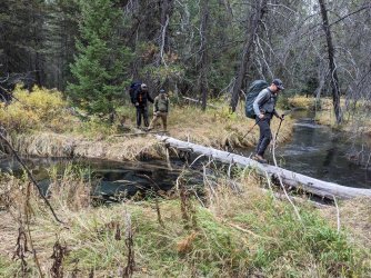
Another crossing of an unnamed creek farther on.
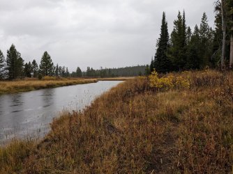
Arriving at the Bechler River. It had begun raining a little before this, but it became pretty steady here. It kept up for a decent while.
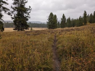
Walking along the meadows toward the canyon.
We took a lunch break at an unoccupied camp site at the mouth of the canyon. The trees were thick enough that we didn't get rained on. The rain had mostly stopped by the time we finished. I put on my gaiters to keep water off my pants and out of my boots from brush along the trail. Turned out to be a great choice.
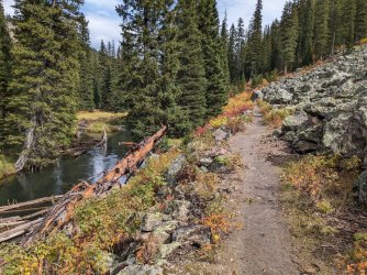
Sun is back out, canyon looking great.
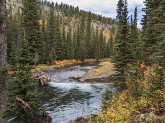
I take a picture of this spot every year and never post it, so I'm doing it this time.
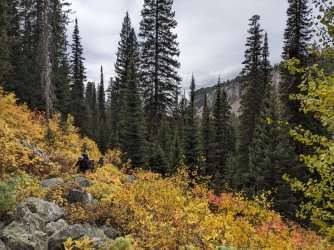
I also always take a picture of this spot with people walking through the fall foliage. This time, we're headed the opposite direction compared to previous years.
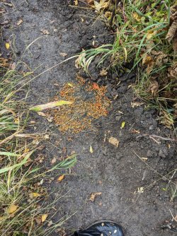
Lots of old bear scat remnants through here. They seem to have a thing for mountain ash berries.
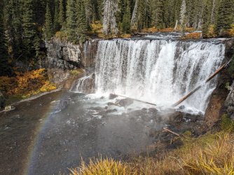
Iris
We came across a group at Iris Falls that was headed down canyon. They said parts of their site flooded in the recent rain. Not fun. They were very enthusiastic though.
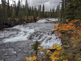
My favorite cascade. Loved the mountain ash berries in this view.
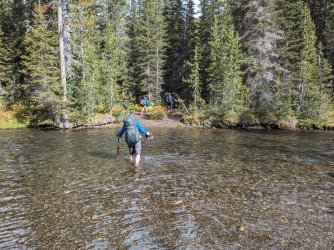
Final ford of the day. Camp was on the right side of the trail here, just back in those trees.
We set out our things to dry a bit, trying to take advantage of the sun while we had it. We preemptively set up our tarps to keep our gear dry and hang out if it did decide to rain more.
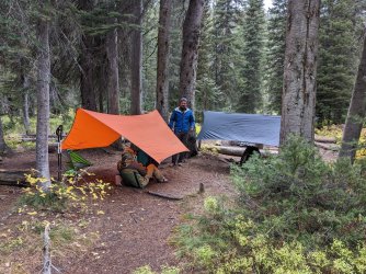
And then it did rain more. And it hailed. And there was some good thunder and lightning.
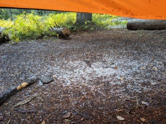
Fortunately, the rain stopped as it was getting dark, so we got a fire going and were able to dry out our boots and socks.
I believe it rained more after we went to bed, but I honestly can't remember. I do remember it was very wet, and I had to pack up a very wet tent in the morning. I kept the wet fly separate from the interior by stuffing it into a trash bag. That also kept all my other stuff from getting soaked in my pack.
That next day, we planned to soak in the hot springs in the late morning, then make our way up over to Shoshone Lake and Geyser Basin. As with the last few days, we were on the trail by around 8:30-9:00.
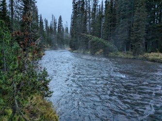
Misty morning on the river next to camp.
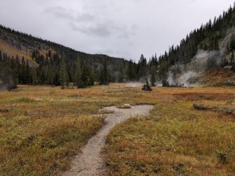
Getting to the thermal areas on the upper river.
As we walked along the thermal areas, Steve spotted a black bear on the slope across the canyon. We took turns looking at it through his binoculars. Then we spotted another one. First time I've seen any bears in the park not from the road.
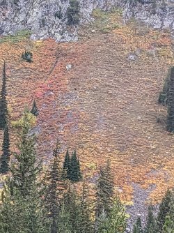
Hilariously poor phone camera zoom. The bear is the black spot. It ran up that little ravine and climbed up through the rocks.
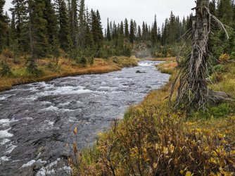
The final ford. Ferris Fork.
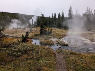
Iconic Ferris Fork thermal area view.
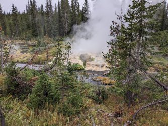
Cauldron
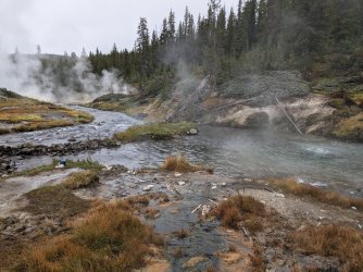
Back again.
We set up the tarp because it had started sprinkling. We had the place to ourselves for a bit, then a duo from Oklahoma rolled up and joined us. Good company. One of them runs a Youtube channel with backpacking videos: "Long Wilderness Walks." They were headed down the canyon to Dunanda, then out on Grassy Lake Road. I watched his video later on, and it sounds like they had a rough go of it this day and the next few days with rain, snow, and cold.
After a couple hours, we headed off, up the long, steep hill toward Douglas Knob.
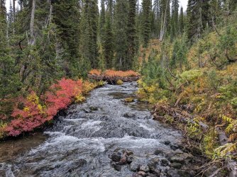
Creek next to 9D2, where we have stayed in years past. Not this time.
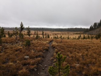
Out of the trees and into Douglas Knob Meadow.
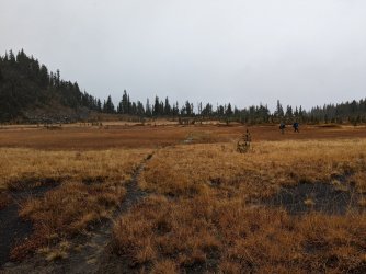
I have yet to find a good way across this marsh.
It had started sleeting by the time we were in the meadow, and it turned into snow as we continued on.
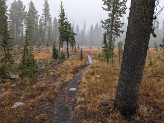
Wet.
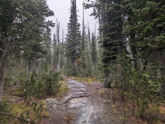
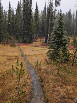
We were getting pretty tired as we made our way downhill from the continental divide. The sun came back out for a bit, so we posted up in a meadow near our trail junction and had a snack and a rest. It was nice.
We ran into a couple of guys at the junction and talked for a bit. They were headed to their camp site along the Firehole after covering some of the same trail we had.
We headed down toward Shoshone Lake, feeling pretty tired and sorry for ourselves (or maybe that was just me). To make matters worse for myself, I slipped while crossing Shoshone Creek on a wet log, dunked my foot, and whacked my hand so hard it went numb. Cool cool. The area was beautiful though. Glad we saw it.
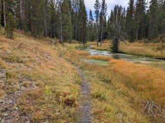
Lot of water grass growing in the creek.
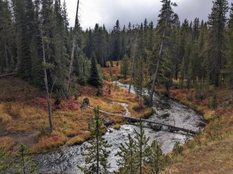
This was one of my favorite shots from the trip. Such a neat little segment of trail. Felt very secluded.
We got down near the Geyser Basin, and we opted to head to camp first.
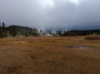
View of the geyser basin.
I took us down the wrong trail at first (headed toward the geyser basin), so we had to backtrack back to the trail along the lake's north shore.
Because the spur trail to our camp site was nearly half a mile long, we decided not to go back to the geyser basin. It was an easy call for me since I was there just a couple months prior.
The lake was foggy, and it was windy and cold. Of course this was the night we couldn't have a camp fire.
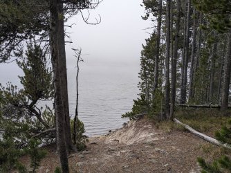
Spooky
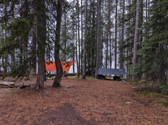
Tarps set up, prepared for more rain or snow.
It didn't rain for most of the late afternoon and early evening, but it was a struggle sitting there getting chilled by the wind. We decided to go to bed around 7:15. Perfect timing because it started raining shortly after that, and it kept up for most of the night.
I had to go to the bathroom in the early morning, and by 6:00 a.m., I couldn't wait any longer. So I went out in the pitch dark, it was snowing heavily, and the toilet was a decent walk from the tent. Did not enjoy that.
The rain and snow stopped by the time it was time to be up for the day. We ate quickly, packed up, and got on our way. Gaiters saved the day again.
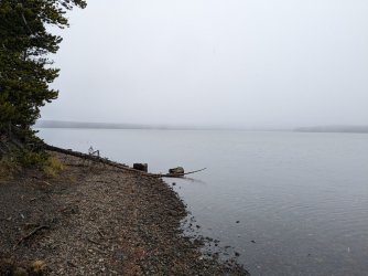
Foggy morning on the lake.
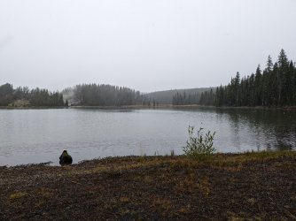
We moved quick on the way out. I also skipped the log I fell on the day before. Just ran through the creek with my gaiters, hoping they would keep the water out. Success.
We got to the Firehole and saw a few bison along the way. Didn't notice this one until we were right next to it.
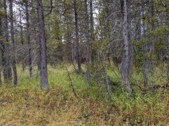
We arrived at Lone Star Geyser. A couple was there and told us that some people they had seen said it had gone off recently, so we must've missed it. We weren't too broken up about it. However, as we moved past, it started firing up. I haven't seen it erupt before, so I can't say whether it was a full eruption or not, but it was pretty darn good.
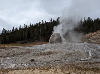
Took this when we figured we wouldn't be seeing anything.
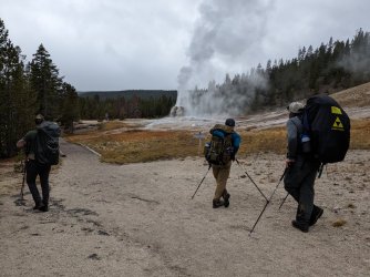 And here's when we stopped and turned around to see it going off.
The paved final portion was hell for my feet, and it also seemed to take forever. I had done this trip in new boots I had only hiked once in prior to the trip. They were good overall, but the bottoms of my feet were killing me by the end. It was a relief getting to the car and putting on Chacos.
We went to the Old Faithful Inn for lunch. We had tried the snow lodge before going there, but their power was out. We ate our fill at the buffet, and then I took everyone back to their cars.
Awesome trip. I'm happy we went and saw some new sights and pushed ourselves a bit harder than usual. We're looking at maybe doing a Thorofare trip next year (earlier in the season) and then making this one more leisurely like we have done in the past. Already itching to go again, and it's not even December yet!
This is the fourth year in a row we've done this sort of trip at the end of September/beginning of October, hence the thread title. The route was a little different this time since we wanted to see the Pitchstone Plateau and some other areas, and also because, for the first time, we didn't manage to get a site near Dunanda Falls.
There were four of us: Andrew, Steve, Alex, and myself. It would be a 4-nighter, and our route was the Pitchstone Plateau to Union Falls and Scout Pool, over to Bechler Meadow, up Bechler Canyon, past Douglas Knob, down to Shoshone Geyser Basin, then back out along the Firehole to Lonestar trailhead.
The weather for the trip was looking fairly iffy, but we were down for pretty much anything short of a blizzard. It turned out being fairly manageable for the time we were out.
Andrew stayed at my place the night before, and we drove down in separate vehicles, dropped my car off at the Lonestar trailhead, and drove from there to the Pitchstone Plateau trailhead/turnout. It was a pretty, sunny day. All the better to get us sweating immediately on the steep climb from road.

Topping out on the initial climb.

Slopes of the Pitchstone Plateau

About to where it mostly leveled off, trees thinned out a bit.
It was surprising to us how quickly the trail thinned out and was close to nonexistent for much of the plateau. I guess it's not an enticing day hike, and most people probably don't backpack it. Their loss!

The trail is the depression in the grass.
We reached Phantom Fumarole a little before mid afternoon and had a late lunch. Cool spot.


On we went to camp.

Nice distant views of the Tetons from where the camp site was.
We got set up and enjoyed the rest of the day. It was interesting that there was no spot that was clearly where people always set up, since most Yellowstone sites do.
We unsurprisingly saw no one all day, and the other camp site across the way was not occupied. Water at the spring was better than I expected given what I've read from others, but it had a notable sulfur scent.


This night seemed to be one of the colder ones. We had a nice fire and then went to bed.

Messing with the night mode on my pixel camera.

Bedtime.

It was a beautiful sunrise the next morning.
Our original plan for the second day was to follow the trail off the Pitchstone Plateau and then hook up with what's marked as the "Old Marysville Road" trail to Mountain Ash Creek, up to Union Falls and Scout Spring. The distance for that was going to be somewhere in the 16-17 mile range. Andrew had been wondering a while about cutting some distance by going off trail down Mountain Ash Creek from the Plateau, and we had talked about it a bit before the trip. We had both read @TheMountainRabbit's report from last year where he did the same thing in reverse, so we discussed a bit more as we covered the first miles of the day and decided to go for it. It would save us around 6 miles and, if it went without much difficulty, would be a much more efficient way to see Union Falls and Scout Spring.

Making our way along the trail. This stretch was just following cairns from point to point. There was no distinguishable trail at all.
We saw a massive mule buck and a pine marten as we walked that morning. Really cool sightings. The pine marten kept running ahead and stopping, and we saw it a few times.

Ascending a little rise. Cool to see Jackson Lake in the background.

Got closer to the Tetons.
We reached the beginning of Mountain Ash Creek according to the map, and we headed down. There was no water in the creek for a decent while.

Down we go.


Got a little cliffy in places, but there was always a good bypass.

Mylar balloons suck. Of course there was one back here where people almost never go. We were #1 and packed it out.

Big, old bear poop.

Andrew diligently checking the GPS to make sure we didn't get pulled too far down the wrong drainage. A lot of the walking was fairly clear like this.
We stayed on course pretty well. I took us a little too far down one little drainage, but we got back on track.

Looking across the upper Mountain Ash Creek drainage before getting into the brush ahead.

Confusing perspective of a precipitous drop to an interesting waterfall.

Some of the walk, especially as we got lower, looked like this, with water running through the brush and making things tricky.

Almost done with the off trail bit. We crossed the creek right here.

Union falls coming into view. Impossible to capture the scale of this one. Such a cool waterfall.

Panorama of Union Falls. We likely wouldn't have walked far enough up for this view had we just taken the longer route and not gone down Mountain Ash Creek.

The classic view of the falls.
We went from there down to Scout Spring. There was a couple there when we arrived, and they were just leaving. Perfect. It was sunny and pretty warm, so it was just right for getting into the water. It would not be all that pleasant if it were cold out. I failed to take pictures of the rest of this day, so the next three are Andrew's.

Scout

Cool dragonfly at Scout.
We went to camp after that. We talked with a ranger outside the patrol cabin just up the trail from our site, then we got set up and settled. Warmer night that night, and nice and dry.

The weather deteriorated a bit the next day. We had about 15 miles to cover.


Serious beaver action in this spot. You can see in this one and the next one that the NPS has put in those wire cage things to keep the stream flowing, but it doesn't seem to be helping much. This was a sketchy bit where most of us got our feet wet.

We walked along the top of the beaver dam here. I did not like it. The water on either side was quite deep. The pro move would have been to put on wading shoes and go upstream a bit to where it was shallower. Oh well.

Another crossing of an unnamed creek farther on.

Arriving at the Bechler River. It had begun raining a little before this, but it became pretty steady here. It kept up for a decent while.

Walking along the meadows toward the canyon.
We took a lunch break at an unoccupied camp site at the mouth of the canyon. The trees were thick enough that we didn't get rained on. The rain had mostly stopped by the time we finished. I put on my gaiters to keep water off my pants and out of my boots from brush along the trail. Turned out to be a great choice.

Sun is back out, canyon looking great.

I take a picture of this spot every year and never post it, so I'm doing it this time.

I also always take a picture of this spot with people walking through the fall foliage. This time, we're headed the opposite direction compared to previous years.

Lots of old bear scat remnants through here. They seem to have a thing for mountain ash berries.

Iris
We came across a group at Iris Falls that was headed down canyon. They said parts of their site flooded in the recent rain. Not fun. They were very enthusiastic though.

My favorite cascade. Loved the mountain ash berries in this view.

Final ford of the day. Camp was on the right side of the trail here, just back in those trees.
We set out our things to dry a bit, trying to take advantage of the sun while we had it. We preemptively set up our tarps to keep our gear dry and hang out if it did decide to rain more.

And then it did rain more. And it hailed. And there was some good thunder and lightning.

Fortunately, the rain stopped as it was getting dark, so we got a fire going and were able to dry out our boots and socks.
I believe it rained more after we went to bed, but I honestly can't remember. I do remember it was very wet, and I had to pack up a very wet tent in the morning. I kept the wet fly separate from the interior by stuffing it into a trash bag. That also kept all my other stuff from getting soaked in my pack.
That next day, we planned to soak in the hot springs in the late morning, then make our way up over to Shoshone Lake and Geyser Basin. As with the last few days, we were on the trail by around 8:30-9:00.

Misty morning on the river next to camp.

Getting to the thermal areas on the upper river.
As we walked along the thermal areas, Steve spotted a black bear on the slope across the canyon. We took turns looking at it through his binoculars. Then we spotted another one. First time I've seen any bears in the park not from the road.

Hilariously poor phone camera zoom. The bear is the black spot. It ran up that little ravine and climbed up through the rocks.

The final ford. Ferris Fork.

Iconic Ferris Fork thermal area view.

Cauldron

Back again.
We set up the tarp because it had started sprinkling. We had the place to ourselves for a bit, then a duo from Oklahoma rolled up and joined us. Good company. One of them runs a Youtube channel with backpacking videos: "Long Wilderness Walks." They were headed down the canyon to Dunanda, then out on Grassy Lake Road. I watched his video later on, and it sounds like they had a rough go of it this day and the next few days with rain, snow, and cold.
After a couple hours, we headed off, up the long, steep hill toward Douglas Knob.

Creek next to 9D2, where we have stayed in years past. Not this time.

Out of the trees and into Douglas Knob Meadow.

I have yet to find a good way across this marsh.
It had started sleeting by the time we were in the meadow, and it turned into snow as we continued on.

Wet.


We were getting pretty tired as we made our way downhill from the continental divide. The sun came back out for a bit, so we posted up in a meadow near our trail junction and had a snack and a rest. It was nice.
We ran into a couple of guys at the junction and talked for a bit. They were headed to their camp site along the Firehole after covering some of the same trail we had.
We headed down toward Shoshone Lake, feeling pretty tired and sorry for ourselves (or maybe that was just me). To make matters worse for myself, I slipped while crossing Shoshone Creek on a wet log, dunked my foot, and whacked my hand so hard it went numb. Cool cool. The area was beautiful though. Glad we saw it.

Lot of water grass growing in the creek.

This was one of my favorite shots from the trip. Such a neat little segment of trail. Felt very secluded.
We got down near the Geyser Basin, and we opted to head to camp first.

View of the geyser basin.
I took us down the wrong trail at first (headed toward the geyser basin), so we had to backtrack back to the trail along the lake's north shore.
Because the spur trail to our camp site was nearly half a mile long, we decided not to go back to the geyser basin. It was an easy call for me since I was there just a couple months prior.
The lake was foggy, and it was windy and cold. Of course this was the night we couldn't have a camp fire.

Spooky

Tarps set up, prepared for more rain or snow.
It didn't rain for most of the late afternoon and early evening, but it was a struggle sitting there getting chilled by the wind. We decided to go to bed around 7:15. Perfect timing because it started raining shortly after that, and it kept up for most of the night.
I had to go to the bathroom in the early morning, and by 6:00 a.m., I couldn't wait any longer. So I went out in the pitch dark, it was snowing heavily, and the toilet was a decent walk from the tent. Did not enjoy that.
The rain and snow stopped by the time it was time to be up for the day. We ate quickly, packed up, and got on our way. Gaiters saved the day again.

Foggy morning on the lake.

We moved quick on the way out. I also skipped the log I fell on the day before. Just ran through the creek with my gaiters, hoping they would keep the water out. Success.
We got to the Firehole and saw a few bison along the way. Didn't notice this one until we were right next to it.

We arrived at Lone Star Geyser. A couple was there and told us that some people they had seen said it had gone off recently, so we must've missed it. We weren't too broken up about it. However, as we moved past, it started firing up. I haven't seen it erupt before, so I can't say whether it was a full eruption or not, but it was pretty darn good.

Took this when we figured we wouldn't be seeing anything.
 And here's when we stopped and turned around to see it going off.
The paved final portion was hell for my feet, and it also seemed to take forever. I had done this trip in new boots I had only hiked once in prior to the trip. They were good overall, but the bottoms of my feet were killing me by the end. It was a relief getting to the car and putting on Chacos.
We went to the Old Faithful Inn for lunch. We had tried the snow lodge before going there, but their power was out. We ate our fill at the buffet, and then I took everyone back to their cars.
Awesome trip. I'm happy we went and saw some new sights and pushed ourselves a bit harder than usual. We're looking at maybe doing a Thorofare trip next year (earlier in the season) and then making this one more leisurely like we have done in the past. Already itching to go again, and it's not even December yet!

