SKLund
Member
- Joined
- Aug 19, 2016
- Messages
- 459
There have been plenty of TR's on this subject and in this area so I will try to impart new information and skip the stuff that's been gone over already. For the most part, I am leaving out locations and mentions of archaeological attractions. See the tracks for each day on the embedded map to see what we were up to.
The focus of this journey was to backpack into the Gulch, pick a central spot to camp in, and then explore the area in as much detail as we could manage using light day packs.
Day 1: Government Trail to first camp.
View from trail head camp, day one, hour one. There is a pretty good camp site about half a mile back from the trail head. After this point, the road gets pretty rough and 4x4/high clearance is recommended although we did see a couple of Subaru's.
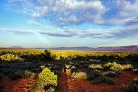
Government Trail Head
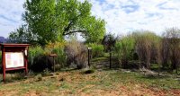
We were packing between four and six liters of water each due to general paranoia. Once you are in Grand Gulch, you'll see water supplies right away at the perennial Polly's Spring outflow. This did not do us any good though as we were heading up stream into a long dry section. If you were to head down stream at this point (towards Collins Spring), you would more water in season because there is more slick rock and holes.
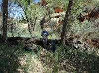
For the next four miles we saw no water except for some holes that were more leaves than water. Camp sites hard to find in this section but after a few hours of dry hiking I found a fairly clean pool with someone's bottle of filtered water next to it. I found this well hidden campsite nearby. We'll call it Camp 1 and we stayed there for the next three nights.
Tom at Camp 1
Day 2: Camp 1 to as far as we can get. The plan was to head out of camp with day packs and get as far up stream as we could with Green House Canyon as the ultimate goal. We would pass by Cow Tank, Dripping Springs, and Step Canyons on the way. The thing about hiking here is that there are a lot of attractions that grab your attention and make you want to hang around a while. The day goes by fast! Needless to say, we did not make it to Green House. We saw some cool stuff however so we called it a day.
Note: We hadn't seen anyone until today but three parties of six or so people came by us on route to various locations. All of them were coming from Kane Gulch, one guy was going all the way to Shangri-la Canyon.
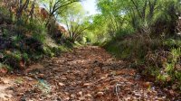
Jamming the Gulch at eye level near Cow Tank Canyon
Day 3: Kinda wasted today so we are going to do a shorter hike. I knew that there was cool stuff in all three canyons we passed yesterday but I couldn't remember what was in what. We did a eeny, meeny, miny, moe, and picked one. Score!
Cave at ground level containing in-ground, rock lined, storage cysts. This identifies this site as Basketmaker II and it was occupied sometime between 1500 BC and 50 AD (some argument about this). Ground level caves are important. Why?
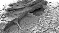
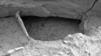
Basket Maker Cave:
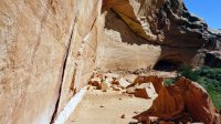
At the pour off...wonder what's up there.
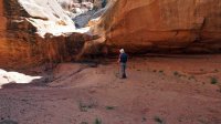
We're starting to see a few more people now. A nearby ruin was being visited by a guided group. I got excited when I saw a guy start climbing up to sit on a wall. This kind of stuff worries me especially when it's a guided group!
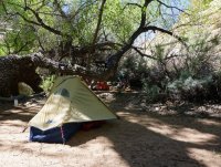
Day 4: Our plan today is to head back down to Polly's Canyon and camp there. It took us a lot less time getting back down to Polly's then going up. Dropping all that water really helped! The water at Polly's is good and probably pretty reliable due to the Spring. There is water intermittently far up Polly's itself. We found the "5 Star Grand Gulch Campsite" which may be the best back country camp site I have ever stayed in. Add to that the good water and Polly's Canyon itself and you have a destination that's worth a visit and a stay. After setting up we hiked up Polly's.
Note: We saw most of the people we would encounter on this day. It's location is fairly close to the trail head, attracts day hikers, and is really quite beautiful, and then there's the water. There were probably ten to twenty other people in the area that night.
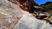
Jamming the Gulch back down to Polly's.
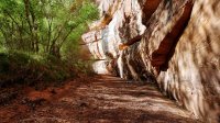
The 5 Star Campsite. Photo does not do justice.
Polly's Canyon
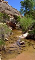
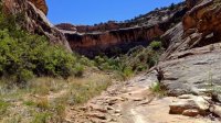
Outlet of Polly's near the camp site.

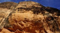
View up Government Trail to the rim.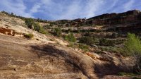
Polly's Grand Gulch confluence
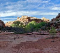
Day 5: Time to bail. When its over it's over. Up at 5:30 AM and jam out of here. Out of food pretty much and don't feel like pumping water. Photos here.
https://backcountrypost.com/threads/the-before-after-thread.5919/page-10
411, Technical, Errata, etc.
GPS: Your GPS will not provide very accurate information in this terrain. It might help you find a camp site, provide pretty accurate track information by line, but forget mileages. They will be way off.
Bag: I used a two season Go Lite quilt and it worked fine in this climate, this season. Note however I got a bunch of bites on the butt the last night. Bags are better for all over coverage. Just a thought.
Filter: I use a Katadyn Vario which failed on the third day. I did not pre-filter as the water we were using wasn't clear but more like weak tea in color. Tom was using a Hiker Pro which worked really well the whole time.
Camera: I used my A6000 with the kit lens. I am kicking myself for not bringing the kit telephoto but could not sweat the weight and bulk starting out. Next time I'll bring the long lens and take short stuff with my phone. It's a Kyocera Duraforce Pro and works pretty good. I noticed that the camera battery depletes pretty fast. I was down to 33 percent by trip end. That's after 155 photos total. 16GB SD card was fine. You don't need a big one unless you are doing video.
Permits: Last year we could find anyone at the Kane Gulch station when we were there (twice) during stated business hours. This year we were told by BLM in Monticello that the station was open from 8:00 - 12:00 and staffed by volunteers. What we got this time was a full time BLMer and a volunteer. They stay open til 3:00 PM now. We did not have to view any film before getting our permit.
Finding Stuff: Archaeological sites are not so hard to find for the most part. Keep your eyes open and look for cairns or side trails that don't seem to belong. Big Man Panel for instance is not obvious despite being well documented. Many of the side trails here are just short cuts around a rincon. Take them anyway and see what's there. It helps to keep your head and eyes open and up.
Route information here...
Click here to view on CalTopo
The focus of this journey was to backpack into the Gulch, pick a central spot to camp in, and then explore the area in as much detail as we could manage using light day packs.
Day 1: Government Trail to first camp.
View from trail head camp, day one, hour one. There is a pretty good camp site about half a mile back from the trail head. After this point, the road gets pretty rough and 4x4/high clearance is recommended although we did see a couple of Subaru's.

Government Trail Head

We were packing between four and six liters of water each due to general paranoia. Once you are in Grand Gulch, you'll see water supplies right away at the perennial Polly's Spring outflow. This did not do us any good though as we were heading up stream into a long dry section. If you were to head down stream at this point (towards Collins Spring), you would more water in season because there is more slick rock and holes.
For the next four miles we saw no water except for some holes that were more leaves than water. Camp sites hard to find in this section but after a few hours of dry hiking I found a fairly clean pool with someone's bottle of filtered water next to it. I found this well hidden campsite nearby. We'll call it Camp 1 and we stayed there for the next three nights.
Tom at Camp 1

Day 2: Camp 1 to as far as we can get. The plan was to head out of camp with day packs and get as far up stream as we could with Green House Canyon as the ultimate goal. We would pass by Cow Tank, Dripping Springs, and Step Canyons on the way. The thing about hiking here is that there are a lot of attractions that grab your attention and make you want to hang around a while. The day goes by fast! Needless to say, we did not make it to Green House. We saw some cool stuff however so we called it a day.
Note: We hadn't seen anyone until today but three parties of six or so people came by us on route to various locations. All of them were coming from Kane Gulch, one guy was going all the way to Shangri-la Canyon.
Jamming the Gulch at eye level near Cow Tank Canyon

Day 3: Kinda wasted today so we are going to do a shorter hike. I knew that there was cool stuff in all three canyons we passed yesterday but I couldn't remember what was in what. We did a eeny, meeny, miny, moe, and picked one. Score!
Cave at ground level containing in-ground, rock lined, storage cysts. This identifies this site as Basketmaker II and it was occupied sometime between 1500 BC and 50 AD (some argument about this). Ground level caves are important. Why?


Basket Maker Cave:

At the pour off...wonder what's up there.

We're starting to see a few more people now. A nearby ruin was being visited by a guided group. I got excited when I saw a guy start climbing up to sit on a wall. This kind of stuff worries me especially when it's a guided group!
Day 4: Our plan today is to head back down to Polly's Canyon and camp there. It took us a lot less time getting back down to Polly's then going up. Dropping all that water really helped! The water at Polly's is good and probably pretty reliable due to the Spring. There is water intermittently far up Polly's itself. We found the "5 Star Grand Gulch Campsite" which may be the best back country camp site I have ever stayed in. Add to that the good water and Polly's Canyon itself and you have a destination that's worth a visit and a stay. After setting up we hiked up Polly's.
Note: We saw most of the people we would encounter on this day. It's location is fairly close to the trail head, attracts day hikers, and is really quite beautiful, and then there's the water. There were probably ten to twenty other people in the area that night.
Jamming the Gulch back down to Polly's.

The 5 Star Campsite. Photo does not do justice.

Polly's Canyon


Outlet of Polly's near the camp site.


View up Government Trail to the rim.

Polly's Grand Gulch confluence

Day 5: Time to bail. When its over it's over. Up at 5:30 AM and jam out of here. Out of food pretty much and don't feel like pumping water. Photos here.
https://backcountrypost.com/threads/the-before-after-thread.5919/page-10
411, Technical, Errata, etc.
GPS: Your GPS will not provide very accurate information in this terrain. It might help you find a camp site, provide pretty accurate track information by line, but forget mileages. They will be way off.
Bag: I used a two season Go Lite quilt and it worked fine in this climate, this season. Note however I got a bunch of bites on the butt the last night. Bags are better for all over coverage. Just a thought.
Filter: I use a Katadyn Vario which failed on the third day. I did not pre-filter as the water we were using wasn't clear but more like weak tea in color. Tom was using a Hiker Pro which worked really well the whole time.
Camera: I used my A6000 with the kit lens. I am kicking myself for not bringing the kit telephoto but could not sweat the weight and bulk starting out. Next time I'll bring the long lens and take short stuff with my phone. It's a Kyocera Duraforce Pro and works pretty good. I noticed that the camera battery depletes pretty fast. I was down to 33 percent by trip end. That's after 155 photos total. 16GB SD card was fine. You don't need a big one unless you are doing video.
Permits: Last year we could find anyone at the Kane Gulch station when we were there (twice) during stated business hours. This year we were told by BLM in Monticello that the station was open from 8:00 - 12:00 and staffed by volunteers. What we got this time was a full time BLMer and a volunteer. They stay open til 3:00 PM now. We did not have to view any film before getting our permit.
Finding Stuff: Archaeological sites are not so hard to find for the most part. Keep your eyes open and look for cairns or side trails that don't seem to belong. Big Man Panel for instance is not obvious despite being well documented. Many of the side trails here are just short cuts around a rincon. Take them anyway and see what's there. It helps to keep your head and eyes open and up.
Route information here...
Click here to view on CalTopo
Last edited:
