- Joined
- Dec 23, 2013
- Messages
- 4,106
Our third day hike on our Yellowstone trip consisted of a hike along the old Plateau / Arnica Creek Trail to Beach Lake, then following a one way marked route to Dryad Lake before exiting at the Natural Bridge Trailhead.
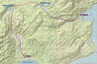
Overview map of hike
We hit the old trail about 7:30 in the morning with a very light rain greeting us. It would end up raining off and on throughout the day. Our route started off at the service road gate located near Arnica Creek. As we hiked up the road, we passed the trail junction for the old Howard Eaton Trail before meeting up with the original road from West Thumb to Bridge Bay. Once across the road, we began hiking up the trail towards the Arnica Creek Meadows. All the way to Beach Lake, we continually ran into bear scat.
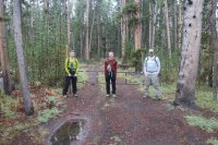
Ready to begin
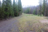
The original road from West Thumb to Bridge Bay
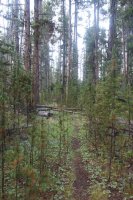
Originally part of the Plateau Trail then became the Arnica Creek Trail before no longer being maintained in the 1960's.
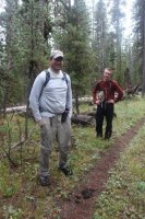
Bear scat along the trail
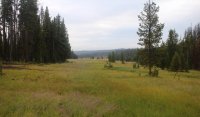
After a mile of hiking along the trail through the trees, we broke out into the meadows along Arnica Creek. These meadows happen to be one of my favorite places in Yellowstone. The meadows are lush and marshy in places but are absolutely gorgeous. This time, we had an added attraction - beaver dams. On my previous two trips to Beach Lake, beavers had not inhabited the Arnica Creek drainage, but now there were three dams with lodges along the creek.
As we made our way up the meadow, a large bull elk came into view on the opposite side. We watched him for a good five minutes before he realized we were there and ran off into the trees.
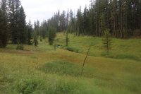
Breaking out into the meadows
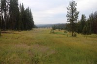
The meadows along Arnica Creek
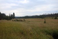
More meadows
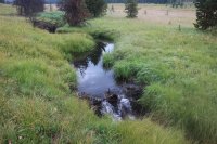
Arnica Creek
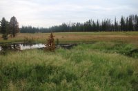
Beaver Dam
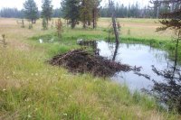
Beaver lodge
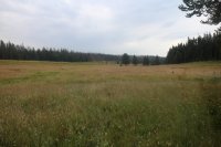
Arnica Creek Meadows
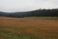
There is a bull elk looking directly at us just left of center on the far side next to the trees
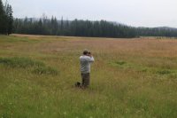
@McGimpkins, getting a picture of the elk
The meadows are roughly a mile and a half in length and soon we find ourselves back in the trees. At this point the trail becomes a little difficult to follow but eventually we pick it back up again and are one our way. In three tenths of a mile we reach a relatively recent burn that the old trail at first skirts then plunges into for half a mile or so. The fireweed in the burn is spectacular as its pinkish color contrasts against the black of the burned trees. We took a quick break and then made our way the last mile to Beach Lake.
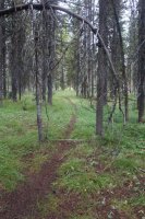
back into the trees
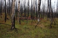
Fireweed in the burn
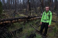
I've got to hike through this Sh#t! Scatman Jr. needs a break
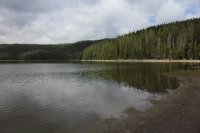
Beach Lake
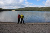
Beach Lake
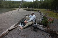
@McGimpkins trying to dry his feet off at Beach Lake
Once at the lake, we took a more substantial break to fuel up for the section between Beach and Dryad Lakes. We were going to attempt to locate the one way marked route and follow it religiously to Dryad Lake. While the distance we covered between the two lakes was only three miles, it took us four hours to hike due to taking time to look for the next marker ahead of us and the tremendous amount of blow-down between the two lakes. It turned out to be rough stretch.
We were able to follow the markers all the way to Dryad and when we reached the lake we stopped for a late lunch.
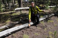
Downed marker on the way to Dryad Lake
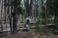
Making our way between the lakes
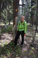
Jr. at another marker
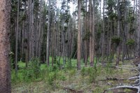
The path ahead
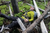
Ouch!
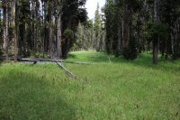
A small clearing between the lakes
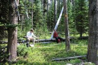
A quick break - markers become more difficult to find after this
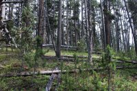
Getting close to Dryad Lake
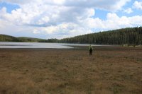
Arriving at Dryad Lake
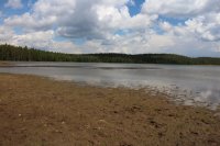
Dryad Lake
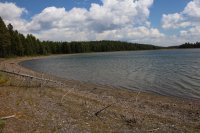
Dryad Lake
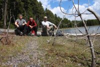
Lunch break at Dryad
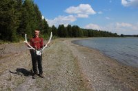
Elk antlers
When we finished with our lunches, we hiked along the north shore of the lake to the outlet where once again we started hiking through meadows. The grass in middle of some of these meadows was chest deep! It actually tired us out a bit walking through the grass. As we hiked through the meadows, we came upon five different grizzly digs - a place where the bears have dug up the ground in order to find ground squirrels.
As the drainage narrowed as we approached Natural Bridge, we took a game trail up to the top of the ridge where we had a nice view down the other side. Along the ridge we saw a big buck and once again had to work our way through downfall. Eventually we made our way off of the ridge right at Natural Bridge where a yellow bellied marmot kept a watchful eye on us. After taking a few pictures of the bridge, it began to pour so we hiked out the last mile and a half in the rain.
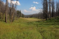
Meadows below Dryad Lake
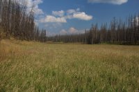
Chest high grass
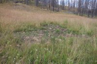
A grizzly dig
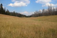
More meadows
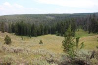
View from the other side of the ridge
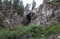
Natural Bridge
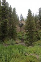
Natural Bridge
Well, another fun day. We finished up about 6:30 in the evening for an 11 hour day for 13.4 miles. I really enjoyed the meadow hiking on this trip. The portion between the lakes was slow going but it was nice to find and follow the old route. The only other creatures we saw besides the elk and the deer were some frogs, butterflies, robins and mosquitoes.
Featured image for home page:

Overview map of hike
We hit the old trail about 7:30 in the morning with a very light rain greeting us. It would end up raining off and on throughout the day. Our route started off at the service road gate located near Arnica Creek. As we hiked up the road, we passed the trail junction for the old Howard Eaton Trail before meeting up with the original road from West Thumb to Bridge Bay. Once across the road, we began hiking up the trail towards the Arnica Creek Meadows. All the way to Beach Lake, we continually ran into bear scat.

Ready to begin

The original road from West Thumb to Bridge Bay

Originally part of the Plateau Trail then became the Arnica Creek Trail before no longer being maintained in the 1960's.

Bear scat along the trail
After a mile of hiking along the trail through the trees, we broke out into the meadows along Arnica Creek. These meadows happen to be one of my favorite places in Yellowstone. The meadows are lush and marshy in places but are absolutely gorgeous. This time, we had an added attraction - beaver dams. On my previous two trips to Beach Lake, beavers had not inhabited the Arnica Creek drainage, but now there were three dams with lodges along the creek.
As we made our way up the meadow, a large bull elk came into view on the opposite side. We watched him for a good five minutes before he realized we were there and ran off into the trees.

Breaking out into the meadows

The meadows along Arnica Creek

More meadows

Arnica Creek

Beaver Dam

Beaver lodge

Arnica Creek Meadows

There is a bull elk looking directly at us just left of center on the far side next to the trees

@McGimpkins, getting a picture of the elk
The meadows are roughly a mile and a half in length and soon we find ourselves back in the trees. At this point the trail becomes a little difficult to follow but eventually we pick it back up again and are one our way. In three tenths of a mile we reach a relatively recent burn that the old trail at first skirts then plunges into for half a mile or so. The fireweed in the burn is spectacular as its pinkish color contrasts against the black of the burned trees. We took a quick break and then made our way the last mile to Beach Lake.

back into the trees

Fireweed in the burn

I've got to hike through this Sh#t! Scatman Jr. needs a break

Beach Lake

Beach Lake

@McGimpkins trying to dry his feet off at Beach Lake
Once at the lake, we took a more substantial break to fuel up for the section between Beach and Dryad Lakes. We were going to attempt to locate the one way marked route and follow it religiously to Dryad Lake. While the distance we covered between the two lakes was only three miles, it took us four hours to hike due to taking time to look for the next marker ahead of us and the tremendous amount of blow-down between the two lakes. It turned out to be rough stretch.
We were able to follow the markers all the way to Dryad and when we reached the lake we stopped for a late lunch.

Downed marker on the way to Dryad Lake

Making our way between the lakes

Jr. at another marker

The path ahead

Ouch!

A small clearing between the lakes

A quick break - markers become more difficult to find after this

Getting close to Dryad Lake

Arriving at Dryad Lake

Dryad Lake

Dryad Lake

Lunch break at Dryad

Elk antlers
When we finished with our lunches, we hiked along the north shore of the lake to the outlet where once again we started hiking through meadows. The grass in middle of some of these meadows was chest deep! It actually tired us out a bit walking through the grass. As we hiked through the meadows, we came upon five different grizzly digs - a place where the bears have dug up the ground in order to find ground squirrels.
As the drainage narrowed as we approached Natural Bridge, we took a game trail up to the top of the ridge where we had a nice view down the other side. Along the ridge we saw a big buck and once again had to work our way through downfall. Eventually we made our way off of the ridge right at Natural Bridge where a yellow bellied marmot kept a watchful eye on us. After taking a few pictures of the bridge, it began to pour so we hiked out the last mile and a half in the rain.

Meadows below Dryad Lake

Chest high grass

A grizzly dig

More meadows

View from the other side of the ridge

Natural Bridge

Natural Bridge
Well, another fun day. We finished up about 6:30 in the evening for an 11 hour day for 13.4 miles. I really enjoyed the meadow hiking on this trip. The portion between the lakes was slow going but it was nice to find and follow the old route. The only other creatures we saw besides the elk and the deer were some frogs, butterflies, robins and mosquitoes.
Featured image for home page:


