IntrepidXJ
ADVENTR
- Joined
- Jan 17, 2012
- Messages
- 3,493
Saturday, July 7, 2012
The Original Trip Report on ADVENTR.CO
This weekend we left home on Saturday morning and headed back up into the San Juan Mountains. I had received reports that the wildflowers were in full swing a few weeks early because of our dismal snowpack and dry spring, and I wanted to try and get some photos of them. I have never really set out to specifically photograph wildflowers before, so this would be a learning experience for me. In the end I came home with some decent wildflower photos and I learned a lot in the process. Hopefully next year I can do a little better!
As a side note, I've also been trying to identify the wildflowers that I've been seeing and learning a little bit about them. If for some reason I have misidentified a flower in one of my photos, please let me know in the comments. I would appreciate it.
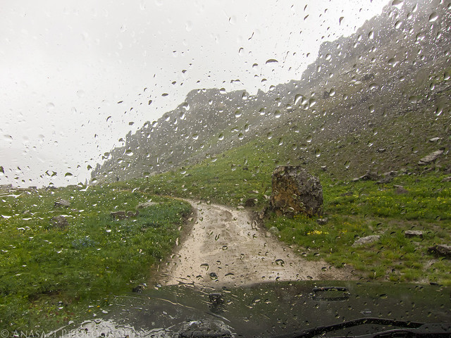
After reaching Ouray and turning up the Camp Bird Road we drove up to our first destination in Governor Basin. We made a few stops along the way to photograph some wildflowers when we saw them. The sky was already overcast all morning and would pretty much stay that way all day...which was good photo for taking photos of the wildflowers.
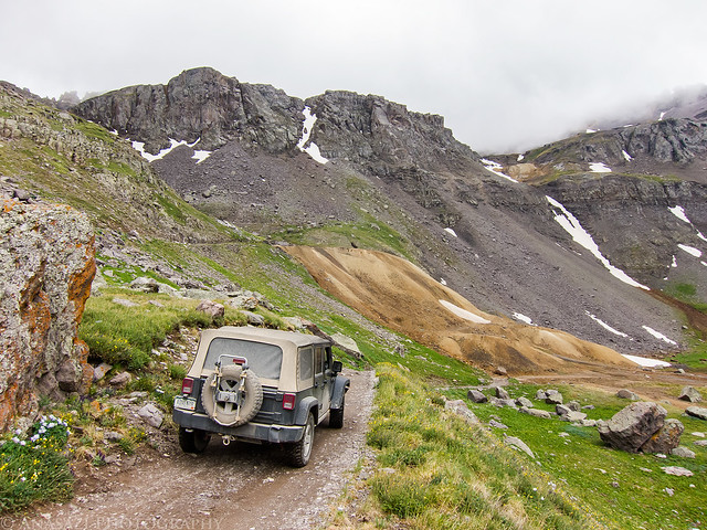
Into Governor Basin by IntrepidXJ, on Flickr
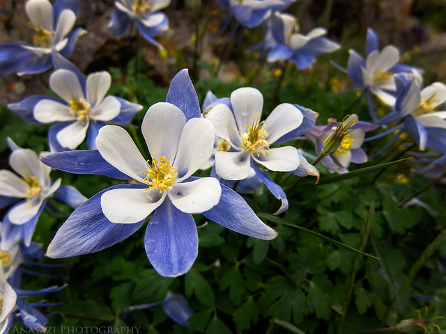
Here's an all white Columbine that Amanda spotted in Governor Basin.
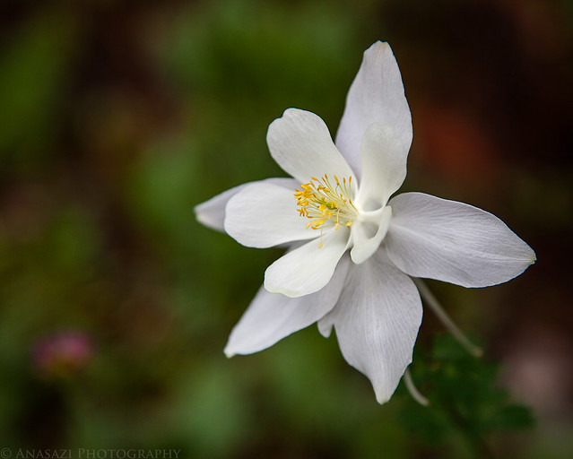
White Columbine by IntrepidXJ, on Flickr
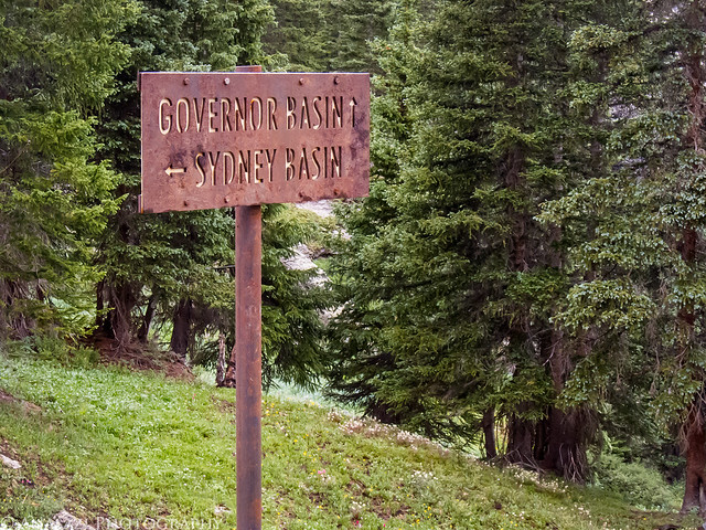
We passed the Virginius Mine on the way up, and the sign was surrounded by little flowers.
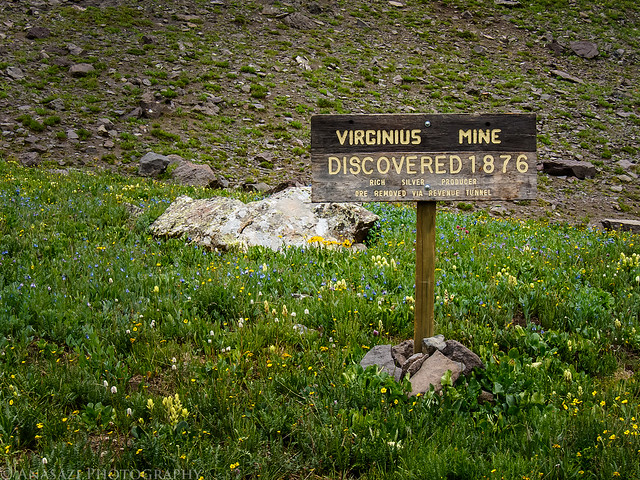
Virginius Mine Sign by IntrepidXJ, on Flickr
My Jeep at the Mountain Top Mine at the end of the road. The Saint Sophia Ridge is above in the background.
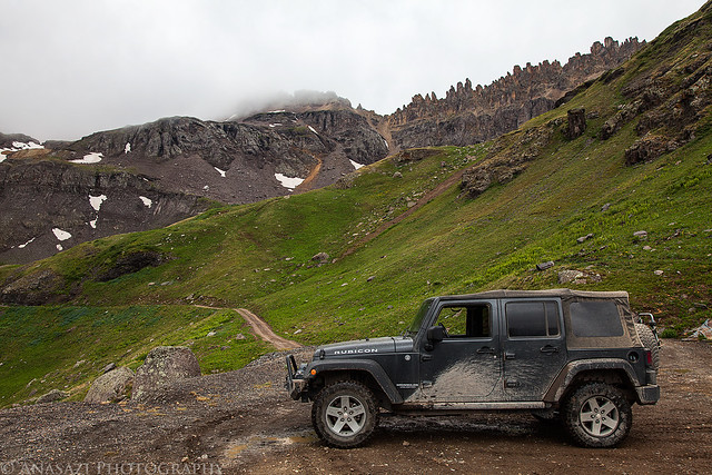
Jeep & Saint Sophia Ridge by IntrepidXJ, on Flickr
Tracks entering the Mountain Top Mine.
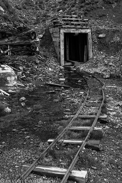
Mountain Top Mine by IntrepidXJ, on Flickr
A few Rose Paintbrush wildflowers next to the tracks.
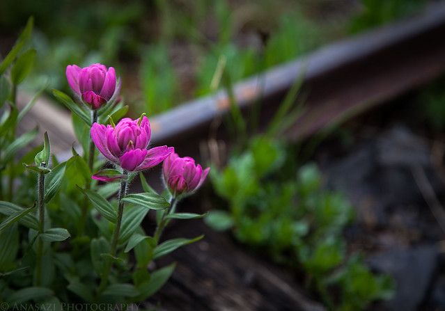
Rose Paintbrush & Tracks by IntrepidXJ, on Flickr
The view down from Governor Basin towards the 13,786 foot Potosi Peak in the clouds. The road at the bottom is the one that goes up into Yankee Boy Basin.
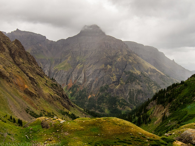
Potosi Peak by IntrepidXJ, on Flickr
Heading back down from the Mountain Top Mine as the clouds closed in on the Saint Sophia Ridge above. Right after I took this photo it started to pour down rain for a little while. It would rain off and on for the rest of the day and evening.
Governor Basin Road by IntrepidXJ, on Flickr
The rain I mentioned above as I drove back down through Governor Basin.
Rain by IntrepidXJ, on Flickr
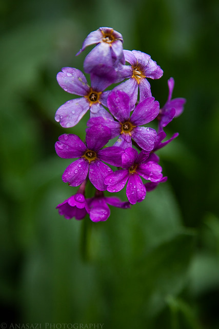
Of course I had to take a photo of the typical blueish Columbines, too.
Columbines by IntrepidXJ, on Flickr
Parry's Primrose just off of the road before we turned up into Sydney Basin.
Parry's Primrose by IntrepidXJ, on Flickr
We did take the short spur up and over into Sydney Basin but didn't find much in the way of wuildflowers. We stopped here for lunch and then continued on to the lower reaches of Yankee Boy Basin. I've seen this basin labeled Sidney Basin on some maps.
Governor - Sydney by IntrepidXJ, on Flickr
Low hanging clouds play hide and go seek with the mountain tops.
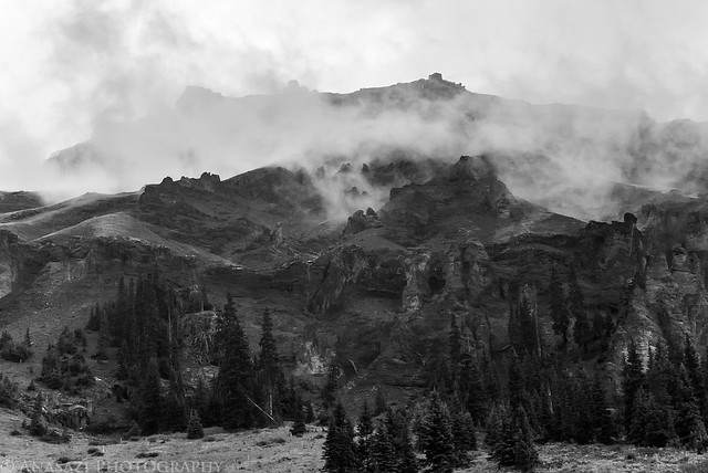
Clouds by IntrepidXJ, on Flickr
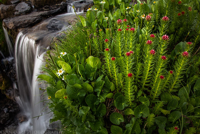
The next few photos were taken as I hiked along the creek and waterfalls flowing out of Yankee Boy Basin
Wilting by IntrepidXJ, on Flickr
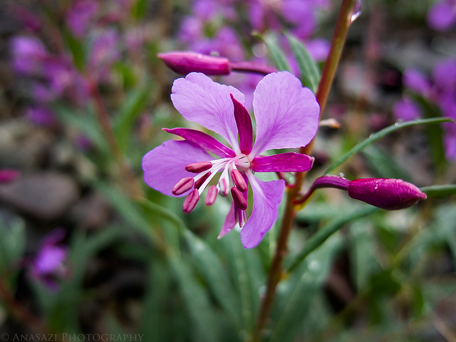
Alpine Fireweed by IntrepidXJ, on Flickr
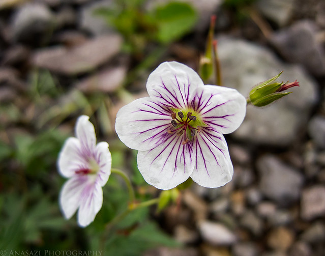
Richardson's Geranium by IntrepidXJ, on Flickr
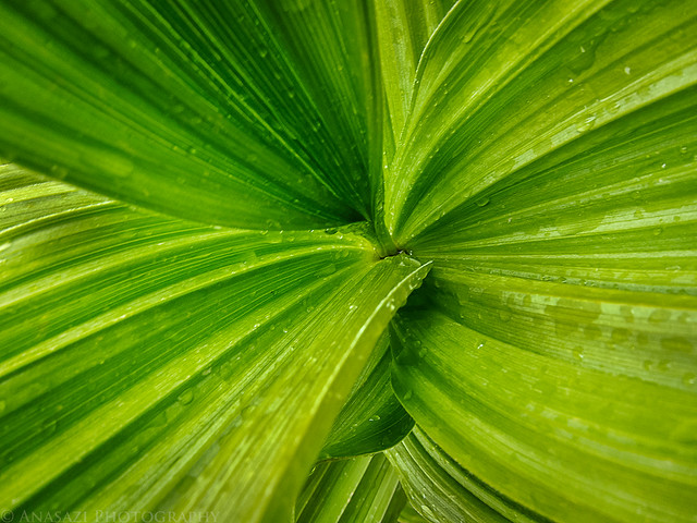
Wet Leaves by IntrepidXJ, on Flickr
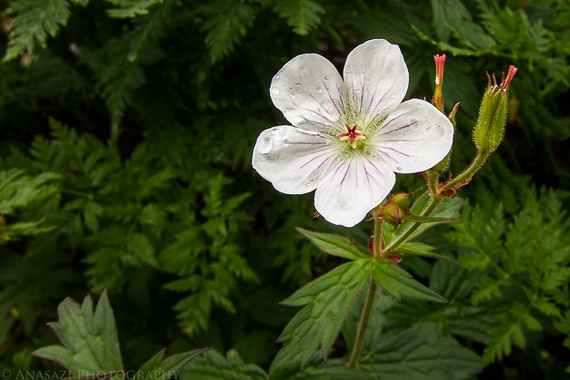
Richardson's Geranium II by IntrepidXJ, on Flickr
There were flies and other insects all over many of the plants and flowers, but they seemed to be especially attracted to the Cow Parsnip.
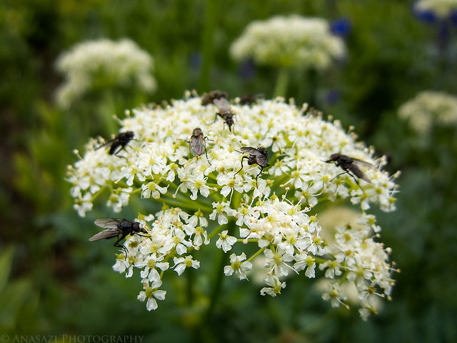
Cow Parsnip with Flies by IntrepidXJ, on Flickr
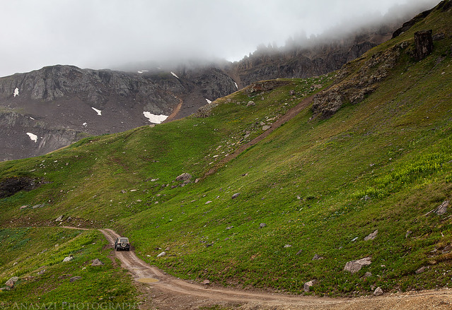
When we were done hiking around Yankee Boy Basin we drove back down to Ouray and then over Red Mountain Pass. Then I took the unmarked side road up into Porphyry Basin. As we were driving up the switchbacks we got a view of the only patches of blue sky we would see all day over one of the Red Mountains.
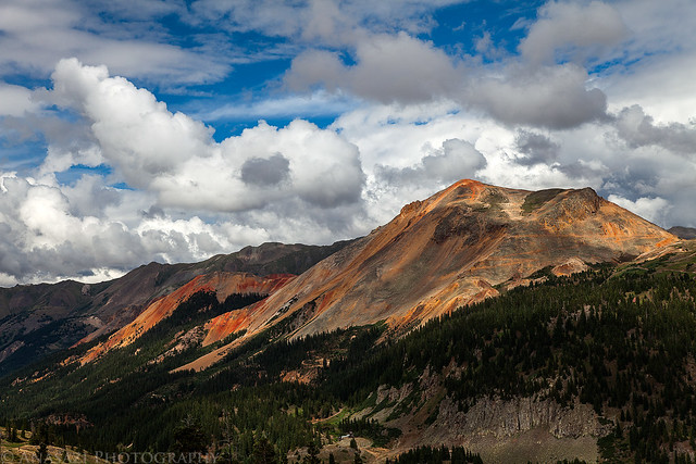
Red Mountain by IntrepidXJ, on Flickr
The point of no return. While the road really isn't that rough and dangerous, it is VERY narrow with no places to pass oncoming traffic. I would hate to meet another vehicle on this section of the road.
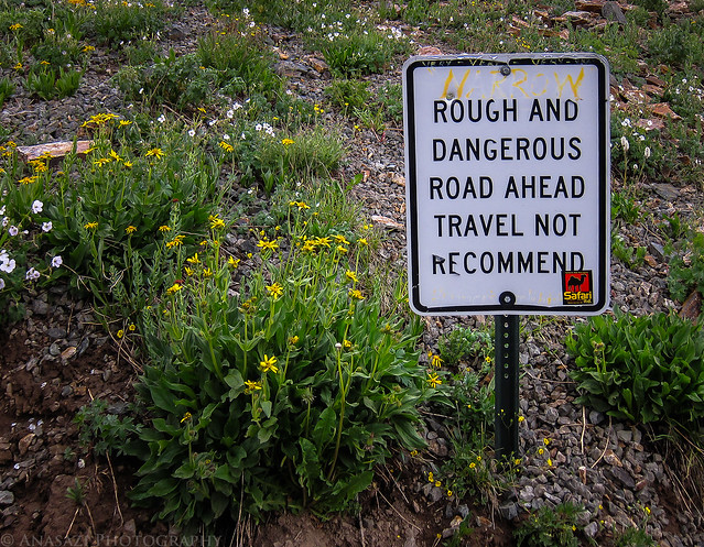
Rough & Dangerous by IntrepidXJ, on Flickr
A view of some dark clouds rolling in from near the Bullion King Mine in Porphyry Basin.
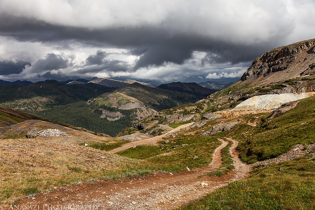
Porphyry Two-Track by IntrepidXJ, on Flickr
Even though the clouds were rolling in, we hadn't seen or heard and lightning or thunder all day, so I decided to hike the short distance to Bullion King Lake while we were up there. It did end up drizzling on me a bit, but never rained enough to get me soaked. On my way up I took this photo of some Elephantheads.
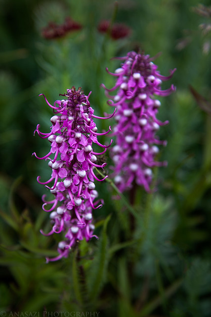
Elephantheads by IntrepidXJ, on Flickr
I didn't take any photos of Bullion King Lake that I am happy with, but after leaving the lake I did a little exploring up in the basin. As I hiked around I was treated to this excellent view of a rainbow in front of Red Mountain #3.
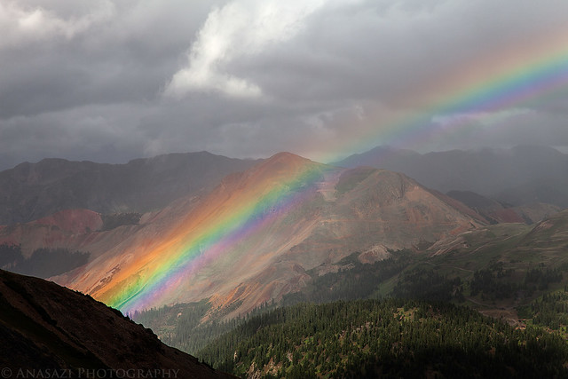
Red Mountain Rainbow by IntrepidXJ, on Flickr
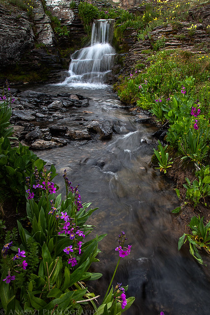
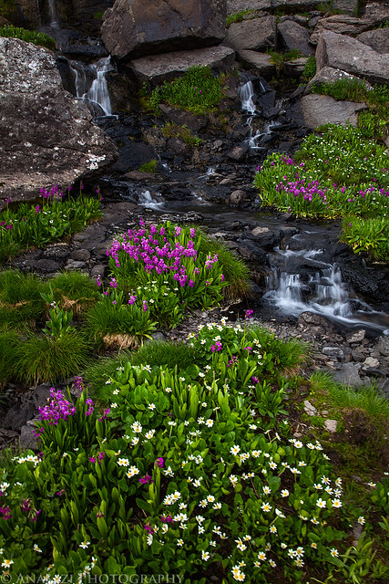
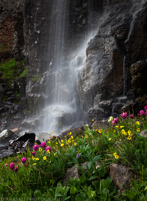
Before hiking back to the Jeep I spent some time exploring the wildflowers along Porphyry Creek, and I am glad that I did! They were everywhere and there were plenty of small waterfalls along the way, too. Unfortunately the wind ruined a bunch of the photos from here, but here are a few of the better ones that I did manage to get.
Flowers & Falls by IntrepidXJ, on Flickr
Porphyry Creek Cascade by IntrepidXJ, on Flickr
Porphyry Creek Wildflowers by IntrepidXJ, on Flickr
Waterfall & Flowers by IntrepidXJ, on Flickr
Just before starting the drive back down on the narrow shelf road, I drove right through this patch of wildflowers and couldn't resist getting a photo with my Jeep.
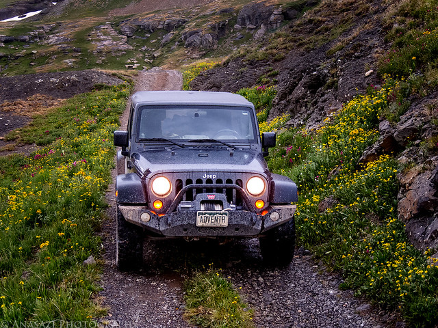
Jeep & Wildflowers by IntrepidXJ, on Flickr
The wet two-track back down from Porphyry Basin. McMillan Peak is across the way.
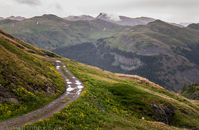
Mountain Road by IntrepidXJ, on Flickr
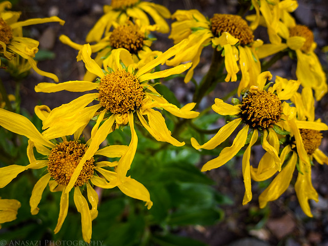
Instead of driving back down the switchbacks to the highway, we took a side trail back that I hoped would connect back up with Black Bear Pass in Mineral Basin. It did. We found a nice field here with a lot of different flowers, including these Comely Daisies.
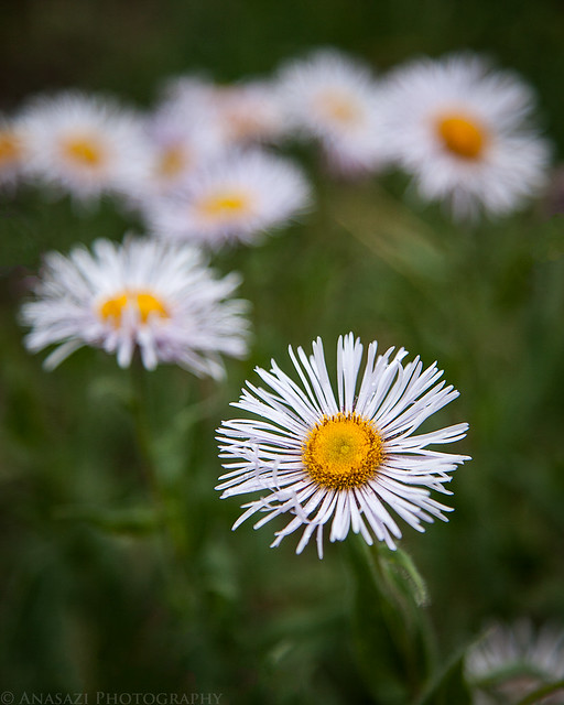
Comely Daisy by IntrepidXJ, on Flickr
When we reached the highway again, it was back to Ridgway for some dinner and then we finished the drive back home to Grand Junction. We had originally planned on camping and had all our gear with us, but decided that we didn't want to setup camp in the rain. It turned out to be a great day trip anyway!
>> Basin Wildflower Tour Photo Gallery
Featured image for home page:

The Original Trip Report on ADVENTR.CO
This weekend we left home on Saturday morning and headed back up into the San Juan Mountains. I had received reports that the wildflowers were in full swing a few weeks early because of our dismal snowpack and dry spring, and I wanted to try and get some photos of them. I have never really set out to specifically photograph wildflowers before, so this would be a learning experience for me. In the end I came home with some decent wildflower photos and I learned a lot in the process. Hopefully next year I can do a little better!
As a side note, I've also been trying to identify the wildflowers that I've been seeing and learning a little bit about them. If for some reason I have misidentified a flower in one of my photos, please let me know in the comments. I would appreciate it.
After reaching Ouray and turning up the Camp Bird Road we drove up to our first destination in Governor Basin. We made a few stops along the way to photograph some wildflowers when we saw them. The sky was already overcast all morning and would pretty much stay that way all day...which was good photo for taking photos of the wildflowers.
Into Governor Basin by IntrepidXJ, on Flickr
Here's an all white Columbine that Amanda spotted in Governor Basin.
White Columbine by IntrepidXJ, on Flickr
We passed the Virginius Mine on the way up, and the sign was surrounded by little flowers.
Virginius Mine Sign by IntrepidXJ, on Flickr
My Jeep at the Mountain Top Mine at the end of the road. The Saint Sophia Ridge is above in the background.
Jeep & Saint Sophia Ridge by IntrepidXJ, on Flickr
Tracks entering the Mountain Top Mine.
Mountain Top Mine by IntrepidXJ, on Flickr
A few Rose Paintbrush wildflowers next to the tracks.
Rose Paintbrush & Tracks by IntrepidXJ, on Flickr
The view down from Governor Basin towards the 13,786 foot Potosi Peak in the clouds. The road at the bottom is the one that goes up into Yankee Boy Basin.
Potosi Peak by IntrepidXJ, on Flickr
Heading back down from the Mountain Top Mine as the clouds closed in on the Saint Sophia Ridge above. Right after I took this photo it started to pour down rain for a little while. It would rain off and on for the rest of the day and evening.
Governor Basin Road by IntrepidXJ, on Flickr
The rain I mentioned above as I drove back down through Governor Basin.
Rain by IntrepidXJ, on Flickr
Of course I had to take a photo of the typical blueish Columbines, too.
Columbines by IntrepidXJ, on Flickr
Parry's Primrose just off of the road before we turned up into Sydney Basin.
Parry's Primrose by IntrepidXJ, on Flickr
We did take the short spur up and over into Sydney Basin but didn't find much in the way of wuildflowers. We stopped here for lunch and then continued on to the lower reaches of Yankee Boy Basin. I've seen this basin labeled Sidney Basin on some maps.
Governor - Sydney by IntrepidXJ, on Flickr
Low hanging clouds play hide and go seek with the mountain tops.
Clouds by IntrepidXJ, on Flickr
The next few photos were taken as I hiked along the creek and waterfalls flowing out of Yankee Boy Basin
Wilting by IntrepidXJ, on Flickr
Alpine Fireweed by IntrepidXJ, on Flickr
Richardson's Geranium by IntrepidXJ, on Flickr
Wet Leaves by IntrepidXJ, on Flickr
Richardson's Geranium II by IntrepidXJ, on Flickr
There were flies and other insects all over many of the plants and flowers, but they seemed to be especially attracted to the Cow Parsnip.
Cow Parsnip with Flies by IntrepidXJ, on Flickr
When we were done hiking around Yankee Boy Basin we drove back down to Ouray and then over Red Mountain Pass. Then I took the unmarked side road up into Porphyry Basin. As we were driving up the switchbacks we got a view of the only patches of blue sky we would see all day over one of the Red Mountains.
Red Mountain by IntrepidXJ, on Flickr
The point of no return. While the road really isn't that rough and dangerous, it is VERY narrow with no places to pass oncoming traffic. I would hate to meet another vehicle on this section of the road.
Rough & Dangerous by IntrepidXJ, on Flickr
A view of some dark clouds rolling in from near the Bullion King Mine in Porphyry Basin.
Porphyry Two-Track by IntrepidXJ, on Flickr
Even though the clouds were rolling in, we hadn't seen or heard and lightning or thunder all day, so I decided to hike the short distance to Bullion King Lake while we were up there. It did end up drizzling on me a bit, but never rained enough to get me soaked. On my way up I took this photo of some Elephantheads.
Elephantheads by IntrepidXJ, on Flickr
I didn't take any photos of Bullion King Lake that I am happy with, but after leaving the lake I did a little exploring up in the basin. As I hiked around I was treated to this excellent view of a rainbow in front of Red Mountain #3.
Red Mountain Rainbow by IntrepidXJ, on Flickr
Before hiking back to the Jeep I spent some time exploring the wildflowers along Porphyry Creek, and I am glad that I did! They were everywhere and there were plenty of small waterfalls along the way, too. Unfortunately the wind ruined a bunch of the photos from here, but here are a few of the better ones that I did manage to get.
Flowers & Falls by IntrepidXJ, on Flickr
Porphyry Creek Cascade by IntrepidXJ, on Flickr
Porphyry Creek Wildflowers by IntrepidXJ, on Flickr
Waterfall & Flowers by IntrepidXJ, on Flickr
Just before starting the drive back down on the narrow shelf road, I drove right through this patch of wildflowers and couldn't resist getting a photo with my Jeep.
Jeep & Wildflowers by IntrepidXJ, on Flickr
The wet two-track back down from Porphyry Basin. McMillan Peak is across the way.
Mountain Road by IntrepidXJ, on Flickr
Instead of driving back down the switchbacks to the highway, we took a side trail back that I hoped would connect back up with Black Bear Pass in Mineral Basin. It did. We found a nice field here with a lot of different flowers, including these Comely Daisies.
Comely Daisy by IntrepidXJ, on Flickr
When we reached the highway again, it was back to Ridgway for some dinner and then we finished the drive back home to Grand Junction. We had originally planned on camping and had all our gear with us, but decided that we didn't want to setup camp in the rain. It turned out to be a great day trip anyway!
>> Basin Wildflower Tour Photo Gallery
Featured image for home page:
")