- Joined
- May 16, 2016
- Messages
- 1,606
This is a very long post and very photo heavy. I condensed a bit from my blog if you want to see more photos.
A mix of dayhikes and car camping and backpacking
6/13 - 6/20/17 (3 nights camping)
Dayhikes: Lake Minnewanka, Tunnel Mountain, Lake Agnes Teahouse (Lake Louise), Bow Glacier Falls.
Backpack/car camp: Lake O'Hara, Rampart Creek campground and Glacier Lake
So my wife got invited to a conference in Banff and wanted me to go as well. I said I would go as long as we stayed for a couple extra days to see some of the area. She did not have a problem with that since we had both enjoyed to small amount of time we got to spend in the Canadian Rockies on our drive to Alaska in 2006. I also wanted to go backpacking while she was occupied with the conference.
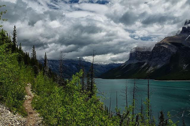
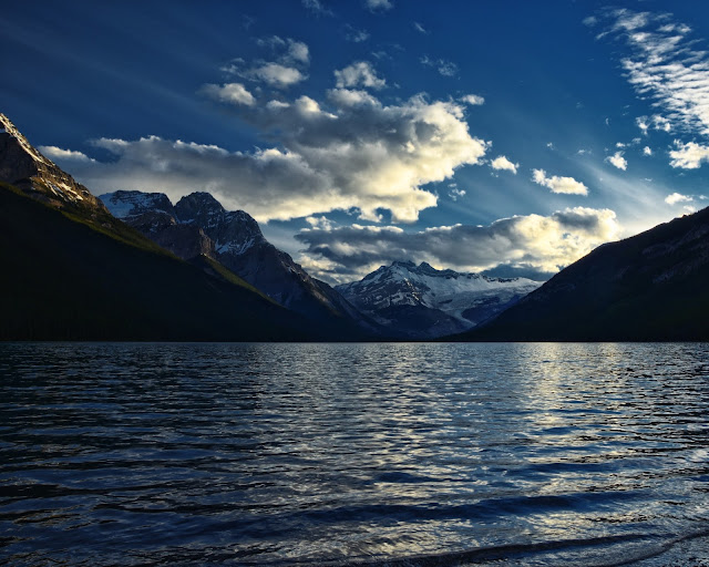
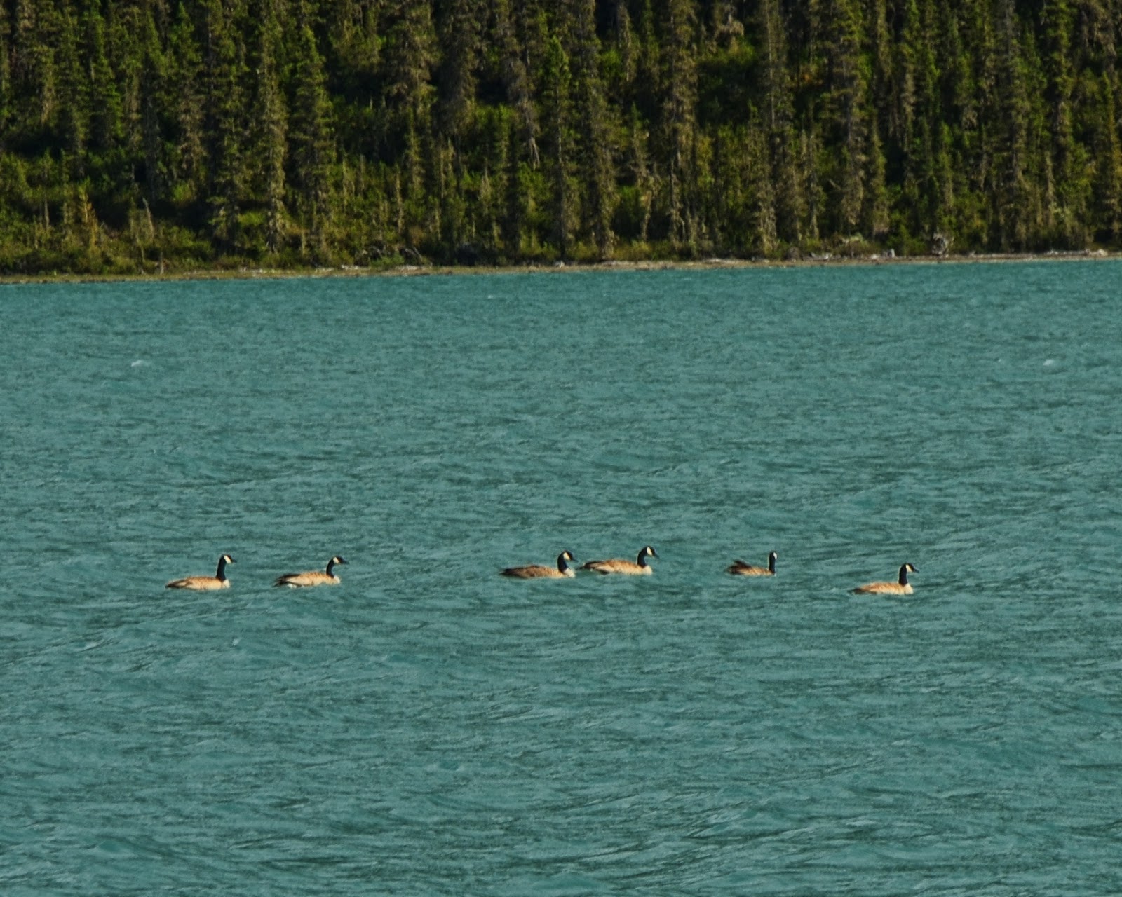
Day 1: Dayhike at Lake Minnewanka
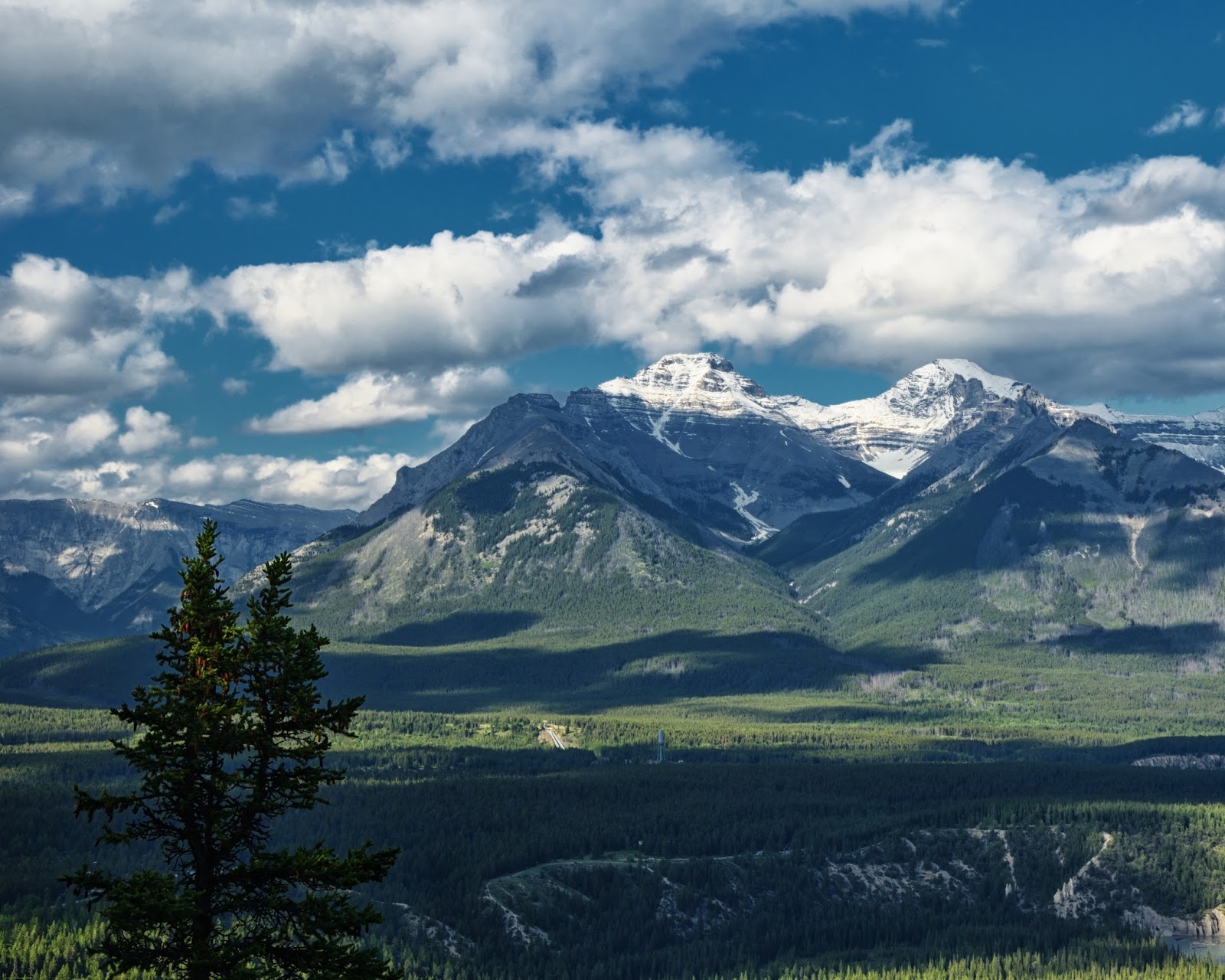
The trailhead is at a large picnic area and marina and there were tons of tourists who did not look like hikers. Luckily almost everyone turned around at the bridge that was only about a 1/2 mile down the trail. We hiked a couple miles out and the sky started to get darker. It did not feel like the views were going to change a whole lot and I knew we would not be hiking all the way to the first backpacking site or climbing any passes, so we turned around and headed back to the car.
Not afraid at all


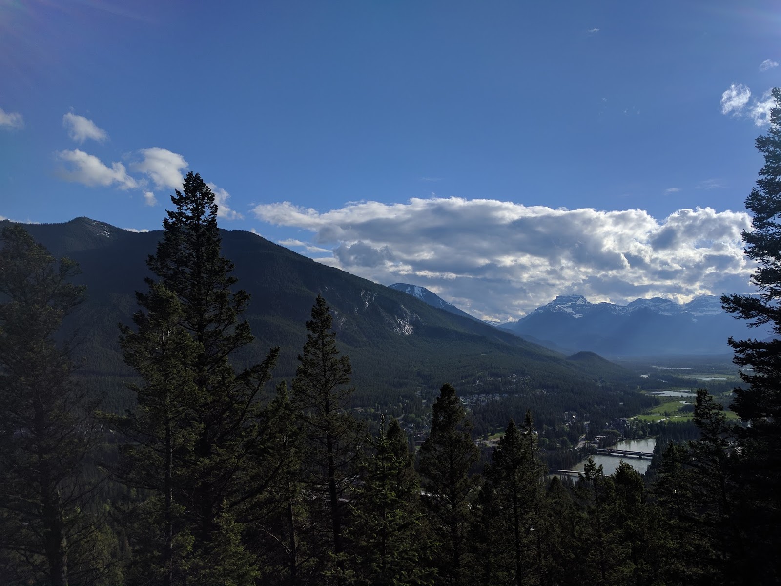
We got back to the car and decided to get something to eat in town and the see what Tunnel Mountain was all about since there was still a lot of daylight left. It ended up being a short and steep climb with lots of people, but the views from the top were nice.

Town of Banff down below.

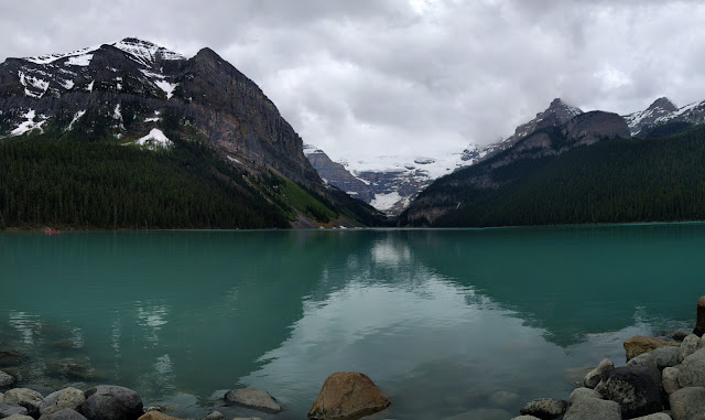
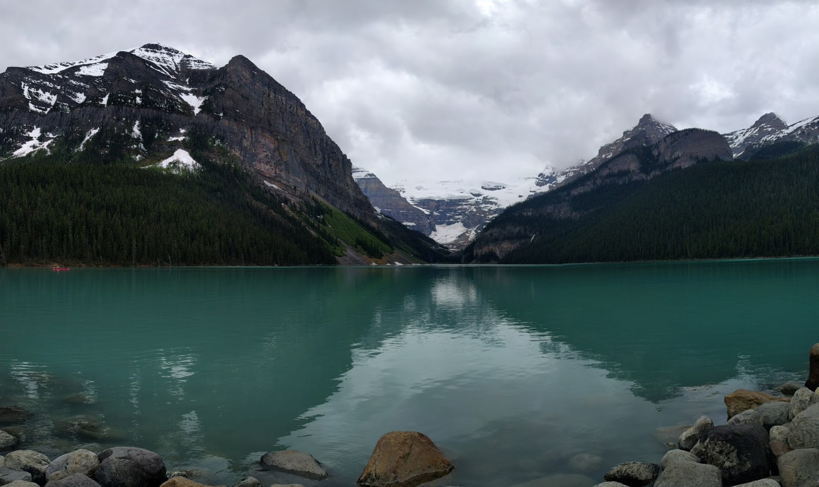
Day 2: We woke up to better weather and headed off to Lake Louise. My wife had read about the teahouses and thought that sounded neat. I just wanted to go hiking more around Lake Louise since I had only walked along the shore for a little bit the last time we were in the area. Unfortunately, most of the trails in the area were buried in snow so everyone was on just a few trails and everything felt very crowded. It was about this point that I realized I had left my SLR in the hotel room and only had my cell phone.
The shore of Lake Louise
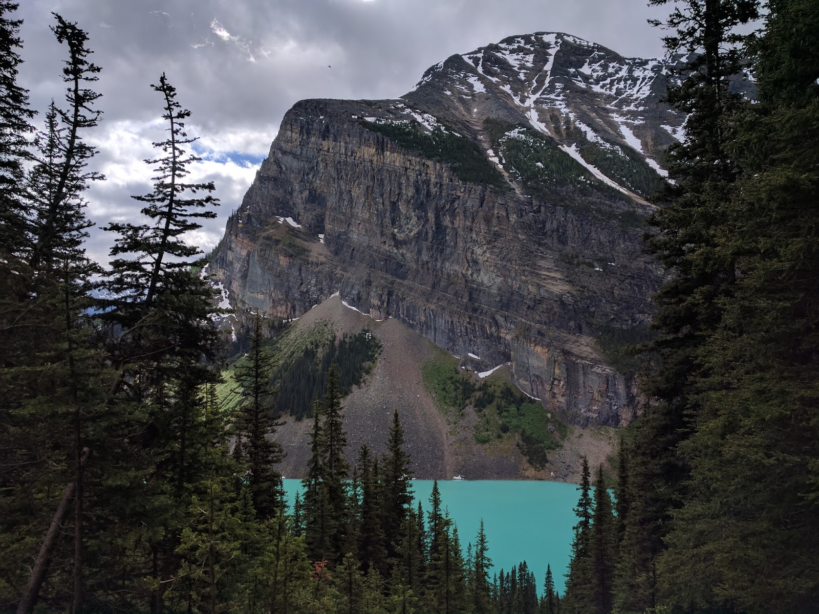
We started the hike up to the Lake Agnes Teahouse with what felt like a million other people. The first part of the trail is in the trees with not much to see, but there are hints of a view on occasion.
Mirror Lake below Lake Agnes

Lake Agnes Teahouse

The view of Lake Agnes was pretty but the Teahouse was packed. I took one look and told my wife I was going to explore while she had tea.
There was an obvious trail along the lake so I hiked to the far end where I was able to escape most of the people. At this point, there was a pretty obvious trail up to what I later determined was the Big Beehouse, so I decided to see how high I could get.
Snow spider
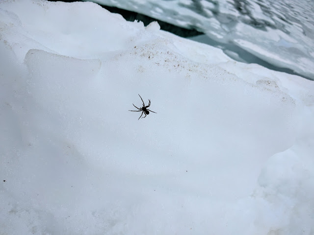
This is looking back towards the end of the lake, you can just see two people hiking across the snow. The Teahouse is out of view to the right.
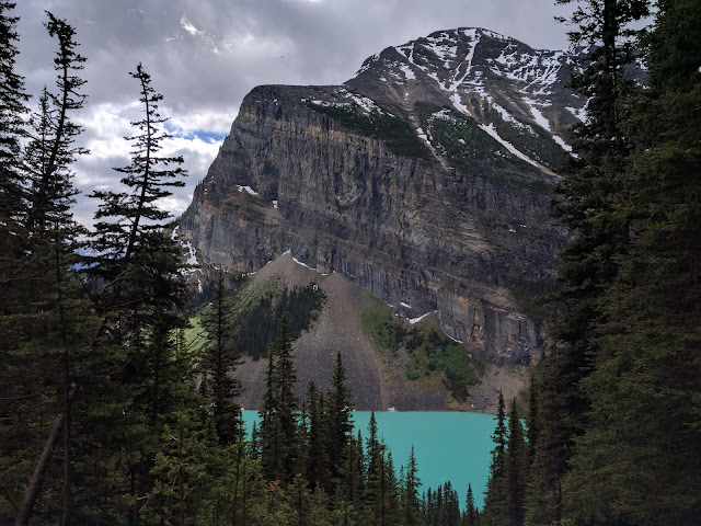
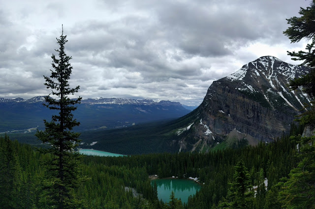
I got high enough to have a great view of both Lake Agnes and Lake Louise before I was stopped by snow and then headed down to find my wife.
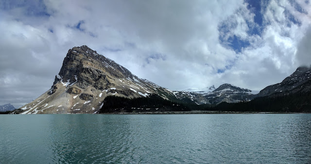
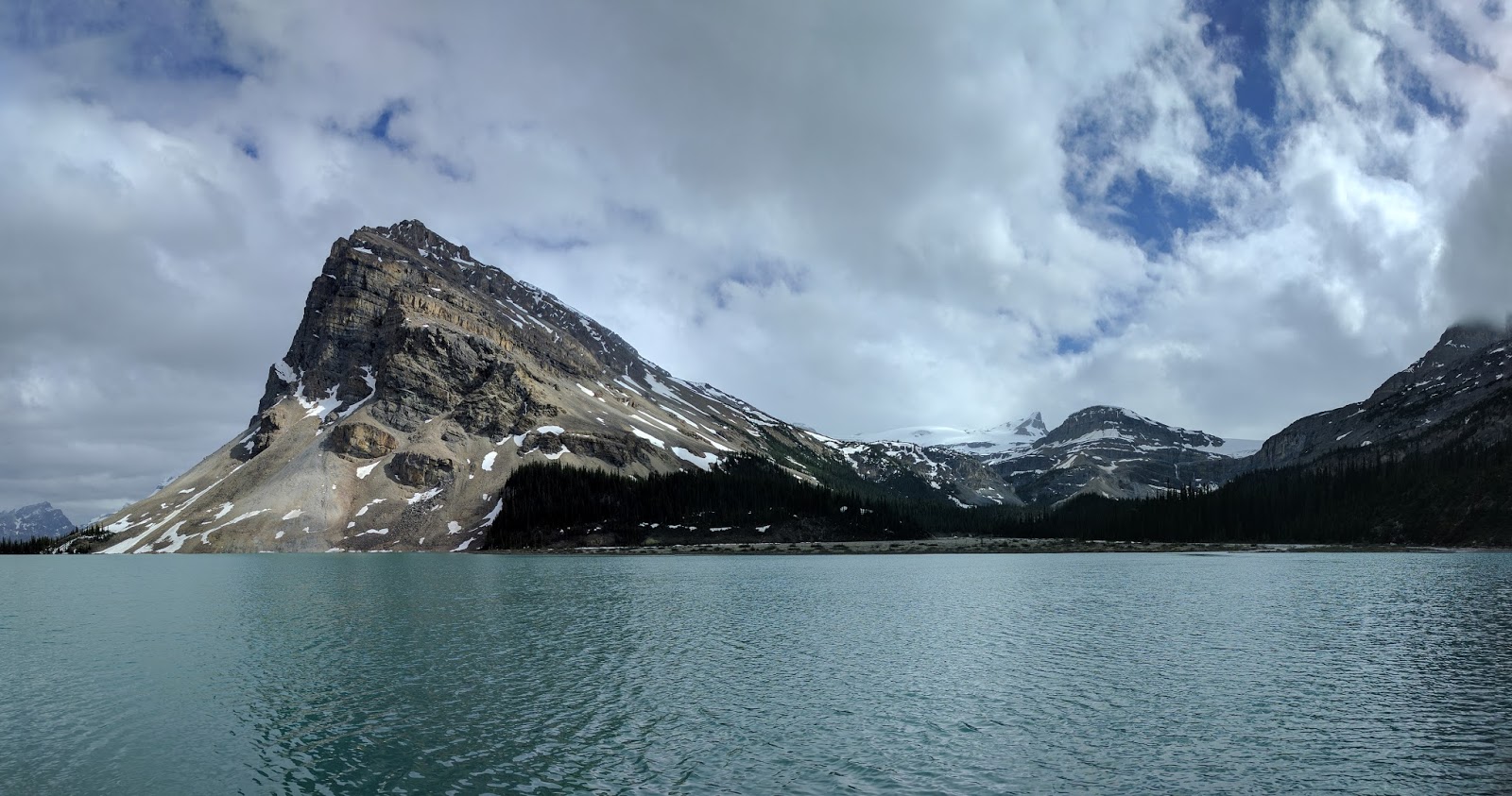
We got back to the car and got sandwiches in the Lake Louise Village and then headed north on the Icefields Parkway to Bow Lake. The view from the pull-off is beautiful and full of tourists getting out of tourbuses.
We headed up the trail towards Bow Glacier Falls. You can just see the falls in the middle of the photo below.
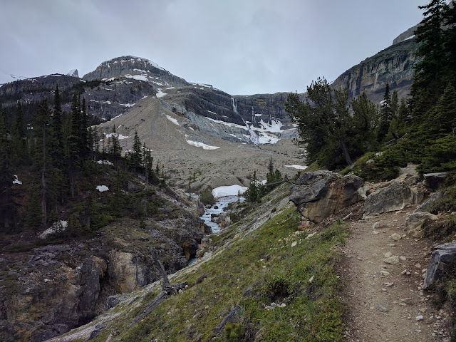
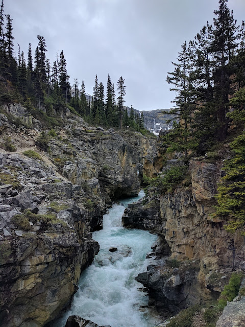
The trail passes through a canyon that is pretty cool, but freaked out my heights-fearing wife, so we did not go further.
Heading back towards the car.
Bow Lake again.
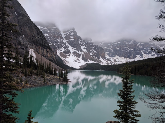
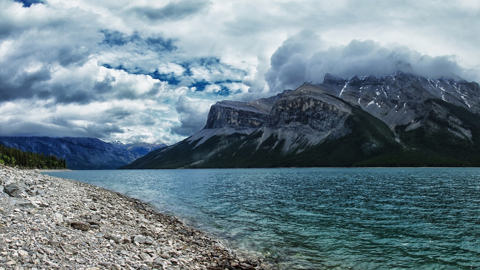
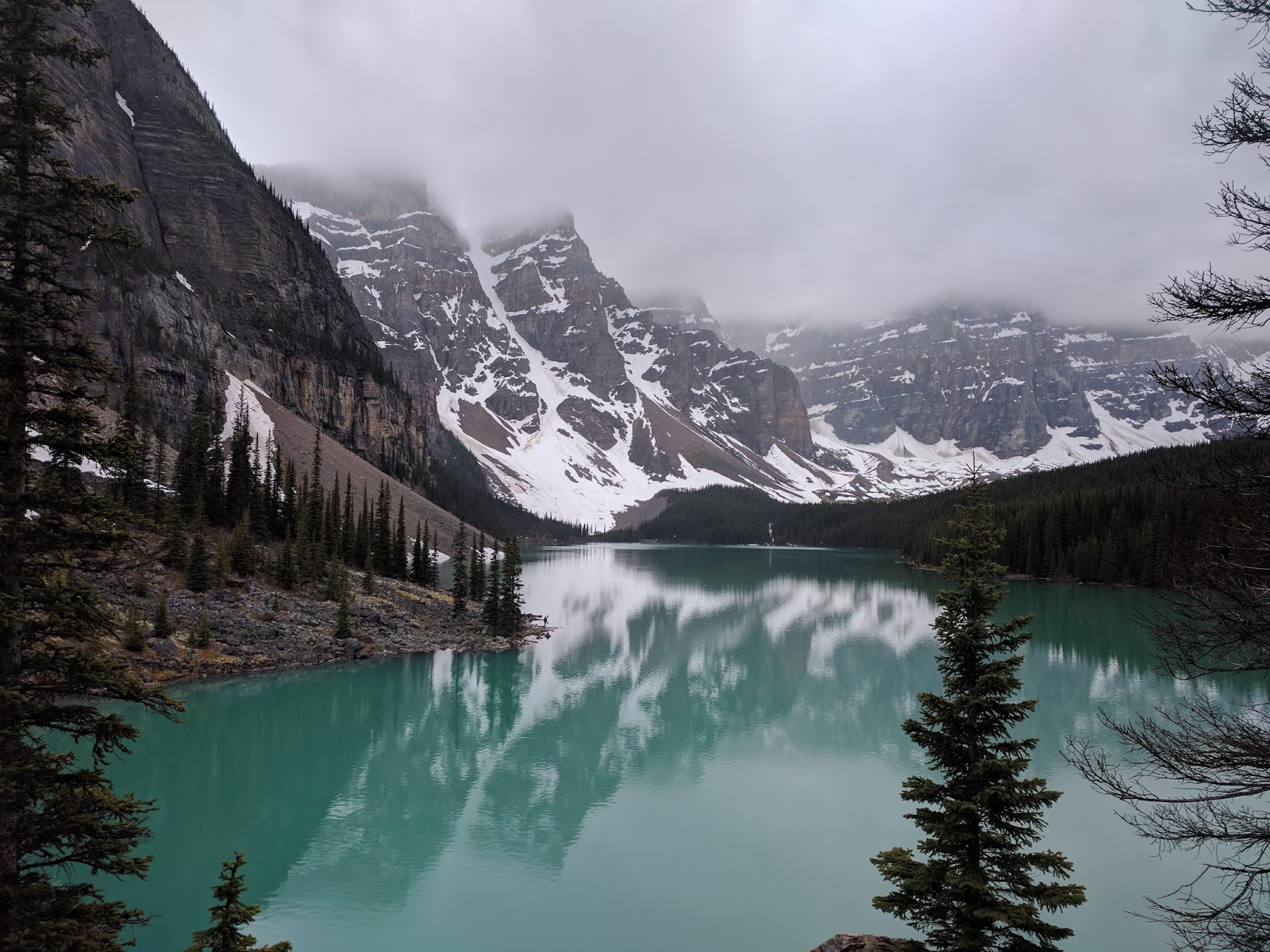
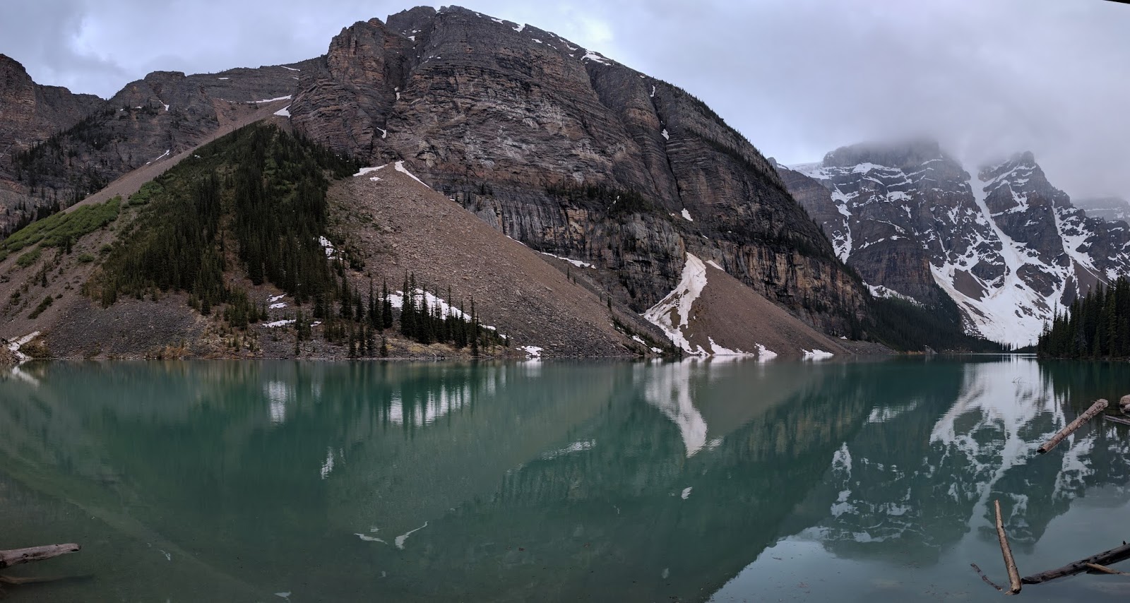
After dinner, we stopped at Lake Moraine. It ended up being a quick stop since the rain came back.

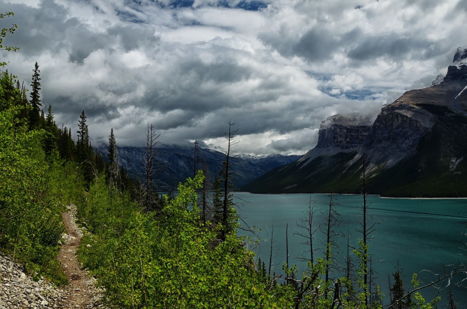
Day 3 and 4: Lake O'Hara
We woke up, packed up and headed to Banff for lunch and my wife's hotel. I had a reservation for the 3pm bus at Lake O'Hara and I figured it was about an hour north of town. No real hurry, but no reason to linger in Banff. I dropped my wife off at the hotel and headed out of town.
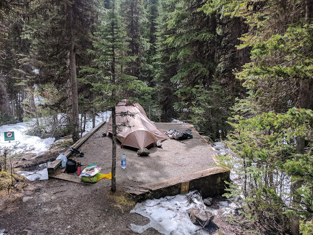
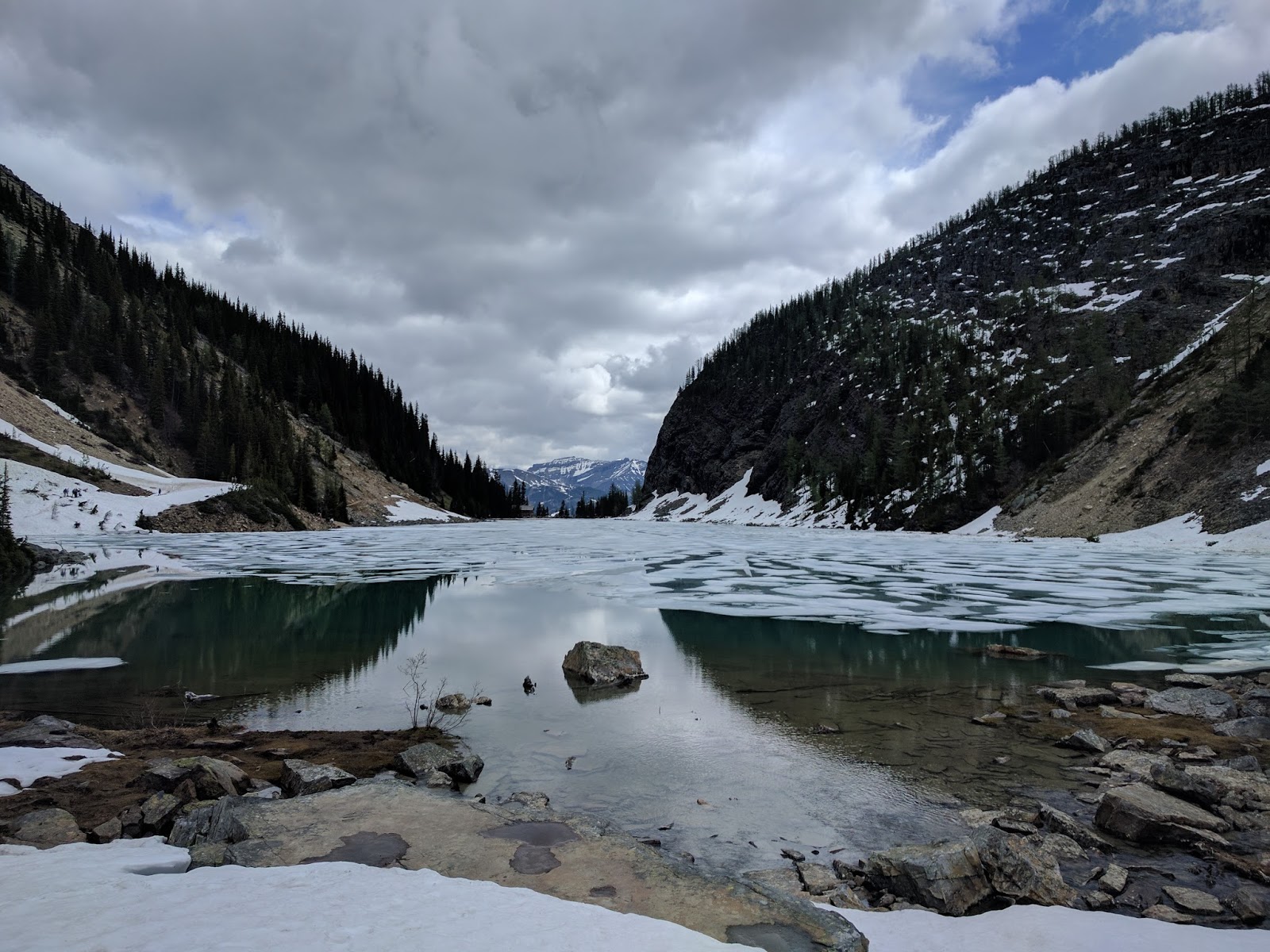
I got to the trailhead with plenty of time, tThe bus showed up and we loaded up and then heard a bit of a speech about the area and were given a choice of campsites based on the small map she held up. I went for #21 which was in a back corner away from as many people as possible. Unfortunately, most of the trails were buried under a ton of snow so hiking options were limited.
Here is home for the night.
I was there to hike as much as possible, but clearly that was not the goal of most other people there. It was about 4pm when I was done setting up and had my extra stuff in the bear lockers. There were about 6 hours of daylight left and there were already at least 20 people sitting around a campfire or hanging out when it was 60 degrees and sunny.
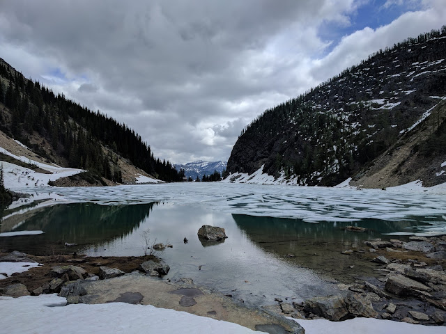
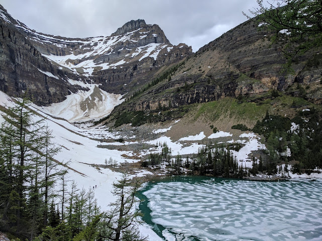
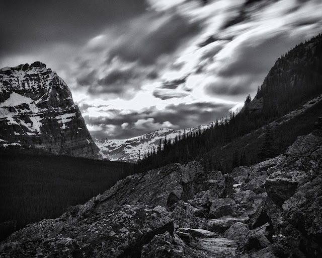
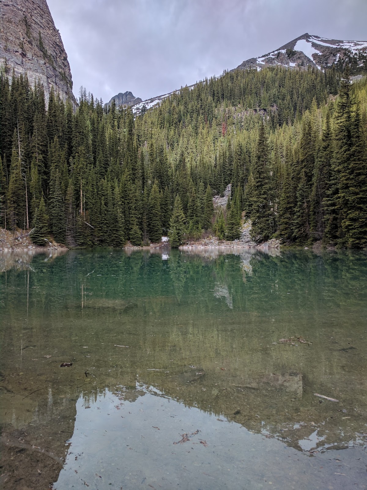
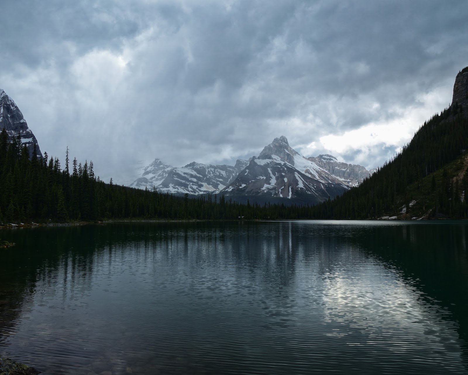
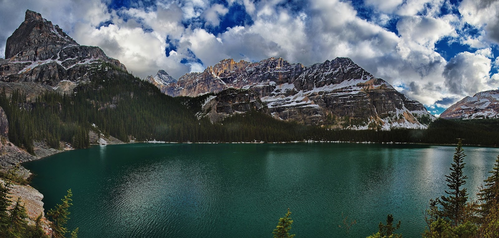
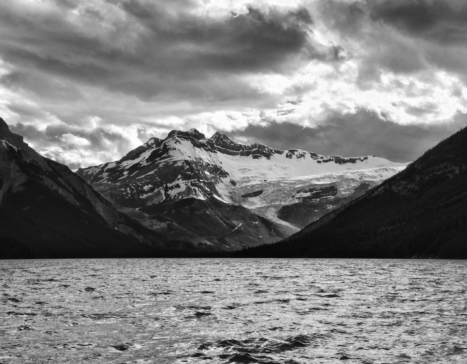
I headed towards Lake O'Hara, the view was pretty nice")
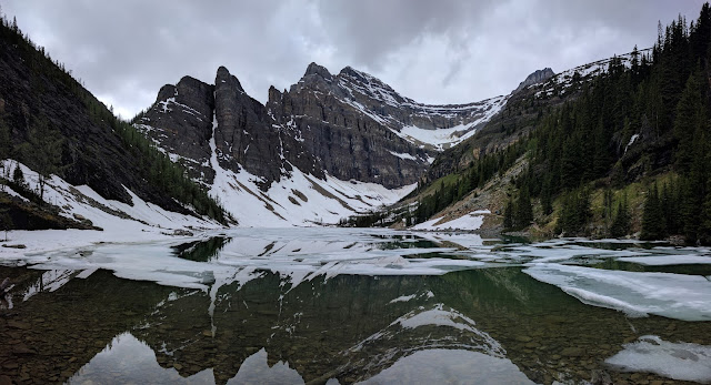
I headed up toward Oesa Lake on one of the few trails that was not buried under 5 feet of snow. It ended up being a great hike through some talus, snow, meadows,... and only a tiny bit of postholing (nice since I was in shorts and running shoes and left my gaiters at home).
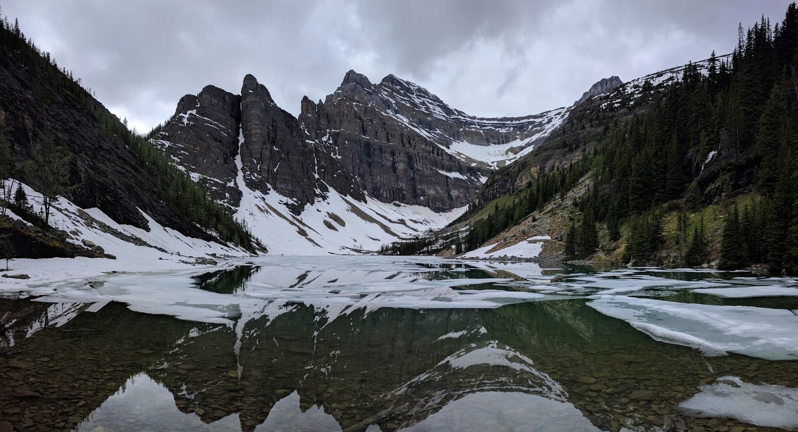
A small lake below Lake Oesa. I think Oesa is buried under all the snow in the distance.
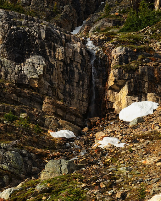
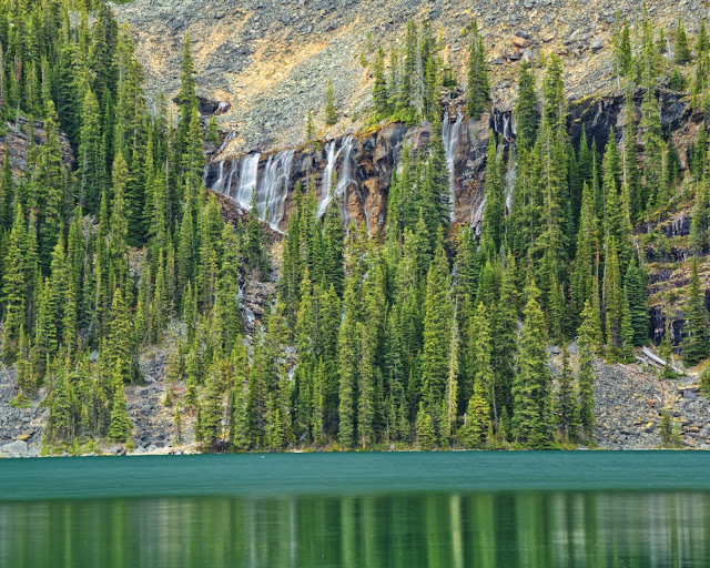
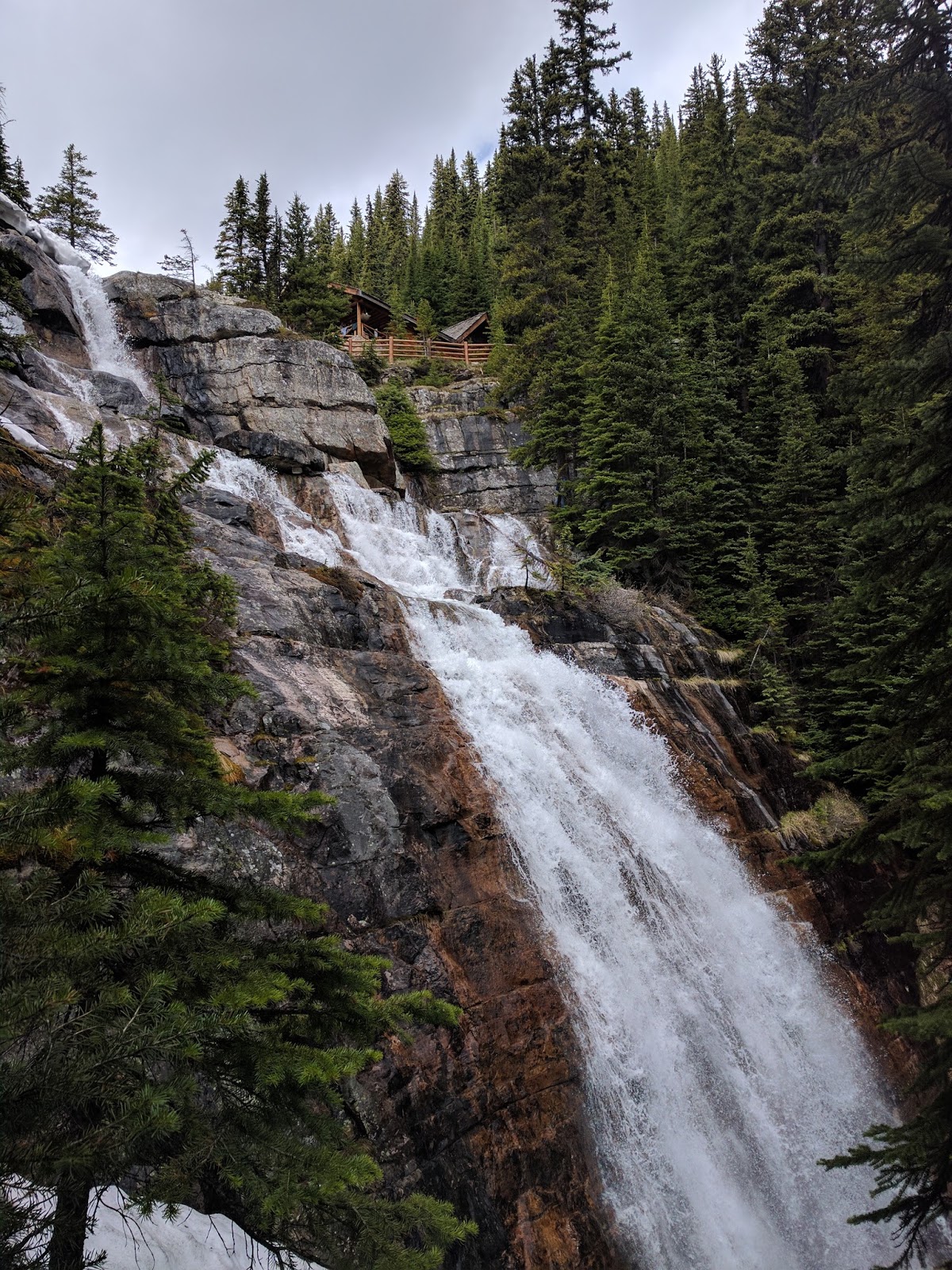
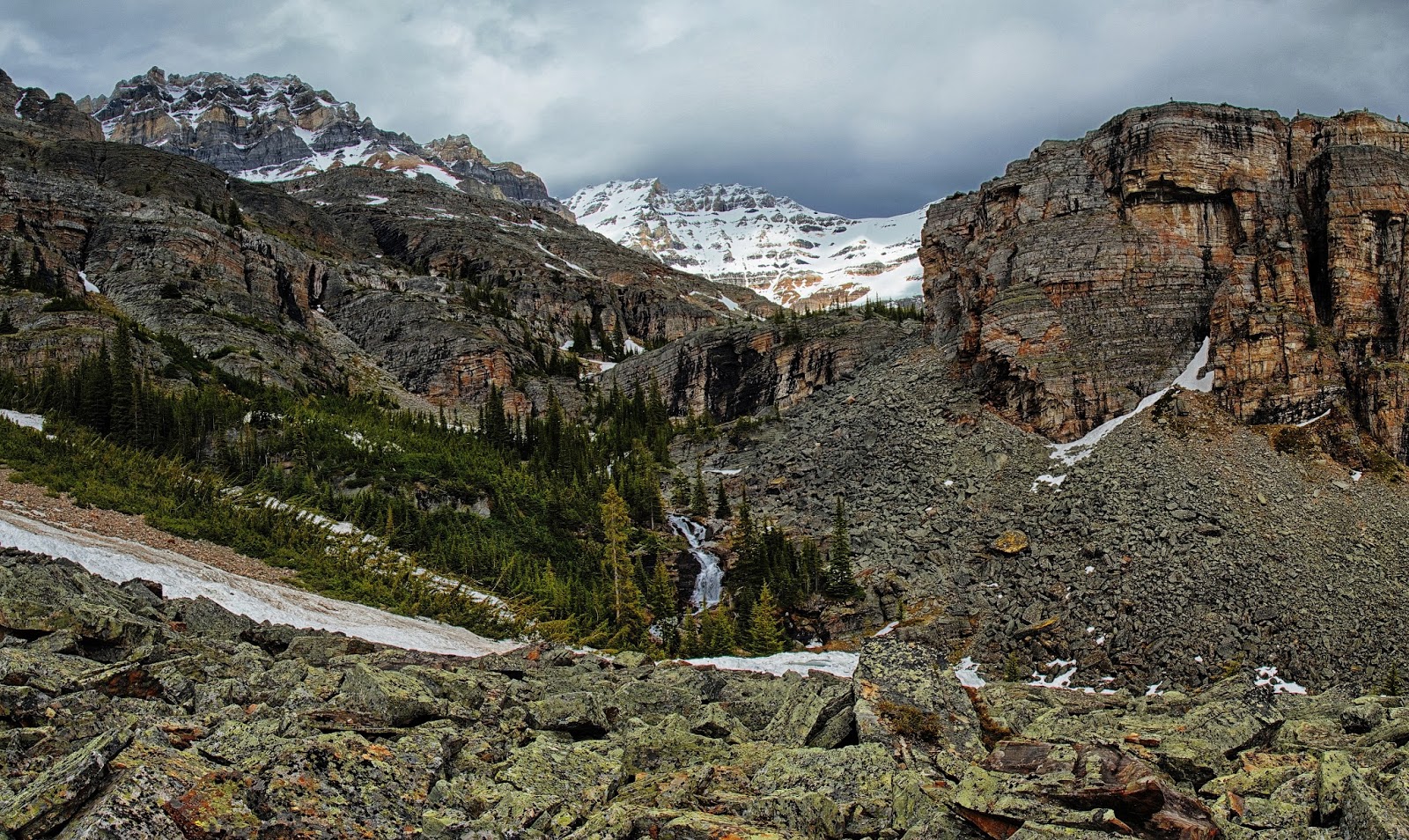
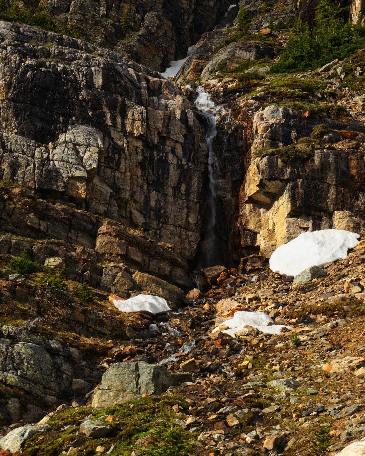
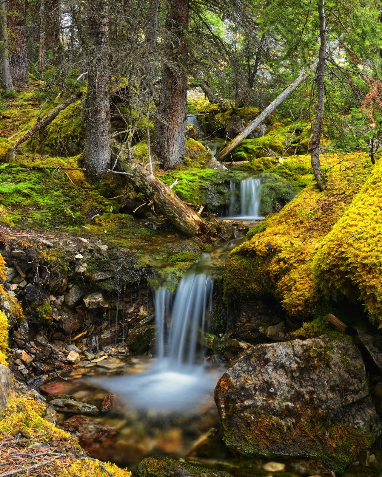
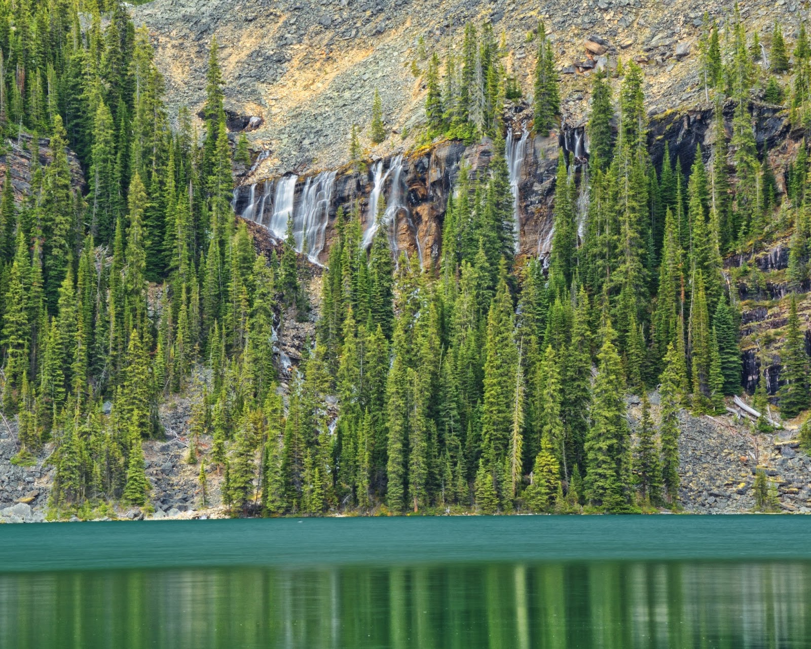
Waterfall below Lake Oesa
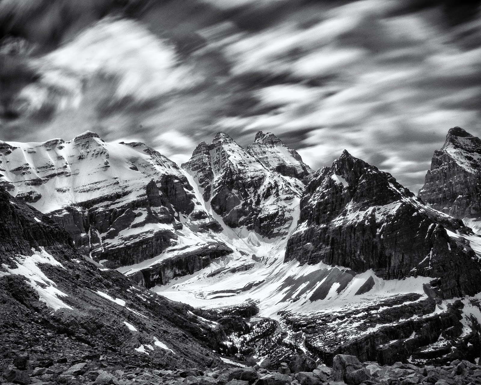
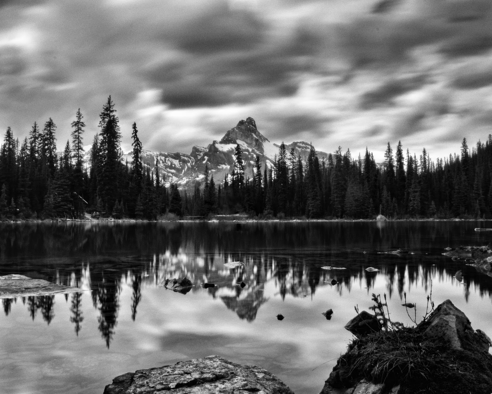
Playing with my ND filter and long exposures.
I got back to the shore of Lake O'Hara and headed around the other side of the lake towards the campground. I found this nice little waterfall just off trail.

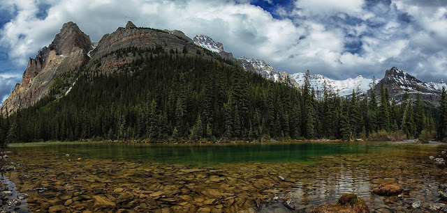
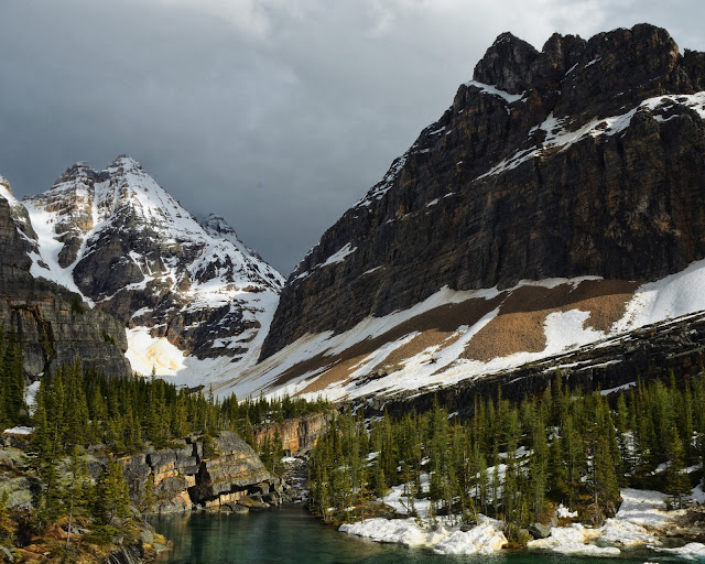
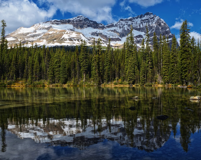
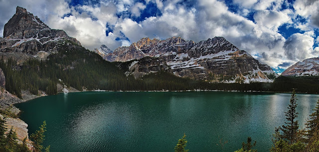
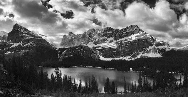
Lake O'Hara

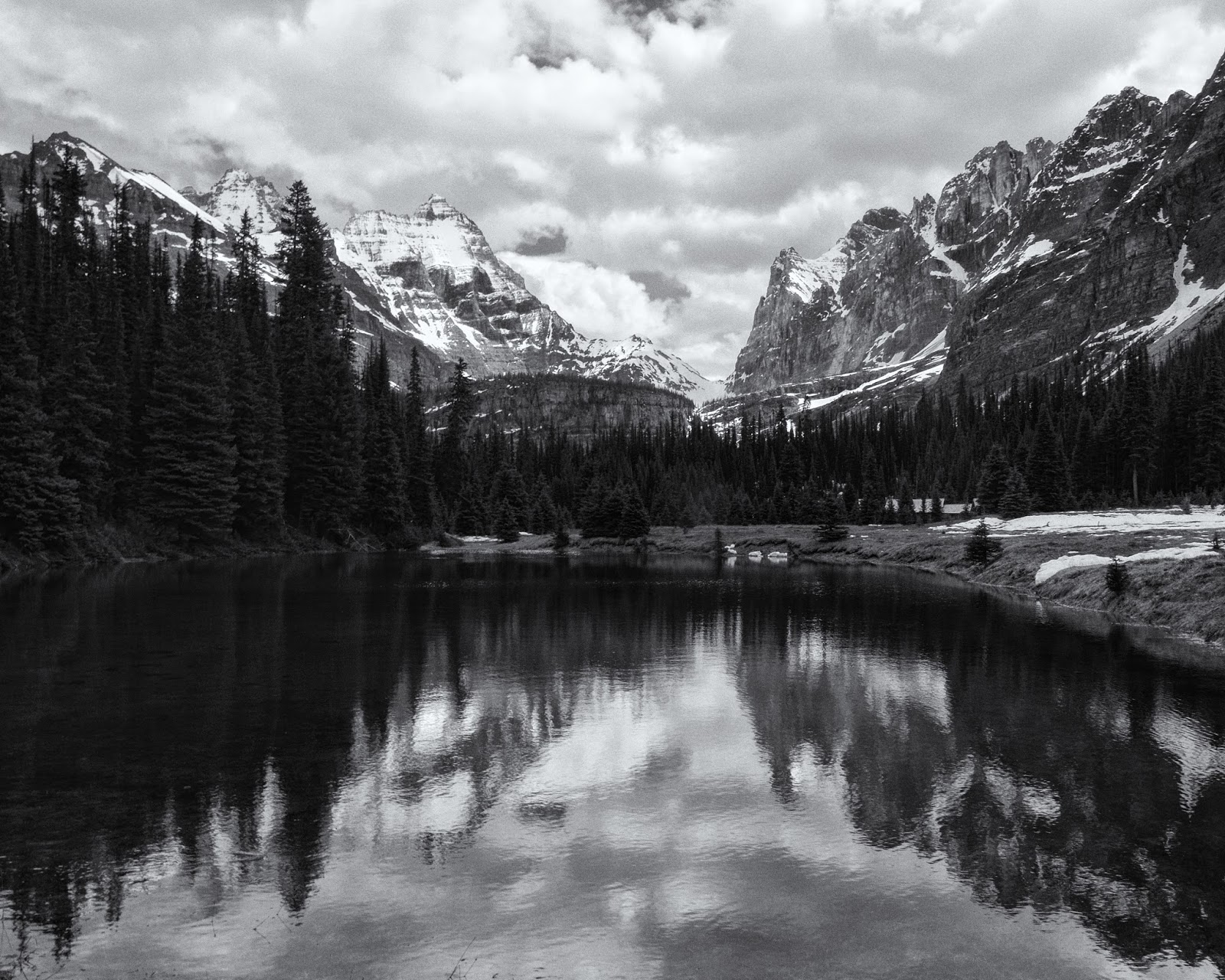
All of the lakes below Oesa Lake end up at Seven Veils Falls and Lake O'Hara
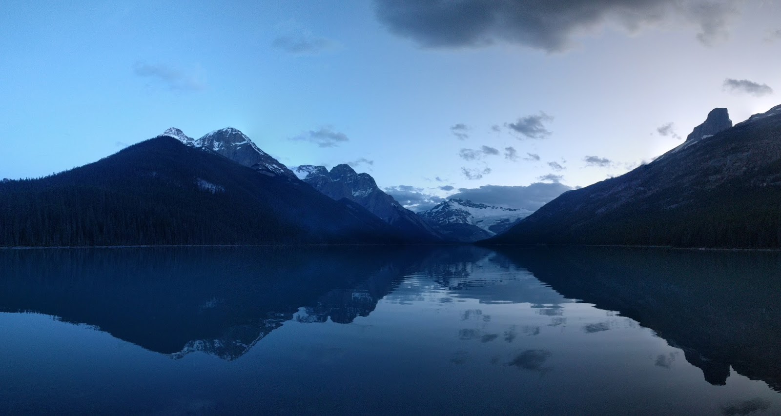
I got back to camp and found a huge number (~25) of people gathered around the community campfire. It was a little chilly away from the fire so I headed into one of the shelters to cook dinner. After dinner, I headed back up the road towards the lake since there was still plenty of light at 10pm. I took a couple of photos, but mostly just watched the light change on the lake. Then off to bed.

I woke up, had breakfast and packed up, then went to see more of the area. Today I was going to climb up to Wiwaxy Gap a ~1600' climb and one of the only other trails that was open.
First a short hike along the shore of Lake O'Hara
Then up a whole bunch of switchbacks cut into the side of the mountain. The nice thing about all of the switchbacks is there were lots of photo opportunities.
Getting higher...
... and higher ...
... and higher (note the people in the bottom right)
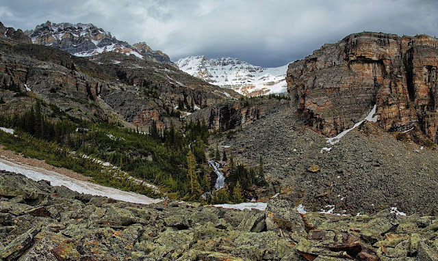
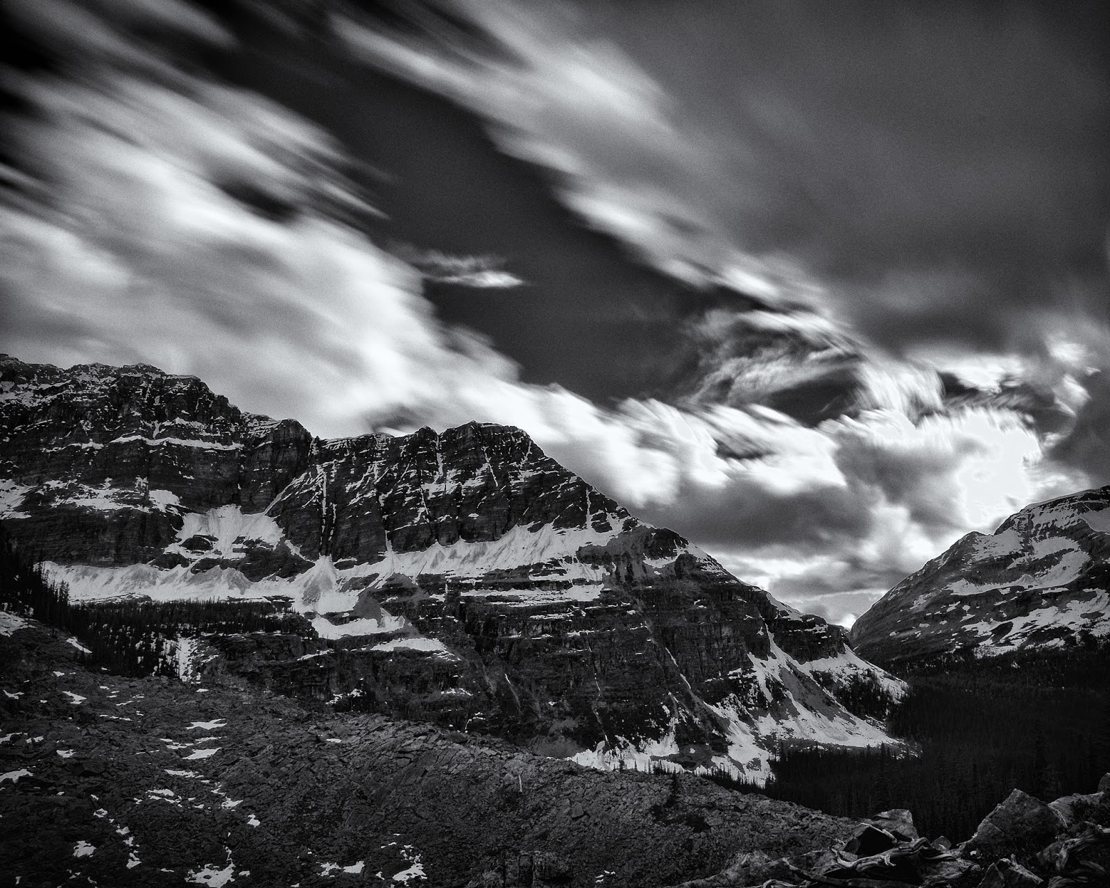
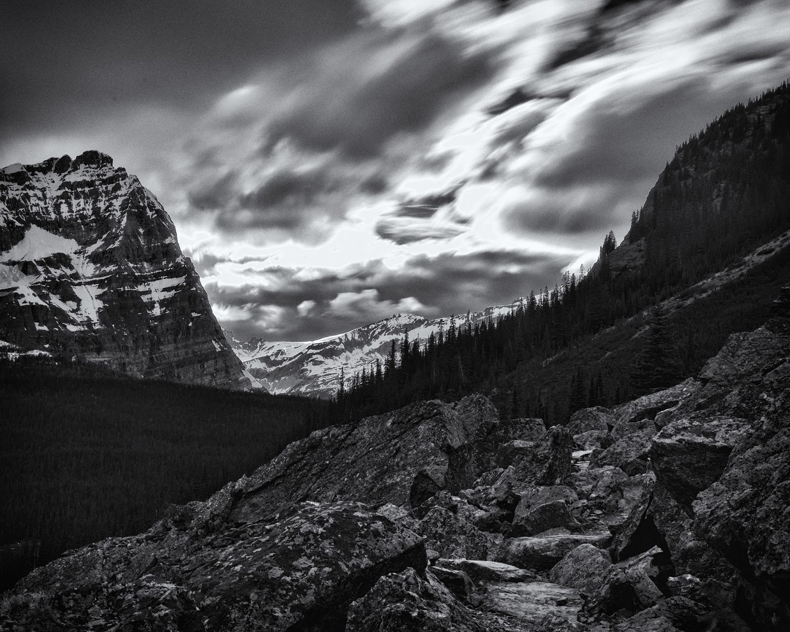
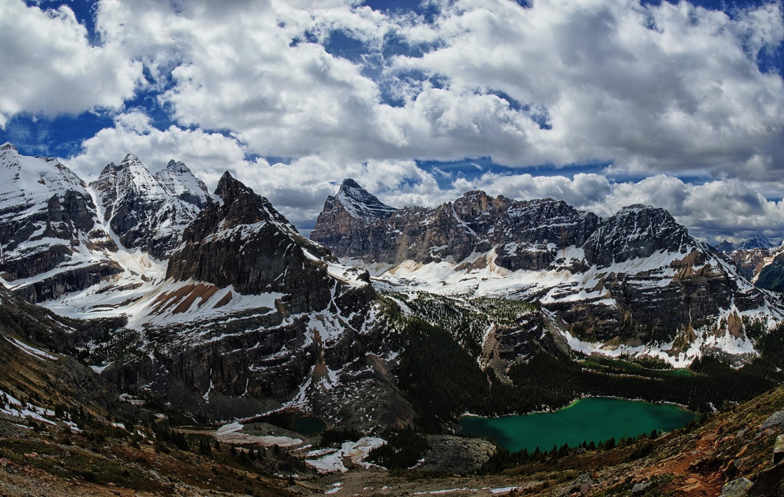
It was very windy at the gap, I immediately put on my fleece and my rain jacket. But the view was spectacular. This photo shows the route I took the day before towards Lake Oesa. The bottom right lake is O'Hara, in the middle far left is the lake where I lost the trail. I think Oesa is under all the snow at middle left below the peaks.
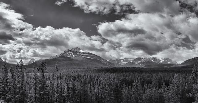
And a wide angle view of the whole valley.
I enjoyed the lunch time view and again played with some long exposures. Then I headed back down to see what else I could see.
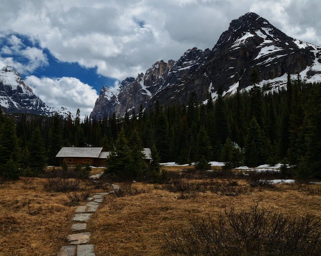
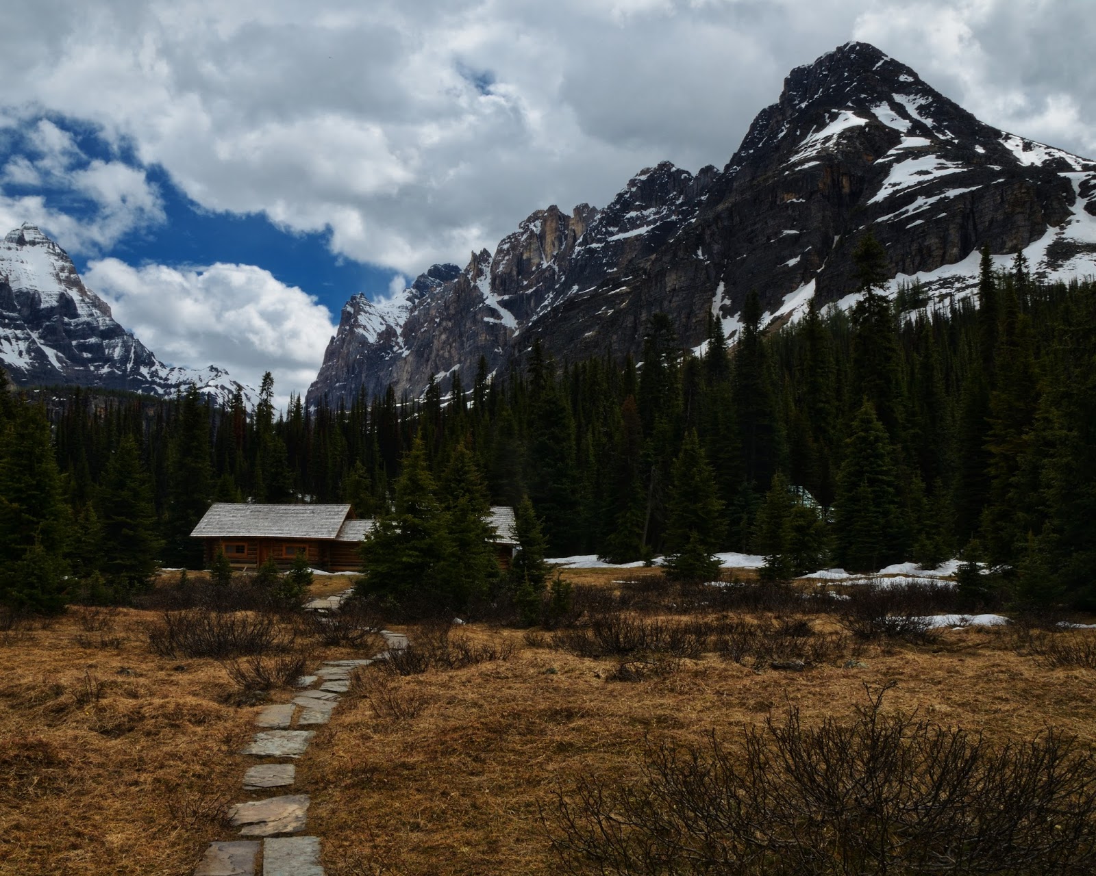
The only other area that was reasonable was the one around Morning Glory Lakes and possibly towards Linda Lake, so that was next. I started up the trail towards the ACC Hut to check that out. The ACC Hut is in a great location, but I'm pretty sure I could not handle the crowds.
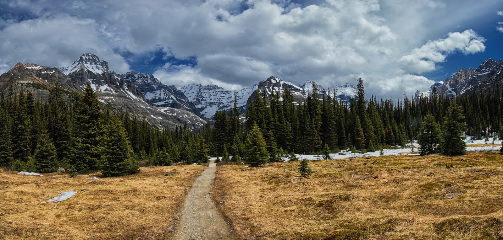
The ACC meadow and the path towards Morning Glory Lakes

And then continued down the trail. I did not take any photos since I was post-holing up to my crotch in places. After about an hour of hiking, I got to Morning Glory Lakes.
I talked to a couple people resting near the lakes about the trail to Linda Lake and they said it was a mess, lots of standing water, mud and snow but they had made it. At this point I had soaking wet feet from all the post-holing, so I did not care about wet feet, but checking the time I began to worry about missing the last bus at 6. So, I decided to avoid Linda Lake and head back towards the campground/bus stop.
I got back about 4:30 and there were a ton of people hanging out around the fire. It appeared most had gone hiking, but were ready to call it quits. I dried my socks and shoes by the fire and chatted with a couple people and then thought about catching the 5pm bus vs. hanging out for an extra hour. It turned out I had imagined a 5pm bus, so I walked down to Lake O'Hara one more time.
One last long exposure.

I got the last bus out of Lake O'Hara (6pm) and was at my car about 6:30. Unfortunately, the beer in the trunk was a little too warm to drink. So back to the Icefields Parkway and north to Waterfowl Lakes and the campground. Unfortunately, the campground was not scheduled to open until the end of June (probably the next weekend). So, I had a decision to make. Where to camp? I could drive further north on the Parkway and hope that I could find something or I could head back to Banff and get an early start the next day. Rampart Creek Campground was about 10 km north of the Glacier Lake Trailhead so that seemed like a reasonable destination. As I drove north, I had visions of just stealth camping somewhere close to the Trailhead or even hiking in to Glacier Lake a day early (that would have made a very late camp setup).
So, I was driving along, it is approaching 7:30pm, I still have tons of daylight left, but don't want to be setting up camp at 10:30 in the dark. As I came around a corner, there was a car pulled off to the side of the road. I slowed down and saw a bear poking around on the side and this time I had my camera with me.
I took a some photos and left the bear in peace. I got to the Rampart Creek Campground and was happy to grab the first site I found. It turns out, I could have been more selective since I found some walk-in tent sites the next morning. Not a big deal, I wasn't going to be there long. I walked over to the registration board where someone said he had just seen a bear up on the road. He seemed pretty sketched out, but there were enough people in the campground that I wasn't worried. As I headed back to my site, I mentioned the bear siting to a neighbor and they said, "yeah, he just wandered through the campground about 10 minutes ago"
Now, my only dilemma was how to cool my beer. The site across the road had some young kids (mid-20s), I figured they would have a cooler and I could either stash my beer in their cooler while I set up camp or I could trade my warm beers for their cold ones. I walked over with my 4 beers, said hello, and made my proposal. They said "we don't have a lot of ice left, but you can use the cooler". Cool, I'm going to go check out the river and I'll be back in a little bit.
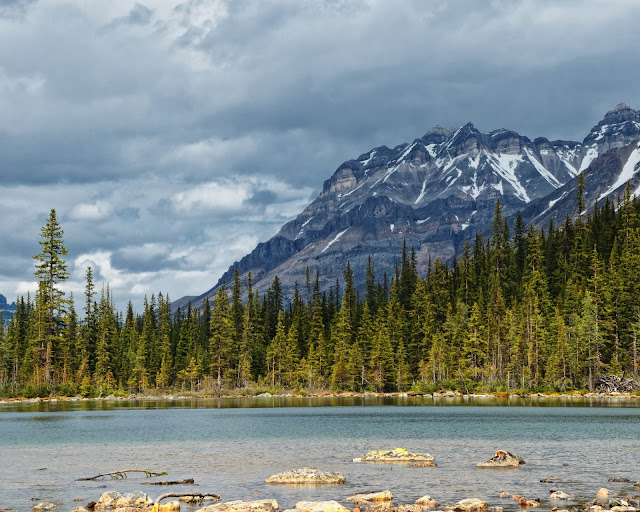
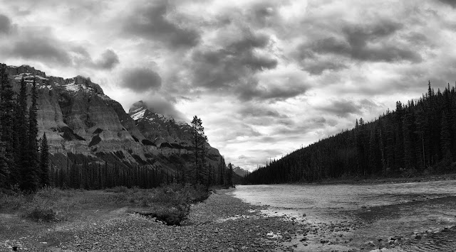
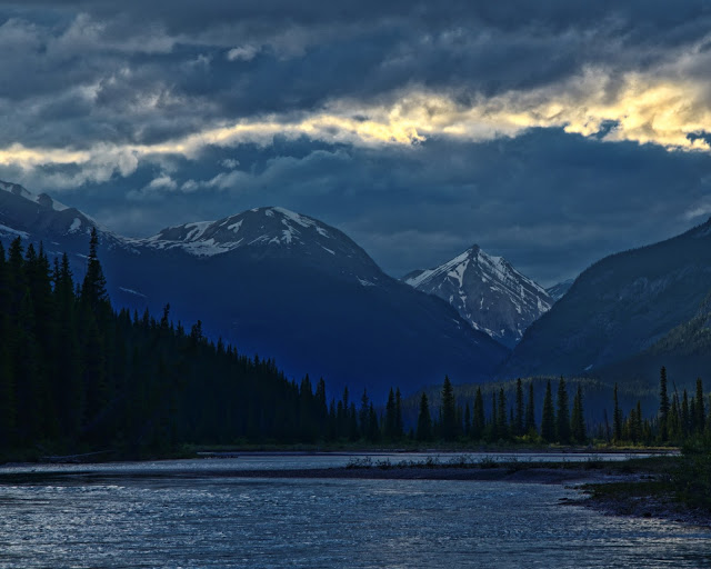
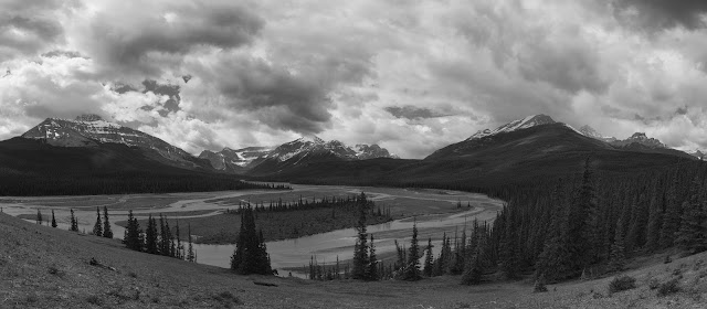
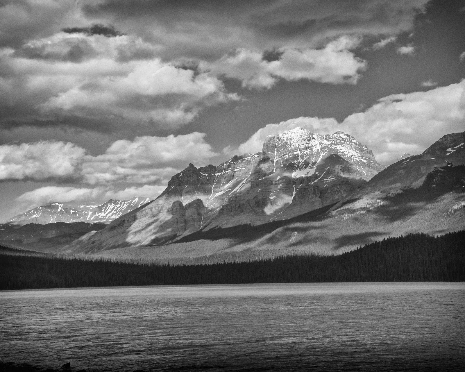
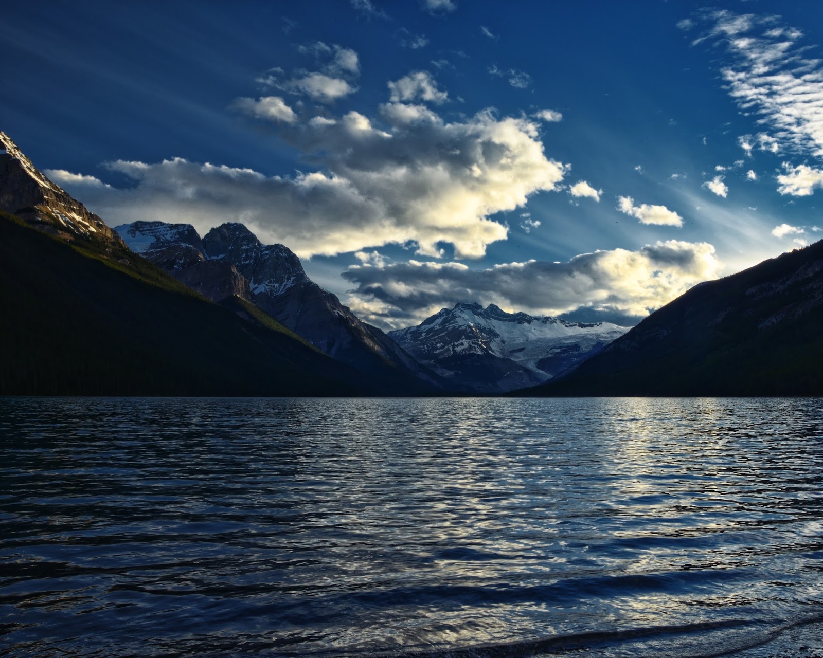
Saskatchewan River at Rampart Creek Campground
I played around at the river for a bit and then headed back to collect my beer and cook dinner. I decided that I did not need to drink 4 tall boys that night so I let them choose which beer I left behind. The mosquitoes were bad enough that after eating, I just sat in the car reading my book and drinking my beer.
Woke up in the morning and had breakfast and then took my coffee and camera back to the river to see what I could find. Not a lot of river photos this morning, but tons of flowers. Talked briefly to the kids with the cooler. A couple guys were riding their bikes from Jasper to Banff and their girlfriends had met them at the campground with food and beer. Sounded like a good way to travel to me.
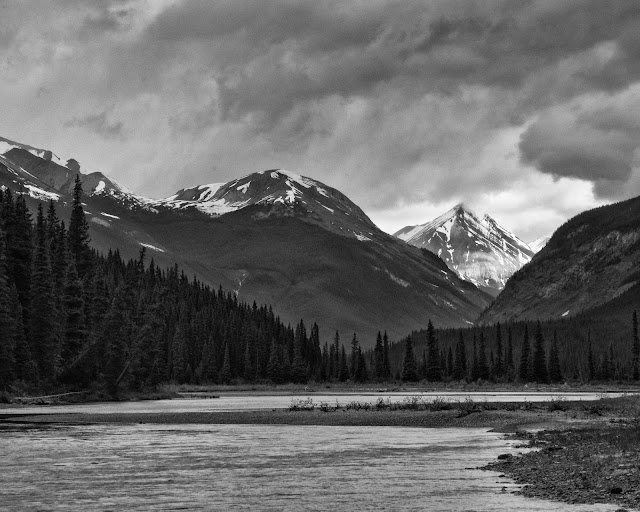
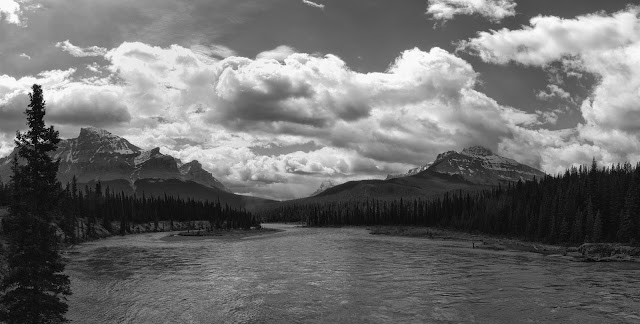
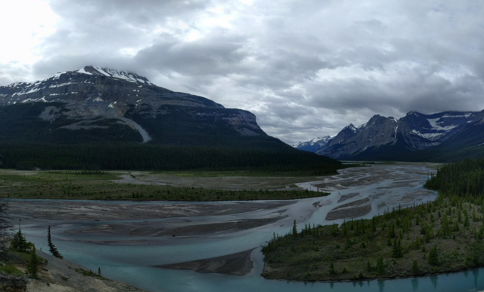
This is looking south along the Saskatchewan River, back towards where I was heading.
Day 5 & 6: Glacier Lake
I got to the Glacier Lake trailhead about 10am and headed down the trail. The first bit is through the forest with not much to see.
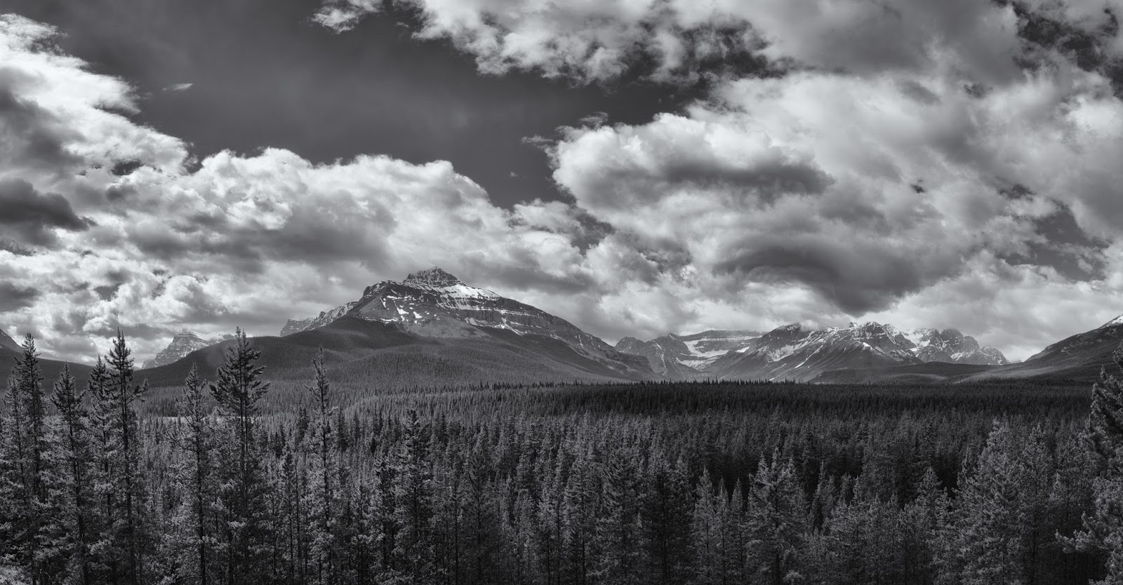
But there is a break in the trees that gives a nice view of what is ahead.
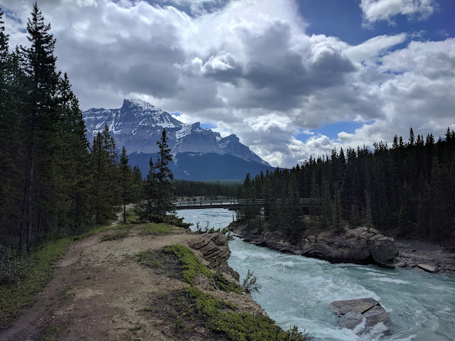
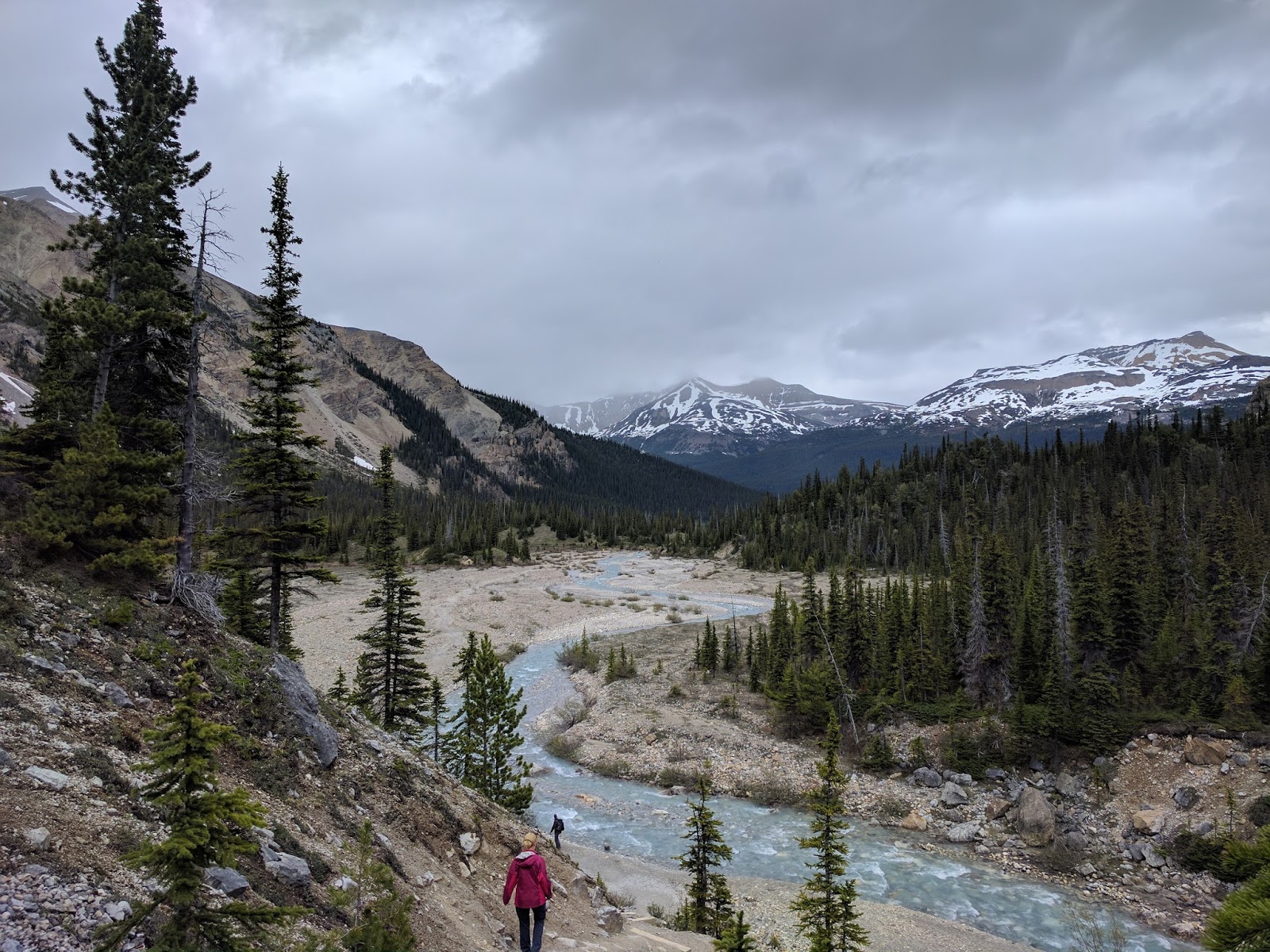
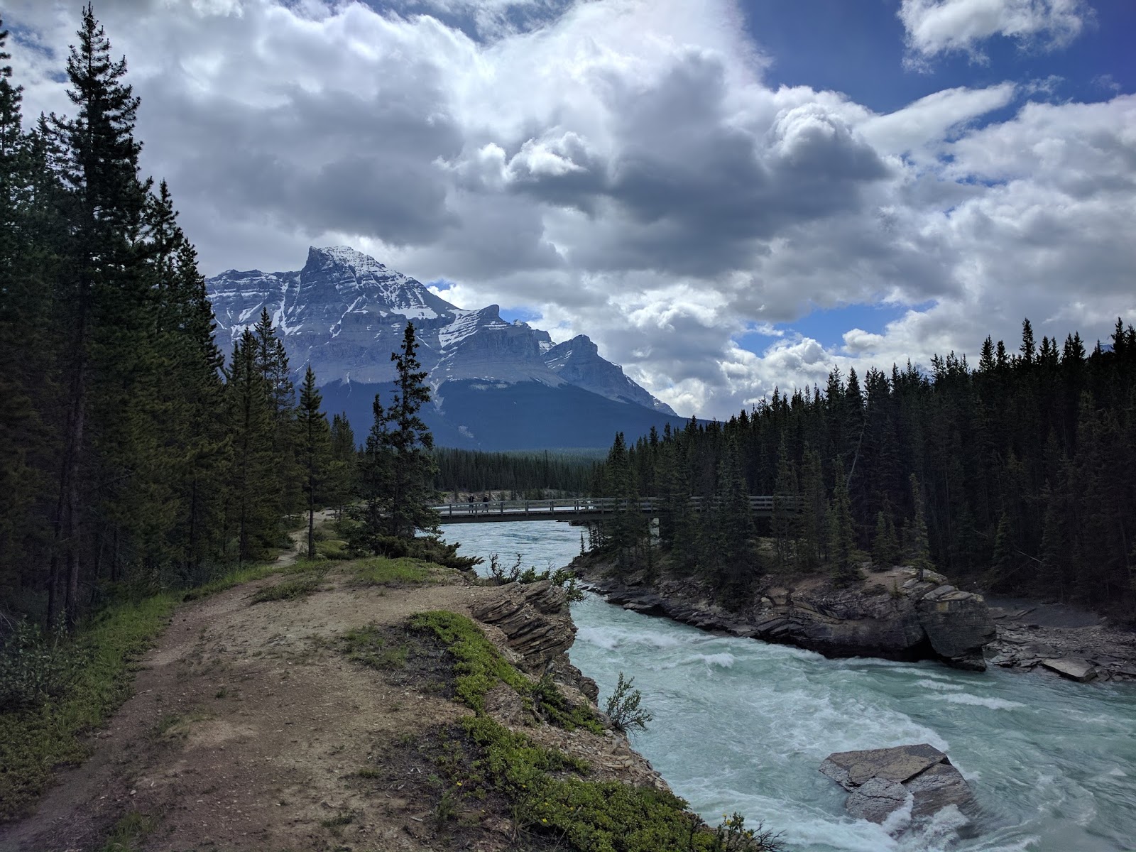
Then the Saskatchewan Rive, there is a very distinct trail along the river. I followed it a little way in both directions before crossing the bridge and heading to Glacier Lake.
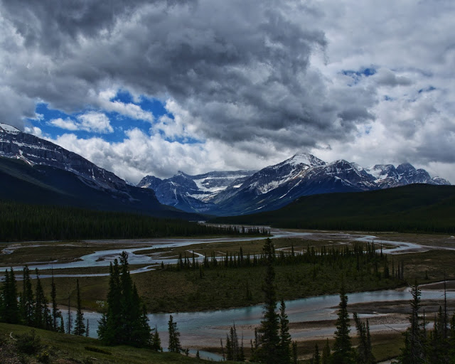
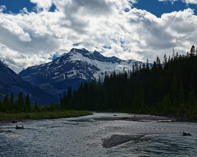
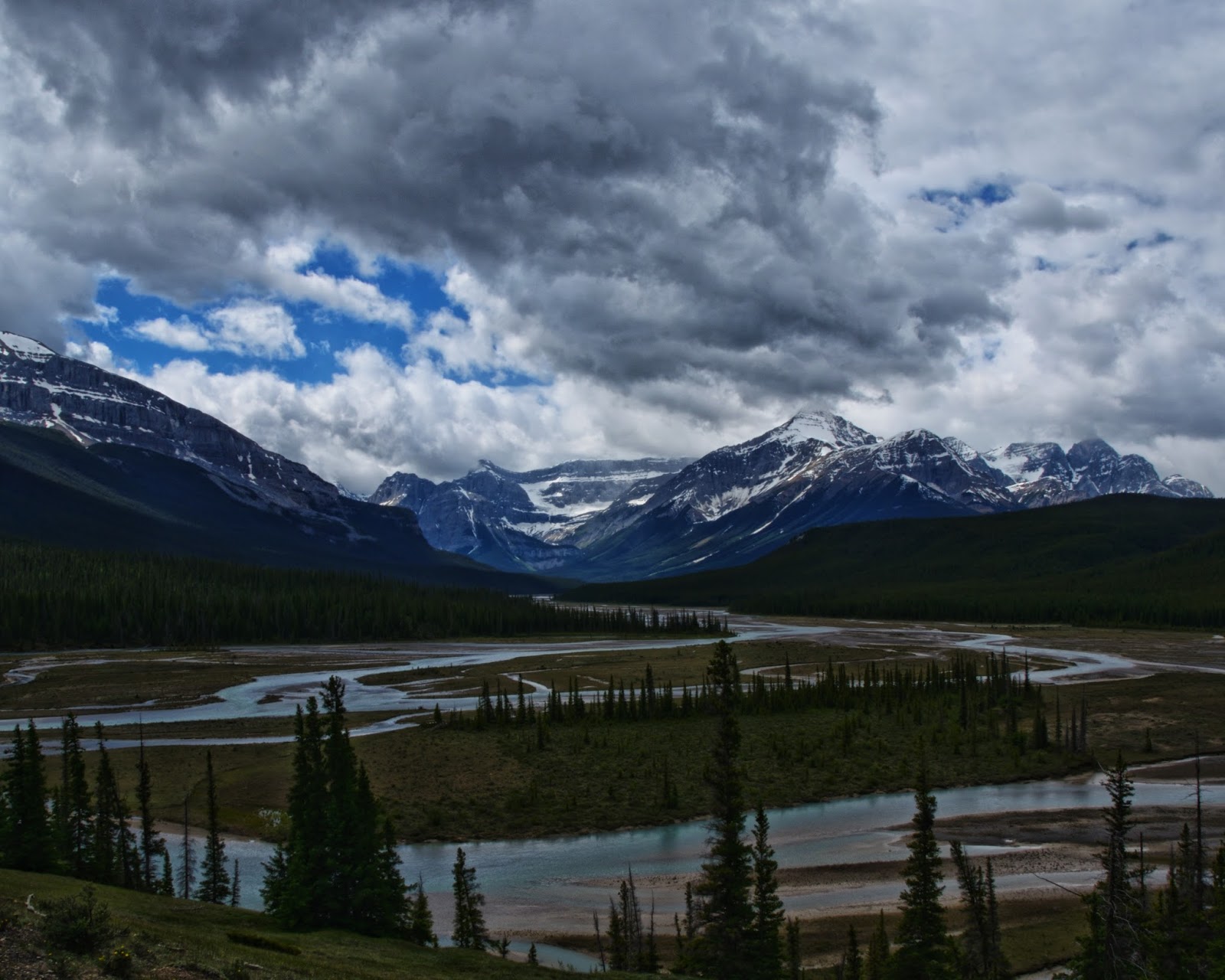
After a little more hiking in the woods, you climb a short hill and get an amazing view of the Howse River valley below.
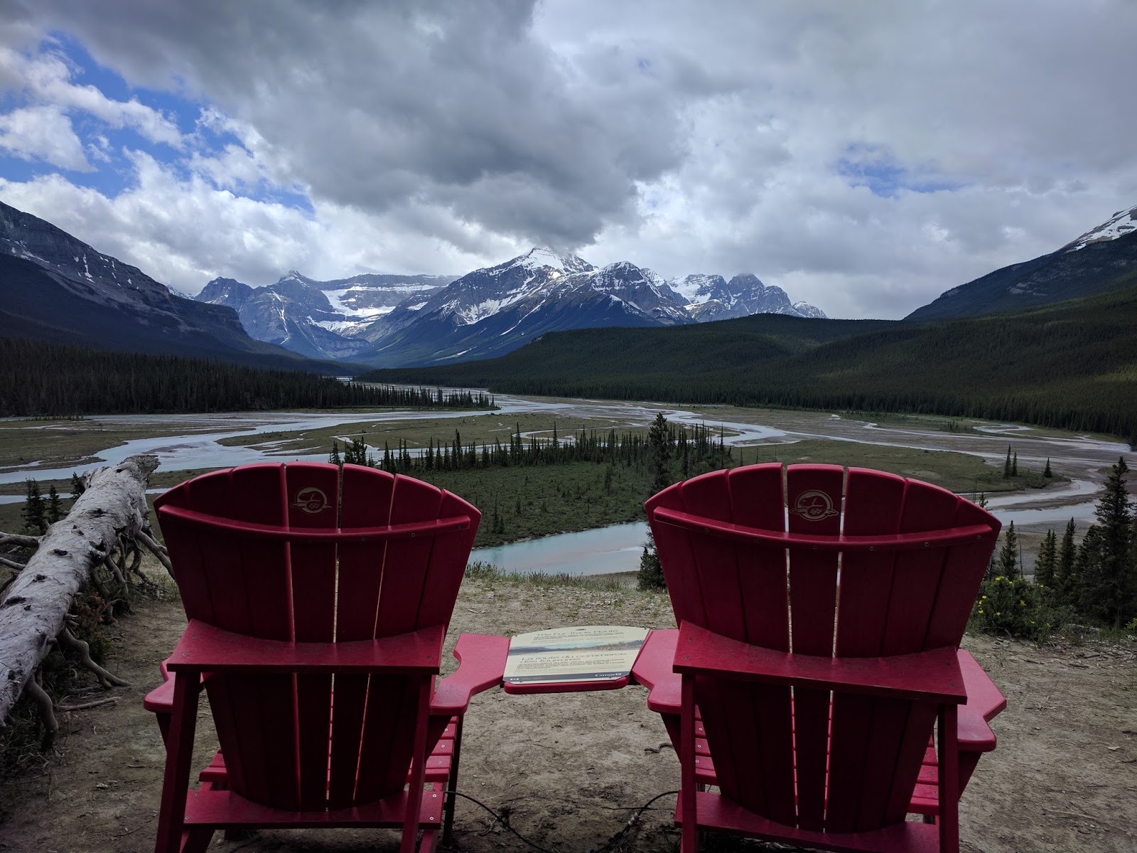
Howse River and the "famous" chairs, I suspect a lot of day hikers turn around at this point.

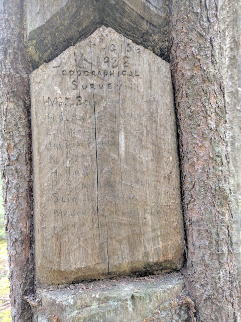
And then back into the forest for more hiking. Off to the side of the trail was this interesting marker/blaze carved into a tree.
1928 Topographical Survey
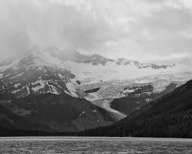
Then finally the "payoff", not too shabby, but very windy.

Glacier at the head of Glacier Lake.
I set up camp, hung my food and headed towards the head of the lake. The guide book mentioned a trail that followed the shore the whole length. Evidently it used to be maintained by the park, but no longer. Someone else must be doing the maintenance, because most of the deadfall had been chainsawed. The trail was very easy to foll and very pretty.
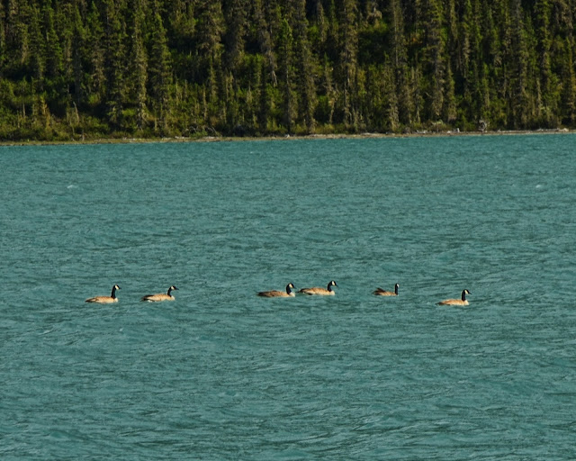
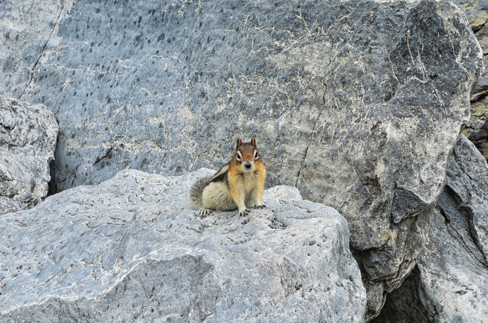
A little bit of local wildlife.
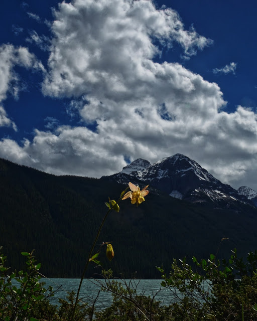
There were tons of flowers along the lakeshore.

I followed the user trail as far as I easily could, but...
... I started getting nervous about spooking a bear. Not to mention, I had not brought anything to eat or drink, so I headed back to camp.
I talked to a couple young women who had shown up as well as a threesome of people more my age and then cooked dinner and watched the lake.


Unfortunately, the wind then died down and the mosquitoes came out in force. I was very glad to have a DEET wipe. I took some photos with the last bit of charge in my batteries and then the two women built a campfire so I chatted with them a little bit more before heading to bed.

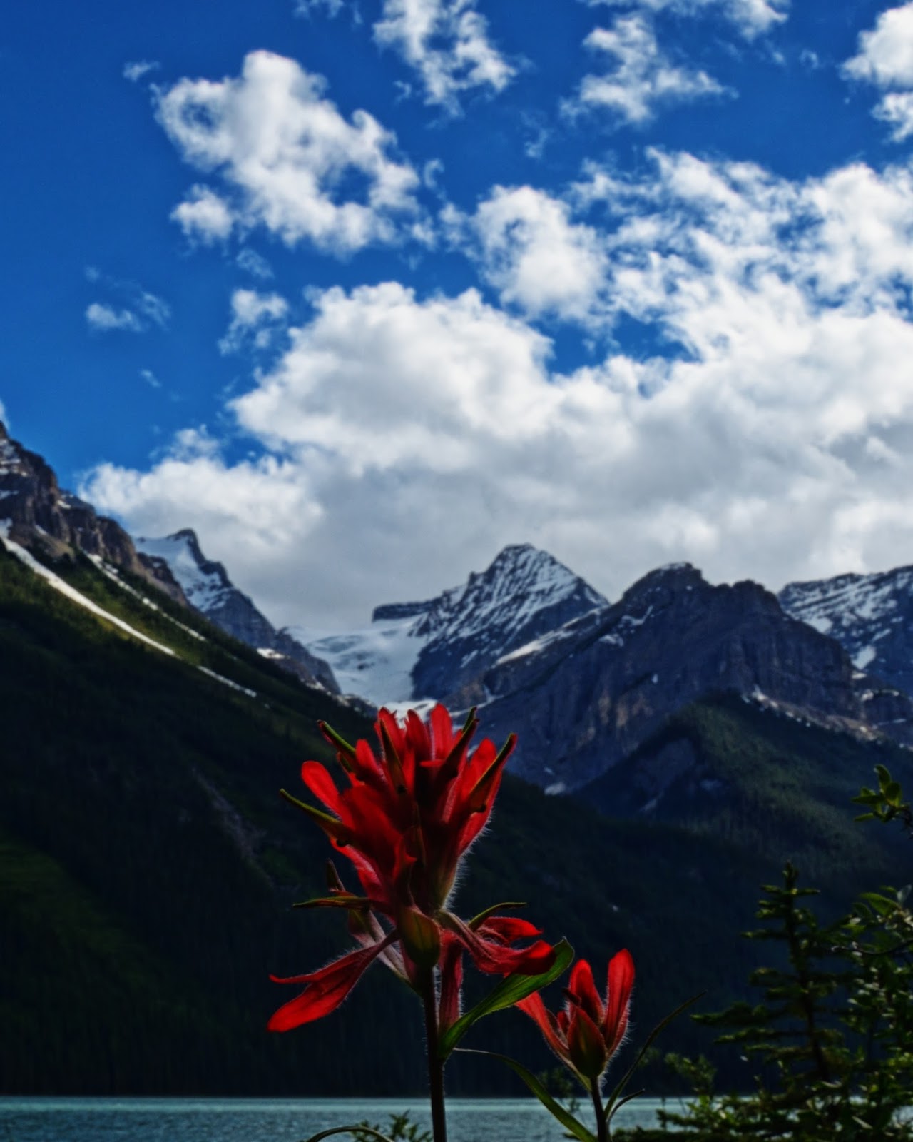
The next morning, I packed up and hung my pack and the took a side trail towards the Howse River. The older threesome had mentioned that the trail was a little overgrown, but that there was a great view of the river. They were right.

One last view of Glacier Lake, then back to the car and civilization
I got to the hotel in Banff about 3, took a shower and we went to find some beer in Banff. After little bit of bar hoping, we grabbed dinner and then back to the hotel. The next morning, we packed up and headed to the airport. Normally, I am very ready for trips to be over, but this time was different. Even with all of the trails buried in snow, there was still more to see. I think I will have to return, hopefully it won't take another 11 years like the last time.
Other things to note: Lake Louise is way too crowded for me to enjoy, especially if there are only a couple trails open. I probably won't go back there again. Lake O'Hara is also way too crowded when there are only a couple trails open. I want to go back, but a local said the best time is September, the larches are turning, the bugs are gone and it is getting cold enough to keep a lot of people away.
I have no desire to see the town of Banff ever again, way too expensive and way too crowded. I had a good breakfast at Wild Flower Bakery, I'd go back there again if it wasn't in Banff.
More photos and details here https://backpackandbeer.blogspot.com/2017/08/banff-2017.html
A mix of dayhikes and car camping and backpacking
6/13 - 6/20/17 (3 nights camping)
Dayhikes: Lake Minnewanka, Tunnel Mountain, Lake Agnes Teahouse (Lake Louise), Bow Glacier Falls.
Backpack/car camp: Lake O'Hara, Rampart Creek campground and Glacier Lake
So my wife got invited to a conference in Banff and wanted me to go as well. I said I would go as long as we stayed for a couple extra days to see some of the area. She did not have a problem with that since we had both enjoyed to small amount of time we got to spend in the Canadian Rockies on our drive to Alaska in 2006. I also wanted to go backpacking while she was occupied with the conference.
Day 1: Dayhike at Lake Minnewanka
The trailhead is at a large picnic area and marina and there were tons of tourists who did not look like hikers. Luckily almost everyone turned around at the bridge that was only about a 1/2 mile down the trail. We hiked a couple miles out and the sky started to get darker. It did not feel like the views were going to change a whole lot and I knew we would not be hiking all the way to the first backpacking site or climbing any passes, so we turned around and headed back to the car.
Not afraid at all
We got back to the car and decided to get something to eat in town and the see what Tunnel Mountain was all about since there was still a lot of daylight left. It ended up being a short and steep climb with lots of people, but the views from the top were nice.
Town of Banff down below.
Day 2: We woke up to better weather and headed off to Lake Louise. My wife had read about the teahouses and thought that sounded neat. I just wanted to go hiking more around Lake Louise since I had only walked along the shore for a little bit the last time we were in the area. Unfortunately, most of the trails in the area were buried in snow so everyone was on just a few trails and everything felt very crowded. It was about this point that I realized I had left my SLR in the hotel room and only had my cell phone.
The shore of Lake Louise
We started the hike up to the Lake Agnes Teahouse with what felt like a million other people. The first part of the trail is in the trees with not much to see, but there are hints of a view on occasion.
Mirror Lake below Lake Agnes
Lake Agnes Teahouse
The view of Lake Agnes was pretty but the Teahouse was packed. I took one look and told my wife I was going to explore while she had tea.
There was an obvious trail along the lake so I hiked to the far end where I was able to escape most of the people. At this point, there was a pretty obvious trail up to what I later determined was the Big Beehouse, so I decided to see how high I could get.
Snow spider
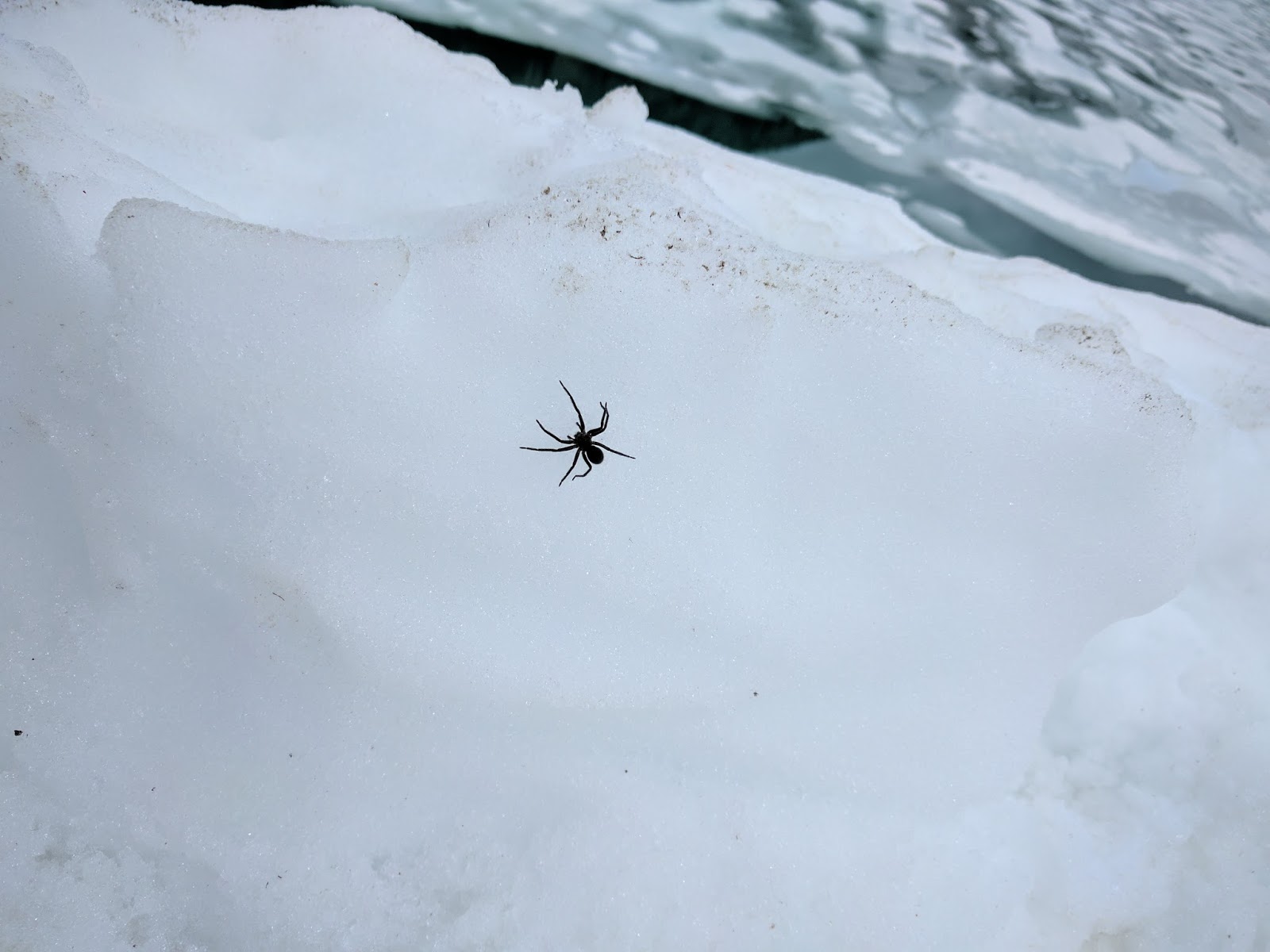
This is looking back towards the end of the lake, you can just see two people hiking across the snow. The Teahouse is out of view to the right.

I got high enough to have a great view of both Lake Agnes and Lake Louise before I was stopped by snow and then headed down to find my wife.

We got back to the car and got sandwiches in the Lake Louise Village and then headed north on the Icefields Parkway to Bow Lake. The view from the pull-off is beautiful and full of tourists getting out of tourbuses.
We headed up the trail towards Bow Glacier Falls. You can just see the falls in the middle of the photo below.

The trail passes through a canyon that is pretty cool, but freaked out my heights-fearing wife, so we did not go further.

Heading back towards the car.
Bow Lake again.
After dinner, we stopped at Lake Moraine. It ended up being a quick stop since the rain came back.
Day 3 and 4: Lake O'Hara
We woke up, packed up and headed to Banff for lunch and my wife's hotel. I had a reservation for the 3pm bus at Lake O'Hara and I figured it was about an hour north of town. No real hurry, but no reason to linger in Banff. I dropped my wife off at the hotel and headed out of town.
I got to the trailhead with plenty of time, tThe bus showed up and we loaded up and then heard a bit of a speech about the area and were given a choice of campsites based on the small map she held up. I went for #21 which was in a back corner away from as many people as possible. Unfortunately, most of the trails were buried under a ton of snow so hiking options were limited.
Here is home for the night.

I was there to hike as much as possible, but clearly that was not the goal of most other people there. It was about 4pm when I was done setting up and had my extra stuff in the bear lockers. There were about 6 hours of daylight left and there were already at least 20 people sitting around a campfire or hanging out when it was 60 degrees and sunny.
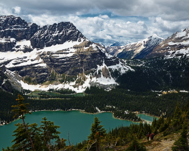
I headed towards Lake O'Hara, the view was pretty nice
I headed up toward Oesa Lake on one of the few trails that was not buried under 5 feet of snow. It ended up being a great hike through some talus, snow, meadows,... and only a tiny bit of postholing (nice since I was in shorts and running shoes and left my gaiters at home).

A small lake below Lake Oesa. I think Oesa is buried under all the snow in the distance.

Waterfall below Lake Oesa
Playing with my ND filter and long exposures.
I got back to the shore of Lake O'Hara and headed around the other side of the lake towards the campground. I found this nice little waterfall just off trail.
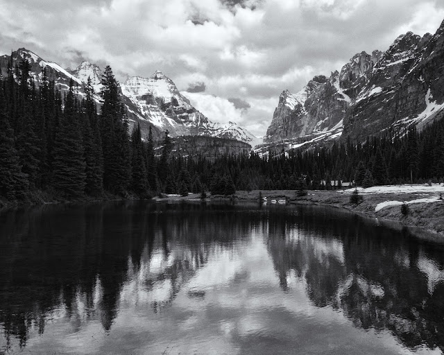
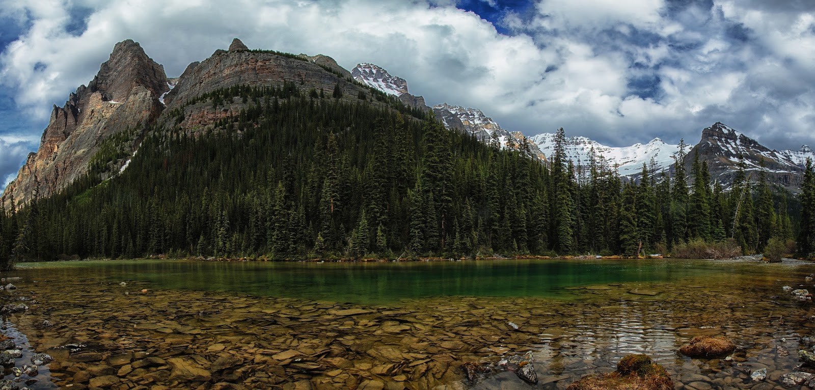
Lake O'Hara
All of the lakes below Oesa Lake end up at Seven Veils Falls and Lake O'Hara
I got back to camp and found a huge number (~25) of people gathered around the community campfire. It was a little chilly away from the fire so I headed into one of the shelters to cook dinner. After dinner, I headed back up the road towards the lake since there was still plenty of light at 10pm. I took a couple of photos, but mostly just watched the light change on the lake. Then off to bed.
I woke up, had breakfast and packed up, then went to see more of the area. Today I was going to climb up to Wiwaxy Gap a ~1600' climb and one of the only other trails that was open.
First a short hike along the shore of Lake O'Hara

Then up a whole bunch of switchbacks cut into the side of the mountain. The nice thing about all of the switchbacks is there were lots of photo opportunities.
Getting higher...
... and higher ...

... and higher (note the people in the bottom right)
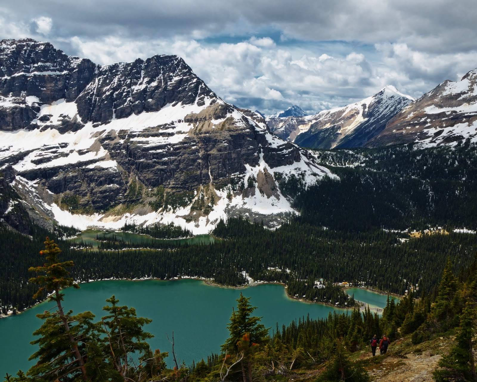
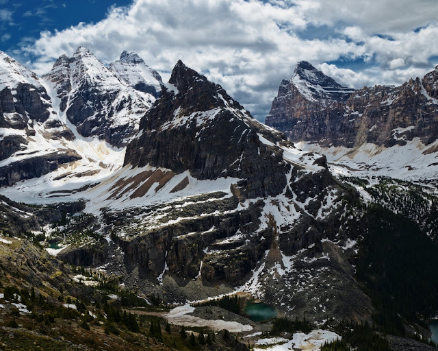
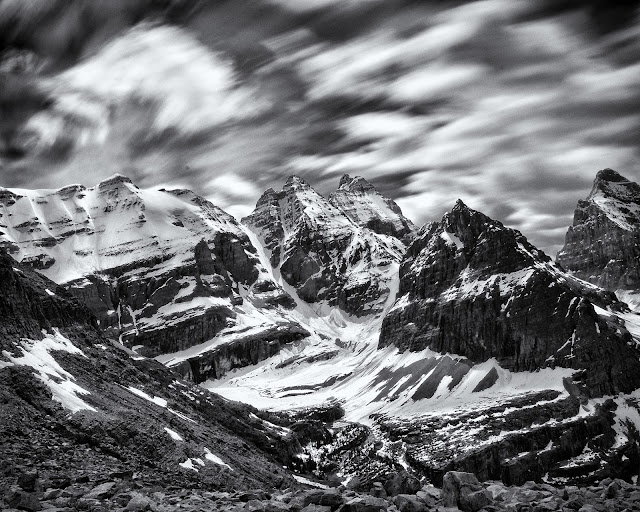
It was very windy at the gap, I immediately put on my fleece and my rain jacket. But the view was spectacular. This photo shows the route I took the day before towards Lake Oesa. The bottom right lake is O'Hara, in the middle far left is the lake where I lost the trail. I think Oesa is under all the snow at middle left below the peaks.

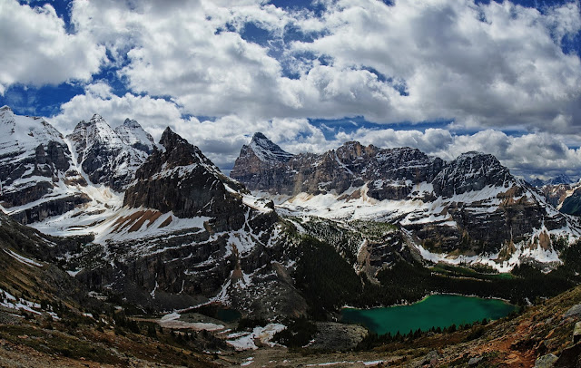
And a wide angle view of the whole valley.
I enjoyed the lunch time view and again played with some long exposures. Then I headed back down to see what else I could see.
The only other area that was reasonable was the one around Morning Glory Lakes and possibly towards Linda Lake, so that was next. I started up the trail towards the ACC Hut to check that out. The ACC Hut is in a great location, but I'm pretty sure I could not handle the crowds.
The ACC meadow and the path towards Morning Glory Lakes
And then continued down the trail. I did not take any photos since I was post-holing up to my crotch in places. After about an hour of hiking, I got to Morning Glory Lakes.

I talked to a couple people resting near the lakes about the trail to Linda Lake and they said it was a mess, lots of standing water, mud and snow but they had made it. At this point I had soaking wet feet from all the post-holing, so I did not care about wet feet, but checking the time I began to worry about missing the last bus at 6. So, I decided to avoid Linda Lake and head back towards the campground/bus stop.
I got back about 4:30 and there were a ton of people hanging out around the fire. It appeared most had gone hiking, but were ready to call it quits. I dried my socks and shoes by the fire and chatted with a couple people and then thought about catching the 5pm bus vs. hanging out for an extra hour. It turned out I had imagined a 5pm bus, so I walked down to Lake O'Hara one more time.
One last long exposure.
I got the last bus out of Lake O'Hara (6pm) and was at my car about 6:30. Unfortunately, the beer in the trunk was a little too warm to drink. So back to the Icefields Parkway and north to Waterfowl Lakes and the campground. Unfortunately, the campground was not scheduled to open until the end of June (probably the next weekend). So, I had a decision to make. Where to camp? I could drive further north on the Parkway and hope that I could find something or I could head back to Banff and get an early start the next day. Rampart Creek Campground was about 10 km north of the Glacier Lake Trailhead so that seemed like a reasonable destination. As I drove north, I had visions of just stealth camping somewhere close to the Trailhead or even hiking in to Glacier Lake a day early (that would have made a very late camp setup).
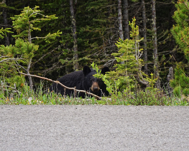
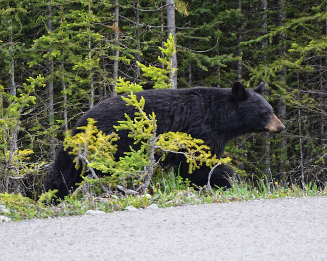
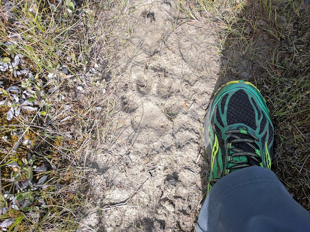
So, I was driving along, it is approaching 7:30pm, I still have tons of daylight left, but don't want to be setting up camp at 10:30 in the dark. As I came around a corner, there was a car pulled off to the side of the road. I slowed down and saw a bear poking around on the side and this time I had my camera with me.
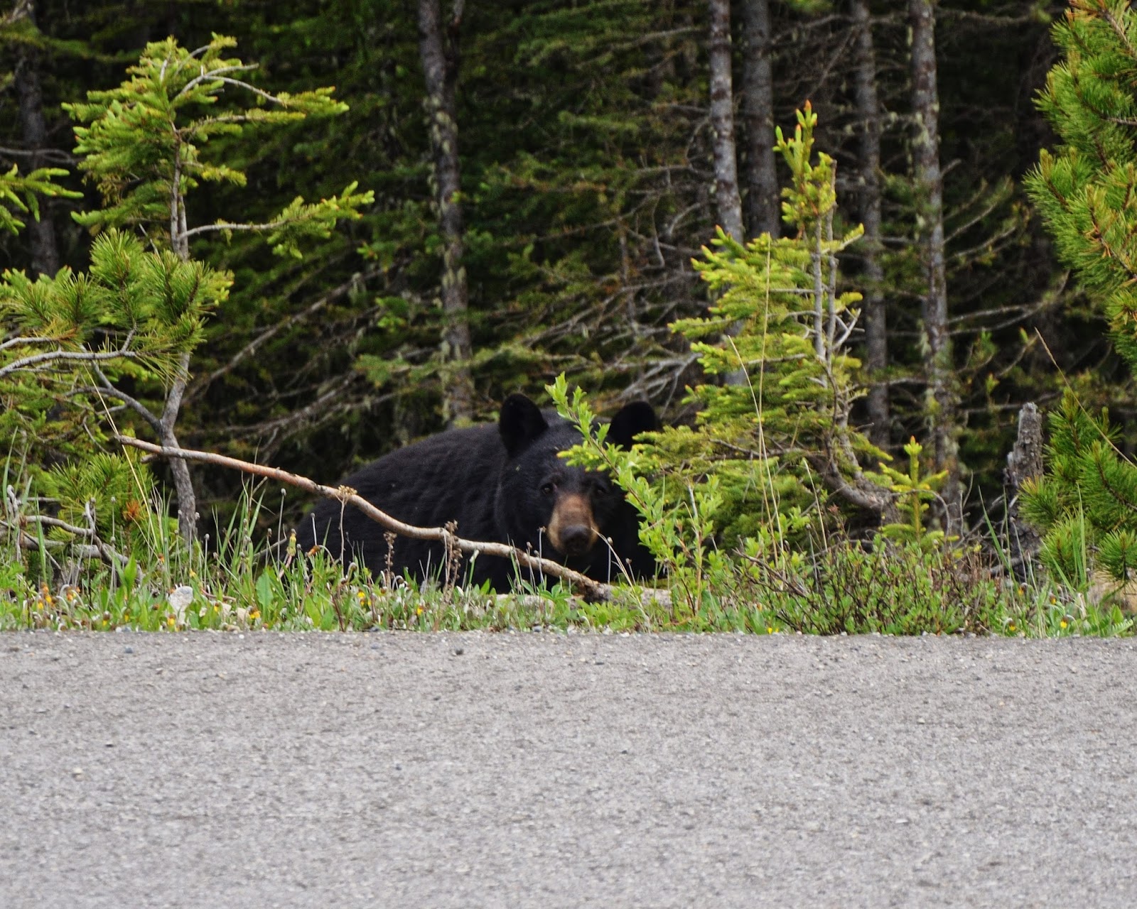

I took a some photos and left the bear in peace. I got to the Rampart Creek Campground and was happy to grab the first site I found. It turns out, I could have been more selective since I found some walk-in tent sites the next morning. Not a big deal, I wasn't going to be there long. I walked over to the registration board where someone said he had just seen a bear up on the road. He seemed pretty sketched out, but there were enough people in the campground that I wasn't worried. As I headed back to my site, I mentioned the bear siting to a neighbor and they said, "yeah, he just wandered through the campground about 10 minutes ago"
Now, my only dilemma was how to cool my beer. The site across the road had some young kids (mid-20s), I figured they would have a cooler and I could either stash my beer in their cooler while I set up camp or I could trade my warm beers for their cold ones. I walked over with my 4 beers, said hello, and made my proposal. They said "we don't have a lot of ice left, but you can use the cooler". Cool, I'm going to go check out the river and I'll be back in a little bit.
Saskatchewan River at Rampart Creek Campground


I played around at the river for a bit and then headed back to collect my beer and cook dinner. I decided that I did not need to drink 4 tall boys that night so I let them choose which beer I left behind. The mosquitoes were bad enough that after eating, I just sat in the car reading my book and drinking my beer.
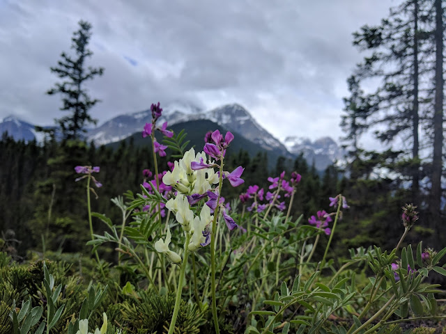
Woke up in the morning and had breakfast and then took my coffee and camera back to the river to see what I could find. Not a lot of river photos this morning, but tons of flowers. Talked briefly to the kids with the cooler. A couple guys were riding their bikes from Jasper to Banff and their girlfriends had met them at the campground with food and beer. Sounded like a good way to travel to me.
This is looking south along the Saskatchewan River, back towards where I was heading.

Day 5 & 6: Glacier Lake
I got to the Glacier Lake trailhead about 10am and headed down the trail. The first bit is through the forest with not much to see.

But there is a break in the trees that gives a nice view of what is ahead.
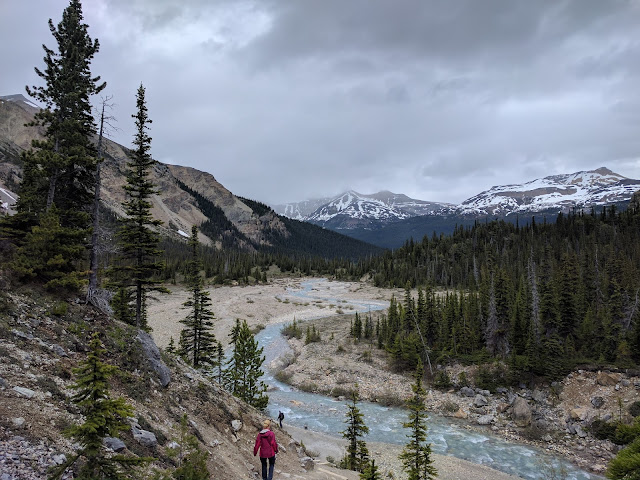
Then the Saskatchewan Rive, there is a very distinct trail along the river. I followed it a little way in both directions before crossing the bridge and heading to Glacier Lake.

After a little more hiking in the woods, you climb a short hill and get an amazing view of the Howse River valley below.

Howse River and the "famous" chairs, I suspect a lot of day hikers turn around at this point.
And then back into the forest for more hiking. Off to the side of the trail was this interesting marker/blaze carved into a tree.
1928 Topographical Survey

Then finally the "payoff", not too shabby, but very windy.
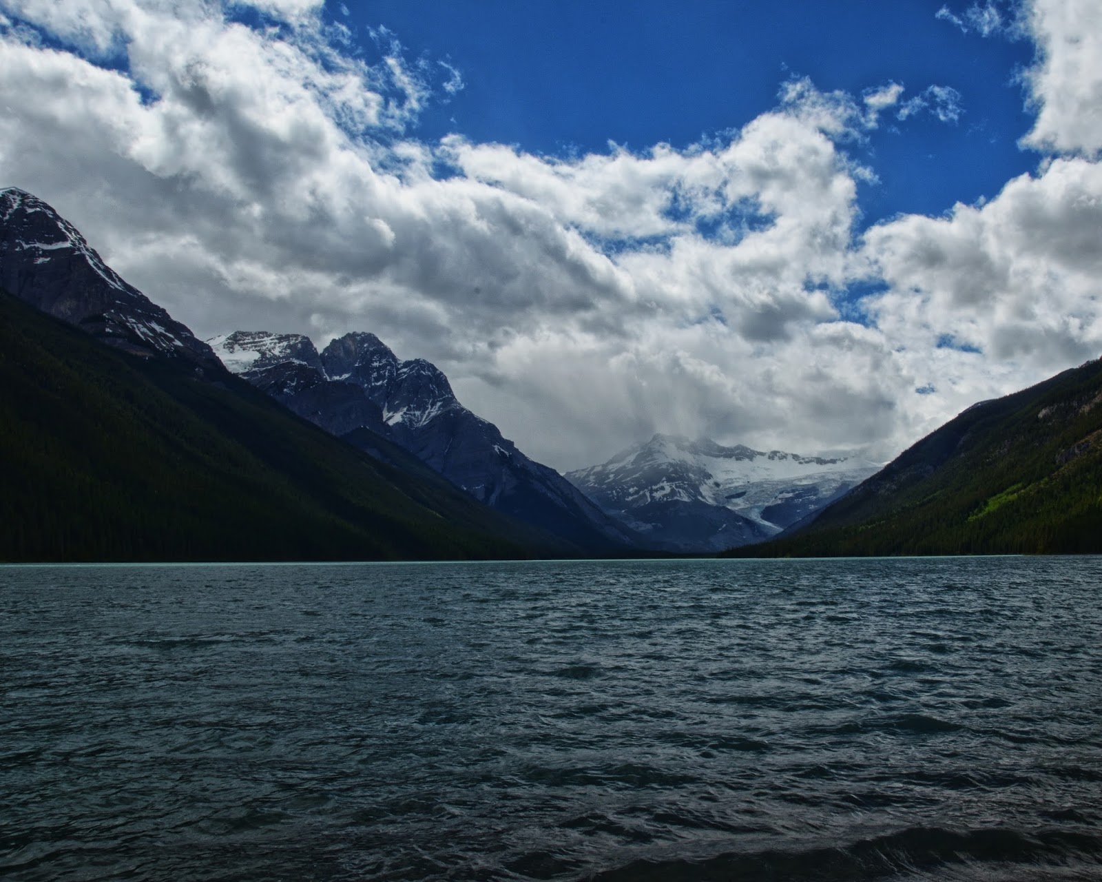
Glacier at the head of Glacier Lake.

I set up camp, hung my food and headed towards the head of the lake. The guide book mentioned a trail that followed the shore the whole length. Evidently it used to be maintained by the park, but no longer. Someone else must be doing the maintenance, because most of the deadfall had been chainsawed. The trail was very easy to foll and very pretty.

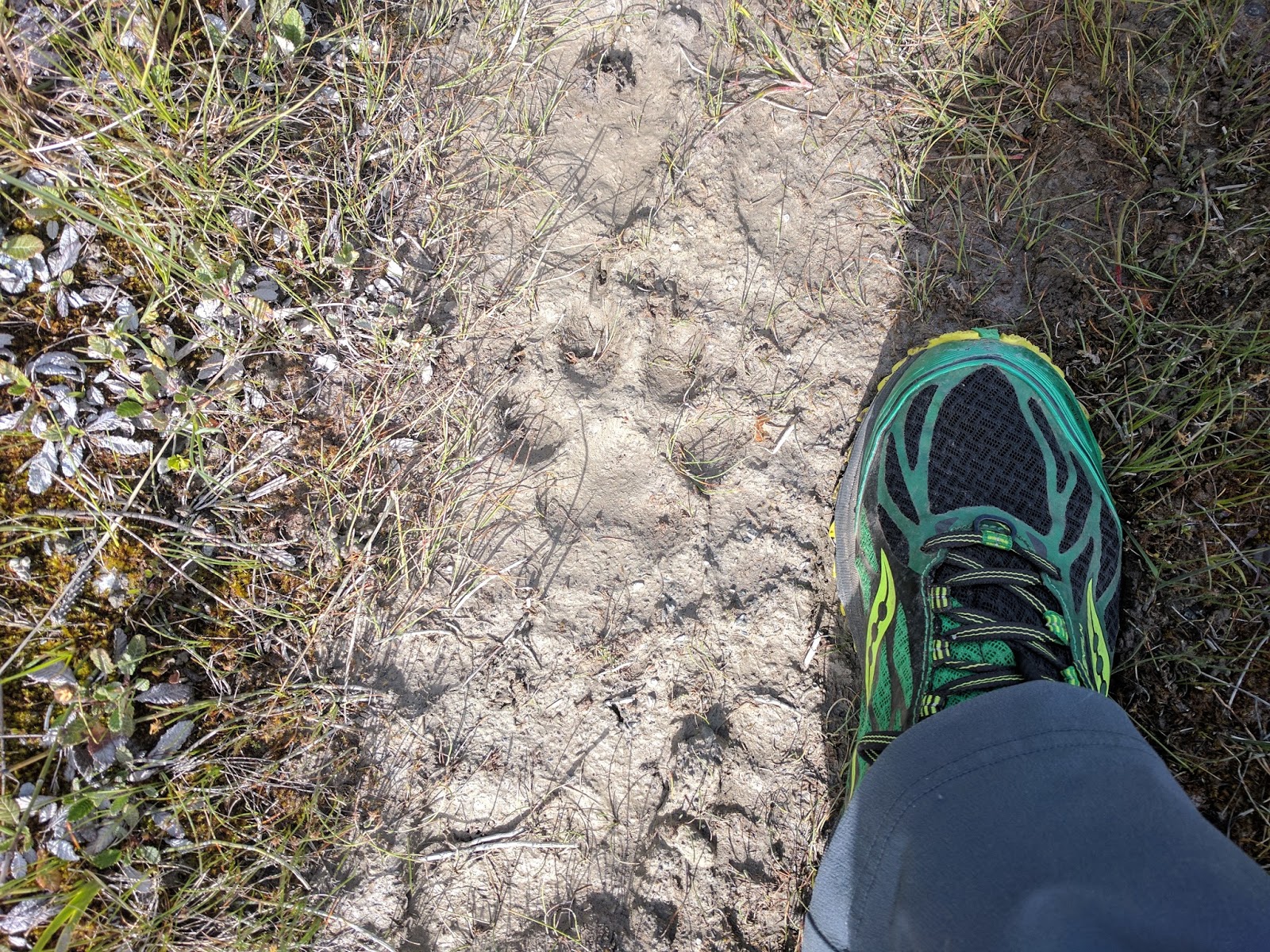
A little bit of local wildlife.
There were tons of flowers along the lakeshore.
I followed the user trail as far as I easily could, but...

... I started getting nervous about spooking a bear. Not to mention, I had not brought anything to eat or drink, so I headed back to camp.
I talked to a couple young women who had shown up as well as a threesome of people more my age and then cooked dinner and watched the lake.


Unfortunately, the wind then died down and the mosquitoes came out in force. I was very glad to have a DEET wipe. I took some photos with the last bit of charge in my batteries and then the two women built a campfire so I chatted with them a little bit more before heading to bed.
The next morning, I packed up and hung my pack and the took a side trail towards the Howse River. The older threesome had mentioned that the trail was a little overgrown, but that there was a great view of the river. They were right.

One last view of Glacier Lake, then back to the car and civilization
I got to the hotel in Banff about 3, took a shower and we went to find some beer in Banff. After little bit of bar hoping, we grabbed dinner and then back to the hotel. The next morning, we packed up and headed to the airport. Normally, I am very ready for trips to be over, but this time was different. Even with all of the trails buried in snow, there was still more to see. I think I will have to return, hopefully it won't take another 11 years like the last time.
Other things to note: Lake Louise is way too crowded for me to enjoy, especially if there are only a couple trails open. I probably won't go back there again. Lake O'Hara is also way too crowded when there are only a couple trails open. I want to go back, but a local said the best time is September, the larches are turning, the bugs are gone and it is getting cold enough to keep a lot of people away.
I have no desire to see the town of Banff ever again, way too expensive and way too crowded. I had a good breakfast at Wild Flower Bakery, I'd go back there again if it wasn't in Banff.
More photos and details here https://backpackandbeer.blogspot.com/2017/08/banff-2017.html
 . I got lucky and was just put on hold for about 15 minutes. If you don't want to deal with the bus, you can walk the road up (8 miles) and then if you don't have a campsite, you can ride the bus down. I think the driver said it is $5 to ride down. It also sounds like there are frequent no shows, so you could maybe hike the road and hope for a site to be available, but then you would be hiking the road with a full pack. In the end, I think you need to get lucky if you want to camp there.