Day 1
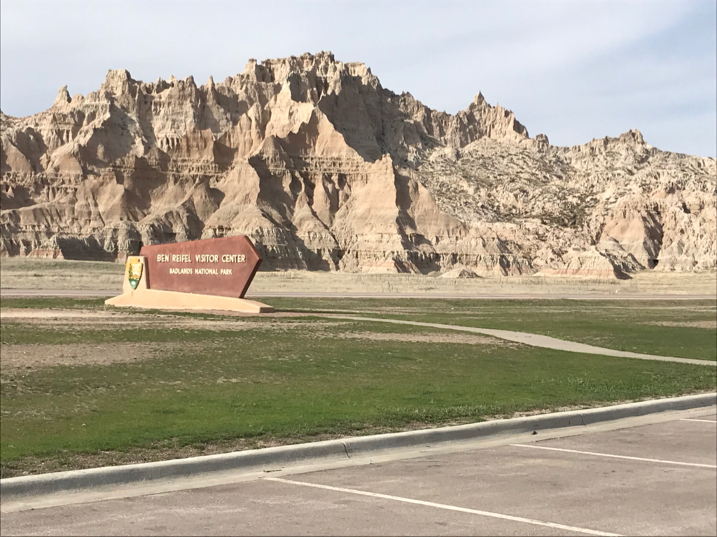
We arrived in the badlands around 4pm local time we had enough time to make it to the visitors center and stock up on some water before our hike and camp that night.
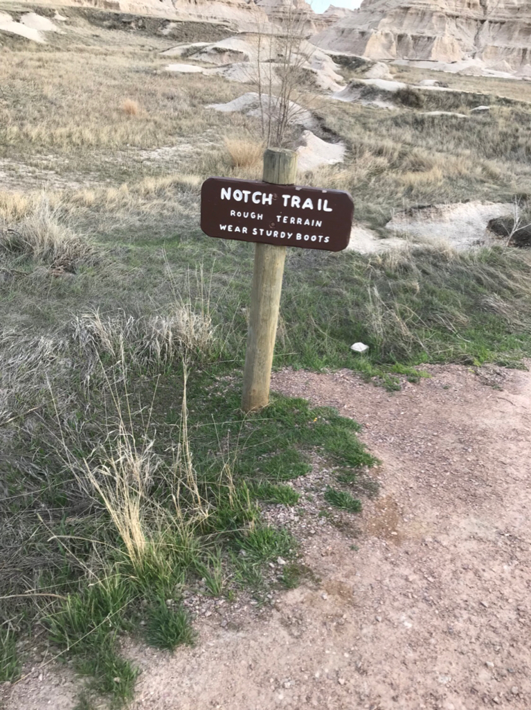
We started off with the notch trail it’s described as a strenuous hike but it is fairly easy with some minor scrambling required
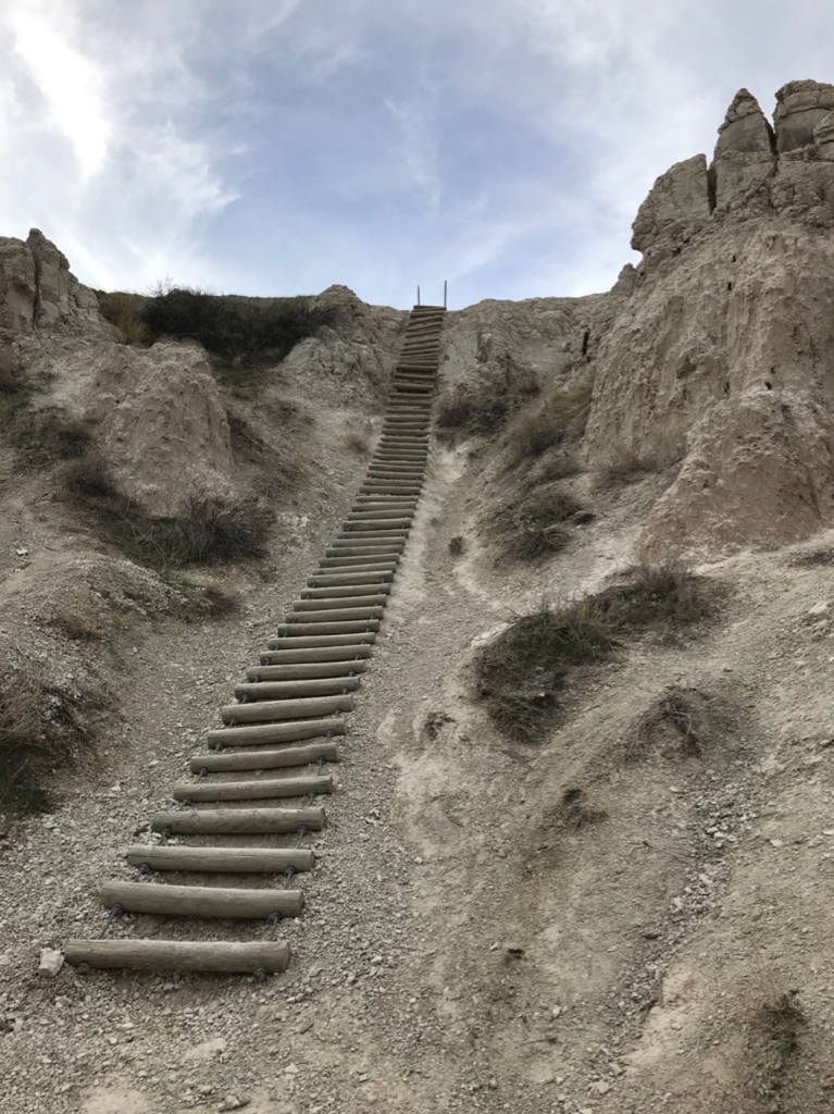
The hike begins winding through a canyon between the rising buttes and come the the infamous “ladder” 3/4 on the ladder is easily walkable but the last portion has to be climbed to the top
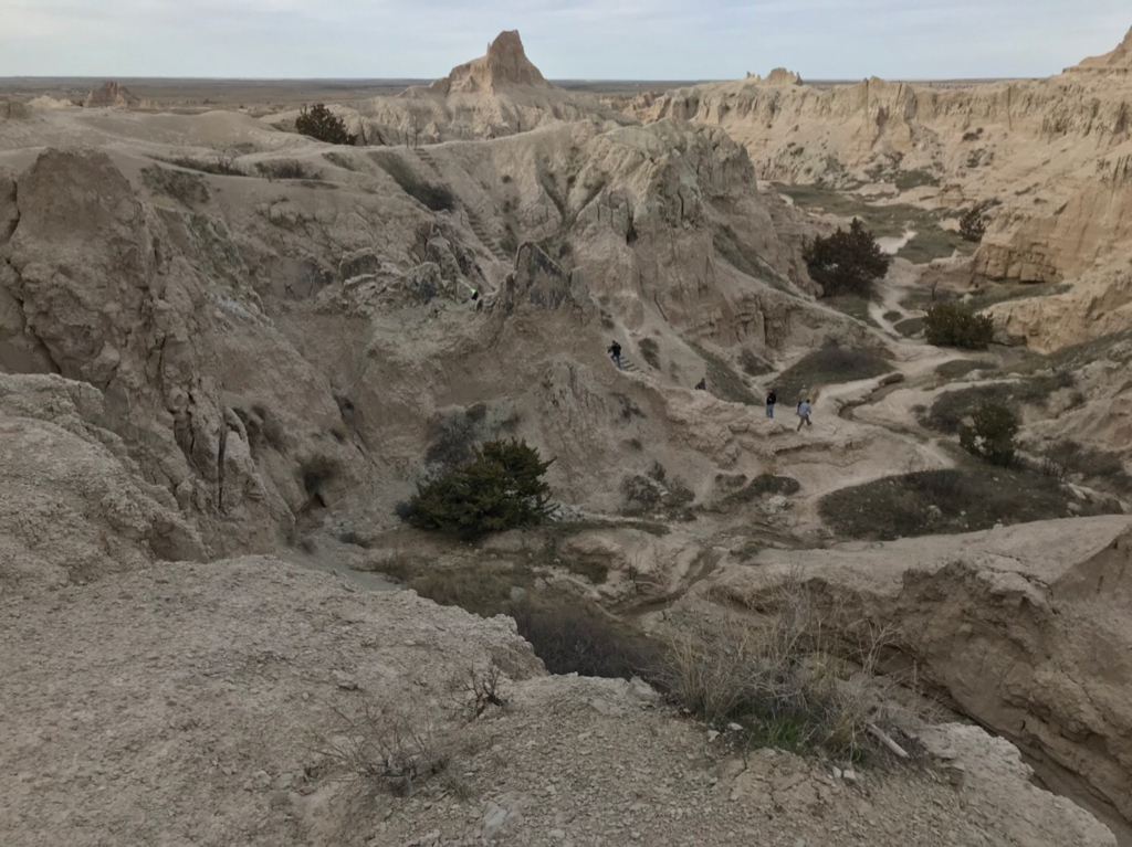
Once along the top you follow the ledge around and to the end of the trail at the notch here is a view of the ladder from the ledge
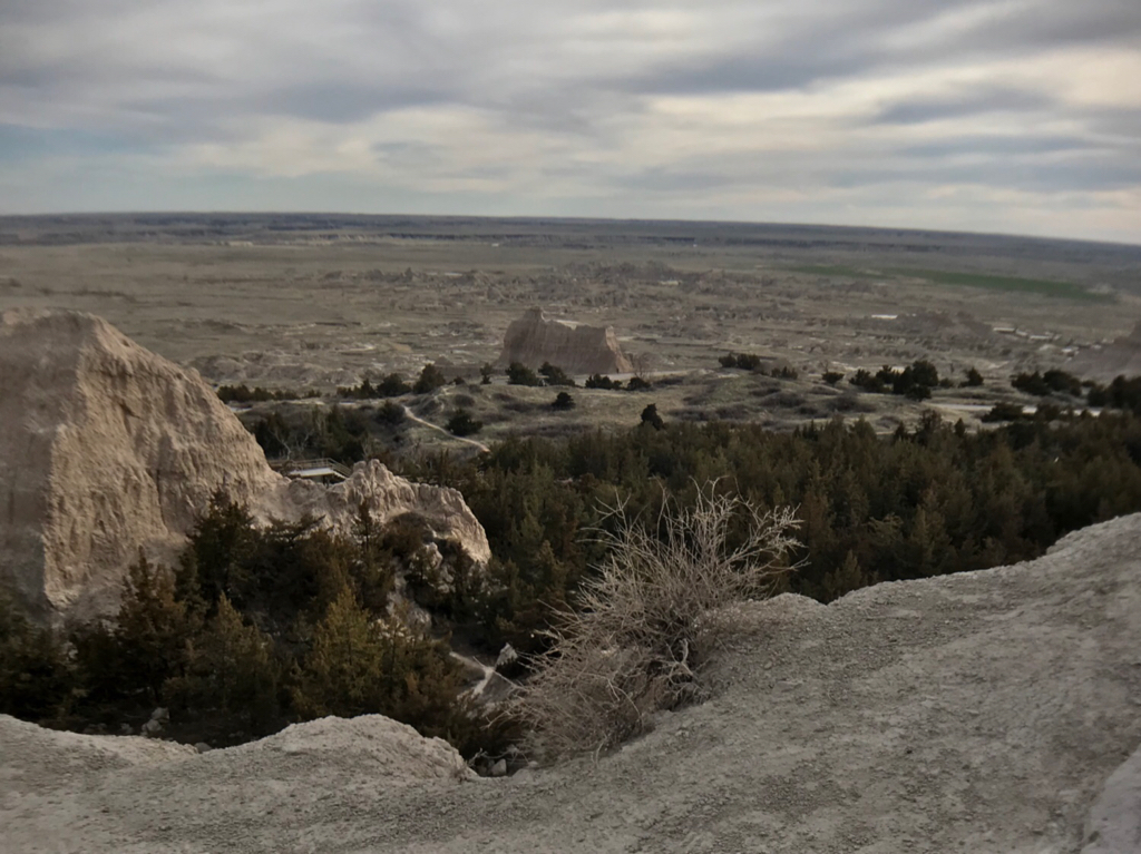
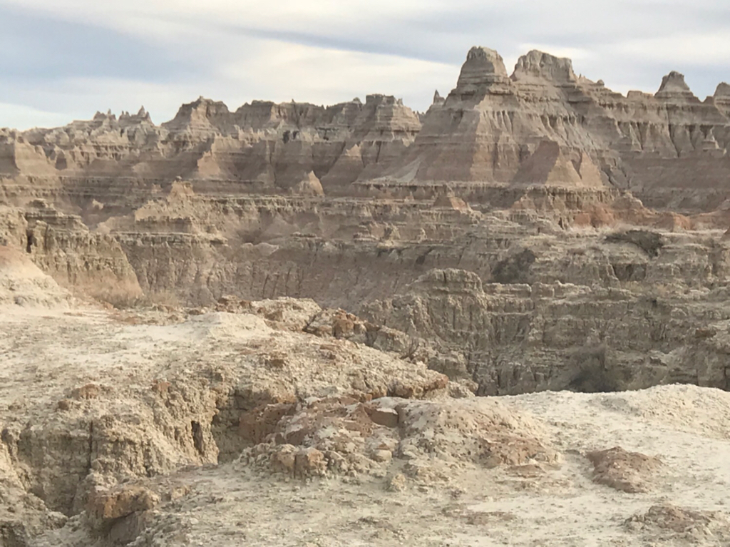
The notch itself is a wide elevated opening that provides an excellent viewpoint of the various formations in the distance and also some of the grasslands in the distance
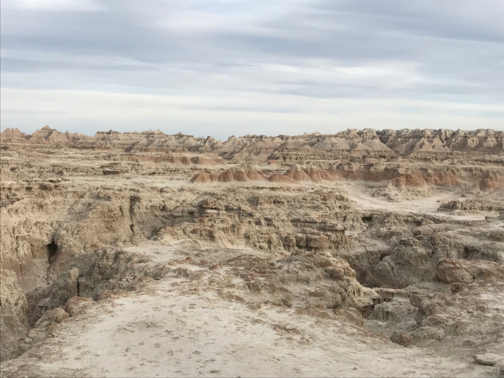
Round trip is 1.5 miles. From the trailhead we walked to the the window which I wouldn’t count as it’s own trail being that it is only 1/5th of a mile it’s more of an overlook. From there we continued on to the window. The trail itself is about 1 mike round trip it starts from a boardwalk and continues down a set of stairs leading to an open area of the badlands that is marked with numbered yellow posts so you walk to your post and search for the next. This was fairly easy trail but very scenic
We headed back to the car and decided it would be a good idea to see where we are camping for the night and try to set up before dark.
We stayed at the sage creek campground which is the free primitive campground in the prairie area of the park echo house is about 30-35 miles down the main road past all the overlooks and down the hilly dirt road. We ended up arriving at dusk and set up camp and called it a night
Day 2
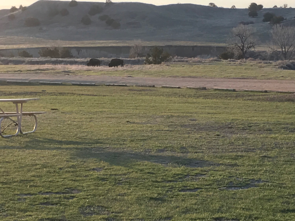
The sage creek campground is excellent and I would definitely stay here again (I actually did on this trip). Upon waking in the morning in addition to the vast rolling prairie we were also treated with buffalo grazing near camp
The important thing to remember is bring lots of water to this campground because there is no running water and the water that is here is not filterable per the park. But they do have put toilets so that is a bonus.
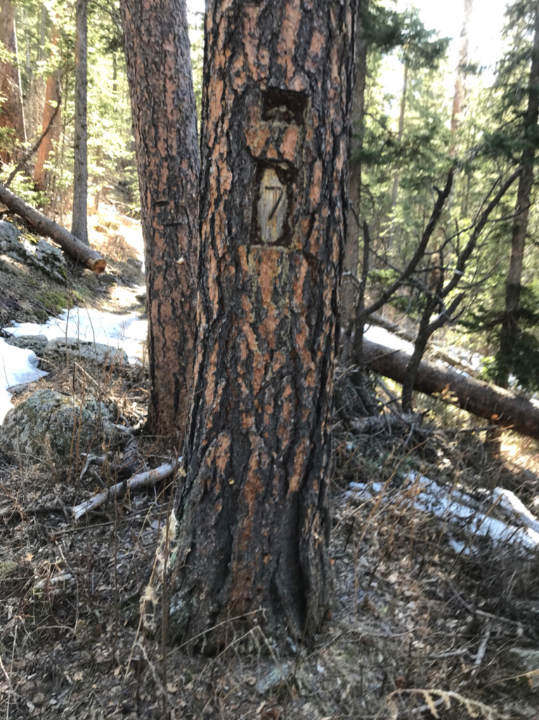
We broke camp and set out for the black hills it was about an hour to an hour and a half drive from badlands our starting point was grizzly bear creek trail #7 which turned out was more difficult to get to the trail head we were directed by staff to drive down the iron mountain road which was excellent it is a long drive with views of Rushmore and the surrounding mountains and hills there are several 1 car tunnels on the 2 way road which wasn’t a issue at the time we went we continued on to the trailhead down a dirt road and set off again
#7 starts at 5000 ft elevation and winds through old growth cedar Forrest the cedar smell fills the air as you start the trail following the creek
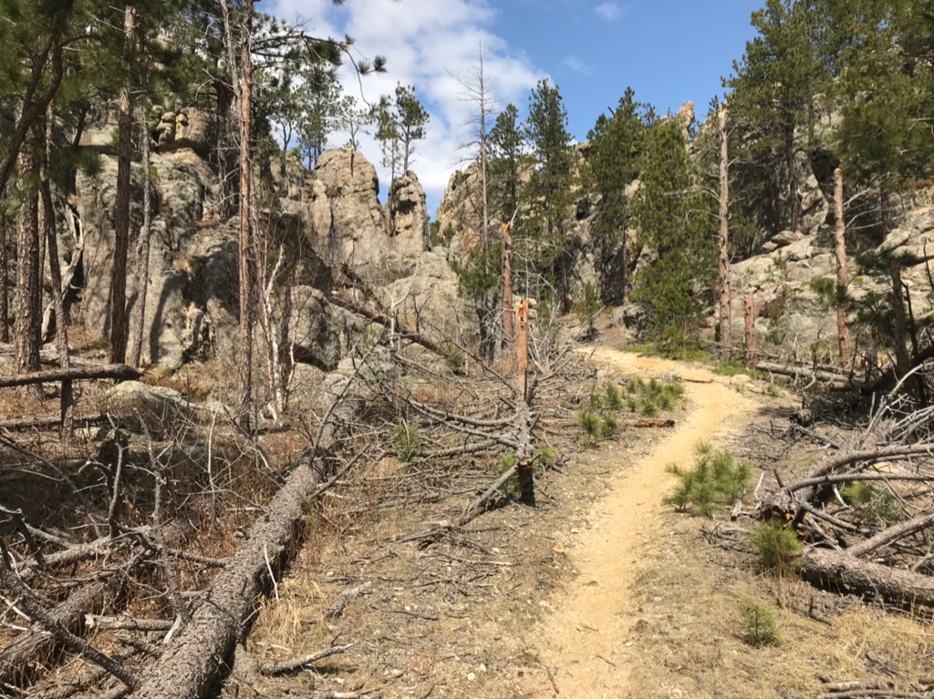
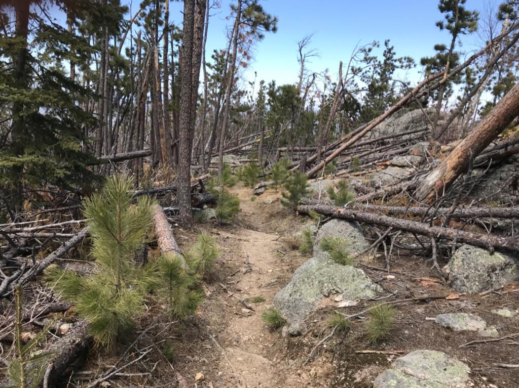
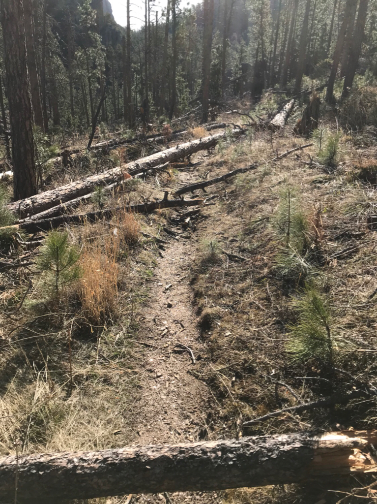
We came to the first few trees that we had to climb over under at this point. At this time it was kind of fun it is a “rugged trail that goes through the most remote areas of the black elk wilderness ” as they describe it.
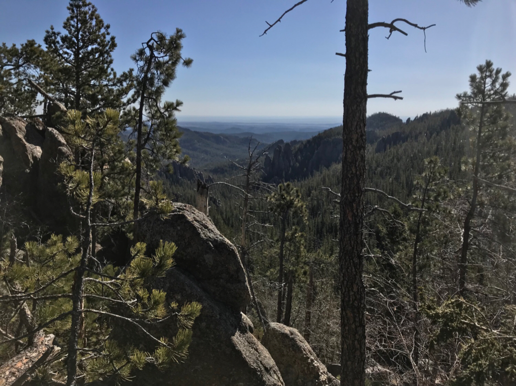
As the trail continues it started to gain elevation near mile 3 slowly to start then near mile 4.5 or so it increases greatly. This definitely does increase the difficulty but it is compounded by the amount of large trees that are blocking the trail close to every few hundred yards or sooner. The trail has 1500 feet of elevation gain most of which is occurs near the last few miles of the trail. As the trail climbs the views of the surrounding areas start to be visible
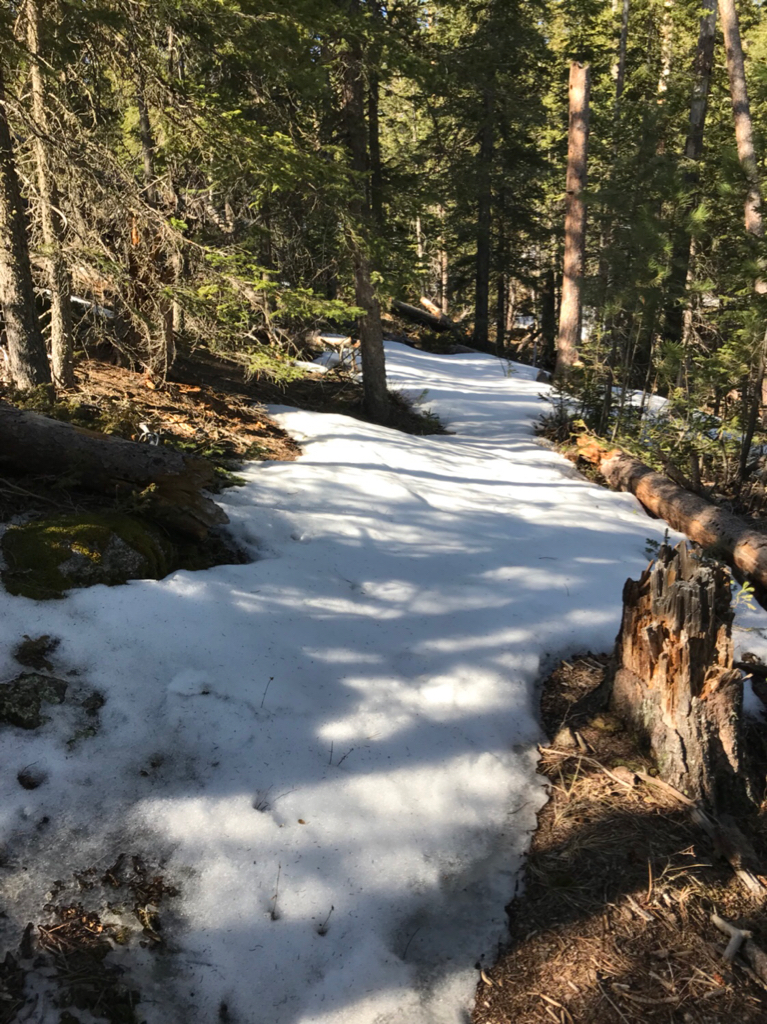
Ice and snow became sporadic on the trail as we climbed some parts completely covered the trail markers are sporadic and at no regular interval
We ended up setting up camp near somewhere near the last 1 -3/4 of a mile of the trail. The guy who I was with was fairly inexperienced and was unable to go on for the day it was also getting close to sunset so we called it a night. Camp ended up being a small clear patch amongst the ice snow and thorn bushes I wasn’t crazy about the site but at least there were no trees that appeared close to falling in the area. I came to see the next day that this was the best spot that would be compared to the rest of the trail.
Day 3
After a cold night and morning we broke camp started the day.
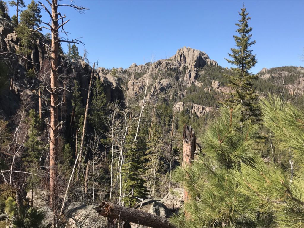
Trails increasingly ice and snow covered with elevation gain parts of the trail were still knee deep snow while challenging the last .5 miles of this trail had great views once we rose out of the trees and got among the cliffs that were towering over us the day before
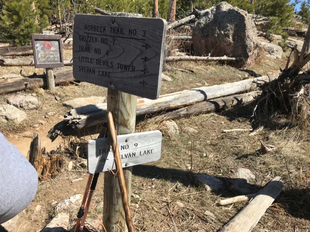
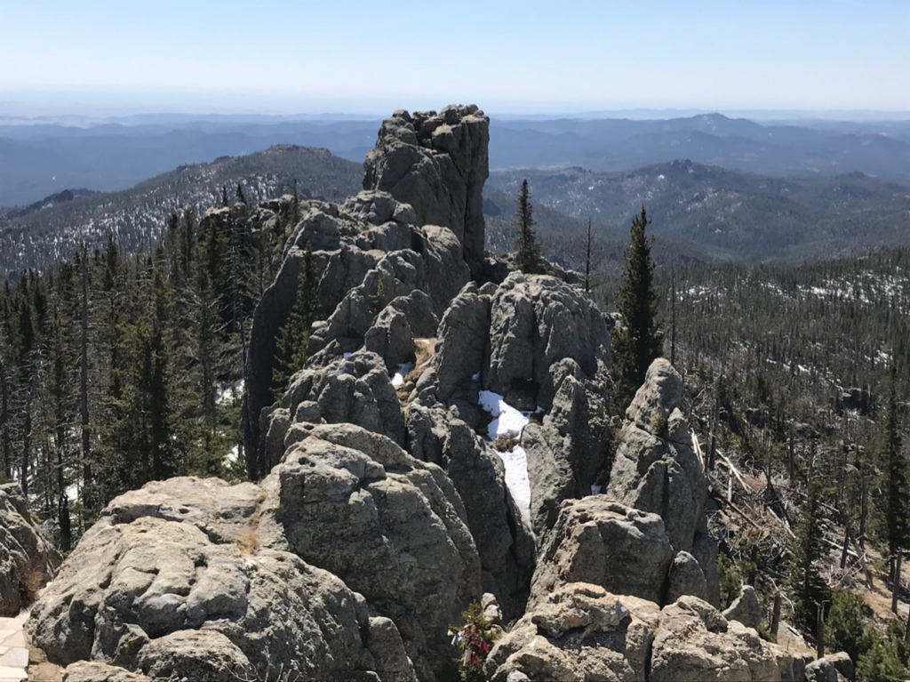
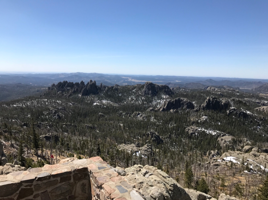
The end of #7 took us to the end of the norbeck trail it was about .65 mile hike to Harney Peak trail from there and an additional .5 miles to the peak up trail rock stairs and then finally 5-7 flights of stairs into the tower these would be the best sections of trail we would see in black hills. There were minimal obstacles or trail obstruction which was a nice break.
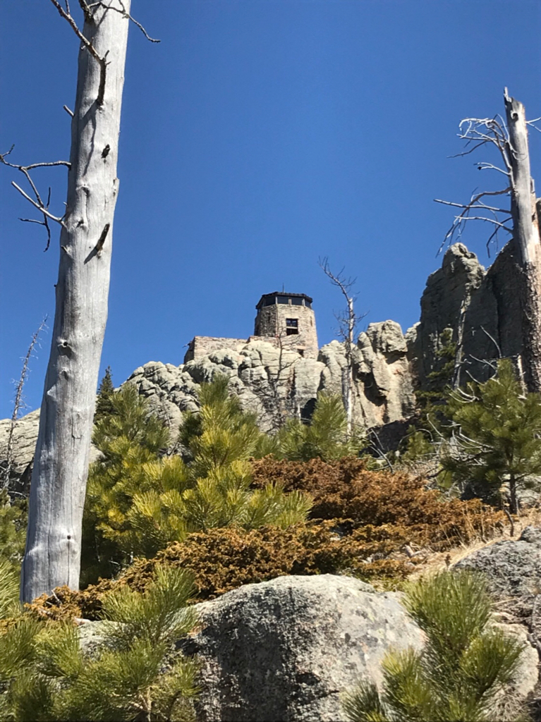
The views from the top made the effort worth it for sure elevation was 7242 feet
After the break we back tracked down the stairs back to the Harney Peak trail and headed north almost all down hill travel down ice and snow covered switchbacks I was glad I packed my microspikes for sure! After the now cleared it took us over ridges that were covered with down trees on and off trail became more frequent
We hiked 4 miles to willow creak trail which winds softly over several hills and along the side overlooking a highway willow creek was 2.8 miles to centennial trail we began to have issues with filtering water at this point the filter I brought began to filter slowly and at times barely trickle even after troubleshooting it we filtered what we could and made the decision to start heading back to the car the next day. We walked a 1-1.5 miles down centennial to cut off some time for tomorrow and search for a campsite that would be decent.
Day 4
Got out of the tent in the morning and was thankful that’s for sure! There were several large branches that had fallen about 3 feet away from our tents but no damage to us or the tents we set off for the day still having about 6.5 or so miles to get to grizzly bear creek.
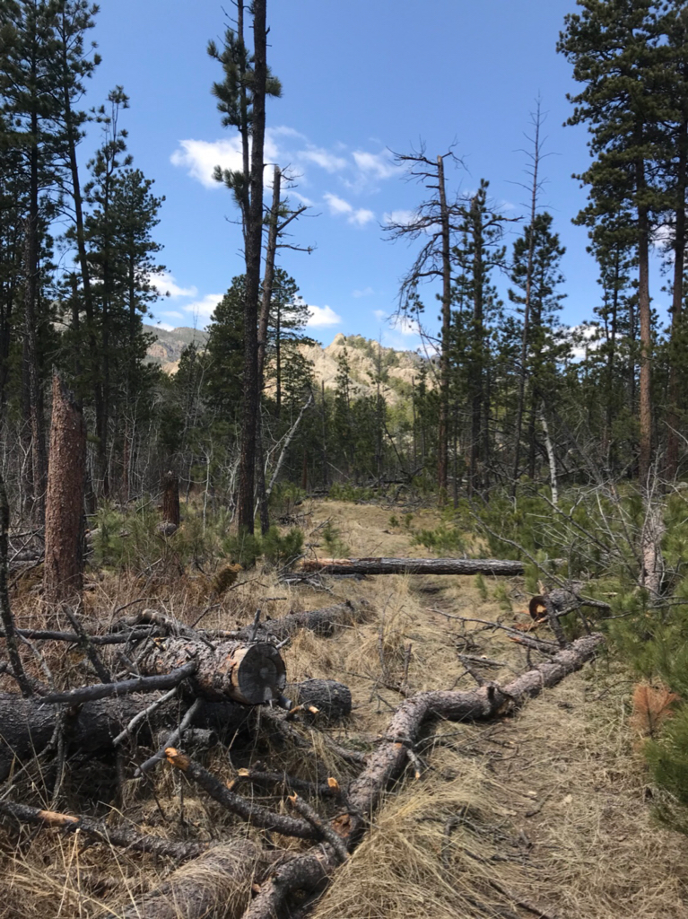
The hells canyon portion of the centennial trail is definitely a challenge the terrain frequently changes and the downed trees are the most frequent here some switchbacks are completely covered not across but on the length of the trail
From the grizzly bear creek intersection it was about 3/4 mile back to the car we celebrated with some real food then decided to head back to the badlands for 1 more day and camp out there after stocking up on water.
We checked out some of the overlooks at badlands and went to set up camp in the high winds and relax before heading home the next day.
All in all it was an excellent and fun trip while it was challenging but that’s part of the fun I will say with the quality of the trails I probably won’t go back to black hills after day 2 of climbing over trees it gets old. Because you end up spending more time negotiating these obstacles than making progress on the trail. In addition to that decent campsites are very limited because of the amount of off trail downed trees and most spots that are clear have trees that are about to fall so it creates another challenge
After talking to one of the rangers after the hike they said that the majority were from a storm in 2013 that all got knocked down and in addition to those whey have had a lot that were downed in this last winter storm and are still falling.
The badlands though is a different story I would go back there for sure I would like to do some of the longer trails in the park. Even driving in or near the park is very surreal and definitely something to be experienced firsthand pictures just don’t do it justice.
Sent from my iPhone using Tapatalk
We arrived in the badlands around 4pm local time we had enough time to make it to the visitors center and stock up on some water before our hike and camp that night.
We started off with the notch trail it’s described as a strenuous hike but it is fairly easy with some minor scrambling required
The hike begins winding through a canyon between the rising buttes and come the the infamous “ladder” 3/4 on the ladder is easily walkable but the last portion has to be climbed to the top
Once along the top you follow the ledge around and to the end of the trail at the notch here is a view of the ladder from the ledge
The notch itself is a wide elevated opening that provides an excellent viewpoint of the various formations in the distance and also some of the grasslands in the distance
Round trip is 1.5 miles. From the trailhead we walked to the the window which I wouldn’t count as it’s own trail being that it is only 1/5th of a mile it’s more of an overlook. From there we continued on to the window. The trail itself is about 1 mike round trip it starts from a boardwalk and continues down a set of stairs leading to an open area of the badlands that is marked with numbered yellow posts so you walk to your post and search for the next. This was fairly easy trail but very scenic
We headed back to the car and decided it would be a good idea to see where we are camping for the night and try to set up before dark.
We stayed at the sage creek campground which is the free primitive campground in the prairie area of the park echo house is about 30-35 miles down the main road past all the overlooks and down the hilly dirt road. We ended up arriving at dusk and set up camp and called it a night
Day 2
The sage creek campground is excellent and I would definitely stay here again (I actually did on this trip). Upon waking in the morning in addition to the vast rolling prairie we were also treated with buffalo grazing near camp
The important thing to remember is bring lots of water to this campground because there is no running water and the water that is here is not filterable per the park. But they do have put toilets so that is a bonus.
We broke camp and set out for the black hills it was about an hour to an hour and a half drive from badlands our starting point was grizzly bear creek trail #7 which turned out was more difficult to get to the trail head we were directed by staff to drive down the iron mountain road which was excellent it is a long drive with views of Rushmore and the surrounding mountains and hills there are several 1 car tunnels on the 2 way road which wasn’t a issue at the time we went we continued on to the trailhead down a dirt road and set off again
#7 starts at 5000 ft elevation and winds through old growth cedar Forrest the cedar smell fills the air as you start the trail following the creek
We came to the first few trees that we had to climb over under at this point. At this time it was kind of fun it is a “rugged trail that goes through the most remote areas of the black elk wilderness ” as they describe it.
As the trail continues it started to gain elevation near mile 3 slowly to start then near mile 4.5 or so it increases greatly. This definitely does increase the difficulty but it is compounded by the amount of large trees that are blocking the trail close to every few hundred yards or sooner. The trail has 1500 feet of elevation gain most of which is occurs near the last few miles of the trail. As the trail climbs the views of the surrounding areas start to be visible
Ice and snow became sporadic on the trail as we climbed some parts completely covered the trail markers are sporadic and at no regular interval
We ended up setting up camp near somewhere near the last 1 -3/4 of a mile of the trail. The guy who I was with was fairly inexperienced and was unable to go on for the day it was also getting close to sunset so we called it a night. Camp ended up being a small clear patch amongst the ice snow and thorn bushes I wasn’t crazy about the site but at least there were no trees that appeared close to falling in the area. I came to see the next day that this was the best spot that would be compared to the rest of the trail.
Day 3
After a cold night and morning we broke camp started the day.
Trails increasingly ice and snow covered with elevation gain parts of the trail were still knee deep snow while challenging the last .5 miles of this trail had great views once we rose out of the trees and got among the cliffs that were towering over us the day before
The end of #7 took us to the end of the norbeck trail it was about .65 mile hike to Harney Peak trail from there and an additional .5 miles to the peak up trail rock stairs and then finally 5-7 flights of stairs into the tower these would be the best sections of trail we would see in black hills. There were minimal obstacles or trail obstruction which was a nice break.
The views from the top made the effort worth it for sure elevation was 7242 feet
After the break we back tracked down the stairs back to the Harney Peak trail and headed north almost all down hill travel down ice and snow covered switchbacks I was glad I packed my microspikes for sure! After the now cleared it took us over ridges that were covered with down trees on and off trail became more frequent
We hiked 4 miles to willow creak trail which winds softly over several hills and along the side overlooking a highway willow creek was 2.8 miles to centennial trail we began to have issues with filtering water at this point the filter I brought began to filter slowly and at times barely trickle even after troubleshooting it we filtered what we could and made the decision to start heading back to the car the next day. We walked a 1-1.5 miles down centennial to cut off some time for tomorrow and search for a campsite that would be decent.
Day 4
Got out of the tent in the morning and was thankful that’s for sure! There were several large branches that had fallen about 3 feet away from our tents but no damage to us or the tents we set off for the day still having about 6.5 or so miles to get to grizzly bear creek.
The hells canyon portion of the centennial trail is definitely a challenge the terrain frequently changes and the downed trees are the most frequent here some switchbacks are completely covered not across but on the length of the trail
From the grizzly bear creek intersection it was about 3/4 mile back to the car we celebrated with some real food then decided to head back to the badlands for 1 more day and camp out there after stocking up on water.
We checked out some of the overlooks at badlands and went to set up camp in the high winds and relax before heading home the next day.
All in all it was an excellent and fun trip while it was challenging but that’s part of the fun I will say with the quality of the trails I probably won’t go back to black hills after day 2 of climbing over trees it gets old. Because you end up spending more time negotiating these obstacles than making progress on the trail. In addition to that decent campsites are very limited because of the amount of off trail downed trees and most spots that are clear have trees that are about to fall so it creates another challenge
After talking to one of the rangers after the hike they said that the majority were from a storm in 2013 that all got knocked down and in addition to those whey have had a lot that were downed in this last winter storm and are still falling.
The badlands though is a different story I would go back there for sure I would like to do some of the longer trails in the park. Even driving in or near the park is very surreal and definitely something to be experienced firsthand pictures just don’t do it justice.
Sent from my iPhone using Tapatalk