Yvonne
I lava it!!!
- Joined
- Jan 19, 2012
- Messages
- 4,175
Backpacking the Winds: From Elkhart TH to Titcomb Basin, July 2018
When my friend Lisa asked me if I wanted to join her to backpack to Titcomb Basin in the Wind River range, I couldn't say no. This was a trip I wanted to do for years. Despite barely being in shape and with all my lung and breathing issues, I agreed to join her. Lisa herself was not in great shape, so I felt a bit more comfortable joining her on the trip.
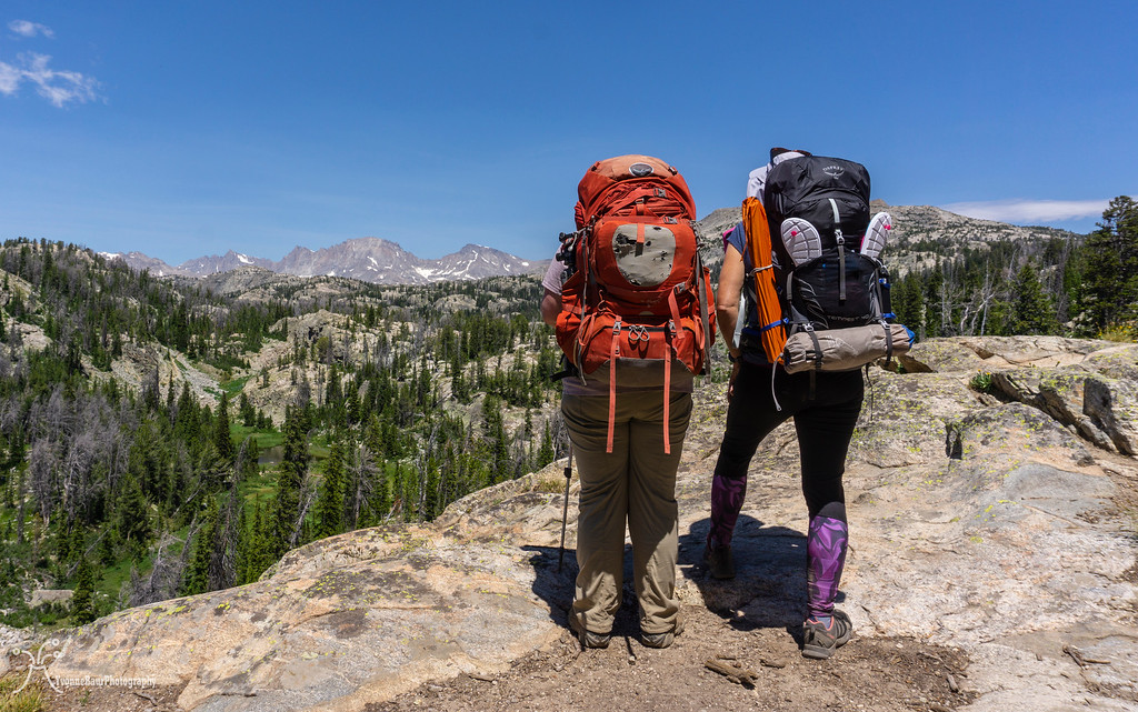
Another issue I had to solve was to get some backpacking gear that would work in high elevation mountain camps. I had a summer sleeping bag, pad, small solo tent, and a stove, but that was it pretty much. In one of the local outdoor stores, I found a really lovely lightweight 40L backpack. This pack would offer more than enough space for a 5-day trip, and I wasn't wrong with the calculations. I even had enough space for my little camp chair.
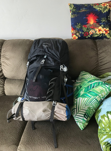
Fully packed and ready to go
The day of our trip came soon, and I headed up north, where I met with Lisa in Salt Lake City. We packed my stuff in her car, grabbed some dinner on the way and were up north toward Pine Dale. We arrived around 11 pm at the Elkhart trailhead and slept in the car. This would give us an early start tomorrow morning. I didn't sleep so well, but the high altitude of more than 9,000 ft might have been the culprit.
Day 1:
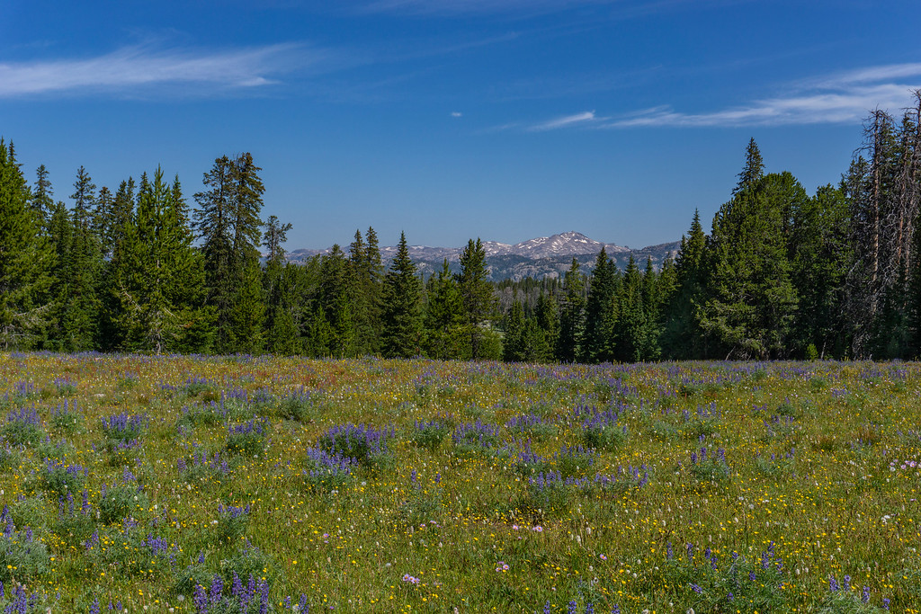
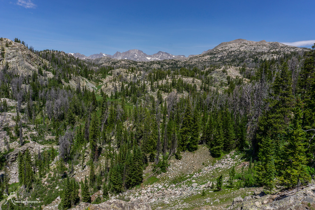
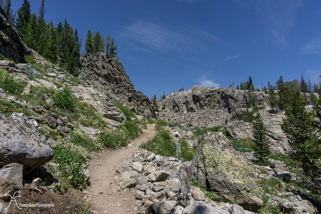
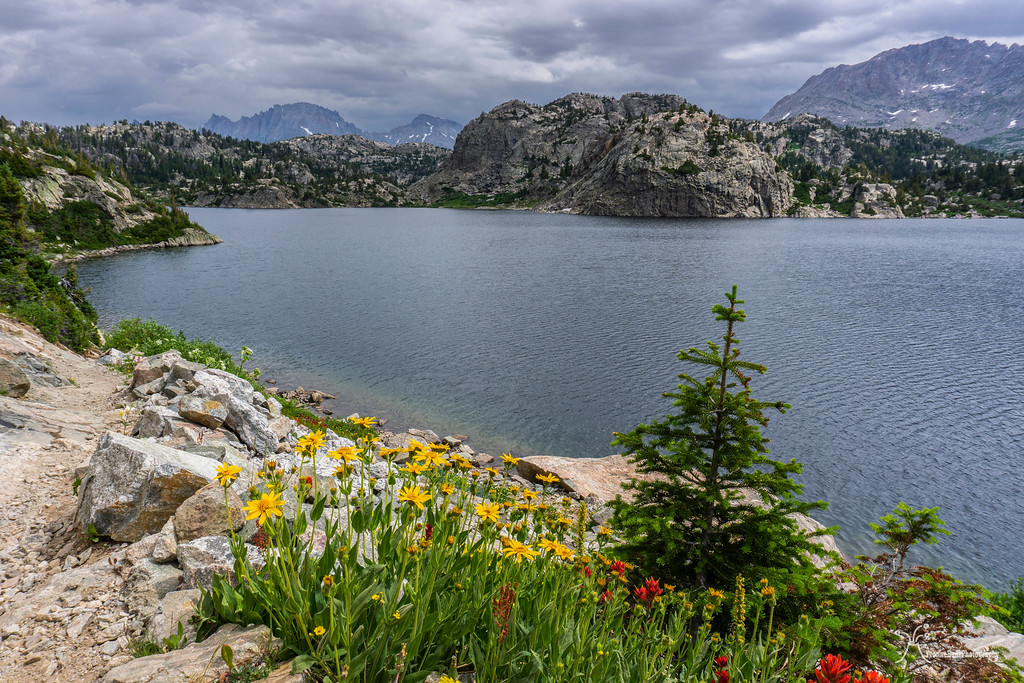
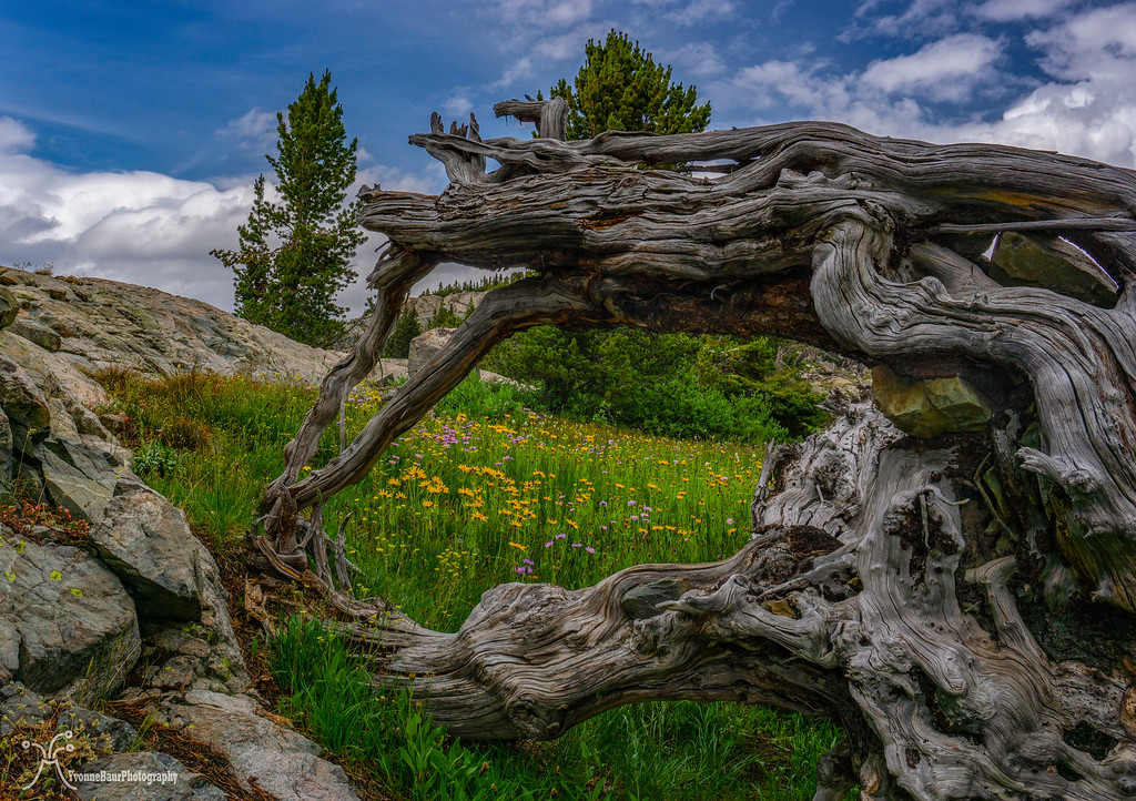
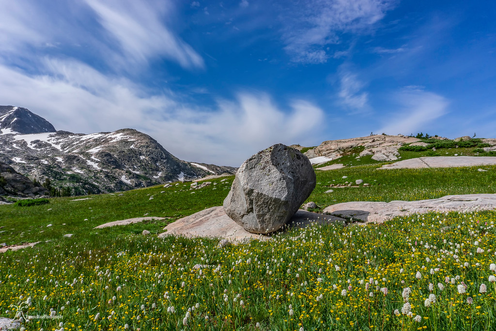
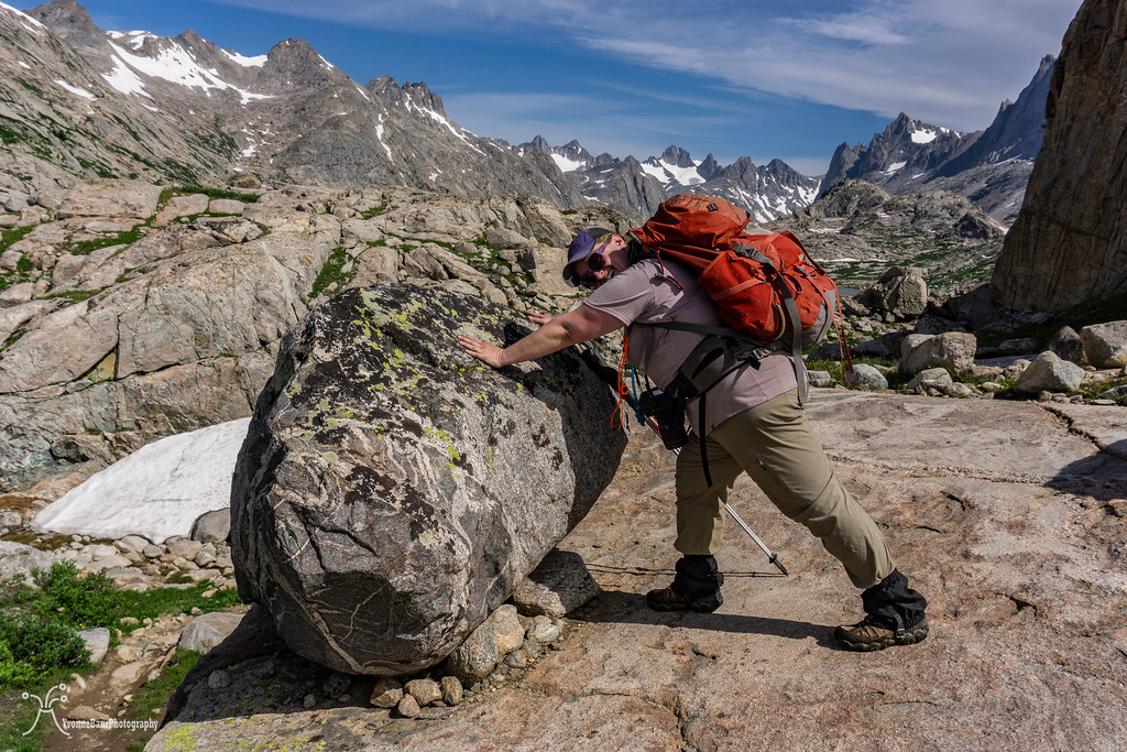
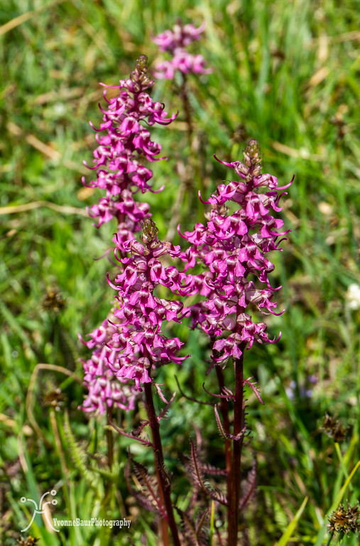
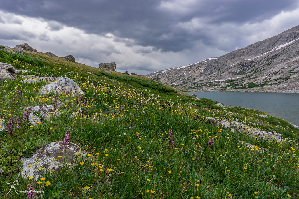
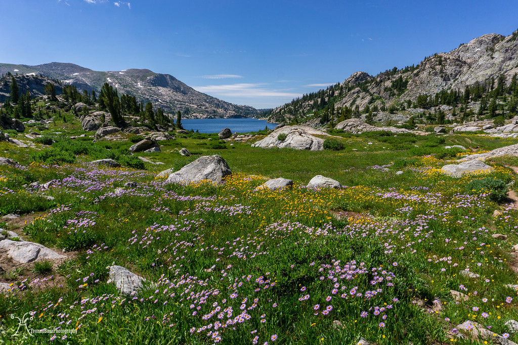
We woke up at sunrise, had a quick breakfast, and finished packing up our packs. The trailhead itself was pretty packed and busy, and we were not the only ones that slept in their cars. And on the way we went. The first mile or two was through a forest of lodgepole pines, and we followed Pole Creek as it meandered next to the trail. Even here in the forested area, we already encountered a lot of wildflowers, and unfortunately, the first mosquitoes. Frequent photo stops allowed us to adjust to the elevation and move forward at a leisurely pace. The first meadow opened up and provided the first excellent views of all the mountain goodness ahead of us.
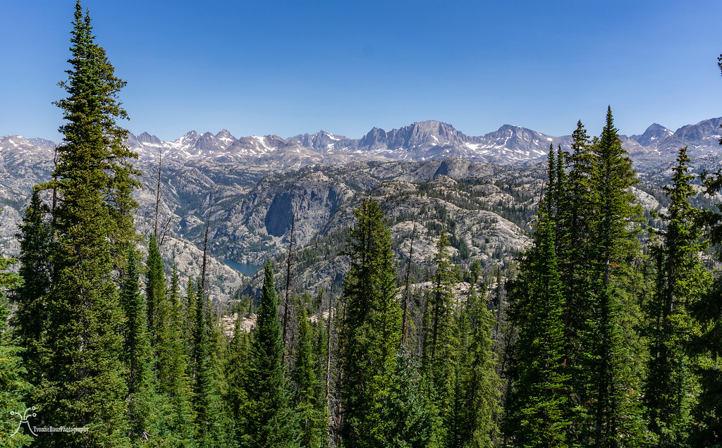
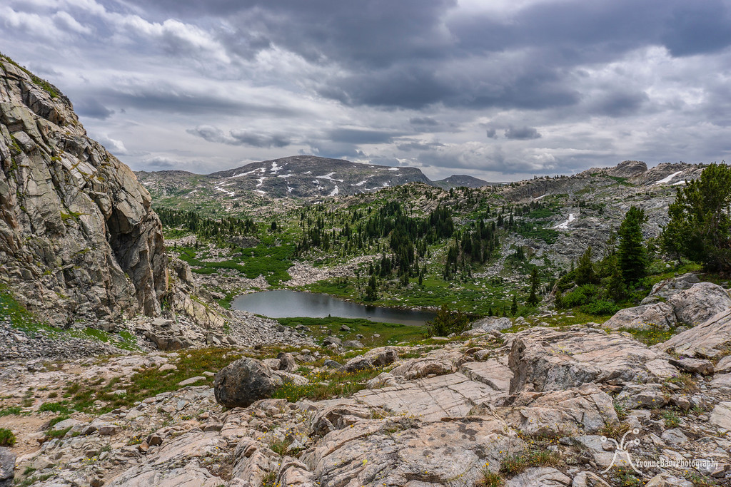
Our next stop was at Photographers Point, and the awe-inspiring views required us to stop for a bit and to enjoy the views to a full extent. Several lakes were nestled into the valley below, surrounded by granite peaks of the range.
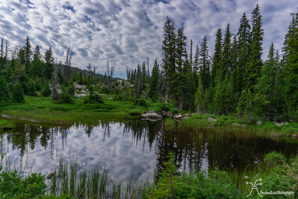
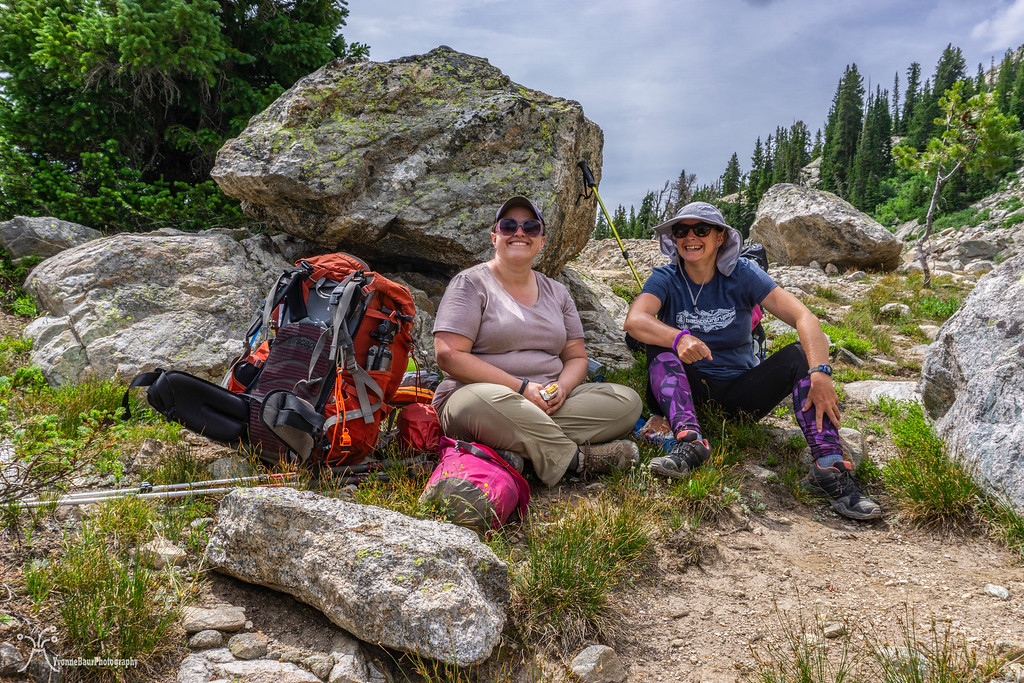
We continued and crossed another meadow, which was fully covered in wildflowers and small tarns. It was such a serene scenery. Near Eklund Lake, we turned off Pole Creek trail and on to Seneca Lake trail. At Barbara Lake, we stopped for a small break and embraced the scenery.
Meadow and tarn near Eklund Lake
short break at Barbara Lake
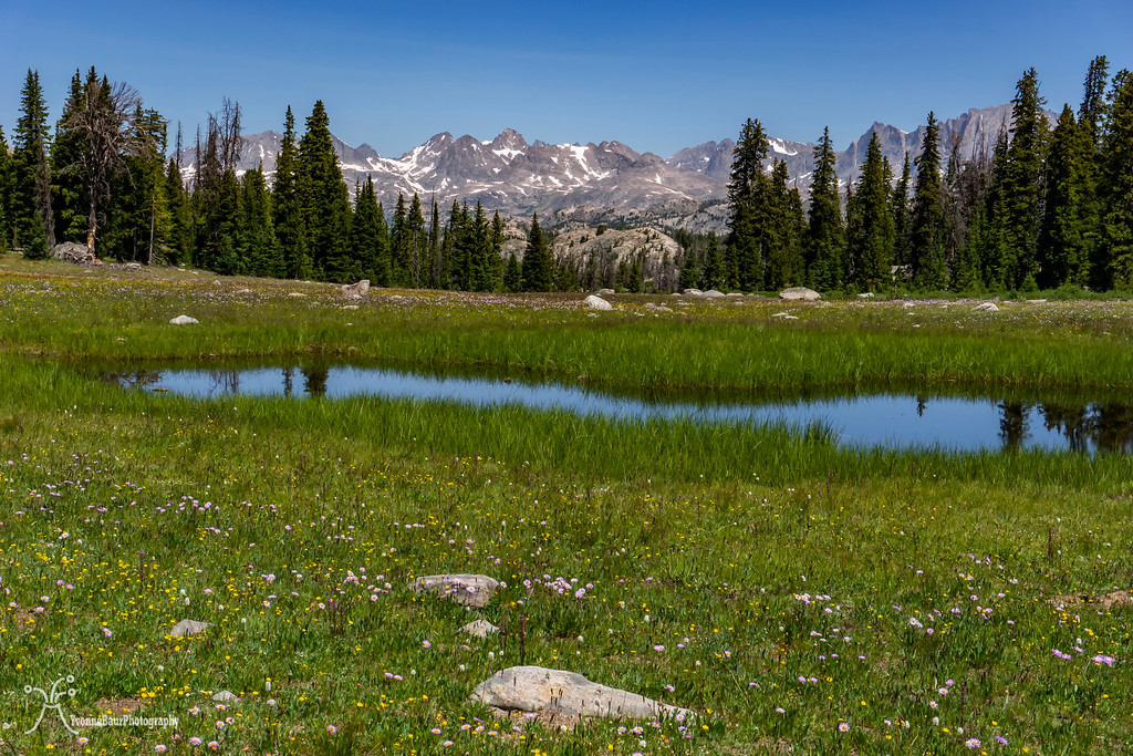
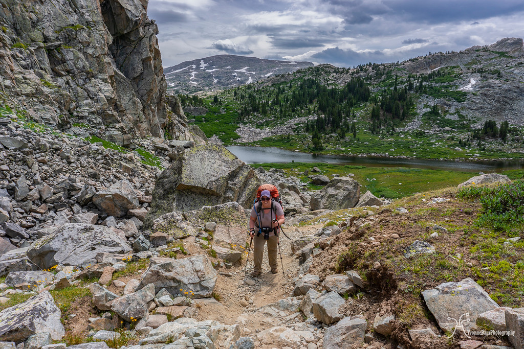
We continued and took our time. The scenery was magnificent, so it didn't matter at all. At one point, we arrived at one of the passes we needed to hike down. The view from the top of the pass offered additional scenic views, and we stopped again for a lot of pictures.
Fremont and Jackson Peak in the distance
No trip is complete without a backpack selfie
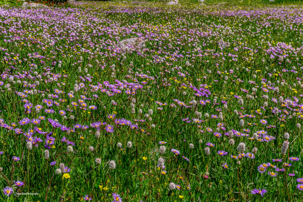
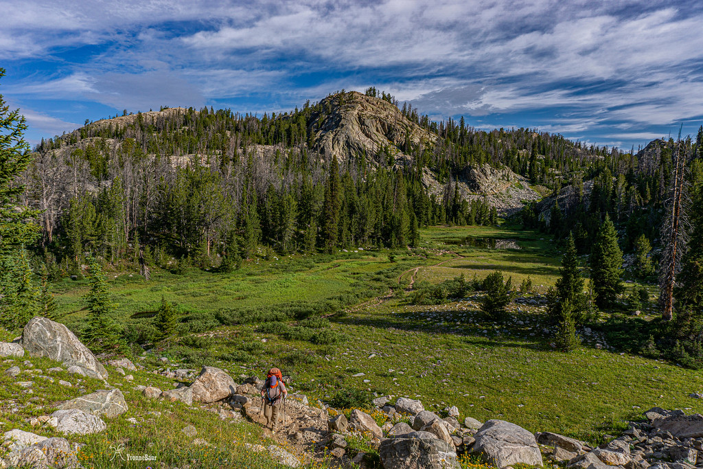
We walked down the pass and encountered another meadow full of wildflowers. It was just so beautiful!!! I was tempted to just lay down in the meadow and do nothing for a while. I actually did, while Lisa cooled her feet in one of the small tarns nearby.
Life was good, and nature provided so many surprises. From here, it wasn't too far to Hobbs Lake, and we decided to camp here tonight. Another short climb out of the meadow followed, and then we arrived at Hobbs Lake.
Luckily we found a great campsite right next to the lake with stellar views and pitched our tent. We had decided to share Lisa's 3-person tent, and there was more than enough room for both of us.
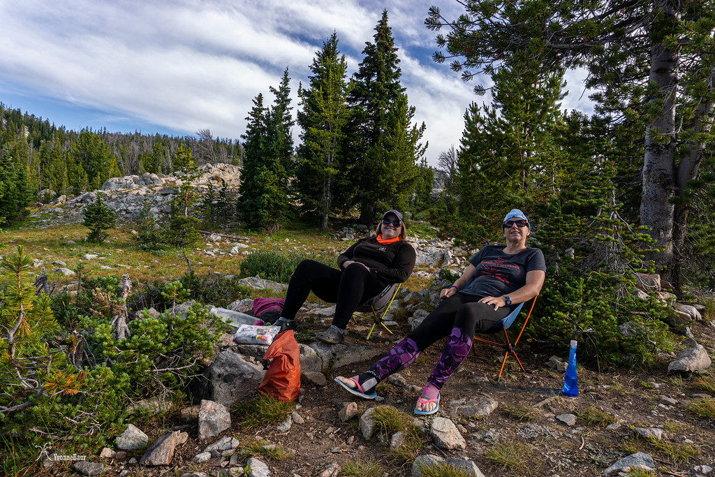
We explored the area, walked around the lake, and just relaxed. Even here were a lot of wildflowers and we took a lot of pictures. The mosquitoes were out in full force, but it was definitely okay with a head net.
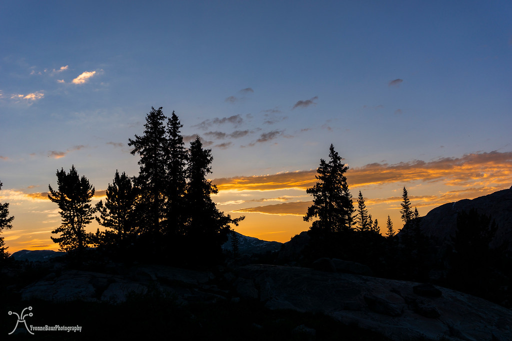
Sunset was lovely but not super dramatic without any clouds. But I guess that's complaining at a high level.
Day 2:
The next morning started with a lot of clouds, so I guess someone heard my complaints. The night itself was not super cold, as I had initially feared with my 45-degree summer sleeping bag. But I had placed an emergency space blanket underneath my sleeping pad, and it kept the cold from the bottom away, and I was warm enough. This was definitely a great and lightweight alternative.
We had breakfast and broke camp. Today would be a beautiful day with a lot of scenery along the way. Our goal was to set up camp at Island Lake.
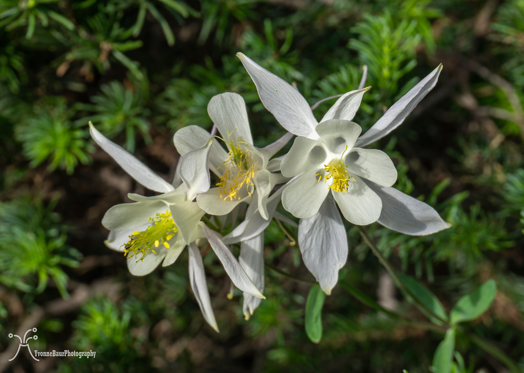
Columbines
Small Kettle Lake near Seneca Lake
We crossed the outlet of Seneca Lake and then followed the trail along its shores. Now and then, the sun broke through the clouds, and the patches of wildflowers all along the trail were just amazing.
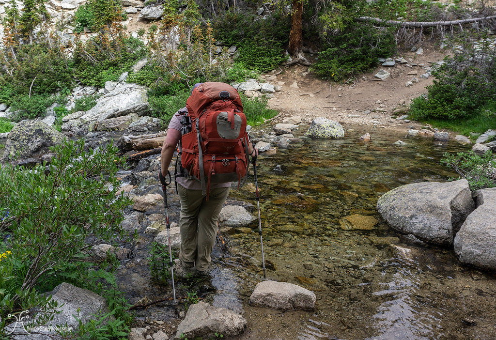
Lisa crossing the outlet

Selfie in the flower bed
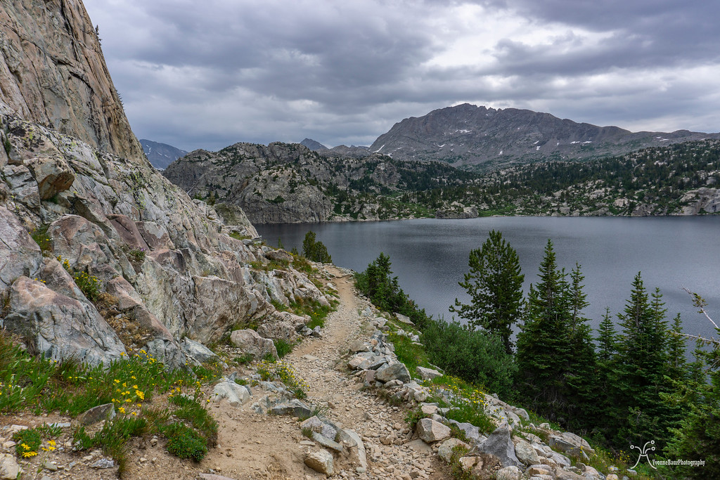
Eventually, the trail went down to the shorelines of Seneca Lake and provided excellent views of the lake and surrounding areas. There were some campsites near the lake, but they were pretty limited and probably filled up fast.
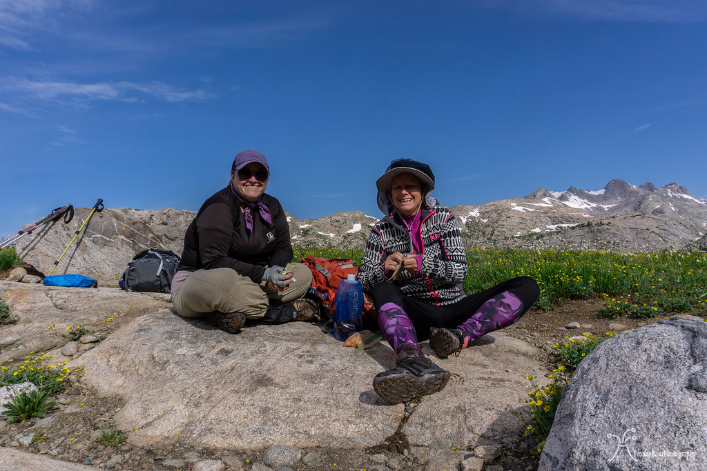
We decided to take a nice snack break on the shores of the lake, and I used the chance for some selfies. Several glacial erratics were spread out into the landscape, remnants of the former glacier that covered the area.
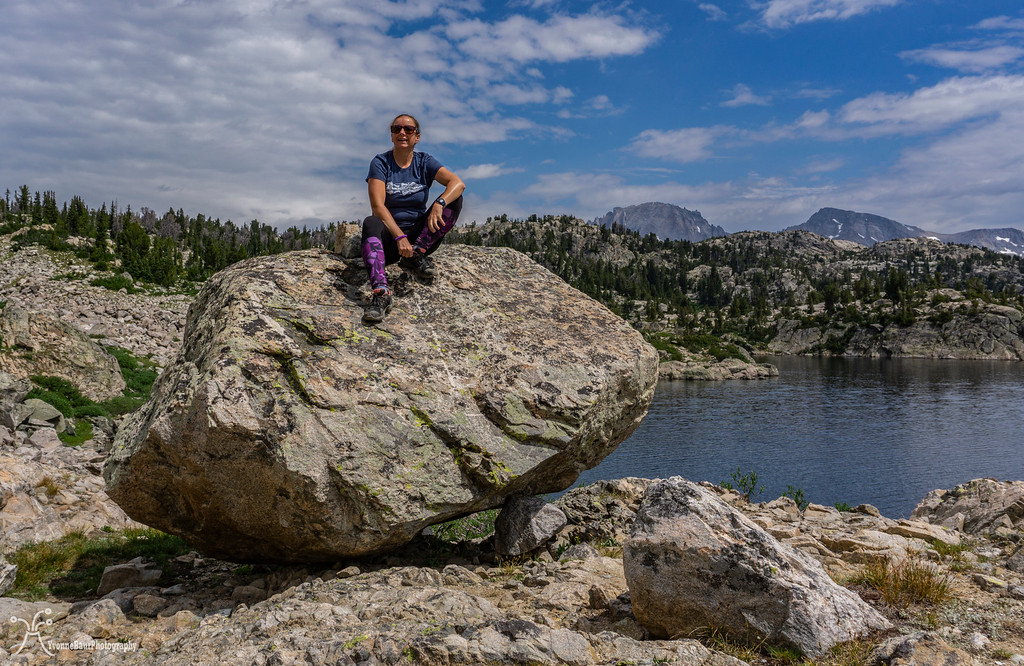
Selfie on top of an erratic

Seneca Lake
The trail continued up to the northern shore and to Little Seneca Lake, which was pretty scenic itself. I'm pretty sure, in the future, I'll be heading back and explore more of the area.

Little Seneca Lake
Soon after, we came to a trail junction with Lester Pass but continued up to the north. The trail started to climb a small pass and offered some excellent views back. Both Lisa and I slowly made our way up, huffing and puffing, while we enjoyed the scenery.
Lisa working her way up the pass
The view toward Lester Pass
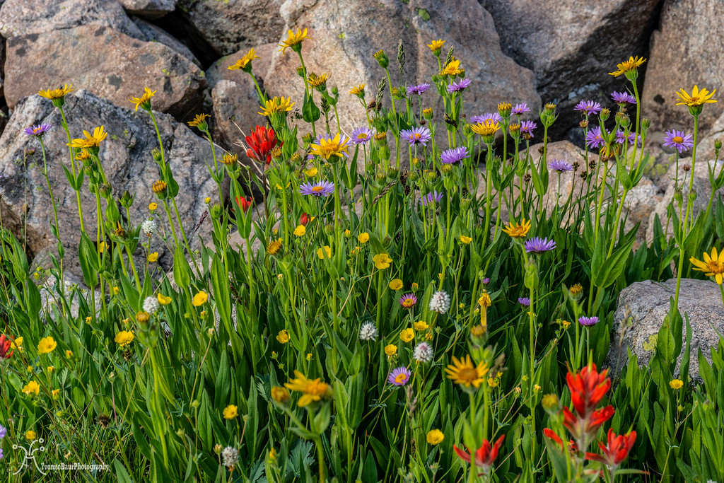
It was quite the workout to get to the top, but as soon as we reached the top, a beautiful meadow rewarded us. Wildflowers again were out in abundance and provided some sweet eye candy.
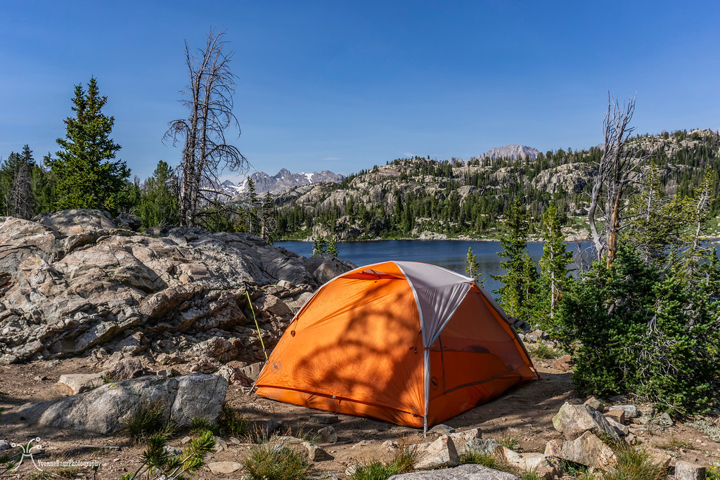
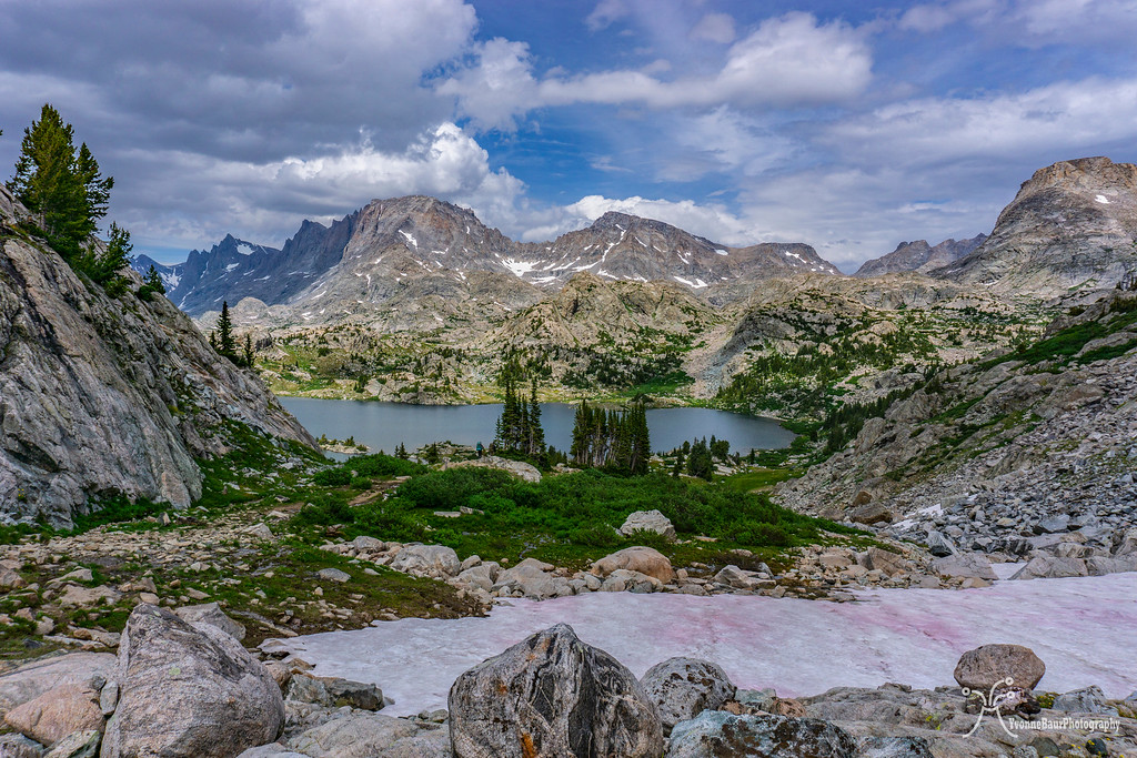
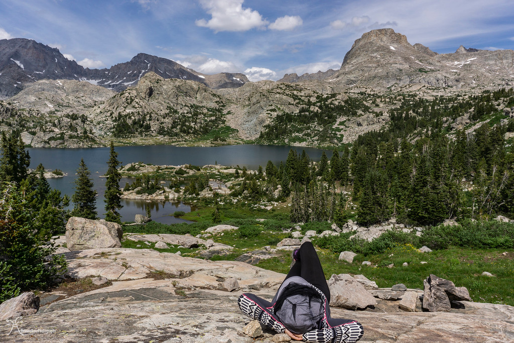
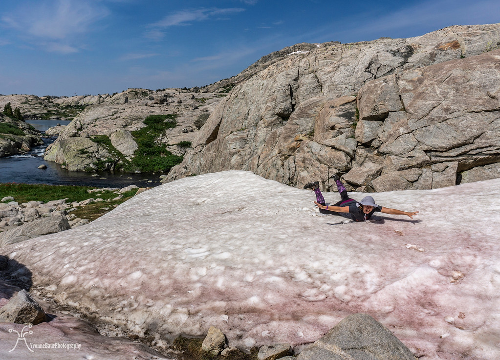
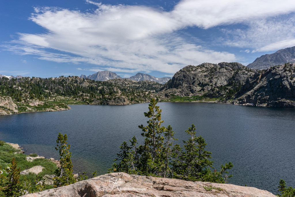
After about an additional mile, we had the first fantastic view of Island Lake. Wow, what a pretty and amazing place. There was still a good amount of snow lingering around, and some of the areas were pretty boggy and infested with mosquitoes.
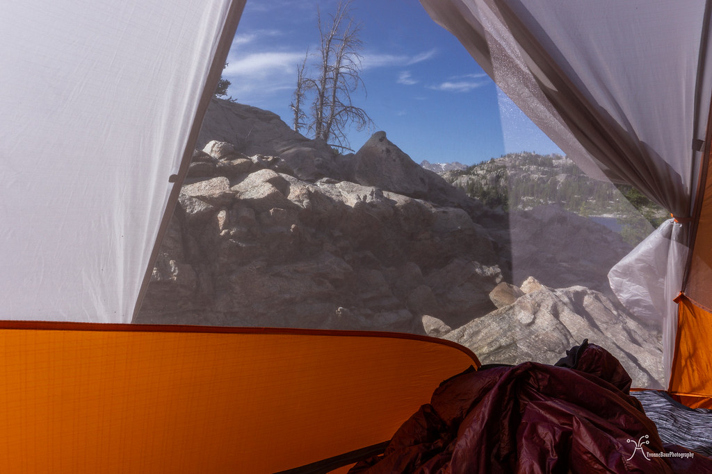
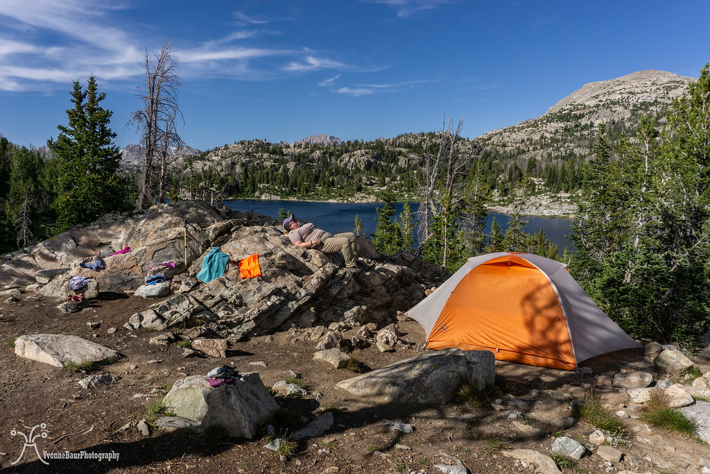
Despite the feisty little suckers out in full force, we enjoyed the scenery a lot. We found a camp spot high above the lake with a wonderful view and quickly pitched the tent.

Island Lake
Life is Good!!
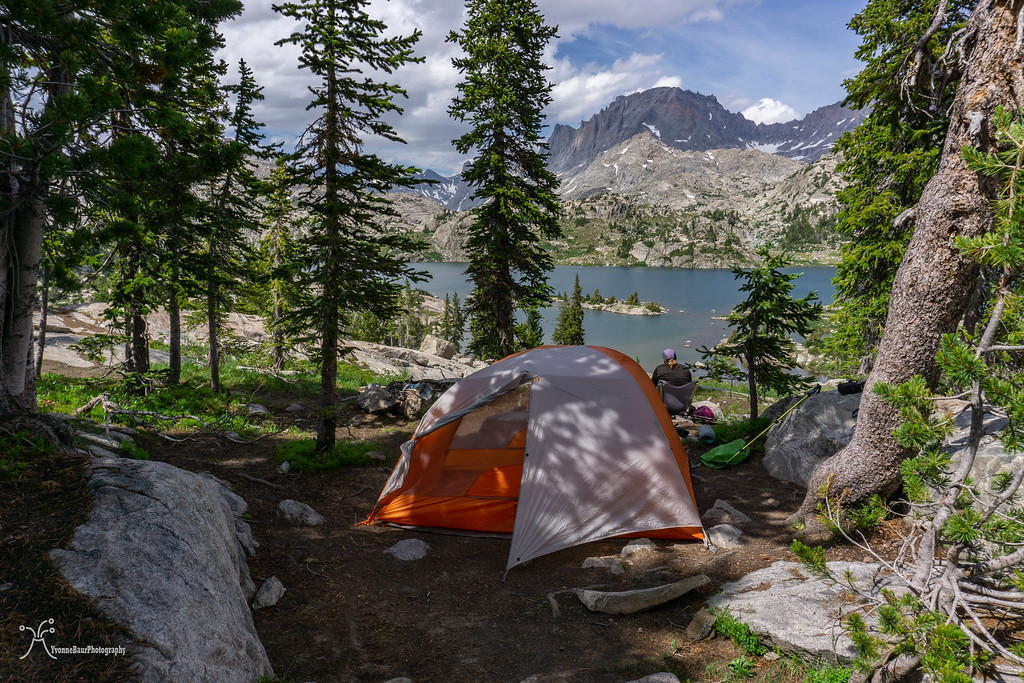
What a great campsite
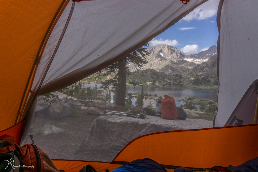
Room with a view
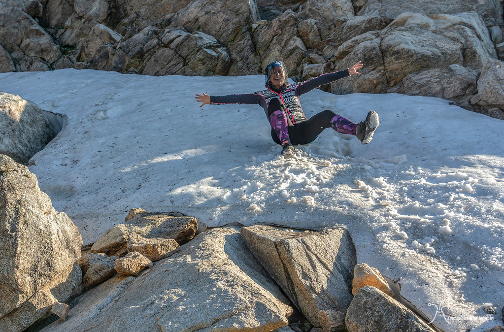
Typical camp chores followed like filtering water and hanging our food bags, but then we finally could relax. I used some patches of snow to glissading down a bit. It was actually a lot of fun.
Dinner followed a bit later after a small nap, but with all the mosquitoes, it was not an easy task. We had to eat with our head nets on and lifting the net, shoving the food in your mouth and not get bitten was definitely a task that needed some practice.
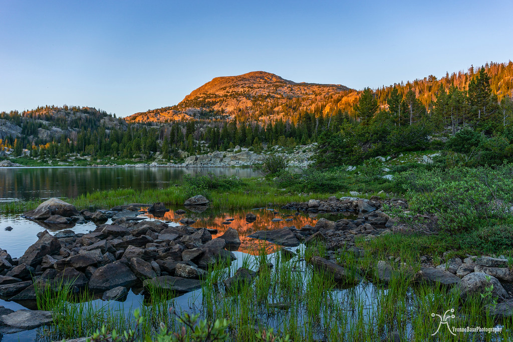
After dinner, we enjoyed the sunset from our camp. Luckily a few clouds moved in just in time and made it a bit more appealing.
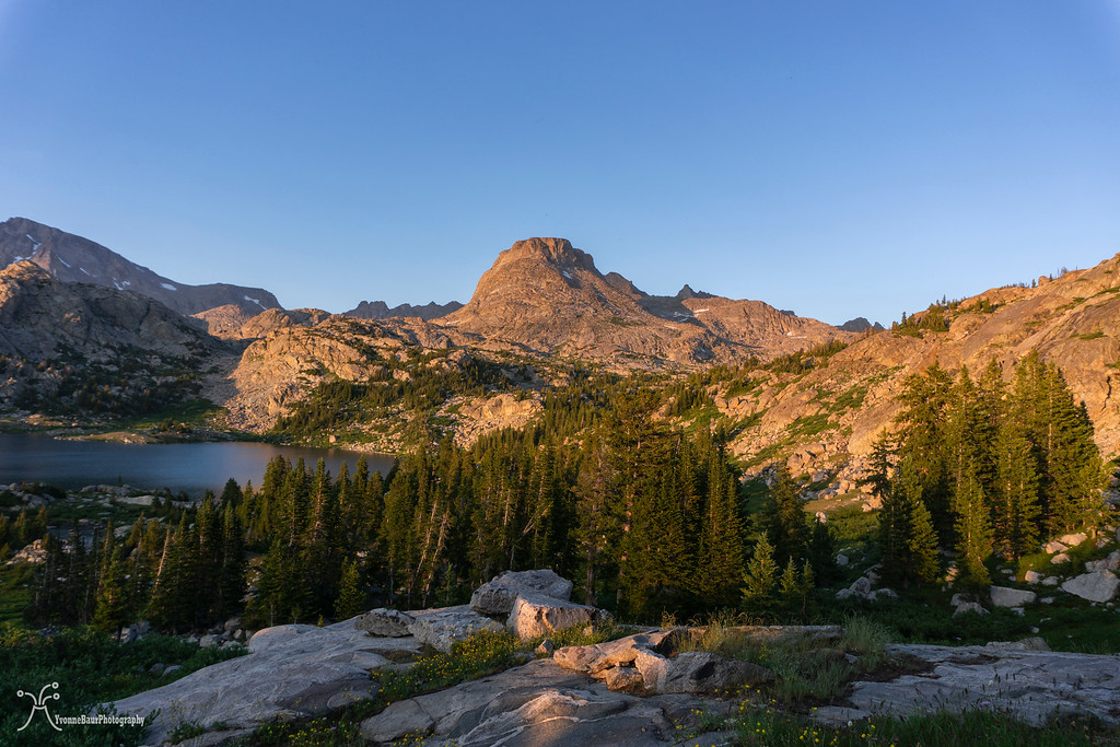

Elephant Head Peak
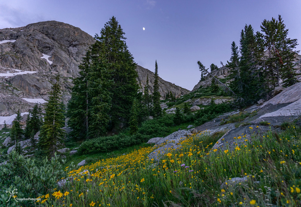
With the last light available, we hung our food bags, and I enjoyed the alpine scenery with a rising moon.
Day 3:
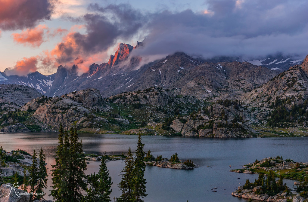
I woke in the middle of the night because I heard some rumbles of thunder. Pretty soon, a lightning storm took place, and the thunder was the loudest I have ever heard. It was even louder than the explosions of Kilauea volcano. Torrential rain came down, and the entire area trembled and shook with each clap of thunder. It was pretty amazing, but it took me a while to fall asleep again. When we got up around seven, the mist was already lifting, and the sun broke through the clouds.
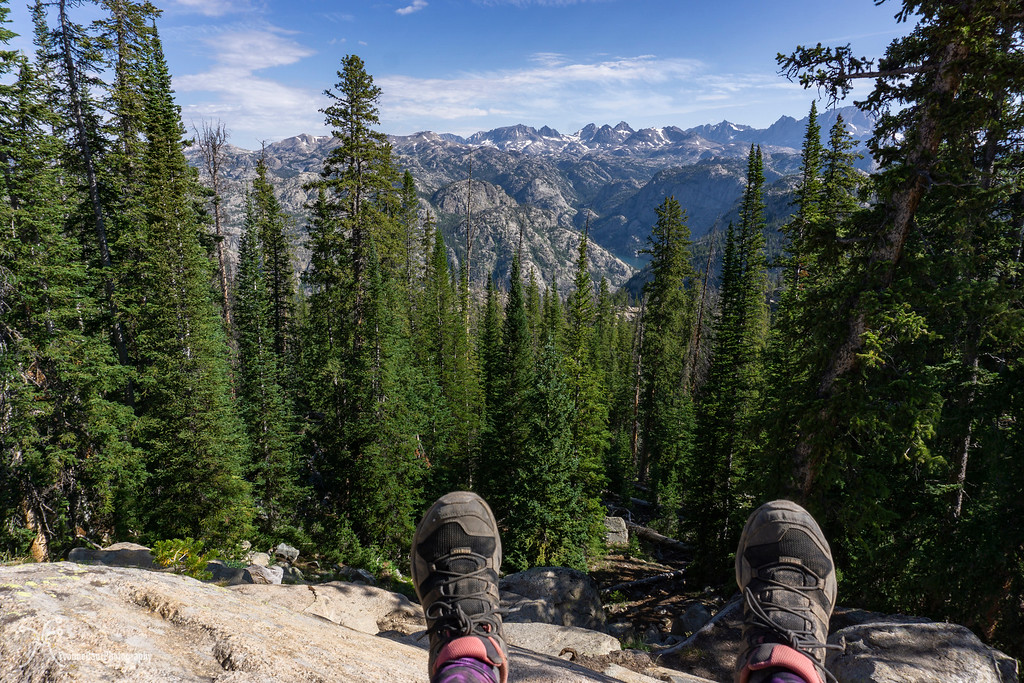
We had breakfast and then started to day hike into Titcomb Basin. This was a bucket list item for both of us for several years, and we were more than just excited to finally see it.
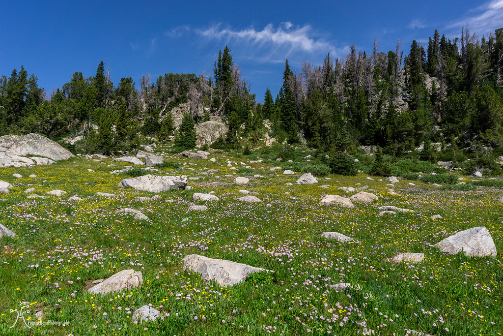
We climbed up a ridge and ended up on a beautiful plateau with a wildflower meadow.
view to the northeast
We passed a small inlet lake with some fantastic reflections, and we needed to stop here for a while.
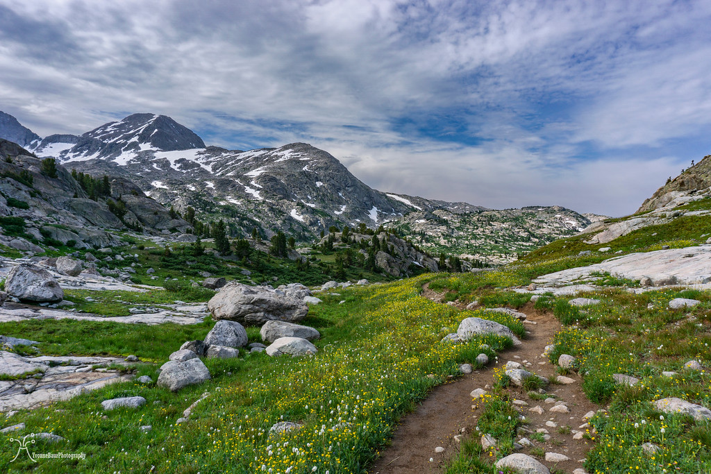
The scenery stayed top-notch the entire time, and between wildflower meadows, granite peaks, and small lakes and streams, we encountered really everything.
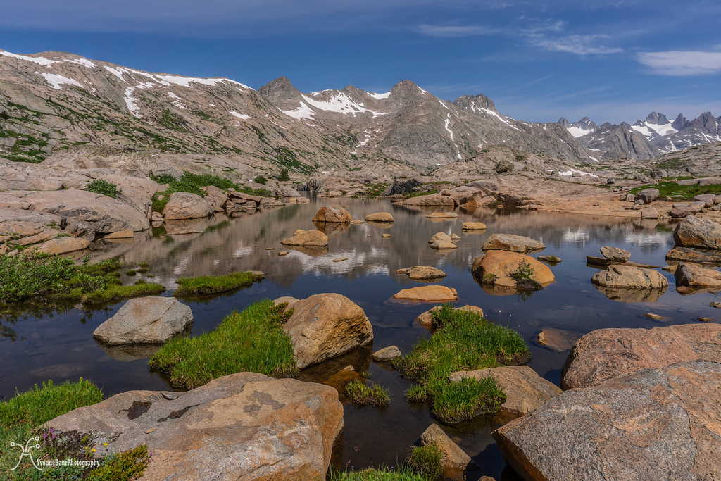
Small tarns and kettle lakes showed recent evidence of glaciation. It was beyond stoked and enjoyed the alpine scenery to its full extent.
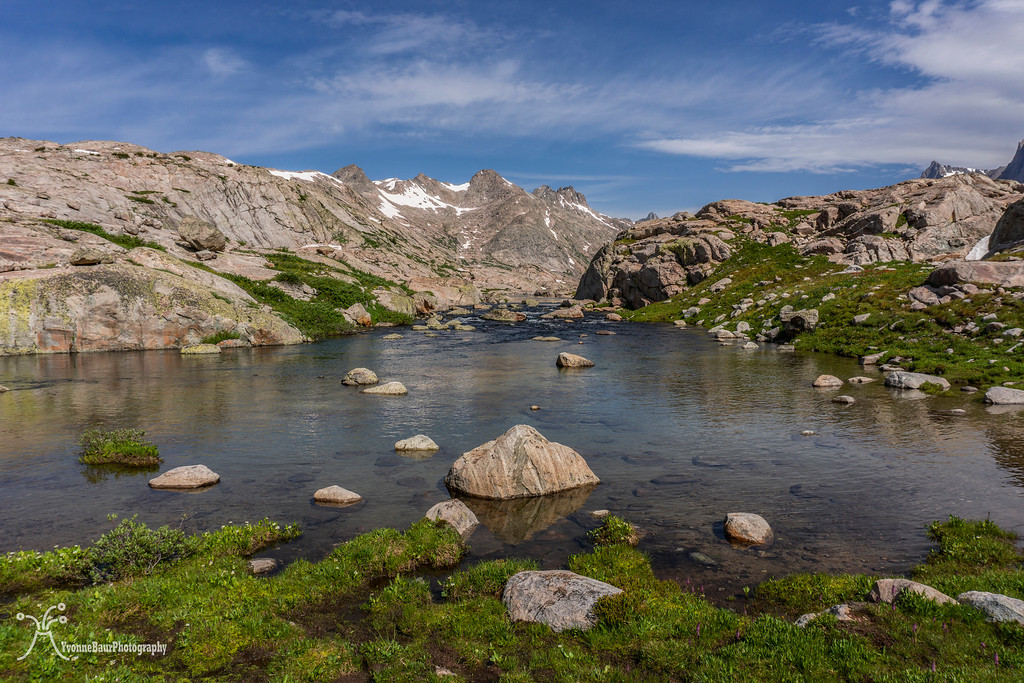
We really had a glorious day out here, it was calm and peaceful, and most of the small lakes and tarns had terrific reflections.
Elephant Head
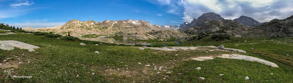
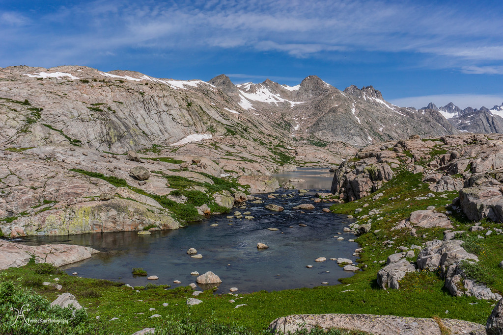
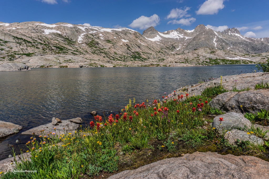
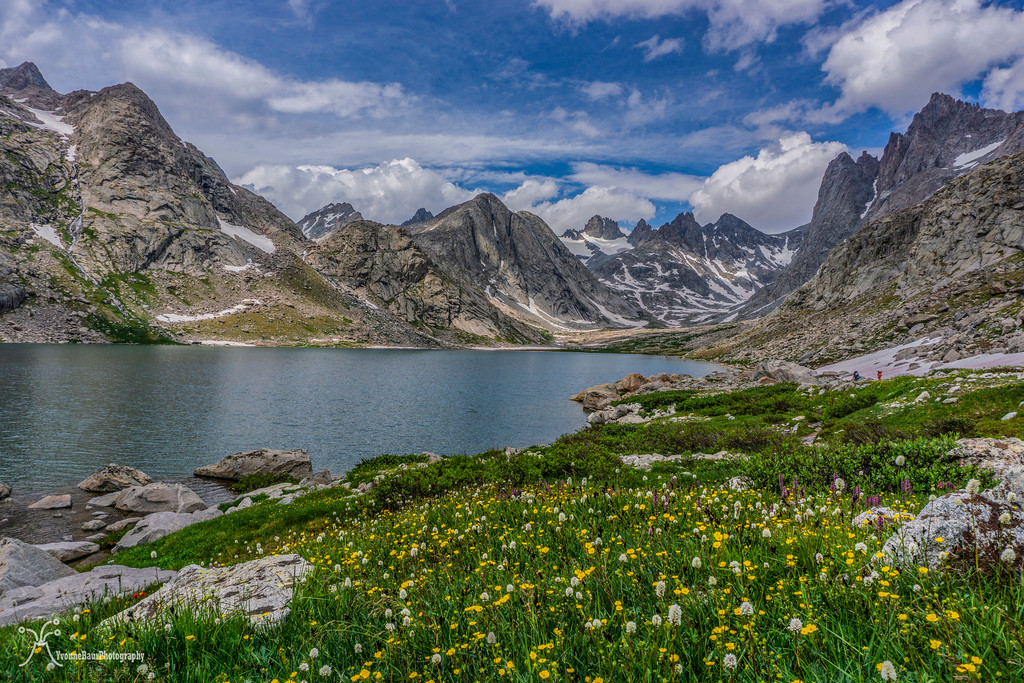
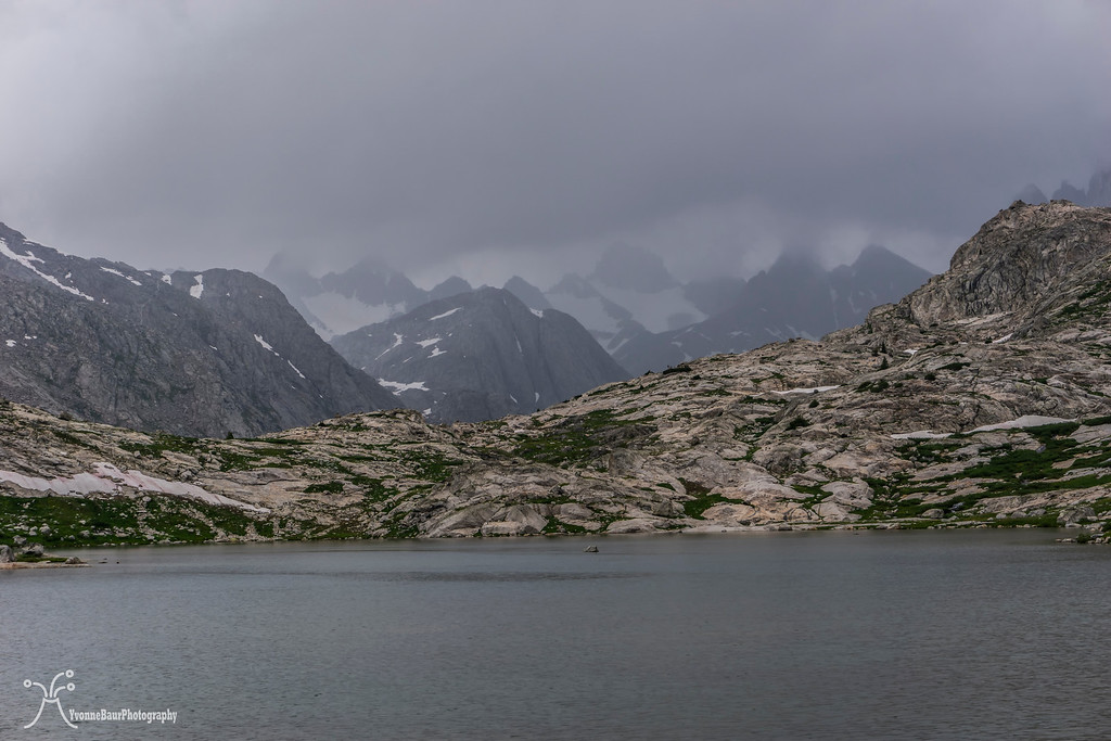
Eventually, we reached the Titcomb Lakes, a string of glacial lakes that end at the base of the glaciated area that goes across Knapsack Col.
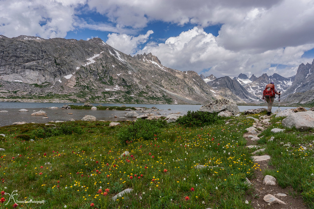
And finally, we reached the last lake. Its shores were covered in wildflowers, and we both were totally in awe. It was so beautiful.
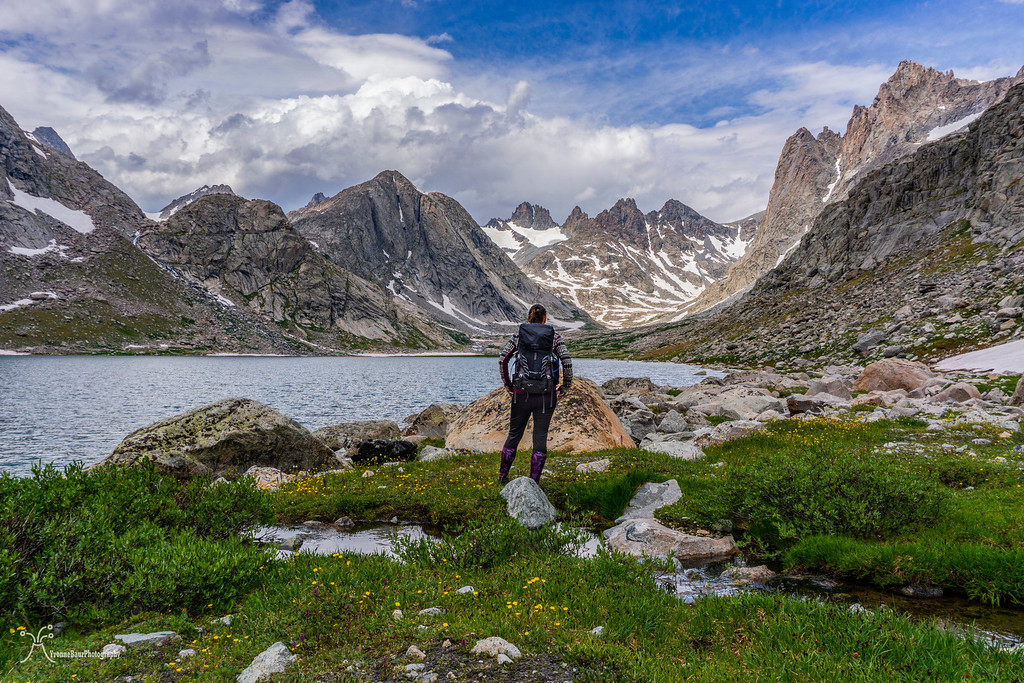
I'm admiring the view
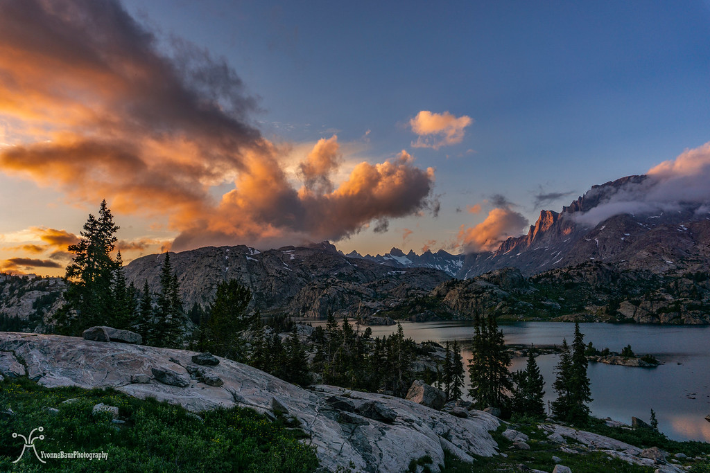
We enjoyed the views for a long time, but then dark clouds started to move in, and it looked that we would get one of the afternoon thunderstorms.
Very soon, Fremont Peak was covered in clouds, and in the distance, we could hear some rumble of thunder. It was time to retreat and start to hike back.
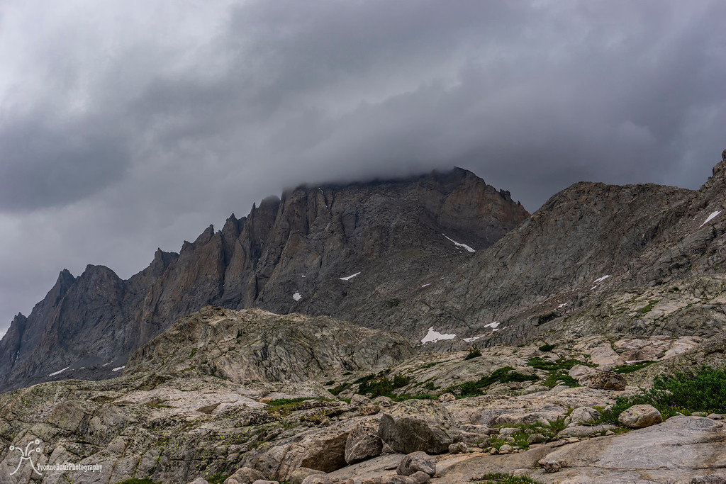
Fremont Peak covered in clouds
About halfway back, it started to rain and continued as a steady light rain all the way back to camp. We both needed to warm up a bit, and that's when we decided to take a nap. Later that afternoon, the clouds broke, and the sun was out again. We filtered water, prepared dinner, and repeated the fight against the mosquitoes. After dinner, we enjoyed one of the best sunsets in a long time.
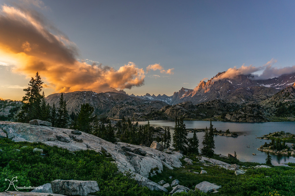
Even though most of the clouds were initially gone, some moved back in and created an amazing scene. It was exactly what I had hoped for.
The show lasted for quite a while, but eventually, it started to get dark. We hung our food bags and went to bed early. It was definitely a fantastic day, and we both crossed off one of our bucket list items.
Day 4:
We got up around seven again, had breakfast ad started to break camp. Most of our stuff needed to dry out a bit because of all moisture that lingered around all night, but finally, we were ready to go. We decided to camp again at Hobbs Lake and then hike out from there to the trailhead.
Beautiful views again on our hike out, but I guess the scenery out here never disappoints.
Back at Hobbs lake, we could snag the same campsite and quickly pitched our tent. After that, it was time for a swim in the lake. I was surprised that it was pretty warm and we enjoyed the water for quite a while.
The rest of the day was pretty relaxing, and we walked around and enjoyed the scenery. Unfortunately, my memory card was almost full, so I had to limit my urge to take pictures.
Day 5:
It was pretty overcast the morning when we woke up. We started to break camp, had breakfast, and packed the last few items before we began to hike out. The packs were definitely lighter than on the way in, and we made good progress.
We stopped again at Photographers Point and enjoyed the view. From now on, the rest of the trail would be through the lodgepole pine forest without any views.
Around 11 am, we reached the trailhead and were back at our car. What a fantastic trip it has been. We celebrated with a beer and some snacks and started to drive back to Salt Lake City. From there, I continued to Hurricane and was back home around 11 pm that night. I never wanted a shower so bad then that night. It was an amazing adventure, and I'm glad I could go. We both were not the fastest hikers on that trip, but sometimes there is no need to hurry at all. I'll definitely be back one day and might approach some of the more accessible peaks that looked so inviting.
When my friend Lisa asked me if I wanted to join her to backpack to Titcomb Basin in the Wind River range, I couldn't say no. This was a trip I wanted to do for years. Despite barely being in shape and with all my lung and breathing issues, I agreed to join her. Lisa herself was not in great shape, so I felt a bit more comfortable joining her on the trip.
Another issue I had to solve was to get some backpacking gear that would work in high elevation mountain camps. I had a summer sleeping bag, pad, small solo tent, and a stove, but that was it pretty much. In one of the local outdoor stores, I found a really lovely lightweight 40L backpack. This pack would offer more than enough space for a 5-day trip, and I wasn't wrong with the calculations. I even had enough space for my little camp chair.

Fully packed and ready to go
The day of our trip came soon, and I headed up north, where I met with Lisa in Salt Lake City. We packed my stuff in her car, grabbed some dinner on the way and were up north toward Pine Dale. We arrived around 11 pm at the Elkhart trailhead and slept in the car. This would give us an early start tomorrow morning. I didn't sleep so well, but the high altitude of more than 9,000 ft might have been the culprit.
Day 1:
We woke up at sunrise, had a quick breakfast, and finished packing up our packs. The trailhead itself was pretty packed and busy, and we were not the only ones that slept in their cars. And on the way we went. The first mile or two was through a forest of lodgepole pines, and we followed Pole Creek as it meandered next to the trail. Even here in the forested area, we already encountered a lot of wildflowers, and unfortunately, the first mosquitoes. Frequent photo stops allowed us to adjust to the elevation and move forward at a leisurely pace. The first meadow opened up and provided the first excellent views of all the mountain goodness ahead of us.
Our next stop was at Photographers Point, and the awe-inspiring views required us to stop for a bit and to enjoy the views to a full extent. Several lakes were nestled into the valley below, surrounded by granite peaks of the range.
We continued and crossed another meadow, which was fully covered in wildflowers and small tarns. It was such a serene scenery. Near Eklund Lake, we turned off Pole Creek trail and on to Seneca Lake trail. At Barbara Lake, we stopped for a small break and embraced the scenery.
Meadow and tarn near Eklund Lake
short break at Barbara Lake
We continued and took our time. The scenery was magnificent, so it didn't matter at all. At one point, we arrived at one of the passes we needed to hike down. The view from the top of the pass offered additional scenic views, and we stopped again for a lot of pictures.
Fremont and Jackson Peak in the distance
No trip is complete without a backpack selfie
We walked down the pass and encountered another meadow full of wildflowers. It was just so beautiful!!! I was tempted to just lay down in the meadow and do nothing for a while. I actually did, while Lisa cooled her feet in one of the small tarns nearby.
Life was good, and nature provided so many surprises. From here, it wasn't too far to Hobbs Lake, and we decided to camp here tonight. Another short climb out of the meadow followed, and then we arrived at Hobbs Lake.
Luckily we found a great campsite right next to the lake with stellar views and pitched our tent. We had decided to share Lisa's 3-person tent, and there was more than enough room for both of us.
We explored the area, walked around the lake, and just relaxed. Even here were a lot of wildflowers and we took a lot of pictures. The mosquitoes were out in full force, but it was definitely okay with a head net.
Sunset was lovely but not super dramatic without any clouds. But I guess that's complaining at a high level.
Day 2:
The next morning started with a lot of clouds, so I guess someone heard my complaints. The night itself was not super cold, as I had initially feared with my 45-degree summer sleeping bag. But I had placed an emergency space blanket underneath my sleeping pad, and it kept the cold from the bottom away, and I was warm enough. This was definitely a great and lightweight alternative.
We had breakfast and broke camp. Today would be a beautiful day with a lot of scenery along the way. Our goal was to set up camp at Island Lake.
Columbines
Small Kettle Lake near Seneca Lake
We crossed the outlet of Seneca Lake and then followed the trail along its shores. Now and then, the sun broke through the clouds, and the patches of wildflowers all along the trail were just amazing.
Lisa crossing the outlet
Selfie in the flower bed
Eventually, the trail went down to the shorelines of Seneca Lake and provided excellent views of the lake and surrounding areas. There were some campsites near the lake, but they were pretty limited and probably filled up fast.
We decided to take a nice snack break on the shores of the lake, and I used the chance for some selfies. Several glacial erratics were spread out into the landscape, remnants of the former glacier that covered the area.
Selfie on top of an erratic
Seneca Lake
The trail continued up to the northern shore and to Little Seneca Lake, which was pretty scenic itself. I'm pretty sure, in the future, I'll be heading back and explore more of the area.
Little Seneca Lake
Soon after, we came to a trail junction with Lester Pass but continued up to the north. The trail started to climb a small pass and offered some excellent views back. Both Lisa and I slowly made our way up, huffing and puffing, while we enjoyed the scenery.
Lisa working her way up the pass
The view toward Lester Pass
It was quite the workout to get to the top, but as soon as we reached the top, a beautiful meadow rewarded us. Wildflowers again were out in abundance and provided some sweet eye candy.
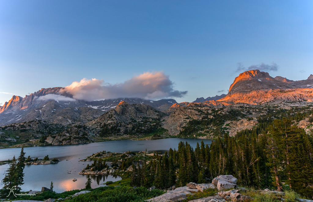
After about an additional mile, we had the first fantastic view of Island Lake. Wow, what a pretty and amazing place. There was still a good amount of snow lingering around, and some of the areas were pretty boggy and infested with mosquitoes.
Despite the feisty little suckers out in full force, we enjoyed the scenery a lot. We found a camp spot high above the lake with a wonderful view and quickly pitched the tent.
Island Lake
Life is Good!!
What a great campsite
Room with a view
Typical camp chores followed like filtering water and hanging our food bags, but then we finally could relax. I used some patches of snow to glissading down a bit. It was actually a lot of fun.
Dinner followed a bit later after a small nap, but with all the mosquitoes, it was not an easy task. We had to eat with our head nets on and lifting the net, shoving the food in your mouth and not get bitten was definitely a task that needed some practice.
After dinner, we enjoyed the sunset from our camp. Luckily a few clouds moved in just in time and made it a bit more appealing.
Elephant Head Peak
With the last light available, we hung our food bags, and I enjoyed the alpine scenery with a rising moon.
Day 3:
I woke in the middle of the night because I heard some rumbles of thunder. Pretty soon, a lightning storm took place, and the thunder was the loudest I have ever heard. It was even louder than the explosions of Kilauea volcano. Torrential rain came down, and the entire area trembled and shook with each clap of thunder. It was pretty amazing, but it took me a while to fall asleep again. When we got up around seven, the mist was already lifting, and the sun broke through the clouds.
We had breakfast and then started to day hike into Titcomb Basin. This was a bucket list item for both of us for several years, and we were more than just excited to finally see it.
We climbed up a ridge and ended up on a beautiful plateau with a wildflower meadow.
view to the northeast
We passed a small inlet lake with some fantastic reflections, and we needed to stop here for a while.
The scenery stayed top-notch the entire time, and between wildflower meadows, granite peaks, and small lakes and streams, we encountered really everything.
Small tarns and kettle lakes showed recent evidence of glaciation. It was beyond stoked and enjoyed the alpine scenery to its full extent.
We really had a glorious day out here, it was calm and peaceful, and most of the small lakes and tarns had terrific reflections.
Elephant Head
Eventually, we reached the Titcomb Lakes, a string of glacial lakes that end at the base of the glaciated area that goes across Knapsack Col.
And finally, we reached the last lake. Its shores were covered in wildflowers, and we both were totally in awe. It was so beautiful.
I'm admiring the view
We enjoyed the views for a long time, but then dark clouds started to move in, and it looked that we would get one of the afternoon thunderstorms.
Very soon, Fremont Peak was covered in clouds, and in the distance, we could hear some rumble of thunder. It was time to retreat and start to hike back.
Fremont Peak covered in clouds
About halfway back, it started to rain and continued as a steady light rain all the way back to camp. We both needed to warm up a bit, and that's when we decided to take a nap. Later that afternoon, the clouds broke, and the sun was out again. We filtered water, prepared dinner, and repeated the fight against the mosquitoes. After dinner, we enjoyed one of the best sunsets in a long time.
Even though most of the clouds were initially gone, some moved back in and created an amazing scene. It was exactly what I had hoped for.
The show lasted for quite a while, but eventually, it started to get dark. We hung our food bags and went to bed early. It was definitely a fantastic day, and we both crossed off one of our bucket list items.
Day 4:
We got up around seven again, had breakfast ad started to break camp. Most of our stuff needed to dry out a bit because of all moisture that lingered around all night, but finally, we were ready to go. We decided to camp again at Hobbs Lake and then hike out from there to the trailhead.
Beautiful views again on our hike out, but I guess the scenery out here never disappoints.
Back at Hobbs lake, we could snag the same campsite and quickly pitched our tent. After that, it was time for a swim in the lake. I was surprised that it was pretty warm and we enjoyed the water for quite a while.
The rest of the day was pretty relaxing, and we walked around and enjoyed the scenery. Unfortunately, my memory card was almost full, so I had to limit my urge to take pictures.
Day 5:
It was pretty overcast the morning when we woke up. We started to break camp, had breakfast, and packed the last few items before we began to hike out. The packs were definitely lighter than on the way in, and we made good progress.
We stopped again at Photographers Point and enjoyed the view. From now on, the rest of the trail would be through the lodgepole pine forest without any views.
Around 11 am, we reached the trailhead and were back at our car. What a fantastic trip it has been. We celebrated with a beer and some snacks and started to drive back to Salt Lake City. From there, I continued to Hurricane and was back home around 11 pm that night. I never wanted a shower so bad then that night. It was an amazing adventure, and I'm glad I could go. We both were not the fastest hikers on that trip, but sometimes there is no need to hurry at all. I'll definitely be back one day and might approach some of the more accessible peaks that looked so inviting.


