Navigation
Install the app
How to install the app on iOS
Follow along with the video below to see how to install our site as a web app on your home screen.
Note: This feature may not be available in some browsers.
More options
Style variation
You are using an out of date browser. It may not display this or other websites correctly.
You should upgrade or use an alternative browser.
You should upgrade or use an alternative browser.
Backpacking The Dirty Devil
- Thread starter Nick
- Start date
- Joined
- Jun 25, 2012
- Messages
- 4,430
No Man's Canyon. Here is a great overnight backpack. From the east side of the Dirty Devil. Walk down from the top of No Man's canyon (the next canyon south of Robbers Roost) to a normally or permanently wet section of the drainage. I can verify that I have always had good water at 38.282897, -110.490069 (towards the bottom of No Man's in the main drainage bottom) with multiple visits. This would be probably 6-8 miles in. Steve Allen's Canyoneering #2 is your friend. Page 73 "Down the North Fork of No Man's Canyon". From the spring you could walk another mile or two to the Dirty Devil itself and there is plenty of exploring if you use this water as a base camp. The hike down is most excellent with some narrows and a possible narrows bypass.
- Joined
- Jun 25, 2012
- Messages
- 4,430
Angel Trail. Hiking into the Dirty Devil drainage on the Angel Trail from either end (the west side or east side) also makes a great overnighter. There is water in the drainage just under the west side trailhead (Angel Cove environs). This is Beaver Canyon - the canyon itself is quite the thrash to hike. The east side is dry so you have to hope for pothole water, filter the Devil itself, or carry your own water in. There is endless exploring possibilites available because of the great expanses of slickrock. Especially if you aren't really afraid of heights and have a good slickrock slope-walking head on.
- Joined
- Jun 25, 2012
- Messages
- 4,430
langutah: great hiking possibilities. Thx for info. Are these THs reachable by an RV - under good conditions?
Thanks a bunch for help.
Michael, well that depends on the RV and the RV driver and the road conditions. I would say in general no it is not worth the risk. Go ahead and PM me and I can give you more detailed info.
- Joined
- Aug 9, 2007
- Messages
- 12,960
Angel Trail. Hiking into the Dirty Devil drainage on the Angel Trail from either end (the west side or east side) also makes a great overnighter. There is water in the drainage just under the west side trailhead (Angel Cove environs). This is Beaver Canyon - the canyon itself is quite the thrash to hike. The east side is dry so you have to hope for pothole water, filter the Devil itself, or carry your own water in. There is endless exploring possibilites available because of the great expanses of slickrock. Especially if you aren't really afraid of heights and have a good slickrock slope-walking head on.
Ahh, I think this answers my question in Aldaron 's Angel Cove trail guide. So if I was looking for an easy, winter-friendly backpacking trip to get my knee going again, this sounds like it might be good. Hiking from the west side down to Beaver Canyon would be nice? And water in beaver canyon is reliable? Certainly looks like it on sat imagery.
- Joined
- Jun 25, 2012
- Messages
- 4,430
Ahh, I think this answers my question in Aldaron 's Angel Cove trail guide. So if I was looking for an easy, winter-friendly backpacking trip to get my knee going again, this sounds like it might be good. Hiking from the west side down to Beaver Canyon would be nice? And water in beaver canyon is reliable? Certainly looks like it on sat imagery.
Well, easy??? It drops 700 feet in a short distance. So kind of steep and hard slickrock. Easy for you without an ouchy, recently rehabbed knee. I don't think it is very hard but I worry about you re-injuring yourself - so take a friend. Beaver canyon had running water when I was there a couple of times and has riparian attributes and marsh plants. I would say that it is perennial. It is a thrash traveling it as I saw at the bottom and I have heard other people report. If it all of a sudden was dry you have the Devil right there to drink off of. Then you could wade the river and head north as Aldaraon did or bump up a couple of hundred feet onto the slickrock and enjoy exploring south.
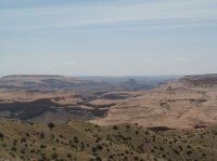
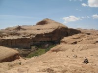
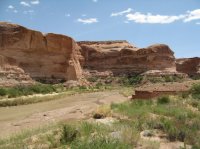
At the truck part above Angel Cove

Beaver Canyon

Beaver Canyon/Dirty Devil confluence

Aldaron
Member
- Joined
- Jun 16, 2012
- Messages
- 1,487
Yeah, I agree. The trail down is generally easy, but it does lose the elevation quickly in a couple of spots. It's not bouldery (I was an English teacher, I can invent words, thank you) or really rocky, though, so I think the risk is just more from the strain on your knees than from turning an ankle.
I would suggest staying above the river this time of year, though. You can head north or south paralleling the river once you get down to the bench. There's a trail heading north on the bench...I've never crossed Beaver to see if there's a trail heading south.
I would suggest staying above the river this time of year, though. You can head north or south paralleling the river once you get down to the bench. There's a trail heading north on the bench...I've never crossed Beaver to see if there's a trail heading south.
Udink
Still right here.
- Joined
- Jan 17, 2012
- Messages
- 1,742
So, @Artemus , it really shouldn't be a problem to filter the Dirty-D with a Katadyn Hiker Pro, right? Currently planning a loop down the Angel Trail (west side), up the D, up RR to the confluence with South Fork, then back down RR, up the D to check out the mouths of Pasture and Buck, and up the Lower Sand Slide back to the vehicle. I think water is my only concern--both drinking and crossing.I have filtered and drank the Dirty Devil quite a few times before.
Michael
Alien from over the pond...
- Joined
- Sep 5, 2012
- Messages
- 1,042
Water directly out of DD has a lot of sediments and will clog the KHP.
I use the same filter.
Let the water settle down in separate container.
FYI: This water hasn't a good taste.
Have fun out there, it's a great place.
Gesendet via iPhone 6 mit TapaTalk
I use the same filter.
Let the water settle down in separate container.
FYI: This water hasn't a good taste.
Have fun out there, it's a great place.
Gesendet via iPhone 6 mit TapaTalk
- Joined
- Jun 25, 2012
- Messages
- 4,430
Hey pal,So, @Artemus , it really shouldn't be a problem to filter the Dirty-D with a Katadyn Hiker Pro, right? Currently planning a loop down the Angel Trail (west side), up the D, up RR to the confluence with South Fork, then back down RR, up the D to check out the mouths of Pasture and Buck, and up the Lower Sand Slide back to the vehicle. I think water is my only concern--both drinking and crossing.
I have filtered before and even wanded the Devil. It clogs your filter pretty quickly. I think you can take yours apart and brush it to fix a clog, no? If so you can do that. I would probably have pills or iodine along just in case. It is pretty alkaline so some chance of gastrointestinal distress. Be eyes open for a non Devil source. I think there is water up the Robbers Roost canyon but don't know how far you have to go.
Good luck and if you don't post a TR (you will) please post the Sand Slide experience. I am working on a trip relying on access down it from the top.
Note there is great, trustable water coming out of Beaver which is the long, vegetated side drainage right at the point you hit the river when descending the Angel trail as you probably already know. Don't know how that could figure in your itinerary but there it is.
(BTW perhaps a good idea skipping the High Uintas this weekend. We and they did see some significant snow this week and it has been in the teens at night)
- Joined
- Jun 25, 2012
- Messages
- 4,430
I tried settling over night as an experiment. Not much settled out. Perhaps if you had a floculant ????We filtered the Dirty Devil water last spring and didn't have issues. Bring something to allow it to settle. We used a couple waterproof stuff sacks. Filtered with a Sawyer mini and then treated with Aqua Mira just to be sure.
Udink
Still right here.
- Joined
- Jan 17, 2012
- Messages
- 1,742
There aren't any springs listed on the USGS topo map for lower Robbers Roost Canyon, but looking in Google Earth I found what appears to be a reliable source here (historical imagery shows water there over the course of several years), plus a couple of other seeps/springs farther up, so I should be good. I'll strap an empty gallon jug to my pack just in case I need to settle and filter river water.I think there is water up the Robbers Roost canyon but don't know how far you have to go.
Thanks y'all for sharing your experience.
- Joined
- Jun 25, 2012
- Messages
- 4,430
You are welcome. Have fun! Should be pothole water too since the last storm wacked them worse than us.There aren't any springs listed on the USGS topo map for lower Robbers Roost Canyon, but looking in Google Earth I found what appears to be a reliable source here (historical imagery shows water there over the course of several years), plus a couple of other seeps/springs farther up, so I should be good. I'll strap an empty gallon jug to my pack just in case I need to settle and filter river water.
Thanks y'all for sharing your experience.
And from Nick's linked TR near the beginning of this thread "Not far into Robbers Roost we started looking for a campsite that would work for a two night camp. We found a few places that would've worked, with water close by, but ended up going into the South Fork of Robbers Roost where we found a nice spot near an alcove with water running out of 190 million years of Navajo Sandstone" - sounds like a spring
Don't like ads? Become a BCP Supporting Member and kiss them all goodbye. Click here for more info.
