fossana
Member
- Joined
- Jan 11, 2018
- Messages
- 1,038
Intro
Most of my off-road travels on the AZ Strip have been as a pass-through to get to other destinations, like Kanab Creek Wilderness and the N Rim of the Grand Canyon. A friend and I have a bikepacking trip planned this spring, so I figured I should transition my hiking only training regimen to include pedaling time. The AZ Strip has a spider web network of dirt roads, which are perfect for longer dirt rides (depending on conditions).
Last weekend I tried a route I found on a gravel ride site, but I wasn't excited about the busy and dusty washboard section closer to the highway/city. This time I decided to start in a more remote location and include a choose your own adventure section. I was pleasantly surprised by the interesting mix of topology and old ranch relics. Granted it was a weekday, but I only ran into one other person, a guy on a gravel bike on a section of the aforementioned published route. Winter riding conditions are ideal, mostly hardpack and gravel with very minimal sand/silt. I am looking forward to further 2-wheeled exploration on the Strip, with or without a motor.
Route Details
Mileage: ~24
Elevation Gain: ~2.3K feet
Water availability: Not guaranteed and limited to cattle troughs
Communications: Spotty cell reception, recommend carrying a backup map and a satellite emergency communication device
Road conditions: Muddy after major precipitation; likely sand slogging during warmer months

Photos
Empty water tank near the Hurricane Wash turnoff


Temple Trail diversion (rocky and absent in spots)


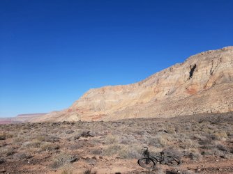
Back on the main road


Most of my off-road travels on the AZ Strip have been as a pass-through to get to other destinations, like Kanab Creek Wilderness and the N Rim of the Grand Canyon. A friend and I have a bikepacking trip planned this spring, so I figured I should transition my hiking only training regimen to include pedaling time. The AZ Strip has a spider web network of dirt roads, which are perfect for longer dirt rides (depending on conditions).
Last weekend I tried a route I found on a gravel ride site, but I wasn't excited about the busy and dusty washboard section closer to the highway/city. This time I decided to start in a more remote location and include a choose your own adventure section. I was pleasantly surprised by the interesting mix of topology and old ranch relics. Granted it was a weekday, but I only ran into one other person, a guy on a gravel bike on a section of the aforementioned published route. Winter riding conditions are ideal, mostly hardpack and gravel with very minimal sand/silt. I am looking forward to further 2-wheeled exploration on the Strip, with or without a motor.
Route Details
Mileage: ~24
Elevation Gain: ~2.3K feet
Water availability: Not guaranteed and limited to cattle troughs
Communications: Spotty cell reception, recommend carrying a backup map and a satellite emergency communication device
Road conditions: Muddy after major precipitation; likely sand slogging during warmer months
Photos
Empty water tank near the Hurricane Wash turnoff
Temple Trail diversion (rocky and absent in spots)
Back on the main road