- Joined
- Feb 23, 2012
- Messages
- 662
UPDATE: I added my video later in this thread embedded via YouTube.
When I got a really good forecast for my early March excursion to southern Utah, I decided to upgrade my day-hike plan to a 9-day backpack around Zion -- somewhat literally. My plan was to set out from the southwest portion of the park near Rockville and make my way up to Coalpits Wash and then over to Right Fork and then continue up and around the Kolob Terrace. From there I'd connect to the West Rim trail and then head back down to Zion Canyon. Then I was going to go over the East Rim to the Barracks and then south to Canaan Mountain and next west down and out the Eagle's Crags route to close the loop back to Rockville.
Well... I ended up skipping the East Rim->Barracks->Canaan Mountain and just hiked out along the Virgin River on Day 5/6. I found that it was still a little too early in the season for my liking. I was spending 12 hrs a day in my bag in my tent due to darkness and cold morning temps. I wasn't really ready for this boredom and I didn't have warm enough clothes (or the desire) to get up and battle the early morning chill (it was sub-freezing at night.) But... it was still a great trip. The daytime weather was great and I still ended up doing 80 miles in six days plus 20 added miles of day hikes the next two days exploring the Eagle's Crags and East Canyon.
If interested, one can see the full post on my site for more detail as well as the full gallery and map. But otherwise here are the highlights:
I got a late-day start and headed up Huber Wash where it took a little bit of work to get past the dryfall at the head of the canyon. Once on top I connected with the Chinle Trail where there was all kinds of partially-eroded petrified wood and great views of the West Temple:
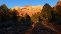
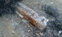
I camped in the at-large section of Coalpits Wash where I was happy to find a good flow of water. Heading out I immediately starting scoping out my planned cross-country route which went through this notch in the ridge separating Cougar Mountain from the higher plateau.
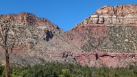
It turned out to be a pretty easy climb. Near the top there was even what appeared to be an old stock trail -- though the only recent use seemed to be by deer. Once up in the saddle I actually dropped the pack and climbed higher to the nearby high-point (top right in above pic.) The views on top were awesome:

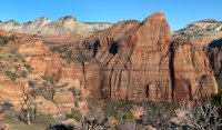
Headed back down toward Right Fork via Trail Canyon I hit an unexpected dryfall and imposing cliffband. After scouting for a while to find a way down the shortest route, I instead backtracked and took a longer (but easier) way down on the canyon's western slopes. I camped near the bottom almost to Right Fork.
The next day I dropped the big pack again and headed up Right Fork to the scenic portion. I spent way too much time trying to stay dry because eventually (as usual) I came to a spot that I had to get above-my-knees wet: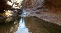
Traveling faster now right up the stream, I was soon to Double Falls:
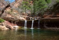
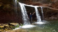
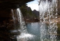
I wanted to keep going and explore all the way up to Barrier Falls -- but it was getting late in the day and I still had a long ways to go. So I backtracked to my pack -- spooking a herd of elk along the way -- and then headed out down Right Fork to the Jct with Left Fork where I headed upstream. I really wanted to explore and find a route up and into Lee Valley and to the Northgate Peaks area, but I was really short on time and didn't want to get stuck in the no-camping area. So instead I huffed it up the Grapevine Trail and walked the road up to camp near Lamb's Knoll.
The next day I contemplated cutting through Cave Valley and Lee Valley -- but didn't want to deal with any of the private property issues in the area. Instead I just walked the road up to Hop Valley TH and then picked up the Connector Trail over past Pine Valley Peak and to Wildcat Canyon:
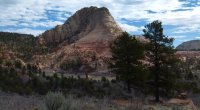
I was worried about snow/mud in this area, but it turned out to NOT be a problem at all. I never thought early March "problem spots" would look like this:
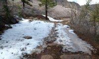
The wind picked up as I connected to the West Rim Trail. I was glad I filled up on water at Wildcat Spring, because Blue Creek and Potato Hollow were both dry. I actually had to melt some snow for extra water. It was already pretty late in the day by the time I got to the really scenic spots along the West Rim:
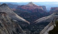
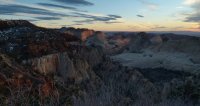
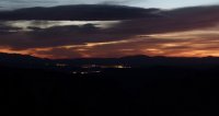
Because I ended up hiking for a bit after dark, I got to see something I'd never seen before... St. George/Hurricane city lights from the West Rim:
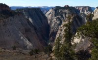
The next day was sunny... but still pretty chilly up on top. I enjoyed peering down the canyons trying to spot where I'd been just a few days prior. Such great views up here:


Dropping off the West Rim and headed toward Angel's Landing I was excited to finally spot the 'backside' view of Walter's Wiggles. Lighting conditions were pretty harsh, but I still snapped a few pics:
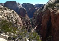
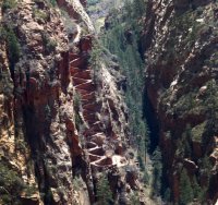
From the other side of the ridge leading down to Angel's Landing:
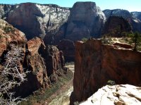
When I got to Angel's Landing I was met with dozens upon dozens of crazy spring breakers. It was a borderline madhouse: one group having a food fight, another asking everybody if they could score some 'bud' and then another guy loudly bragging to his 8+ buddies how he just took a leak off the top and it was F'ING AWESOME MAN! Ug. I skipped the side-hike that I've done many times and just hiked down the paved trail.
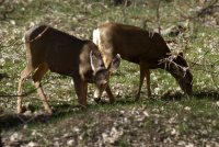
It wasn't until I was down at the Grotto Picnic area that I decided to skip the East Rim and the Barracks. Having done these before, it didn't seem like the best time of year for a repeat -- especially the water in the Barracks. Instead I hiked down the main canyon and camped at the campground. I usually just buzz through Zion Canyon anymore, so it was a good change of pace to slow down a bit and enjoy the walk along the Virgin down and out the main canyon. I saw a bunch of deer and some wild turkeys along the way:
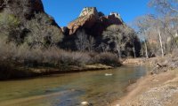
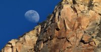
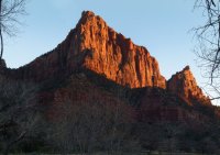
I also got to get some good shots of Crawford Arch and the moon coming up over Bridge Mountain as well as a great sundown on The Watchman:
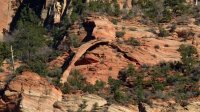
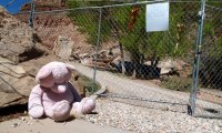
The final half day was a really uneventful walk down through Springdale and Rockville. Ideally one would have a shuttle for this stretch. One spot of note though, I did pause for a bit at the very sad site of the rockfall were two people perished in 12/2013.
The next two days I spent exploring the Eagle's Crags route up to Canaan Mountain and the Jughandle Arch area and other spots in the East Canyon. Not quite as much fun as backpacking, but it was nice to have a motel room at night!
I'd like to try and complete the full loop again some day. When I do I'll try it a bit later in the season for the longer days and the option to fully enjoy the water portions of Right Fork and the Barracks.
- Jamal
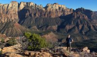
Featured image for home page:
When I got a really good forecast for my early March excursion to southern Utah, I decided to upgrade my day-hike plan to a 9-day backpack around Zion -- somewhat literally. My plan was to set out from the southwest portion of the park near Rockville and make my way up to Coalpits Wash and then over to Right Fork and then continue up and around the Kolob Terrace. From there I'd connect to the West Rim trail and then head back down to Zion Canyon. Then I was going to go over the East Rim to the Barracks and then south to Canaan Mountain and next west down and out the Eagle's Crags route to close the loop back to Rockville.
Well... I ended up skipping the East Rim->Barracks->Canaan Mountain and just hiked out along the Virgin River on Day 5/6. I found that it was still a little too early in the season for my liking. I was spending 12 hrs a day in my bag in my tent due to darkness and cold morning temps. I wasn't really ready for this boredom and I didn't have warm enough clothes (or the desire) to get up and battle the early morning chill (it was sub-freezing at night.) But... it was still a great trip. The daytime weather was great and I still ended up doing 80 miles in six days plus 20 added miles of day hikes the next two days exploring the Eagle's Crags and East Canyon.
If interested, one can see the full post on my site for more detail as well as the full gallery and map. But otherwise here are the highlights:
I got a late-day start and headed up Huber Wash where it took a little bit of work to get past the dryfall at the head of the canyon. Once on top I connected with the Chinle Trail where there was all kinds of partially-eroded petrified wood and great views of the West Temple:


I camped in the at-large section of Coalpits Wash where I was happy to find a good flow of water. Heading out I immediately starting scoping out my planned cross-country route which went through this notch in the ridge separating Cougar Mountain from the higher plateau.

It turned out to be a pretty easy climb. Near the top there was even what appeared to be an old stock trail -- though the only recent use seemed to be by deer. Once up in the saddle I actually dropped the pack and climbed higher to the nearby high-point (top right in above pic.) The views on top were awesome:


Headed back down toward Right Fork via Trail Canyon I hit an unexpected dryfall and imposing cliffband. After scouting for a while to find a way down the shortest route, I instead backtracked and took a longer (but easier) way down on the canyon's western slopes. I camped near the bottom almost to Right Fork.
The next day I dropped the big pack again and headed up Right Fork to the scenic portion. I spent way too much time trying to stay dry because eventually (as usual) I came to a spot that I had to get above-my-knees wet:

Traveling faster now right up the stream, I was soon to Double Falls:


I wanted to keep going and explore all the way up to Barrier Falls -- but it was getting late in the day and I still had a long ways to go. So I backtracked to my pack -- spooking a herd of elk along the way -- and then headed out down Right Fork to the Jct with Left Fork where I headed upstream. I really wanted to explore and find a route up and into Lee Valley and to the Northgate Peaks area, but I was really short on time and didn't want to get stuck in the no-camping area. So instead I huffed it up the Grapevine Trail and walked the road up to camp near Lamb's Knoll.
The next day I contemplated cutting through Cave Valley and Lee Valley -- but didn't want to deal with any of the private property issues in the area. Instead I just walked the road up to Hop Valley TH and then picked up the Connector Trail over past Pine Valley Peak and to Wildcat Canyon:

I was worried about snow/mud in this area, but it turned out to NOT be a problem at all. I never thought early March "problem spots" would look like this:

The wind picked up as I connected to the West Rim Trail. I was glad I filled up on water at Wildcat Spring, because Blue Creek and Potato Hollow were both dry. I actually had to melt some snow for extra water. It was already pretty late in the day by the time I got to the really scenic spots along the West Rim:


Because I ended up hiking for a bit after dark, I got to see something I'd never seen before... St. George/Hurricane city lights from the West Rim:

The next day was sunny... but still pretty chilly up on top. I enjoyed peering down the canyons trying to spot where I'd been just a few days prior. Such great views up here:


Dropping off the West Rim and headed toward Angel's Landing I was excited to finally spot the 'backside' view of Walter's Wiggles. Lighting conditions were pretty harsh, but I still snapped a few pics:


From the other side of the ridge leading down to Angel's Landing:

When I got to Angel's Landing I was met with dozens upon dozens of crazy spring breakers. It was a borderline madhouse: one group having a food fight, another asking everybody if they could score some 'bud' and then another guy loudly bragging to his 8+ buddies how he just took a leak off the top and it was F'ING AWESOME MAN! Ug. I skipped the side-hike that I've done many times and just hiked down the paved trail.
It wasn't until I was down at the Grotto Picnic area that I decided to skip the East Rim and the Barracks. Having done these before, it didn't seem like the best time of year for a repeat -- especially the water in the Barracks. Instead I hiked down the main canyon and camped at the campground. I usually just buzz through Zion Canyon anymore, so it was a good change of pace to slow down a bit and enjoy the walk along the Virgin down and out the main canyon. I saw a bunch of deer and some wild turkeys along the way:


I also got to get some good shots of Crawford Arch and the moon coming up over Bridge Mountain as well as a great sundown on The Watchman:


The final half day was a really uneventful walk down through Springdale and Rockville. Ideally one would have a shuttle for this stretch. One spot of note though, I did pause for a bit at the very sad site of the rockfall were two people perished in 12/2013.

The next two days I spent exploring the Eagle's Crags route up to Canaan Mountain and the Jughandle Arch area and other spots in the East Canyon. Not quite as much fun as backpacking, but it was nice to have a motel room at night!
I'd like to try and complete the full loop again some day. When I do I'll try it a bit later in the season for the longer days and the option to fully enjoy the water portions of Right Fork and the Barracks.
- Jamal
Featured image for home page:

Last edited:
