- Joined
- Aug 9, 2007
- Messages
- 12,955
So there I was, cruising south on Highway 6 in the LED spaceship, about 30 miles south of Wellington. After my last solo trip I decided to get back on the podcast bandwagon and I was totally entertained by season 1 of Serial. But a nagging thought kept popping to the foreground. I do not want to go to Moab. As much as I love everything about what I was setting out to do, there's just something about fighting the crowds around that town that makes me want to turn and run. My plan was to start with Moab again, hit Delicate and Landscape and a few others first thing on Saturday and then south to The Needles. Follow 191 down to 95, over through Cedar Mesa and up through Hanksville and back home on Sunday. But the image of the Arches NP sunroof girls on that late February morning a few weeks back was stuck in my head. And now it was even warmer! Camping alone sucks, but true solitude makes it better. So shortly before hitting I-70, I decided to change up the plan and do things in the opposite direction. Instead of heading to Arches tonight, I'd head southwest toward Hanksville and camp in an area that made me much more excited to sit out there alone all night.
Home.
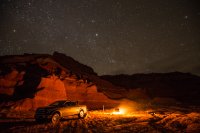
After a while I went out and did a little exploring.
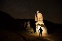
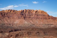
It just so happens that the place where I slept was also one of my intended hikes. Unfortunately, when I woke up in the back of my truck, the wind was howling and the sky was grey. I looked to the east and saw a storm pounding north wash. Doing my 'work hikes' with overcast skies is pointless. I need sunshine and blue to make the trails look good. If I have to sit and wait for it, I do. But there was blue all over on the horizon, just no sun, so I started walking. I made it through much of the area shooting overcast photos when the sun finally broke through. The early morning light and the stormy horizon made for some pretty nice shots.
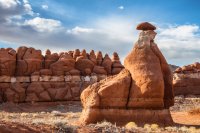
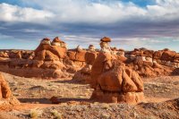
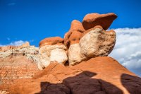
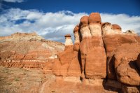
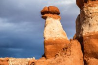
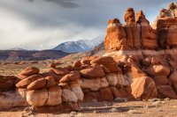
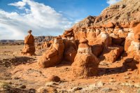
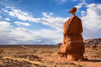
Satisfied with the light and the fact I had one hike under my belt before leaving camp, I set off down an unknown route, assuming it would eventually lead me back to a highway. It did. I stopped along the way to use a nearby facility. I thought about hiking this trail, but it was through a canyon bottom still dormant from winter. Maybe next time.
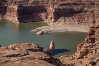
Next stop, Hite Overlook in Glen Canyon. Once upon a time, Lake Powell was down there. Now it's just the Colorado River and a bunch of silt. I'm floating this next month with Glen Canyon Institute and a bunch of fellow Glen Canyon lovers. Want to come? Info here: https://www.facebook.com/events/465709730290534/
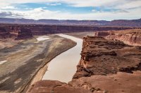
Looking down at what I like to call North Wash Lake. The actual reservoir is far down stream from here now, but the river has dropped so much silt that it has essentially dammed North Wash, leaving a deep reservoir behind while the river flows on by.
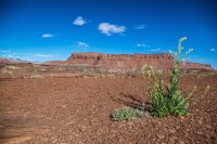
Thanks to @mattvogt7 for posting a photo that made me stop and look for this little gem.
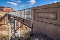
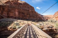
The drive down UT 95 along White Canyon is such a treat. I want to spend so much more time there. But today I was off to Natural Bridges National Monument. Hike #3 for the day is Owachomo Bridge.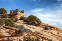
Owachomo is the shortest and easiest bridge to hike to in the monument, but it's not without a bit of elevation change.
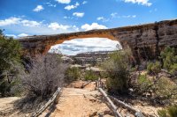
The view from the other side.
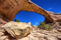
Next stop, Mule Canyon Ruins. No, not House on Fire or anything like that. I'm talking about the roadside ruins that are accessed by a paved walkway. Not exactly a hike, but for my purposes, it's perfect.
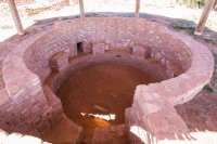
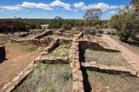
Next up, Butler Wash Ruins. A mile round trip to a nice little overlook of the ruins. I've done this before but didn't have enough photos.
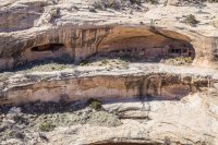
After that it was on to Blanding and then north through Monticello, then west into Indian Creek to The Needles. First stop, the short loop hike to Roadside Ruin.
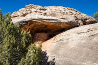
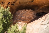
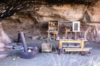
Next up was Cave Spring, another short hike but I really liked this one. First the cowboy cave.
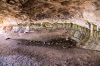
Then cave spring.
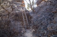
Then a couple of fun ladders.
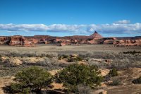
Then up top for some awesome views of the surroundings.
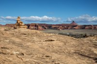
And then on to hike #8 for the day: Pothole Point. Nice views off toward The Needles.
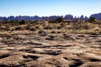
Cool formations along the way.
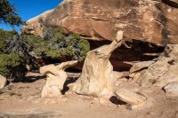
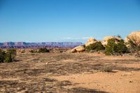
As I hiked, I was thinking it was too bad it hadn't rained recently. Everything was totally dry. No wet potholes to put in the trail guide. But I was wrong.
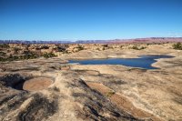
I almost cashed it in at that point and headed for Moab. The next possibility was the Slickrock Trail. 2.4 miles round trip but there was only an hour or so of light left. Granted, none of the hikes I'd done were very long, but I was tired and saving energy for the next day sounded smart. But that's not what I did. I pulled up to the trailhead, grabbed my pack and started my way up the trail. 4 view points on a loop - no problem!
I made it to the first 3 viewpoints and was thinking this feels like quite a bit more than 2.4 miles. A check on my GPS confirmed it would go over. And then it got messy. After the third viewpoint I was zipping through the up and down of slickrock domes looking for the next cairn. I got to the other side of the mesa and kind of ran out of cairns. I looked left and right and noticed one in each direction. I assumed the left was the return of the loop and that I should go right. Other junctions like this had signs, but whatever.
Light was fading so I was hustling. The cairns got smaller and smaller. I finally reached a point that just wasn't sure where to go next. I turned and noticed a large family and a group of asian tourists had followed me. Shit. Someone saw another cairn so the big group started picking down a slope. Then another little cairn. And another.
We finally reached a break in the cliffs that led out onto a big flat plain and on to the end of the peninsula. I was in business mode and just went for it. About halfway there I realized everyone behind me had wised up and turned around. What, no head lamps? I made it to the very tip of the peninsula and was treated to a fine view.
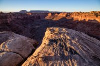
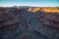
Off with the pack, a quick sip of water and then back. I had my headlamp, but this was not a place for hiking with a headlamp. No trail, just cairns in a rolling sea of slickrock. Back up from the lower plain, not much light left now.

It was totally dark by the time I made it back. My GPS registered 3.64 miles. On the way back, I realized the error in my ways. The cairns to my left led to the 4th overlook and on to the return loop. Oops. Don't build cairns, people!

There was nothing but deer around as I drove out of the Needles and up through Indian Creek. I encountered an ambulance which I later found out was heading in to respond to a fatal fall at a climb called Rambo Wall.
As I drove through the night, I once again found myself dreading the thought of Moab and the crowds. I was feeling pretty good about getting 9 hikes done so I made another change of plan. Instead of turning north toward Moab, I turned south back the way I came. It was a long, lonely drive back over Cedar Mesa and along White Canyon, then up North Wash and eventually right back to where I'd started my day near Hanksville. But it was worth it. I love that area for solo camping. I didn't choose the exact same spot, but it was close enough. It was 10:30 by the time I got there.
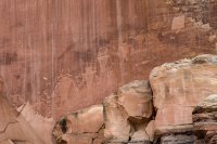
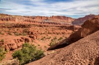
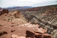
The next day I woke up and headed northwest toward Capitol Reef in hopes of knocking 3-5 more hikes out before heading home for the weekend. When I got there, the sun was gone. Overcast skies are just not acceptable, so I killed time driving the scenic drive. I stopped and walked the petroglyphs trail, Sunset Point and The Goosenecks. I think I got good enough pics out of the last two to make it work. Maybe all three. Regardless, I'll be back soon to pickup another handful there, hopefully with plenty of sunshine and leaves on the cottonwoods.
Only 20-25 more 'work hikes' to go this year. Having fun.
Home.

After a while I went out and did a little exploring.

It just so happens that the place where I slept was also one of my intended hikes. Unfortunately, when I woke up in the back of my truck, the wind was howling and the sky was grey. I looked to the east and saw a storm pounding north wash. Doing my 'work hikes' with overcast skies is pointless. I need sunshine and blue to make the trails look good. If I have to sit and wait for it, I do. But there was blue all over on the horizon, just no sun, so I started walking. I made it through much of the area shooting overcast photos when the sun finally broke through. The early morning light and the stormy horizon made for some pretty nice shots.


Satisfied with the light and the fact I had one hike under my belt before leaving camp, I set off down an unknown route, assuming it would eventually lead me back to a highway. It did. I stopped along the way to use a nearby facility. I thought about hiking this trail, but it was through a canyon bottom still dormant from winter. Maybe next time.

Next stop, Hite Overlook in Glen Canyon. Once upon a time, Lake Powell was down there. Now it's just the Colorado River and a bunch of silt. I'm floating this next month with Glen Canyon Institute and a bunch of fellow Glen Canyon lovers. Want to come? Info here: https://www.facebook.com/events/465709730290534/


Looking down at what I like to call North Wash Lake. The actual reservoir is far down stream from here now, but the river has dropped so much silt that it has essentially dammed North Wash, leaving a deep reservoir behind while the river flows on by.


Thanks to @mattvogt7 for posting a photo that made me stop and look for this little gem.

The drive down UT 95 along White Canyon is such a treat. I want to spend so much more time there. But today I was off to Natural Bridges National Monument. Hike #3 for the day is Owachomo Bridge.

Owachomo is the shortest and easiest bridge to hike to in the monument, but it's not without a bit of elevation change.

The view from the other side.

Next stop, Mule Canyon Ruins. No, not House on Fire or anything like that. I'm talking about the roadside ruins that are accessed by a paved walkway. Not exactly a hike, but for my purposes, it's perfect.


Next up, Butler Wash Ruins. A mile round trip to a nice little overlook of the ruins. I've done this before but didn't have enough photos.

After that it was on to Blanding and then north through Monticello, then west into Indian Creek to The Needles. First stop, the short loop hike to Roadside Ruin.


Next up was Cave Spring, another short hike but I really liked this one. First the cowboy cave.

Then cave spring.

Then a couple of fun ladders.

Then up top for some awesome views of the surroundings.


And then on to hike #8 for the day: Pothole Point. Nice views off toward The Needles.

Cool formations along the way.


As I hiked, I was thinking it was too bad it hadn't rained recently. Everything was totally dry. No wet potholes to put in the trail guide. But I was wrong.

I almost cashed it in at that point and headed for Moab. The next possibility was the Slickrock Trail. 2.4 miles round trip but there was only an hour or so of light left. Granted, none of the hikes I'd done were very long, but I was tired and saving energy for the next day sounded smart. But that's not what I did. I pulled up to the trailhead, grabbed my pack and started my way up the trail. 4 view points on a loop - no problem!
I made it to the first 3 viewpoints and was thinking this feels like quite a bit more than 2.4 miles. A check on my GPS confirmed it would go over. And then it got messy. After the third viewpoint I was zipping through the up and down of slickrock domes looking for the next cairn. I got to the other side of the mesa and kind of ran out of cairns. I looked left and right and noticed one in each direction. I assumed the left was the return of the loop and that I should go right. Other junctions like this had signs, but whatever.
Light was fading so I was hustling. The cairns got smaller and smaller. I finally reached a point that just wasn't sure where to go next. I turned and noticed a large family and a group of asian tourists had followed me. Shit. Someone saw another cairn so the big group started picking down a slope. Then another little cairn. And another.
We finally reached a break in the cliffs that led out onto a big flat plain and on to the end of the peninsula. I was in business mode and just went for it. About halfway there I realized everyone behind me had wised up and turned around. What, no head lamps? I made it to the very tip of the peninsula and was treated to a fine view.


Off with the pack, a quick sip of water and then back. I had my headlamp, but this was not a place for hiking with a headlamp. No trail, just cairns in a rolling sea of slickrock. Back up from the lower plain, not much light left now.

It was totally dark by the time I made it back. My GPS registered 3.64 miles. On the way back, I realized the error in my ways. The cairns to my left led to the 4th overlook and on to the return loop. Oops. Don't build cairns, people!

There was nothing but deer around as I drove out of the Needles and up through Indian Creek. I encountered an ambulance which I later found out was heading in to respond to a fatal fall at a climb called Rambo Wall.
As I drove through the night, I once again found myself dreading the thought of Moab and the crowds. I was feeling pretty good about getting 9 hikes done so I made another change of plan. Instead of turning north toward Moab, I turned south back the way I came. It was a long, lonely drive back over Cedar Mesa and along White Canyon, then up North Wash and eventually right back to where I'd started my day near Hanksville. But it was worth it. I love that area for solo camping. I didn't choose the exact same spot, but it was close enough. It was 10:30 by the time I got there.
The next day I woke up and headed northwest toward Capitol Reef in hopes of knocking 3-5 more hikes out before heading home for the weekend. When I got there, the sun was gone. Overcast skies are just not acceptable, so I killed time driving the scenic drive. I stopped and walked the petroglyphs trail, Sunset Point and The Goosenecks. I think I got good enough pics out of the last two to make it work. Maybe all three. Regardless, I'll be back soon to pickup another handful there, hopefully with plenty of sunshine and leaves on the cottonwoods.


Only 20-25 more 'work hikes' to go this year. Having fun.
Last edited:
