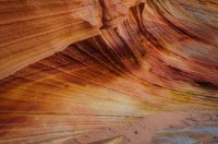
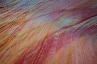
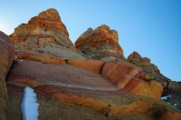
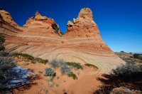
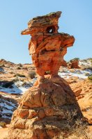
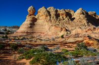
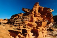
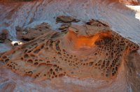
Arizona/Nevada – Winter 2016

Cool Danish

Member
Joined
Jan 13, 2013
Messages
136
I had a long weekend coming up and the weather looked promising for winter camping with clear skies. So I decided to do a short solo-trip to the Paria Plateau area without any concrete plans, just play it by ear and explore.

Friday, December 2, 2016
Home to Cottonwood Cove

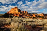
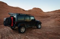
I left my home in southern California early in the morning and made the long drive towards Utah. Around 2pm I made it to St. George and stopped by the BLM office there to see if there were any available Coyote Butte permits. The ranger called the Kanab office and was able to reserve a CB South permit for the next day, but I had to pick it up in Kanab before 4pm. I easily made it and was soon off towards the Paria Plateau with permit in hand and a full tank of gas. The shadows were getting long as I drove past Paw Hole on my way to Cottonwood Cove.
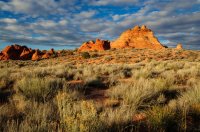
UT_AZ_NV_2016-1.jpg

UT_AZ_NV_2016-2.jpg

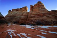
I call this one the pirate ship on a wave :thumbsup:
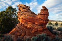
UT_AZ_NV_2016-3.jpg

I drove past Poverty Flat and all the way out to the end of the sandy two track. I quickly got my tent set up and was able to catch the sunset over Coyote Buttes. After a quick dinner and a warm cup of coffee, I got in my comfy down sleeping bag and read a little before going to sleep.
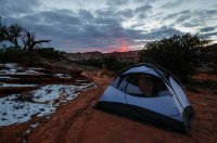
UT_AZ_NV_2016-4.jpg

Saturday, December 3, 2016
Cottonwood Cove to Death Pockets

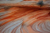
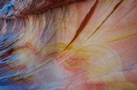
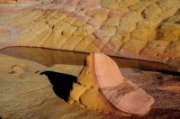
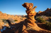
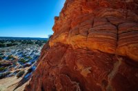
It was a cold night and the Jeep was covered in frost in the morning. I think the temperature gauge in the Jeep read 17F. I quickly made some coffee , packed a few breakfast snacks and started my hike into Coyote Buttes South. The colors and textures were great in the morning light.
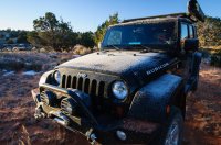
UT_AZ_NV_2016-5.jpg

UT_AZ_NV_2016-6.jpg

UT_AZ_NV_2016-7.jpg

UT_AZ_NV_2016-8.jpg

UT_AZ_NV_2016-9.jpg

UT_AZ_NV_2016-10.jpg

Half & Half.
UT_AZ_NV_2016-11.jpg

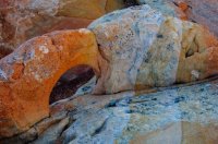
Mini arch.
UT_AZ_NV_2016-12.jpg

UT_AZ_NV_2016-13.jpg

UT_AZ_NV_2016-14.jpg

Woody wood pecker?
UT_AZ_NV_2016-15.jpg

UT_AZ_NV_2016-16.jpg

Control Tower.
UT_AZ_NV_2016-17.jpg

UT_AZ_NV_2016-18.jpg

After exploring CBS for several hours I walked out to the road and over to check out "The Chess Queen".
I walked back to the Jeep, ate lunch and then packed up camp.
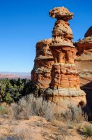
UT_AZ_NV_2016-19.jpg

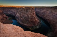
Next I drove off the Plateau towards Page AZ and headed out to an area I have wanted to explore for a while. My destination was called Death Pockets, but first I drove up to the edge of Paria River Canyon and enjoyed the view down on Lee's Ferry where the Paria River joins the Colorado River.UT_AZ_NV_2016-30.jpg
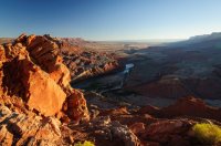
On the drive over to Death Pockets I saw a Big Horn Sheep run cross the trail and then up the side of the cliff.
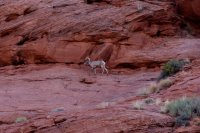
UT_AZ_NV_2016-29.jpg

Eventually I reached the end of the trail at an area called Death Pockets on the TOPO map. You can see Marble Canyon in the middle of the picture and Navajo Mountain and the Page Coal power plant on the left side of the horizon.
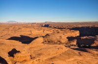
UT_AZ_NV_2016-20.jpg

I hiked on the slick rock out to the Colorado River for the sunset. I didn't have enough time to find a better spot for a good sunset picture, so these will have to do.
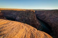
UT_AZ_NV_2016-21.jpg

UT_AZ_NV_2016-22.jpg

On the way back to the jeep I found this large alcove.
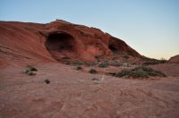
UT_AZ_NV_2016-23.jpg

I decided that I didn't want to camp out another night in freezing temperatures, so I drove out back out the sandy trail to SR-89 and drove west to a hotel room in Mt. Carmel Junction.
UT_AZ_NV_2016-24.jpg

Sunday, December 4, 2016
Mt. Carmel Junction to Home

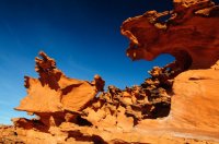
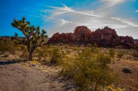
I got up early next morning and started the long drive back home. In Mesquite I made a side trip out Gold Butte Road to visit Little Finland. For some reason I didn't get any good pictures, even though there were plenty of nice formations.
UT_AZ_NV_2016-25.jpg

UT_AZ_NV_2016-26.jpg

UT_AZ_NV_2016-27.jpg

UT_AZ_NV_2016-28.jpg

After exploring a few hours, I made it home 5 hours later. It had been a nice long weekend to break up the winter.
 
Last edited:
great looking trip, thanks for sharing.
 
My destination was called Death Pockets, but first I drove up to the edge of Paria River Canyon and enjoyed the view down on Lee's Ferry where the Paria River joins the Colorado River.

Can you tell me about getting to that overlook? Is that close to the road? I seek high overlooks that I can drive to and observe thunderstorms during the monsoon. I'm looking to be in that area this summer.

Thank you for the TR. Beautiful pics.
 
Can you tell me about getting to that overlook? Is that close to the road? I seek high overlooks that I can drive to and observe thunderstorms during the monsoon. I'm looking to be in that area this summer.

Thank you for the TR. Beautiful pics.
The overlook I drove up to is at the end of an access trail to some radio towers. Here is where the picture is taken from: 36.880514, -111.586596.
It requires 4x4 and high clearance as there is deep sand in many places. Some of the trail is actually in a sandy wash.
I accessed the trail from Hwy 89 just North of Glenn Canyon Dam here: 36.938051, -111.493949
I have attached some GPX files. Hopeful you can read them.
 

Attachments

  • Ferryswalecanyon.gpx
    16.3 KB · Views: 3
  • FerrySwaleCanyonToLeeFerryOverlook.gpx
    51.1 KB · Views: 2
Just gorgeous photos, I love it @Cool Danish . We were at the Wave Dec 7,2016 just a few days after you, but I always wanted to see Coyote Butte South and your pictures show how beautiful it is. Thanks for sharing, we will be tracking your footsteps to Cottonwood Cove this coming December and I secured some permits yesterday. Now.... I had been trying to convince myself and Rick to car camp outside Coyote Butte South this December, knowing it will likely dip into the teens. We are used to frigid weather and hiking in single digits, but it's a whole other event, when it gets dark at 5 pm, light at 7 am and you don't hike and keep moving to stay warm.
Can you share more of how that evening and night went? Is it just too cold to do? I haven't camped for decades, so this might be a bit of a stretch. :rolleyes:
Also thanks for putting "Little Finland" on my radar again... it's been on our list for a while.
Greetings, The Danish Girl ( for real! )

Hi Titans,
Winter camping in sub-freezing temperatures is not super interesting. It’s a very long cold night in the sleeping bag. There is nothing to do… I basically went in the sleeping bag as soon as the sun went down. I did it because I wanted to be right at Cottonwood Cove at sunrise.

I think a better option is probably staying at a Hotel room in either Kanab, Page or Mt. Carmel Jct. and then drive out very early in the morning. But keep in mind that from the start of House Rock Valley Rd (whether you come in from North Hwy-89 or South Hwy-89A) to Lone Pine TH is probably a good 45mins depending on how fast you like to drive in the dark. It’s probably another 15mins to Paw Hole and an additional 20mins to Cottonwood Cove TH. Make sure you have a couple of GPS waypoints for the road intersection so you can find your turns in the dark.

The good news with going in December, is that the sand will be frozen in the early morning hours and you should be able to drive all the way to Cottonwood Cove (even up the deep sand hill right after Paw Hole TH). As long as your vehicle have some height clearance and you keep your revs up going up the hill, it will be a piece of cake in the winter time. In the winter time I rarely never use 4WD on the Paria Plateau. One other thing to look out for is the Buckskin wash crossing right after a storm, when coming in from the north on House Rock Valley Rd. (Just see IntrepidXJ's Trip report!), but again in the winter morning hours the mud will most likely be frozen solid and should not present a problem.

BTW, I am a genuine Danish too.. Born and raised.. Moved to the US in the mid 90s.

Thanks so much, great info, I really appreciate it @Cool Danish ! Yah, I was concerned about a very long and cold winter night in a sleeping bag with little to nothing to do from 6 pm to 7 am or so.
 
Last edited:
Similar threads
Thread starter Title Forum Replies Date
M Suggestions for early April in Arizona, 2-3 nights Trip Planning 2
Baddogranchaz Hello from Northern Arizona Noobs: Introduce yourself! 3
Arizona Jones Wet Beaver Creek Arizona, Backpack Trip Backpacking 10
Arizona Jones Willow Valley Loop Hike, Arizona Canyoneering 8
Arizona Jones Hello from Arizona Jones Noobs: Introduce yourself! 1
Titans 2020 Road Conditions Southern Utah (& Arizona Strip ) Trip Planning 1
Mack Shaft Phoenix, Arizona Trip Planning 6
Ross Arizona/Utah road trip loop with sandstone/badlands/canyon hikes Hiking & Camping 14
Titans Winter campfires - Utah / Arizona strip General Discussion 13
JDWalters Three days in Utah/Arizona Hiking & Camping 12
blueeyes Black Canyon Trail Arizona December 2018 Everything Else 10
Titans This week- Kanab, Arizona strip Trip Planning 13
Titans 3 week Arizona road trip: Tucson Desert Rain & Hiking SAGUARO NP Hiking & Camping 1
Titans Chiricahua National Monument- Southeast Arizona Hiking & Camping 8
stevecochranephotography Bright Angel Trail.. Grand Canyon, Arizona Hiking & Camping 1
T New from Arizona Noobs: Introduce yourself! 4
regehr 9 dead, boy missing in flash flood in Arizona swim hole General Discussion 1
LizardAZ Hello from Arizona Noobs: Introduce yourself! 3
Cool Danish Arizona Strip - Fall 2014 Hiking & Camping 8
Joey Trip Video: Wyoming's Teton Wilderness, Arizona Creek and the Huckleberry Lookout Tower. 10/14 Backpacking 11
DrNed Sasquatch Sighting In Arizona General Discussion 1
scatman Arizona Creek / Huckleberry Lookout - Teton Wilderness - October 10, 2014 Backpacking 12
uintahiker Another Southern Arizona TR: Hot Well Dunes Hiking & Camping 0
Ross Arizona and Utah wanderings Hiking & Camping 9
uintahiker The bloodiest spot in Arizona Hiking & Camping 0
N Labor Day Backpack in Arizona/Utah Trip Planning 3
uintahiker Southern Arizona- Garden Canyon Pictographs Hiking & Camping 0
Christian 1,764 Miles Across Utah and Arizona Hiking & Camping 6
Michael Clam Shell - Arizona Strip Hiking & Camping 6
IntrepidXJ Once in a Blue Moon | The Arizona Strip Hiking & Camping 18
Kerrie at Thru We Go Packraft Trip in the Sierra Nevada Mountains Trip Reports 3
seekinglost 1000 Mile Nevada Thru Hike on the Basin and Range Trail Trip Reports 14
napatony13 SUCCESSFUL SLEUTHING-Nevada Rock Art Off Road 6
Reef&Ruins Nevada Mining Ruins/Ghost Towns Trip Planning 6
balzaccom Ruby Mountains, Nevada Hiking & Camping 2
Stephanie B Gold Butte National Monument, Nevada, February 11 - 15, 2020 Hiking & Camping 3
balzaccom Sierra (Nevada) Stories General Discussion 0
dug Bikepacking in Nevada. Not what you think? Everything Else 16
wsp_scott A week in the Sierra Nevada Backpacking 23
mikejones3 Northfork to Second Lake Eastern Sierra Nevada Mountains Backpacking 5
KevinBoyer South Lake to North Lake Sierra Nevada Trip Planning 4
stevecochranephotography Valley of Fire State Park, Nevada Hiking & Camping 0
Jenessa Lamoille Lake, Nevada's Ruby Mountains Hiking & Camping 11
Jenessa Hello from Nevada Noobs: Introduce yourself! 3
scatman The Theodore Solomon's Trail (southern portion), Sierra Nevada - July 6, 2017 Backpacking 14
WasatchWill A night at Nevada's Valley of Fire State Park Hiking & Camping 7
J Summits and Rock Art in Nevada's Mojave Nov 8-10, 2016 Hiking & Camping 2
isleroyaleguy 170 Miles in the Sierra Nevada Backpacking 22
balzaccom Blue skies and green trees in the Sierra Nevada General Discussion 0
BryanG Sequoia National Forest - Sierra Nevada, CA Backpacking 5

Similar threads

Back
Top