- Joined
- May 24, 2015
- Messages
- 175
The inspiration for this trip came from Leigh Ortenburger's book, A Climbers Guide to the Tetons. Having spent a couple of summers working in YNP, I had managed to learn enough climbing to find the easiest ways up Grand, Middle and South Tetons. Ortenburgers condensed pocket size book had been the bible for all of the previous climbs. Now, I was looking for another climb that would be fresh, but not too technical, since I was not sure of the experience level of any potential partners. Mount Moran jumped out as a great candidate, since it was so dominant in the landscape. The NE ridge looked like something within our capabilities. Ortenburger describes the NE side of the mountain as not having any easy approach access. Either a long approach hike through an overgrown abandoned trail or a canoe paddle across String and Leigh Lake, are needed, just to get to the base of the mountain. The other, preferable alternative, is to take a boat across Jackson Lake. After I read that, a light bulb went off in my head.
My hiking buddy, Ron, and I had been learning to sail for a couple of years, at the urging of our college roommate Russ. Russ, an experienced sailor, had planted a seed in our heads about one day sailing in the South Pacific. Island hopping in warm waters, to uninhabited tropical places. We wanted in on that dream and he told us we needed to learn how to sail. So Ron bought a Hobie catamaran 16, and I bought a stock windsurfing board, just as they were starting to become popular on the West coast. We could use the Hobie to ferry our gear across Jackson Lake, over to the remote beach, at the base of the climb. It would be a perfect marriage of our new found sport, sailing, in our favorite playground, YNP/Tetons. The best part was that we could use the sailing aspect to hopefully, lure Russ into joining us, in Wyoming, for this adventure.
This trip is from 1982. I recently digitized many of my slides so I thought I should share this unique trip on the forum. The picture quality is lacking a bit, since they are from slides, but should be good enough to get the story across.
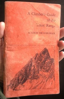
Here is my worn copy of Ortenburger's guidebook. It is only 144 pages. Designed, I think, to be carried on a climb, in your pants pocket. This was all we had to go on for climbs back then, but it had everything we needed.
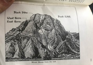
The typical map is a black and white pencil sketch, with not a lot of detail, as shown below, We would always spend a lot of time route finding, but eventually got it right, during our climbs. The same book, updated to a third edition, is over 400 pages with lots of gorgeous helo or drone photographs, covering every possible angle, and route. It is a huge improvement and still the bible for Teton climbing.
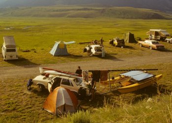
We would be towing the Hobie over a 1000 miles to the park. We didn't want to subject any of our personal cars to that kind of work, so we rented a car and a tow hitch. We knew from experience that we were not allowed to take a rental car to Baja, but there were no restrictions on interstate travel. So, we found a rental car with unlimited milage and attached a hitch to it to tow the boat trailer.
The Mercury Zephyr with one sailboard on top and the Hobie, in tow, at our first driving campsite.
We were so stoked just to get the Hobie up to the park, without incident. Russ , Jill and Ron, on the trampoline, which doubled as a sleeping platform, when it wasn't raining.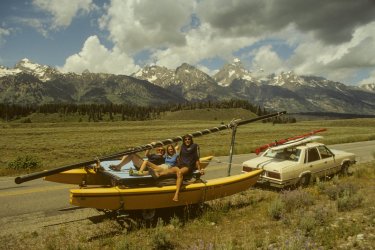
We did a warm up hike to get better acclimated. Up Cascade Canyon and down Paintbrush Canyon.
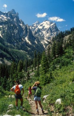
Russ was also an avid backpacker, but stayed primarily in the Sierra. I was so glad we could get him out into the Rockies. It was fun to see the park through his eyes on his first visit.
Crossing Paintbrush Divide, one of the most scenic hikes in the park. Mt Moran from the South, in the background.
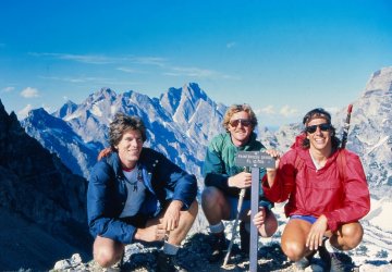
We finished up the hike with a fun boot glissade down a snow field.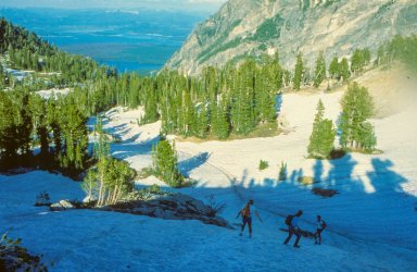
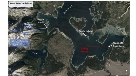
This map shows our travel plan for the Mount Moran climb. Load up the Hobie, as a cargo vessel, with our gear, at Signal Mt boat ramp. The Hobie, with three of us onboard, would carry us to the beach camp at the base of Mt Moran's North East ridge. Russ and I would take turns sailing the windsurfer up to the same beach, while hopping on and off the Hobie, as necessary. It was about 6 miles in distance as the crow flies, but more like 8 miles with all of the upwind tacking involved. The prevailing wind was westerly. so we would be going up wind the entire day.
Preparing the gear at the Signal Mountain boat ramp.
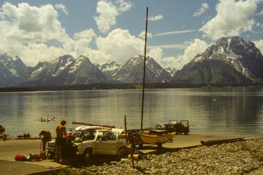
Hobies are very fast boats, built for speed. As a result, they can capsize, even going completely upside down. They can be righted easily enough, by an experienced crew. Since we would be towing our camping gear and cameras, we had to be more conservative while sailing the catamaran fully loaded. Capsizing was not really an option with all of our gear on board.
Skipper Ron was in heaven as he sailed the cat on a boat check cruise before we loaded it up. " I can't believe we have the boat here and we are sailing in front of the Tetons ! "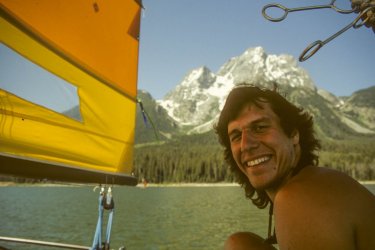
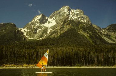
Russ did the same on the stock Windsurfer. He was hoping for more wind.
The trip across the Lake was pretty uneventful, but took longer than we expected. Too bad we didn't have better wind, but at least we had made it to camp, with all of our gear. Beach camp.
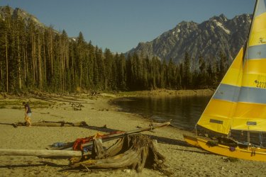
Ron and Jill were an experienced, Hobie racing team. They did a good job of adapting the Hobie into a cargo vessel, keeping everything in balance and from getting too wet. That evening we enjoyed our secluded camp.
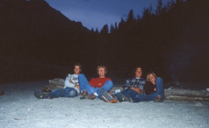
The next morning, the boys headed off up the mountain. We gained altitude fast.
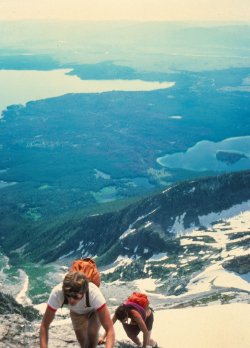
Following Ortenburger's route, we negotiated around the Great Gendarme, at 10,230 ft.
Ron, making it around the loose ledges on the right side of the Gendarme.
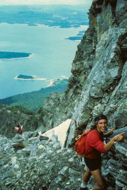
We scrambled back to attain the ridge line, staying on route. Gendarme in background.
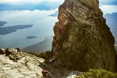
We were getting a lot higher now and noticed some clouds forming below us.
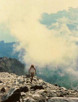
The climbing was pretty easy as long as we stayed on route. A couple of times we came onto some serious exposure and had to back off, knowing we were off route. We had a lunch snack with this scenic view of the Lake below us. (Little Marie Island visible in the top right)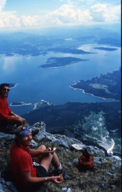
Some of the snow patches we crossed were pretty intimidating
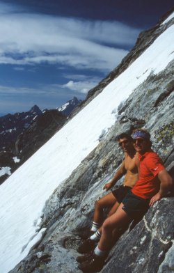
As we approached the chimney leading to the Southern summit, the terrain became steeper, with more snow patches.
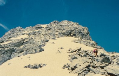
At this point we came up behind another climbing party. They were in the chimney that we wanted to negotiate, in order for us to finish the final steep pitch of the climb. We waited quite a while for them and could still hear them, although they were out of sight. We noticed we were starting to get cold due to the inactivity, but we also noticed it was also just getting cold, as if the weather was changing.
Ortenburger's book is very specific about the NE ridge approach. The one concern that needs to be constantly considered is the inability to see storms coming from the west (which is the prevailing direction) when you are on this route. "The ridge is an exposed and fearful place during a thunderstorm." We took this into consideration as we thought we detected more clouds building up as well as colder air. The colder air, coupled with the fact that we did not want to have to change out of our shorts , just to sit and wait for the other party influenced our decision. So we agreed to start to down climb instead of sitting any longer. Maybe we could catch a late evening sailing session if we hurried back to camp.
Turning back at this point was not a big deal. None of us had any summit fever going on. We were quite high and impressed with the view. My only disappointment was that I knew from reading the climbing book that the summit of Mt Moran had a unique, big, 15 acre flat spot on top. I had secretly planned to break out a frisbee I was carrying with me and see if the guys wanted to join me in a summit top frisbee session. That would have to wait for another day.
Down climbing some of the steep snow patches.
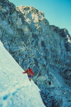
Headed down above the Gendarme. At least we were moving again.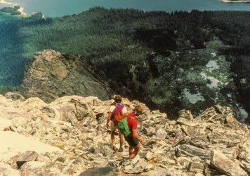
We got back down safely. It rained on us a bit in camp but we still had a little color for another sunset.
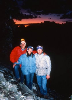
The next morning we broke camp and loaded up the cargo hobie for the trip back. The skies were already a little darker than normal. It looked like we might get the wind we were hoping for. Russ took off on the windsurfer, headed toward the open water and in the direction of Signal Mountain. Ron and Jill crewed the Hobie. I was also on board for added ballast and to make sure our gear did not get sprayed too much, since the wind had picked up and the skies were getting darker quickly.
Skipper Ron, expecting a quicker, broad reach sail, back to the boat ramp.
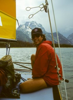
We were about a third of the way home when it became apparent that a summer thunderstorm was developing and about ready to pass through the area. The wind picked up and suddenly we were making great time. Instead of letting the boat cruise at maximum performance, Ron had to rein her in, to keep her in contact with the water. He and Jill did a great job of keeping the boat properly balanced as the wind and waves became more challenging. We were getting our wind wish fulfilled but since the boat was so loaded down, we could not take full advantage of the fun conditions. Meanwhile Russ had caught the wind ahead of us and was long gone, under full power on the Windsled. The early windsurfers only had one size sail, large and billowy, no storm daggerboard and no harness lines. So Russ was at risk of being overpowered by the storm winds. Fortunately, he was well equipped to handle the situation since he weighed enough to keep the sail held down and he also knew how to remove the daggerboard and plane the board with the daggerboard carried over his shoulder. The storm hit us with full force and we were having a good fun challenge to keep the boat from flying its windward hull too high. Gybing was becoming a careful challenge and we needed to make many more to weave our way back to the ramp. This went on for a while and seemed like we were going to race to victory, all the way to Signal Mountain but then we started to notice lightning in the area. The thunder was close too, and the combination really put a damper on what was a good sailing session. A Hobie 16 has a 26 foot metal mast sticking up into the sky. That is basically a 26 foot lightning rod. So we had a quick discussion and noticed a small island coming up in front of us. Ron made the call, and we decided to beach the boat on Marie Island, two miles from Signal Mountain. We would wait out the storm on this treeless, 100 yards of earth, in the middle of the Lake, and distance ourselves from the lightning rod mast.
Ron and Jill stowing the Jib to keep the boat from blowing over.
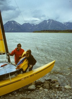
Ron lowering the main sail to put the boat out of commission until the conditions improved.
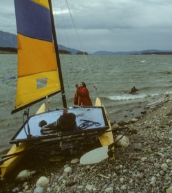
It started to get late and the storm had not abated. Still windy with rain and lightning and thunder. We started to realize we might not get to sail the boat the last couple of miles that evening.
Ron and Jill after the threat of lightning had momentarily passed.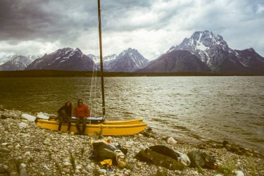
One of the last boats on the water was a a small aluminum motored houseboat. They swung by within shouting distance and asked if we wanted a ride. It was time to head to the marina. The hobie was safe and we could return to pick it up later, even the next day. So we jumped on board the houseboat and started to look for any sign of Russ or his board, as we were motored back to the Signal Mt boat ramp area. There was no sign of Russ but if he would have had a problem sailing he would have ended up downwind, only a mile or so from the boat ramp. We made it back to Signal Mt and unloaded our gear into the dry car, at the boat ramp parking area. It started to get dark, so we thought maybe we should go look for Russ, or the board he was on.
Just then Russ walks up in his wetsuit from the other direction, as fresh as a daisy. He had been in the comfort of the Signal Mt bar ( Deadmans?) enjoying a beer, waiting for us. While he was waiting for us, the gal that owned the short lived, Alpine Windsurfing shop, in Jackson, had bought him a beer and listened to our sailing/climbing story. He evidently had a great sail in, fully powered up, planing all the way with the daggerboard draped over his shoulder.
Russ wishing he could have sailed more of the fun storm.
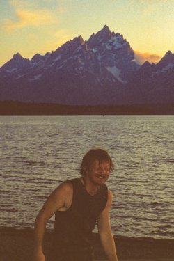
It was an exciting 24 hours for us. We had made a couple of conservative decisions that seemed like no brainers at the time but also cut short our adventures.
The next morning we had a Snake River whitewater raft trip already scheduled, so we didn't get back to the Lake to retrieve the hobie ,until later in the day. We hitched a ride to Marie Island and sailed the catamaran back, under smooth, light wind conditions. We sailed until sunset in front of the range, getting some memorable sailing and Teton landscape images forever ingrained into our memories.
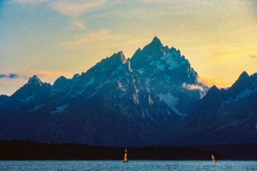
Russ chatted up some folks and found out that the climbing party that was ahead of us, on Mt Moran, ended up spending the night on the NE ridge. They had to bivouc and had a miserable, shivering night with high wind and hail. So we felt a little vindicated about our decision on turning back. We had accomplished our goal of combining small craft sailing with the beauty of the Tetons as a backdrop, in a remote part of the park.
Final sunset in the Tetons then off to YNP.
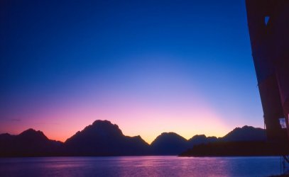
We traveled up to YNP for the next few days and wowed Russ with the wonders up there. We also tried to sail again on Lake Hebgen, near West Yellowstone, but as the wind picked up, into the fun range, the boat popped a shroud and dismasted. I think that we had overstressed the boat a bit on Jackson Lake with all of the weight and extra bodies. When we hit good wind on Lake Hebgen one of the two shrouds that holds up the mast, had had enough, and gave up. No one got hurt. We were able to self rescue without any problems but that put an end to our alpine catamaranning for the trip.
It was a memorable trip that worked out for the best. I still want to get up to the top of Moran mountain to see if it is possible to throw the frisbee.
Thanks for watching,
TV
My hiking buddy, Ron, and I had been learning to sail for a couple of years, at the urging of our college roommate Russ. Russ, an experienced sailor, had planted a seed in our heads about one day sailing in the South Pacific. Island hopping in warm waters, to uninhabited tropical places. We wanted in on that dream and he told us we needed to learn how to sail. So Ron bought a Hobie catamaran 16, and I bought a stock windsurfing board, just as they were starting to become popular on the West coast. We could use the Hobie to ferry our gear across Jackson Lake, over to the remote beach, at the base of the climb. It would be a perfect marriage of our new found sport, sailing, in our favorite playground, YNP/Tetons. The best part was that we could use the sailing aspect to hopefully, lure Russ into joining us, in Wyoming, for this adventure.
This trip is from 1982. I recently digitized many of my slides so I thought I should share this unique trip on the forum. The picture quality is lacking a bit, since they are from slides, but should be good enough to get the story across.
Here is my worn copy of Ortenburger's guidebook. It is only 144 pages. Designed, I think, to be carried on a climb, in your pants pocket. This was all we had to go on for climbs back then, but it had everything we needed.

The typical map is a black and white pencil sketch, with not a lot of detail, as shown below, We would always spend a lot of time route finding, but eventually got it right, during our climbs. The same book, updated to a third edition, is over 400 pages with lots of gorgeous helo or drone photographs, covering every possible angle, and route. It is a huge improvement and still the bible for Teton climbing.

We would be towing the Hobie over a 1000 miles to the park. We didn't want to subject any of our personal cars to that kind of work, so we rented a car and a tow hitch. We knew from experience that we were not allowed to take a rental car to Baja, but there were no restrictions on interstate travel. So, we found a rental car with unlimited milage and attached a hitch to it to tow the boat trailer.
The Mercury Zephyr with one sailboard on top and the Hobie, in tow, at our first driving campsite.

We were so stoked just to get the Hobie up to the park, without incident. Russ , Jill and Ron, on the trampoline, which doubled as a sleeping platform, when it wasn't raining.

We did a warm up hike to get better acclimated. Up Cascade Canyon and down Paintbrush Canyon.

Russ was also an avid backpacker, but stayed primarily in the Sierra. I was so glad we could get him out into the Rockies. It was fun to see the park through his eyes on his first visit.
Crossing Paintbrush Divide, one of the most scenic hikes in the park. Mt Moran from the South, in the background.

We finished up the hike with a fun boot glissade down a snow field.

This map shows our travel plan for the Mount Moran climb. Load up the Hobie, as a cargo vessel, with our gear, at Signal Mt boat ramp. The Hobie, with three of us onboard, would carry us to the beach camp at the base of Mt Moran's North East ridge. Russ and I would take turns sailing the windsurfer up to the same beach, while hopping on and off the Hobie, as necessary. It was about 6 miles in distance as the crow flies, but more like 8 miles with all of the upwind tacking involved. The prevailing wind was westerly. so we would be going up wind the entire day.

Preparing the gear at the Signal Mountain boat ramp.

Hobies are very fast boats, built for speed. As a result, they can capsize, even going completely upside down. They can be righted easily enough, by an experienced crew. Since we would be towing our camping gear and cameras, we had to be more conservative while sailing the catamaran fully loaded. Capsizing was not really an option with all of our gear on board.
Skipper Ron was in heaven as he sailed the cat on a boat check cruise before we loaded it up. " I can't believe we have the boat here and we are sailing in front of the Tetons ! "

Russ did the same on the stock Windsurfer. He was hoping for more wind.

The trip across the Lake was pretty uneventful, but took longer than we expected. Too bad we didn't have better wind, but at least we had made it to camp, with all of our gear. Beach camp.

Ron and Jill were an experienced, Hobie racing team. They did a good job of adapting the Hobie into a cargo vessel, keeping everything in balance and from getting too wet. That evening we enjoyed our secluded camp.

The next morning, the boys headed off up the mountain. We gained altitude fast.

Following Ortenburger's route, we negotiated around the Great Gendarme, at 10,230 ft.
Ron, making it around the loose ledges on the right side of the Gendarme.

We scrambled back to attain the ridge line, staying on route. Gendarme in background.

We were getting a lot higher now and noticed some clouds forming below us.

The climbing was pretty easy as long as we stayed on route. A couple of times we came onto some serious exposure and had to back off, knowing we were off route. We had a lunch snack with this scenic view of the Lake below us. (Little Marie Island visible in the top right)

Some of the snow patches we crossed were pretty intimidating

As we approached the chimney leading to the Southern summit, the terrain became steeper, with more snow patches.

At this point we came up behind another climbing party. They were in the chimney that we wanted to negotiate, in order for us to finish the final steep pitch of the climb. We waited quite a while for them and could still hear them, although they were out of sight. We noticed we were starting to get cold due to the inactivity, but we also noticed it was also just getting cold, as if the weather was changing.
Ortenburger's book is very specific about the NE ridge approach. The one concern that needs to be constantly considered is the inability to see storms coming from the west (which is the prevailing direction) when you are on this route. "The ridge is an exposed and fearful place during a thunderstorm." We took this into consideration as we thought we detected more clouds building up as well as colder air. The colder air, coupled with the fact that we did not want to have to change out of our shorts
Turning back at this point was not a big deal. None of us had any summit fever going on. We were quite high and impressed with the view. My only disappointment was that I knew from reading the climbing book that the summit of Mt Moran had a unique, big, 15 acre flat spot on top. I had secretly planned to break out a frisbee I was carrying with me and see if the guys wanted to join me in a summit top frisbee session. That would have to wait for another day.
Down climbing some of the steep snow patches.

Headed down above the Gendarme. At least we were moving again.

We got back down safely. It rained on us a bit in camp but we still had a little color for another sunset.

The next morning we broke camp and loaded up the cargo hobie for the trip back. The skies were already a little darker than normal. It looked like we might get the wind we were hoping for. Russ took off on the windsurfer, headed toward the open water and in the direction of Signal Mountain. Ron and Jill crewed the Hobie. I was also on board for added ballast and to make sure our gear did not get sprayed too much, since the wind had picked up and the skies were getting darker quickly.
Skipper Ron, expecting a quicker, broad reach sail, back to the boat ramp.

We were about a third of the way home when it became apparent that a summer thunderstorm was developing and about ready to pass through the area. The wind picked up and suddenly we were making great time. Instead of letting the boat cruise at maximum performance, Ron had to rein her in, to keep her in contact with the water. He and Jill did a great job of keeping the boat properly balanced as the wind and waves became more challenging. We were getting our wind wish fulfilled but since the boat was so loaded down, we could not take full advantage of the fun conditions. Meanwhile Russ had caught the wind ahead of us and was long gone, under full power on the Windsled. The early windsurfers only had one size sail, large and billowy, no storm daggerboard and no harness lines. So Russ was at risk of being overpowered by the storm winds. Fortunately, he was well equipped to handle the situation since he weighed enough to keep the sail held down and he also knew how to remove the daggerboard and plane the board with the daggerboard carried over his shoulder. The storm hit us with full force and we were having a good fun challenge to keep the boat from flying its windward hull too high. Gybing was becoming a careful challenge and we needed to make many more to weave our way back to the ramp. This went on for a while and seemed like we were going to race to victory, all the way to Signal Mountain but then we started to notice lightning in the area. The thunder was close too, and the combination really put a damper on what was a good sailing session. A Hobie 16 has a 26 foot metal mast sticking up into the sky. That is basically a 26 foot lightning rod. So we had a quick discussion and noticed a small island coming up in front of us. Ron made the call, and we decided to beach the boat on Marie Island, two miles from Signal Mountain. We would wait out the storm on this treeless, 100 yards of earth, in the middle of the Lake, and distance ourselves from the lightning rod mast.
Ron and Jill stowing the Jib to keep the boat from blowing over.

Ron lowering the main sail to put the boat out of commission until the conditions improved.

It started to get late and the storm had not abated. Still windy with rain and lightning and thunder. We started to realize we might not get to sail the boat the last couple of miles that evening.
Ron and Jill after the threat of lightning had momentarily passed.

One of the last boats on the water was a a small aluminum motored houseboat. They swung by within shouting distance and asked if we wanted a ride. It was time to head to the marina. The hobie was safe and we could return to pick it up later, even the next day. So we jumped on board the houseboat and started to look for any sign of Russ or his board, as we were motored back to the Signal Mt boat ramp area. There was no sign of Russ but if he would have had a problem sailing he would have ended up downwind, only a mile or so from the boat ramp. We made it back to Signal Mt and unloaded our gear into the dry car, at the boat ramp parking area. It started to get dark, so we thought maybe we should go look for Russ, or the board he was on.
Just then Russ walks up in his wetsuit from the other direction, as fresh as a daisy. He had been in the comfort of the Signal Mt bar ( Deadmans?) enjoying a beer, waiting for us. While he was waiting for us, the gal that owned the short lived, Alpine Windsurfing shop, in Jackson, had bought him a beer and listened to our sailing/climbing story. He evidently had a great sail in, fully powered up, planing all the way with the daggerboard draped over his shoulder.
Russ wishing he could have sailed more of the fun storm.

It was an exciting 24 hours for us. We had made a couple of conservative decisions that seemed like no brainers at the time but also cut short our adventures.
The next morning we had a Snake River whitewater raft trip already scheduled, so we didn't get back to the Lake to retrieve the hobie ,until later in the day. We hitched a ride to Marie Island and sailed the catamaran back, under smooth, light wind conditions. We sailed until sunset in front of the range, getting some memorable sailing and Teton landscape images forever ingrained into our memories.

Russ chatted up some folks and found out that the climbing party that was ahead of us, on Mt Moran, ended up spending the night on the NE ridge. They had to bivouc and had a miserable, shivering night with high wind and hail. So we felt a little vindicated about our decision on turning back. We had accomplished our goal of combining small craft sailing with the beauty of the Tetons as a backdrop, in a remote part of the park.
Final sunset in the Tetons then off to YNP.

We traveled up to YNP for the next few days and wowed Russ with the wonders up there. We also tried to sail again on Lake Hebgen, near West Yellowstone, but as the wind picked up, into the fun range, the boat popped a shroud and dismasted. I think that we had overstressed the boat a bit on Jackson Lake with all of the weight and extra bodies. When we hit good wind on Lake Hebgen one of the two shrouds that holds up the mast, had had enough, and gave up. No one got hurt. We were able to self rescue without any problems but that put an end to our alpine catamaranning for the trip.
It was a memorable trip that worked out for the best. I still want to get up to the top of Moran mountain to see if it is possible to throw the frisbee.
Thanks for watching,
TV
Last edited:
