- Joined
- Aug 23, 2016
- Messages
- 144
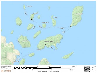
Have not seen many trips posted here from the Great Lakes so thought I’d contribute this one. My wife, Stacy, and our friend Ken spent a week sea kayaking in the Apostle Islands, Lake Superior in June, 2021. We did a loop through the main archipelago intending to camp two nights at each stop to leave time for hiking or day-paddling. We were windbound one extra day on Rocky Island and the weather forecast for our last day looked bad so we paddled out a day early. Our route is shown below.
The area is called a National Lakeshore and is administered by the National Park Service. Camping is by reservation only. There are established campsites on most islands and dispersed camping is allowed for a limited number of parties on each island as well. Campsites include bear boxes and fire rings and some include picnic tables. For this trip we stayed in established campsites. Some of the islands have hiking trails but not all are regularly maintained.
Day 1
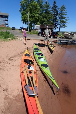
We put in at Red Cliff, WI, which is the administrative center of the Red Cliff Indian Reservation. For a small fee the local hotel/casino/marina allows kayak launching and parking.
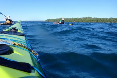
It was a little rough at first but smoothed out later.
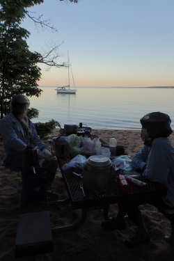
Our first campsite was at Quarry Bay, Stockton Island. We got to camp just in time to set up and have dinner before dark. When the wind died the mosquitoes were a bit thick. The park is popular for sailing and Quarry Bay often has sailboats anchored overnight. The bay is named for a nearby quarry--the sandstone making up the bedrock of the islands was quarried extensively in the late 1800s and used for building stone.
Day 2
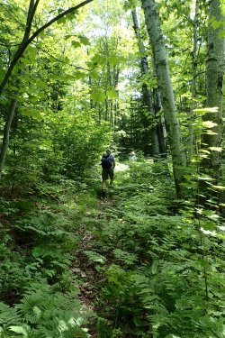
We spent today hiking. Apostle Islands forest is right on the line between temperate and boreal. It includes oak, maple, pine, aspen, birch, arborvitae, fir and spruce.
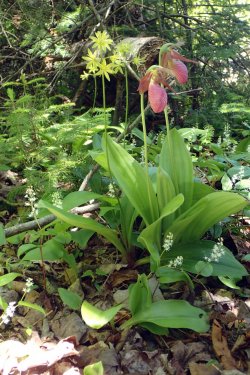
Lots of wildflowers in June. Pink ladyslipper, blue bead lily and Canada mayflower here.
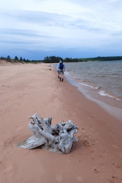
The trail goes along the beach at Julien Bay.
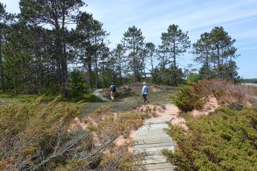
The southeastern part of Stockton, Presque Isle Point, is made of sand (beach and dune) deposited as the last continental glaciers were retreating. The plant community there is different from the rest of the island.
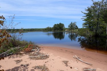
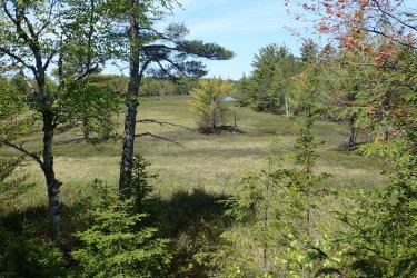
There is a lagoon and large bog behind the beach.
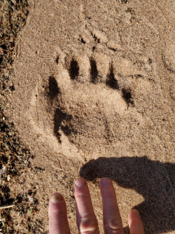
Many of the islands have full-time bear populations. We saw bear tracks but no other signs of bears.
Day 3
Packing up for the paddle to Outer Island.
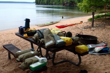
Lake Superior is cold. About 50° where we were paddling. You need to wear a wetsuit or drysuit to survive for any amount of time should you end up in the water. Part of our morning ritual was struggling into neoprene.
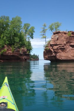
Rock formations on the northwest side of Stockton Island.
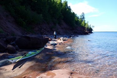
We stopped on a tiny beach before the long crossing to Outer
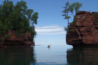
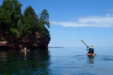
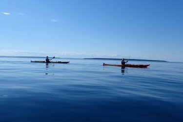
The paddle to Outer Island was incredibly smooth.
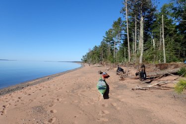
The campsite on Outer is on old beach deposits and stabilized sand dunes. This looking south, with Stockton Is. in the distance. Camp is on the embankment to the right.
Day 4
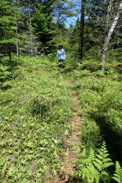
There was a trail the length of the island but a big piece of it in the middle has been inundated by beaver dams. We hiked a mile or two and gave up. The forest here has more of a boreal character with lots of fir trees.
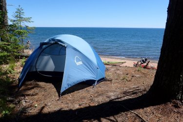
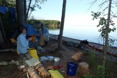
Outer Island camp again.
Day 5
Another smooth day for our paddle to Rocky.
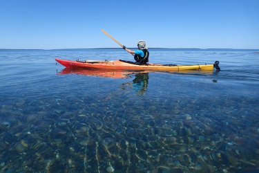
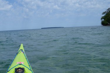
Our first stop will be Cat Island, on the horizon.
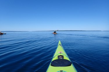
Smooth days can be incredibly relaxing. Rest stop at Cat Island sand spit.
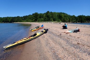
Another beautiful sand spit on Ironwood Island.
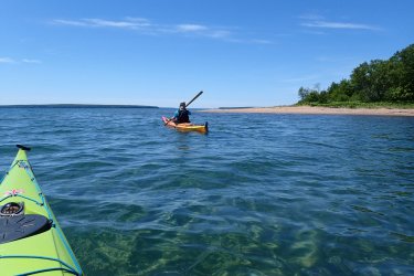
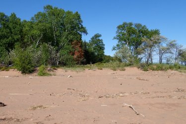
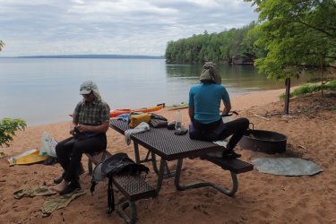
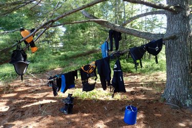
Campsite on Rocky Island. Lots of white pine here—they are great for drying gear.
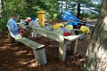
Someone made excellent camp furniture from debris washed up by storms.
Day 6
Today we did a day-paddle out to Devil’s island. We had pretty strong crosswinds so the crossing was a little nerve-wracking. No photos—I was afraid to let go of my paddle!
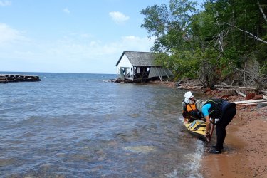
There is a dock and boathouse on Devil’s but both were severely storm-damaged a few years ago and have not been rebuilt. Luckily the dock remnants still create a sheltered area to land kayaks.
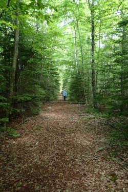
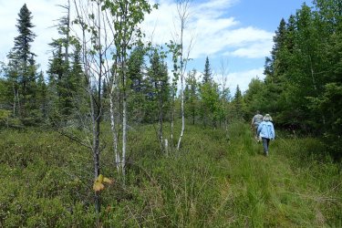
We hiked the trail to the lighthouse at the north end of the island. Seems to be pretty much boreal forest here. Lots of spruce, fir and birch.
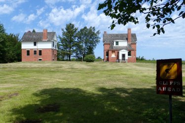
Housing for lighthouse-keeper. Lights are now fully automated so houses are only occupied sporadically by park service people.
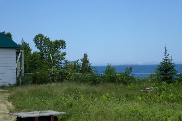
Great Lakes ore boat on horizon.
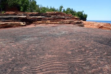
Ripples in nearly one billion year old sandstone.
After hiking we paddled around the island. The northern and eastern sides were sheltered from the wind. Lots of cliffs and sea caves at the northern end.
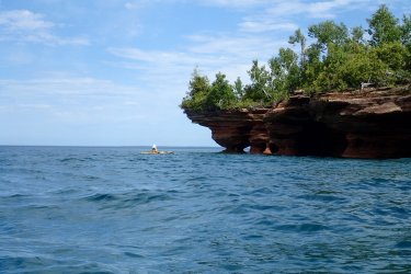
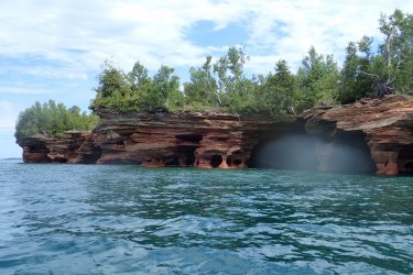
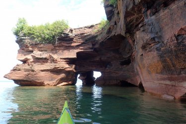
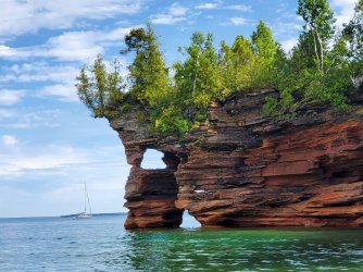
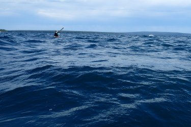
Still a bit rough for the return leg to Rocky but I was able to take some pictures.
Day 7
We were supposed to move on to our next camp today but it was too windy. We stayed put on Rocky.
Day 8
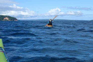
Today was beautiful and we headed for Oak Island—the one ahead with the big embankment. Our campsite is around to the right side of the island. The campsite was nothing special and the weather was slated to deteriorate overnight so we paddled out a day early.
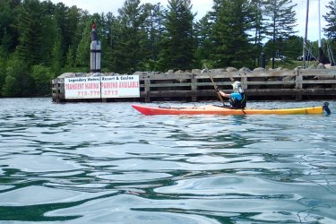
Arriving back at the casino.
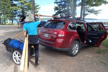
Ken found a cart to haul our gear back the cars. I don’t think it was there for kayakers but it sure was handy!
The area is called a National Lakeshore and is administered by the National Park Service. Camping is by reservation only. There are established campsites on most islands and dispersed camping is allowed for a limited number of parties on each island as well. Campsites include bear boxes and fire rings and some include picnic tables. For this trip we stayed in established campsites. Some of the islands have hiking trails but not all are regularly maintained.

Day 1
We put in at Red Cliff, WI, which is the administrative center of the Red Cliff Indian Reservation. For a small fee the local hotel/casino/marina allows kayak launching and parking.

It was a little rough at first but smoothed out later.

Our first campsite was at Quarry Bay, Stockton Island. We got to camp just in time to set up and have dinner before dark. When the wind died the mosquitoes were a bit thick. The park is popular for sailing and Quarry Bay often has sailboats anchored overnight. The bay is named for a nearby quarry--the sandstone making up the bedrock of the islands was quarried extensively in the late 1800s and used for building stone.

Day 2
We spent today hiking. Apostle Islands forest is right on the line between temperate and boreal. It includes oak, maple, pine, aspen, birch, arborvitae, fir and spruce.

Lots of wildflowers in June. Pink ladyslipper, blue bead lily and Canada mayflower here.

The trail goes along the beach at Julien Bay.

The southeastern part of Stockton, Presque Isle Point, is made of sand (beach and dune) deposited as the last continental glaciers were retreating. The plant community there is different from the rest of the island.

There is a lagoon and large bog behind the beach.


Many of the islands have full-time bear populations. We saw bear tracks but no other signs of bears.

Day 3
Packing up for the paddle to Outer Island.

Lake Superior is cold. About 50° where we were paddling. You need to wear a wetsuit or drysuit to survive for any amount of time should you end up in the water. Part of our morning ritual was struggling into neoprene.

Rock formations on the northwest side of Stockton Island.


We stopped on a tiny beach before the long crossing to Outer

The paddle to Outer Island was incredibly smooth.

The campsite on Outer is on old beach deposits and stabilized sand dunes. This looking south, with Stockton Is. in the distance. Camp is on the embankment to the right.

Day 4
There was a trail the length of the island but a big piece of it in the middle has been inundated by beaver dams. We hiked a mile or two and gave up. The forest here has more of a boreal character with lots of fir trees.

Outer Island camp again.


Day 5
Another smooth day for our paddle to Rocky.

Our first stop will be Cat Island, on the horizon.

Smooth days can be incredibly relaxing. Rest stop at Cat Island sand spit.

Another beautiful sand spit on Ironwood Island.


Campsite on Rocky Island. Lots of white pine here—they are great for drying gear.

Someone made excellent camp furniture from debris washed up by storms.

Day 6
Today we did a day-paddle out to Devil’s island. We had pretty strong crosswinds so the crossing was a little nerve-wracking. No photos—I was afraid to let go of my paddle!

There is a dock and boathouse on Devil’s but both were severely storm-damaged a few years ago and have not been rebuilt. Luckily the dock remnants still create a sheltered area to land kayaks.

We hiked the trail to the lighthouse at the north end of the island. Seems to be pretty much boreal forest here. Lots of spruce, fir and birch.


Housing for lighthouse-keeper. Lights are now fully automated so houses are only occupied sporadically by park service people.

Great Lakes ore boat on horizon.

Ripples in nearly one billion year old sandstone.

After hiking we paddled around the island. The northern and eastern sides were sheltered from the wind. Lots of cliffs and sea caves at the northern end.


Still a bit rough for the return leg to Rocky but I was able to take some pictures.

Day 7
We were supposed to move on to our next camp today but it was too windy. We stayed put on Rocky.
Day 8
Today was beautiful and we headed for Oak Island—the one ahead with the big embankment. Our campsite is around to the right side of the island. The campsite was nothing special and the weather was slated to deteriorate overnight so we paddled out a day early.

Arriving back at the casino.

Ken found a cart to haul our gear back the cars. I don’t think it was there for kayakers but it sure was handy!

