AustinCronnelly
Butte Rat
- Joined
- Jan 18, 2012
- Messages
- 132
In a short span of less than 4 years I've gone from zero to 3 kids. For the time being, my growing family has considerably shrunk my circle of opportunities for outdoor adventure. Fortunately I've been able to fill this void by only being 20 minutes door-to-door (garage door to visitor center door) from Antelope Island. I calculated this last time I went out to the island and had to run back home because I forgot my 3 year old's shoes.
Like most people, my first visit to AI was in the summer. My first impression was that it was strangely beautiful, but HOT, buggy, no shade, has none of the allure of the Wasatch...and when can I get back and the car? Fortunately, I gave it a second chance. Over the years I've found that AI is the king of the shoulder seasons/ winter for local hiking. From November-April, you will almost always have pleasant hiking conditions. No bugs, pleasant temps, and little to no crowds.
I've hiked/ran all of the open trails on the Island except for the newly open to the public "West Side/ Buffalo Scaffold Trail". When I found out you could link up trails from the north end to trails on the south, it immediately became a bucket list item. I recruited a trail running buddy and we set out to run the trail without a real idea of the distance or terrain other than what google earth offered up. I wasn't able to find any information about the trail other than an old management plan from the early 00's that suggested of exploring overnight sites along the trail. For us is was Terra Incognita.
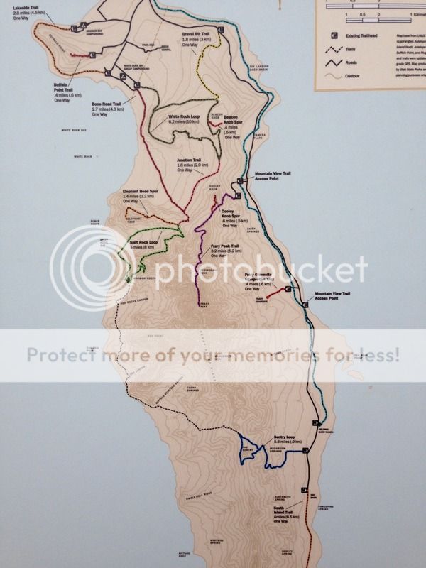
Here is an overview of the island trail system. We started at the White Rock Bay Campground, followed the red line SE to the Junction Trail, continued onto the Split Rock Loop (green), from there we dropped onto the black dotted line of the West Side Trail, finally linking back over to the east side of the island at Sentry peak and ending at the ranch.
Please forgive the quality of the pictures. Because we were running, they are all taken with my phone...and at least I think I stopped running for most of them.
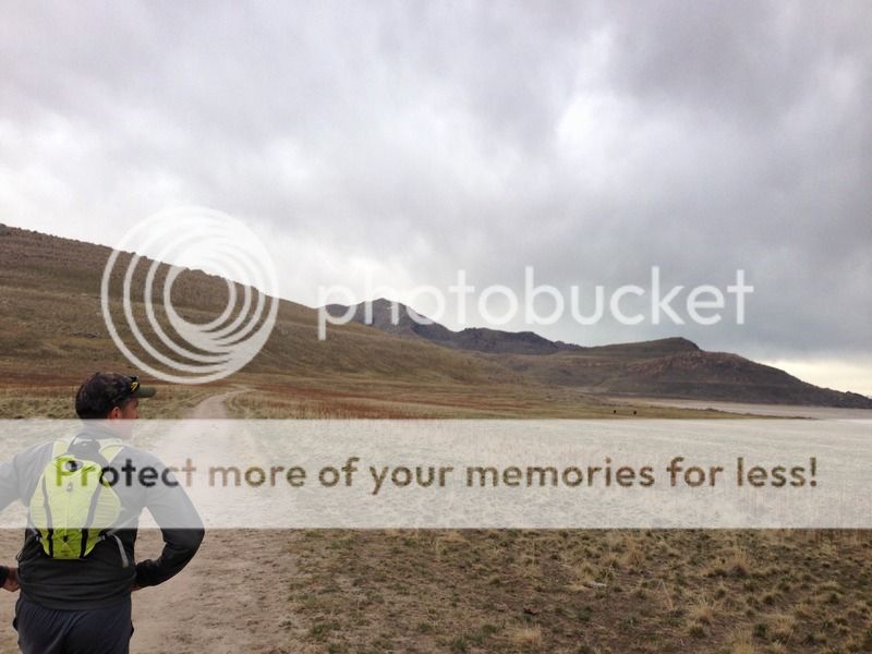
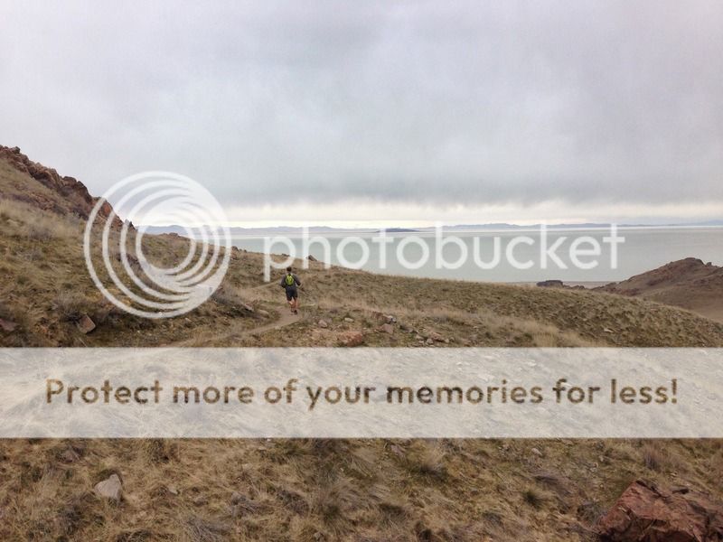
Started out with a little rain and breeze. Frary peak, the high point on the island is visible in the distance.
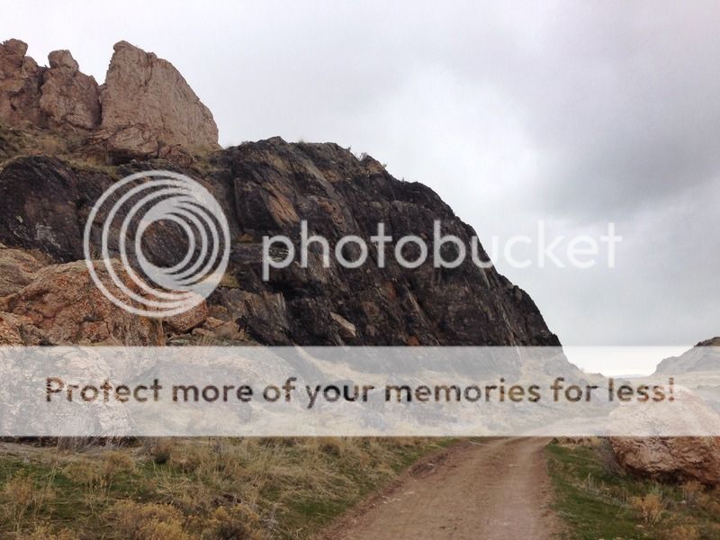
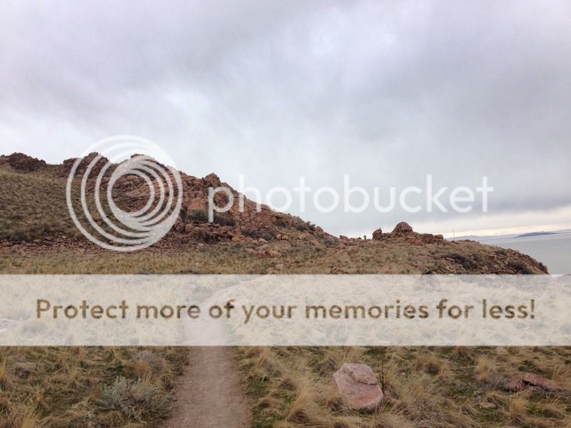
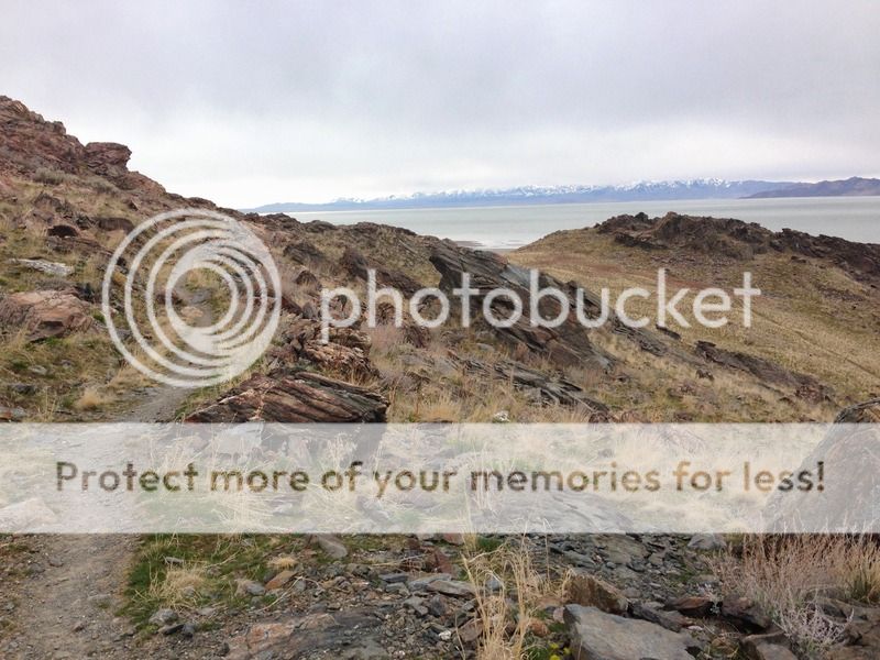
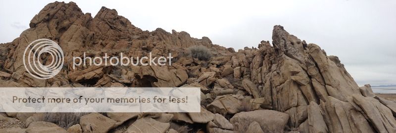
Wild rock formations like this are all over the island.

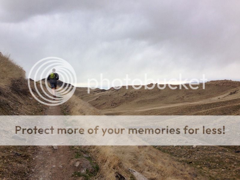
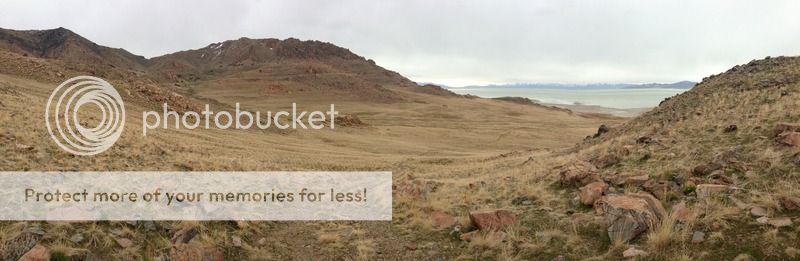
Heading up across "Death Valley". The junction with the other trail is a the lone tree, just left of center.

Lone Tree Junction.

Shortly after Lone Tree, we climb up onto the Split Rock Trail and get on some of the best single track on the island.

Views into Split Rock Bay and Elephant Head.

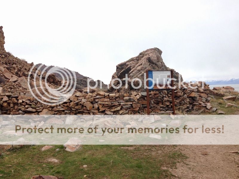
Old Horse Corral in the area known as Mormon Rocks.
Mormon Rocks one of my favorite features on the island. I wish I had something to offer as a sense of scale here.


This is where we left the Split Rock Bay trail and joined onto the West Side Trail. It was a steep, rocky go deep down into the valley.
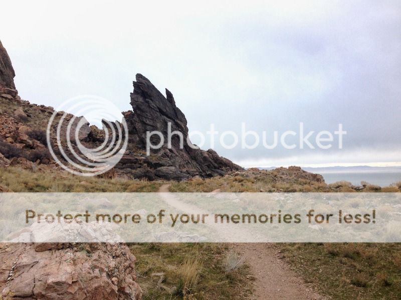
Red Rock Canyon

I was surprised at how deep the canyons were and how rocky the terrain was on the west side. I spotted numerous large caves that wouldn't surprise me if they held some secrets. Aside from that we kept cruising along the trail.

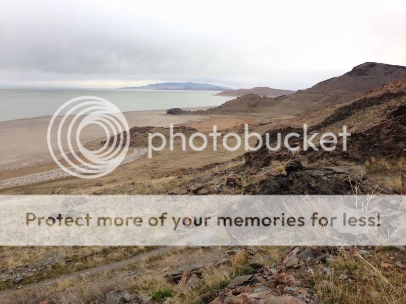
Dropping down to lake level.

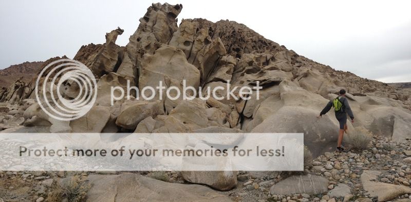
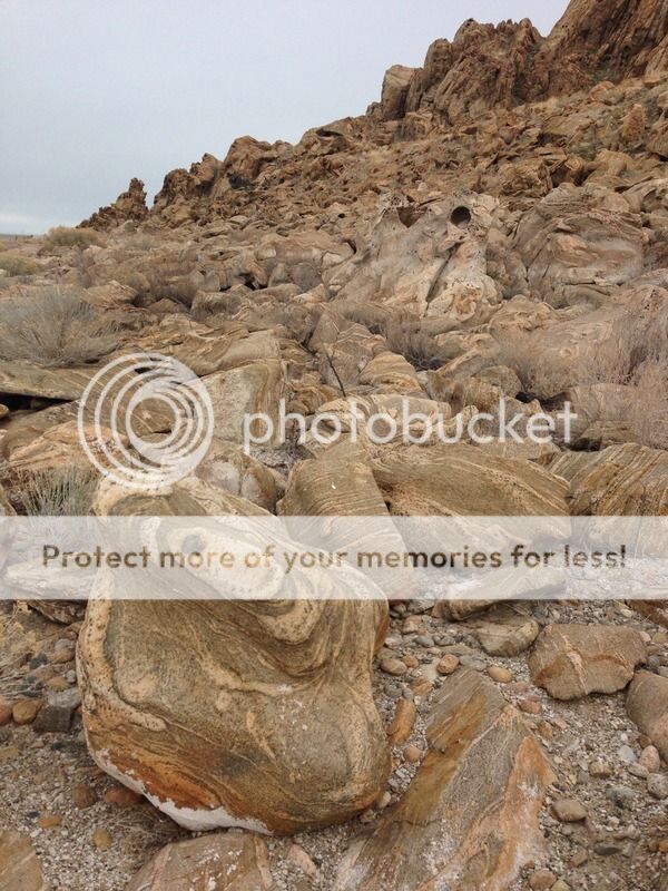
The trail takes you to a very cool section of water sculpted rocks. We spent some time climbing around and exploring here. This type of geology can be found all over the island, but this was far and away the largest conglomerate I've stumbled across.


I see a hint of Fantasy Canyon, Valley of Fire and Goblin Valley in here.

It would be awesome to camp near this area of backpacking permits ever become a possibility.
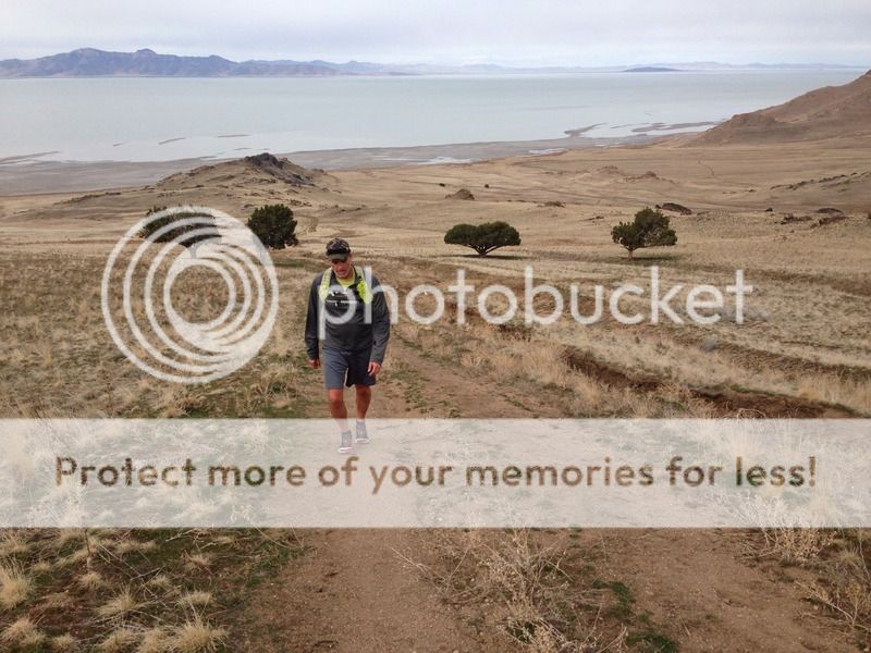
Our next goal was Sentry Peak, the hill nearly directly above the road.

A deceptively steep and long climb. Looking back down the trail, the rock formations are where the water meets the base of the hill.

One day I'd like to get there with my SLR, but this climb will probably keep me hesitant.
Finally almost at the saddle, looking at Sentry Peak and Daddy Stump ridge.

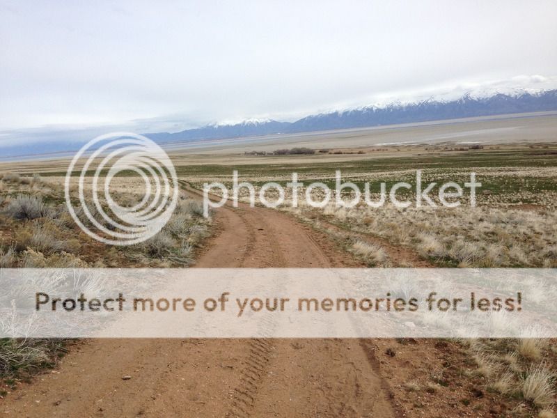
Dropped over to the East side of the island, looking south.

A long way back down to the ranch and the light at the end of the tunnel.
Looking up at Sentry Peak from the East. We crossed over the saddle on the right horizon .

Ahhh... Light at the end of the tunnel.

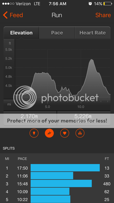
Total mileage about 14.5 miles. Saw a handful of deer, a few buffalo and only started seeing humans near the ranch. It really is amazing how you can be so close to society, yet feel so far away from everyone out there.
For those interest, a link to the access management plan I mentioned earlier.
http://stateparks.utah.gov/statepar...sites/26/2015/03/AntelopeIsland_AMP_final.pdf
Like most people, my first visit to AI was in the summer. My first impression was that it was strangely beautiful, but HOT, buggy, no shade, has none of the allure of the Wasatch...and when can I get back and the car? Fortunately, I gave it a second chance. Over the years I've found that AI is the king of the shoulder seasons/ winter for local hiking. From November-April, you will almost always have pleasant hiking conditions. No bugs, pleasant temps, and little to no crowds.
I've hiked/ran all of the open trails on the Island except for the newly open to the public "West Side/ Buffalo Scaffold Trail". When I found out you could link up trails from the north end to trails on the south, it immediately became a bucket list item. I recruited a trail running buddy and we set out to run the trail without a real idea of the distance or terrain other than what google earth offered up. I wasn't able to find any information about the trail other than an old management plan from the early 00's that suggested of exploring overnight sites along the trail. For us is was Terra Incognita.
Here is an overview of the island trail system. We started at the White Rock Bay Campground, followed the red line SE to the Junction Trail, continued onto the Split Rock Loop (green), from there we dropped onto the black dotted line of the West Side Trail, finally linking back over to the east side of the island at Sentry peak and ending at the ranch.
Please forgive the quality of the pictures. Because we were running, they are all taken with my phone...and at least I think I stopped running for most of them.
Started out with a little rain and breeze. Frary peak, the high point on the island is visible in the distance.
Wild rock formations like this are all over the island.
Heading up across "Death Valley". The junction with the other trail is a the lone tree, just left of center.
Lone Tree Junction.
Shortly after Lone Tree, we climb up onto the Split Rock Trail and get on some of the best single track on the island.
Views into Split Rock Bay and Elephant Head.
Old Horse Corral in the area known as Mormon Rocks.
Mormon Rocks one of my favorite features on the island. I wish I had something to offer as a sense of scale here.
This is where we left the Split Rock Bay trail and joined onto the West Side Trail. It was a steep, rocky go deep down into the valley.
Red Rock Canyon
I was surprised at how deep the canyons were and how rocky the terrain was on the west side. I spotted numerous large caves that wouldn't surprise me if they held some secrets. Aside from that we kept cruising along the trail.
Dropping down to lake level.
The trail takes you to a very cool section of water sculpted rocks. We spent some time climbing around and exploring here. This type of geology can be found all over the island, but this was far and away the largest conglomerate I've stumbled across.
I see a hint of Fantasy Canyon, Valley of Fire and Goblin Valley in here.
It would be awesome to camp near this area of backpacking permits ever become a possibility.
Our next goal was Sentry Peak, the hill nearly directly above the road.
A deceptively steep and long climb. Looking back down the trail, the rock formations are where the water meets the base of the hill.
One day I'd like to get there with my SLR, but this climb will probably keep me hesitant.
Finally almost at the saddle, looking at Sentry Peak and Daddy Stump ridge.
Dropped over to the East side of the island, looking south.
A long way back down to the ranch and the light at the end of the tunnel.
Looking up at Sentry Peak from the East. We crossed over the saddle on the right horizon .
Ahhh... Light at the end of the tunnel.
Total mileage about 14.5 miles. Saw a handful of deer, a few buffalo and only started seeing humans near the ranch. It really is amazing how you can be so close to society, yet feel so far away from everyone out there.
For those interest, a link to the access management plan I mentioned earlier.
http://stateparks.utah.gov/statepar...sites/26/2015/03/AntelopeIsland_AMP_final.pdf