ZubenElGenubi
Negative Space Identifier
- Joined
- Jan 23, 2014
- Messages
- 25
Summary: August 15-17, 2015; three-day, two-night backpacking trip through Ansel Adams Wilderness.
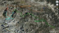
Background: I was going to be around Yosemite for a couple of weeks in August and wanted to visit Thousand Island Lake (inspired by a great outdoor show called "Motion" - more later). I thought it might be neat to backpack there via the Pacific Crest Trail (PCT) from Agnew Meadows (aka, the "High Trail") and then return via the John Muir Trail (JMT) ending at Devil's Postpile National Monument. I had considered looping, but since there's a shuttle system (mandatory, except in special cases) it would be possible to do solo (and save 4½ miles).
However, after I worked out the route, I did ask around if anyone wanted to join along (here @ BCP also). An acquaintance (also a "Motion" show fan and one of the founders of the "Motion Nation" Facebook page) asked to join me and it was set.
I wasn't able to get a permit online for the High Trail (PCT), but did get one for the River Trail (which runs parallel to the High Trail and eventually joins the High Trail) as a backup, but unfortunately one day later. The hope was that I could get a next-day walk-in permit for either High Trail or River Trail on August 15. Fortunately, this turned out to be possible and we got our permit for the River Trail.
We elected to drop off my car at Devil's Postpile NM the night before (there is a backpacker's parking area) and then drive to Agnew Meadows the next morning.
Day 1: Saturday, August 15 - Agnew Meadows to Thousand Island Lake - 9 miles
We left Mammoth Lakes around 8:00 AM and drove to Mammoth Lakes Adventure Center to pay the obligatory shuttle fee ($7/person). I was told in advance - in phone calls with Inyo National Forest personnel - that as long as we paid the fee we could still park in Agnew Meadows since we were backpacking and had permits. This turned out NOT to be true.
(RANT Warning!) The ticket person said that we would pay the fee at the ranger station up the road. But when we got there, we were told that we could not drive in unless we did so before 7:00 AM and were now required to take the shuttle. So, we had to drive back to Mammoth Lakes Adventure Center, buy shuttle tickets, and wait for the next available shuttle. We ended up not arriving at Agnew Meadows until 10:00 AM. (end RANT).
Although I had originally wanted to hike the High Trail (PCT), the River Trail was very nice. What's missed in broad views of the valley and surrounding mountains, is made up with rich meadows, flowing water, and forests of juniper and lodgepole.
The aptly-named River Trail follows the Middle Fork San Joaquin River (MFSJ). Even with the drought, the river was actively flowing with several nice falls and cascades. The trail descends mildly for the first 2½ miles until it reaches Olaine Lake, then begins a long and steady climb of over 2,000 feet across five miles, with the steepest section in the final mile before it rejoins the PCT. After that, one continues south about a half-mile to Thousand Island Lake.
Starting just after 10:00 AM, we hiked about 3½ hours (5½ miles) and took a lunch break near some falls on the MFSJ and got fresh water there. We saw less than a dozen people the entire hike. When we saw Banner Peak peeking through the trees I was elated that we made such good time even after our late start. We ended up at the Thousand Island Lake outflow (where the JMT and PCT merge) around 3:45 PM (less than six hours over eight miles). After pausing to take it in, we hiked along the southern shore for a mile until we found a nice, flat campsite overlooking the shoreline.
We saw a large jet (DC-10 maybe) fly over the lake after we got there, but didn't notice until we got to our campsite that there was a large fire north of us (the so-called "Walker Fire" we would find out later). It was ominous, but didn't seem to be threatening. What was unusual was the cumulonimbus clouds forming on top of the smoke.
After a too-much-to-eat dinner, we settled in under light breeze, sheltered by the rocks and trees around our site. Tomorrow would be a lazy day.
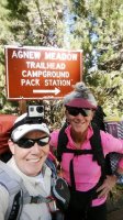
Me and my backpacking partner, Neenah. All smiles, despite an hour-and-a-half late start.
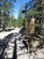
Entering Ansel Adams shortly after Agnew Meadows trailhead.
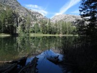
Olaine Lake
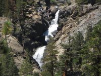
Falls on the Middle Fork San Joaquin River
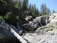
Lunch Break Falls - and fresh water!
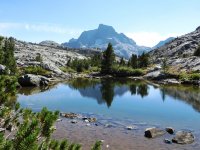
Almost There! (small pond just before Thousand Island Lake. Banner Peak in the background)
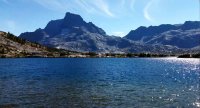
Thousand Island Lake - Banner Peak (screen grab from video)
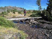
My fellow traveler testing the route...
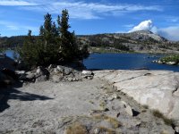
Our campsite - and an ominous cloud (smoke from the Walker Fire with cumulonimbus on top)
End of a good day.
Day 2: Sunday, August 16 - Thousand Island Lake to Garnet Lake - 4.2 miles
Originally this would have been just a day of hiking around Thousand Island Lake. However, I decided it would be prudent to cut off a few miles from the final day's hike and make our way over to Garnet Lake. I had been told by many people that Garnet Lake was a great destination, also.
To spice things up, I picked a route over a pass beneath Banner Peak that separates the two lakes. This would be off-trail over boulders and scree, but probably only Class 2.
We got a lazy start and ended up breaking camp just before noon. We ambled over to a sub-alpine meadow and took in the sweeping view of the large collection of islands at the western end of the lake. We also had our first grand views of Banner Peak , with Mt. Ritter peeking from behind. We could faintly hear the glacial waterfalls feeding into Thousand Island Lake. Above Banner Peak some of the high clouds became iridescent and we were mesmerized for several minutes as we watched the rainbow-colored cirrus clouds drift by and seemingly guide us to the pass.
Once we scrambled over some granite breaks at the end of the meadow, we got our first look at the entire pass. It was a fairly evenly-distributed mass of rubble making a shallow saddle in the middle: about a 350-foot climb over a quarter-mile. We split up, climbing side-by-side several yards apart. Most of the boulders were stable and I only had a couple of rockers. I ended up on the ridge overlooking the lowest part (where my fellow traveler was) and then climbed down to meet her and stop for lunch.
We then made our way down to Garnet. There was less scree here, but was just as steep and we made a few switchbacks along the way. The roar from the glacial runoff of Banner Peak was obvious to the ear, but invisible to the eye as it ran below the boulders along the base and into some shallow pools. At first they looked rather muddy, but as we got closer could see that they were quite clear and it was just the color of the ground below.
We wound our way along some deeply-cut channels in the grassy meadow and marveled at how beautiful this area was. I was a little gobsmacked, admittedly. My friend wanted to camp right there, but I convinced her that we had to move on (one, because there were no durable surfaces to be found, and two, we needed to get closer to the JMT again to shorten our last day's hike).
We followed the stream as it got larger and louder and rounded a large granite bulge that borders the west end of Garnet Lake. There, the stream became a long, curved cascade of over 300 yards, dropping well over 150 feet before easing into the lake.
We continued along the northern shore, the goal being to find a campsite within a half-mile of the JMT where it meets the lake coming from the north (from Thousand Island Lake). After finally seeing a couple of possible campsites along the trail, we dropped packs and did a recon into a large peninsula leading more than halfway across Garnet and found a great campsite. It had several large, flat areas, offering us each some tent privacy as well as a central "kitchen/dining" area. There were also two pools in the peninsula - both obviously fed by the lake, but bordered by large granite outcrops. Nice place to take a swim!
After retrieving our packs, I set up camp pretty quickly, got fresh water, took a quick dip in the pond, and started on dinner. My hiking partner kicked back and enjoyed the evening, opting to set up her tent after sundown. We smartly split dinner this time and resolved to get up early to see the sunrise on Banner Peak and Mt. Ritter (aka "Banner-Ritter" by now).
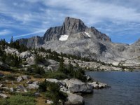
Banner Peak from our campsite on Day 2.
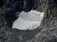
The ever-diminishing glacier on Banner Peak.
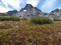
Though the meadow to the mountain.
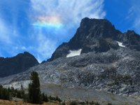
Our iridescent guide toward the pass.
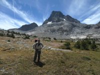
Yours Truly. Truly Happy.

Looking back on Thousand Island Lake from Banner Pass.
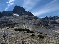
A sense of scale... Top of Banner Pass.

Garnet Lake - view from the waterfall on the west end of the lake.

Panoramic view back to my campsite in the middle of Garnet Lake.
Day 3: Monday, August 17 - Garnet Lake - Devil's Postpile National Monument - 13.5 miles
I woke at 6:00 AM, just about 15 minutes before sunrise. I had prepared my camera gear the night before to take a time-lapse (see end of this post for link to YouTube vid), so I was out and ready in just a few minutes. The water was glass with just a few ripples from the occasional fish. The air was still and not very cold.
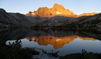
When the sun began to set fire to the tops of Ritter-Banner, I could hardly keep up. I took photos for at least the first twenty minutes (later regretting that I didn't just take it in without my gadgets). One of the finest sunrises I've ever experienced.
I eventually got breakfast started, worrying a bit about the exit hike. I didn't want to be hiking out in the dark and sunset was around 7:45 PM. So, thirteen miles, mostly downhill, but several dips and climbs into lake valleys, and I wanted to get out around 8:00 AM. Plus, if time allowed, I wanted to visit Devil's Postpile.
We ended up not leaving until after 9:00 AM, so I was fretting it a bit at the start. But after we met up with folks coming down the JMT and all heading down to the outflow of Garnet, I loosened up. The weather was perfect, our pace was good and the views were downright spectacular.
After crossing the bridge over the outflow, we made our way up the first set of switchbacks for the day. They weren't too bad, and the views back to the lake made it worthwhile. After we crossed the pass there and began descending down toward Shadow Lake, we met up with a father, son, and grandfather who were in the middle of a five-day trip. Had a wonderful conversation with them all and it was nice to see three generations all enjoying the wilderness.
After leaving them, we descended to Shadow Lake then made the second - and sloggiest - ascent. Twenty-two switchbacks and 800 feet later we crested the pass leading to Rosalie Lake. Exhausted, we headed down to a beach there for a well-deserved break. I took some time to wade around in the shallow water there and just chill.
One more set of switchbacks out of Rosalie - not nearly as taxing - got us to our final high point - Gladys Lake. From here on, it was all downhill. And boy did we make up for the time! As we dropped, we got into more forest and so the views were more limited. Sadly, there were are a lot of downed trees in this section (most from the 2011 wind storm that still has Agnew Meadows closed to camping).
As we began dropping into the valley (near Minaret Falls), the trail got more gravel-ly (lots of pumice) and I was glad that I didn't have to hike it at night. There were several open sections where the trail would have been almost impossible to see at dusk or even with good headlamps.
After crossing the boundary into Devil's Postpile (just before 5:00 PM!), there was still more than a mile of hiking left to descend to the footbridge crossing the river and then back up to the backpacker's parking area where my car was. The bad news was that the ranger station was closed by now (we had hoped to get some more info on the fires), but the good news was that the park was nearly deserted, but still day-lit.
So, after happily unloading our gear, we make the short hike to Devil's Postpile and caught it just as the mountain shadows were creeping up the basalt columns. And no one else was there but us! It was fantastic. My fellow traveler, with a degree in geomorphology, gave me the low down on this amazing place. It was definitely the "cherry on top" of a awesome trek.

Pre-dawn.
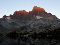
Catching Fire.
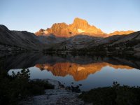
Burning.
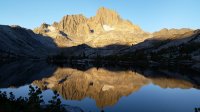
Ablaze.
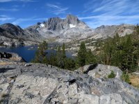
A look back at our home for the night from the JMT (we were on the large peninsula in the middle).
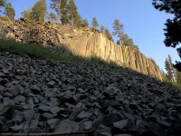
Devil's Postpile National Monument
Banner Pass Panorama - Timelapse (note the small bright cloud above the mountains across the lake; that is cumulonimbus forming on top of the hot smoke from the Walker Fire)
Sunrise Time-lapse. Turn up the volume. 
Featured image for home page:

Background: I was going to be around Yosemite for a couple of weeks in August and wanted to visit Thousand Island Lake (inspired by a great outdoor show called "Motion" - more later). I thought it might be neat to backpack there via the Pacific Crest Trail (PCT) from Agnew Meadows (aka, the "High Trail") and then return via the John Muir Trail (JMT) ending at Devil's Postpile National Monument. I had considered looping, but since there's a shuttle system (mandatory, except in special cases) it would be possible to do solo (and save 4½ miles).
However, after I worked out the route, I did ask around if anyone wanted to join along (here @ BCP also). An acquaintance (also a "Motion" show fan and one of the founders of the "Motion Nation" Facebook page) asked to join me and it was set.
I wasn't able to get a permit online for the High Trail (PCT), but did get one for the River Trail (which runs parallel to the High Trail and eventually joins the High Trail) as a backup, but unfortunately one day later. The hope was that I could get a next-day walk-in permit for either High Trail or River Trail on August 15. Fortunately, this turned out to be possible and we got our permit for the River Trail.
We elected to drop off my car at Devil's Postpile NM the night before (there is a backpacker's parking area) and then drive to Agnew Meadows the next morning.
Day 1: Saturday, August 15 - Agnew Meadows to Thousand Island Lake - 9 miles
We left Mammoth Lakes around 8:00 AM and drove to Mammoth Lakes Adventure Center to pay the obligatory shuttle fee ($7/person). I was told in advance - in phone calls with Inyo National Forest personnel - that as long as we paid the fee we could still park in Agnew Meadows since we were backpacking and had permits. This turned out NOT to be true.
(RANT Warning!) The ticket person said that we would pay the fee at the ranger station up the road. But when we got there, we were told that we could not drive in unless we did so before 7:00 AM and were now required to take the shuttle. So, we had to drive back to Mammoth Lakes Adventure Center, buy shuttle tickets, and wait for the next available shuttle. We ended up not arriving at Agnew Meadows until 10:00 AM. (end RANT).
Although I had originally wanted to hike the High Trail (PCT), the River Trail was very nice. What's missed in broad views of the valley and surrounding mountains, is made up with rich meadows, flowing water, and forests of juniper and lodgepole.
The aptly-named River Trail follows the Middle Fork San Joaquin River (MFSJ). Even with the drought, the river was actively flowing with several nice falls and cascades. The trail descends mildly for the first 2½ miles until it reaches Olaine Lake, then begins a long and steady climb of over 2,000 feet across five miles, with the steepest section in the final mile before it rejoins the PCT. After that, one continues south about a half-mile to Thousand Island Lake.
Starting just after 10:00 AM, we hiked about 3½ hours (5½ miles) and took a lunch break near some falls on the MFSJ and got fresh water there. We saw less than a dozen people the entire hike. When we saw Banner Peak peeking through the trees I was elated that we made such good time even after our late start. We ended up at the Thousand Island Lake outflow (where the JMT and PCT merge) around 3:45 PM (less than six hours over eight miles). After pausing to take it in, we hiked along the southern shore for a mile until we found a nice, flat campsite overlooking the shoreline.
We saw a large jet (DC-10 maybe) fly over the lake after we got there, but didn't notice until we got to our campsite that there was a large fire north of us (the so-called "Walker Fire" we would find out later). It was ominous, but didn't seem to be threatening. What was unusual was the cumulonimbus clouds forming on top of the smoke.
After a too-much-to-eat dinner, we settled in under light breeze, sheltered by the rocks and trees around our site. Tomorrow would be a lazy day.

Me and my backpacking partner, Neenah. All smiles, despite an hour-and-a-half late start.

Entering Ansel Adams shortly after Agnew Meadows trailhead.

Olaine Lake

Falls on the Middle Fork San Joaquin River

Lunch Break Falls - and fresh water!

Almost There! (small pond just before Thousand Island Lake. Banner Peak in the background)

Thousand Island Lake - Banner Peak (screen grab from video)

My fellow traveler testing the route...

Our campsite - and an ominous cloud (smoke from the Walker Fire with cumulonimbus on top)

End of a good day.
Day 2: Sunday, August 16 - Thousand Island Lake to Garnet Lake - 4.2 miles
Originally this would have been just a day of hiking around Thousand Island Lake. However, I decided it would be prudent to cut off a few miles from the final day's hike and make our way over to Garnet Lake. I had been told by many people that Garnet Lake was a great destination, also.
To spice things up, I picked a route over a pass beneath Banner Peak that separates the two lakes. This would be off-trail over boulders and scree, but probably only Class 2.
We got a lazy start and ended up breaking camp just before noon. We ambled over to a sub-alpine meadow and took in the sweeping view of the large collection of islands at the western end of the lake. We also had our first grand views of Banner Peak , with Mt. Ritter peeking from behind. We could faintly hear the glacial waterfalls feeding into Thousand Island Lake. Above Banner Peak some of the high clouds became iridescent and we were mesmerized for several minutes as we watched the rainbow-colored cirrus clouds drift by and seemingly guide us to the pass.
Once we scrambled over some granite breaks at the end of the meadow, we got our first look at the entire pass. It was a fairly evenly-distributed mass of rubble making a shallow saddle in the middle: about a 350-foot climb over a quarter-mile. We split up, climbing side-by-side several yards apart. Most of the boulders were stable and I only had a couple of rockers. I ended up on the ridge overlooking the lowest part (where my fellow traveler was) and then climbed down to meet her and stop for lunch.
We then made our way down to Garnet. There was less scree here, but was just as steep and we made a few switchbacks along the way. The roar from the glacial runoff of Banner Peak was obvious to the ear, but invisible to the eye as it ran below the boulders along the base and into some shallow pools. At first they looked rather muddy, but as we got closer could see that they were quite clear and it was just the color of the ground below.
We wound our way along some deeply-cut channels in the grassy meadow and marveled at how beautiful this area was. I was a little gobsmacked, admittedly. My friend wanted to camp right there, but I convinced her that we had to move on (one, because there were no durable surfaces to be found, and two, we needed to get closer to the JMT again to shorten our last day's hike).
We followed the stream as it got larger and louder and rounded a large granite bulge that borders the west end of Garnet Lake. There, the stream became a long, curved cascade of over 300 yards, dropping well over 150 feet before easing into the lake.
We continued along the northern shore, the goal being to find a campsite within a half-mile of the JMT where it meets the lake coming from the north (from Thousand Island Lake). After finally seeing a couple of possible campsites along the trail, we dropped packs and did a recon into a large peninsula leading more than halfway across Garnet and found a great campsite. It had several large, flat areas, offering us each some tent privacy as well as a central "kitchen/dining" area. There were also two pools in the peninsula - both obviously fed by the lake, but bordered by large granite outcrops. Nice place to take a swim!
After retrieving our packs, I set up camp pretty quickly, got fresh water, took a quick dip in the pond, and started on dinner. My hiking partner kicked back and enjoyed the evening, opting to set up her tent after sundown. We smartly split dinner this time and resolved to get up early to see the sunrise on Banner Peak and Mt. Ritter (aka "Banner-Ritter" by now).

Banner Peak from our campsite on Day 2.

The ever-diminishing glacier on Banner Peak.

Though the meadow to the mountain.

Our iridescent guide toward the pass.

Yours Truly. Truly Happy.

Looking back on Thousand Island Lake from Banner Pass.

A sense of scale... Top of Banner Pass.

Garnet Lake - view from the waterfall on the west end of the lake.
Panoramic view back to my campsite in the middle of Garnet Lake.
Day 3: Monday, August 17 - Garnet Lake - Devil's Postpile National Monument - 13.5 miles
I woke at 6:00 AM, just about 15 minutes before sunrise. I had prepared my camera gear the night before to take a time-lapse (see end of this post for link to YouTube vid), so I was out and ready in just a few minutes. The water was glass with just a few ripples from the occasional fish. The air was still and not very cold.
When the sun began to set fire to the tops of Ritter-Banner, I could hardly keep up. I took photos for at least the first twenty minutes (later regretting that I didn't just take it in without my gadgets). One of the finest sunrises I've ever experienced.
I eventually got breakfast started, worrying a bit about the exit hike. I didn't want to be hiking out in the dark and sunset was around 7:45 PM. So, thirteen miles, mostly downhill, but several dips and climbs into lake valleys, and I wanted to get out around 8:00 AM. Plus, if time allowed, I wanted to visit Devil's Postpile.
We ended up not leaving until after 9:00 AM, so I was fretting it a bit at the start. But after we met up with folks coming down the JMT and all heading down to the outflow of Garnet, I loosened up. The weather was perfect, our pace was good and the views were downright spectacular.
After crossing the bridge over the outflow, we made our way up the first set of switchbacks for the day. They weren't too bad, and the views back to the lake made it worthwhile. After we crossed the pass there and began descending down toward Shadow Lake, we met up with a father, son, and grandfather who were in the middle of a five-day trip. Had a wonderful conversation with them all and it was nice to see three generations all enjoying the wilderness.
After leaving them, we descended to Shadow Lake then made the second - and sloggiest - ascent. Twenty-two switchbacks and 800 feet later we crested the pass leading to Rosalie Lake. Exhausted, we headed down to a beach there for a well-deserved break. I took some time to wade around in the shallow water there and just chill.
One more set of switchbacks out of Rosalie - not nearly as taxing - got us to our final high point - Gladys Lake. From here on, it was all downhill. And boy did we make up for the time! As we dropped, we got into more forest and so the views were more limited. Sadly, there were are a lot of downed trees in this section (most from the 2011 wind storm that still has Agnew Meadows closed to camping).
As we began dropping into the valley (near Minaret Falls), the trail got more gravel-ly (lots of pumice) and I was glad that I didn't have to hike it at night. There were several open sections where the trail would have been almost impossible to see at dusk or even with good headlamps.
After crossing the boundary into Devil's Postpile (just before 5:00 PM!), there was still more than a mile of hiking left to descend to the footbridge crossing the river and then back up to the backpacker's parking area where my car was. The bad news was that the ranger station was closed by now (we had hoped to get some more info on the fires), but the good news was that the park was nearly deserted, but still day-lit.
So, after happily unloading our gear, we make the short hike to Devil's Postpile and caught it just as the mountain shadows were creeping up the basalt columns. And no one else was there but us! It was fantastic. My fellow traveler, with a degree in geomorphology, gave me the low down on this amazing place. It was definitely the "cherry on top" of a awesome trek.
Pre-dawn.

Catching Fire.

Burning.

Ablaze.

A look back at our home for the night from the JMT (we were on the large peninsula in the middle).

Devil's Postpile National Monument
Featured image for home page:

Last edited:
