Vegan.Hiker
Member
- Joined
- Jul 5, 2014
- Messages
- 2,099
This probably isn't trip report worthy for a site called "backcountry" post, but I figured it was different enough from what you desert rats are used to out west to warrant posting a few pics.
This weekend was not a planned hiking weekend for me. I had to spend 3 days in the Hamptons for my brother-in-law's wedding. Weddings (and the Hamptons) really aren't my thing, so I was pretty stoked when I heard that I would have free-time until 2pm on the day of the wedding while the girls had their hair, nail, makeup appts, etc. I'd never heard of there being any hiking in the Hamptons (or Long Island in general), so I almost didn't bother checking. But I did a quick google search the night before and to my surprise there was a State Park called Hither Hills State Park that looked like it had about 20 or so miles of coastal trails about 20 minutes away. I mapped out an 8 mile loop on my Gaia gps app, borrowed my mother-in-law’s a6000, and headed out early the next morning to do some exploring.
The trail was super easy with barely any elevation change and smooth, well-groomed trails. Nobody goes to the Hamptons to hike, so I didn’t run into anyone else on the trails, although I did see a fishing boat with a few fishermen tending to their clamming nets. The sky was mostly clear although there was some low laying fog which made it hard to make out where the ocean met the sky for much of the hike.
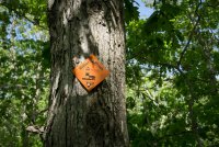
From the trail head it's about a 2 mile hike to the coast. The hike started out in a pretty hardwood forest. This isn't the AT but this trail used the same white blazes for some reason.
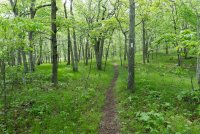
There were some pretty fern growth in several spots along the trail (iPhone pic)
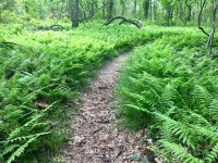
The soil got sandier and the fauna became more coastal as I neared the ocean.
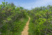
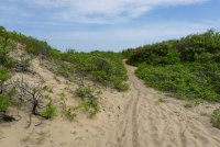
I was hoping there wouldn't be much soft sand, and fortunately there wasn't. Just a few small areas like this..
Once the trail reached the coast I could see the fog was lingering on the ocean, but would dissipate as the day went on.
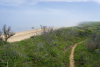
Right of center are the clamming nets and the fishermen on a boat on the right end. You can't really make them out unless you zoom into the picture though.
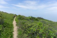
I had only seen the public beaches on the southern shore of the Hamptons. I was pleasantly surprised to see what the "mostly" unspoiled landscape looked like on the north side. You can make out another set of clamming nets in the fog near the top right corner.
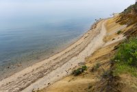
Another example of how you couldn't see where the ocean and the sky met. It looked like an endless abyss. This was atop a small cliff maybe 150' above the beach.
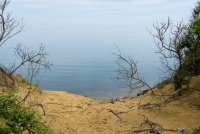
The fog started to clear eventually and I could make out the skyline.
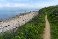
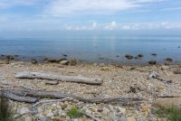
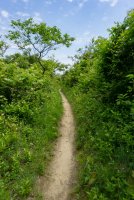
I had to get back for wedding photos, so I eventually took one of the trails that headed back through the woods and back to the trail head. I'm considering driving back out here and spending an entire day redlining the coastal trails.
This weekend was not a planned hiking weekend for me. I had to spend 3 days in the Hamptons for my brother-in-law's wedding. Weddings (and the Hamptons) really aren't my thing, so I was pretty stoked when I heard that I would have free-time until 2pm on the day of the wedding while the girls had their hair, nail, makeup appts, etc. I'd never heard of there being any hiking in the Hamptons (or Long Island in general), so I almost didn't bother checking. But I did a quick google search the night before and to my surprise there was a State Park called Hither Hills State Park that looked like it had about 20 or so miles of coastal trails about 20 minutes away. I mapped out an 8 mile loop on my Gaia gps app, borrowed my mother-in-law’s a6000, and headed out early the next morning to do some exploring.
The trail was super easy with barely any elevation change and smooth, well-groomed trails. Nobody goes to the Hamptons to hike, so I didn’t run into anyone else on the trails, although I did see a fishing boat with a few fishermen tending to their clamming nets. The sky was mostly clear although there was some low laying fog which made it hard to make out where the ocean met the sky for much of the hike.

From the trail head it's about a 2 mile hike to the coast. The hike started out in a pretty hardwood forest. This isn't the AT but this trail used the same white blazes for some reason.

There were some pretty fern growth in several spots along the trail (iPhone pic)

The soil got sandier and the fauna became more coastal as I neared the ocean.

I was hoping there wouldn't be much soft sand, and fortunately there wasn't. Just a few small areas like this..

Once the trail reached the coast I could see the fog was lingering on the ocean, but would dissipate as the day went on.

Right of center are the clamming nets and the fishermen on a boat on the right end. You can't really make them out unless you zoom into the picture though.

I had only seen the public beaches on the southern shore of the Hamptons. I was pleasantly surprised to see what the "mostly" unspoiled landscape looked like on the north side. You can make out another set of clamming nets in the fog near the top right corner.

Another example of how you couldn't see where the ocean and the sky met. It looked like an endless abyss. This was atop a small cliff maybe 150' above the beach.

The fog started to clear eventually and I could make out the skyline.


I had to get back for wedding photos, so I eventually took one of the trails that headed back through the woods and back to the trail head. I'm considering driving back out here and spending an entire day redlining the coastal trails.

Last edited:
