Kullaberg63
Member
- Joined
- Mar 6, 2014
- Messages
- 683
When passing through Teton Valley after a few days mountain biking near Jackson, my kid noticed on the map a trail leading to a peak, with a description stating this lofty vantage point the finest place from which to see the Grand Teton.
Immidiately excited we swung the van up Teton Creek, while looking closer at our objective. The trailhead was low, 7200', and the summit over 11000'. Not too bad except the trail mileage was listed as only 4 miles, and last two looked mostly level. So very steep right out of the car. Another enticing factor was the obvious low snow line, following an above average winter. The presence of grizzlies, an hitherto unknown aspect of our usual outdoor pursuits, added a last appeal.
We found a good camp and awoke to partly cloudy skies and a forecast for thunderstorms. The Tetons are known as a magnet for afternoon lightning and violent deluges so we decided to keep an extra vigilant eye to the skies, but otherwise proceed wit our plan.
The trail did indeed ascend 3000' in first mile and a half. As can be imagined such steepness is not part of regular official trailbuilding, nor is it sustainable to halting erosion and preserving the illusion of actually being on anything more than a 'route'.
We hit 100% snow coverage at 9000', but a reasonbly cold night and typical early summer conditions permitted us to walk on top, mostly. In fact this was much better than the rubbly, eroded trail, now pleasingly buried under clean white snow.
The summit cone was bare and had a steep path thru some cliffbands, before things came to an abrupt precipice and the splendor of the entire central Teton Range lay before us.
Neither grizzlies nor thunderstorms bothered us on this altogether fine day in the mountains. Later in the season one can avoid the steep trail we did, called the Face Trail, for a more gradual creek bottom route further north.
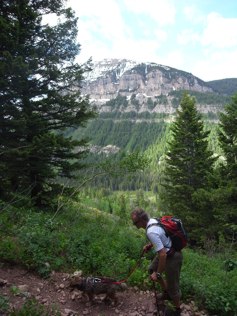
image by kullaberg631, on Flickr
The Face Trail, in all it's steepness. Off course, in pics it does not look steep at all, yet it ascends 3000' in a little more than a mile and a half.
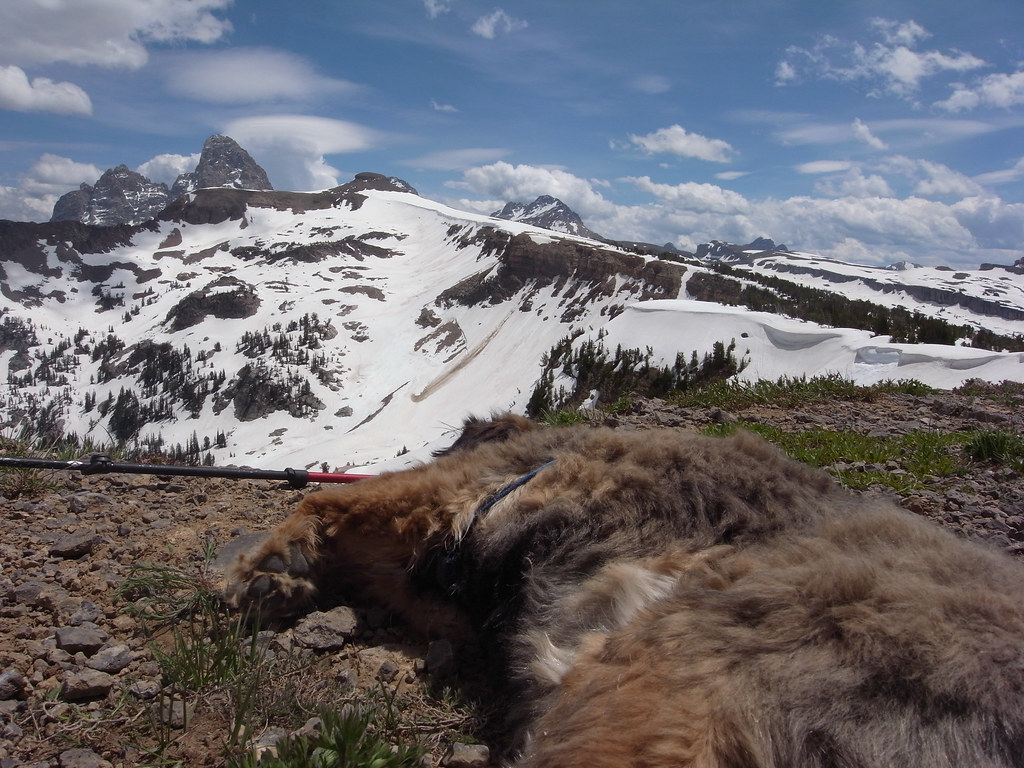
image by kullaberg631, on Flickr
The upper part of the route goes along the snowy corniced ridge to the right. Yes, that's a tired dog in foreground.
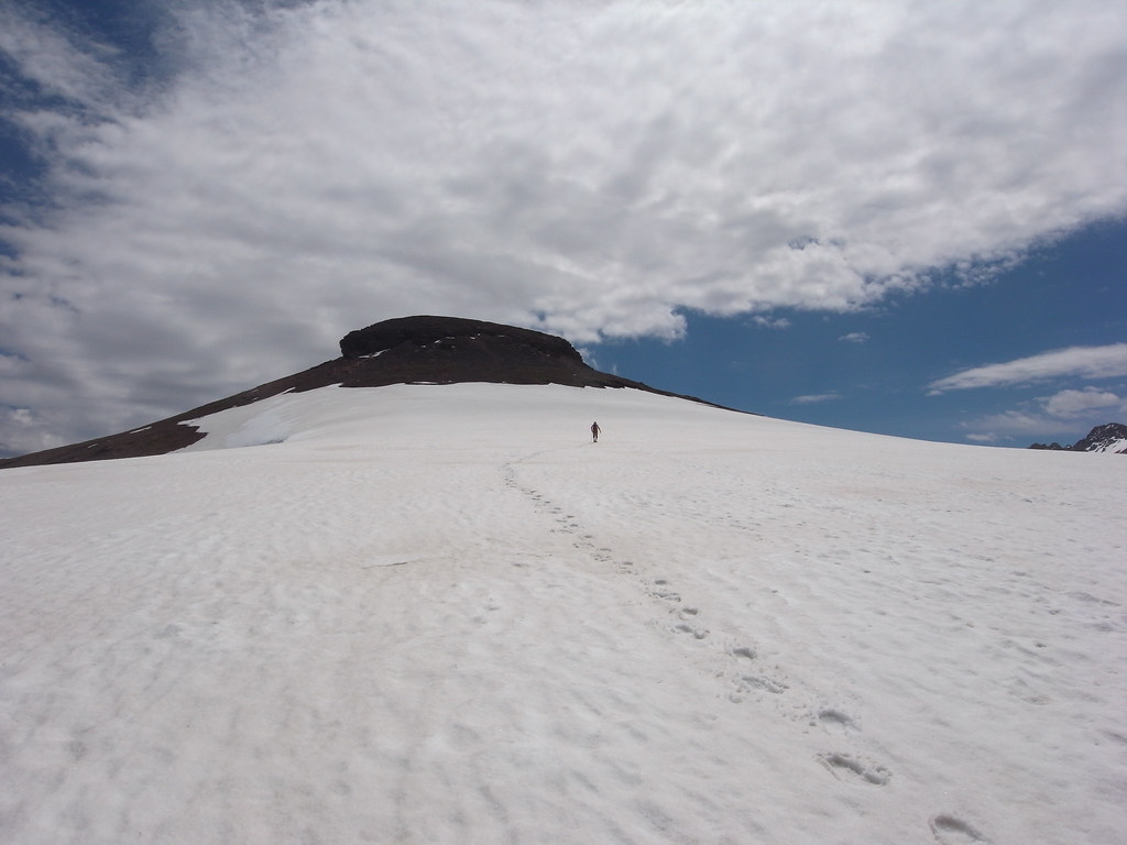
image by kullaberg631, on Flickr
Approaching the summit cone.
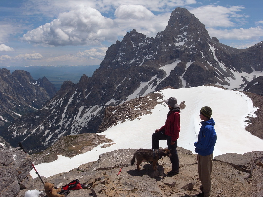
image by kullaberg631, on Flickr
My wife, kid and dog on top. Grand Teton behind.
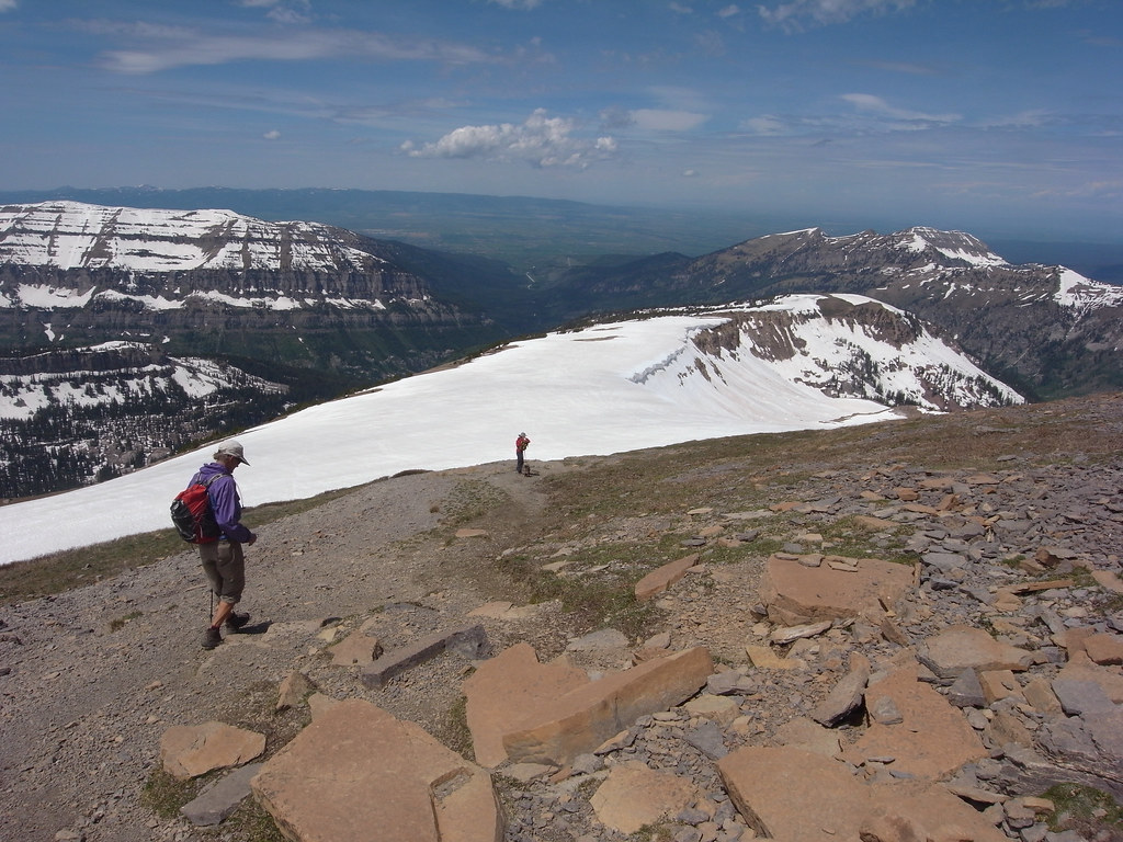
image by kullaberg631, on Flickr
Heading down. The really steep part drops out of view behind the end of the snowy ridge.
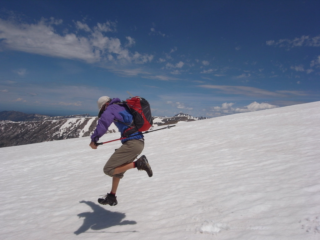
image by kullaberg631, on Flickr
What's mountaineering without snow?
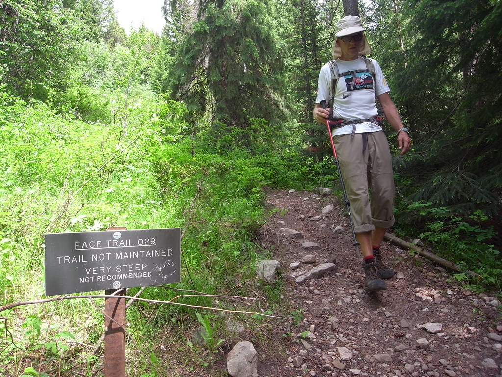
image by kullaberg631, on Flickr
The ominous sign at the beginning of the trail. And yes, I would highly recommend it!
Featured image for home page:

Immidiately excited we swung the van up Teton Creek, while looking closer at our objective. The trailhead was low, 7200', and the summit over 11000'. Not too bad except the trail mileage was listed as only 4 miles, and last two looked mostly level. So very steep right out of the car. Another enticing factor was the obvious low snow line, following an above average winter. The presence of grizzlies, an hitherto unknown aspect of our usual outdoor pursuits, added a last appeal.
We found a good camp and awoke to partly cloudy skies and a forecast for thunderstorms. The Tetons are known as a magnet for afternoon lightning and violent deluges so we decided to keep an extra vigilant eye to the skies, but otherwise proceed wit our plan.
The trail did indeed ascend 3000' in first mile and a half. As can be imagined such steepness is not part of regular official trailbuilding, nor is it sustainable to halting erosion and preserving the illusion of actually being on anything more than a 'route'.
We hit 100% snow coverage at 9000', but a reasonbly cold night and typical early summer conditions permitted us to walk on top, mostly. In fact this was much better than the rubbly, eroded trail, now pleasingly buried under clean white snow.
The summit cone was bare and had a steep path thru some cliffbands, before things came to an abrupt precipice and the splendor of the entire central Teton Range lay before us.
Neither grizzlies nor thunderstorms bothered us on this altogether fine day in the mountains. Later in the season one can avoid the steep trail we did, called the Face Trail, for a more gradual creek bottom route further north.
image by kullaberg631, on Flickr
The Face Trail, in all it's steepness. Off course, in pics it does not look steep at all, yet it ascends 3000' in a little more than a mile and a half.
image by kullaberg631, on Flickr
The upper part of the route goes along the snowy corniced ridge to the right. Yes, that's a tired dog in foreground.
image by kullaberg631, on Flickr
Approaching the summit cone.
image by kullaberg631, on Flickr
My wife, kid and dog on top. Grand Teton behind.
image by kullaberg631, on Flickr
Heading down. The really steep part drops out of view behind the end of the snowy ridge.
image by kullaberg631, on Flickr
What's mountaineering without snow?
image by kullaberg631, on Flickr
The ominous sign at the beginning of the trail. And yes, I would highly recommend it!
Featured image for home page:
")