Joey
walking somewhere
- Joined
- Apr 1, 2014
- Messages
- 878
This is an 8 day, mostly off trail backpacking route I did In Grand Teton National Park last September (2015). The route includes the area between Moran and Avalanche Canyons. Some of the highlights include Cirque Lake, Ortenburger Lake, Mink Lake, Maidenform Peak, Table Mountain, Littles Peak, and the Wigwams.
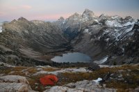
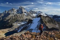
How about a few teasers......
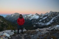
Here is the trip video:
Here you can see the route:
Click here to view on CalTopo
The week before I did this trip, I had attempted a similar route with several of the forum members here on BCP. We had started at the north end of the park, and intended to hike all the way down to Avalanche Canyon. We encountered 3 days of snowy weather at upper Glacier Lakes, and bailed on the trip. You can read @Vegan.Hiker 's excellent trip report for that one here:
http://backcountrypost.com/threads/grand-teton-national-park-september-2015.5184/#post-60738
I was left with an empty feeling in my heart. I had really wanted to get back to Ortenburger Lake, and had been trying to get out to Cirque Lake for almost 10 years. I had another backpack planned somewhere else, but decided to scrap it at the last minute. The weather forecast was perfect. So I headed back into the Tetons.
Day 1: It was late in the day when I finally got situated and hit the trail. I started at String Lake, and headed up into Paintbrush Canyon. I was permitted to camp in the Upper Paintbrush Camp zone, so I had to make it past Holly Lake. It was a beautiful afternoon, and the fresh snow from the storms a few days earlier lingered on all the peaks. This would really stand out for the entire trip. Fresh white snow combined with clear blue skies in the mountains is one of the most beautiful things in this world. The trail at first was wooded, but soon broke free of the trees, and took on an alpine feel. There are great views looking back down at Leigh and Jackson Lakes. The sun was already going down on the other side of the mountains, but still lit up all the high peaks. I hustled my way up the trail, passing several people coming down. Definitely one of the busier trails in the park. Around dusk, I ran into 2 girls coming down the trail near Holly Lake. They swore they had just ran into a grizzly sow with two cubs 30 minutes before, and gave me a heads up. Although they seemed believable, I had my doubts it was a grizzly. Although grizzlies are common throughout the park, it's almost unheard of to see them in the trailed canyons. Almost all of the reports are people misidentifying brown black bears as grizzlies. Still, I perked up a bit. I reached the camp zone right after that, and found a spot overlooking Holly Lake. I set my tent up in the dark, and had a solid night of sleep.
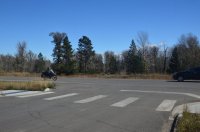
@Ben was with me when I pulled the permit. This is him taking off on his motorcycle, heading back to Idaho after his big Alaska bike ride.
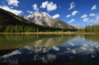
String Lake
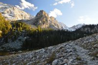
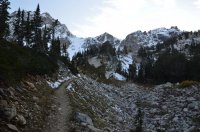
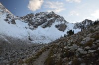
Views along the trail as I hiked up Paintbrush Canyon
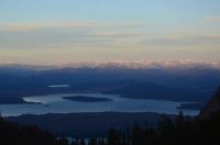
Looking back out across Jackson Lake, with the snow covered Absaroka Mountains in the background.
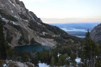
My view of Holly Lake from where I ate dinner.
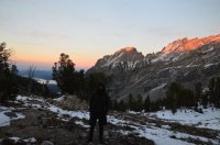
Me prepping for bed at camp night number 1.
Day 2: What a beautiful morning. Those clear, deep blue skies contrasted with the snow intensely. I packed up camp, and headed up the trail towards Paintbrush Divide. About 100 yards from camp I ran into numerous bear tracks that were just everywhere. To me, they appear to be black bear tracks.
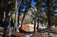
My tent in the morning.
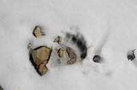
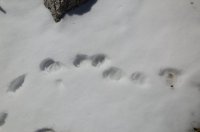
Black bear tracks where every where right behind my camp.
I really wasn't sure what my plans were for the day. Originally I intended to get to Cirque Lake, but that would change by the end of the day. I needed to get into Leigh Canyon, and wasn't sure which way I wanted to take. I decided to head up to Paintbrush Divide because I knew the views would be beautiful with the perfect weather. I was right. At this point the trail up to the divide was snow covered, but enough hikers coming through had already compacted a path. I slowly climbed up, and took in the snowy views.
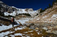
Leaving camp in the morning.
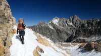
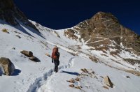
Here you can see Paintbrush Divide above me, along with the trail.
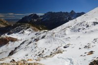
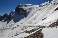
More views of the snow covered trail up to the divide.
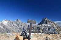
Paintbrush Divide, which sits at 10,700 feet elevation.
At the divide, I spent some time enjoying the views. I hiked over towards Cascade Canyon to get a better view down. This is one of my favorite views in the park. I love looking down on Lake Solitude, along with Mica Lake above it. It also gave me a good look at the landscape I would be traveling over the next few days.
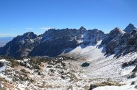
Looking down Paintbrush Canyon.
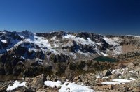
The view across the North Fork of Cascade Canyon. Lake Solitude is to the right, and Mica Lake sits higher up to the left. I would walk the entire top wall above the lakes a few days later, and even camp up there.
Next it was time to leave the trail. And the people. I would only see people in 2 places the rest of this trip, once at Table Mountain, and then when I finished at Taggart Lake. From the divide, I headed straight down into Leigh Canyon, essentially towards Mink Lake. It was a steep, snowy decent. Soon I reached the bottom of the basin, and the terrain flattened out. Still covered in snow, it was just awesome. I had still been considering going over to Cirque Lake, but changed my mind at this point. To start with, I hadn't even started hiking until after noon. And looking up at the northern wall of Leigh Canyon, I didn't see anything that looked exciting to climb up. Since I had permits to camp in Moran Canyon the next 3 nights, I decided to change up my route a little bit. I was going to camp at the saddle between Leigh Canyon and the south fork of Moran Canyon. I've camped there before, and traveled through it a few times. Its a beautiful spot, probably one of the sweetest camping spots in the park. So I headed straight towards Mink Lake. There are some beautiful views here, but its kind of marshy around the lake, and not an ideal campsite.
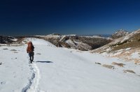
Me about to leave the trail and head into Leigh Canyon, which is down to the right in this picture.
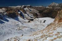
Looking down at my decent into the basin. That is NOT Mink Lake in this picture. Just one of the many un named tarns in the high alpine here.
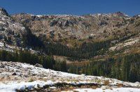
Down in the basin, I got my first glimpse of Mink Lake, which you can make out down in the trees. I would walk right down to it, and then past it up to the saddle in the top right corner. That would be camp for the night.
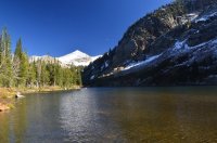
Mink Lake, with Paintbrush Divide visible in the top background.
After leaving Mink Lake, I headed straight up to the saddle. There isn't much underbrush, and its not too difficult to climb up. I was glad I made the change. Its beautiful up there. I had carried up water expecting it to be dry, but the recent snow created plenty of water options. I got my tent set up, and spent the evening enjoying the views into both canyons. For me, this is what it's all about.
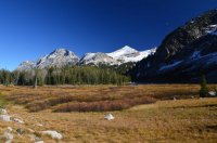
Another beautiful view looking back at Mink Lake.
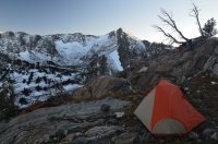
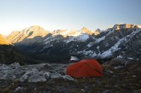
Some views of my tent for night number 2.
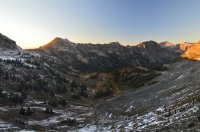
My view down into the South Fork of Moran Canyon from my camp. Such a beautiful spot.

Me eating dinner at camp night 2 overlooking Mink Lake. Mount Woodring is above my head, and Paintbrush Divide is between the 2 pyramid style peaks in the center of the picture. The Grand Teton is barely popping out to the right. Safe to say I was high on life this night.
Day 3: My goal for the day was to reach Ortenburger Lake. I have traveled between these 2 spots before, but this time decided to try a different route. I followed the edge of the south fork, staying close to the park's boundary line. I easily made my way to the un-named peak at elevation 10,484. I opted to stay inside the park, and had to do a little climbing to reach the first lake (which still drains into the south fork). In hindsight, it would be much easier to stay outside the park, and follow the park boundary north. The terrain is easier. But this particular lake was beautiful. I found bear tracks here too. The views down into Moran Canyon were amazing. I scrambled through a small saddle, and dropped down to the other lake, which is at the head of the North Fork of Moran Canyon. What an absolutely sweet spot! There isn't much shelter up there, but with great weather is a nice campsite.
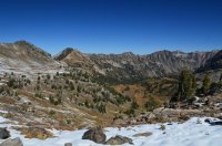
Looking into the South Fork of Moran Canyon in the morning. I basically stayed at a similar elevation, and circled the canyon along the left side.
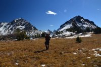
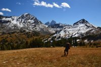
Views looking back towards camp as I walked above the canyon.
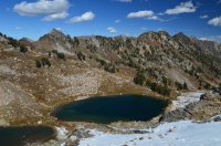
The first lake I reached. I would climb down to it, then walk up over the next ridge to reach the other lake.
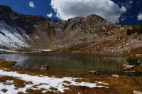
Another view of the first lake. There are actually 2 lakes here, as a small tarn sits right above this one.
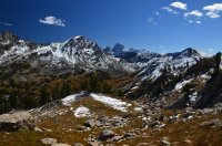
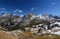
Views of Moran Canyon, as I climbed over to the second lake.
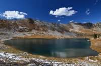
The second lake. This lake sits at the top of the North Fork of Moran Canyon. It is possibly called North Lake, I've seen it referenced that way a few times, but don't know for sure.
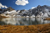
Another view of the lake. I came over from the first lake via the snowy ridge above.
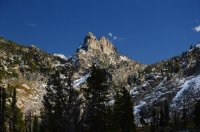
I believe this is Cleaver Peak, rising above the saddle near Window Peak. Kind of hard to describe this shot. Cirque Lake is on the other side of it, but there are 2 canyons between me and there.
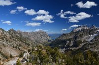
My view looking down Moran Canyon. Jackson Lake is visible in the background.
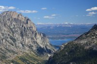
A close up of Jackson Lake.
From this lake, I circled the north side of the canyon, and worked my way over to Ortenburger Lake. It wasn't very difficult, although I was walking on steep, slanted scree and grass the whole way. No flat steps here. A few hours later, I reached the creek draining out of Ortenburger Lake, and climbed up a few hundred feet to the foot of the lake.
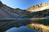
The foot of Ortenburger Lake, looking north.
Ortenburger is beautiful. I had been there the year before with @Chuck the Mauler , so I knew what I was coming for. There is great camping near the foot of the lake, along with the east side of it. But I headed for the north side. Here the backdrop is absolutely spectacular. It just mesmerized me. Numerous mountains abound. Mount Moran sits all the way to the left, and in the center the Grand Teton itself rises above everything. It looks like something out of a fairy tale. It was an incredible place to have all to myself.
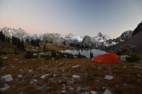
Camp at Ortenburger Lake night number 3.
Day 4: Someone once wrote a comment about one of my trip reports, stating "they didn't know how I could sit at a campsite for so long without moving on" and that "if it were them, they would become extremely bored".
Since reading that quote, I've spent more than 100 hundred mornings, sitting in beautiful campsites, wondering why I have to pack up camp and leave at all. I often wonder how so many people can go to work everyday, and just sit in the same place, and stare at basically the same thing. That used to be me, and I became extremely bored.
I sat there at Ortenburger Lake the entire morning. And into the afternoon. I really don't know what to tell you. I don't even remember what I did. But I was there. I smiled. I laughed at myself. I was high on something, without taking any kind of drug. There was no boredom. I just sat and stared. I was happy, and felt fully alive.
Eventually I looked across Moran Canyon, where I could see the Cirque Lake basin. Cirque Lake is at an elevation of 9,605 feet, which is almost the same exact elevation at Ortenburger Lake (9,610 ft). Suddenly I did have a good reason to get going. Today was the day to finally get there. It was somewhere between 1 and 2 pm when I finally set off. I wasn't sure what to expect along the way. As the crow flies, it wasn't that many miles between the lakes. But I had to drop down 1500 feet, before climbing back up the same amount. And I wasn't sure how thick the forested canyon bottom would be. Surprisingly it was easy. At the bottom, the fall colors really popped.
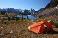
A morning view of camp at Ortenburger Lake.
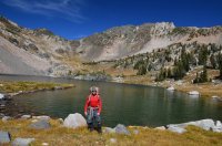
A crooked picture of me standing at the foot of Ortenburger Lake.
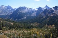
My view looking across Moran Canyon at the Cirque Lake drainage. I would basically go straight down, across, and up to the lake. Cirque Lake is not visible in the picture.
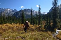
Making my way down into Moran Canyon.
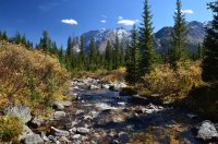
The North Fork of Moran Creek. This what I mean by the fall colors really popping.
Is it a weasel or martin? I give up.
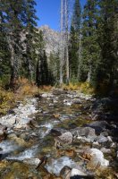
Looking down the South Fork of Moran Creek.
I crossed both forks of Moran Creek, then headed straight up towards Cirque Lake. Soon the forest gave way to a boulder field, and lots of waterfalls. Waterfalls are so common in the high alpine, I almost forget to mention them. They are kind of everywhere, especially early in the year when all the snow starts melting. But there were several nice ones as I climbed up. I reached some cliffs, and diverted to the east, climbing up next to another waterfall towards the lowest lake in the Cirque Lake drainage. This lake is pretty. From here, it was a straight, open alpine shot right up to Cirque Lake. I started noticing fresh bear scat in a few places. Near the top, I set my tripod up to shoot a walk through shot. As I was finishing up the shot, I noticed a shadow move out of the corner of my eye. I stared at the shadow for a minute, and then it moved. A black bear was just sitting there, looking at me. A few more shadows moved. She had cubs. The bears took off. I went to take shots, but my camera battery died right then. I sat and watched them run down what I had just come up. I quickly changed batteries, and was able to capture some video of them running off.
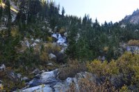
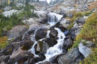
Waterfalls as I climbed up the drainage.
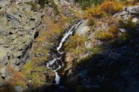
This waterfall is the one coming out of the lower, un-named lake in the drainage. I climbed up along the right hand side.
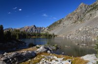
The lower lake.
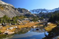
Another view of the lower lake, and also looking at my final route up to Cirque Lake.
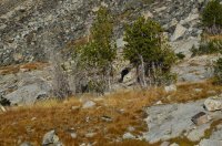
The black bear that had been watching me film myself.
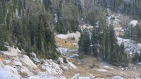
This is a still shot I pulled from video footage of the black bear and cubs running away from me. It was really a treat to watch them run down this entire slope, but I felt bad for stressing them out.
After watching the bears, I continued up a few hundred yards to reach Cirque Lake. My first thought was that it was much larger than I was expecting. Hard to capture with my lens. And it was beautiful. Just beautiful.
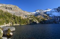
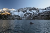
My first views of Cirque Lake.
I walked around the lake for a while trying to figure out where I was going to camp. Much of the lake shore is wooded. The southern and western edges border steep rocky talus fields, where boulders appear tofall on a routine basis. There were some nice open spots near the north west corner, kind of sitting up on a bluff. But there were 6 piles of bear scat there. Actually, there was a lot of bear scat everywhere around the lake. It was much bigger than the scat I had seen earlier in the day, where the black bear sow was. I don't think it was all from the same bear. I eventually settled on camping in a flat spot nested in some trees. I cooked dinner at the foot of the lake, where the outlet is. Its an incredible spot. An almost full moon was out, and it seemed to light up the cirque walls as darkness set in. Eventually I put my food away, and trekked back to my bed for the night.
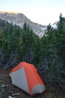
My tent in the trees at Cirque Lake.
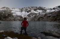 Food prep area night 4 at Cirque Lake.
Day 5: Today the plan was to make my way towards Littles Peak, and then camp somewhere high above Lake Solitude. I wasn't sure how to go about getting there. I kept looking up at the walls around Cirque Lake. The shortest route looked to be through the saddle right below Maidenform Peak, which I also wanted to climb. So that's the way I headed. Its a fairly strenuous climb, especially with a full pack. I did get into some sketchy climbing with exposure, but it could probably be avoided by staying farther south. Sometimes I just enjoy the thrill of it. At the windy saddle, I dropped my pack, and climbed maybe a few hundred more feet up to the top. Maidenform Peak sits at 11,137 feet. It kind of goes without saying that the views were spectacular.
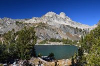
This is looking across the northern end of Cirque Lake from my tent site. Cleaver Peak is rising above.
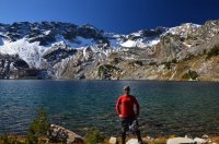
Me all jacked up on coffee getting ready for the climb out. Maidenform peak sits above, along with my route up.
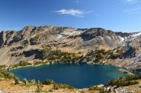
Looking down on Cirque Lake from the west side.
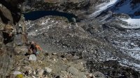
A still image taken from video of me climbing up towards the saddle just below Maidenform Peak.
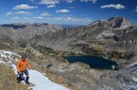 On the final approach to the top, after dropping my pack.
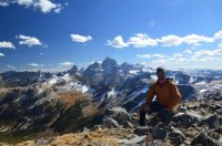
Me sitting on top of Maidenform Peak, with the Tetons visible behind me.
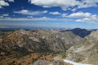
Looking down into the South Fork of Moran Canyon.
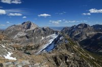
Looking east along the ridge line that divides Leigh and Moran Canyons. Mount Moran is visible in the back.
I climbed back down to my pack, then dropped steeply through boulders, high above the south fork of Moran Canyon. I carefully scaled the NW side of the peak, and made my way back to the saddle I camped at on night 2. I continued on, circling the top of Leigh Canyon, and climbed up to Littles Peak. Another beautiful spot.
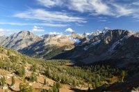
Looking down at Mink Lake in Leigh Canyon from where I camped on night 2.
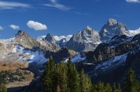
A closer shot of Grand Teton.
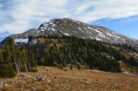
The backside of Littles Peak, outside the park's boundary. I walked right up the left hand side to the top.
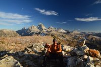
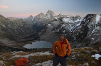
Me sitting at the top of Littles Peak. Notice the moon above me.
Next I headed down, and made my way to the head of Cascade Canyon's North Fork, where I overlooked Lake Solitude. I set my tent up on a bench overlooking the lake and the Grand Teton. A near full moon was out again. These views were incredible, and it was once again just awesome to sit there. I'm not even going to bother trying to describe it, just look at the pictures and create your description.

Camp night 5 above Lake Solitude. My tent is not visible from the lake. I had to climb up higher to capture the picture. I did this so I didn't ruin anyone's view down below.
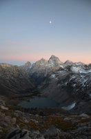
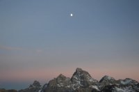
Almost a full moon.
Day 6: After spending the entire morning, you know, just being there (how boring!), I packed up camp and headed south. I followed the crest line, which makes up the park boundary. Lots of up and down. I scaled several un-named peaks, and had spectacular views the entire day. I was surprised to see several beautiful lakes outside the park boundary. These lakes would make for great camping, and require no permits. It would be an easy climb to the crest, where you can get great views of the park.
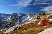
A view of my tent in the morning, with the first part of my route visible in the background.
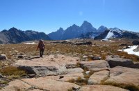
Setting off in the morning.
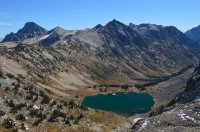
Looking down at Lake Solitude as I circled it.
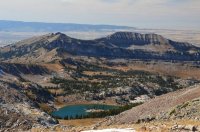
One of the numerous beautiful lakes outside the park's boundary. I believe this one is in the chain referred to as South Leigh Lakes.
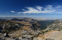
Another view looking west outside the park, down Leigh Creek.
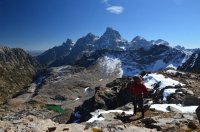
My first view looking down on Mica Lake.
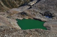
A close up look at Mica Lake.
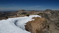
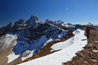
Walking along the actual Teton Crest.
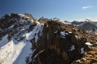
A close up of the route. For the most part I stayed along the edge.
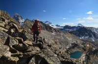
Lots of boulder hopping.
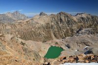
Another shot of Mica Lake.
One of the sweetest spots was the un-named peak that sits above Mica Lake, and is marked at elevation 10,855 feet on the map. Mica Lake is to the north, and 2 un-named lakes sit close together to the south.
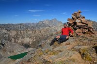
On top of the un-named peak marked as elevation 10,855 ft on the map. Mica Lake is below me.
Pika!
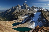
The 2 lakes sitting on the south side of the peak. The main fork of Cascade Canyon is clearly visible to the left.
From this peak I continued south towards the Wigwams. The route got difficult in a few places, and I had to drop my pack a few times to scout out routes. Although nothing technical, there was some hand over foot climbing where a fall could be dangerous. The Wigwams appear to be an area of 2 peaks. I by passed the first one, climbed to the saddle between them, and then to the top of the second (southern) peak.

Heading for The Wigwams.
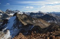
A good look at the route. Both peaks that make up the Wigwams are visible.
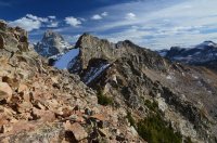
Definitely the most difficult part of the hike. Lots of route finding.
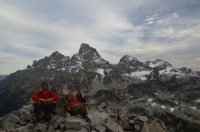
Me sitting on top of the southern peak of The Wigwams.
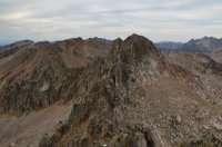
A look towards the northern peak, as well as the terrain I had to navigate through.
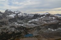
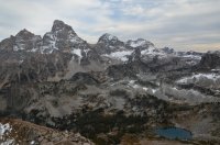
My views from the top looking down at the lakes to the south.
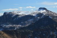 A good look across at Table Mountain, which I would climb the next day.
It was starting to get late. I decided to drop down into the basin south of the Wigwams, still inside the park. I actually didn't really care for the first lake, calling it the lake of death. I think it was because there was so many dead tree's in and around it. Plus I had been spoiled by all the other lakes. This one just didn't impress me. It was too late to try for the second lake, so I walked out to a ledge that overlooked Cascade Canyon, and set my tent up there. My view of the Grand Teton was incredible that night.
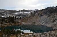
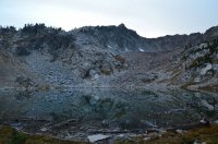
The lake I camped near night 6. Notice the dead trees.
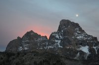
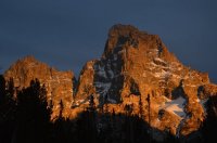
I had some awesome shots of the Grand Teton right from my tent.
Day 7: The plan for the day was to climb Table Mountain, then head south to Hurricane Pass. From there I wanted to make my way to Avalanche Canyon, and camp for the night. I packed up camp, and headed back to the lake of death. Surprisingly, I found it much more beautiful this morning. I made my way over to the second lake, which is definitely my favorite. I wished I camped there instead. From the second (southern) lake, I climbed straight up towards the crest, and then directly at Table Mountain. By this time my camera batteries were dying out quickly, so I stopped taking pictures, and really only took video.
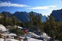
The view of my tent in the morning, overlooking Cascade Canyon
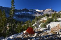
Another shot of my tent, looking the other way. Table Mountain high above.
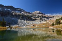
The other lake in the drainage, the southern one. I liked this one much better. My route up to Table Mountain is in the background.
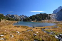
Looking back at the second lake.
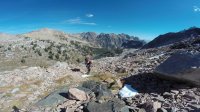
A video still as I climb up. I was eating a snowball. The 2nd lake is visible in the background.
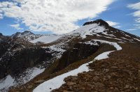
After a steep climb, I was left with this approach to Table Mountain.
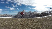
On my way to Table Mountain.
I approached Table Mountain from the north side, and eventually made my way around the west end, where I hit the trail coming up from the Idaho side. This is a popular hike, and more than a dozen people where there. It was the only people I had seen since leaving Paintbrush Divide. The views here are really nice, because they look right into the Tetons.
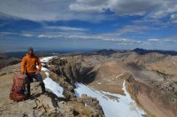
Me on top of Table Mountain.
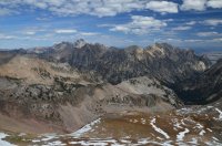
A good look at the ridge I climbed up.
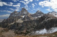
Looking at the Tetons from atop Table Mountain.
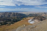
Looking to the west from Table Mountain. You can see the trail coming up that way. After not seeing people for so many days, it was weird to see more than a dozen at the top of the peak.
From Table Mountain, I dropped down to the saddle on its south side. It was very steep. I skirted the western edge of the crest outside the park down to Hurricane Pass. I took the Crest Trail down several hundred feet to the tarns there, where I filled up water. Rather than use the trail system, I decided to cross the talus fields directly towards Avalanche Divide. Another sweet spot. The views are great looking into Cascade Canyon, as well as down into the top of Avalanche Canyon. Kit Lake and Snowdrift Lake are the 2 beautiful lakes up high here. I was right next to "The Wall", which you can see from the highway. I dropped down to Snowdrift Lake, and almost camped there. But I decided to head down to Taminah Lake, which is another spectacular lake. It was pretty much dark when I finally reached the foot of the lake. There are really nice sheltered camp spots there. I sat by the lake in the dark, and enjoyed it in the moonlight. Both Taminah and Snowdrift are 2 of my favorite places. I always struggle between which one to camp at. Snowdrift is much more open. Taminah is in a narrow section of canyon, and the walls seem to come right down into the lake.
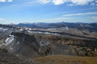
A look to the south at my route down from Table Mountain. I would drop to the saddle below, then stay to the right of the wall to reach Hurricane Pass.
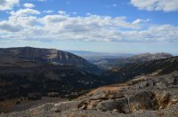
Looking west out of the park, down Roaring Creek drainage.
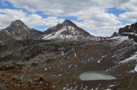
At Hurricane Pass, looking across towards Avalanche Divide.
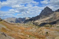
Looking down into the South Fork of Cascade Canyon from Hurricane Pass.
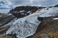
Schoolroom Glacier.
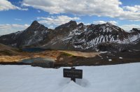
The Avalanche Divide marker, at Elevation 10,680 feet.
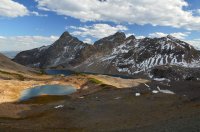
Looking down at the top of Avalanche Canyon from the divide. Kit Lake is to the left, and Snowdrift Lake is farther to the back.
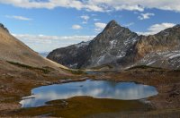
A closer look at Kit Lake.
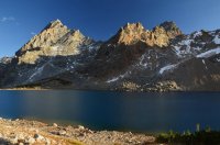
Snowdrift Lake.
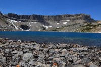
When I got to the foot of Snowdrift Lake, the sun was setting, and I couldn't get a good shot of Snowdrift Lake with "The Wall" in the background. So i'm going to cheat, and use this picture I took 4 days ago while on another trip.
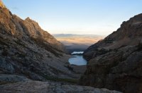
Looking down at Lake Taminah. You can see Taggart lake behind it.
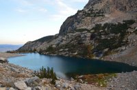
Lake Taminah. I would camp at the foot of the lake.
Day 8: My camera was done at this point. I packed up camp, and headed out. There is no maintained trail through Avalanche Canyon, but there is an old trail running through it that is easy to pick up in places. Its gets a fair amount of use too. There is some very steep boulder fields to deal with, so going down it is much easier than coming up it. There is also some avalanche debris down in the vegetated canyon bottom. Since I was out of camera batteries, I moved much quicker. Down at the bottom, I walked right into 4 adult moose. One bull and three cows. They just looked at me. I scrambled up a large boulder, and watched them for about 10 minutes. They didn't seem to care at all. I continued down the canyon, eventually reaching the Taggart Lake trail. I followed that back a few miles to the trail head and got my bike. It's about a 7 mile bike ride back to String Lake, and I attempted to ride with my backpack on. That sucked. I made it to Jenny Lake, and decided to stash my pack. My food was in a bear canister, so I stashed it separately, then finished off the bike ride back to my van. I was exhausted by the time I finished.
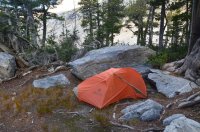
My tent the morning of day 8.
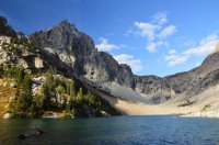
Lake Taminah. Snowdrift Lake is above that head wall in the background.
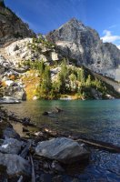
Another shot of Lake Taminah.
I took a shower, then drove north into Yellowstone. The next morning I met up with @Keith , and started our Lamar River Wapiti Lake trip. The End.
How about a few teasers......


Here is the trip video:
Here you can see the route:
Click here to view on CalTopo
The week before I did this trip, I had attempted a similar route with several of the forum members here on BCP. We had started at the north end of the park, and intended to hike all the way down to Avalanche Canyon. We encountered 3 days of snowy weather at upper Glacier Lakes, and bailed on the trip. You can read @Vegan.Hiker 's excellent trip report for that one here:
http://backcountrypost.com/threads/grand-teton-national-park-september-2015.5184/#post-60738
I was left with an empty feeling in my heart. I had really wanted to get back to Ortenburger Lake, and had been trying to get out to Cirque Lake for almost 10 years. I had another backpack planned somewhere else, but decided to scrap it at the last minute. The weather forecast was perfect. So I headed back into the Tetons.
Day 1: It was late in the day when I finally got situated and hit the trail. I started at String Lake, and headed up into Paintbrush Canyon. I was permitted to camp in the Upper Paintbrush Camp zone, so I had to make it past Holly Lake. It was a beautiful afternoon, and the fresh snow from the storms a few days earlier lingered on all the peaks. This would really stand out for the entire trip. Fresh white snow combined with clear blue skies in the mountains is one of the most beautiful things in this world. The trail at first was wooded, but soon broke free of the trees, and took on an alpine feel. There are great views looking back down at Leigh and Jackson Lakes. The sun was already going down on the other side of the mountains, but still lit up all the high peaks. I hustled my way up the trail, passing several people coming down. Definitely one of the busier trails in the park. Around dusk, I ran into 2 girls coming down the trail near Holly Lake. They swore they had just ran into a grizzly sow with two cubs 30 minutes before, and gave me a heads up. Although they seemed believable, I had my doubts it was a grizzly. Although grizzlies are common throughout the park, it's almost unheard of to see them in the trailed canyons. Almost all of the reports are people misidentifying brown black bears as grizzlies. Still, I perked up a bit. I reached the camp zone right after that, and found a spot overlooking Holly Lake. I set my tent up in the dark, and had a solid night of sleep.

@Ben was with me when I pulled the permit. This is him taking off on his motorcycle, heading back to Idaho after his big Alaska bike ride.

String Lake


Views along the trail as I hiked up Paintbrush Canyon

Looking back out across Jackson Lake, with the snow covered Absaroka Mountains in the background.

My view of Holly Lake from where I ate dinner.

Me prepping for bed at camp night number 1.
Day 2: What a beautiful morning. Those clear, deep blue skies contrasted with the snow intensely. I packed up camp, and headed up the trail towards Paintbrush Divide. About 100 yards from camp I ran into numerous bear tracks that were just everywhere. To me, they appear to be black bear tracks.

My tent in the morning.


Black bear tracks where every where right behind my camp.
I really wasn't sure what my plans were for the day. Originally I intended to get to Cirque Lake, but that would change by the end of the day. I needed to get into Leigh Canyon, and wasn't sure which way I wanted to take. I decided to head up to Paintbrush Divide because I knew the views would be beautiful with the perfect weather. I was right. At this point the trail up to the divide was snow covered, but enough hikers coming through had already compacted a path. I slowly climbed up, and took in the snowy views.

Leaving camp in the morning.


Here you can see Paintbrush Divide above me, along with the trail.


More views of the snow covered trail up to the divide.

Paintbrush Divide, which sits at 10,700 feet elevation.
At the divide, I spent some time enjoying the views. I hiked over towards Cascade Canyon to get a better view down. This is one of my favorite views in the park. I love looking down on Lake Solitude, along with Mica Lake above it. It also gave me a good look at the landscape I would be traveling over the next few days.

Looking down Paintbrush Canyon.

The view across the North Fork of Cascade Canyon. Lake Solitude is to the right, and Mica Lake sits higher up to the left. I would walk the entire top wall above the lakes a few days later, and even camp up there.
Next it was time to leave the trail. And the people. I would only see people in 2 places the rest of this trip, once at Table Mountain, and then when I finished at Taggart Lake. From the divide, I headed straight down into Leigh Canyon, essentially towards Mink Lake. It was a steep, snowy decent. Soon I reached the bottom of the basin, and the terrain flattened out. Still covered in snow, it was just awesome. I had still been considering going over to Cirque Lake, but changed my mind at this point. To start with, I hadn't even started hiking until after noon. And looking up at the northern wall of Leigh Canyon, I didn't see anything that looked exciting to climb up. Since I had permits to camp in Moran Canyon the next 3 nights, I decided to change up my route a little bit. I was going to camp at the saddle between Leigh Canyon and the south fork of Moran Canyon. I've camped there before, and traveled through it a few times. Its a beautiful spot, probably one of the sweetest camping spots in the park. So I headed straight towards Mink Lake. There are some beautiful views here, but its kind of marshy around the lake, and not an ideal campsite.

Me about to leave the trail and head into Leigh Canyon, which is down to the right in this picture.

Looking down at my decent into the basin. That is NOT Mink Lake in this picture. Just one of the many un named tarns in the high alpine here.

Down in the basin, I got my first glimpse of Mink Lake, which you can make out down in the trees. I would walk right down to it, and then past it up to the saddle in the top right corner. That would be camp for the night.

Mink Lake, with Paintbrush Divide visible in the top background.
After leaving Mink Lake, I headed straight up to the saddle. There isn't much underbrush, and its not too difficult to climb up. I was glad I made the change. Its beautiful up there. I had carried up water expecting it to be dry, but the recent snow created plenty of water options. I got my tent set up, and spent the evening enjoying the views into both canyons. For me, this is what it's all about.

Another beautiful view looking back at Mink Lake.


Some views of my tent for night number 2.

My view down into the South Fork of Moran Canyon from my camp. Such a beautiful spot.

Me eating dinner at camp night 2 overlooking Mink Lake. Mount Woodring is above my head, and Paintbrush Divide is between the 2 pyramid style peaks in the center of the picture. The Grand Teton is barely popping out to the right. Safe to say I was high on life this night.
Day 3: My goal for the day was to reach Ortenburger Lake. I have traveled between these 2 spots before, but this time decided to try a different route. I followed the edge of the south fork, staying close to the park's boundary line. I easily made my way to the un-named peak at elevation 10,484. I opted to stay inside the park, and had to do a little climbing to reach the first lake (which still drains into the south fork). In hindsight, it would be much easier to stay outside the park, and follow the park boundary north. The terrain is easier. But this particular lake was beautiful. I found bear tracks here too. The views down into Moran Canyon were amazing. I scrambled through a small saddle, and dropped down to the other lake, which is at the head of the North Fork of Moran Canyon. What an absolutely sweet spot! There isn't much shelter up there, but with great weather is a nice campsite.

Looking into the South Fork of Moran Canyon in the morning. I basically stayed at a similar elevation, and circled the canyon along the left side.


Views looking back towards camp as I walked above the canyon.

The first lake I reached. I would climb down to it, then walk up over the next ridge to reach the other lake.

Another view of the first lake. There are actually 2 lakes here, as a small tarn sits right above this one.


Views of Moran Canyon, as I climbed over to the second lake.

The second lake. This lake sits at the top of the North Fork of Moran Canyon. It is possibly called North Lake, I've seen it referenced that way a few times, but don't know for sure.

Another view of the lake. I came over from the first lake via the snowy ridge above.

I believe this is Cleaver Peak, rising above the saddle near Window Peak. Kind of hard to describe this shot. Cirque Lake is on the other side of it, but there are 2 canyons between me and there.

My view looking down Moran Canyon. Jackson Lake is visible in the background.

A close up of Jackson Lake.
From this lake, I circled the north side of the canyon, and worked my way over to Ortenburger Lake. It wasn't very difficult, although I was walking on steep, slanted scree and grass the whole way. No flat steps here. A few hours later, I reached the creek draining out of Ortenburger Lake, and climbed up a few hundred feet to the foot of the lake.

The foot of Ortenburger Lake, looking north.
Ortenburger is beautiful. I had been there the year before with @Chuck the Mauler , so I knew what I was coming for. There is great camping near the foot of the lake, along with the east side of it. But I headed for the north side. Here the backdrop is absolutely spectacular. It just mesmerized me. Numerous mountains abound. Mount Moran sits all the way to the left, and in the center the Grand Teton itself rises above everything. It looks like something out of a fairy tale. It was an incredible place to have all to myself.

Camp at Ortenburger Lake night number 3.
Day 4: Someone once wrote a comment about one of my trip reports, stating "they didn't know how I could sit at a campsite for so long without moving on" and that "if it were them, they would become extremely bored".
Since reading that quote, I've spent more than 100 hundred mornings, sitting in beautiful campsites, wondering why I have to pack up camp and leave at all. I often wonder how so many people can go to work everyday, and just sit in the same place, and stare at basically the same thing. That used to be me, and I became extremely bored.
I sat there at Ortenburger Lake the entire morning. And into the afternoon. I really don't know what to tell you. I don't even remember what I did. But I was there. I smiled. I laughed at myself. I was high on something, without taking any kind of drug. There was no boredom. I just sat and stared. I was happy, and felt fully alive.
Eventually I looked across Moran Canyon, where I could see the Cirque Lake basin. Cirque Lake is at an elevation of 9,605 feet, which is almost the same exact elevation at Ortenburger Lake (9,610 ft). Suddenly I did have a good reason to get going. Today was the day to finally get there. It was somewhere between 1 and 2 pm when I finally set off. I wasn't sure what to expect along the way. As the crow flies, it wasn't that many miles between the lakes. But I had to drop down 1500 feet, before climbing back up the same amount. And I wasn't sure how thick the forested canyon bottom would be. Surprisingly it was easy. At the bottom, the fall colors really popped.

A morning view of camp at Ortenburger Lake.

A crooked picture of me standing at the foot of Ortenburger Lake.

My view looking across Moran Canyon at the Cirque Lake drainage. I would basically go straight down, across, and up to the lake. Cirque Lake is not visible in the picture.

Making my way down into Moran Canyon.

The North Fork of Moran Creek. This what I mean by the fall colors really popping.

Is it a weasel or martin? I give up.

Looking down the South Fork of Moran Creek.
I crossed both forks of Moran Creek, then headed straight up towards Cirque Lake. Soon the forest gave way to a boulder field, and lots of waterfalls. Waterfalls are so common in the high alpine, I almost forget to mention them. They are kind of everywhere, especially early in the year when all the snow starts melting. But there were several nice ones as I climbed up. I reached some cliffs, and diverted to the east, climbing up next to another waterfall towards the lowest lake in the Cirque Lake drainage. This lake is pretty. From here, it was a straight, open alpine shot right up to Cirque Lake. I started noticing fresh bear scat in a few places. Near the top, I set my tripod up to shoot a walk through shot. As I was finishing up the shot, I noticed a shadow move out of the corner of my eye. I stared at the shadow for a minute, and then it moved. A black bear was just sitting there, looking at me. A few more shadows moved. She had cubs. The bears took off. I went to take shots, but my camera battery died right then. I sat and watched them run down what I had just come up. I quickly changed batteries, and was able to capture some video of them running off.


Waterfalls as I climbed up the drainage.

This waterfall is the one coming out of the lower, un-named lake in the drainage. I climbed up along the right hand side.

The lower lake.

Another view of the lower lake, and also looking at my final route up to Cirque Lake.

The black bear that had been watching me film myself.

This is a still shot I pulled from video footage of the black bear and cubs running away from me. It was really a treat to watch them run down this entire slope, but I felt bad for stressing them out.
After watching the bears, I continued up a few hundred yards to reach Cirque Lake. My first thought was that it was much larger than I was expecting. Hard to capture with my lens. And it was beautiful. Just beautiful.


My first views of Cirque Lake.
I walked around the lake for a while trying to figure out where I was going to camp. Much of the lake shore is wooded. The southern and western edges border steep rocky talus fields, where boulders appear tofall on a routine basis. There were some nice open spots near the north west corner, kind of sitting up on a bluff. But there were 6 piles of bear scat there. Actually, there was a lot of bear scat everywhere around the lake. It was much bigger than the scat I had seen earlier in the day, where the black bear sow was. I don't think it was all from the same bear. I eventually settled on camping in a flat spot nested in some trees. I cooked dinner at the foot of the lake, where the outlet is. Its an incredible spot. An almost full moon was out, and it seemed to light up the cirque walls as darkness set in. Eventually I put my food away, and trekked back to my bed for the night.

My tent in the trees at Cirque Lake.
 Food prep area night 4 at Cirque Lake.
 Day 5: Today the plan was to make my way towards Littles Peak, and then camp somewhere high above Lake Solitude. I wasn't sure how to go about getting there. I kept looking up at the walls around Cirque Lake. The shortest route looked to be through the saddle right below Maidenform Peak, which I also wanted to climb. So that's the way I headed. Its a fairly strenuous climb, especially with a full pack. I did get into some sketchy climbing with exposure, but it could probably be avoided by staying farther south. Sometimes I just enjoy the thrill of it. At the windy saddle, I dropped my pack, and climbed maybe a few hundred more feet up to the top. Maidenform Peak sits at 11,137 feet. It kind of goes without saying that the views were spectacular.

This is looking across the northern end of Cirque Lake from my tent site. Cleaver Peak is rising above.

Me all jacked up on coffee getting ready for the climb out. Maidenform peak sits above, along with my route up.

Looking down on Cirque Lake from the west side.

A still image taken from video of me climbing up towards the saddle just below Maidenform Peak.
 On the final approach to the top, after dropping my pack.
Me sitting on top of Maidenform Peak, with the Tetons visible behind me.

Looking down into the South Fork of Moran Canyon.

Looking east along the ridge line that divides Leigh and Moran Canyons. Mount Moran is visible in the back.
I climbed back down to my pack, then dropped steeply through boulders, high above the south fork of Moran Canyon. I carefully scaled the NW side of the peak, and made my way back to the saddle I camped at on night 2. I continued on, circling the top of Leigh Canyon, and climbed up to Littles Peak. Another beautiful spot.

Looking down at Mink Lake in Leigh Canyon from where I camped on night 2.

A closer shot of Grand Teton.

The backside of Littles Peak, outside the park's boundary. I walked right up the left hand side to the top.

Me sitting at the top of Littles Peak. Notice the moon above me.
Next I headed down, and made my way to the head of Cascade Canyon's North Fork, where I overlooked Lake Solitude. I set my tent up on a bench overlooking the lake and the Grand Teton. A near full moon was out again. These views were incredible, and it was once again just awesome to sit there. I'm not even going to bother trying to describe it, just look at the pictures and create your description.


Camp night 5 above Lake Solitude. My tent is not visible from the lake. I had to climb up higher to capture the picture. I did this so I didn't ruin anyone's view down below.


Almost a full moon.
Day 6: After spending the entire morning, you know, just being there (how boring!), I packed up camp and headed south. I followed the crest line, which makes up the park boundary. Lots of up and down. I scaled several un-named peaks, and had spectacular views the entire day. I was surprised to see several beautiful lakes outside the park boundary. These lakes would make for great camping, and require no permits. It would be an easy climb to the crest, where you can get great views of the park.

A view of my tent in the morning, with the first part of my route visible in the background.

Setting off in the morning.

Looking down at Lake Solitude as I circled it.

One of the numerous beautiful lakes outside the park's boundary. I believe this one is in the chain referred to as South Leigh Lakes.

Another view looking west outside the park, down Leigh Creek.

My first view looking down on Mica Lake.

A close up look at Mica Lake.


Walking along the actual Teton Crest.

A close up of the route. For the most part I stayed along the edge.

Lots of boulder hopping.

Another shot of Mica Lake.
One of the sweetest spots was the un-named peak that sits above Mica Lake, and is marked at elevation 10,855 feet on the map. Mica Lake is to the north, and 2 un-named lakes sit close together to the south.

On top of the un-named peak marked as elevation 10,855 ft on the map. Mica Lake is below me.

Pika!

The 2 lakes sitting on the south side of the peak. The main fork of Cascade Canyon is clearly visible to the left.
From this peak I continued south towards the Wigwams. The route got difficult in a few places, and I had to drop my pack a few times to scout out routes. Although nothing technical, there was some hand over foot climbing where a fall could be dangerous. The Wigwams appear to be an area of 2 peaks. I by passed the first one, climbed to the saddle between them, and then to the top of the second (southern) peak.

Heading for The Wigwams.

A good look at the route. Both peaks that make up the Wigwams are visible.

Definitely the most difficult part of the hike. Lots of route finding.

Me sitting on top of the southern peak of The Wigwams.

A look towards the northern peak, as well as the terrain I had to navigate through.


My views from the top looking down at the lakes to the south.
 A good look across at Table Mountain, which I would climb the next day.
It was starting to get late. I decided to drop down into the basin south of the Wigwams, still inside the park. I actually didn't really care for the first lake, calling it the lake of death. I think it was because there was so many dead tree's in and around it. Plus I had been spoiled by all the other lakes. This one just didn't impress me. It was too late to try for the second lake, so I walked out to a ledge that overlooked Cascade Canyon, and set my tent up there. My view of the Grand Teton was incredible that night.


The lake I camped near night 6. Notice the dead trees.


I had some awesome shots of the Grand Teton right from my tent.
Day 7: The plan for the day was to climb Table Mountain, then head south to Hurricane Pass. From there I wanted to make my way to Avalanche Canyon, and camp for the night. I packed up camp, and headed back to the lake of death. Surprisingly, I found it much more beautiful this morning. I made my way over to the second lake, which is definitely my favorite. I wished I camped there instead. From the second (southern) lake, I climbed straight up towards the crest, and then directly at Table Mountain. By this time my camera batteries were dying out quickly, so I stopped taking pictures, and really only took video.

The view of my tent in the morning, overlooking Cascade Canyon

Another shot of my tent, looking the other way. Table Mountain high above.

The other lake in the drainage, the southern one. I liked this one much better. My route up to Table Mountain is in the background.

Looking back at the second lake.

A video still as I climb up. I was eating a snowball. The 2nd lake is visible in the background.

After a steep climb, I was left with this approach to Table Mountain.

On my way to Table Mountain.
I approached Table Mountain from the north side, and eventually made my way around the west end, where I hit the trail coming up from the Idaho side. This is a popular hike, and more than a dozen people where there. It was the only people I had seen since leaving Paintbrush Divide. The views here are really nice, because they look right into the Tetons.

Me on top of Table Mountain.

A good look at the ridge I climbed up.

Looking at the Tetons from atop Table Mountain.

Looking to the west from Table Mountain. You can see the trail coming up that way. After not seeing people for so many days, it was weird to see more than a dozen at the top of the peak.
From Table Mountain, I dropped down to the saddle on its south side. It was very steep. I skirted the western edge of the crest outside the park down to Hurricane Pass. I took the Crest Trail down several hundred feet to the tarns there, where I filled up water. Rather than use the trail system, I decided to cross the talus fields directly towards Avalanche Divide. Another sweet spot. The views are great looking into Cascade Canyon, as well as down into the top of Avalanche Canyon. Kit Lake and Snowdrift Lake are the 2 beautiful lakes up high here. I was right next to "The Wall", which you can see from the highway. I dropped down to Snowdrift Lake, and almost camped there. But I decided to head down to Taminah Lake, which is another spectacular lake. It was pretty much dark when I finally reached the foot of the lake. There are really nice sheltered camp spots there. I sat by the lake in the dark, and enjoyed it in the moonlight. Both Taminah and Snowdrift are 2 of my favorite places. I always struggle between which one to camp at. Snowdrift is much more open. Taminah is in a narrow section of canyon, and the walls seem to come right down into the lake.

A look to the south at my route down from Table Mountain. I would drop to the saddle below, then stay to the right of the wall to reach Hurricane Pass.

Looking west out of the park, down Roaring Creek drainage.

At Hurricane Pass, looking across towards Avalanche Divide.

Looking down into the South Fork of Cascade Canyon from Hurricane Pass.

Schoolroom Glacier.

The Avalanche Divide marker, at Elevation 10,680 feet.

Looking down at the top of Avalanche Canyon from the divide. Kit Lake is to the left, and Snowdrift Lake is farther to the back.

A closer look at Kit Lake.

Snowdrift Lake.

When I got to the foot of Snowdrift Lake, the sun was setting, and I couldn't get a good shot of Snowdrift Lake with "The Wall" in the background. So i'm going to cheat, and use this picture I took 4 days ago while on another trip.

Looking down at Lake Taminah. You can see Taggart lake behind it.

Lake Taminah. I would camp at the foot of the lake.
Day 8: My camera was done at this point. I packed up camp, and headed out. There is no maintained trail through Avalanche Canyon, but there is an old trail running through it that is easy to pick up in places. Its gets a fair amount of use too. There is some very steep boulder fields to deal with, so going down it is much easier than coming up it. There is also some avalanche debris down in the vegetated canyon bottom. Since I was out of camera batteries, I moved much quicker. Down at the bottom, I walked right into 4 adult moose. One bull and three cows. They just looked at me. I scrambled up a large boulder, and watched them for about 10 minutes. They didn't seem to care at all. I continued down the canyon, eventually reaching the Taggart Lake trail. I followed that back a few miles to the trail head and got my bike. It's about a 7 mile bike ride back to String Lake, and I attempted to ride with my backpack on. That sucked. I made it to Jenny Lake, and decided to stash my pack. My food was in a bear canister, so I stashed it separately, then finished off the bike ride back to my van. I was exhausted by the time I finished.

My tent the morning of day 8.

Lake Taminah. Snowdrift Lake is above that head wall in the background.

Another shot of Lake Taminah.
I took a shower, then drove north into Yellowstone. The next morning I met up with @Keith , and started our Lamar River Wapiti Lake trip. The End.

