- Joined
- Jul 23, 2013
- Messages
- 1,665
For a meetup with friends, mostly inspired by Adam from last year's Highline Trail trip, we opted for a more casual trip up into the Uintas this year. We chose Allsop Lake, a place neither of us had been yet. Given how the trail conditions turned out, it would have been just as fitting had it been named "All Slop" Lake because the trail was mostly mud or marsh the whole way up. I reached out and invited a few others along to join us as well. As it turned out, we ended up with a group of five, including a buddy of Adam's who would be backpacking for the first time.
Day 1
Friday - July 14, 2017
Our group of five consisted of @Parma, Brett (the 'newbie'), @Blake Merrell, @Jackson, and myself. I was familiar with Adam (@Parma) of course, from last year's Highline trip, and Blake from a couple of prior trips together. It was my first time meeting up with Jackson and Brett. We met up at the mouth of Provo Canyon where we then decided to all drive further up the canyon to another lot to set up our carpool. It should have happened almost an hour earlier in the morning, but due to an early morning doctor appointment that resulted in an unexpected need for a prescription of antibiotics, I caused us all a delay. What faithful friends they all were to wait for me though.
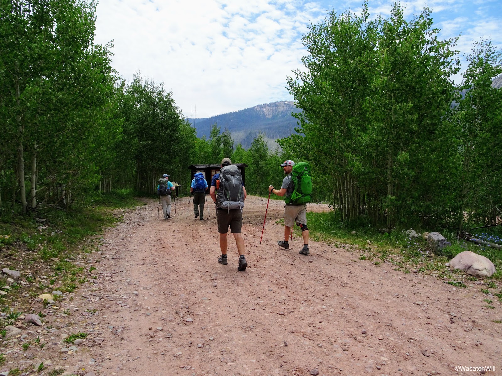
Once on the road, we drove on up to the East Fork Bear River trailhead on the northern slope of the Uintas. At the trailhead we did the ritualistic routine of readying ourselves for the trail and got underway.

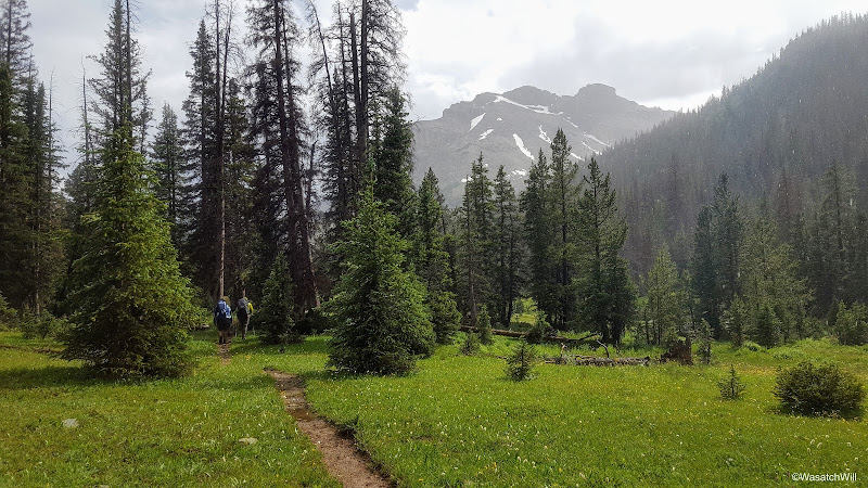
The start
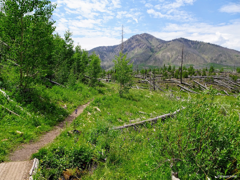
Just past the trailhead
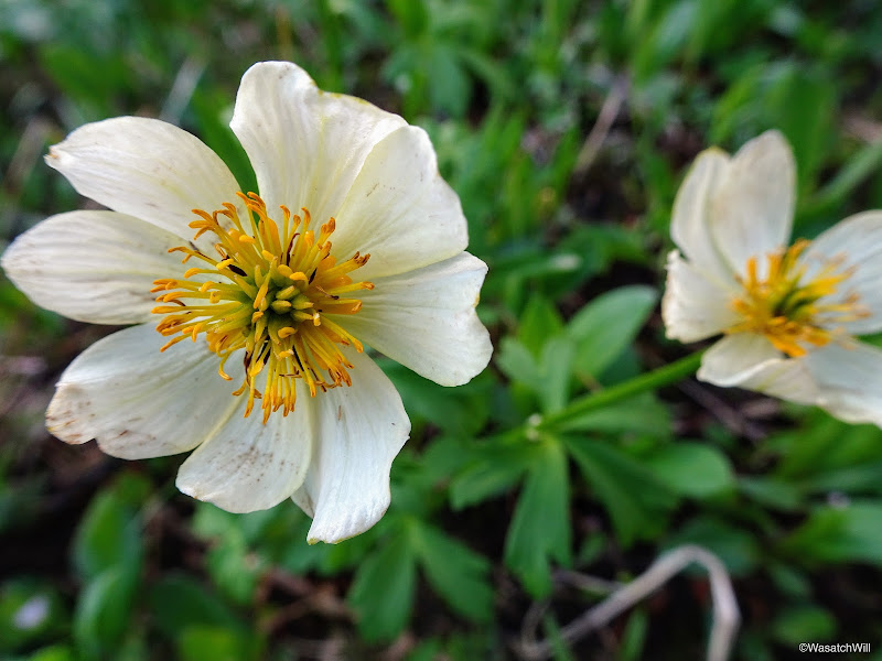
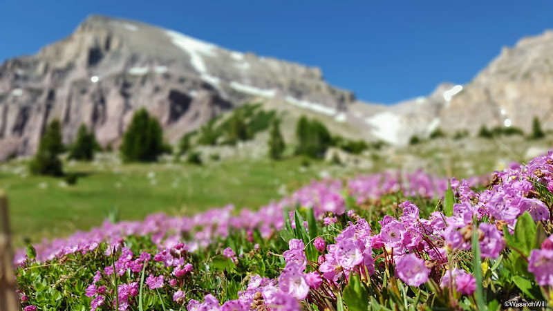
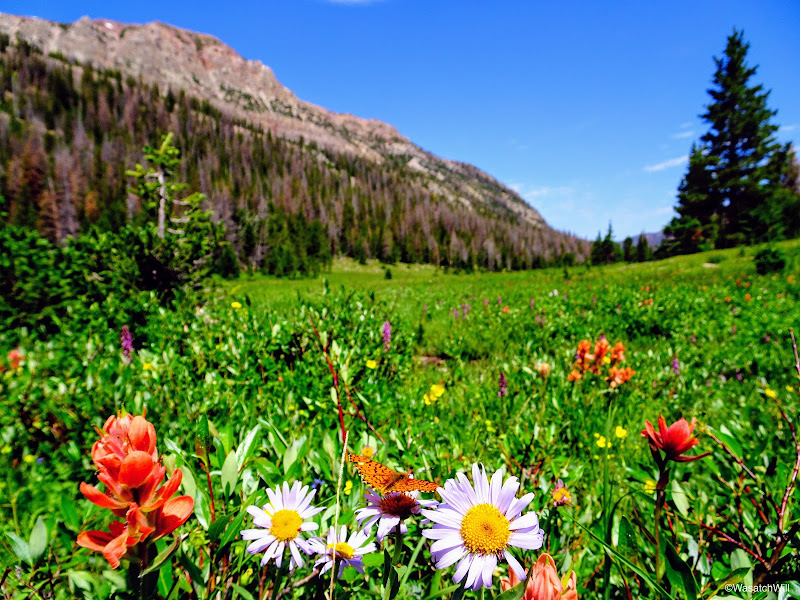
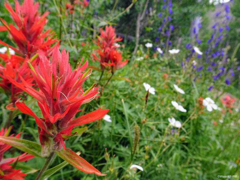
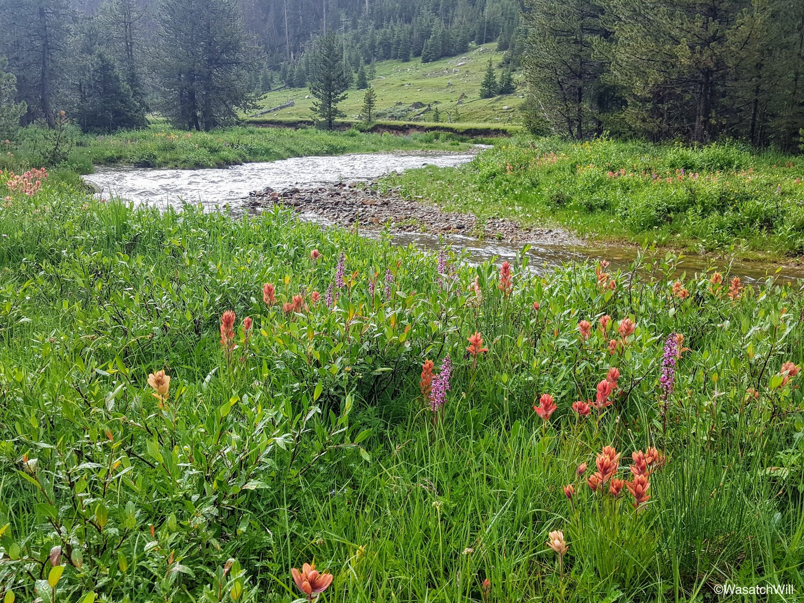
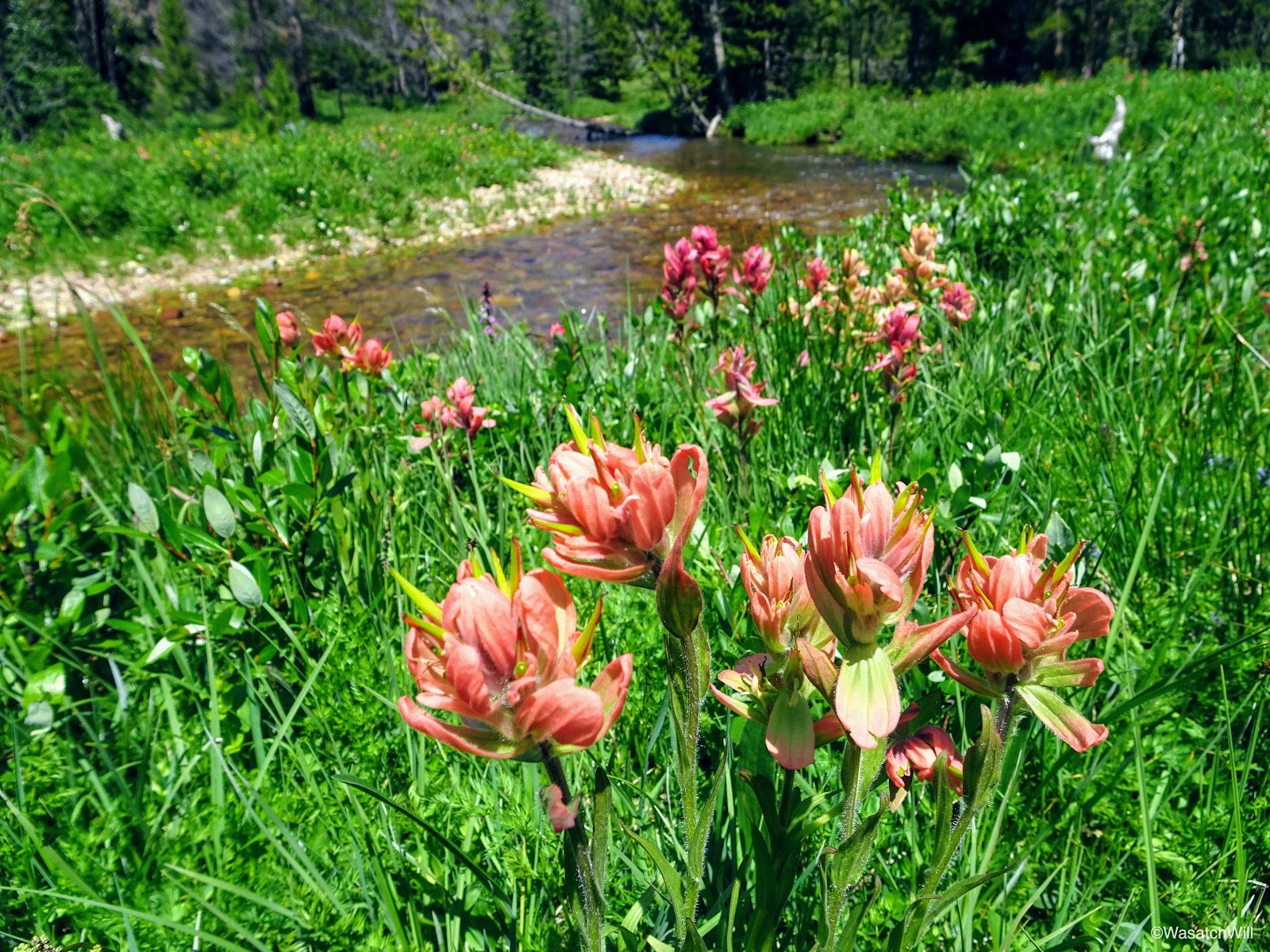
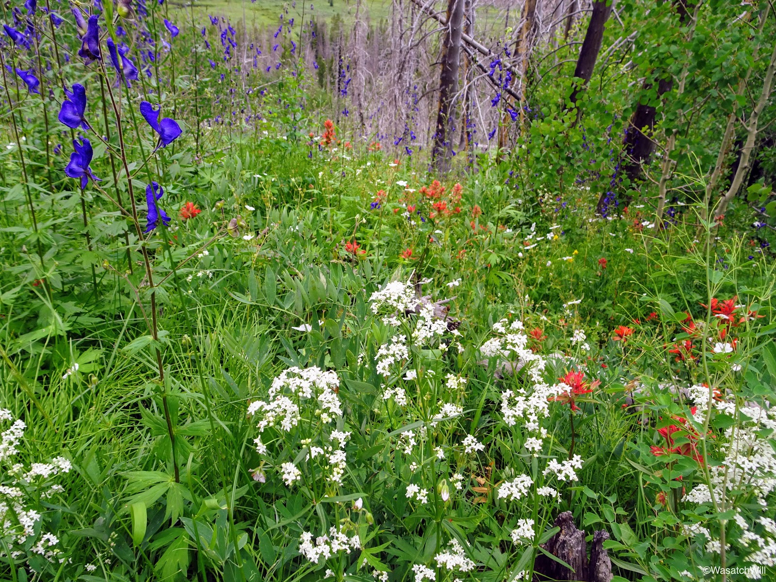
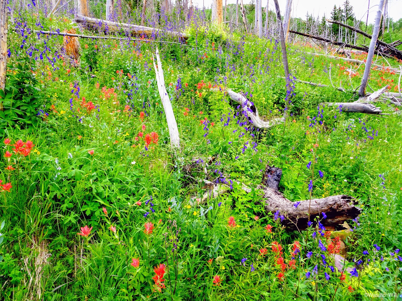
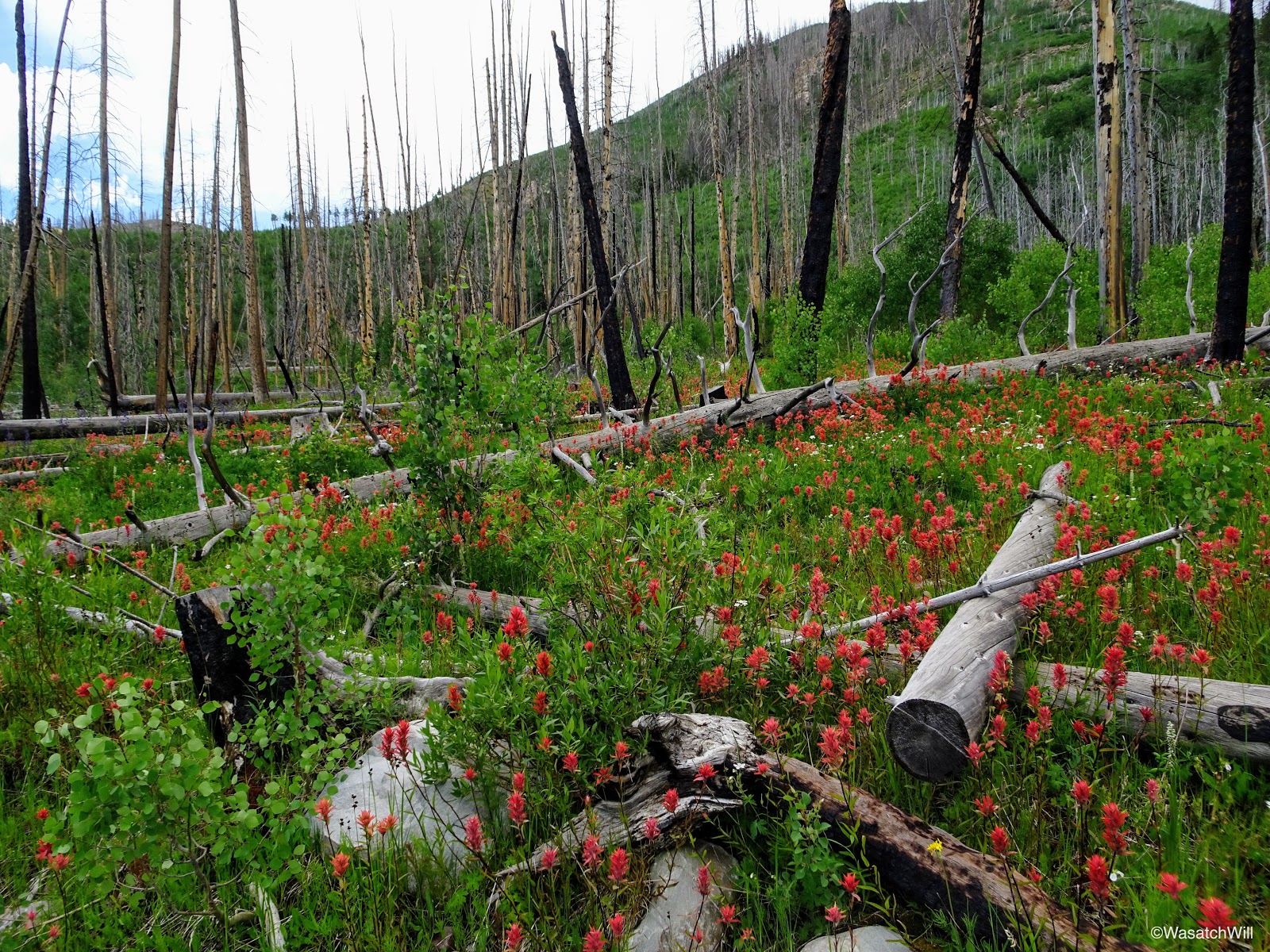
Almost right off the bat, the trail immersed us into thick stands of an assortment of wildflowers of almost all colors. It was like stepping through a rainbow.
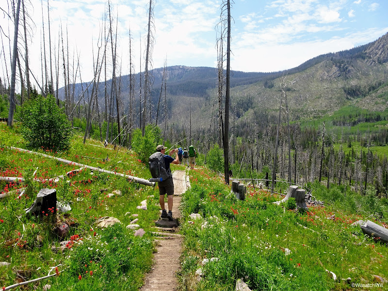
Adam capturing a picture from near the start of the trail
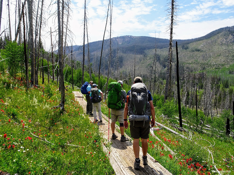
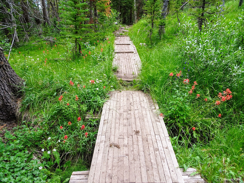
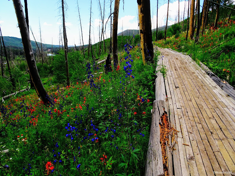
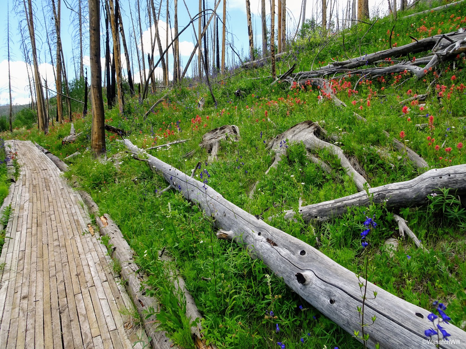
Along an early boardwalk
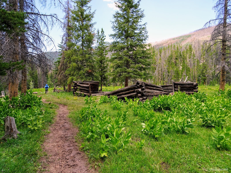
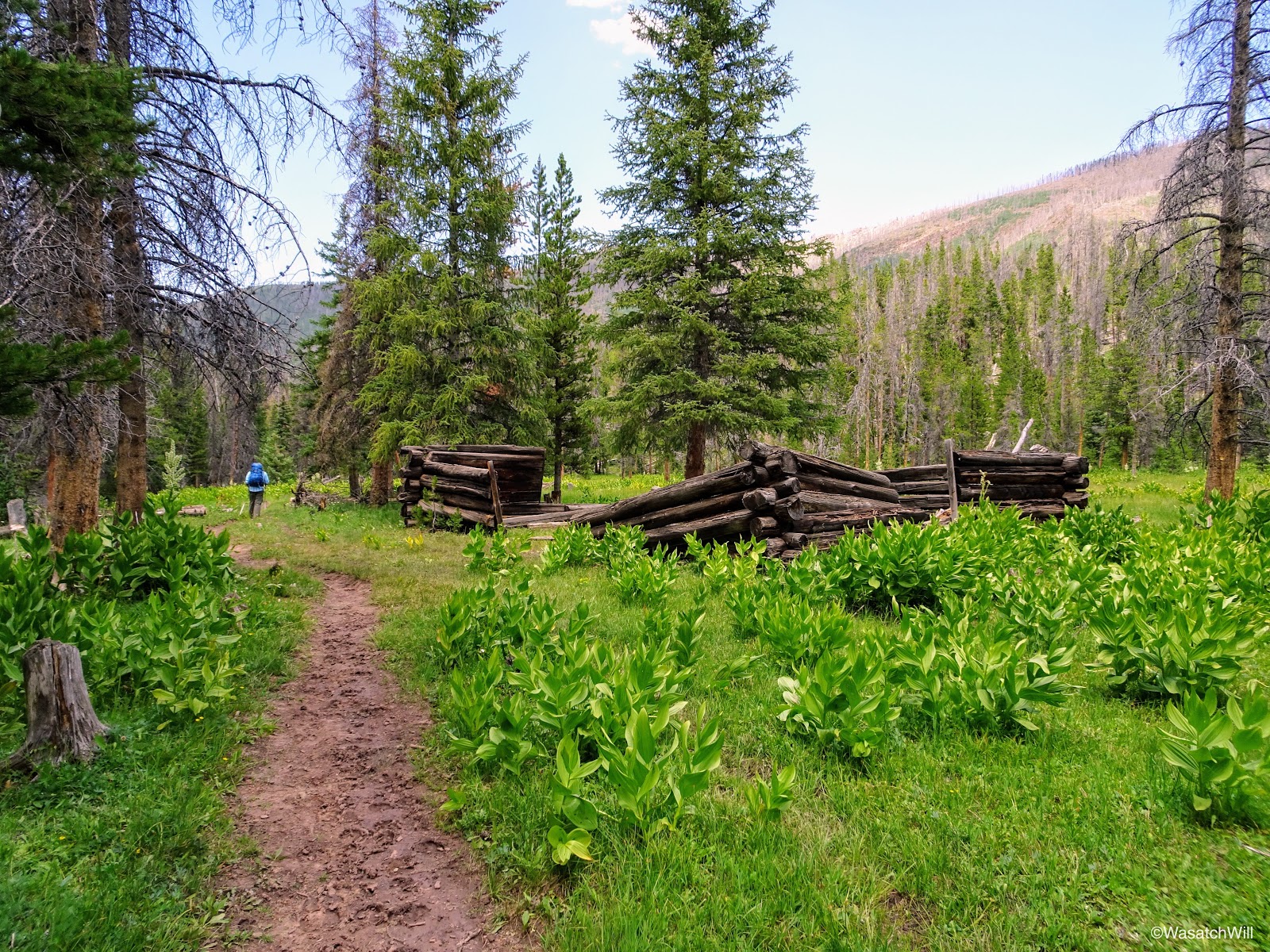
A couple miles up the trail, we passed by what is believed to be an old tie-hacker cabin. Tie-hackers were people who harvested timber to be used for railroad ties in the construction of the transcontinental railroad.
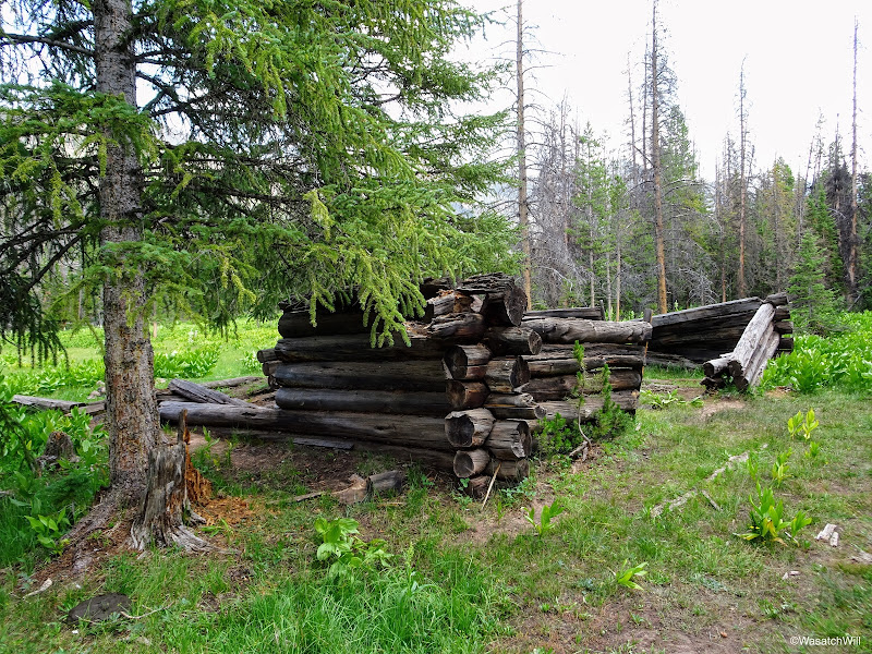
Old tie-hacker cabin
Inside the remains of the largest structure was a tree growing right out what would have been the interior floor.
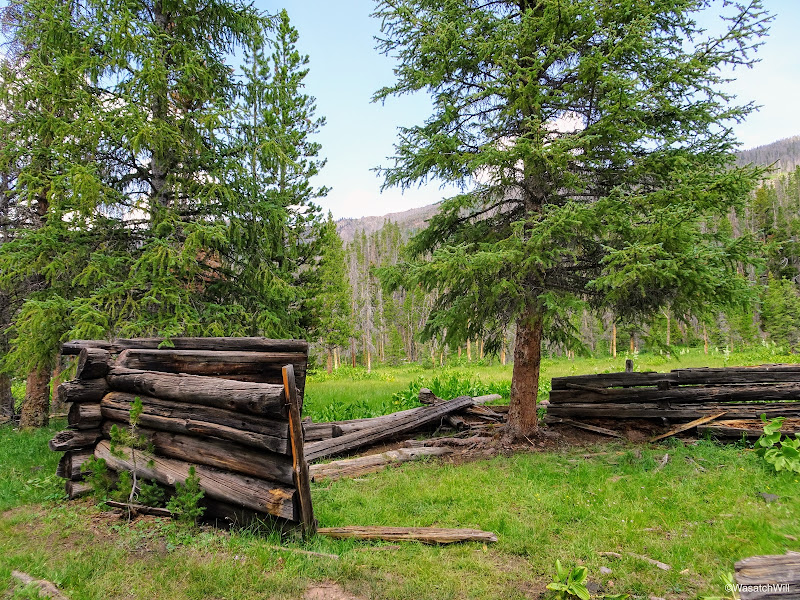
Tree in the middle of old cabin
Soon after the cabin, we were greeted by the resident herd of cattle. Needless to say, because of these guys, the trail was littered with cow pies the whole way up to the lake.

Resident cattle
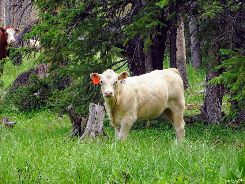
Ghost cow
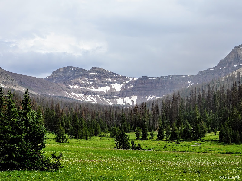
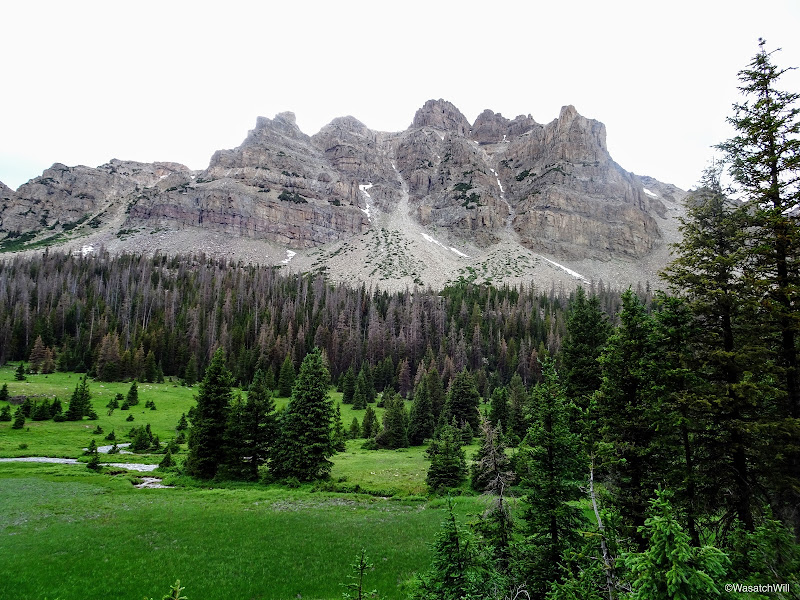
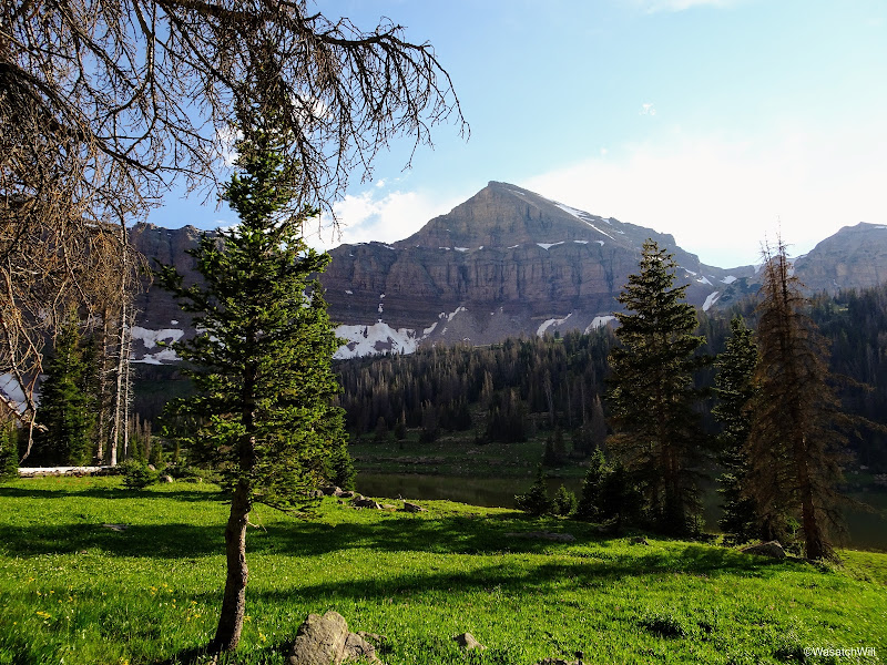
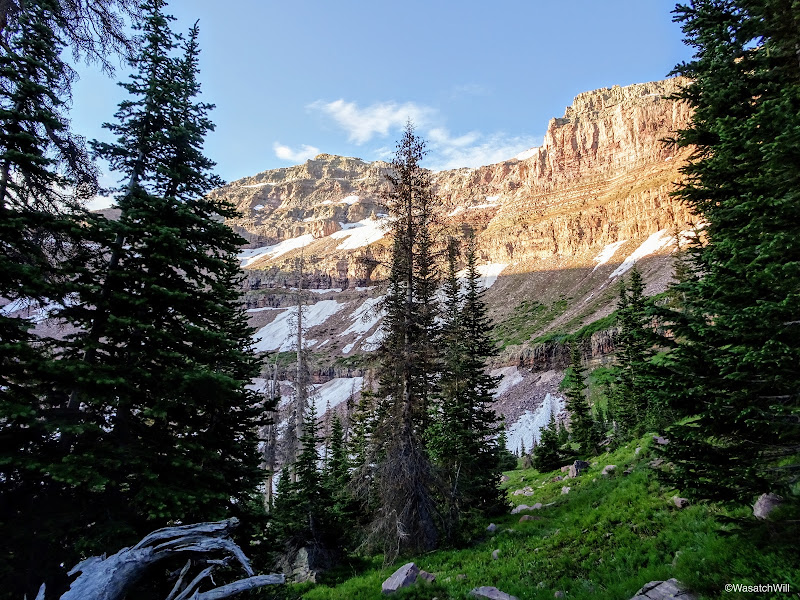
We enjoyed views of Mount Beulah early on.
Meadow with Mount Beulah in the distance
Mount Beulah
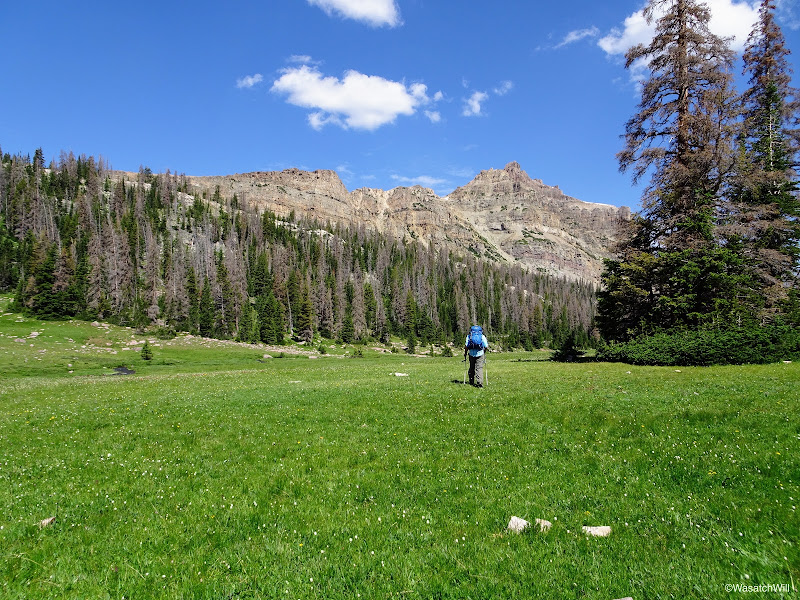
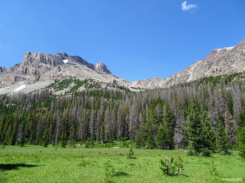
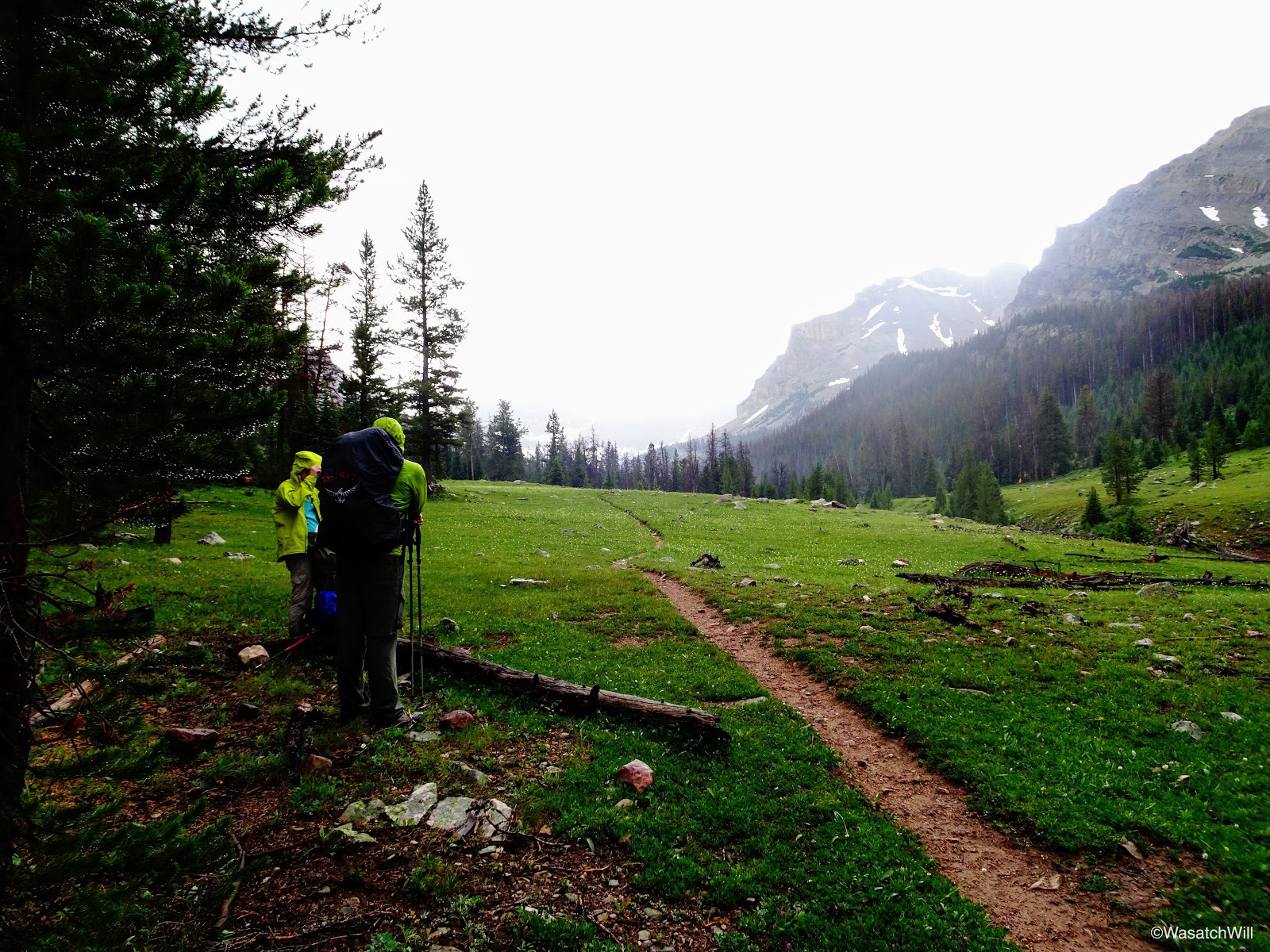
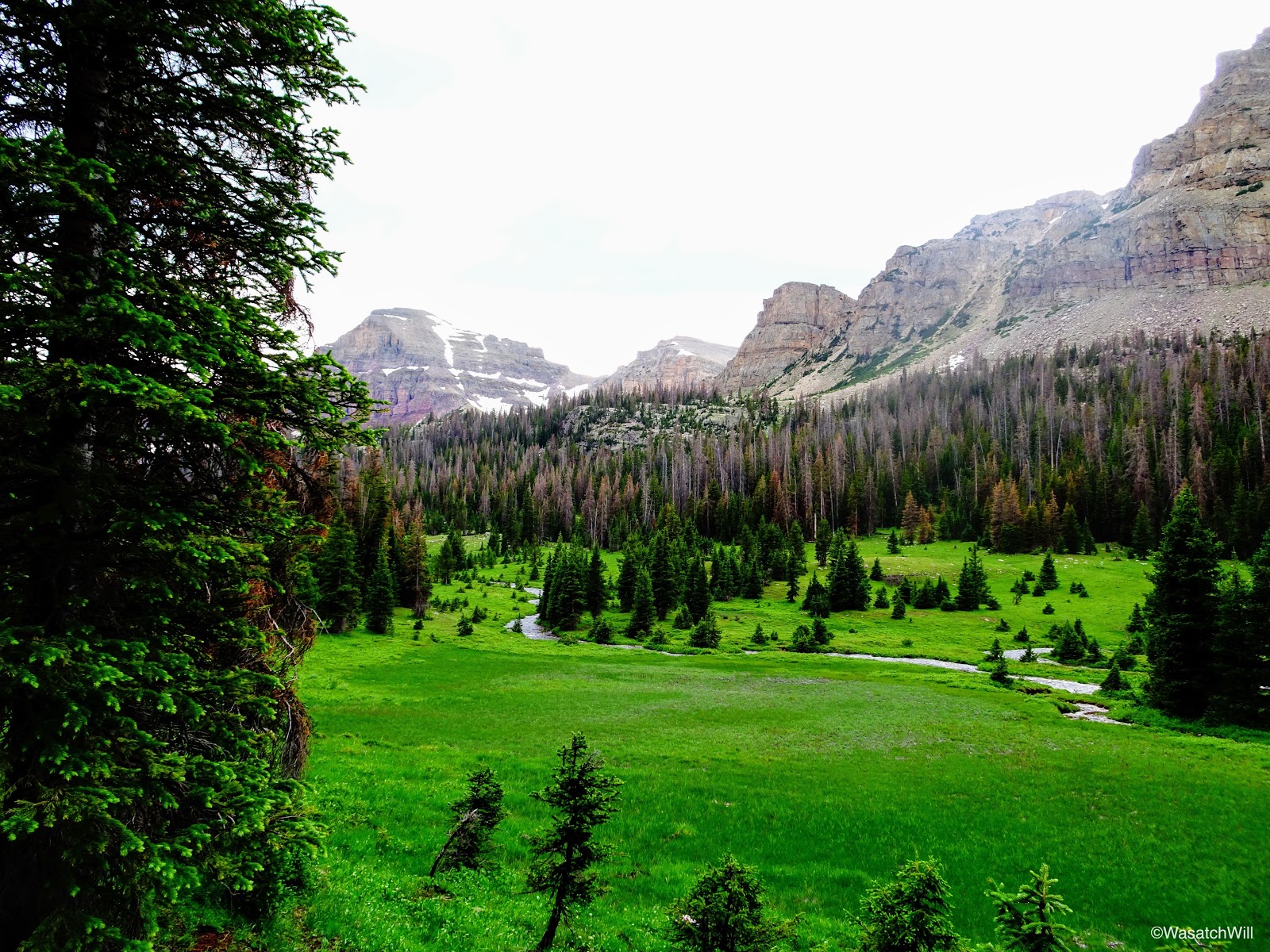
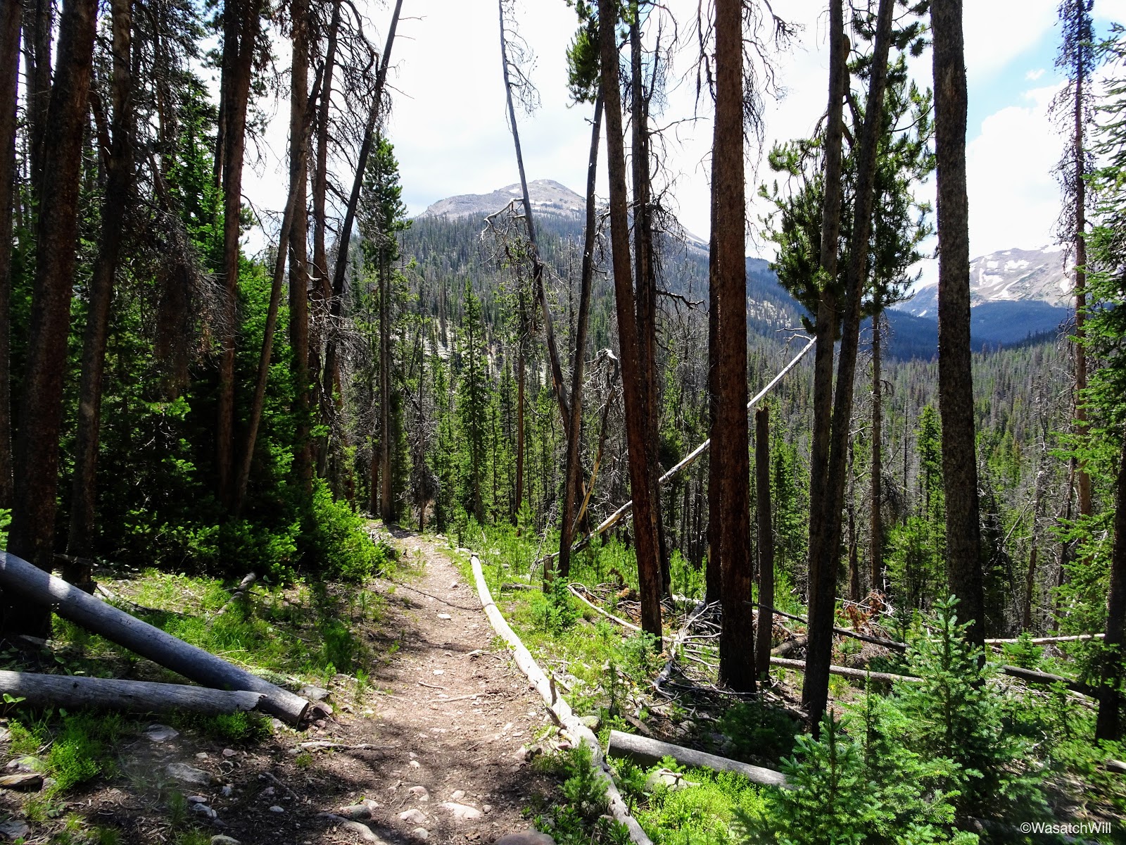
Within about 4 miles, we would be hiking under the cover of trees for long stretches over the next couple miles. Through this section we saw some more wildflowers and stopped for quick rests at the Wilderness marker and the junction with the fork up to Priord Lake. Through this section, we'd also be enveloped with a good bit of rain, hail, thunder, and lightning that would linger around for a good hour or two. In the 'shelter' of so many trees, we hiked on through.

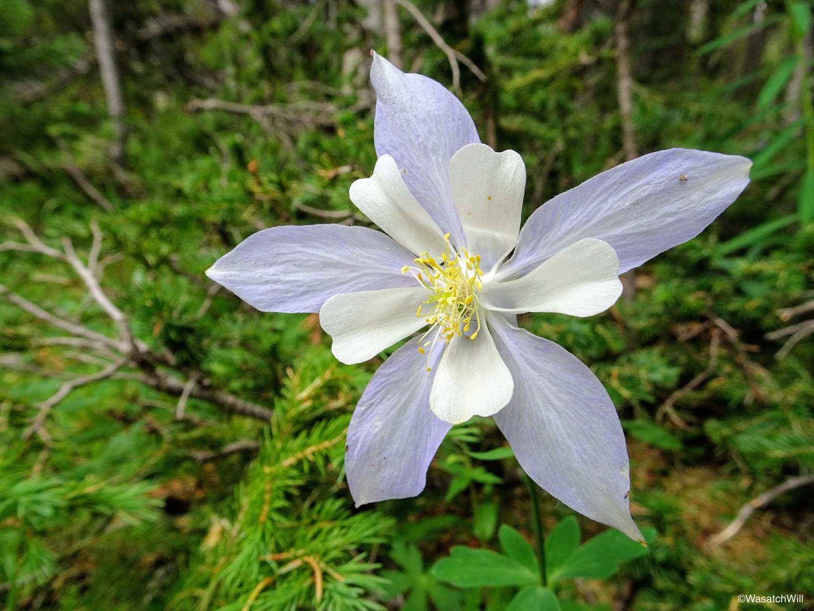
Columbine
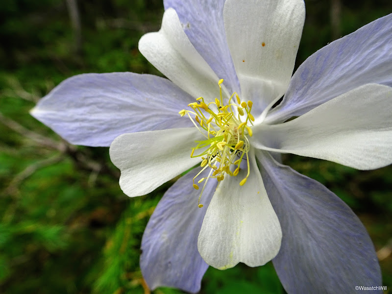
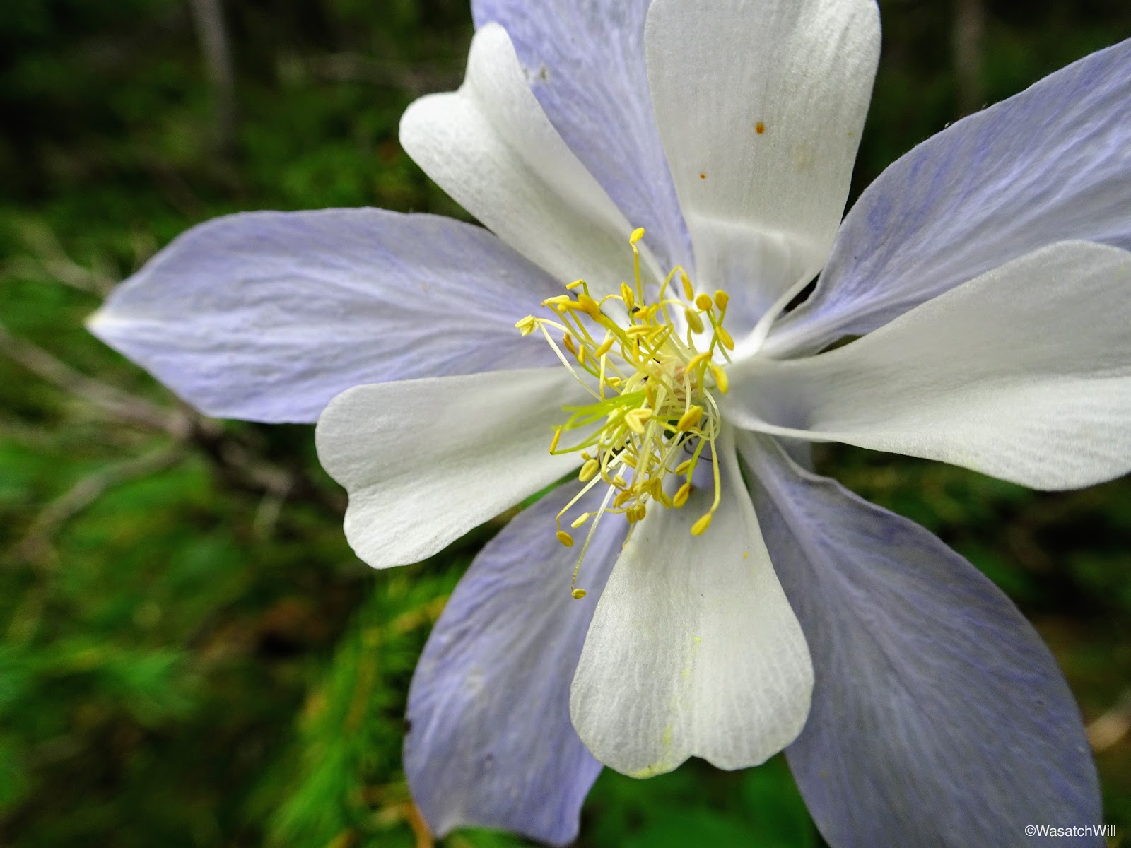
Columbine closer-up
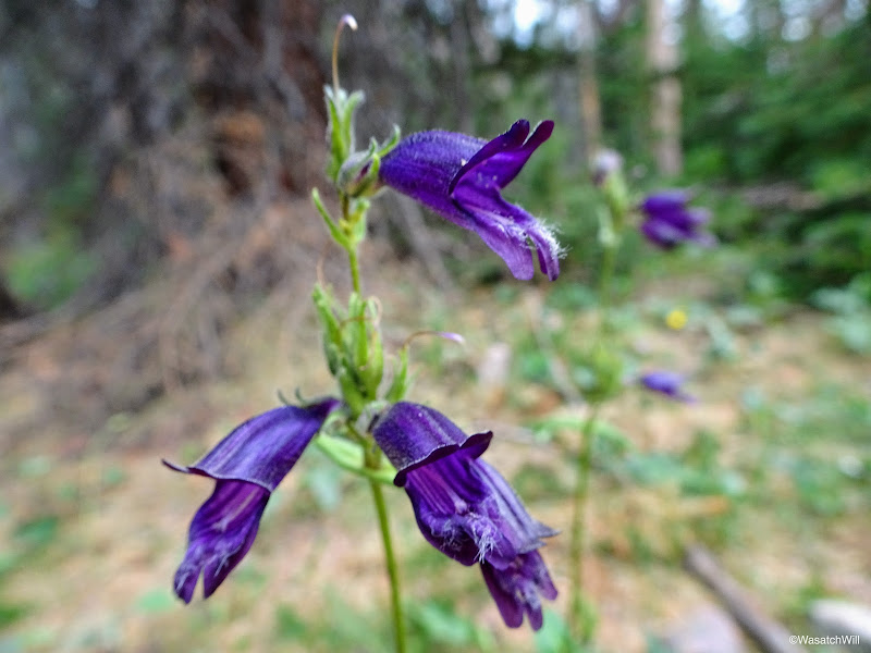
Purple Penstemon (aka Beard Tongue)

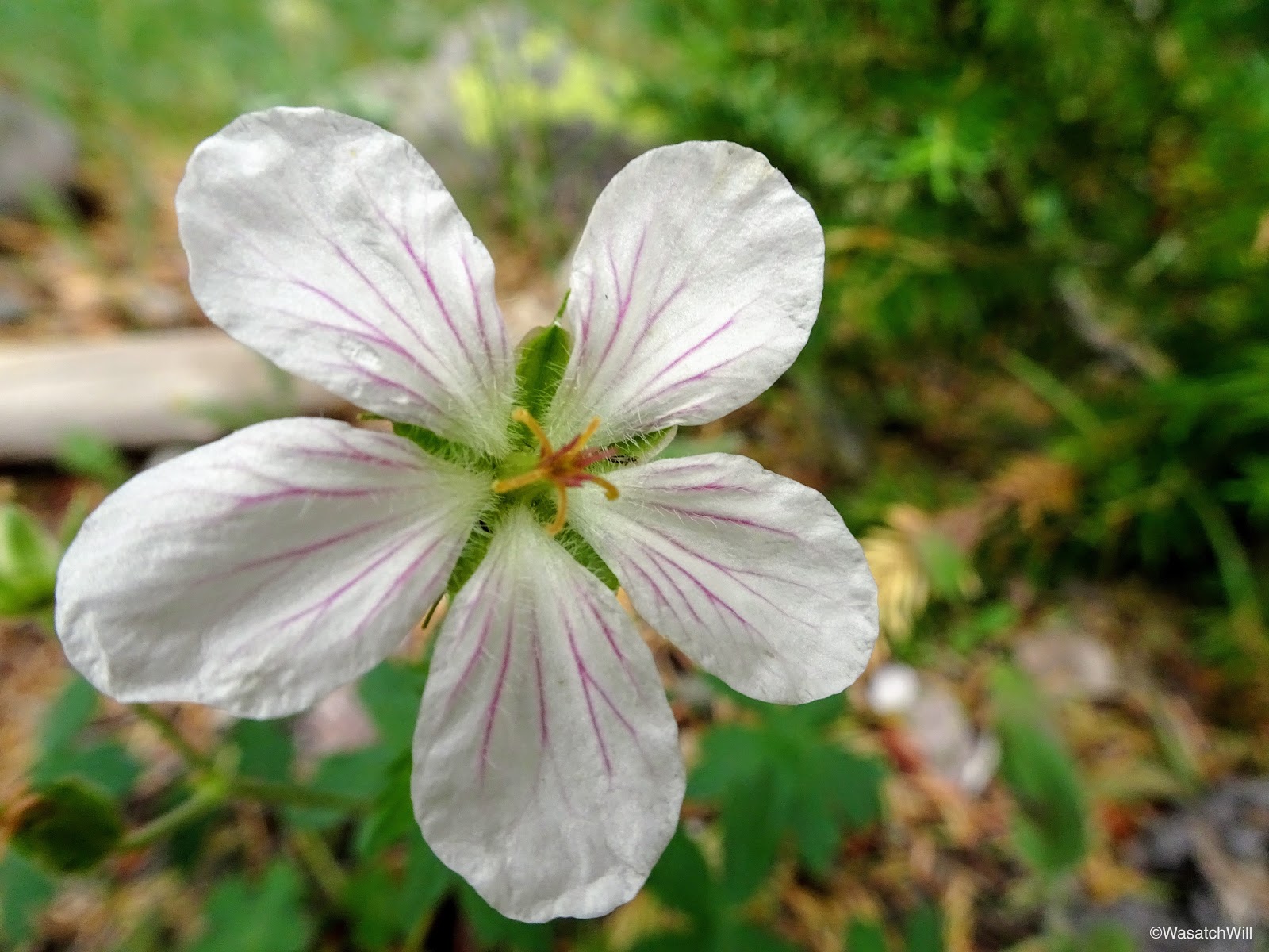
Sticky Geranium
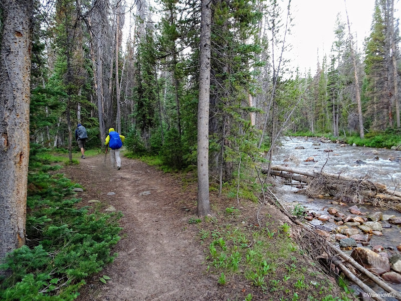
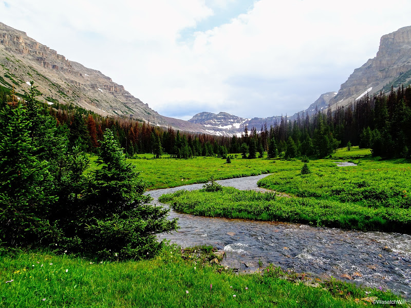
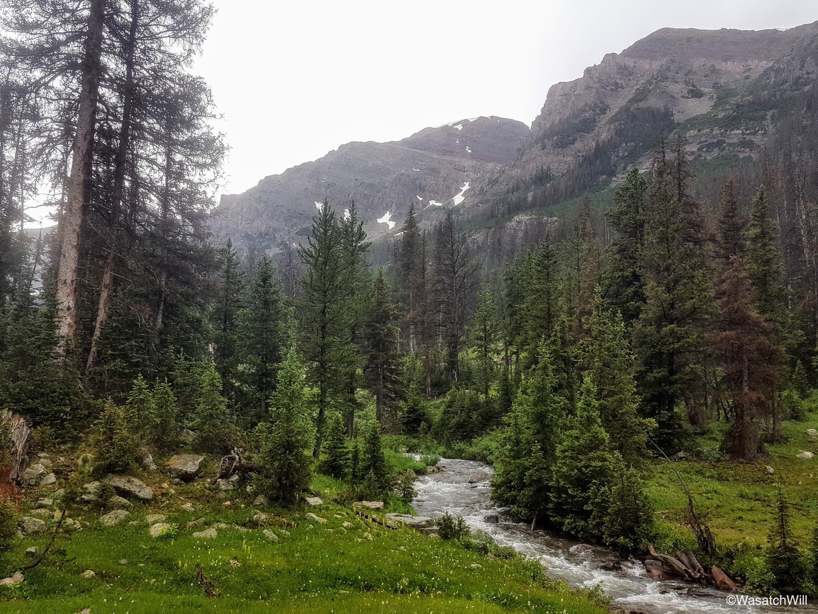
Along the East Fork Bear River
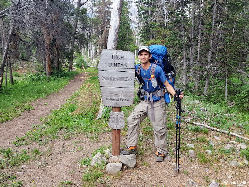
The author at the wilderness boundary
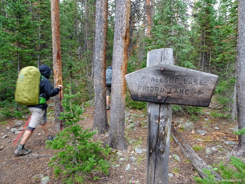
Brett keeping to the left at Allsop-Priord Fork
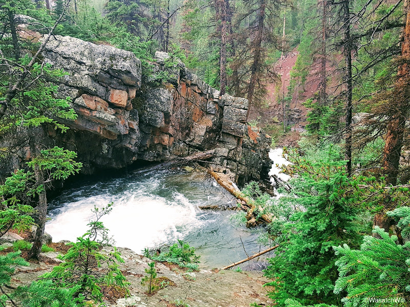
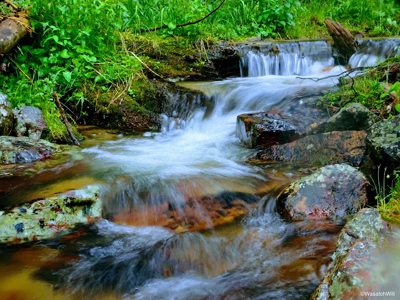
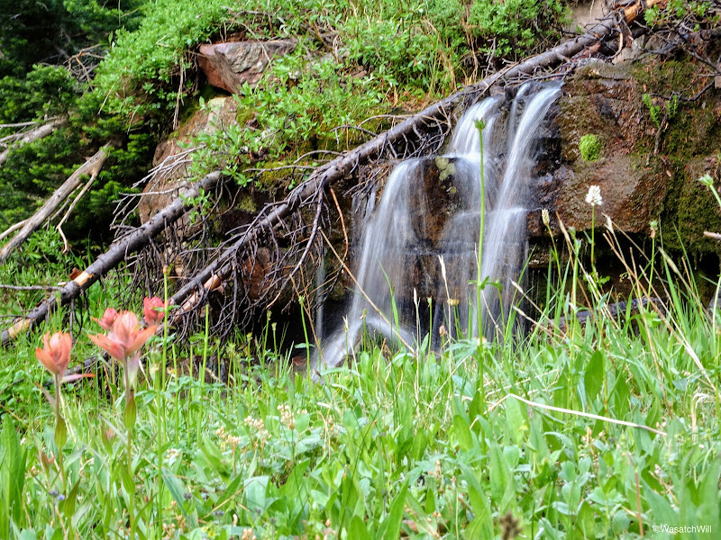
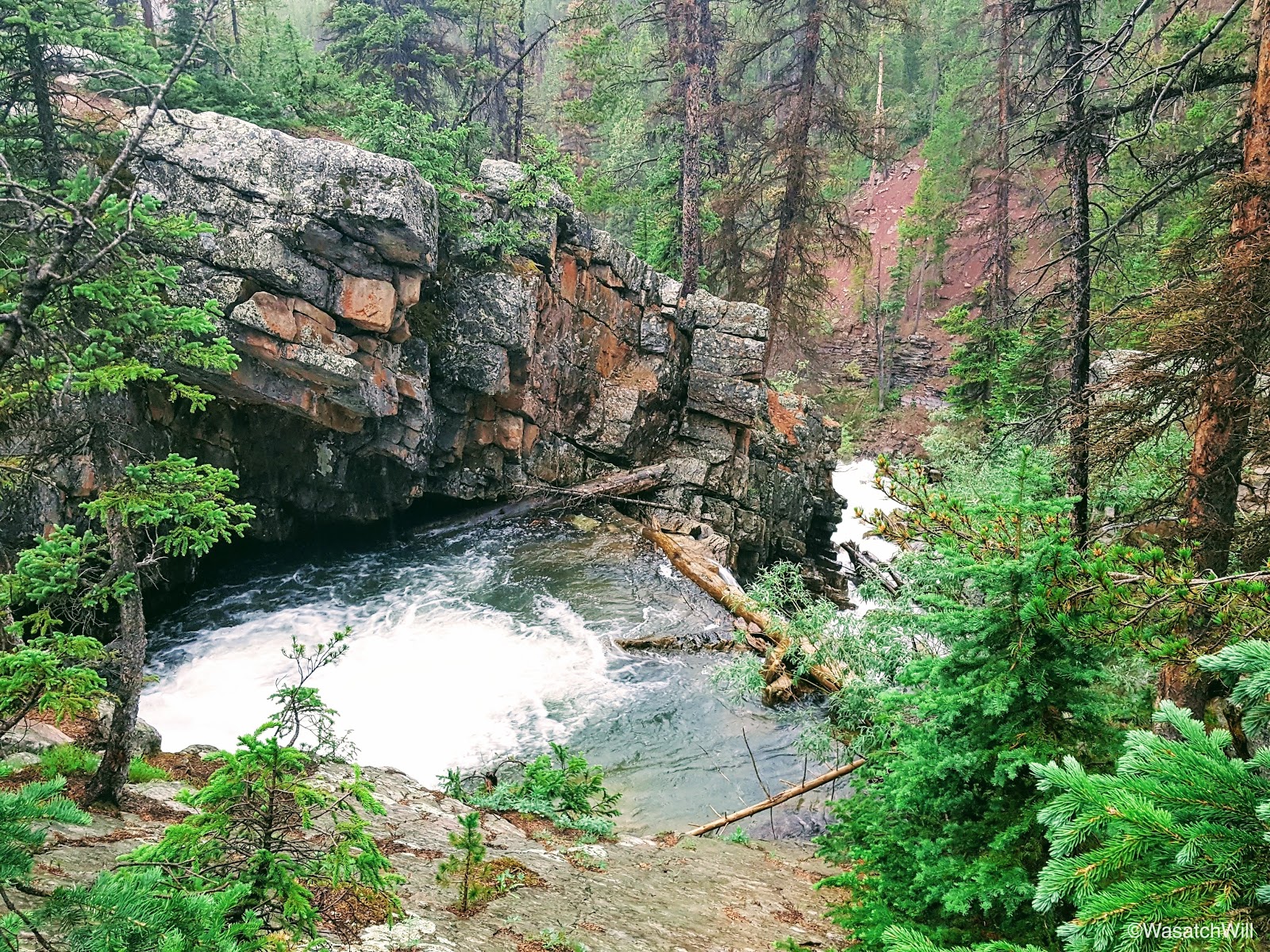
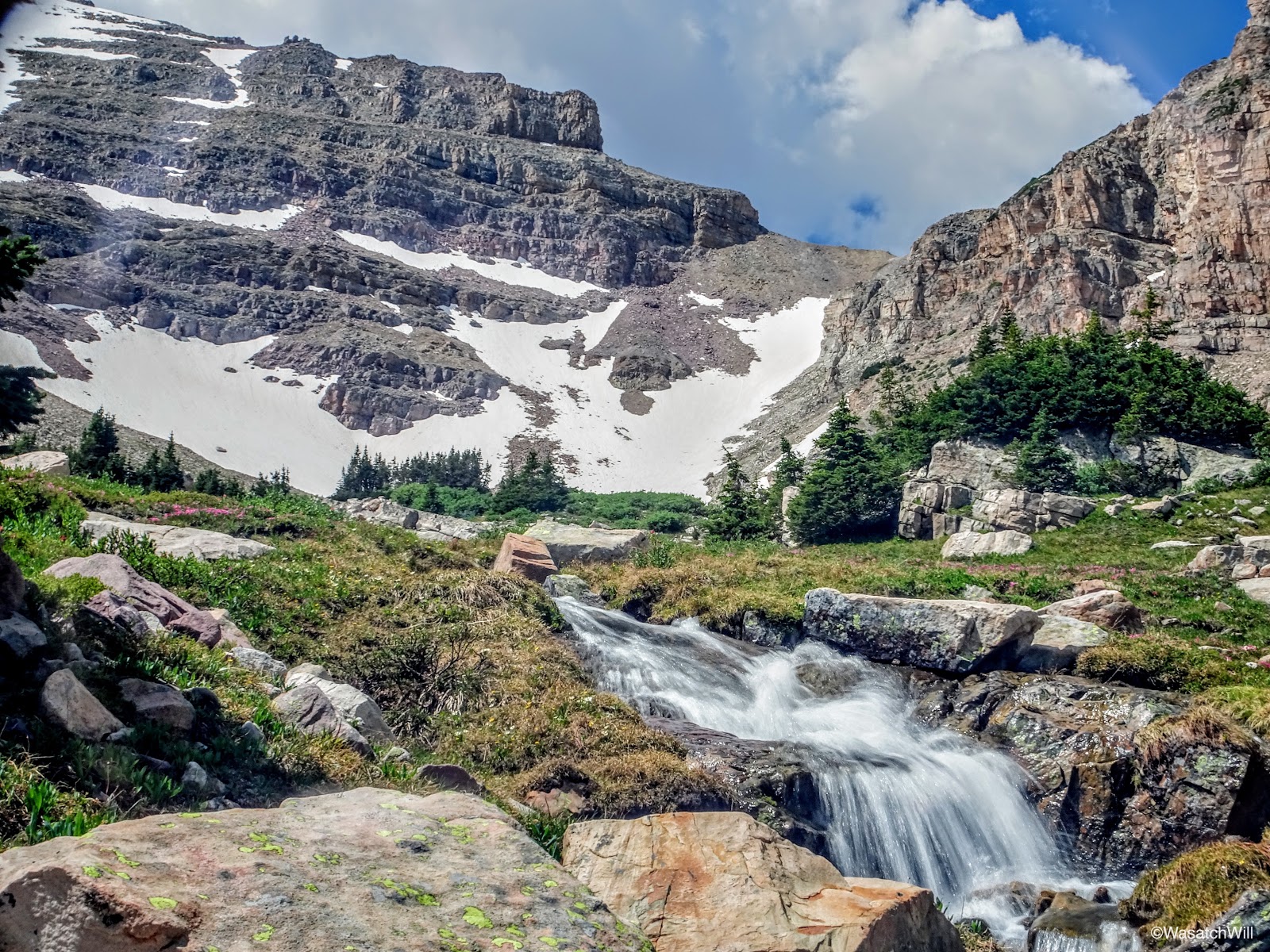
Above a waterfall along the Left Hand fork of East Fork Bear River
Hiking along Left Hand Fork of East Fork Bear River
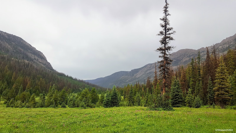
Afternoon storm
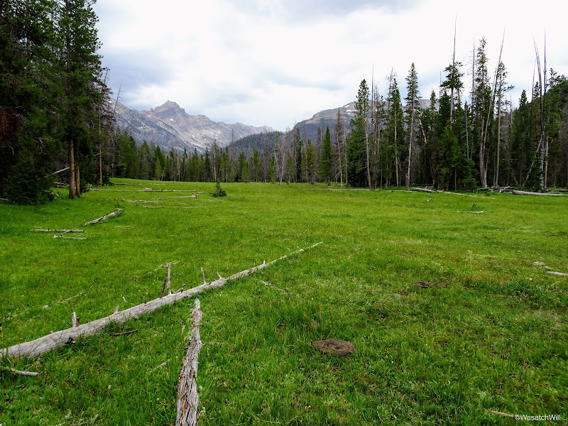
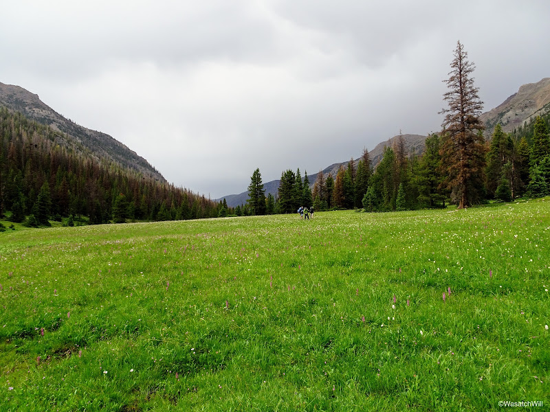
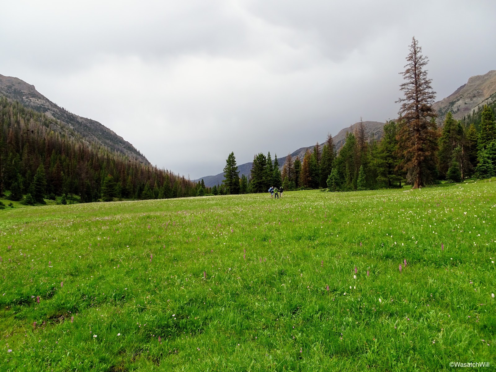
In due time, the trees parted, giving way to a very large meadow and almost on cue, the storm began to part as well. The sky began to brighten up, setting the meadow ahead of us all aglow. We paused to take in the view and wait for others in the group to catch up.
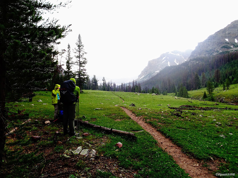
Jackson and Blake amidst the brightening light in the meadow
We noticed some colorful birds not far from us feasting on the aftermath of the storm. Jackson's best guess was that they were Pine Grosbeaks and I think he was right.
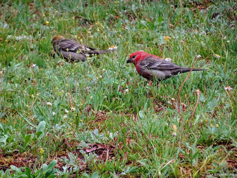
Pine Grosbeaks
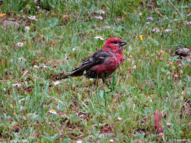
Pine Grosbeak
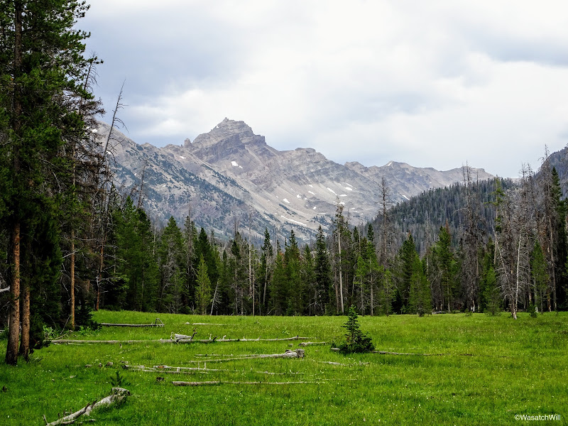
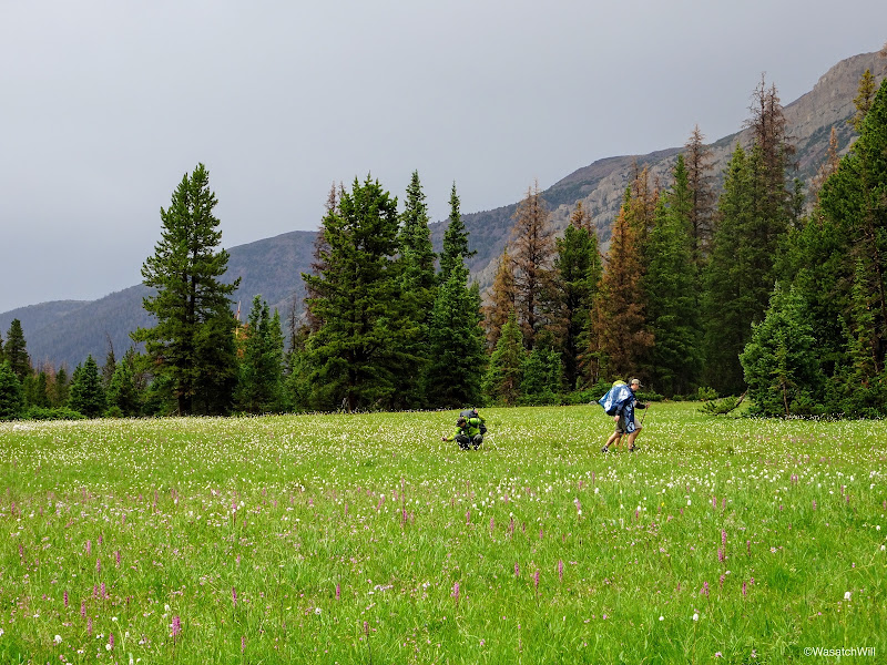
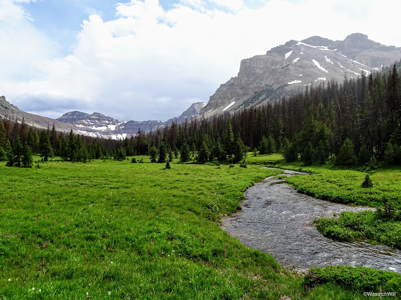
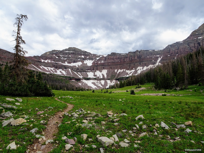
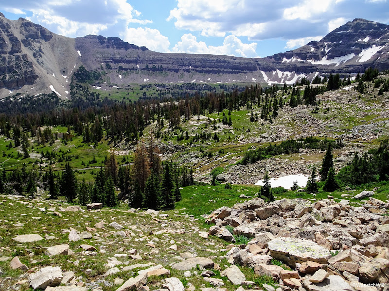
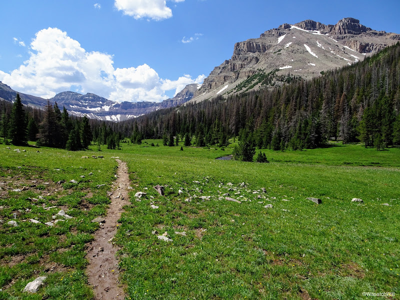
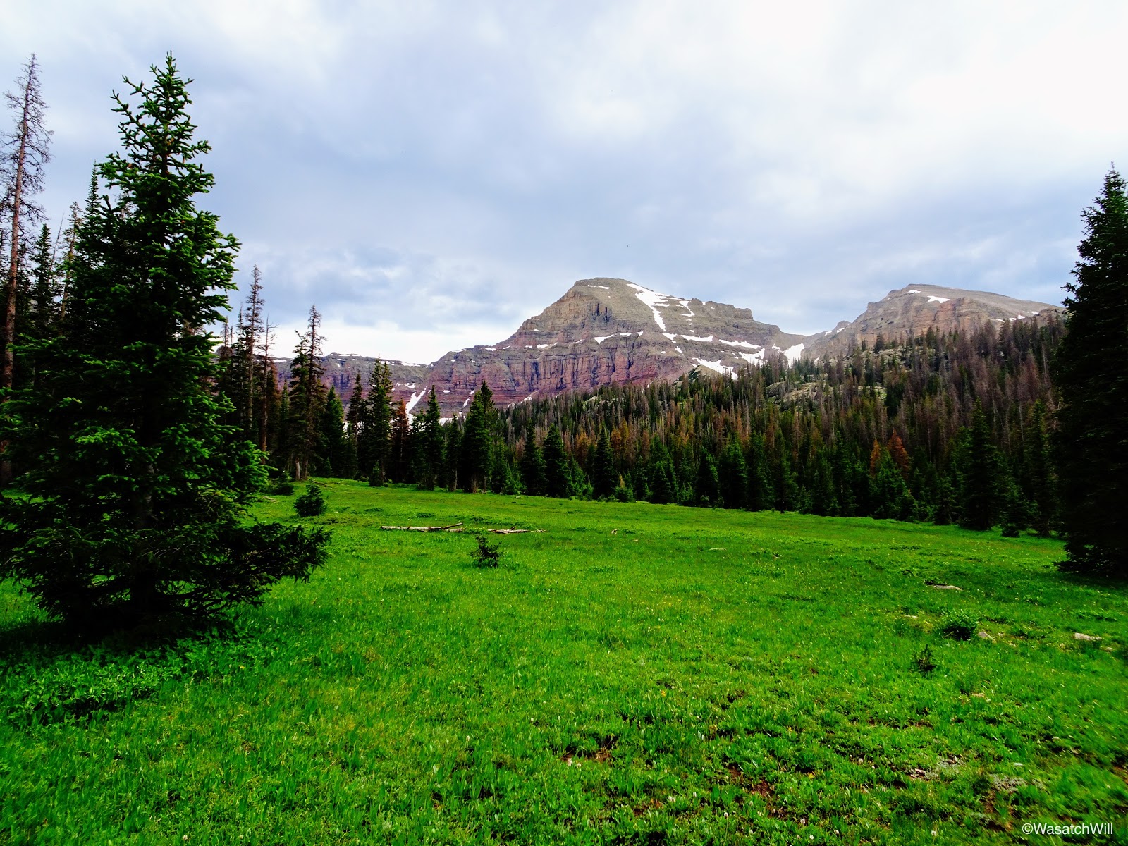
As the clouds began to break apart, the meadow became more and more magical as it were. The grassy flats remained aglow and began to twinkle and sparkle as rays of sunlight reached forth and penetrated from the clouds above. Wildflowers were scattered all about us. To add to the view and the excitement of being present there at that moment, we could now see the end of the basin. We now had a visual of Dead Horse Peak showing us how far we had to go to reach the lake at the upper end of the basin.
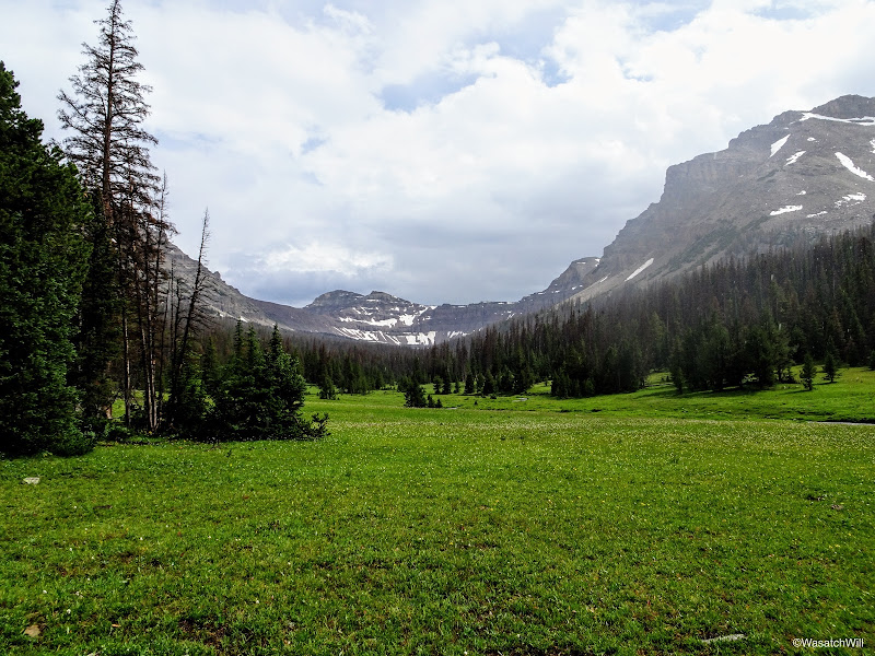
Meadow with Dead Horse Peak in the distance
Dead Horse Peak
View up the Left Hand fork of East Fork Bear River toward Allsop lake
Looking back down the meadow with some of our group for scale
Blake and Adam
Heading back into a small stand of trees
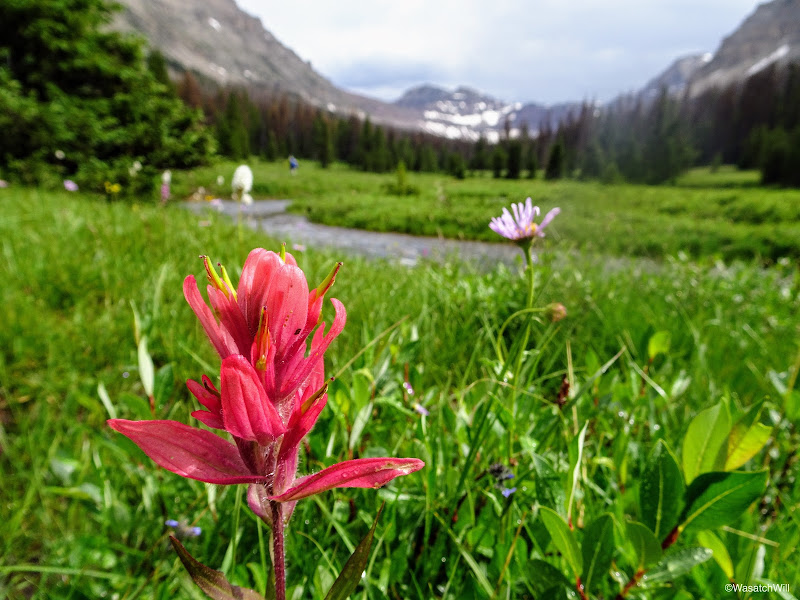
Indian Paintbrush and Daisy in the meadow
Deadhorse Peak (distant left) and the Cathedral (right) from along Left Hand East Fork Bear River
Looking back down the meadow at the storm retreating behind us

Flowers along Left Hand East Fork Bear River
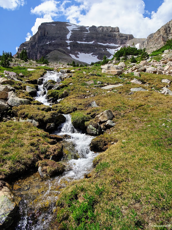
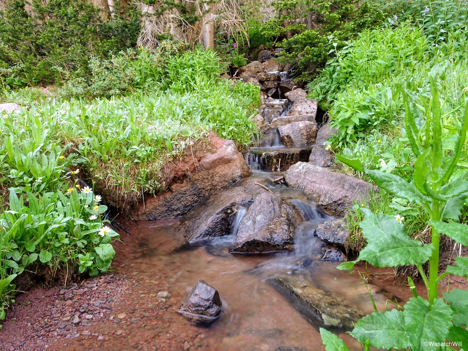
Trickling brook
As we continued through the meadows, we'd pass by the majestic looking Cathedral.
The Cathedral

Looking up toward Yard Peak (left) further up the basin
Yard Peak (middle)
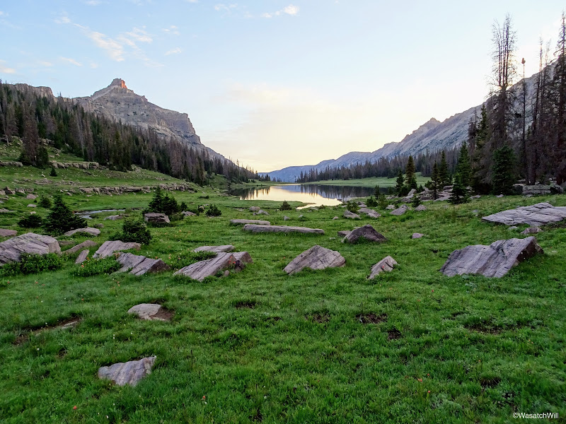
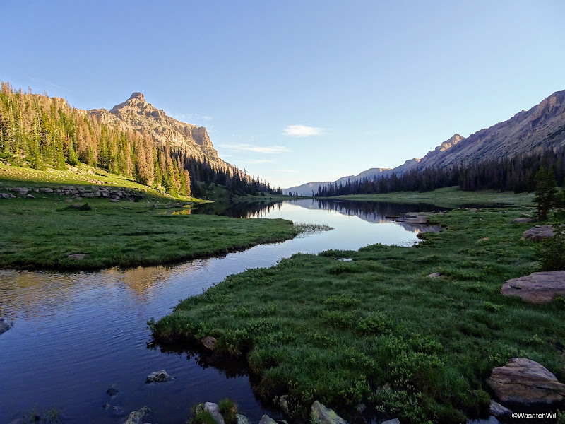
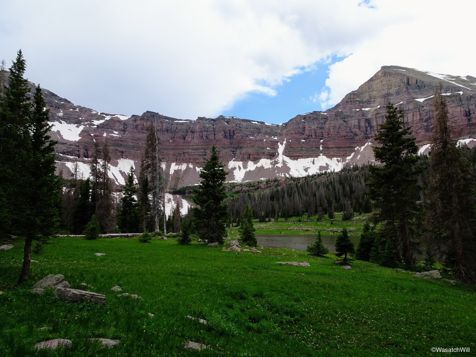
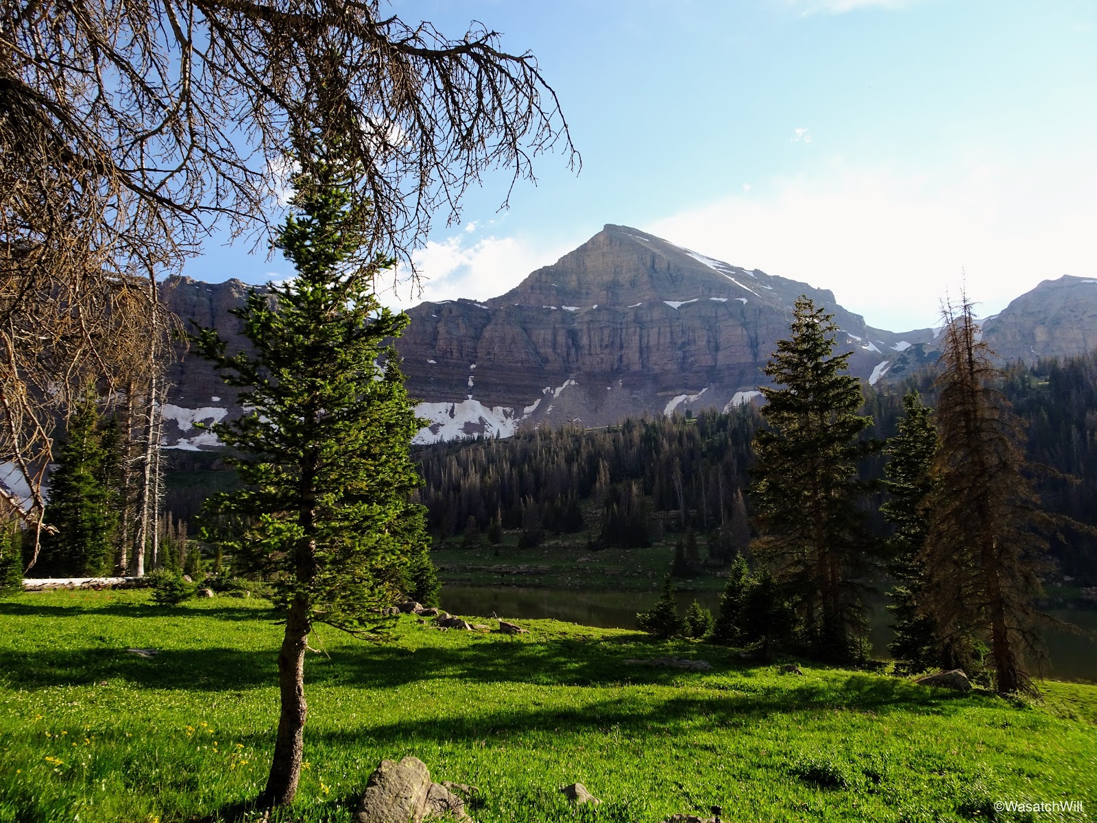
Approaching Allsop Lake
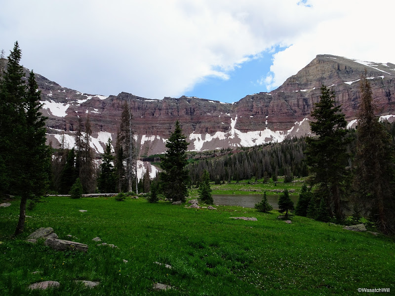
After a muddy, marshy, and wet, though blissful and beautiful couple of miles of hiking, we arrived at the shores of Allsop Lake.
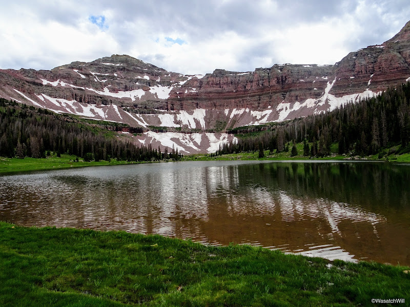
Arriving at Allsop Lake
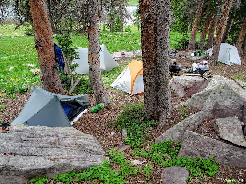
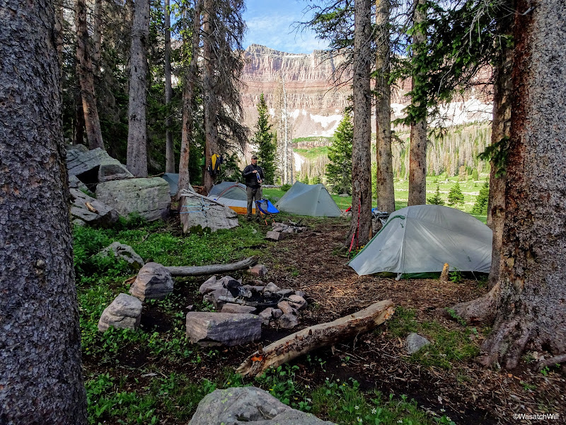
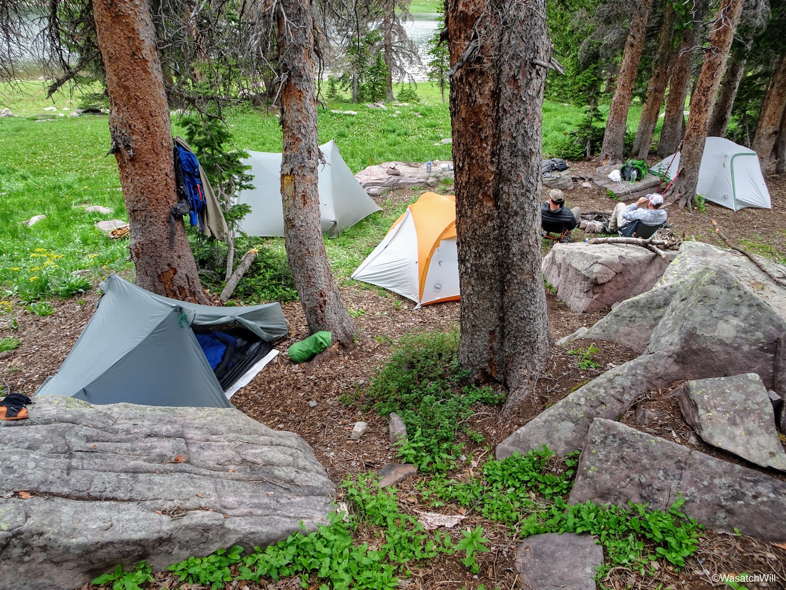
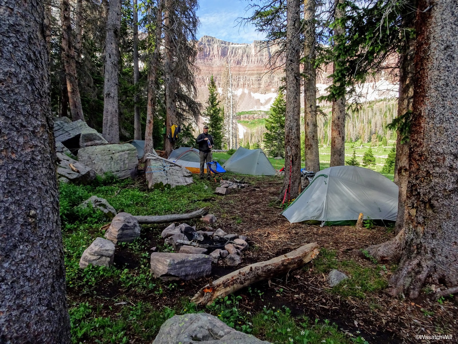
From there, we scoured the eastern side looking for a campsite. We knew from other acquaintances of a good one along that side of the lake and I think we found it. (Shout out to @Nick and a prior TR of his)
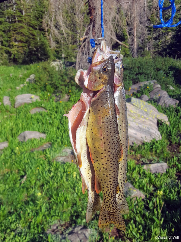
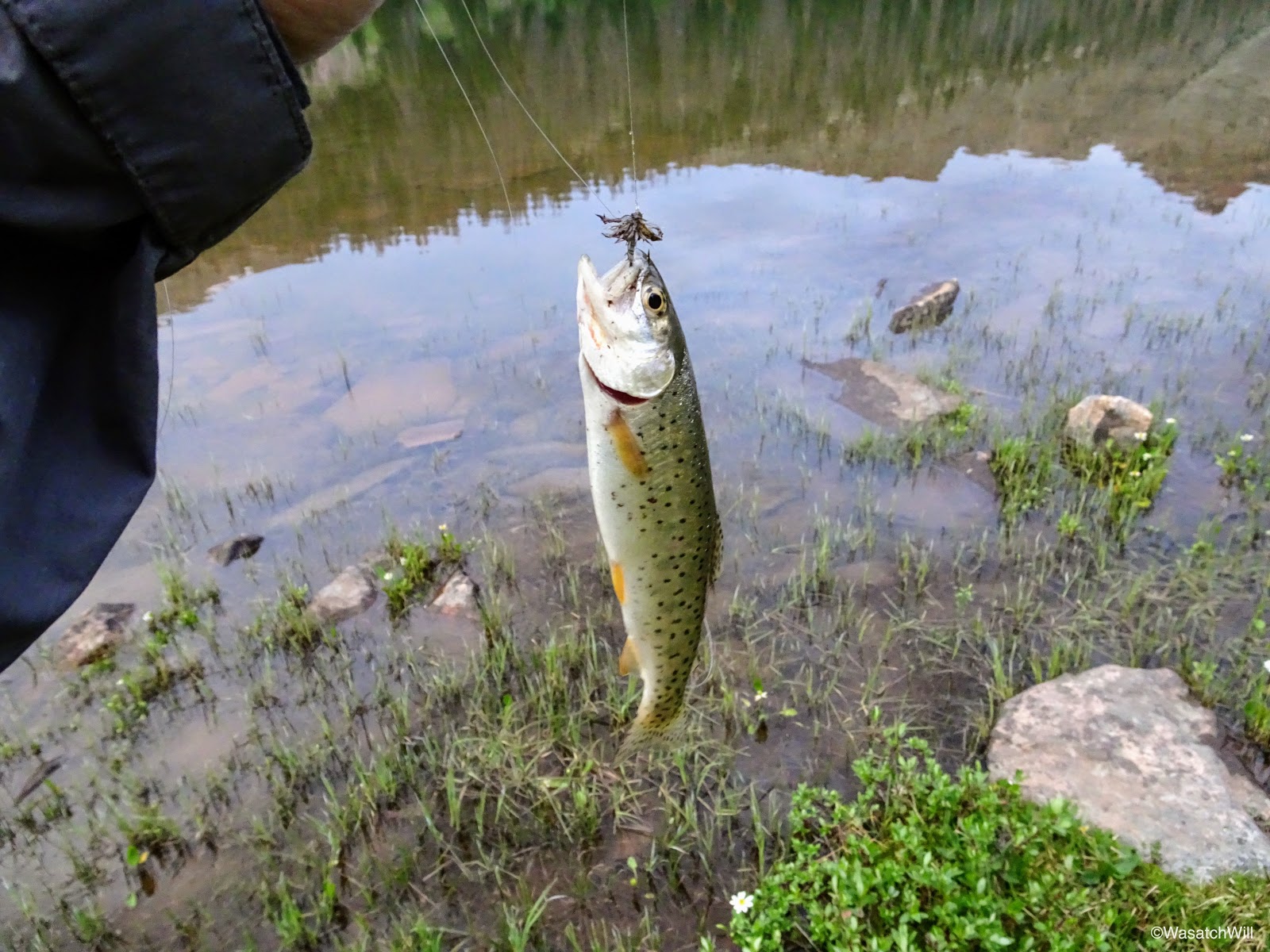
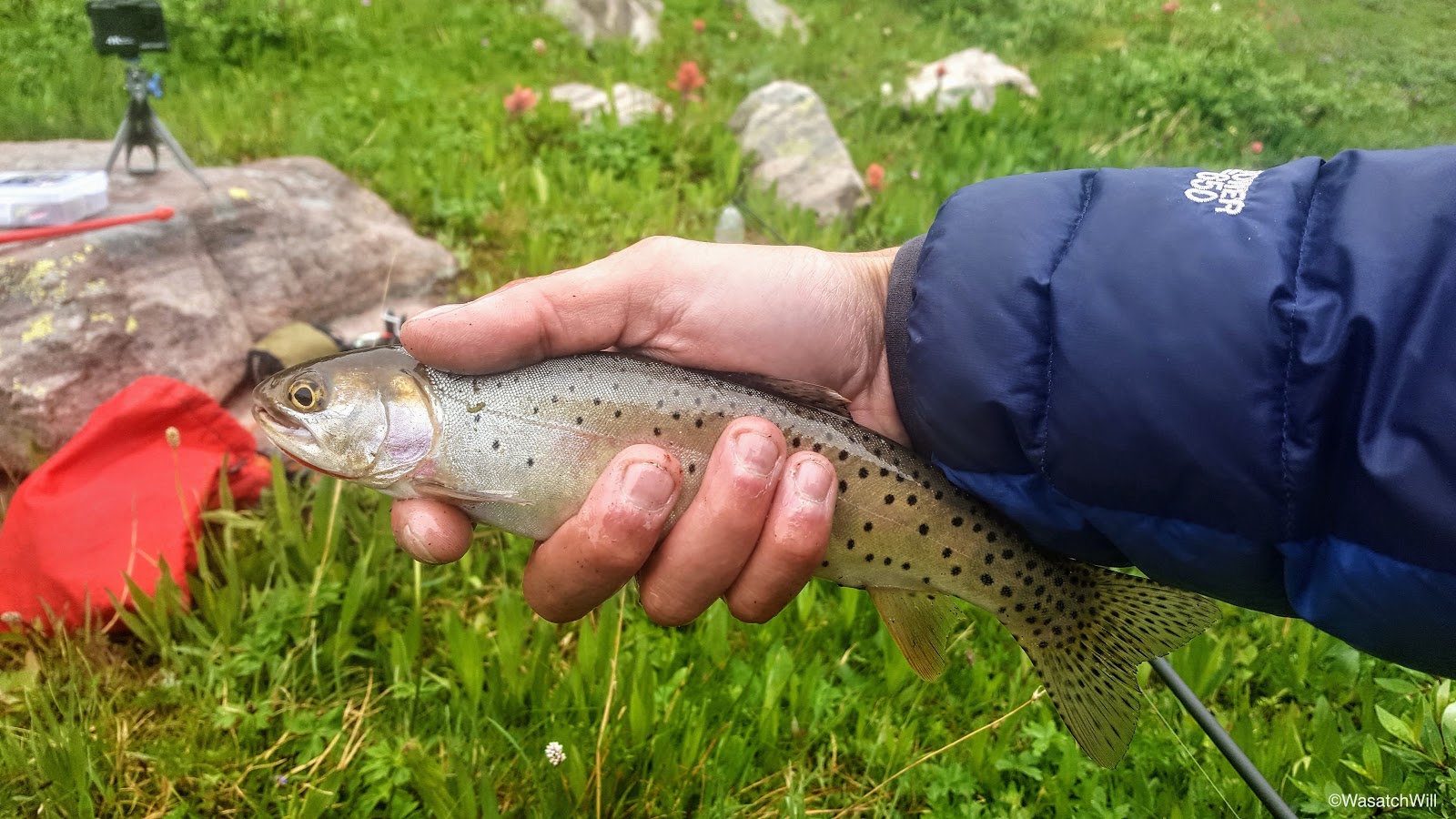
With camp all set up, and a few hours of daylight left, I went down to the lake to do some fishing. Without a whole lot of effort, I was able to pull up a few rainbows of various sizes.

First catch
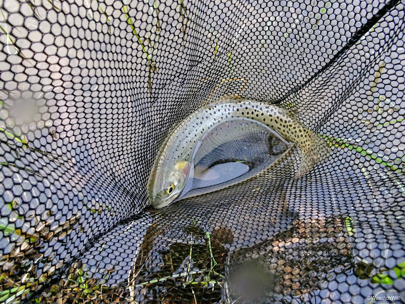
Another Rainbow
I had brought stuff to cook some up with, but with how wet and cold everything was from the storm that afternoon, I didn't want to bother with cleaning out any fish that night. I was confident enough that I would have equal success the next day.
Satisfied with the success I had fishing, I returned back to the group at camp where we made ourselves dinner and gathered around a fire, where we desperately tried in vein to dry off our socks and shoes before retiring for the night.
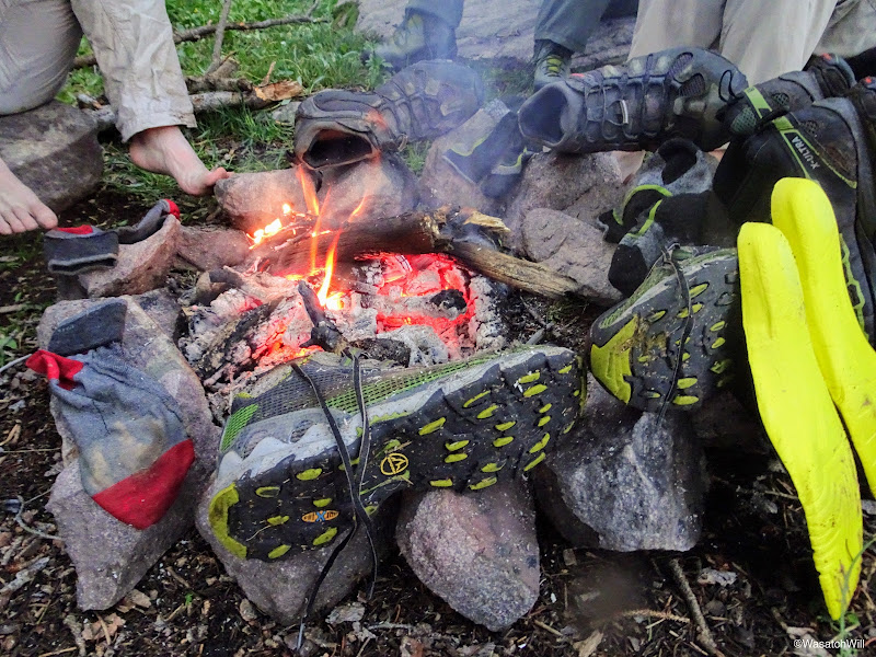
Community dryer
Rise and shine
Jackson and I were the first ones up. We gathered some essentials for the day, had a quick breakfast, and set off for the ridges up above the west side of the lake. Our whole group had originally thought to pack up that day and make a go up the pass between Allsop Lake and Priord Lake in the next basin over to the west. But with how beautiful Allsop Lake proved to be the night before, we opted to take it easy and keep camp where we were. Still curious to see how the pass was, Jackson and I sought it out. We knew Blake had downloaded a copy of the route I had mapped out on his phone as well, so we figured he would lead Adam and Brett up it if they so desired to catch up with Jackson and I once they all awoke.
Yard Peak above Allsop Lake
Looking back down toward the Cathedral
Yard Peak
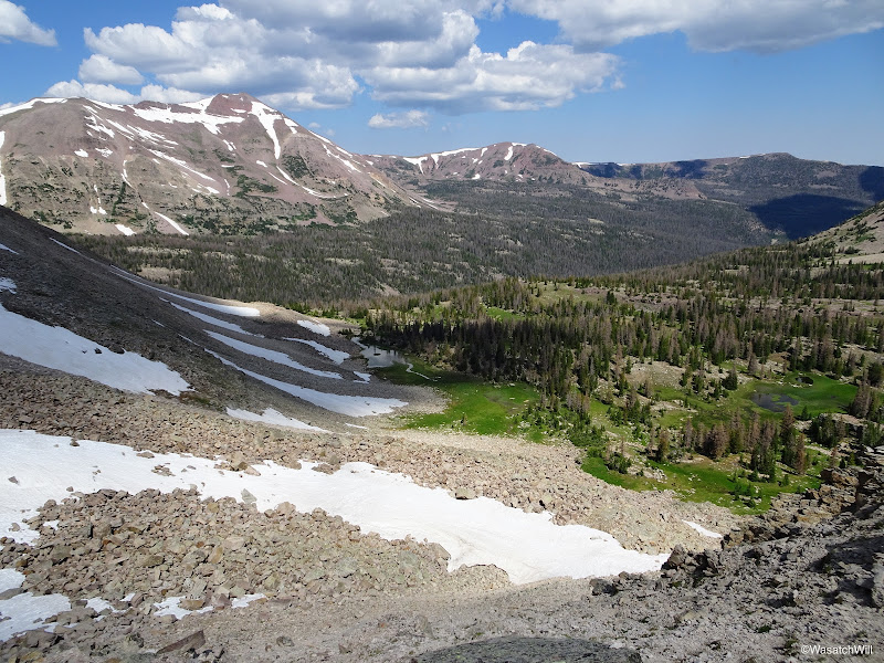
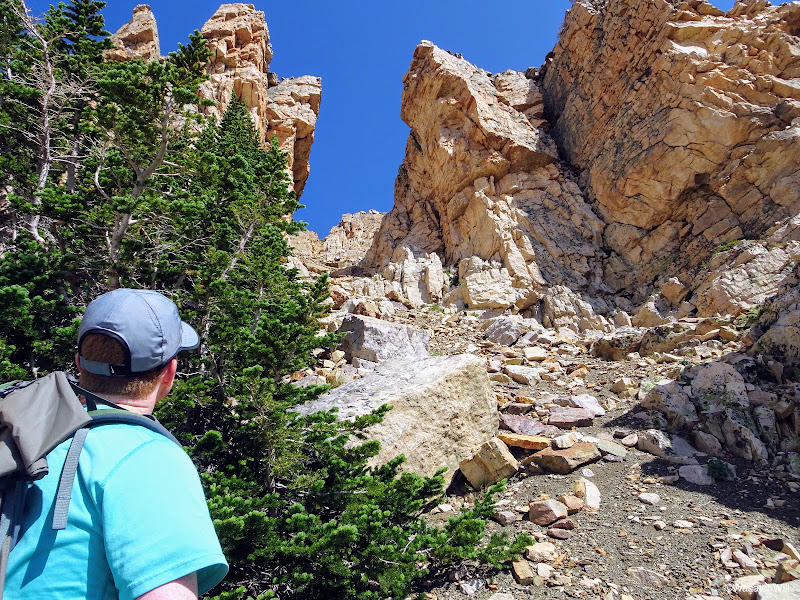
After a short but very steep hike up and over a hill into what I'll call a "mini-basin", we could see the ridge we were after in full view. Allegedly, there was to be an old sheep-herder trail up through the ridge somewhere, but there was no sign of any trail, or cairns. All the better for a real adventure.

The Cathedral and ridge from across the 'mini-basin'
The map I had marked out and modified actually showed a route up and over as per the USFS 2016 map through a notch in the ridge toward the south. Jackson and I picked a line up the moraine to the notch on my map and began the boulder scramble up it. Along the way we'd have to watch our step extra carefully lest we walk through a number of active spider webs.

Looking up the moraine
Spider on web
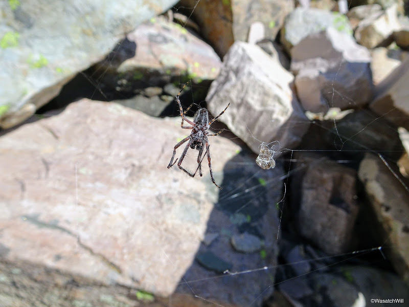
Another spider
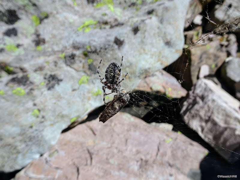
And another spider

Looking up the first chute
Once on the ridge, we sought out a safe passage down the other side as per my map, but what we encountered in reality was some cliff bands beneath us with no apparent way to bypass them from where we were. In hindsight, and confirmed by what we saw as a faint trail further to the north coming off the ridge, we should have went up to another notch we had originally eyed from across the mini-basin further north on the ridge. It was actually a spot I originally marked out on my map going by topography and satellite imagery long before seeing a route for it laid out on the USFS map.
Looking west down into the Priord drainage from the top of the ridge

Tarns down below
Not to be stifled, we made our way back down the chute we had come up and traversed the moraine northward to another promising looking notch. We scouted that out, only to hit another dead end.
Jackson sizing up the 2nd chute
We carefully descended back down that loose gully and continued our traverse along the top of the moraine to the next notch where we expected to finally find the safer route over.

Some stray flowers while traversing across the moraine
In our approach to that spot on the ridge, we encountered Blake making his way up to the same spot. Adam and Brett chose to linger around the lake. Apparently, Blake had not updated his map from the copy I originally laid out when we first started planning this trip, so his map was leading to the original spot over the ridge I had marked out. We intersected each other just below the ridge, and for Jackson and I, the 3rd attempt to find the right way over proved to be the charm. We had finally found it at the spot marked out on my original map. It was tempting to venture on down and go out for a look down at Norice and Priord Lakes, but that would require losing and regaining a lot of elevation off the ridge and there were already a number of clouds developing now with darker ones out on the distant horizon. We knew it would be storming that afternoon and it was only a matter of how soon it would all roll in.
Instead of descending the other side of the ridge, the three of us walked along the ridge northward for a ways hoping to still sneak a peek out at Norice and/or Priord Lake. The effort proved fruitless in that regard. After studying out the topography on the map more closely, it was evident that we'd probably have to get pretty close to the Cathedral further up the ridge, if not on top of it, to get the angle that would be needed for a view out to Priord Lake.
Atop the ridge once more
The effort wasn't entirely in vain however. The views we had back down into Allop Lake's basin were extraordinary.
Looking upper basin of Allsop Lake with Deadhorse Peak (left) and Yard Peak (right)
Panorama from ridge looking south with Blake and Jackson
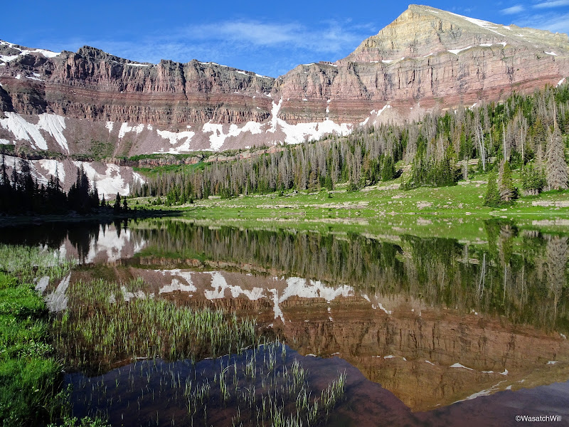
View of Allsop Lake (center) far below from the ridge

Close up of Allsop Lake
Because of the gathering clouds, we did not linger long on the ridge and descended back down for Allsop before we got ourselves into trouble with the weather.

Blake in the distance walking the ridge
Heading back down
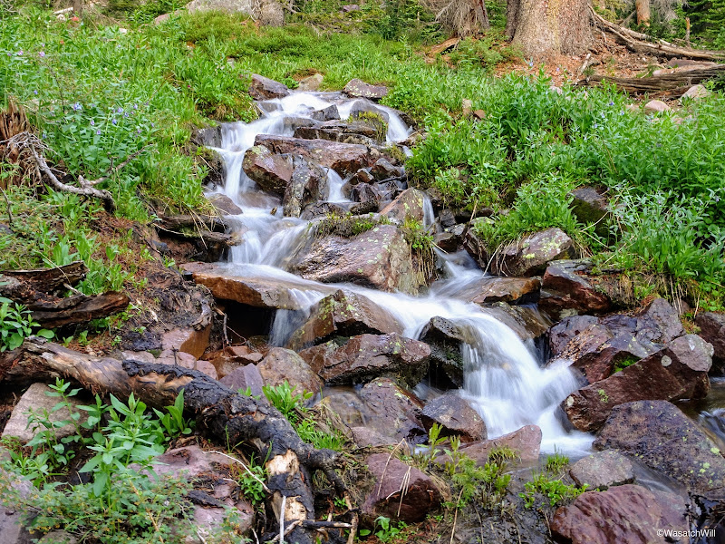
On the way down we opted to navigate and route-find our way around the northern end of the lake back to camp rather than the southern end we had come around earlier in the morning. Along the way, we paused for another brief break at a nice set of cascades within the mini-basin.
Cascading stream
Cascades in 'mini-basin'
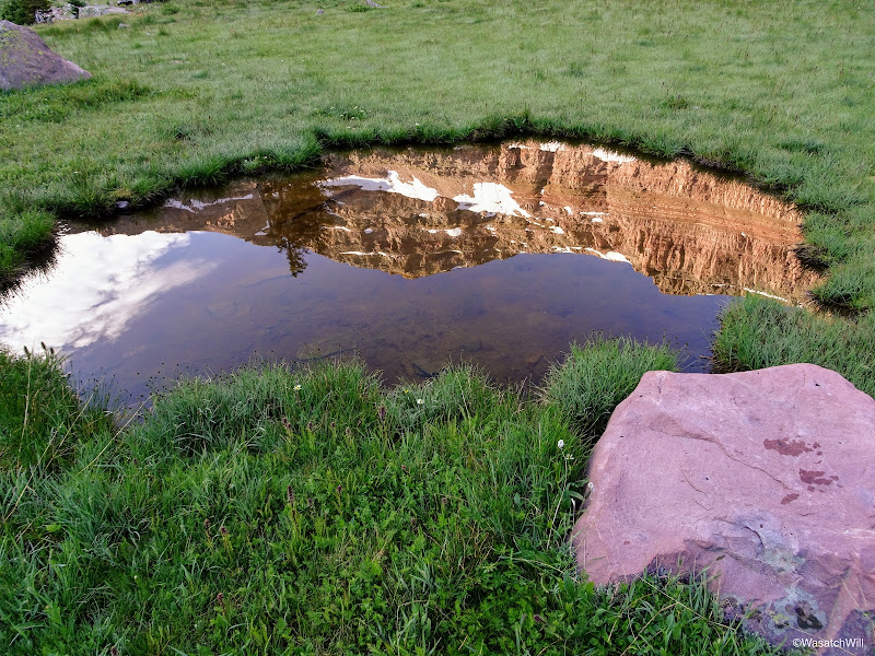
We passed by a few picturesque tarns en route back down to the lake as well.

Picturesque tarn
Close to camp, we ran into a pair of wilderness rangers who were up for the weekend taking inventory on the number of fire rings they could find throughout the basin with a focus around the lake. Possibly to explore the possibility of putting Allsop within the same fire restrictions that so many other High Uinta lakes are now under, which is that there are to be no campfires within a quarter mile of their shores. From our own explorations, there weren't many at all compared to what I've encountered throughout more popular basins in the Uintas.
We also chatted about LNT etiquette, the lamas they had packed up, and the surrounding landscape in general.
Back near camp at Allsop Lake
We returned to camp, had lunch, and got that all cleaned up just in time for the oncoming afternoon storm to settle in. We took refuge in our tents to wait it all out. There was considerable rain and hail for the next few hours mixed in with some good bouts of lightning and thunder. One strike was counted to be within a mile. I think we all fell asleep to a nice little nap at one point while waiting out the storm.
Hanging out back at camp
Shelter from the storm
By early evening, the storm began to thin out and move out.
Emerging back out to clearing skies
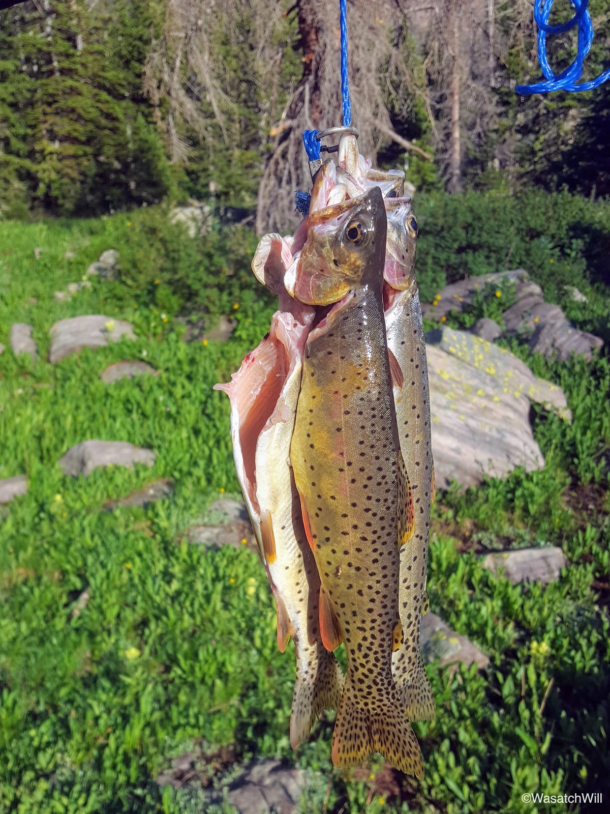
I figured it was as good a time as any to go back down to the lake for some fishing. Out came some more Rainbows...the fishing variety that is, not the sky variety. This time I'd select a few larger ones to keep and cook up with supper on the fire back at camp.

Another rainbow caught
Cleaned and gutted, ready to be seasoned and wrapped
While I had been fishing, I heard some rocks tumbling down the cliff bands up above the basin. I assumed it was some mountain goats, and sure enough, after scanning the cliff bands with my binoculars I found a nanny goat and kid out having some supper of their own.
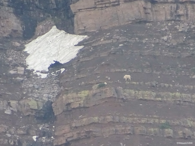
Nanny goat and kid high up on the cliff side
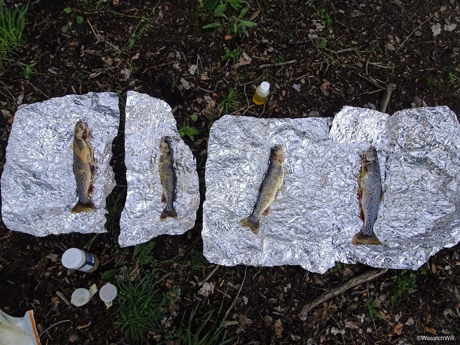
After pointing out the goats to the others, I finished prepping the fish to be cooked. I brought up a small variety of seasonings. Some tried and true lemon pepper, some Tony Chachere's Creole, and some Cavender's Greek seasoning mix. Of the four fish, I did lemon pepper alone on one, creole alone on one, Cavender's alone on one, and at least mix of the Cavender's and creole on the fourth. I honestly can't remember if I included a bit of lemon pepper on it as well. But either way, that final mix proved to be incredible!

Seasoning the fish
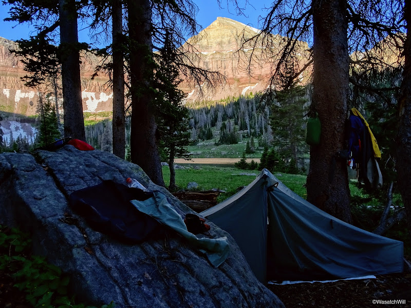
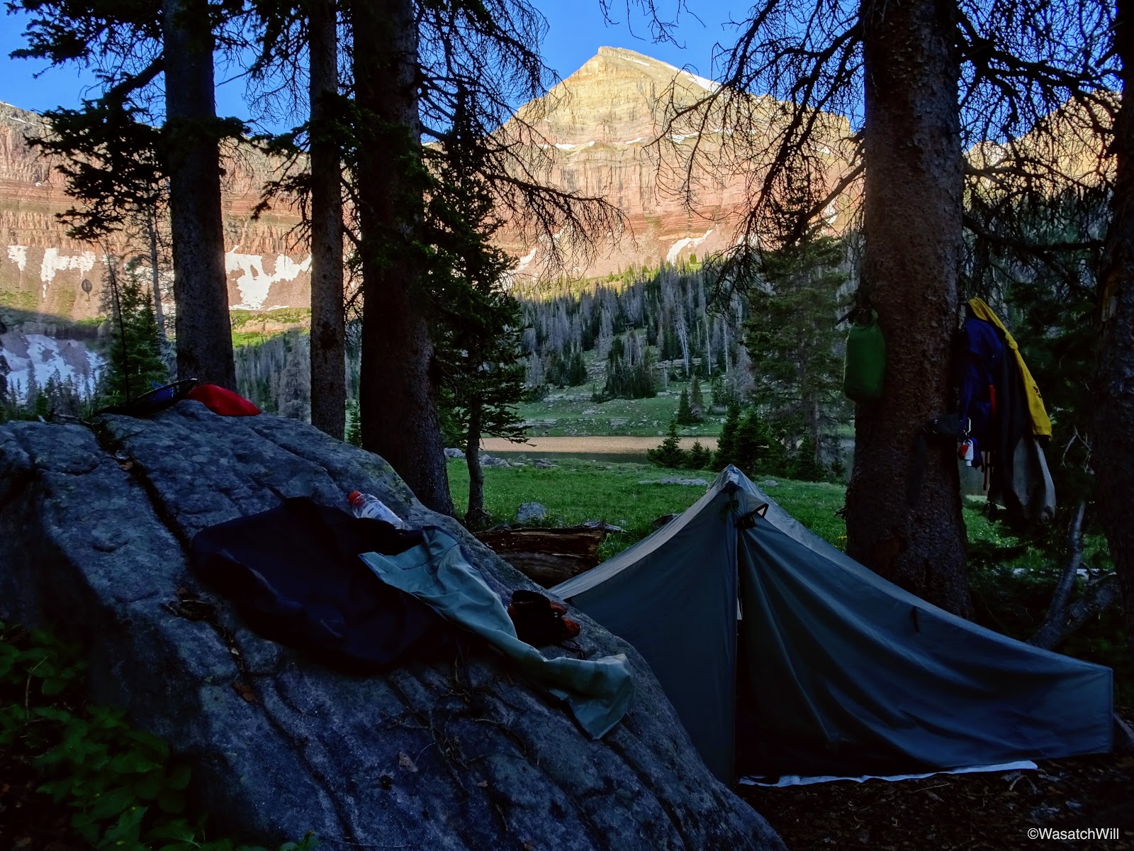
With full bellies from delicious dinners, including the fish, we cleaned up and got back into our tents to finish out the evening.

Tents aglow
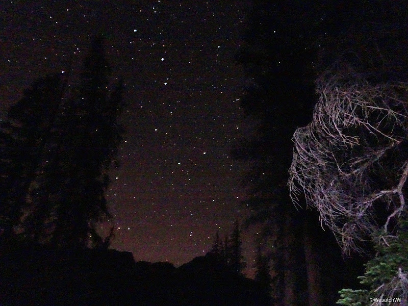
Big Dipper amidst clear night sky

Yard Peak at night
Morning came and once again, clear blue skies surrounded us. The day before, Jackson and I mulled the idea of using this morning to scout out the ridge to the east and southeast of us, standing between Allsop and Dead Horse Lakes. Instead, we scrapped that idea. With everyone else still asleep when I awoke, I ventured on out to do some picture hunting. I specifically targeted a waterfall high up above the western shore of the lake that I had only noticed while fishing the evening before.
Hiking around the southern tip of the lake was once again, incredibly peaceful, beautiful, and serene, much as it had been the prior morning. I think early mornings, as the sun breaks over the horizon, are definitely my favorite time of day up in these high alpine settings.
Rounding the southern tip of Allsop Lake looking toward Cathedral (left)
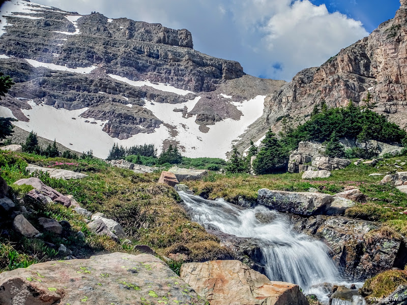
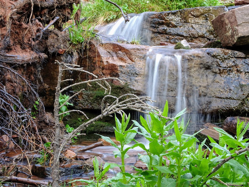
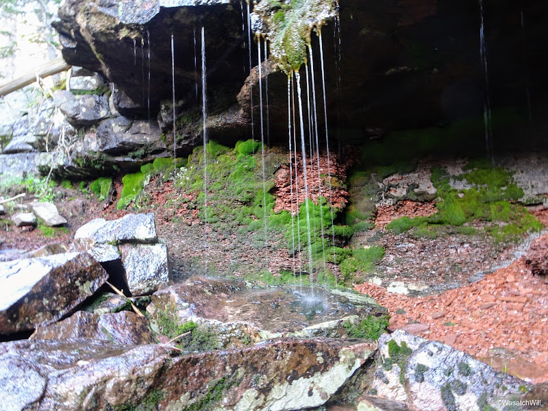
After some considerable effort and a bit of bushwhacking, I reached the waterfall I was after, but was a little underwhelmed by it once I got there. Still, I did my best to take a couple longer exposures of it despite quickly increasing light.

The waterfall above Allsop Lake
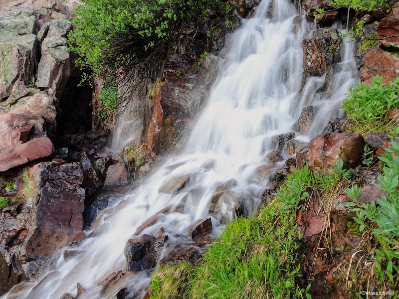
Waterfall from the other side
On my way back down to camp, I stopped for several more pictures of flowers, reflections, little cascading streams, and other picture-worthy objects.
Unknown flower
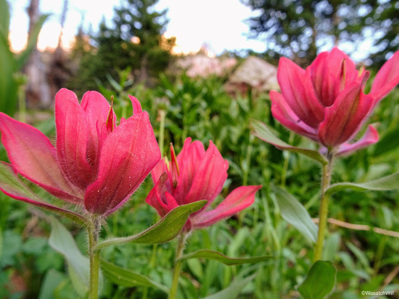
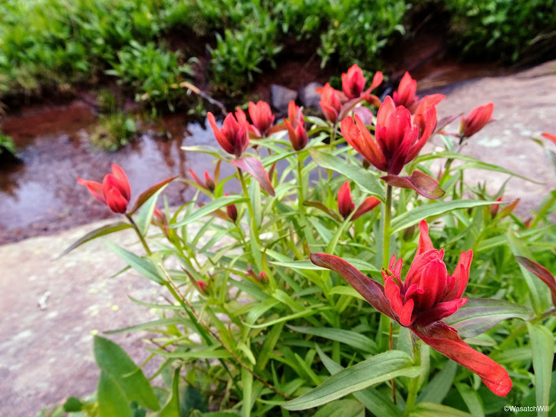
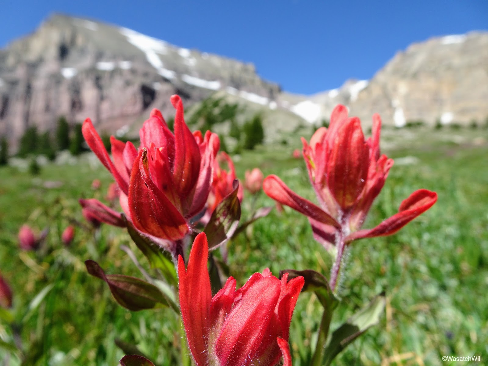
Red Indian Paintbrush

Orange Indian Paintbrush
Morning light on the cliffs

Alpine Primrose
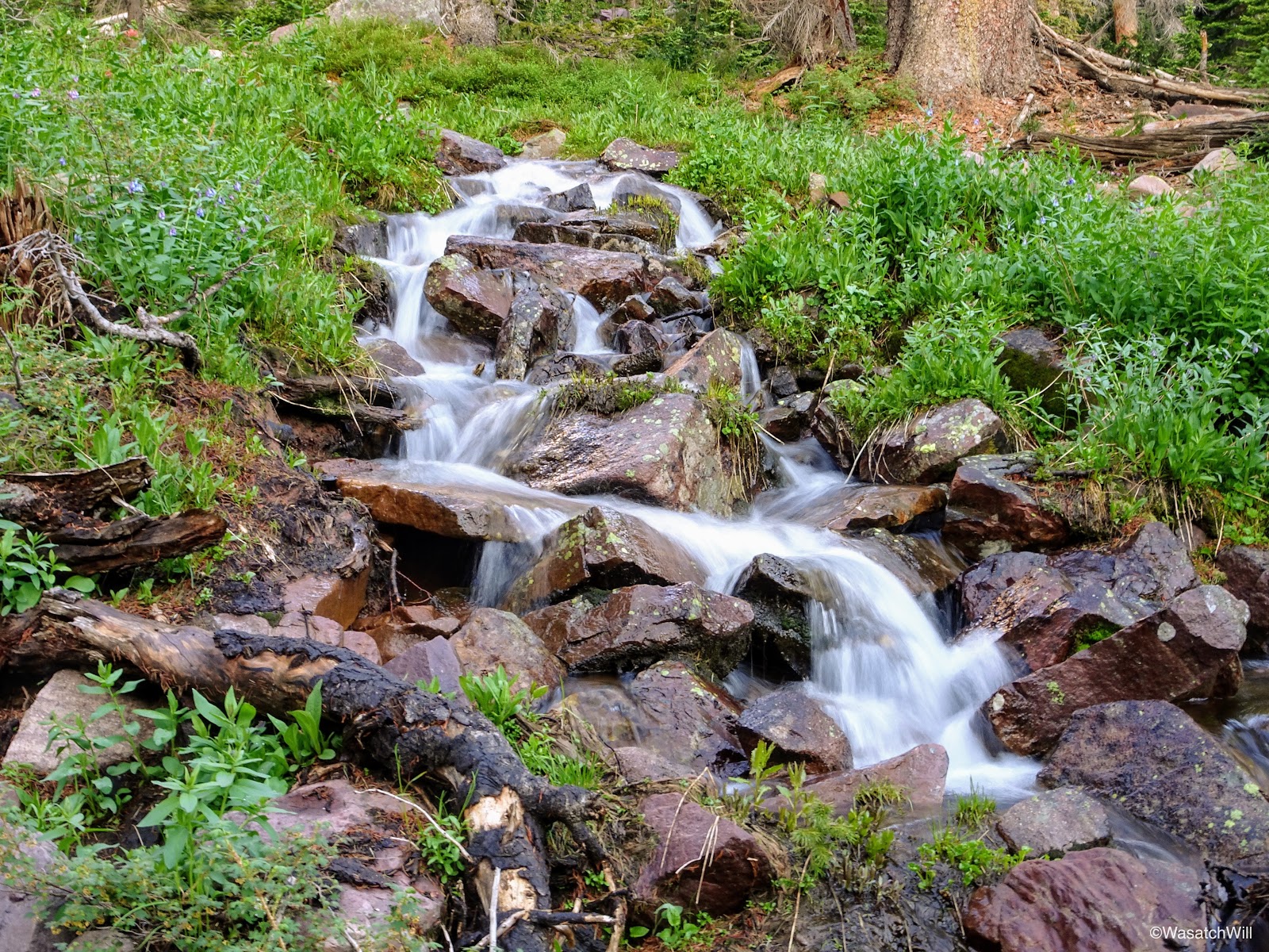
Small waterfall
Small waterfall
Cascading stream
Small little grotto falls
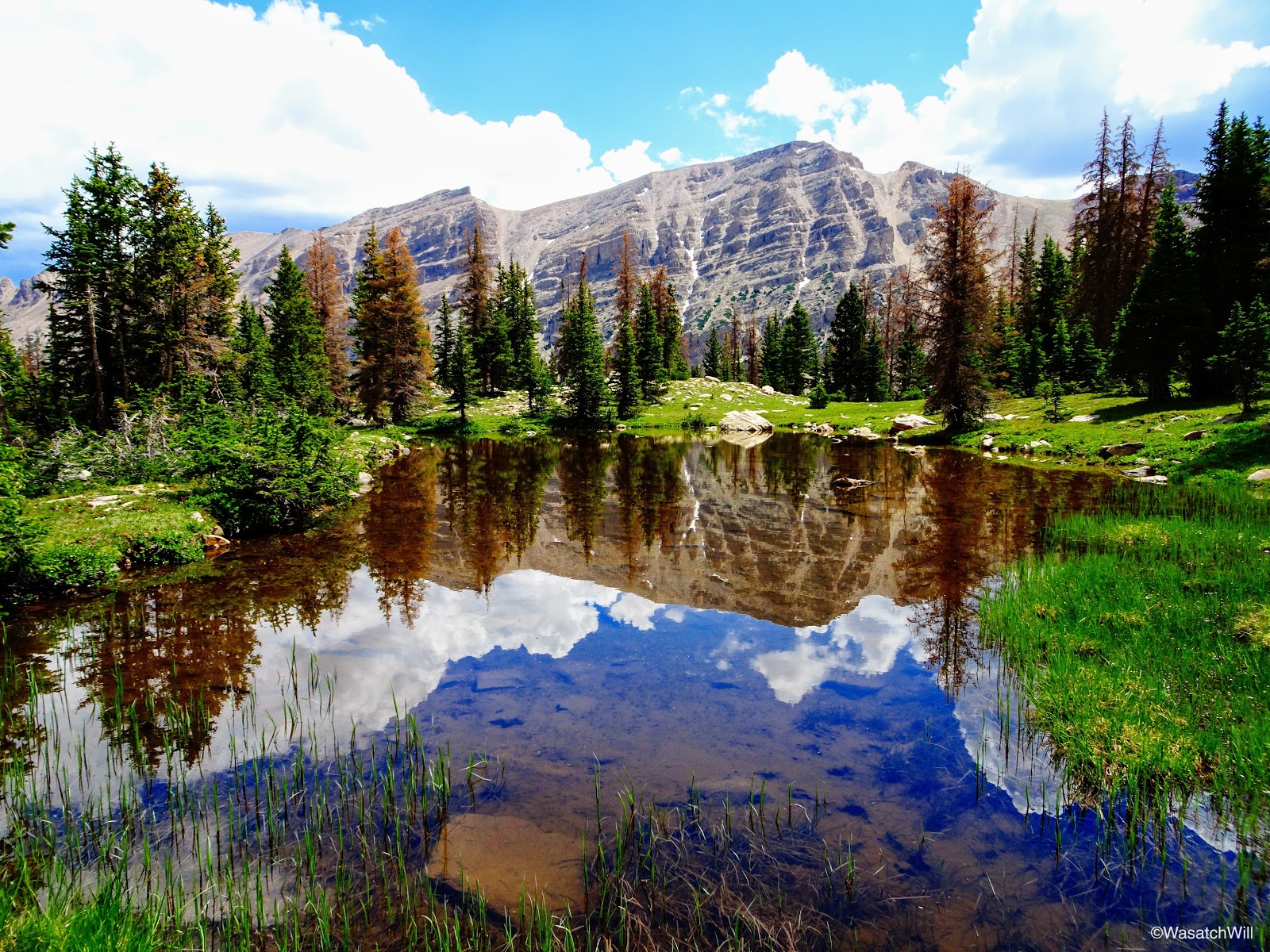
Reflective tarn

Shooting Stars
Allsop Lake inlet
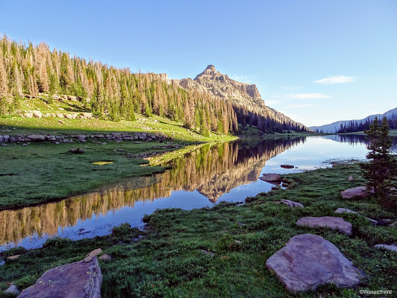
Cathedral reflection
Indian paintbrush

Mountain brook
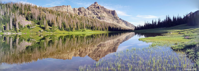
Cathedral reflection panorama
Yard Peak reflection

Indian Paintbrush and Elephant Heads
With my morning picture hunt complete, I returned to camp where we all packed up for the hike back out to the trailhead.
Back at camp
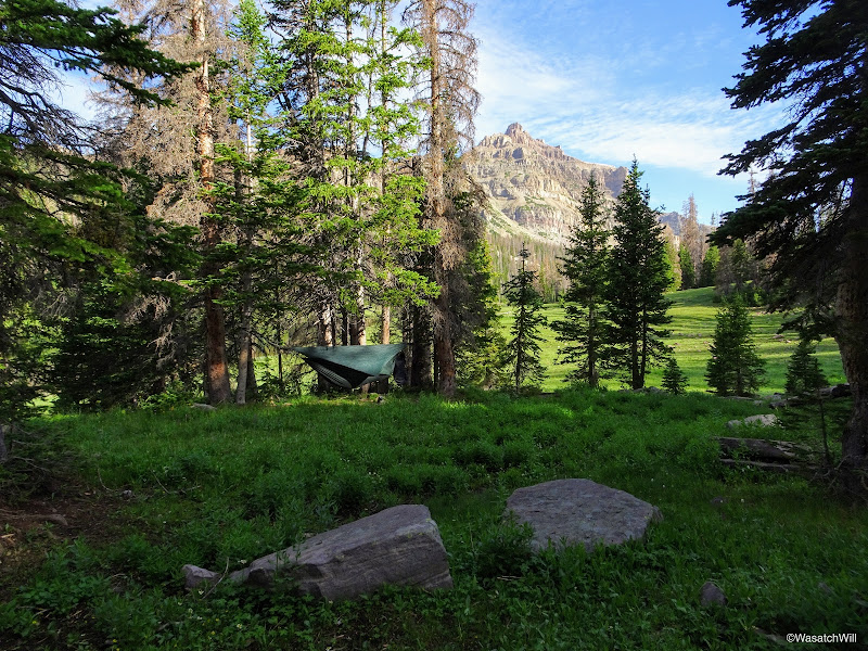
Blake's Hennessy Hammock
However, instead of keeping with the rest of the group to hike out, somehow I was able to convince Blake to lead me up to a spot he had stumbled into on his way up to the ridge we had hiked up the previous morning to check out a patch of pink flowers he had gotten some great pictures of. We chose to leave our packs back down at camp and retrieve them after. I'm not sure what type of flowers they were, but they were very, very small. I'm guessing they are a type of saxifrage. Apparently saxifrage does exist high up in the Uintas and but it's a rare flower up there.
Pink Saxifrage?
Pink Saxifrage?
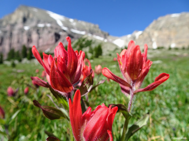
Red Indian Paintbrush
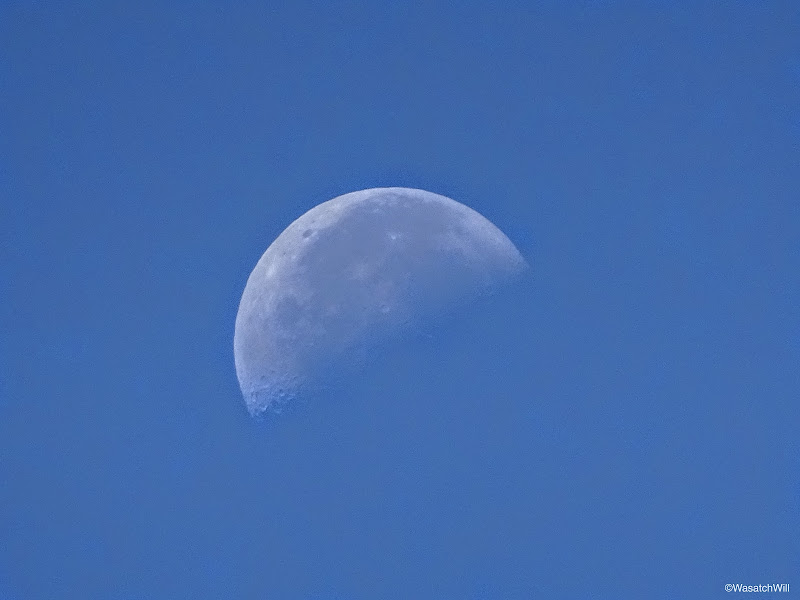
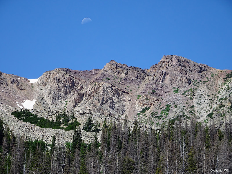
Half moon
After successfully navigating up to the pink flower patch and back, we picked up our packs and set off down the trail. The little side trip we took ended up costing us an hour. Still, with Brett having suffered a bit of leg pain on the way up, we thought for sure the others would be taking it easy enough with lots of breaks so as to allow for Blake and I to catch them on the way back down somewhere.
Blake leading the way back down the trail with Cathedral above
The Cathedral (left) and its northern saddle (middle)
Moon over unnamed peaks north of Cathedral
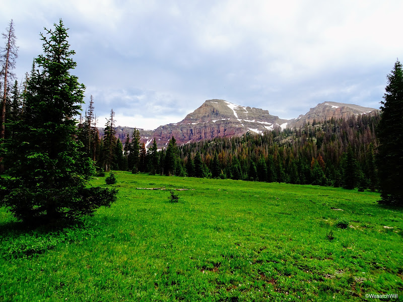
Flower-filled meadow
Looking back up the trail toward Allsop Lake
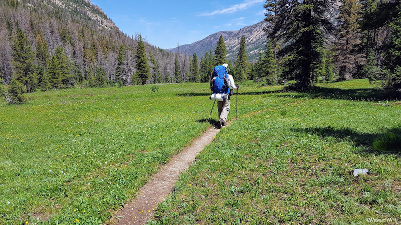
The author heading down trail

Indian Paintbrush along side the creek

Looking across East Fork Bear River above waterfall and up right fork toward Priord drainage
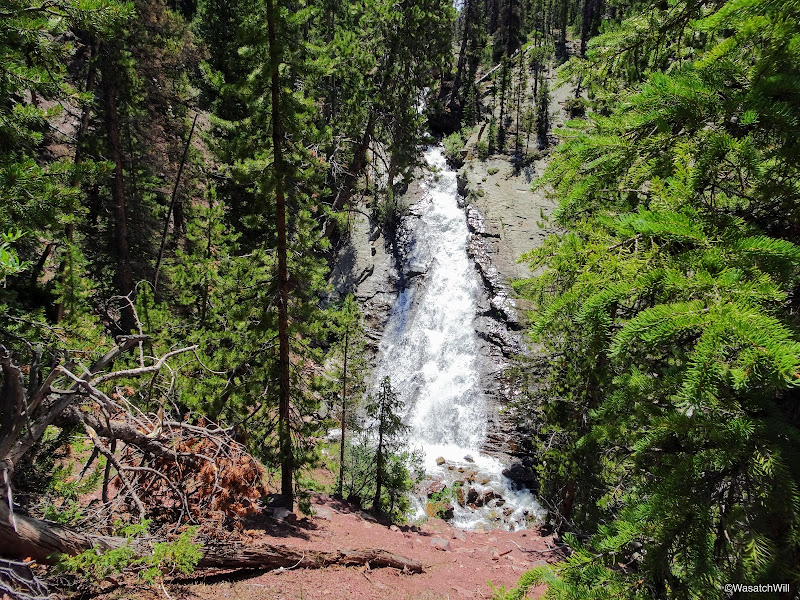
Waterfall just above Left Hand fork between Allsop and Priord trails.
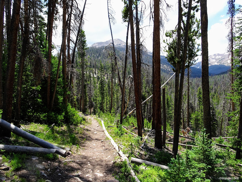
A wooded section of trail
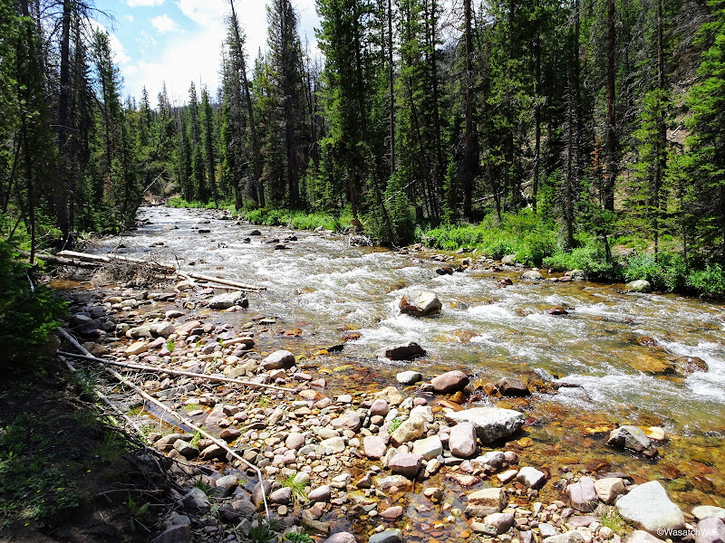
East Fork Bear River
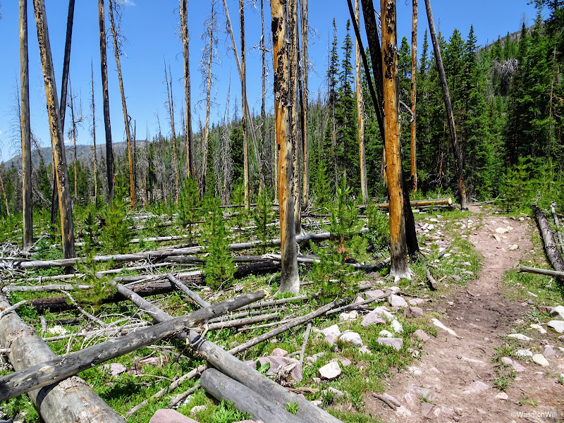
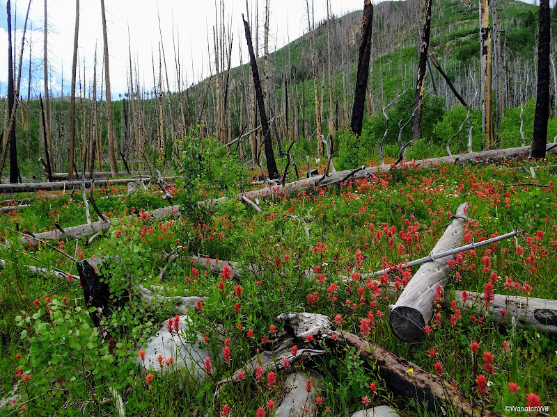
Remnants of a wildfire
Passing back by the cabin
Boardwalk
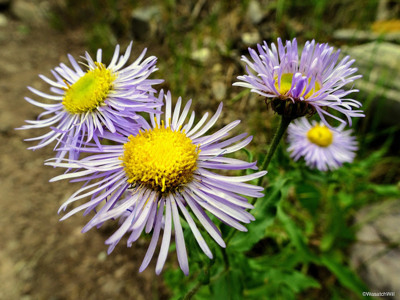
Fleabanes

Flower patch
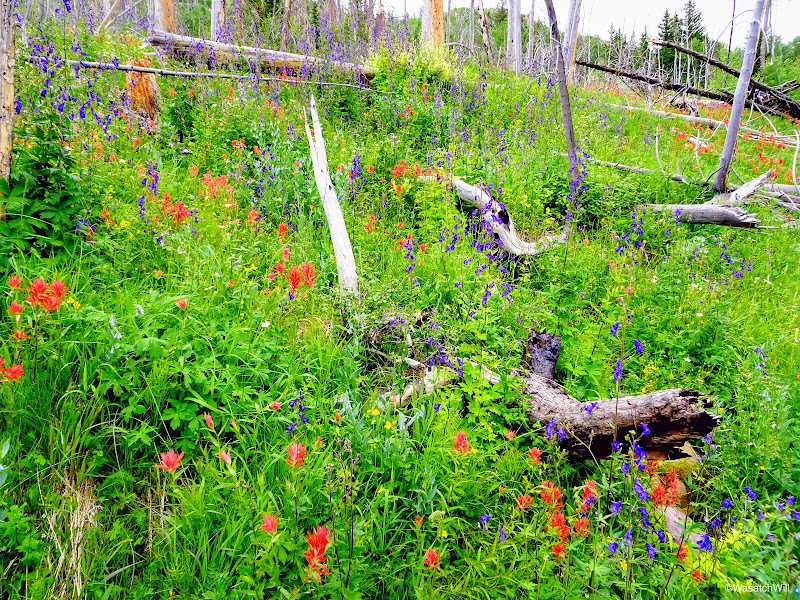
Red, White, and Blue

Boardwalk through flower patch
Boardwalk through flower patch
So many flowers!
Indian Paintbrush jackpot!
Unfortunately, catching up with the rest of the group never happened. Fortunately for Brett though, that meant he had no trouble with any pain hiking back on down to the trailhead. As it turned out, Adam, Brett, and Jackson still ended up waiting nearly a whole hour for Blake and I to arrive. Fortunately, they were good sports about it. I think they enjoyed being able to use the time to change clothes, snack, and just lounge around a bit while they waited.
In the end, it was a weekend well spent. The scenery was incredible and the company, enjoyable.
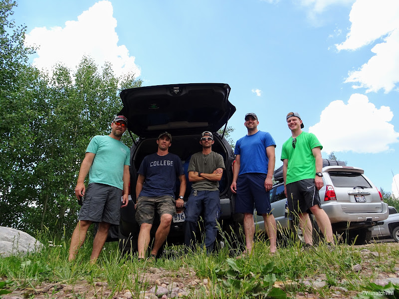
The fab five!
VIDEO:
Day 1
Friday - July 14, 2017
Our group of five consisted of @Parma, Brett (the 'newbie'), @Blake Merrell, @Jackson, and myself. I was familiar with Adam (@Parma) of course, from last year's Highline trip, and Blake from a couple of prior trips together. It was my first time meeting up with Jackson and Brett. We met up at the mouth of Provo Canyon where we then decided to all drive further up the canyon to another lot to set up our carpool. It should have happened almost an hour earlier in the morning, but due to an early morning doctor appointment that resulted in an unexpected need for a prescription of antibiotics, I caused us all a delay. What faithful friends they all were to wait for me though.
Once on the road, we drove on up to the East Fork Bear River trailhead on the northern slope of the Uintas. At the trailhead we did the ritualistic routine of readying ourselves for the trail and got underway.
The start

Just past the trailhead
Almost right off the bat, the trail immersed us into thick stands of an assortment of wildflowers of almost all colors. It was like stepping through a rainbow.

Adam capturing a picture from near the start of the trail

Along an early boardwalk
A couple miles up the trail, we passed by what is believed to be an old tie-hacker cabin. Tie-hackers were people who harvested timber to be used for railroad ties in the construction of the transcontinental railroad.
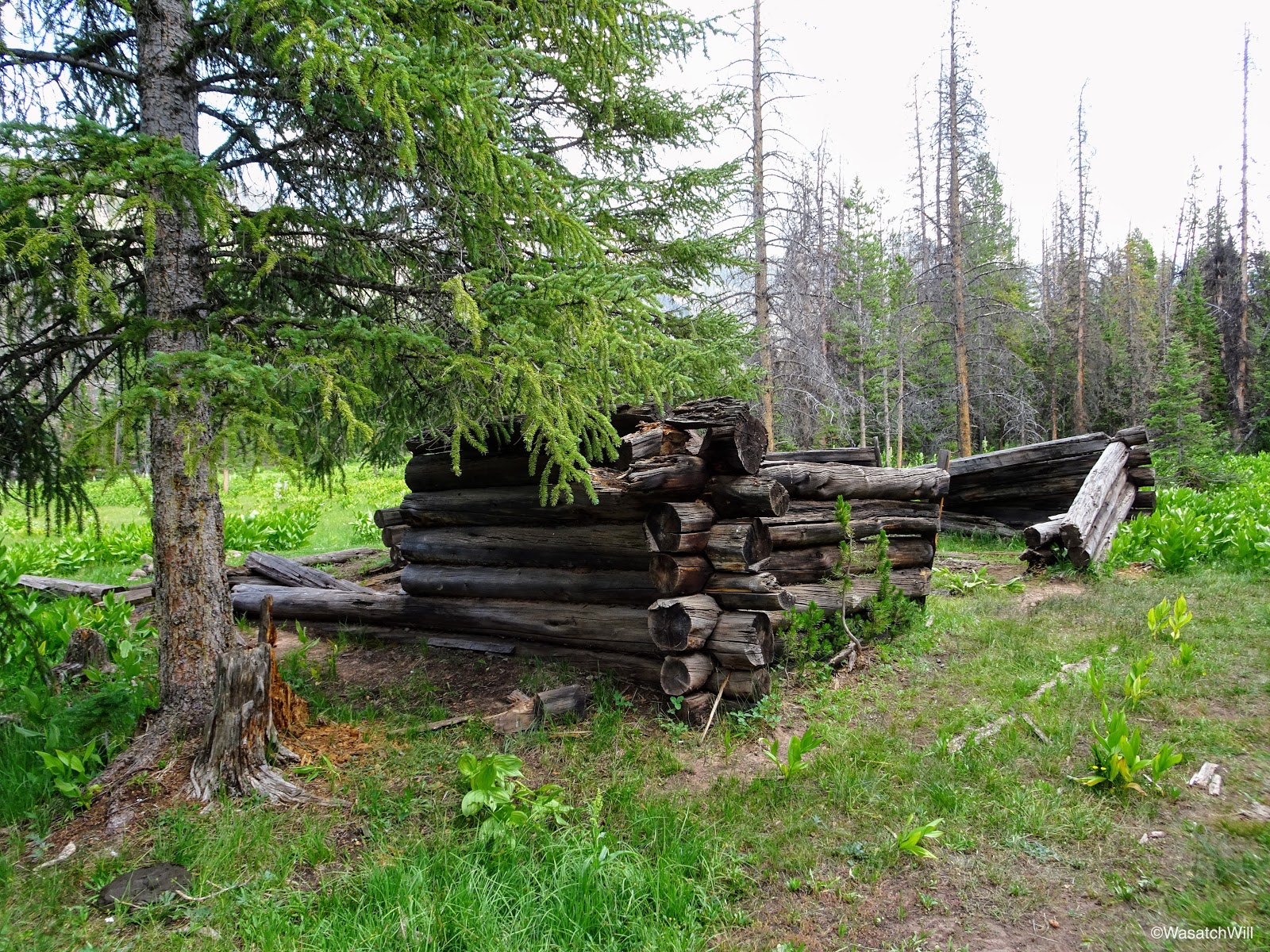
Old tie-hacker cabin
Inside the remains of the largest structure was a tree growing right out what would have been the interior floor.

Tree in the middle of old cabin
Soon after the cabin, we were greeted by the resident herd of cattle. Needless to say, because of these guys, the trail was littered with cow pies the whole way up to the lake.
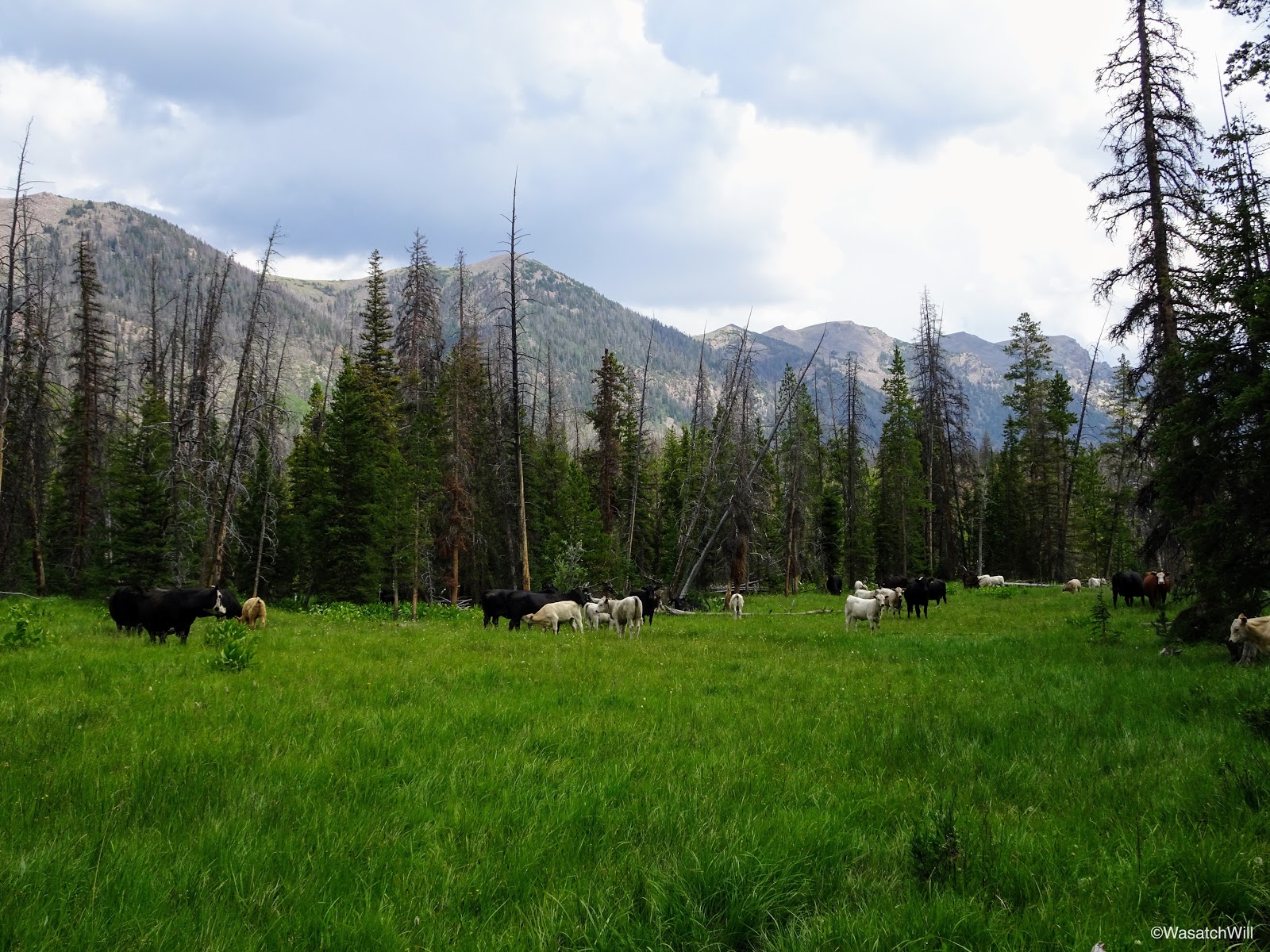
Resident cattle

Ghost cow
We enjoyed views of Mount Beulah early on.

Meadow with Mount Beulah in the distance

Mount Beulah
Within about 4 miles, we would be hiking under the cover of trees for long stretches over the next couple miles. Through this section we saw some more wildflowers and stopped for quick rests at the Wilderness marker and the junction with the fork up to Priord Lake. Through this section, we'd also be enveloped with a good bit of rain, hail, thunder, and lightning that would linger around for a good hour or two. In the 'shelter' of so many trees, we hiked on through.
Columbine
Columbine closer-up

Purple Penstemon (aka Beard Tongue)
Sticky Geranium

Along the East Fork Bear River

The author at the wilderness boundary

Brett keeping to the left at Allsop-Priord Fork
Above a waterfall along the Left Hand fork of East Fork Bear River
Hiking along Left Hand Fork of East Fork Bear River

Afternoon storm
In due time, the trees parted, giving way to a very large meadow and almost on cue, the storm began to part as well. The sky began to brighten up, setting the meadow ahead of us all aglow. We paused to take in the view and wait for others in the group to catch up.
Jackson and Blake amidst the brightening light in the meadow
We noticed some colorful birds not far from us feasting on the aftermath of the storm. Jackson's best guess was that they were Pine Grosbeaks and I think he was right.

Pine Grosbeaks

Pine Grosbeak
As the clouds began to break apart, the meadow became more and more magical as it were. The grassy flats remained aglow and began to twinkle and sparkle as rays of sunlight reached forth and penetrated from the clouds above. Wildflowers were scattered all about us. To add to the view and the excitement of being present there at that moment, we could now see the end of the basin. We now had a visual of Dead Horse Peak showing us how far we had to go to reach the lake at the upper end of the basin.

Meadow with Dead Horse Peak in the distance

Dead Horse Peak
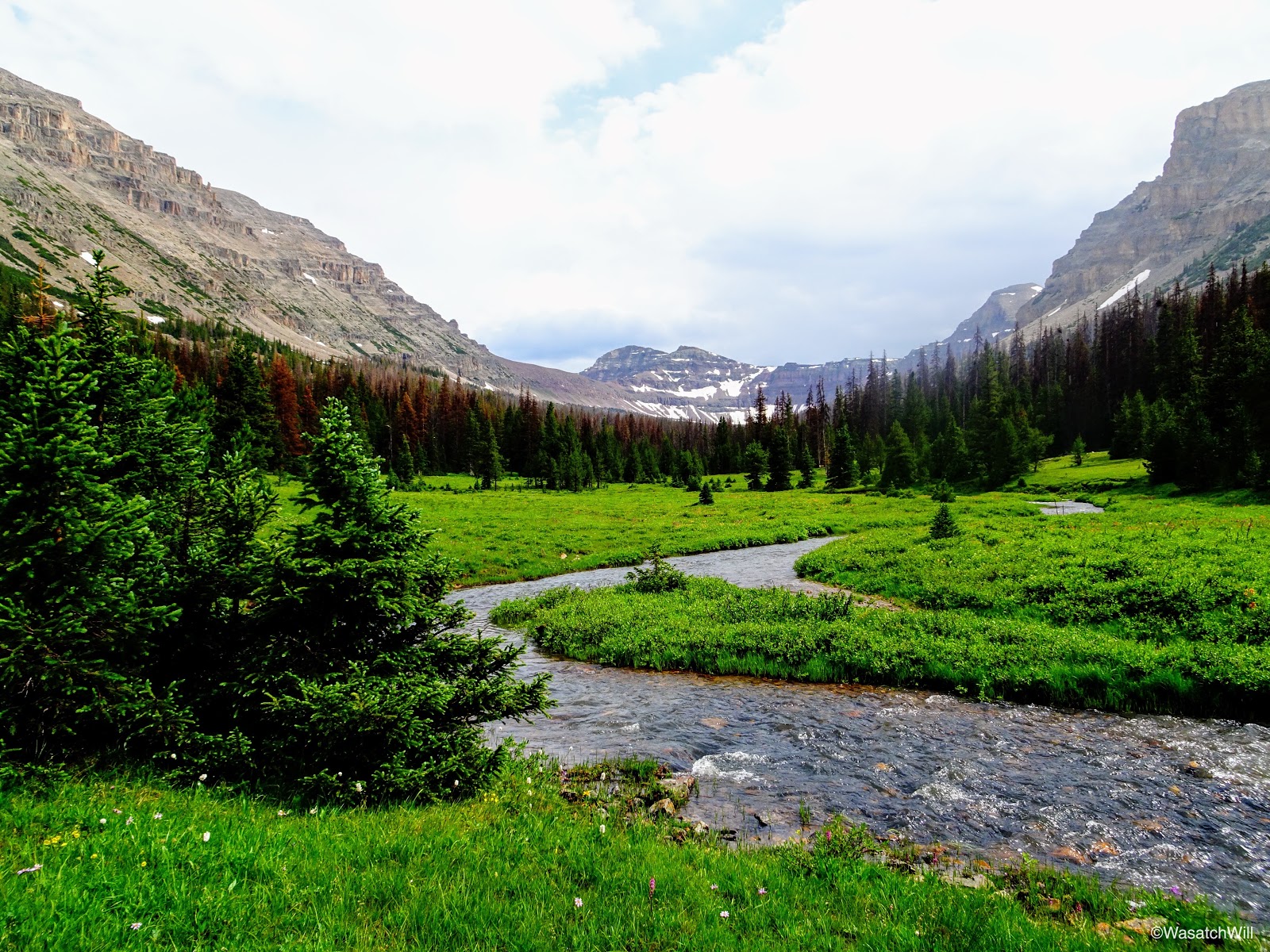
View up the Left Hand fork of East Fork Bear River toward Allsop lake
Looking back down the meadow with some of our group for scale

Blake and Adam

Heading back into a small stand of trees

Indian Paintbrush and Daisy in the meadow

Deadhorse Peak (distant left) and the Cathedral (right) from along Left Hand East Fork Bear River

Looking back down the meadow at the storm retreating behind us
Flowers along Left Hand East Fork Bear River

Trickling brook
As we continued through the meadows, we'd pass by the majestic looking Cathedral.
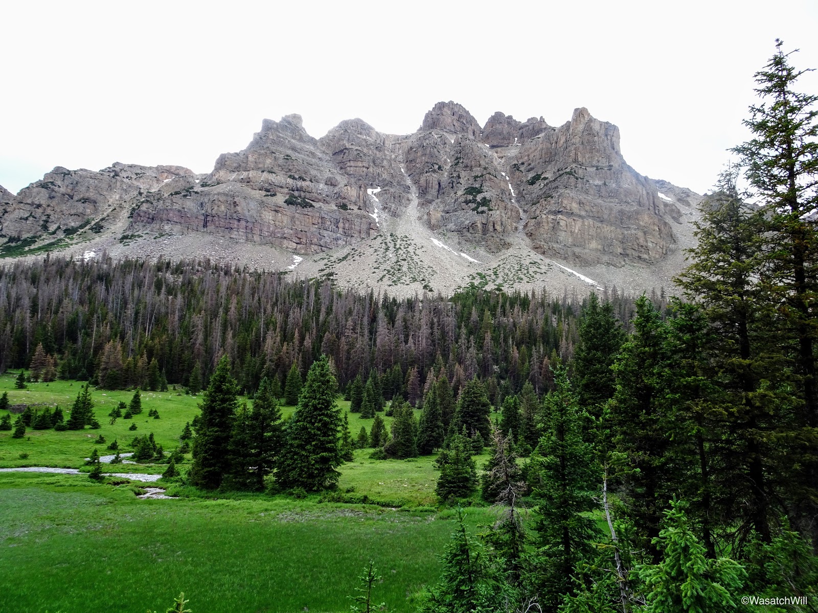
The Cathedral
Looking up toward Yard Peak (left) further up the basin
Yard Peak (middle)

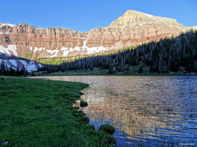
Approaching Allsop Lake
After a muddy, marshy, and wet, though blissful and beautiful couple of miles of hiking, we arrived at the shores of Allsop Lake.

Arriving at Allsop Lake
From there, we scoured the eastern side looking for a campsite. We knew from other acquaintances of a good one along that side of the lake and I think we found it. (Shout out to @Nick and a prior TR of his)
With camp all set up, and a few hours of daylight left, I went down to the lake to do some fishing. Without a whole lot of effort, I was able to pull up a few rainbows of various sizes.
First catch

Another Rainbow
I had brought stuff to cook some up with, but with how wet and cold everything was from the storm that afternoon, I didn't want to bother with cleaning out any fish that night. I was confident enough that I would have equal success the next day.
Satisfied with the success I had fishing, I returned back to the group at camp where we made ourselves dinner and gathered around a fire, where we desperately tried in vein to dry off our socks and shoes before retiring for the night.

Community dryer
Day 2
Saturday - July 15, 2017
The next morning brought with it clear blue skies.Saturday - July 15, 2017
Rise and shine
Jackson and I were the first ones up. We gathered some essentials for the day, had a quick breakfast, and set off for the ridges up above the west side of the lake. Our whole group had originally thought to pack up that day and make a go up the pass between Allsop Lake and Priord Lake in the next basin over to the west. But with how beautiful Allsop Lake proved to be the night before, we opted to take it easy and keep camp where we were. Still curious to see how the pass was, Jackson and I sought it out. We knew Blake had downloaded a copy of the route I had mapped out on his phone as well, so we figured he would lead Adam and Brett up it if they so desired to catch up with Jackson and I once they all awoke.

Yard Peak above Allsop Lake

Looking back down toward the Cathedral

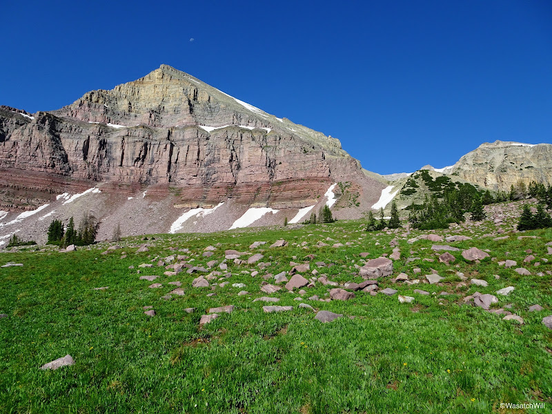
Yard Peak
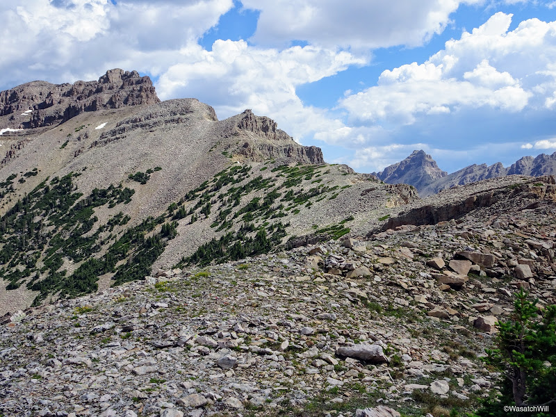
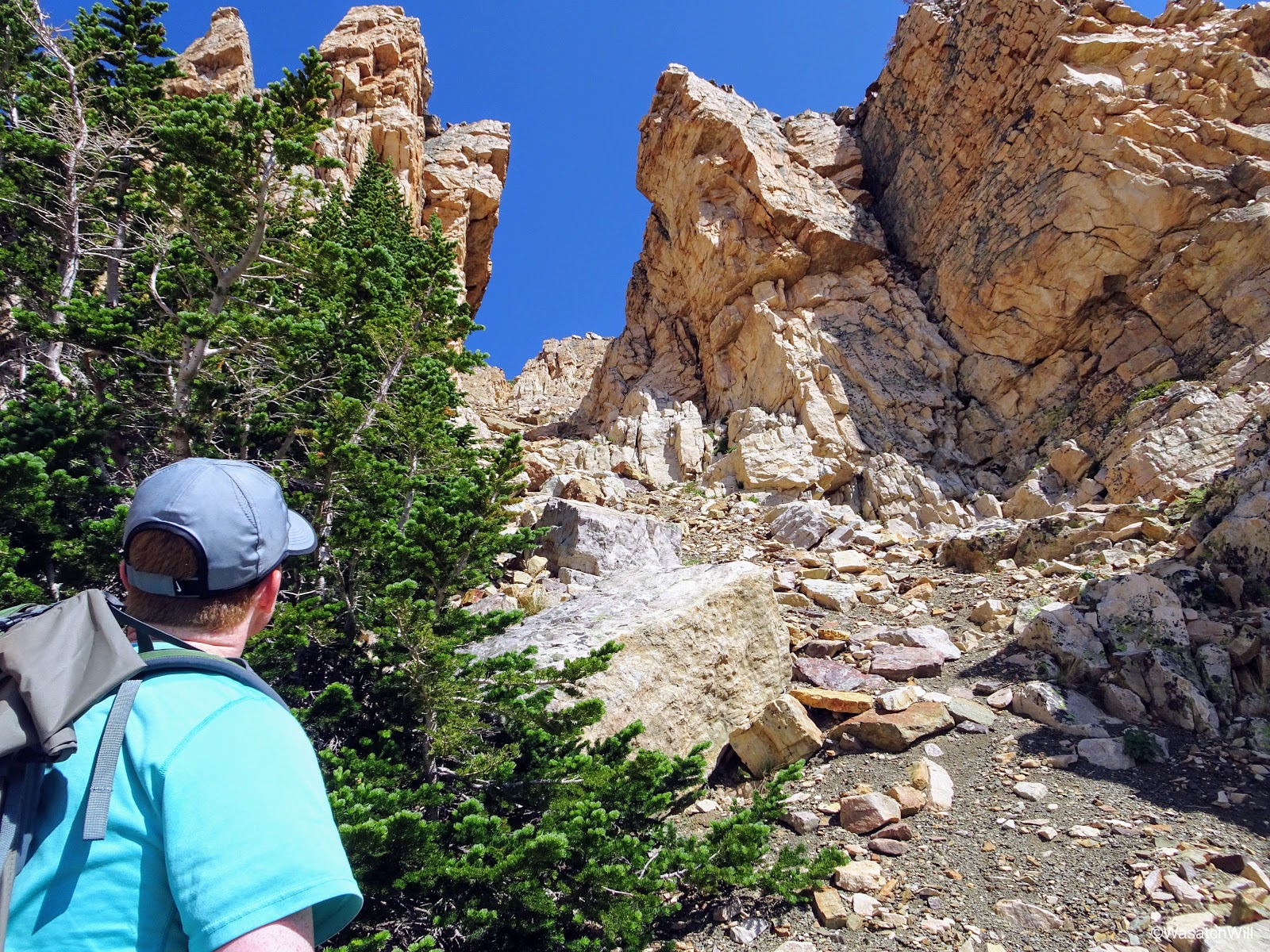
After a short but very steep hike up and over a hill into what I'll call a "mini-basin", we could see the ridge we were after in full view. Allegedly, there was to be an old sheep-herder trail up through the ridge somewhere, but there was no sign of any trail, or cairns. All the better for a real adventure.
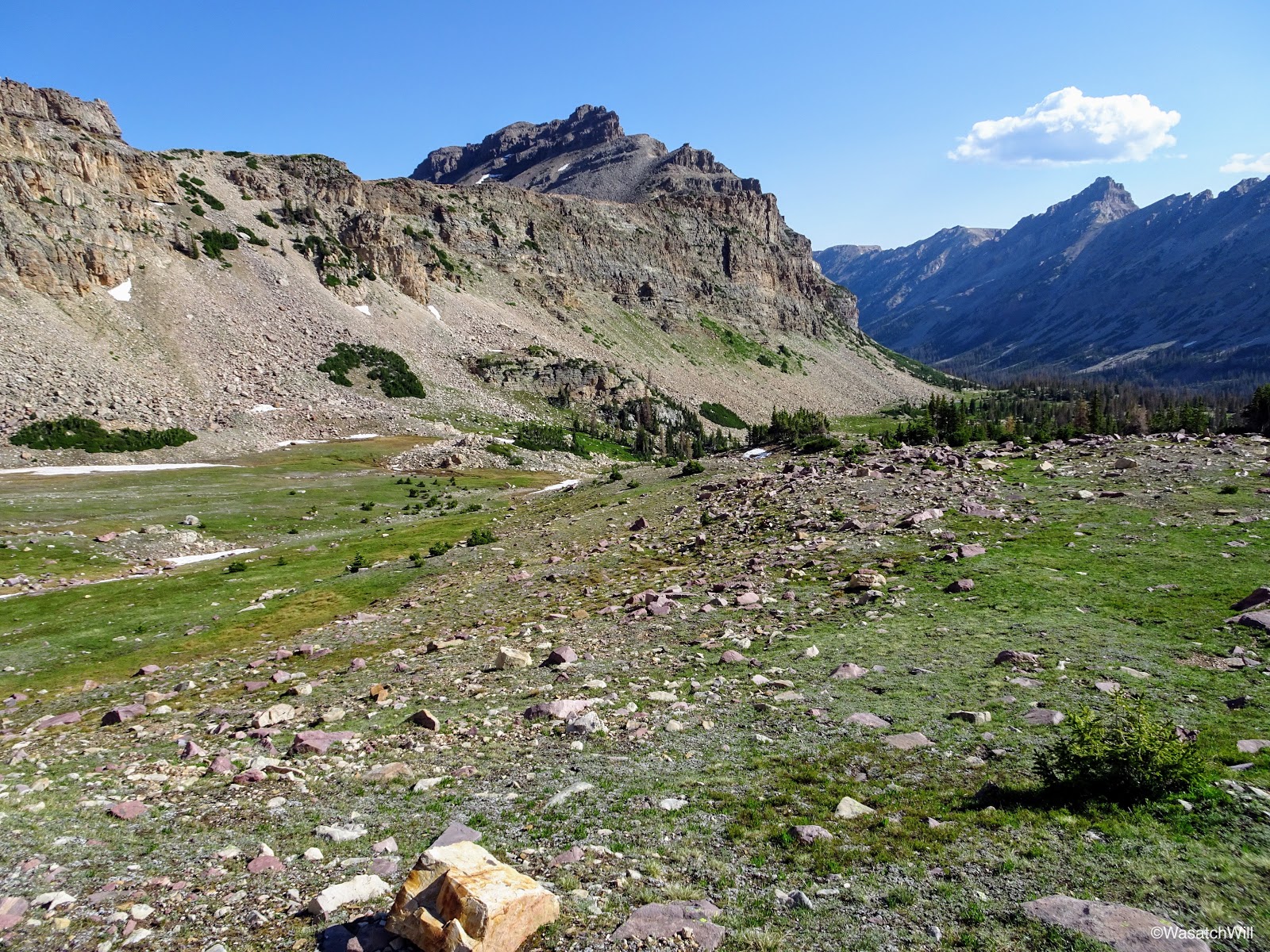
The Cathedral and ridge from across the 'mini-basin'
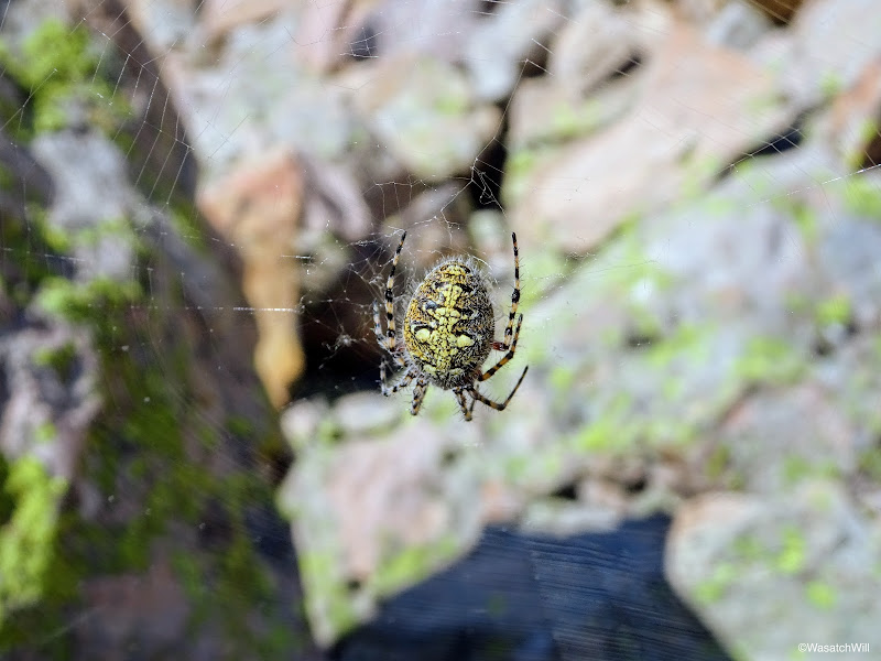
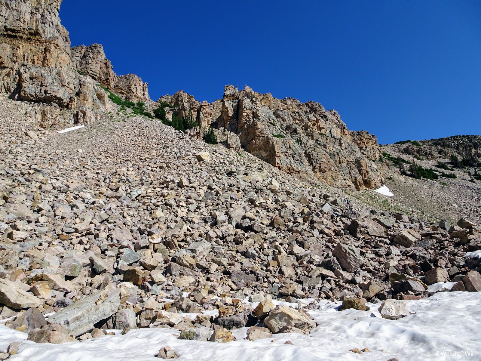
The map I had marked out and modified actually showed a route up and over as per the USFS 2016 map through a notch in the ridge toward the south. Jackson and I picked a line up the moraine to the notch on my map and began the boulder scramble up it. Along the way we'd have to watch our step extra carefully lest we walk through a number of active spider webs.
Looking up the moraine

Spider on web

Another spider

And another spider
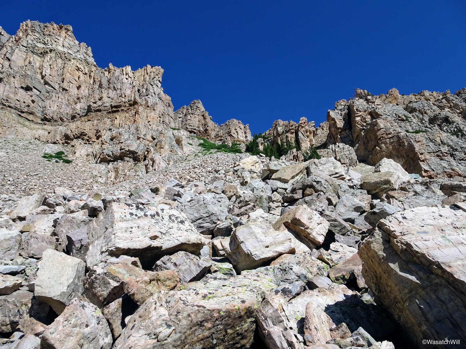
Looking up the first chute
Once on the ridge, we sought out a safe passage down the other side as per my map, but what we encountered in reality was some cliff bands beneath us with no apparent way to bypass them from where we were. In hindsight, and confirmed by what we saw as a faint trail further to the north coming off the ridge, we should have went up to another notch we had originally eyed from across the mini-basin further north on the ridge. It was actually a spot I originally marked out on my map going by topography and satellite imagery long before seeing a route for it laid out on the USFS map.

Looking west down into the Priord drainage from the top of the ridge
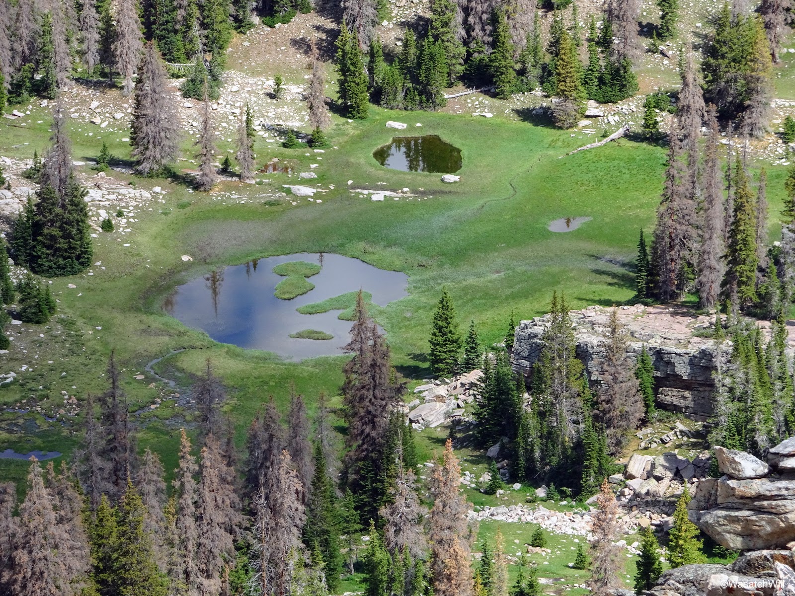
Tarns down below
Not to be stifled, we made our way back down the chute we had come up and traversed the moraine northward to another promising looking notch. We scouted that out, only to hit another dead end.
Jackson sizing up the 2nd chute
We carefully descended back down that loose gully and continued our traverse along the top of the moraine to the next notch where we expected to finally find the safer route over.
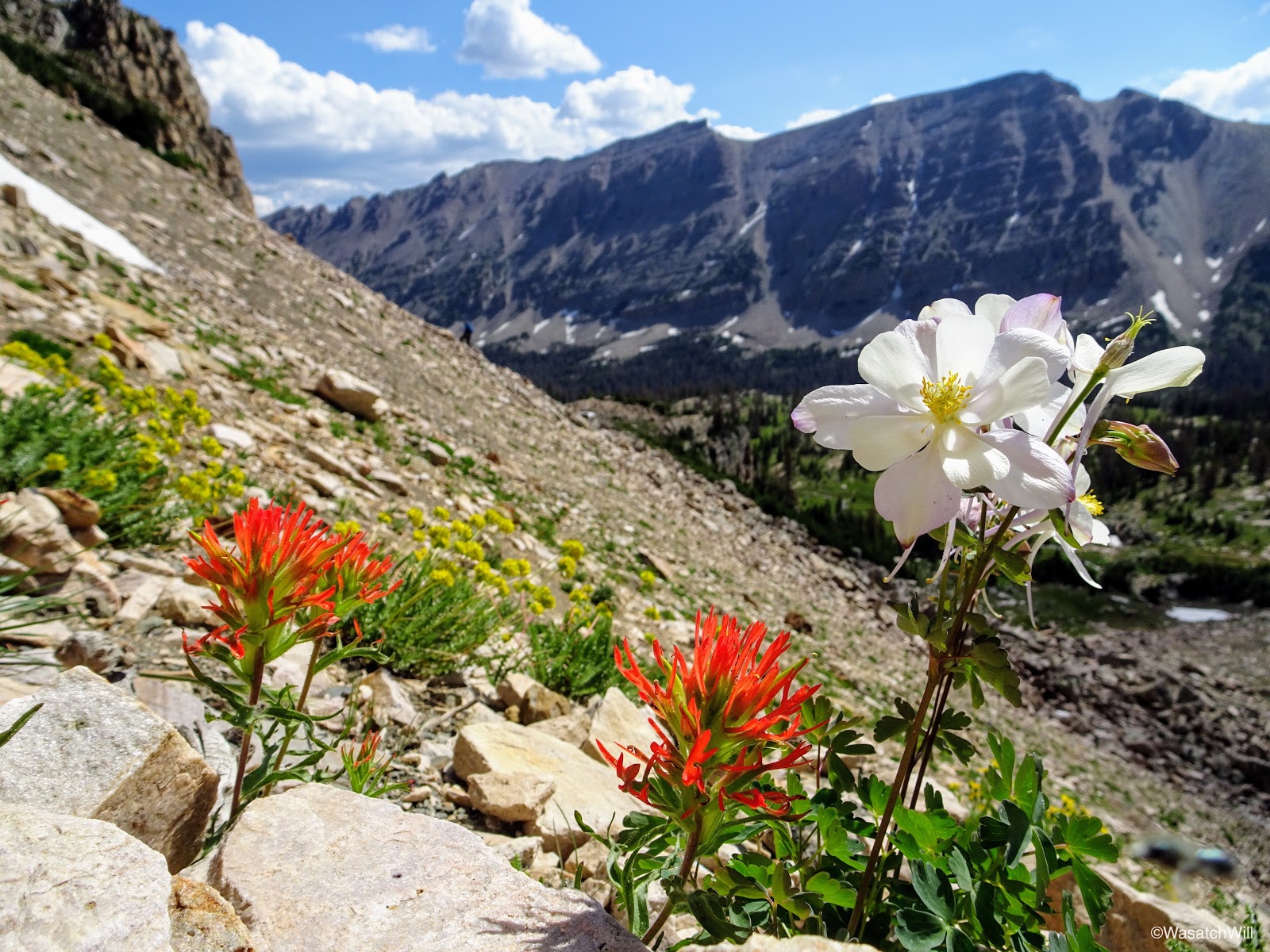
Some stray flowers while traversing across the moraine
In our approach to that spot on the ridge, we encountered Blake making his way up to the same spot. Adam and Brett chose to linger around the lake. Apparently, Blake had not updated his map from the copy I originally laid out when we first started planning this trip, so his map was leading to the original spot over the ridge I had marked out. We intersected each other just below the ridge, and for Jackson and I, the 3rd attempt to find the right way over proved to be the charm. We had finally found it at the spot marked out on my original map. It was tempting to venture on down and go out for a look down at Norice and Priord Lakes, but that would require losing and regaining a lot of elevation off the ridge and there were already a number of clouds developing now with darker ones out on the distant horizon. We knew it would be storming that afternoon and it was only a matter of how soon it would all roll in.
Instead of descending the other side of the ridge, the three of us walked along the ridge northward for a ways hoping to still sneak a peek out at Norice and/or Priord Lake. The effort proved fruitless in that regard. After studying out the topography on the map more closely, it was evident that we'd probably have to get pretty close to the Cathedral further up the ridge, if not on top of it, to get the angle that would be needed for a view out to Priord Lake.

Atop the ridge once more
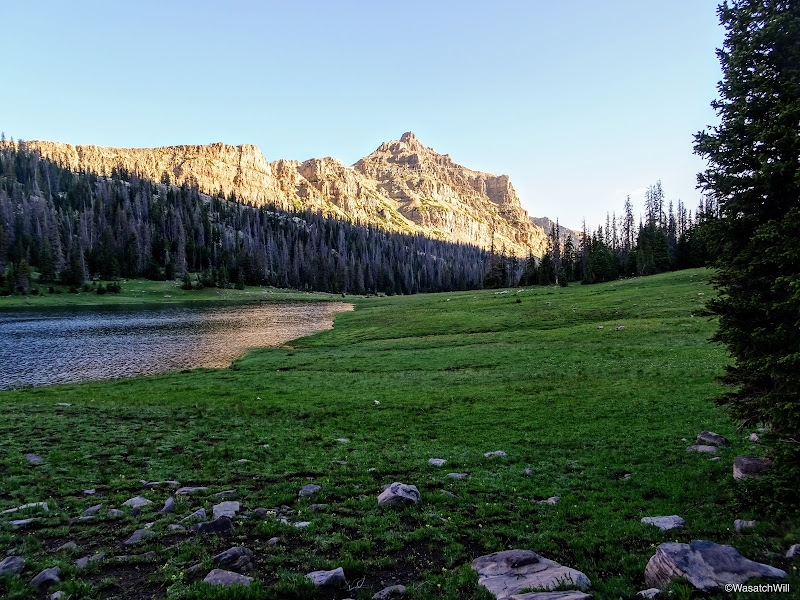
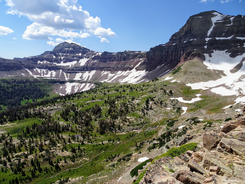
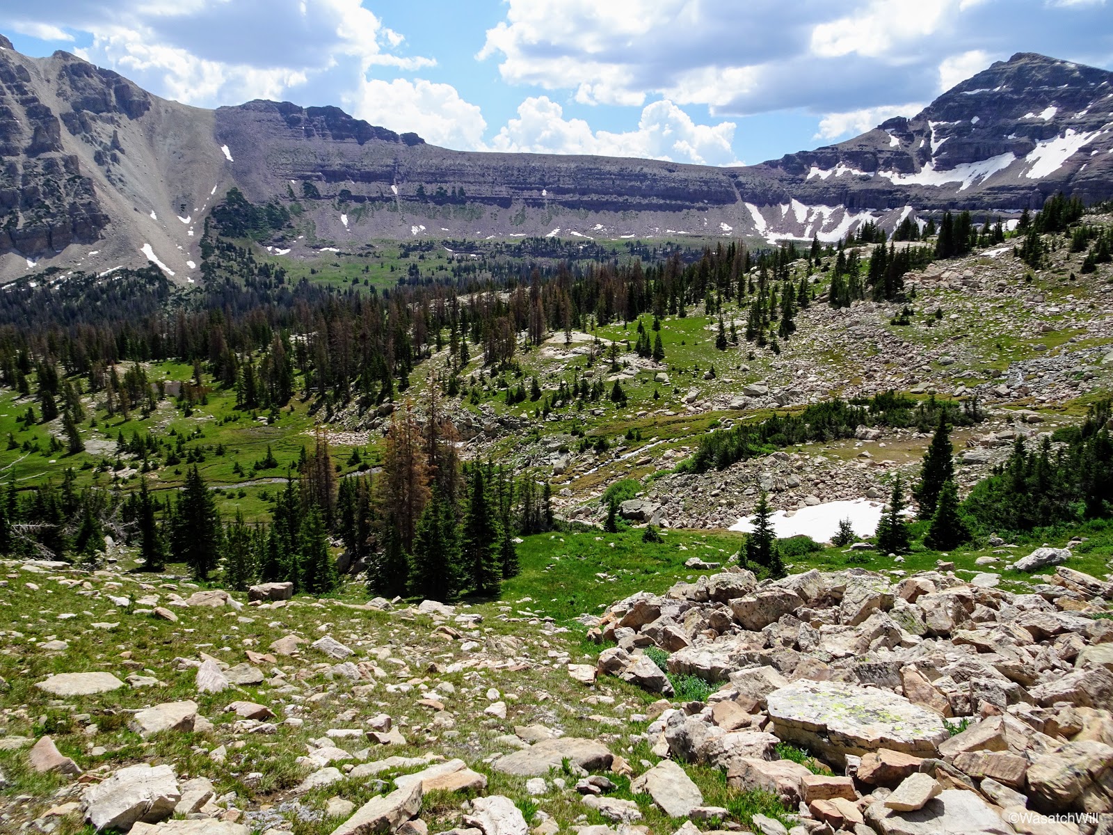
The effort wasn't entirely in vain however. The views we had back down into Allop Lake's basin were extraordinary.

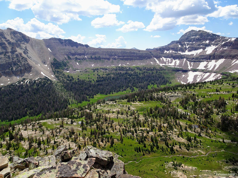
Looking upper basin of Allsop Lake with Deadhorse Peak (left) and Yard Peak (right)

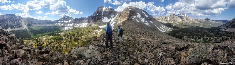
Panorama from ridge looking south with Blake and Jackson
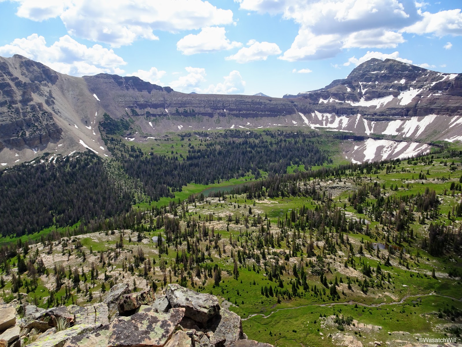
View of Allsop Lake (center) far below from the ridge
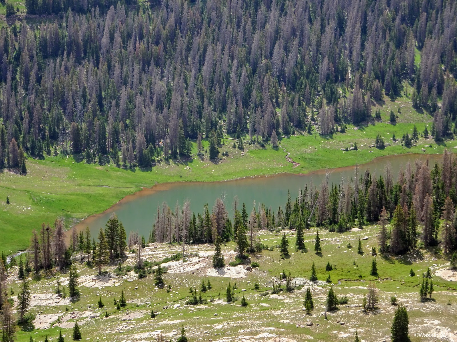
Close up of Allsop Lake
Because of the gathering clouds, we did not linger long on the ridge and descended back down for Allsop before we got ourselves into trouble with the weather.
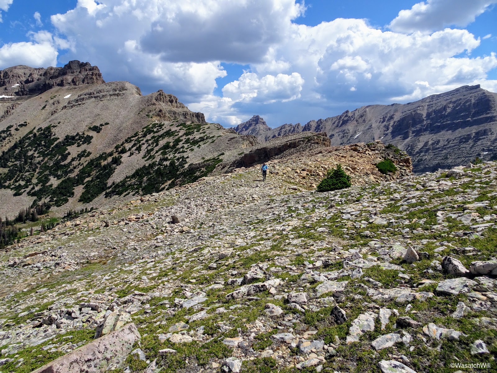
Blake in the distance walking the ridge
Heading back down
On the way down we opted to navigate and route-find our way around the northern end of the lake back to camp rather than the southern end we had come around earlier in the morning. Along the way, we paused for another brief break at a nice set of cascades within the mini-basin.

Cascading stream
Cascades in 'mini-basin'
We passed by a few picturesque tarns en route back down to the lake as well.
Picturesque tarn
Close to camp, we ran into a pair of wilderness rangers who were up for the weekend taking inventory on the number of fire rings they could find throughout the basin with a focus around the lake. Possibly to explore the possibility of putting Allsop within the same fire restrictions that so many other High Uinta lakes are now under, which is that there are to be no campfires within a quarter mile of their shores. From our own explorations, there weren't many at all compared to what I've encountered throughout more popular basins in the Uintas.
We also chatted about LNT etiquette, the lamas they had packed up, and the surrounding landscape in general.
Back near camp at Allsop Lake
We returned to camp, had lunch, and got that all cleaned up just in time for the oncoming afternoon storm to settle in. We took refuge in our tents to wait it all out. There was considerable rain and hail for the next few hours mixed in with some good bouts of lightning and thunder. One strike was counted to be within a mile. I think we all fell asleep to a nice little nap at one point while waiting out the storm.
Hanging out back at camp

Shelter from the storm
By early evening, the storm began to thin out and move out.
Emerging back out to clearing skies
I figured it was as good a time as any to go back down to the lake for some fishing. Out came some more Rainbows...the fishing variety that is, not the sky variety. This time I'd select a few larger ones to keep and cook up with supper on the fire back at camp.
Another rainbow caught
Cleaned and gutted, ready to be seasoned and wrapped
While I had been fishing, I heard some rocks tumbling down the cliff bands up above the basin. I assumed it was some mountain goats, and sure enough, after scanning the cliff bands with my binoculars I found a nanny goat and kid out having some supper of their own.

Nanny goat and kid high up on the cliff side
After pointing out the goats to the others, I finished prepping the fish to be cooked. I brought up a small variety of seasonings. Some tried and true lemon pepper, some Tony Chachere's Creole, and some Cavender's Greek seasoning mix. Of the four fish, I did lemon pepper alone on one, creole alone on one, Cavender's alone on one, and at least mix of the Cavender's and creole on the fourth. I honestly can't remember if I included a bit of lemon pepper on it as well. But either way, that final mix proved to be incredible!
Seasoning the fish
With full bellies from delicious dinners, including the fish, we cleaned up and got back into our tents to finish out the evening.
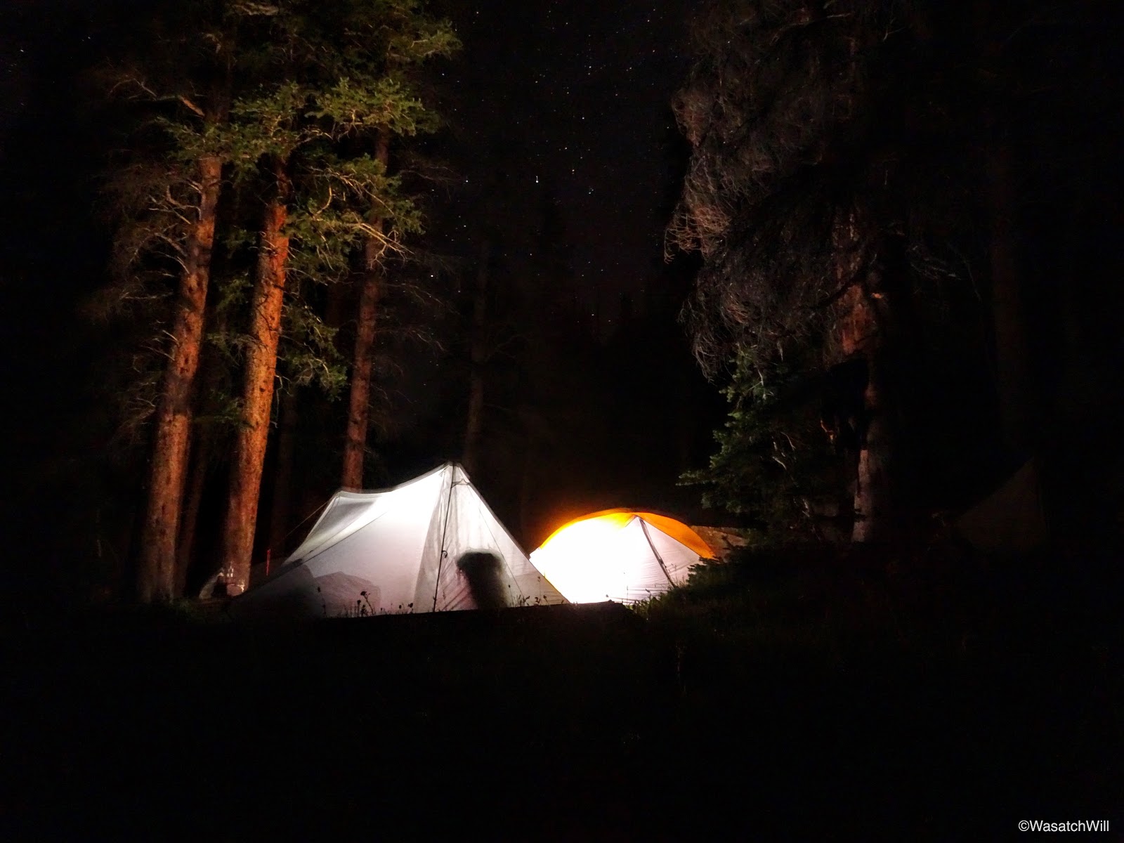
Tents aglow
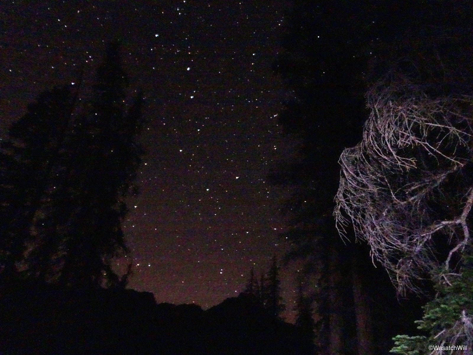
Big Dipper amidst clear night sky
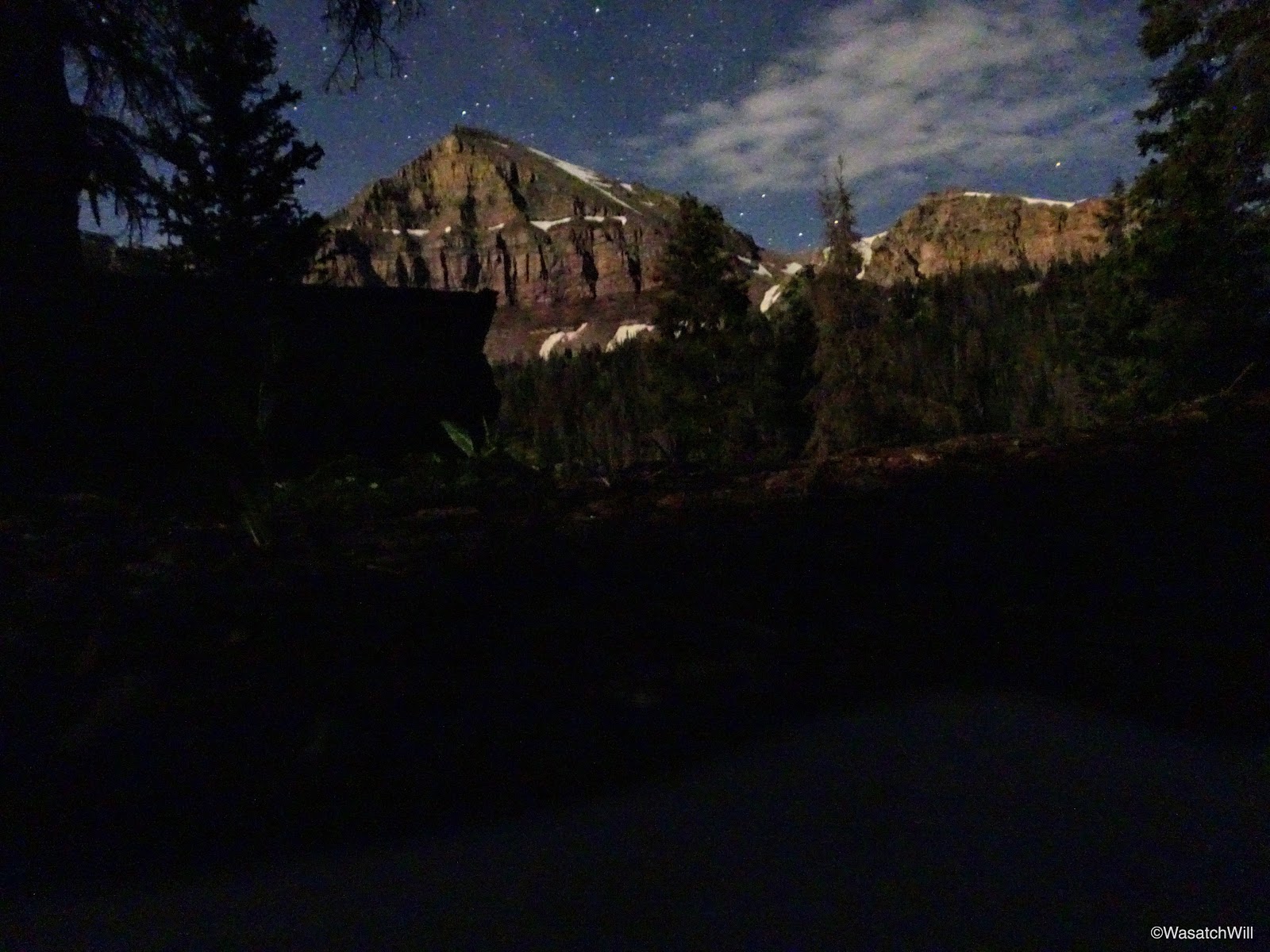
Yard Peak at night
Day 3
Sunday - July 16, 2017
Sunday - July 16, 2017
Morning came and once again, clear blue skies surrounded us. The day before, Jackson and I mulled the idea of using this morning to scout out the ridge to the east and southeast of us, standing between Allsop and Dead Horse Lakes. Instead, we scrapped that idea. With everyone else still asleep when I awoke, I ventured on out to do some picture hunting. I specifically targeted a waterfall high up above the western shore of the lake that I had only noticed while fishing the evening before.
Hiking around the southern tip of the lake was once again, incredibly peaceful, beautiful, and serene, much as it had been the prior morning. I think early mornings, as the sun breaks over the horizon, are definitely my favorite time of day up in these high alpine settings.

Rounding the southern tip of Allsop Lake looking toward Cathedral (left)
After some considerable effort and a bit of bushwhacking, I reached the waterfall I was after, but was a little underwhelmed by it once I got there. Still, I did my best to take a couple longer exposures of it despite quickly increasing light.
The waterfall above Allsop Lake

Waterfall from the other side
On my way back down to camp, I stopped for several more pictures of flowers, reflections, little cascading streams, and other picture-worthy objects.

Unknown flower
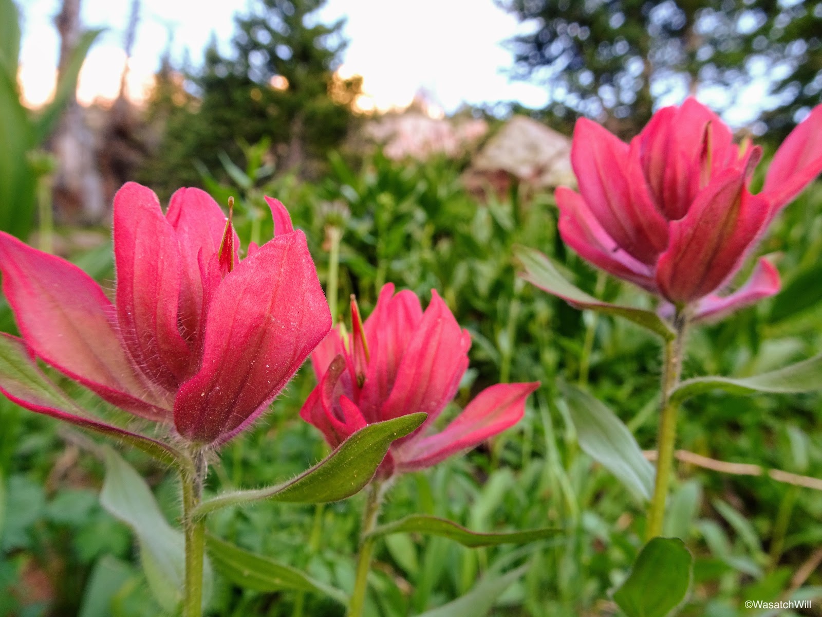
Red Indian Paintbrush
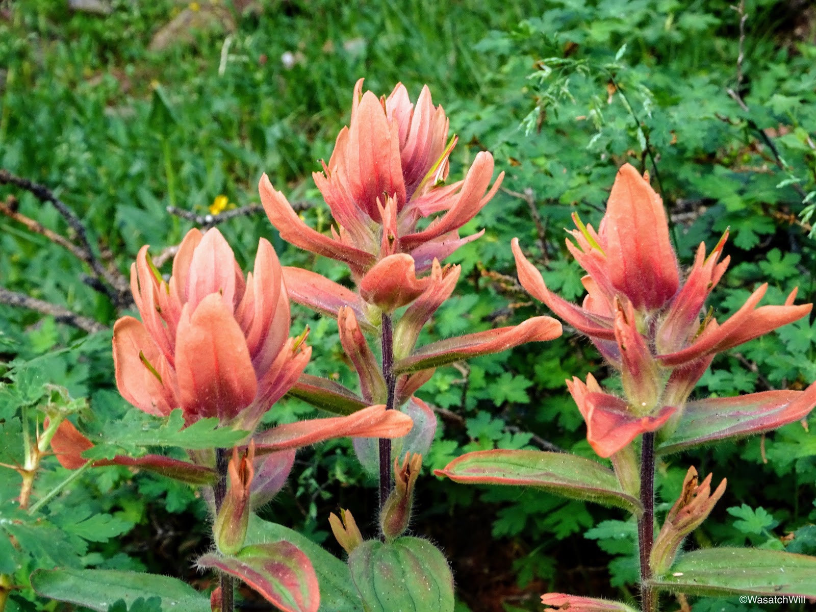
Orange Indian Paintbrush

Morning light on the cliffs
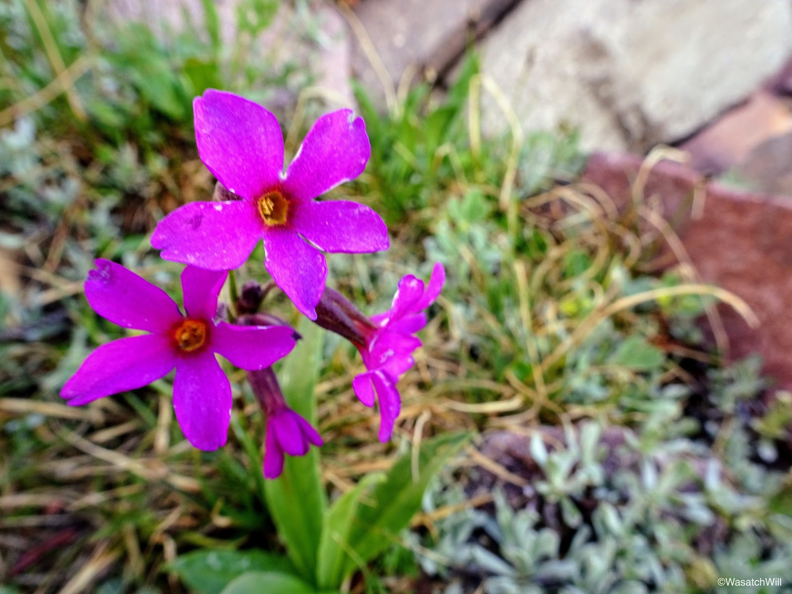
Alpine Primrose

Small waterfall

Small waterfall
Cascading stream
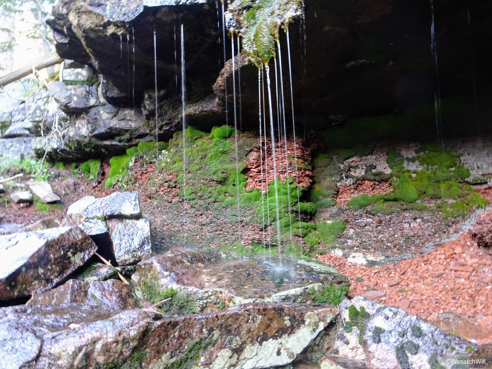
Small little grotto falls

Reflective tarn
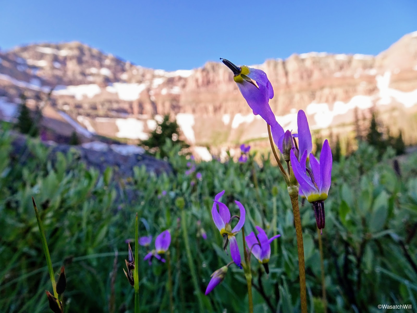
Shooting Stars

Allsop Lake inlet

Cathedral reflection

Indian paintbrush
Mountain brook

Cathedral reflection panorama

Yard Peak reflection
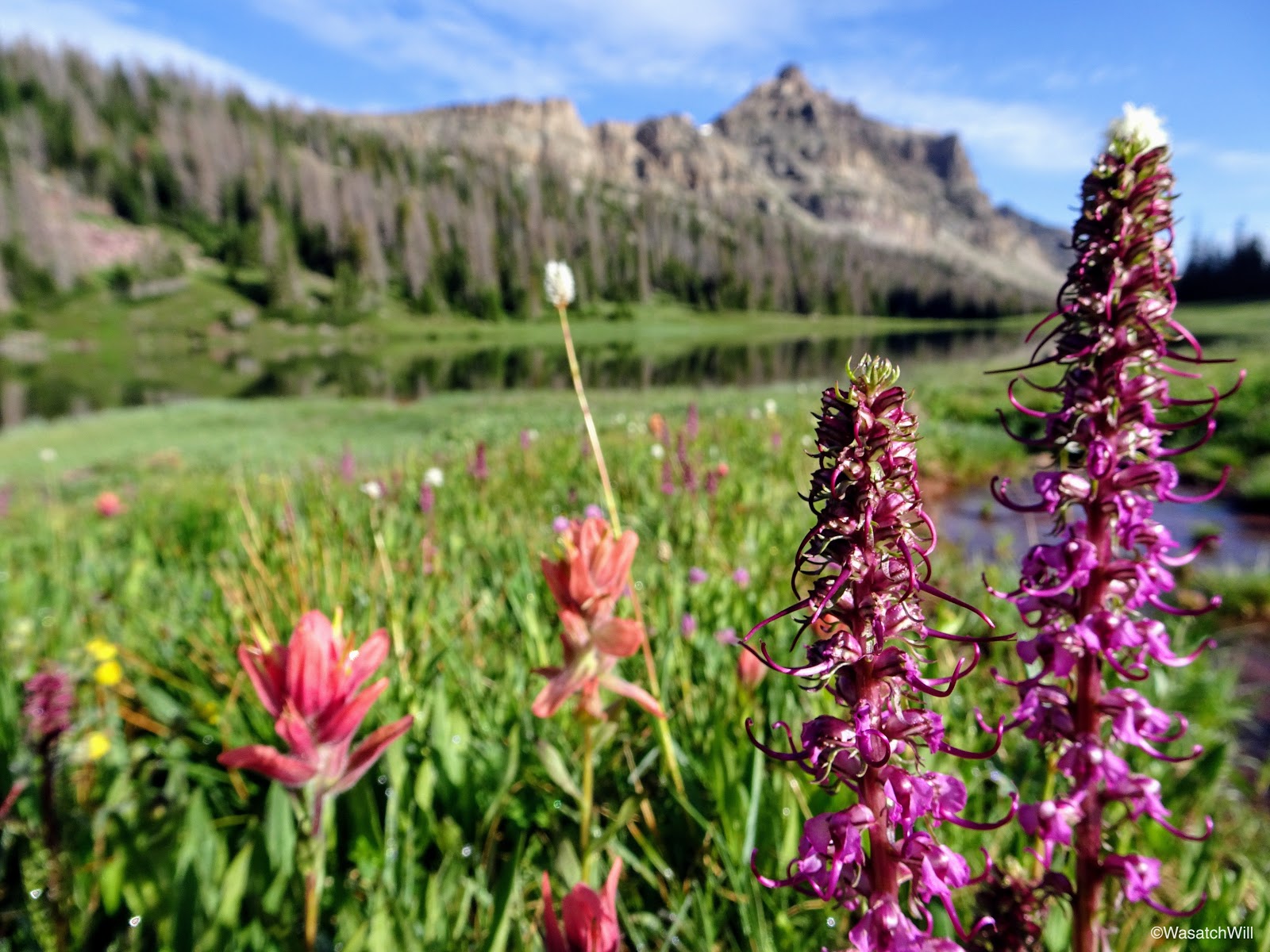
Indian Paintbrush and Elephant Heads
With my morning picture hunt complete, I returned to camp where we all packed up for the hike back out to the trailhead.
Back at camp
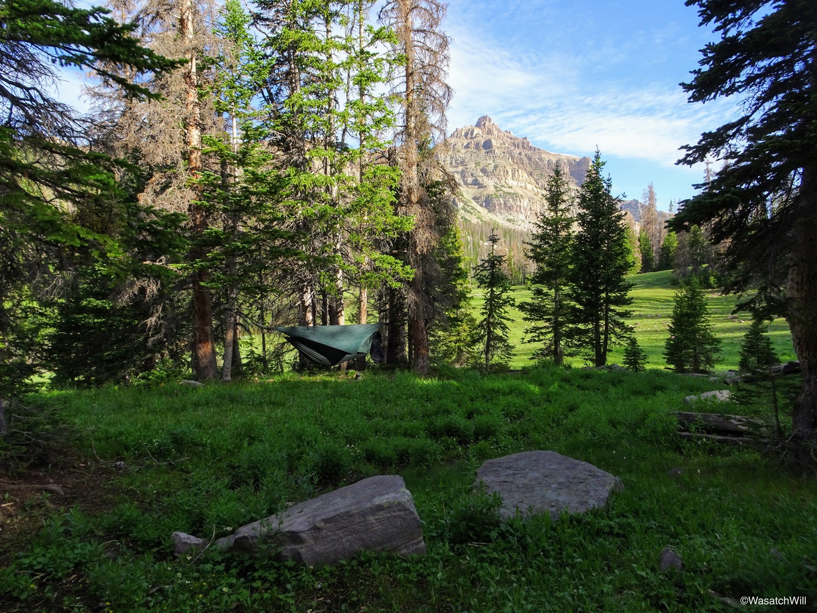
Blake's Hennessy Hammock
However, instead of keeping with the rest of the group to hike out, somehow I was able to convince Blake to lead me up to a spot he had stumbled into on his way up to the ridge we had hiked up the previous morning to check out a patch of pink flowers he had gotten some great pictures of. We chose to leave our packs back down at camp and retrieve them after. I'm not sure what type of flowers they were, but they were very, very small. I'm guessing they are a type of saxifrage. Apparently saxifrage does exist high up in the Uintas and but it's a rare flower up there.
Pink Saxifrage?

Pink Saxifrage?
Red Indian Paintbrush

Half moon
After successfully navigating up to the pink flower patch and back, we picked up our packs and set off down the trail. The little side trip we took ended up costing us an hour. Still, with Brett having suffered a bit of leg pain on the way up, we thought for sure the others would be taking it easy enough with lots of breaks so as to allow for Blake and I to catch them on the way back down somewhere.

Blake leading the way back down the trail with Cathedral above

The Cathedral (left) and its northern saddle (middle)

Moon over unnamed peaks north of Cathedral

Flower-filled meadow

Looking back up the trail toward Allsop Lake

The author heading down trail
Indian Paintbrush along side the creek

Looking across East Fork Bear River above waterfall and up right fork toward Priord drainage

Waterfall just above Left Hand fork between Allsop and Priord trails.
A wooded section of trail

East Fork Bear River

Remnants of a wildfire
Passing back by the cabin

Boardwalk

Fleabanes
Flower patch

Red, White, and Blue
Boardwalk through flower patch

Boardwalk through flower patch
So many flowers!
Indian Paintbrush jackpot!
Unfortunately, catching up with the rest of the group never happened. Fortunately for Brett though, that meant he had no trouble with any pain hiking back on down to the trailhead. As it turned out, Adam, Brett, and Jackson still ended up waiting nearly a whole hour for Blake and I to arrive. Fortunately, they were good sports about it. I think they enjoyed being able to use the time to change clothes, snack, and just lounge around a bit while they waited.
In the end, it was a weekend well spent. The scenery was incredible and the company, enjoyable.

The fab five!
VIDEO:
Last edited:
")
")