IntrepidXJ
ADVENTR
- Joined
- Jan 17, 2012
- Messages
- 3,488
Death Valley Trip 2013 | Day 8
Saturday, February 16, 2013
The Original Trip Report on ADVENTR.CO
Today would be my last full day in Death Valley National Park. I spent the day visiting a few popular areas of the park I had skipped over earlier in the week so I could at least check them out. While I would spend much of the day visiting new locations I did decide to return to Zabriskie Point again to catch another sunrise this morning. As usual, I arrived at Zabriskie Point well before the sunrise and before anyone else was there. Instead of going up by the main overlook, this time I went to a different location a little further to the south. I was expecting other people to show up and setup next to me, but luckily that never happened and I had this area to myself.
A view over the Zabriskie badlands in the soft dawn light.
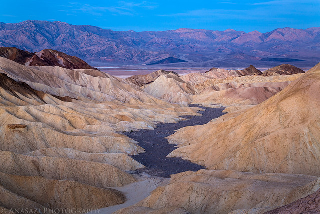
Soft Light by IntrepidXJ, on Flickr
Photographers lined up at the main viewpoint while I sat all by myself.
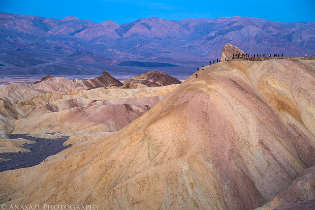
Dawn Lineup by IntrepidXJ, on Flickr
Early morning sunlight strikes the Panamint Range across the valley.
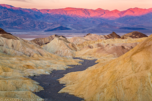
Zabriskie Point Morning View by IntrepidXJ, on Flickr
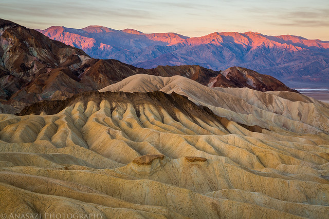
Badlands by IntrepidXJ, on Flickr
When I had the shots I had come for I got back to my Jeep and took the short drive through the nearby Twenty Mule Team Canyon.
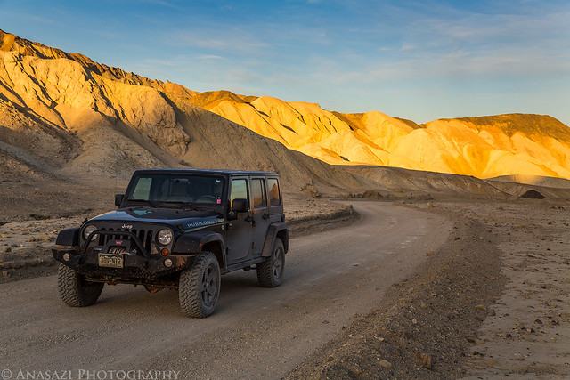
Twenty Mule Team Canyon Road by IntrepidXJ, on Flickr
Next up, I made my way back over near Stovepipe Wells and hiked into Mosaic Canyon before the sun was too high in the sky.
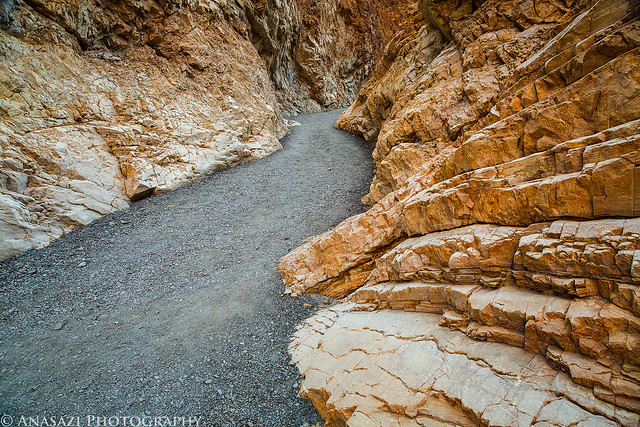
Mosaic Wash by IntrepidXJ, on Flickr
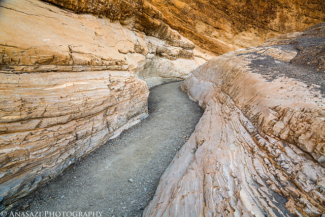
Mosaic Canyon by IntrepidXJ, on Flickr
I soon found myself following the Emegrant Canyon Road up into the Panamint Range. I first stopped at Aguereberry Point with a hazy view over Death Valley.
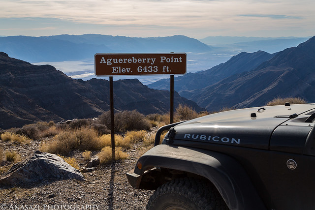
Aguereberry Point by IntrepidXJ, on Flickr
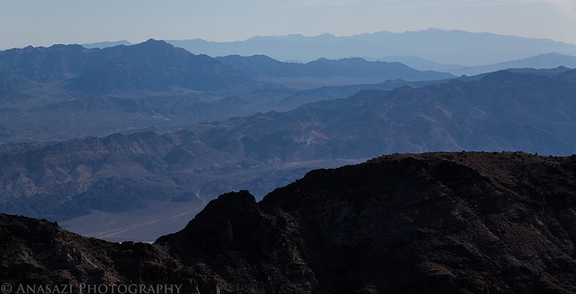
Haze & Mountains by IntrepidXJ, on Flickr
I made a quick stop at the Eureka Mine to explore the area a bit.
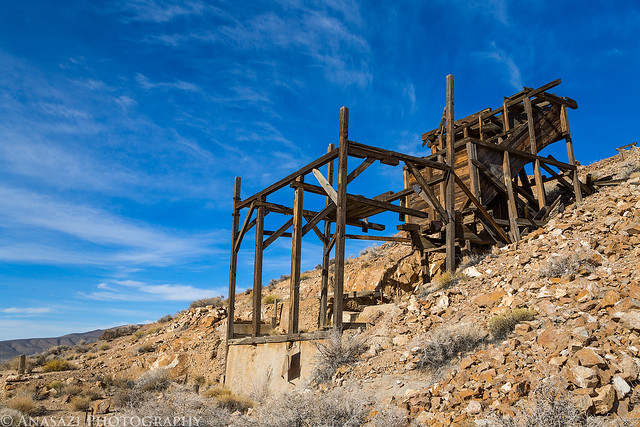
Eureka Mine by IntrepidXJ, on Flickr
I continued driving higher into the mountains until I reached the large and impressive Charcoal Kilns.
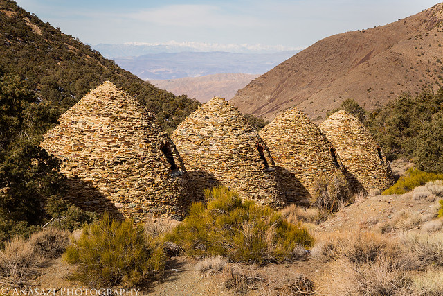
Charcoal Kilns by IntrepidXJ, on Flickr
Not far past the kilns I ran into a bit of snow on the road.
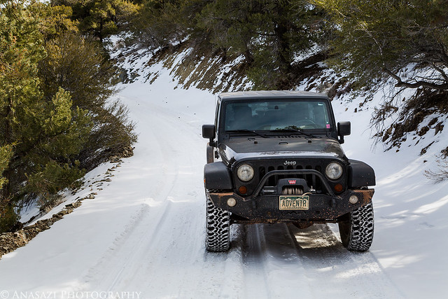
Snow by IntrepidXJ, on Flickr
Then I reached the end of the road at Mahogany Flat. At 8,133 feet, this is the highest point in Death Valley that I would visit this trip. One day I will have to return and hike to the top of Telescope Peak.
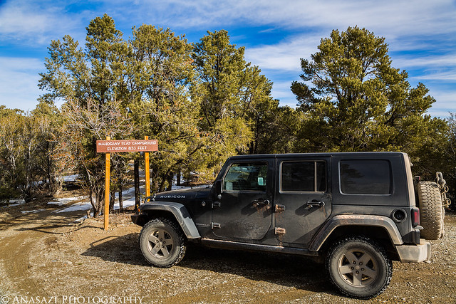
Mahogany Flat by IntrepidXJ, on Flickr
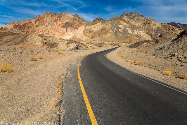
Next, I went from above 8,000 feet to below sea level so I could visit Artists Drive.
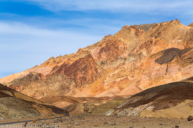
Artists Drive by IntrepidXJ, on Flickr
Artists Road by IntrepidXJ, on Flickr
I had some extra time before sunset, so I hiked up this unnamed wash where I ran into the canyoneering group that I was planning to camp with tonight. They had just finished descending a nearby canyon and were heading back to camp.
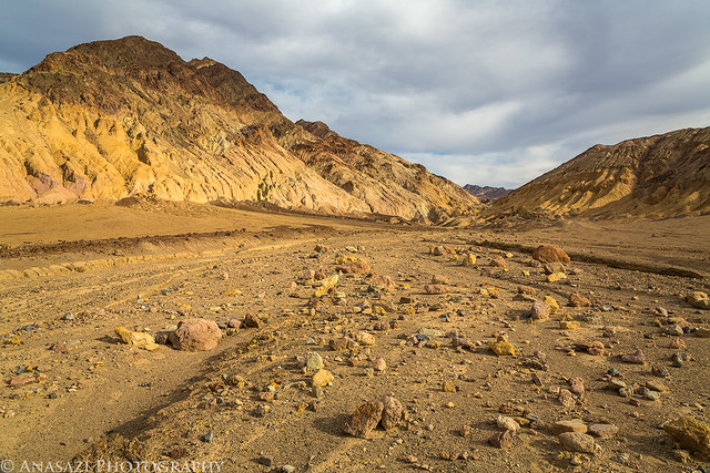
Unnamed Wash by IntrepidXJ, on Flickr
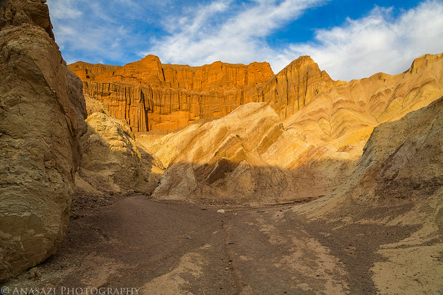
My last stop of the day was a nice sunset hike through Golden Canyon.
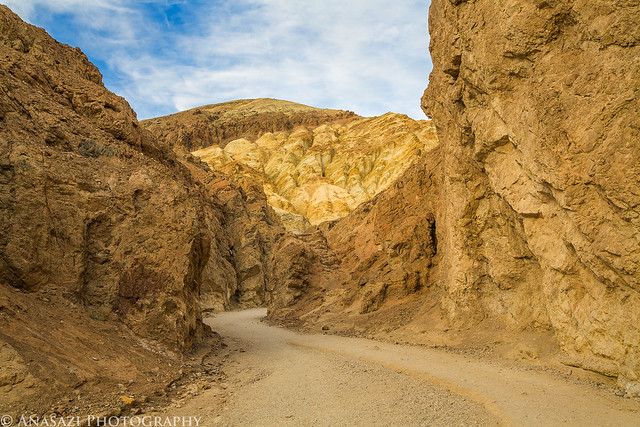
Golden Canyon by IntrepidXJ, on Flickr
Red Cathedral by IntrepidXJ, on Flickr
Last light of the day strikes Manly Beacon.
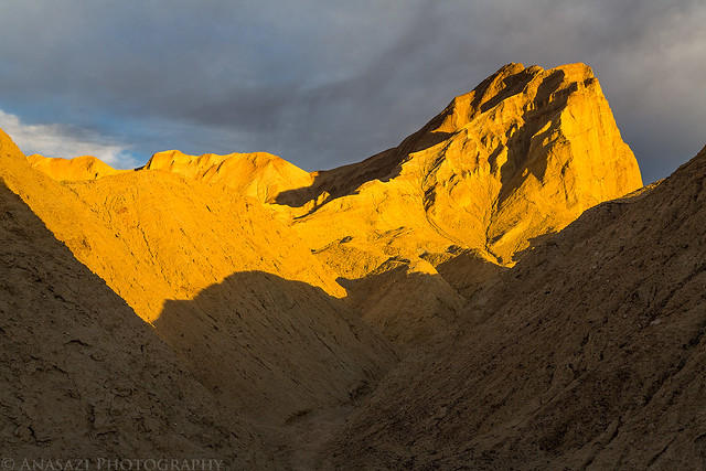
Manly Sunset by IntrepidXJ, on Flickr
As I was leaving Golden Canyon the sky lit up with color and I witnessed the best sunset of the week. Of course I pulled over and got a few photos!
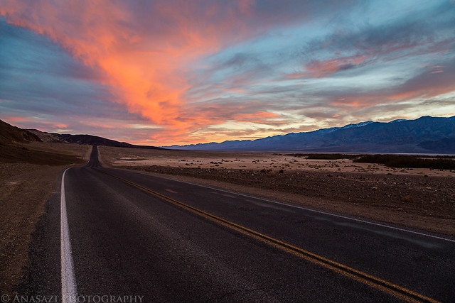
Badwater Road by IntrepidXJ, on Flickr
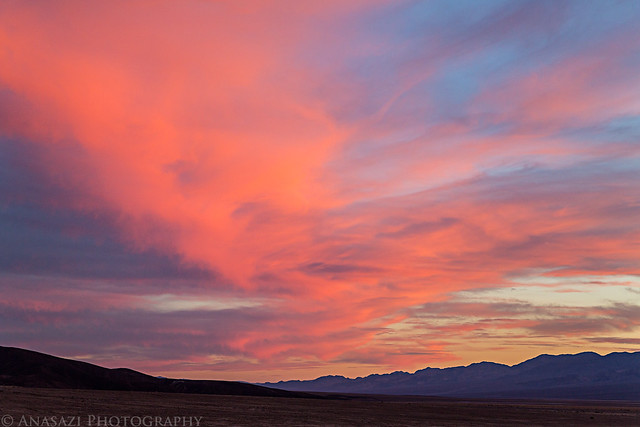
Death Valley Sunset by IntrepidXJ, on Flickr
When the light was gone I continued driving until I was just outside of the park where I met up with the canyoneering group at their campsite. I hung out around the campfire with them a little bit before heading off to bed. It was the only night of the trip I was camped with a group of people instead of by myself.
>> All Around Death Valley Photo Gallery
Featured image for home page:

Saturday, February 16, 2013
The Original Trip Report on ADVENTR.CO
Today would be my last full day in Death Valley National Park. I spent the day visiting a few popular areas of the park I had skipped over earlier in the week so I could at least check them out. While I would spend much of the day visiting new locations I did decide to return to Zabriskie Point again to catch another sunrise this morning. As usual, I arrived at Zabriskie Point well before the sunrise and before anyone else was there. Instead of going up by the main overlook, this time I went to a different location a little further to the south. I was expecting other people to show up and setup next to me, but luckily that never happened and I had this area to myself.
A view over the Zabriskie badlands in the soft dawn light.
Soft Light by IntrepidXJ, on Flickr
Photographers lined up at the main viewpoint while I sat all by myself.
Dawn Lineup by IntrepidXJ, on Flickr
Early morning sunlight strikes the Panamint Range across the valley.
Zabriskie Point Morning View by IntrepidXJ, on Flickr
Badlands by IntrepidXJ, on Flickr
When I had the shots I had come for I got back to my Jeep and took the short drive through the nearby Twenty Mule Team Canyon.
Twenty Mule Team Canyon Road by IntrepidXJ, on Flickr
Next up, I made my way back over near Stovepipe Wells and hiked into Mosaic Canyon before the sun was too high in the sky.
Mosaic Wash by IntrepidXJ, on Flickr
Mosaic Canyon by IntrepidXJ, on Flickr
I soon found myself following the Emegrant Canyon Road up into the Panamint Range. I first stopped at Aguereberry Point with a hazy view over Death Valley.
Aguereberry Point by IntrepidXJ, on Flickr
Haze & Mountains by IntrepidXJ, on Flickr
I made a quick stop at the Eureka Mine to explore the area a bit.
Eureka Mine by IntrepidXJ, on Flickr
I continued driving higher into the mountains until I reached the large and impressive Charcoal Kilns.
Charcoal Kilns by IntrepidXJ, on Flickr
Not far past the kilns I ran into a bit of snow on the road.
Snow by IntrepidXJ, on Flickr
Then I reached the end of the road at Mahogany Flat. At 8,133 feet, this is the highest point in Death Valley that I would visit this trip. One day I will have to return and hike to the top of Telescope Peak.
Mahogany Flat by IntrepidXJ, on Flickr
Next, I went from above 8,000 feet to below sea level so I could visit Artists Drive.
Artists Drive by IntrepidXJ, on Flickr
Artists Road by IntrepidXJ, on Flickr
I had some extra time before sunset, so I hiked up this unnamed wash where I ran into the canyoneering group that I was planning to camp with tonight. They had just finished descending a nearby canyon and were heading back to camp.
Unnamed Wash by IntrepidXJ, on Flickr
My last stop of the day was a nice sunset hike through Golden Canyon.
Golden Canyon by IntrepidXJ, on Flickr
Red Cathedral by IntrepidXJ, on Flickr
Last light of the day strikes Manly Beacon.
Manly Sunset by IntrepidXJ, on Flickr
As I was leaving Golden Canyon the sky lit up with color and I witnessed the best sunset of the week. Of course I pulled over and got a few photos!
Badwater Road by IntrepidXJ, on Flickr
Death Valley Sunset by IntrepidXJ, on Flickr
When the light was gone I continued driving until I was just outside of the park where I met up with the canyoneering group at their campsite. I hung out around the campfire with them a little bit before heading off to bed. It was the only night of the trip I was camped with a group of people instead of by myself.
>> All Around Death Valley Photo Gallery
Featured image for home page: