Aggasiz Peak

danger02ward

Love the Mountains!
Joined
Mar 1, 2016
Messages
402
In the summer of 2014 and 2015 I had the pleasure of joining some nice people on their annual summer uintas trip to pinto lake in the granddaddy basin. As I hiked around pinto lake, governor dern lake, and the four lakes basin I couldn't help but stare at beautiful Mount Aggasiz. The longer I stared the more I thought I need to climb that peak. So I am happy to report that last Friday on September 16th I was able to achieve my goal. Aggasiz is 12,433 feet. I talked my brother into joining me. I was a little disheartened as we got closer to the trailhead. There was some white stuff on the peaks that I wasn't expecting. I was afraid this might keep me from making it up to the peak. Nevertheless we pressed on to see how far we could get. We set off on the highline trail and headed into the naturalist basin. I was excited to finally make it into the naturalist basin for the first time. It was beautiful and this time of year we seemed to have the basin to ourselves. We only saw people at the trailhead and the beginning of the highline trail. View of Aggasiz from the highline trail.
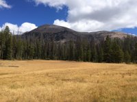
image.jpeg
its about 5 miles to the turn off into the naturalist basin. Creek below the two morat lakes. image.jpeg
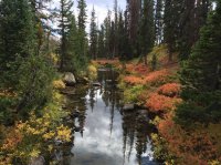
Getting closer. Aggasiz in the background. The morat lakes are above that ridge.
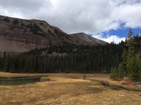
image.jpeg
One of the morat lakes from above.
image.jpeg
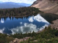
Climbing up the next ridge at about 6 miles in you get to beautiful blue lake.
Aggasiz above blue lake.
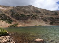
image.jpeg
The trail ends at blue lake. To get to Aggasiz you climb straight north up to the saddle seen in the middle of the picture below.
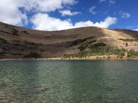
image.jpeg
Blue lake from just below the saddle.
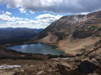
image.jpeg
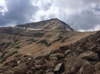
Aggasiz from just below the saddle.
image.jpeg

Aggasiz from the saddle.
image.jpeg

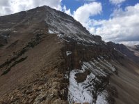
Time to climb the ridgeline.
image.jpeg
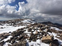
The trip to the top was quite a hike through large boulders.
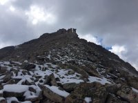
image.jpeg
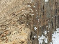
The snow did not help the matter but was not as slippery as I had feared.
Nothing like climbing up a good snowy Boulder field.
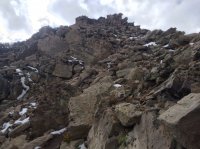
image.jpeg

The views from the top make it all worth it. Beautiful blue lake and the naturalist basin from the top of Aggasiz.
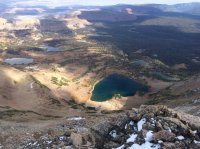
image.jpeg
Great view of middle basin with Ryder and mcpheters lakes and Hayden peak. image.jpeg
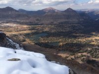
Spread eagle peak. Naturalist basin on the right and middle basin on the left.
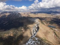
image.jpeg
View of Grandaddy basin with governor dern and pinto lakes.
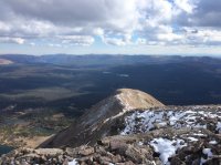
image.jpeg
View of the peak.
image.jpeg
I clocked my gps on the way down from the peak at 7.65 miles. Making it a nice day hike of 15.3 miles. We got back to the trailhead in the dark. It was a beautiful day.
 

Attachments

  • image.jpeg
    image.jpeg
    89.7 KB · Views: 44
Impressive! Quite the drop off of that ridge line. I was up in the area Friday night and was surprised when I saw snow up on Agassiz. Way to go!
 
Impressive! Quite the drop off of that ridge line. I was up in the area Friday night and was surprised when I saw snow up on Agassiz. Way to go!
Wow! That is a drop off indeed!

Sent from my SM-G920V using Tapatalk
 
Nice! the views are great and it is so great to see it from a different perspective.
I had wanted to go up the saddle, not the peak as I was not that motivated... but the weather was too consistent with a shower every hour or so. I plan on going back at some point and seeing more.

Pretty sweet to get up there in a day. Did you give any thought to descending down the west instead of back the way you came?
 
Impressive! Quite the drop off of that ridge line. I was up in the area Friday night and was surprised when I saw snow up on Agassiz. Way to go!
Thanks, I had read about the hike on summit post but was surprised by both the snow and the nice drop off.
 
Nice! the views are great and it is so great to see it from a different perspective.
I had wanted to go up the saddle, not the peak as I was not that motivated... but the weather was too consistent with a shower every hour or so. I plan on going back at some point and seeing more.

Pretty sweet to get up there in a day. Did you give any thought to descending down the west instead of back the way you came?

The view from the saddle was beautiful definitely worth going up for. I had read on summit post that there is a shorter steeper route called the west face direct route. It is 7 miles round trip from that route. I had thought about it briefly. It sounds like there is a lot of dead fall that way and a a lot of loose rocks on that route. My brother went with me and he didn't make it all the way to the top. So it wasn't really an option this time. Also we also took our fishing poles with us just in case we had time. When we passed the West Morat lake the fish were jumping but with the snow and the boulder fields it was pretty slow going. No time to fish. Loved your pictures.
What kind of camera are you using?

Thanks. I haven't been up there, but had contemplated going up to the peak if I go back with friends - not kids. So just wondering about the west side.

I have a Nikon d5200. It has been pretty solid.
 
Thanks. I haven't been up there, but had contemplated going up to the peak if I go back with friends - not kids. So just wondering about the west side.

I have a Nikon d5200. It has been pretty solid.

Your pictures look amazing. I thought my Iphone 5 did okay until I looked at your pictures of the same area. Are you doing anything fancy to process them after you take the pictures?
 
Your pictures look amazing. I thought my Iphone 5 did okay until I looked at your pictures of the same area. Are you doing anything fancy to process them after you take the pictures?

Thanks! I am still learning and dabbling. There are real pros here where I see the difference and push me to try to figure out what they did, and their results are awesome.
I do the majority of editing quickly in the camera raw plugin for photoshop, but photoshop itself is rarely used these days unless it is for panoramas, or lately when I have been playing with the NIK plugin. I use camera raw because the only thing I know to do when shooting is trying to keep the histogram not blowing things out. For some reason I am drawn to backlit flowers and leaves and such, so I don't know how to get those without doing some adjustments or a gradient. Sometimes, like the first photo, I do a lot of playing around to take it from something I probably didn't shoot right the first time, into something that I like. Just trying to learn and try different shots, and a few turn out.
It's therapeutic for me... not as much as slowing down and being outside... but it helps between adventures.
 
In any case, trying to not hijack the thread... your peakbagging and variety is awesome. I always add to the to-do list, but some reports move things higher up. Just need more time.
 
Great report! Awesome shots from on top of Mount Agassiz. I was in middle basin a few weeks ago and it's cool to see this basin from the top of Agassiz. Nothing better than the view from on top of a mountain. Thanks for the post.
 
Gorgeous! Nice job! I need to get back up there myself when there isn't so much snow to finish the job. Last time I was up there with hopes of getting on the summit of Agassiz, it looked like this...

upload_2016-10-15_22-25-29.png

For obvious reasons, I didn't continue on.
 

Don't like ads? Become a BCP Supporting Member and kiss them all goodbye. Click here for more info.

Back
Top