- Joined
- May 5, 2012
- Messages
- 1,732
Defying gravity, ignoring slope. It seemed the river was running backward. Spawning like salmon, the little waves crested on their upstream sides.
I could see the wind. It pushed across the surface of the river, turning it from chocolate-milk brown to frothy white. The curtain of air danced on the surface. The front edge hit me like a wall. It pushed the bow to the left, out of the current, into the eddy.
"Stop! #*%@ing stop already!"
Leaning forward, I pushed back. The paddle flailed. Blades dug deep, pulling for the eddy line. Tense arms ached from the effort.
The boat moved backward.
"I'm done! I'm done. I'm $^*&ing done!"
Wavelets lapped over the plump tubes and into the little raft, soaking my backside. Sandy wind whistled in my ears. Disrespectful of nature, I cursed the turbulence.
"You just aren't going to give me anything easy today, are you!?!"
No one could hear me. Someone 20 feet away wouldn't have been able to make out the words, which is good, since they were a sailor's melange.
The wind, of course, didn't care.
Angry and exhausted, feeling a worrying twinge in the left tricep, I looked down river into the waves. I gazed at the sheer walls rising hundreds of feet out of the water. Only one escape existed. Calloused fingers tightened their grip on the paddle's carbon fiber shaft.
"So be it. Let's get this done."
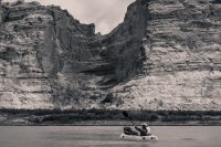
I can't remember exactly when @Nick first floated the idea of this route to me. It might have come in the dim amber campfire glow of another paddle trip, as we mused about the receding waters in Glen Canyon.
Dark Canyon to Cataract, then on to where the water grows still. A degree of romanticism existed in the idea of taking a lightly traveled route into the recovered river channel. Had anyone ever huffed boats down the Sundance Trail before? We couldn't possibly be the first, could we?
As with most such ideas, I figured we were either just that awesome or just that stupid. The only way to know for sure was to try.
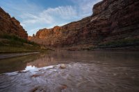
The forecast in the days leading up to our departure remained dry, but the projected wind speeds continued to grow. Undeterred, we did our best packing jobs on the packrafts. We loaded PFDs and paddles. We ran our car shuttle.
Finally, we started out on the road to the Sundance Trail.
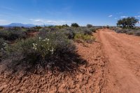
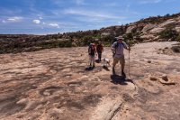
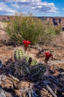
A degree of apprehension lingered at the back of my mind when we looked across the way to the giant rock slide that would provide access into the canyon.
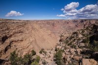
The view from the top helped dispel that unease.
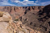
Late April afternoon heat had already taken its toll. We paused at the lip, bracing for the drop.
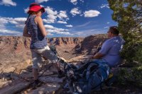
We were high and the way down was certainly steep, but doable.
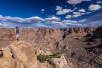
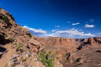
Did I mention it was steep?
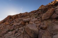
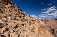
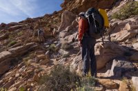
The descent took longer than expected.
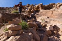
Three quarters of the way down, I decided to push on ahead with the group's water filter. We agreed to meet at the point where the Sundance meets the creek.
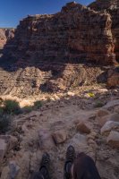
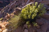
At last, the ground flattened.
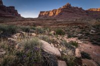
The canyon bottom beckoned.
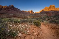
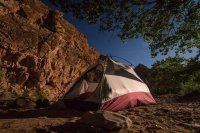
A choir of frogs serenaded my approach. Our planned rendezvous, it turned out, was also the most prime camping spot.
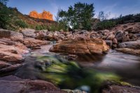
The frog song continued unabated for hours, well past the last of the day glow and after the rise of a bright desert moon.
[PARSEHTML]<iframe src="http://www.mappingsupport.com/p/gmap4.php?q=https://dl.dropboxusercontent.com/u/3847512/GPS/Dark_Canyon_entry.kml&t=t4" frameborder="0" marginheight="0" scrolling="no" width="800" height="800"></iframe><br><br>[/PARSEHTML]
Morning light drew us deeper into the canyon depths.
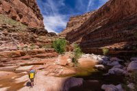
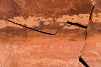
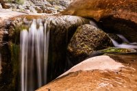
Encumbered with heavy packs, we made poor time. No one complained, except Jen with her occasional adoration of photographers.
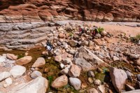
The trail took bypasses out of the constricted watercourse.
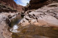
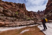
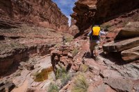
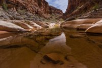
It became more interesting anywhere the water cut from red into gray.
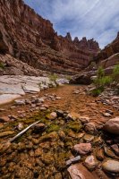
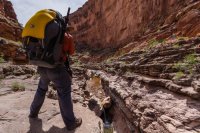
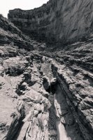
Watch your step.
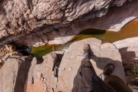
The higher we climbed up the canyon wall, the more its scale seemed to dwarf us.
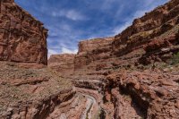
Can you see @colefeet?
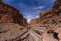
Here's a 100% crop. Can you see her now?
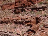
Our slow pace allowed plenty of time to gawk.
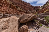
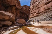
Each twist of the canyon revealed a new piece of stunning scenery.
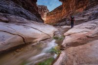
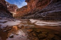
I could have remained in this grotto, decked with its twin cascades, for hours.
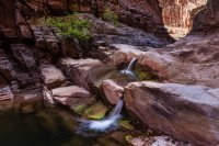
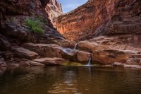
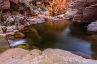
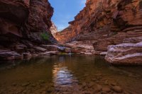
But the river called.
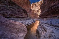
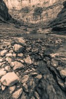
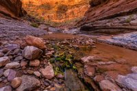
Powell's high water mark wasn't too evident, marked by a subtle layer of sediment.
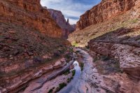
Nick wasn't a huge fan of this crawl.
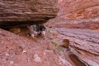
In some places, recovery made itself evident. There is life after Powell.
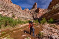
Elsewhere, lake deposits grew and grew into monstrous walls of eroded sand.
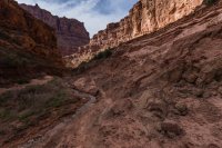
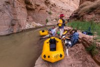
At last our path ended at the river's edge. The sun was sagging. We needed to move. Out came the boats.
[PARSEHTML]<iframe src="http://www.mappingsupport.com/p/gmap4.php?q=https://dl.dropboxusercontent.com/u/3847512/GPS/Lower_Dark_Canyon.kml&t=t4" frameborder="0" marginheight="0" scrolling="no" width="800" height="800"></iframe><br><br>[/PARSEHTML]
Testflight. We paddled out of the eddy and into the main flow of the current. A short float into the glare of sun brought our fleet aground on the bank.
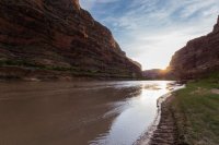
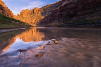
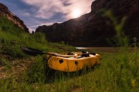
Daylight faded out with such a smooth decay, it was hard to mark the moment when night began. Jen and I tried to get some sleep, but Nick and @neiloro were feeling talkative. We all ended up staying awake longer than was wise, especially knowing an early morning awaited us.
[PARSEHTML]<iframe src="http://www.mappingsupport.com/p/gmap4.php?q=https://dl.dropboxusercontent.com/u/3847512/GPS/Cataract_leg_1.kml" frameborder="0" marginheight="0" scrolling="no" width="800" height="800"></iframe><br><br>[/PARSEHTML]
We rose before sunrise, buoyed by the hope of beating the winds. Saturday held promise of some intense gusts, with the worst expected in the afternoon.
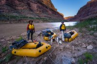
No sooner were we on the water than those hopes evaporated.
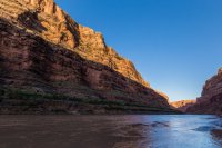
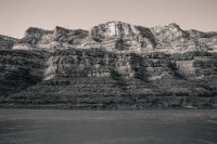
A steady press of air pushed up canyon, knocking our boats around. My camera remained safely lodged in a dry bag. I struggled to keep in the main current, finding the wind wanted to push my little boat off course. Jen, Nilauro and Nick all seemed to fare better, though all of us struggled to some degree.
Curls of sand whipped off the edges of the cut banks, blowing out over the water. Granules lodged in the corners of our eyes.
In need of a break, we pulled off at the mouth of Sheep Canyon. Even there, the wind didn't relent.
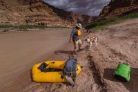
Like the eye of a hurricane, a brief moment of calm came as we floated around the back side of Millie Crag bend. It vanished before too long, bringing even stronger gusts.
The forecast had called for gusts in the 20-25 mile per hour range. MesoWest sensors in Hanksville recorded gusts in excess of 40 miles per hour. In Blanding, they topped 50.
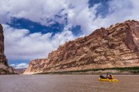
We battled our way to the end, fighting for every single stroke, every mile.
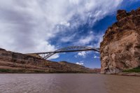
[PARSEHTML]<iframe src="http://www.mappingsupport.com/p/gmap4.php?q=https://dl.dropboxusercontent.com/u/3847512/GPS/Cataract_leg_2.kml" frameborder="0" marginheight="0" scrolling="no" width="800" height="800"></iframe><br><br>[/PARSEHTML]
Once out of the water, we ran to retrieve Nick's truck and enjoyed some well-earned refreshment at the small boat ramp across the river from Hite. Then, I waved goodbye to the group and struck out for the Swell.
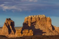
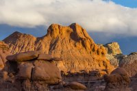
A couple friends from Australia were headed to Utah and had asked me to help them surprise their hosts with a photo of Goblin Valley.
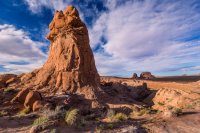
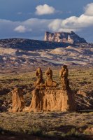
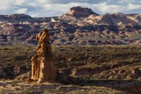
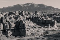
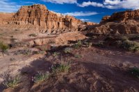
Although exhausted from 16 miles of hard paddling, I geared up with camera and tripod and headed into the park.
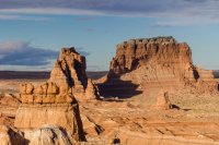
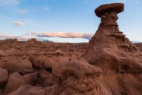
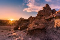
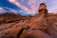
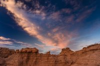
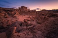
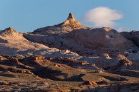
I had just enough fuel left in me to get out of the park as the stars emerged. The best camping spots were long since taken, but I managed to stake out a decent location not far off the road. It proved a perfect place to enjoy the sunrise on Sunday morning.
I could see the wind. It pushed across the surface of the river, turning it from chocolate-milk brown to frothy white. The curtain of air danced on the surface. The front edge hit me like a wall. It pushed the bow to the left, out of the current, into the eddy.
"Stop! #*%@ing stop already!"
Leaning forward, I pushed back. The paddle flailed. Blades dug deep, pulling for the eddy line. Tense arms ached from the effort.
The boat moved backward.
"I'm done! I'm done. I'm $^*&ing done!"
Wavelets lapped over the plump tubes and into the little raft, soaking my backside. Sandy wind whistled in my ears. Disrespectful of nature, I cursed the turbulence.
"You just aren't going to give me anything easy today, are you!?!"
No one could hear me. Someone 20 feet away wouldn't have been able to make out the words, which is good, since they were a sailor's melange.
The wind, of course, didn't care.
Angry and exhausted, feeling a worrying twinge in the left tricep, I looked down river into the waves. I gazed at the sheer walls rising hundreds of feet out of the water. Only one escape existed. Calloused fingers tightened their grip on the paddle's carbon fiber shaft.
"So be it. Let's get this done."

I can't remember exactly when @Nick first floated the idea of this route to me. It might have come in the dim amber campfire glow of another paddle trip, as we mused about the receding waters in Glen Canyon.
Dark Canyon to Cataract, then on to where the water grows still. A degree of romanticism existed in the idea of taking a lightly traveled route into the recovered river channel. Had anyone ever huffed boats down the Sundance Trail before? We couldn't possibly be the first, could we?
As with most such ideas, I figured we were either just that awesome or just that stupid. The only way to know for sure was to try.

The forecast in the days leading up to our departure remained dry, but the projected wind speeds continued to grow. Undeterred, we did our best packing jobs on the packrafts. We loaded PFDs and paddles. We ran our car shuttle.

Finally, we started out on the road to the Sundance Trail.


A degree of apprehension lingered at the back of my mind when we looked across the way to the giant rock slide that would provide access into the canyon.

The view from the top helped dispel that unease.

Late April afternoon heat had already taken its toll. We paused at the lip, bracing for the drop.

We were high and the way down was certainly steep, but doable.


Did I mention it was steep?


The descent took longer than expected.

Three quarters of the way down, I decided to push on ahead with the group's water filter. We agreed to meet at the point where the Sundance meets the creek.


At last, the ground flattened.

The canyon bottom beckoned.

A choir of frogs serenaded my approach. Our planned rendezvous, it turned out, was also the most prime camping spot.

The frog song continued unabated for hours, well past the last of the day glow and after the rise of a bright desert moon.

[PARSEHTML]<iframe src="http://www.mappingsupport.com/p/gmap4.php?q=https://dl.dropboxusercontent.com/u/3847512/GPS/Dark_Canyon_entry.kml&t=t4" frameborder="0" marginheight="0" scrolling="no" width="800" height="800"></iframe><br><br>[/PARSEHTML]
Morning light drew us deeper into the canyon depths.


Encumbered with heavy packs, we made poor time. No one complained, except Jen with her occasional adoration of photographers.

The trail took bypasses out of the constricted watercourse.


It became more interesting anywhere the water cut from red into gray.


Watch your step.

The higher we climbed up the canyon wall, the more its scale seemed to dwarf us.

Can you see @colefeet?

Here's a 100% crop. Can you see her now?

Our slow pace allowed plenty of time to gawk.


Each twist of the canyon revealed a new piece of stunning scenery.


I could have remained in this grotto, decked with its twin cascades, for hours.


But the river called.


Powell's high water mark wasn't too evident, marked by a subtle layer of sediment.

Nick wasn't a huge fan of this crawl.

In some places, recovery made itself evident. There is life after Powell.

Elsewhere, lake deposits grew and grew into monstrous walls of eroded sand.

At last our path ended at the river's edge. The sun was sagging. We needed to move. Out came the boats.

[PARSEHTML]<iframe src="http://www.mappingsupport.com/p/gmap4.php?q=https://dl.dropboxusercontent.com/u/3847512/GPS/Lower_Dark_Canyon.kml&t=t4" frameborder="0" marginheight="0" scrolling="no" width="800" height="800"></iframe><br><br>[/PARSEHTML]
Testflight. We paddled out of the eddy and into the main flow of the current. A short float into the glare of sun brought our fleet aground on the bank.


Daylight faded out with such a smooth decay, it was hard to mark the moment when night began. Jen and I tried to get some sleep, but Nick and @neiloro were feeling talkative. We all ended up staying awake longer than was wise, especially knowing an early morning awaited us.

[PARSEHTML]<iframe src="http://www.mappingsupport.com/p/gmap4.php?q=https://dl.dropboxusercontent.com/u/3847512/GPS/Cataract_leg_1.kml" frameborder="0" marginheight="0" scrolling="no" width="800" height="800"></iframe><br><br>[/PARSEHTML]
We rose before sunrise, buoyed by the hope of beating the winds. Saturday held promise of some intense gusts, with the worst expected in the afternoon.

No sooner were we on the water than those hopes evaporated.


A steady press of air pushed up canyon, knocking our boats around. My camera remained safely lodged in a dry bag. I struggled to keep in the main current, finding the wind wanted to push my little boat off course. Jen, Nilauro and Nick all seemed to fare better, though all of us struggled to some degree.
Curls of sand whipped off the edges of the cut banks, blowing out over the water. Granules lodged in the corners of our eyes.
In need of a break, we pulled off at the mouth of Sheep Canyon. Even there, the wind didn't relent.

Like the eye of a hurricane, a brief moment of calm came as we floated around the back side of Millie Crag bend. It vanished before too long, bringing even stronger gusts.
The forecast had called for gusts in the 20-25 mile per hour range. MesoWest sensors in Hanksville recorded gusts in excess of 40 miles per hour. In Blanding, they topped 50.

We battled our way to the end, fighting for every single stroke, every mile.

[PARSEHTML]<iframe src="http://www.mappingsupport.com/p/gmap4.php?q=https://dl.dropboxusercontent.com/u/3847512/GPS/Cataract_leg_2.kml" frameborder="0" marginheight="0" scrolling="no" width="800" height="800"></iframe><br><br>[/PARSEHTML]
Once out of the water, we ran to retrieve Nick's truck and enjoyed some well-earned refreshment at the small boat ramp across the river from Hite. Then, I waved goodbye to the group and struck out for the Swell.


A couple friends from Australia were headed to Utah and had asked me to help them surprise their hosts with a photo of Goblin Valley.


Although exhausted from 16 miles of hard paddling, I geared up with camera and tripod and headed into the park.


I had just enough fuel left in me to get out of the park as the stars emerged. The best camping spots were long since taken, but I managed to stake out a decent location not far off the road. It proved a perfect place to enjoy the sunrise on Sunday morning.


Last edited:

