- Joined
- Dec 11, 2015
- Messages
- 2,066
After postponing this trip in 2020 due to the pandemic, I was optimistic about attempting this trip in 2021, barring any crazy shifts in the world of Covid. My wife, son and I flew south, met with my brother-in-law and off we went. After a problematic first trip (my fault, a last-minute change put us in blowdown hell, TR coming) with my wife, son Riley, and brother-in-law, they dropped my son and I off at the trailhead in the evening, and off Riley & I went.
Earlier that day, we had stopped off at the local FS Ranger Station to inquire about water sources for this trek. The FS employee, who I think was a former backcountry ranger where we were headed, let us know that water was scarce up high but should be available if we were willing to look for it. With such a hot, dry summer and lots of limestone bedrock, water was a big concern for me.
Day 1.
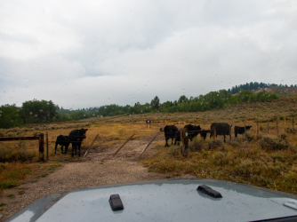
This is our trailhead. This picture was taken upon our return to pick up some items we had cached nearby at the start. The evening that we started was dry and sunny. The cows were also there when we started.
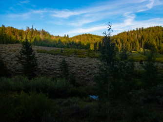
After following a Forest Service road for a couple miles, we left it behind, and headed cross-country. After an hour or so we found a nice campsite adjacent to a creek and set up camp.
Day 2
The next morning, as we left our campsite, we poked around an old cabin we had found the previous evening .
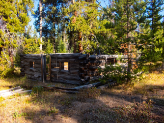
After hiking off-road, we hit a FS road and followed it a while, until we reached a trail that would take us north to camp. This trail led us through some beautiful country. Further up the trail we saw elk, mule deer, a goshawk, and a dead long-tailed weasel.
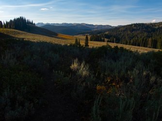
We reached our destination a little before dark, set up camp, watched some elk that had appeared on an adjacent ridge, and ate dinner.
Day 3.
The next morning, we woke to beautiful sunshine again.
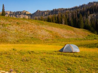
We ate a quick breakfast, packed and hit the trail, at least what there was of it.
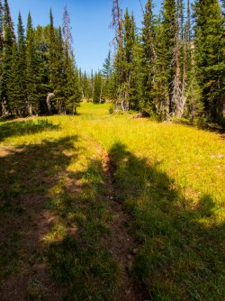
This trail took us to a small pass that was our jump-off point. We hiked up and through a low spot in the ridge to the right.
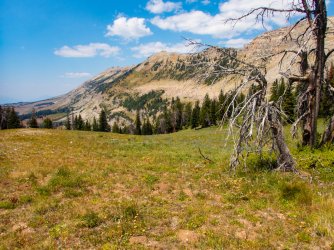
We take a break and Riley enjoys the view.
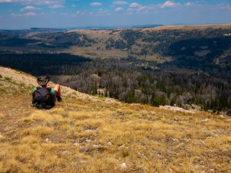
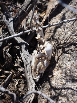
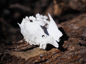
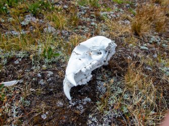
We hiked down and near the floor of the valley Riley finds this bear skull. He wrapped it up in his bandana and stashed it in his pack.
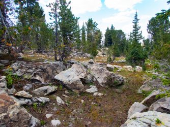
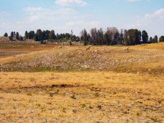
We headed west through a mix of terrains. The forest was a mix of spruce, whitebark pine, and some fir.
We eventually ran into a small group of pronghorns. We ran into a few more groups later in the day and the next day.
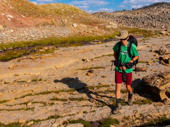
We eventually found a real nice water source along a moraine and stop to rest, hydrate, and refill the water bottles. This was a great relief as we had seen no water since our previous camp.
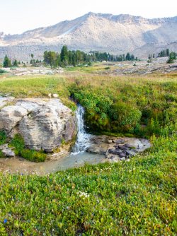
A little bit later we pass this little water fall.
An hour later I was wishing I had stopped at the waterfall for the night. The sun was hot and no water sources were visible.
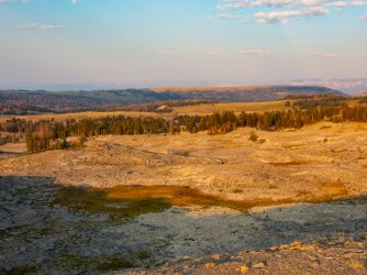
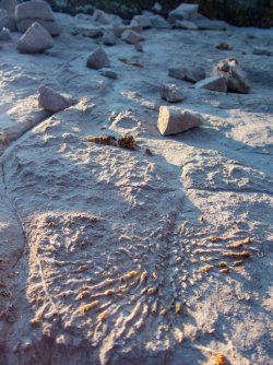
Along the way we did find lots of cool fossils.
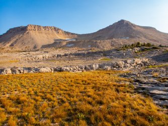
Camp was adjacent to this meadow, which was dry, like everything else up here. If needed, we could hike up to the snowfields for some water.
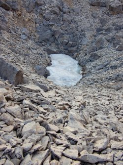
Before dinner, I roamed the area a bit and found this sinkhole just north of camp. Pretty convenient.
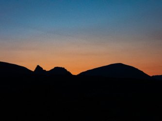
A nice sunset.
Day 4.
The next morning was another sunny one.
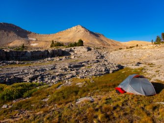
We left camp heading up the basin. This was the first time Riley has heard the word "moonscape" to describe an area, he thought it was appropriate.
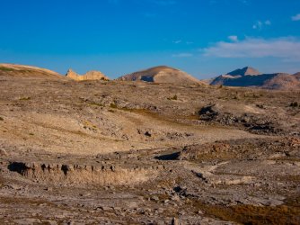
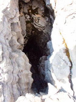
One of the many cracks and sinkholes we passed.
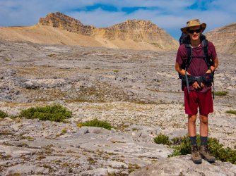
Riley and a prominent peak at the north end of the basin.
A sinkhole and the peak.
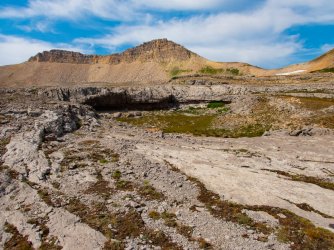
We had seen no water source since passing the snow in the sinkhole by camp. This was a great water source so we filled our bottles here.
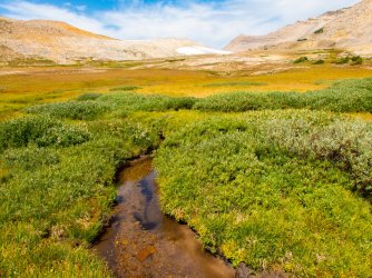
We hadn't seen a human trail all day but fortunately found some elk trails traversing this slope. There may have been some
old FS trails in the mix but we saw no blazes or anything else to suggest they were human-made. There was one set of
boot prints that we occasionally saw.
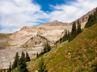
Riley was happy to reach this lake. He wanted to spend more time here but I felt the need to press on so I let him relax
here for a half-hour or so. We skirted to the left of the ridge behind the spruce to continue on.
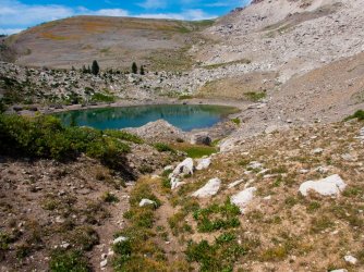
The view north along the ridge. There is a saddle behind the whitebark(?) tree on the left that we used to hike around to
the west side of the ridge.
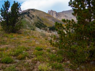
Again we found an old trail to contour this slope. Only elk tracks before us, and not many of those.
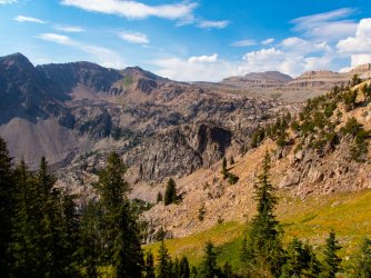
Our camp spot comes into view, on the far side of the pond.
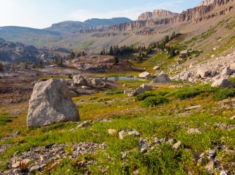
This massive boulder has come down since 2014 according to Google Earth imagery. For most of the trip, we have missed
smoke from all the wildfires burning. In the background you can see smoke moving in. By the next mid-morning it
was pretty much gone again.
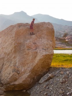
Day 5.
Another beautiful morning, with some smoke. The winds moved the smoke out pretty quickly.
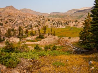
We continue northerly up valley.
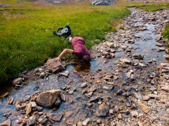
Riley trusting the local creek water at the top of the valley.
Approaching the top of the pass into the next drainage.
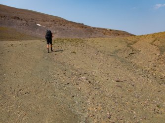
Riley taking in the scenery.
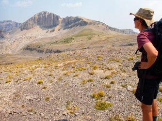
Since we left the high and dry basin, water has become much less of an issue. The scenery continues to impress us.
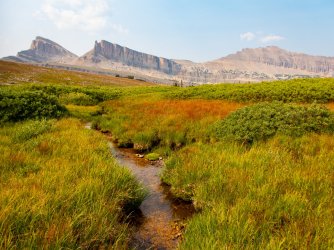
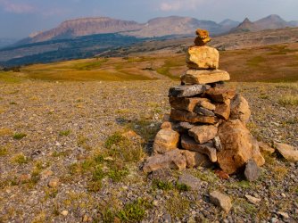
Looking back across the headwater basin, with the gratuitous cairn porn.
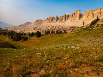
Dropping into the next valley.
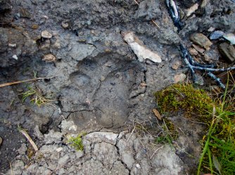
First bear track in a few days, a decent-sized black bear.
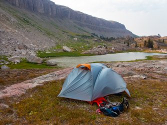
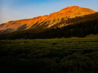
We reach the meadows. A quick hike through the willows and we find a nice spot to camp.
Day 6.
We head up the ridge to the west to reach the high country again.
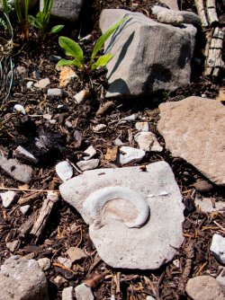
Another fossil.
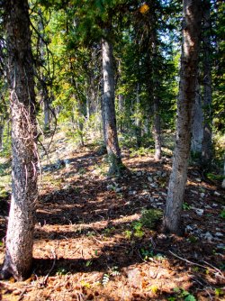
Using elk trails, we pass through a closed forest which pretty soon opens up until we reach the open country.
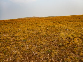
No real trails but the hiking is easy.
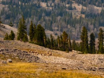
We bump into a band of bighorn sheep. After a few minutes, they panic and run off through the trees.
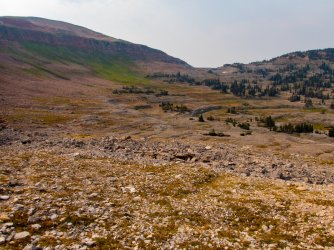
We continue across the basin heading for the next divide. The snowfield below the pass is our next water source.
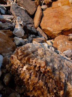
Just below the divide, we walk into an area filled with crystals. Here is one of the larger finds, almost a foot across.
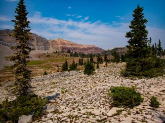
Riley heading into the next valley. At this point, he is ecstatic with the progress we've made and the overall experience.
There is a bench just above the thick group of trees that provides us with excellent drinking water as well as an easy
route across the slope. Before coming down from the previous divide a gyrfalcon flew over us, circling a couple times. A rare sighting.
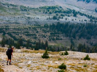
The bench. We passed a bear scat a little after this photo was taken.
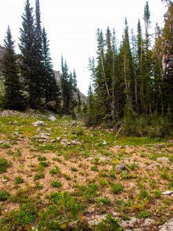
We eventually reach a good campsite. Water is scarce but we were able to fill up on the bench earlier.
More smoke moves in but is not too bad where we are, overall. I good flat spot to eat and camp.
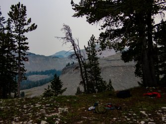
Day 7.
Heading out the next morning. A cooler morning with clouds and some smoke. Sort of a relief from the relentless sun.
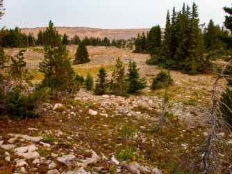
Looking back at the previous day's progress. Smoke to the south.
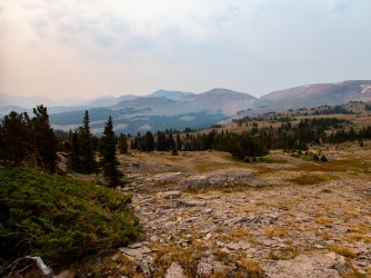
The view along the divide (not the Continental Divide).
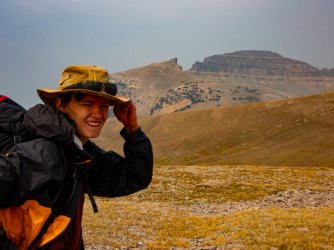
Riley happy in the wind with a major landmark behind him.
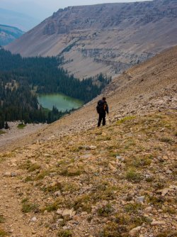
The trek off the ridge. Luckily there were sheep trails to enable us to hike down mostly unscathed, otherwise, this would have been hellish.
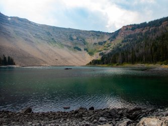
We reach a lake I have wanted to hike to for several years. Getting there was challenging with no trails in from the
direction we approached from but it was absolutely worth it.
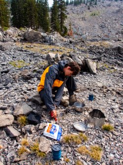
One of the coolest parts of this trip was Riley's desire to learn how to set up camp, run the stove, filter water, etc.
Here he is prepping the stove for use.
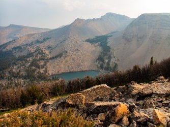
Looking down at the lake. We decided on an early dinner at the lake to provide the energy to hike up and out, which ended
up being a good decision. We still had a couple hours to camp.
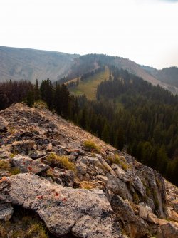
This ridge led us to the main ridge out. Once we hit that back ridge, it was pretty much downhill all the way to camp.
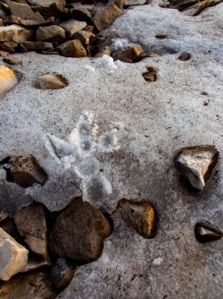
Once we topped the main ridge we caught a glimpse of something about 400 yards away moving quickly so
we went up to investigate. It had been on a snowfield so we looked for tracks and found these. The track is about
4 inches long. Give it a guess. Answer at the end.
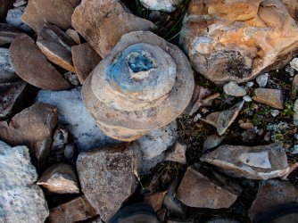
We also found this which is completely unrelated to the track.
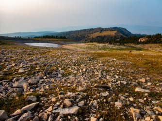
We continued down the ridge to camp.
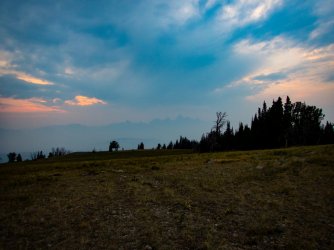
We went to bed with a great sunset augmented with cloud and smoke. Riley was really looking forward to the view of these mountains in the morning.
We climbed into our sleeping bags and I immediately started falling asleep. I then heard the sound of thunder to the southwest.
The thunder continued popping and growing louder. Pretty soon the flashes became visible. Soon enough, the wind picked up
and we felt the full brunt of the storm. Lightning was flashing every 8-10 seconds with louder and louder thunder. The rain was
pelting the tent hard. The wind gusted and flattened the tent to our faces. "Crap", I thought, this is where we die. We were camped
somewhat exposed so we could have a great view in the morning and here we are being hammered by a thunderstorm. The storm
continued for 30 - 45 minutes. Our tent was flattened another time but the poles did not break, luckily. The storm passed by us to
the west and then north, then northeast, seemingly circling somewhat. The nearest strike was 1/2 mile or so, but most were at least
a mile away.
Riley was enjoying the heck out of it all. Crazy kids.
Day 8.
I woke up the next morning and looked out. Everything was soaked but we were dry inside. I took a photo.
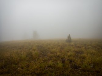
So much for great views. Riley eventually awoke and we packed and headed down. The rain came and went repeatedly.
On the way down we could smell ozone in spots and occasionally we would come upon this. It must have been rocking
and rolling.
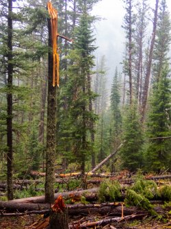
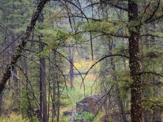
At one point we saw a cow and calf moose. This is the calf, the cow is off in the trees to the left.
We kept on going down, eventually hitting a refuge, some private land, the main river and then the town. Soaked.
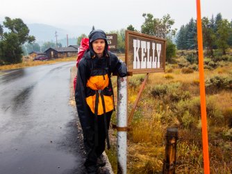
We really lucked out. We caught a ride within 2 minutes of sticking our thumbs out. The guy gave us a ride to the airport. I
went in to look for a rental and they actually had one, a Hyundai something. I said heck yeah and started signing paperwork. The
guy then asked if we'd mind upgrading to a 4-door Jeep Wrangler, no extra fee. I could not answer fast enough as I knew
we might be sleeping in it tonight. I grabbed the key, went out and drove the Jeep back to Riley.
He was craving mickey D's so off we went and gorged ourselves. Yuck, I hate McDonalds. Anyway, we drove back to our
starting point, grabbed our cached gear and headed back to find a place for the night, I knew of 2 places that I was willing
to pay for out east toward the pass and the first one had a room for $100, which we jumped on. We showered and
unpacked our gear to dry.
The next morning, we ate breakfast there (I love their breakfasts), packed, headed to the airport, dropped off the Jeep and
caught our flight out. Whew, did we luck out.
The track is from a golden eagle.
Earlier that day, we had stopped off at the local FS Ranger Station to inquire about water sources for this trek. The FS employee, who I think was a former backcountry ranger where we were headed, let us know that water was scarce up high but should be available if we were willing to look for it. With such a hot, dry summer and lots of limestone bedrock, water was a big concern for me.
Day 1.
This is our trailhead. This picture was taken upon our return to pick up some items we had cached nearby at the start. The evening that we started was dry and sunny. The cows were also there when we started.

After following a Forest Service road for a couple miles, we left it behind, and headed cross-country. After an hour or so we found a nice campsite adjacent to a creek and set up camp.

Day 2
The next morning, as we left our campsite, we poked around an old cabin we had found the previous evening .

After hiking off-road, we hit a FS road and followed it a while, until we reached a trail that would take us north to camp. This trail led us through some beautiful country. Further up the trail we saw elk, mule deer, a goshawk, and a dead long-tailed weasel.

We reached our destination a little before dark, set up camp, watched some elk that had appeared on an adjacent ridge, and ate dinner.
Day 3.
The next morning, we woke to beautiful sunshine again.

We ate a quick breakfast, packed and hit the trail, at least what there was of it.

This trail took us to a small pass that was our jump-off point. We hiked up and through a low spot in the ridge to the right.

We take a break and Riley enjoys the view.

We hiked down and near the floor of the valley Riley finds this bear skull. He wrapped it up in his bandana and stashed it in his pack.

We headed west through a mix of terrains. The forest was a mix of spruce, whitebark pine, and some fir.

We eventually ran into a small group of pronghorns. We ran into a few more groups later in the day and the next day.

We eventually found a real nice water source along a moraine and stop to rest, hydrate, and refill the water bottles. This was a great relief as we had seen no water since our previous camp.

A little bit later we pass this little water fall.

An hour later I was wishing I had stopped at the waterfall for the night. The sun was hot and no water sources were visible.

Along the way we did find lots of cool fossils.

Camp was adjacent to this meadow, which was dry, like everything else up here. If needed, we could hike up to the snowfields for some water.

Before dinner, I roamed the area a bit and found this sinkhole just north of camp. Pretty convenient.

A nice sunset.

Day 4.
The next morning was another sunny one.

We left camp heading up the basin. This was the first time Riley has heard the word "moonscape" to describe an area, he thought it was appropriate.

One of the many cracks and sinkholes we passed.

Riley and a prominent peak at the north end of the basin.

A sinkhole and the peak.

We had seen no water source since passing the snow in the sinkhole by camp. This was a great water source so we filled our bottles here.

We hadn't seen a human trail all day but fortunately found some elk trails traversing this slope. There may have been some
old FS trails in the mix but we saw no blazes or anything else to suggest they were human-made. There was one set of
boot prints that we occasionally saw.

Riley was happy to reach this lake. He wanted to spend more time here but I felt the need to press on so I let him relax
here for a half-hour or so. We skirted to the left of the ridge behind the spruce to continue on.

The view north along the ridge. There is a saddle behind the whitebark(?) tree on the left that we used to hike around to
the west side of the ridge.

Again we found an old trail to contour this slope. Only elk tracks before us, and not many of those.

Our camp spot comes into view, on the far side of the pond.

This massive boulder has come down since 2014 according to Google Earth imagery. For most of the trip, we have missed
smoke from all the wildfires burning. In the background you can see smoke moving in. By the next mid-morning it
was pretty much gone again.

Day 5.
Another beautiful morning, with some smoke. The winds moved the smoke out pretty quickly.

We continue northerly up valley.

Riley trusting the local creek water at the top of the valley.

Approaching the top of the pass into the next drainage.

Riley taking in the scenery.

Since we left the high and dry basin, water has become much less of an issue. The scenery continues to impress us.

Looking back across the headwater basin, with the gratuitous cairn porn.

Dropping into the next valley.

First bear track in a few days, a decent-sized black bear.

We reach the meadows. A quick hike through the willows and we find a nice spot to camp.

Day 6.
We head up the ridge to the west to reach the high country again.
Another fossil.

Using elk trails, we pass through a closed forest which pretty soon opens up until we reach the open country.

No real trails but the hiking is easy.

We bump into a band of bighorn sheep. After a few minutes, they panic and run off through the trees.

We continue across the basin heading for the next divide. The snowfield below the pass is our next water source.

Just below the divide, we walk into an area filled with crystals. Here is one of the larger finds, almost a foot across.

Riley heading into the next valley. At this point, he is ecstatic with the progress we've made and the overall experience.
There is a bench just above the thick group of trees that provides us with excellent drinking water as well as an easy
route across the slope. Before coming down from the previous divide a gyrfalcon flew over us, circling a couple times. A rare sighting.

The bench. We passed a bear scat a little after this photo was taken.

We eventually reach a good campsite. Water is scarce but we were able to fill up on the bench earlier.
More smoke moves in but is not too bad where we are, overall. I good flat spot to eat and camp.

Day 7.
Heading out the next morning. A cooler morning with clouds and some smoke. Sort of a relief from the relentless sun.

Looking back at the previous day's progress. Smoke to the south.

The view along the divide (not the Continental Divide).

Riley happy in the wind with a major landmark behind him.

The trek off the ridge. Luckily there were sheep trails to enable us to hike down mostly unscathed, otherwise, this would have been hellish.

We reach a lake I have wanted to hike to for several years. Getting there was challenging with no trails in from the
direction we approached from but it was absolutely worth it.

One of the coolest parts of this trip was Riley's desire to learn how to set up camp, run the stove, filter water, etc.
Here he is prepping the stove for use.

Looking down at the lake. We decided on an early dinner at the lake to provide the energy to hike up and out, which ended
up being a good decision. We still had a couple hours to camp.

This ridge led us to the main ridge out. Once we hit that back ridge, it was pretty much downhill all the way to camp.

Once we topped the main ridge we caught a glimpse of something about 400 yards away moving quickly so
we went up to investigate. It had been on a snowfield so we looked for tracks and found these. The track is about
4 inches long. Give it a guess. Answer at the end.

We also found this which is completely unrelated to the track.

We continued down the ridge to camp.

We went to bed with a great sunset augmented with cloud and smoke. Riley was really looking forward to the view of these mountains in the morning.

We climbed into our sleeping bags and I immediately started falling asleep. I then heard the sound of thunder to the southwest.
The thunder continued popping and growing louder. Pretty soon the flashes became visible. Soon enough, the wind picked up
and we felt the full brunt of the storm. Lightning was flashing every 8-10 seconds with louder and louder thunder. The rain was
pelting the tent hard. The wind gusted and flattened the tent to our faces. "Crap", I thought, this is where we die. We were camped
somewhat exposed so we could have a great view in the morning and here we are being hammered by a thunderstorm. The storm
continued for 30 - 45 minutes. Our tent was flattened another time but the poles did not break, luckily. The storm passed by us to
the west and then north, then northeast, seemingly circling somewhat. The nearest strike was 1/2 mile or so, but most were at least
a mile away.
Riley was enjoying the heck out of it all. Crazy kids.
Day 8.
I woke up the next morning and looked out. Everything was soaked but we were dry inside. I took a photo.

So much for great views. Riley eventually awoke and we packed and headed down. The rain came and went repeatedly.
On the way down we could smell ozone in spots and occasionally we would come upon this. It must have been rocking
and rolling.

At one point we saw a cow and calf moose. This is the calf, the cow is off in the trees to the left.

We kept on going down, eventually hitting a refuge, some private land, the main river and then the town. Soaked.

We really lucked out. We caught a ride within 2 minutes of sticking our thumbs out. The guy gave us a ride to the airport. I
went in to look for a rental and they actually had one, a Hyundai something. I said heck yeah and started signing paperwork. The
guy then asked if we'd mind upgrading to a 4-door Jeep Wrangler, no extra fee. I could not answer fast enough as I knew
we might be sleeping in it tonight. I grabbed the key, went out and drove the Jeep back to Riley.
He was craving mickey D's so off we went and gorged ourselves. Yuck, I hate McDonalds. Anyway, we drove back to our
starting point, grabbed our cached gear and headed back to find a place for the night, I knew of 2 places that I was willing
to pay for out east toward the pass and the first one had a room for $100, which we jumped on. We showered and
unpacked our gear to dry.
The next morning, we ate breakfast there (I love their breakfasts), packed, headed to the airport, dropped off the Jeep and
caught our flight out. Whew, did we luck out.
The track is from a golden eagle.
Last edited:

