- Joined
- Jan 4, 2015
- Messages
- 2,886
April 2015. I drove down to Cedar Mesa, intending to hike the class Fish/Owl loop. I stopped by the ranger station to collect my permit. The road to Fish and Owl, the kindly volunteer ranger told me, was impassible. Too much wet clay.
Fortunately, I had thrown my third-edition Kelsey book in my car before I left. Michael Kelsey is an interesting feller - he hikes outlandishly quickly, denominates everything in metric, spells it "fotos", and home-publishes his book - as I could tell from the fact that he skips pages 65-96, and duplicates pages 97-128 in my copy. Still, I at least one resource to come up with a Plan B. On the spur of the moment, I got a permit for Slickhorn Canyon, and was on my way.
The story turns out predictably. the cryptic maps and vague descriptions proved inadequate, and I had to turn around before I got to my intended destination, the San Juan River. It bugged me to turn around, all the more because I didn't know exactly how close I'd gotten to the river. Darn those maps.
Fast forward a couple years. I had a free long weekend over MLK Day Sale, and no commitments or obligations for the first time in what seemed like forever. And I wanted redemption for my first Slickhorn misadventure.
This time I printed out USGS topos prior to heading out. I still couldn't find a ton of information online, but Kelsey, reassuring as always, indicated that both Slickhorn and its unnamed neighbor to the south could be hiked all the way to the San Juan. Hmph. We'll see.
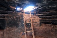
I dropped into Slickhorn #1. I had heard horrible things about the pouroff bypass immediately above Perfect Kiva, but aside from some slow/careful going, I didn't fine it too bad. I was the first visitor in two weeks to Perfect Kiva, per the ammo box log. I didn't make great time that afternoon; although the walking wasn't too difficult, I soaked in the relaxation of being at home in the wilderness - the first time in three months I'd had the chance. I stopped and saw a couple ruins and pictographs along the way. Around mid-afternoon, I set up a nice camp in a place that I hoped wouldn't be too cold overnight.
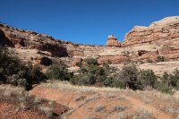
The night was clear but not particularly cold underneath my lush juniper, and I got an early start. Frost covered much of the canyon bottom, and all the recent rain had frozen into sheets of along the tops of potholes, suspended over nothingness. I played the ice drums like a drum kit - some of them sounded like snares, some like toms, and the big potholes sounded like base drums. Middle school jazz band finally paid off.
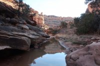
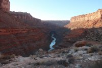
I made consistent time throughout the morning, even as the terrain grew more challenging. Constant boulders in the canyon bottom blocked quick progress, and I found myself doing a little buttsliding and a little climbing. As I neared the San Juan, the canyon fell away in a series of endless, unnavigable pouroffs. I jumped on a bench-like formation and cruised down to the San Juan - or at least, down to a point four hundred feet below the San Juan. What a lunch spot!
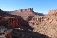
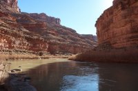
A four wheel drive road made for quick time, although I took a side trip down to the river to check out the confluence. I cruised the bench most of the afternoon with spectacular views through the river canyon, and turned into another unnamed canyon shortly before dark. The canyon proved to be the perfect mix of challenging, interesting scrambling. There was always a way forward, even if it involved a little adventure. I found a flat rock to throw my sleeping bag on for the night.
Another temperate night. I had no idea what time it was. I had forgotten my watch in the hurry of a last-minute pack job, I'd forgotten my phone in the car, my iPod (which I only carry in the deep winter when nights are long and I need a little entertainment in the evening) had given up the ghost, and my camera's battery was on its last legs.
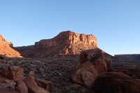
Never in my life have I had zero ability to tell what time it was for hours or days on end. It was a little unnerving at first, but I grew to appreciate it. I've always preferred living life by the sun - getting up when it's light, no alarm clock needed, and going to bed when it's dark. This was a different experience though - and not one that was altogether unpleasant. Obviously exhausted from several months of too much work and too little sleep, I slept through the long January night anyhow.
My camera died the next morning, after one picture. But I continued upcanyon, and the canyon continued to change. Forks appeared, with no discernable trail or sign of human presence. I followed my map closely as I ducked through thick, annoying brush. Near the top of the canyon, I tanked up on water. Water had been everywhere; every single pothole was either full, frozen, or both. But this was my last water before I left the canyon.
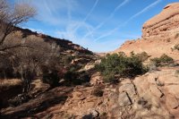
Kelsey claims that there's a stock trail out the top of the canyon. I don't know if that's true or not, but I was feeling pretty confident after navigating a canyon whose status had been a total mystery to me. So naturally, I took a different fork near the top and put together a really interesting , scrambly, highly scenic exit to the canyon. I saw some more Indian ruins along the way, but alas my camera was dead.
From there, it was a simple hike back to my car.
I'm so glad I came back to Slickhorn - maybe this time a little older, and a little wiser. Certainly more appreciative of this endangered space. If this landscape isn't worth protecting, I don't know what is.
