OldBill
Member
- Joined
- Aug 18, 2015
- Messages
- 564
First, my apologies as this story pales in comparison to the epic journeys many have posted here. But, thought I'd share it as several on this board and at bpbasecamp helped with the planning.
On my 20th year of visiting the area, I was doing it solo again. My nephew bailed a few weeks before as he just had a big promotion and needed to relocate. My GF couldn't get the time off.
So, this became a mostly fishing trip. I like to target a specific location and have decent weather to make it worthwhile. I do shorter backpacks of 3-5 days so I can also fish the major rivers in the front-country and visit totally different parts of the range.
When going for golden trout, it's custom not to provide the name of the lake. I had heard of reports of large goldens being taken in a drainage. I recognized the “no-name” lake, confirmed it with the poster offline and checked with others regarding routes. I want to thank Rich Osthoff for getting his MegaScud flies out to me before I left.
I spent the first night at Signal Mountain CG in GTNP. Nice sunset and cool, foggy morning.
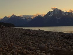
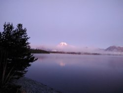
Since I just slept in the back of the SUV, packing up was easy and I left early for Lander. The weather report was showing a system coming in 4 days, so rather than 1 more day of acclimation, I decided to hit the trail the following morning. A little risky as SAR devotes a fair amount of resources to folks that aren't properly acclimated. But, figured I'd take it slow and there wasn't a lot of major climbing involved: only a ~1200' gain over several miles. The plan was to basecamp at the end of a use-trail, then dayhike to the golden lake via a faint use-trail.
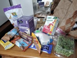
My trail diet leaves something to be desired...I eat what I want, but the bars do get old... I'd made 2 turkey wraps for the first day and had some beef jerky as well.
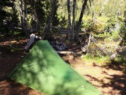
After leaving the main trail, I saw or heard no one until I returned. I found an established campsite at the end of the trail. Set up camp late afternoon and was treated to a nice sunset. Didn't bother with a campfire.
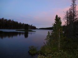
The next morning was beautiful. Took my time with breakfast and a second cup of coffee, then strapped up for the “trail” to the lake. I had downloaded the gps-enabled map to my phone with the path marked, but as most know a lot of this is common sense and following whatever sign there is.
There were a few cairns and sometimes the trail was obvious. Other times, it was absent, in which the “continue in this general direction”, occasional backtrack-and-start-again game begins. After crossing this stream there was some disagreement with the mapped trail, but there was clear sign of “some” trail there. Fighting willows is never fun and somehow, they always seem to “eat” trails.
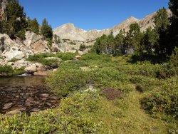
This is a view back along the final bit of the “trail” to the lake although, again, it deviated from that on the map. On the way back, I chose the map route, which frankly wasn't any better.
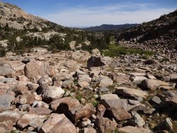
Anyway, I arrived late morning and the wind was blowing straight towards me making whitecaps though they don't show up well in the shot.
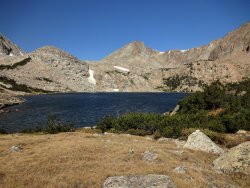
I spent the next 3 hours fishing with both spinning gear (Jake's Money Clip) and the MegaScud without seeing a single fish. Well, it's nice scenery anyway. So, I returned to camp, had a cold dinner and decided not to bother trying the lake again the next day. I broke camp and left about 9:30, really appreciating the speed at which I could travel on a well defined trail.
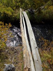
Luckily, these logs were dry or I wouldn't bother crossing on this.
I made it back to the car late afternoon, trading fishing notes with just 1 inbound hiker. I dumped my pack, pulled out a few things, changed into fresh socks and shoes and went back to town for a decent meal and shower. Only the next morning when loading the car did I realize that I had left my hiking poles and fishing rod at the trailhead!
So, throwing everything in the car in a hurried checkout, I buzzed up a series of switchback in heavy rain and sleet. But, everything was gone. I checked the kiosk and the restroom area, then headed on back. Stopped in the the FS office to leave contact info in case someone turned it in, but figured that was unlikely. My tent requires poles to set up, so I headed to a local outdoor store which had the newer version. Bought that as well as another canister of bear spray as my next stop was Dubois and I wanted to fish East Fork. Oh well. It's not the first time I've forgotten stuff at the TH. Hope whoever picked it up enjoys the equipment. At least I still had my fly rod.
Pulled into my favorite campground just outside of Dubois and set up camp. Couldn't get a good set with the foot of the tent. Pulled up a Y stake using a stick on the prongs, which slipped and I found my finger ripped open. This was not going well.... Luckily, the medical clinic was quite close so a few stitches and several curses later, I was finishing my setup.
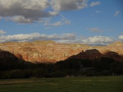
Headed out the next morning to fish East Fork after picking up a few flies at the local shop. The water was low so going too far upstream wasn't an option. I started by fishing Wiggen's Fork just before the confluence but only had a whitefish and a missed take. Caught another few whitefish in East Fork, but no cutthroat. There were quite a few other fisherman at the walk-in sites. More than I usually see. The campground was also more fully occupied than usual. Scenic area though.
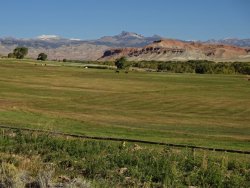
The next day I returned to a few different locations on the East Fork. I had a few missed opportunities, but it was slow. Chatted with one fellow that said it was slow for him as well. I was swinging nymphs. He suggested grasshopper or stimulator. Neither of those worked for me in the next hour or so. Might be a matter of timing too. Bright skies and low water make for wary fish, even in the deeper holes I was targeting. So, gave it up and hit one of my favorite spots on the Wind River but surprisingly, only had 1 fish (yep, whitefish again).
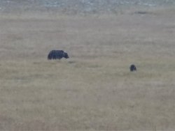
Weather was turning again, so I was using the next day as a travel day to Pinedale. It was snowing good near Togwotee Pass. Saw a truck on the side of the road so I pulled over and got to watch a sow and her cub tearing up the meadow. They slowly meandered towards the road, so I finally got a chance of fair photo with my simple p&s camera. I had originally guessed black bear, but when enlarged, it looks like that distinctive grizzly hump and dish face is there.
Grabbed a few supplies passing through Jackson and got to Pinedale in time for to use the shower at the Aquatic Center, then headed to camp at Fremont Lake. The next day was pretty miserable with more sleet and rain so I just did laundry, visited the FS office to check on a permit for next year and pondered how to make the best use of time with the forecast.
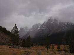
While the next day was still sleet/snow/rain but was supposed to be “isolated”. I decided to head to Green River Lakes TH to at least stretch my legs going into Clear Creek canyon. There were a few spots where the SUV rental was sliding a bit, but it was manageable. Sometimes the photos in stormy conditions turn out OK.
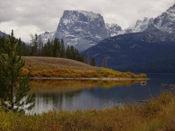
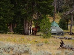
I noted the bear fence passing this camp in the meadow.
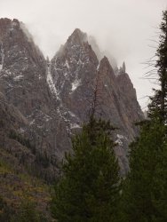
Somehow the peaks of Mordor come to mind when I see the pinnacles of Osborne:
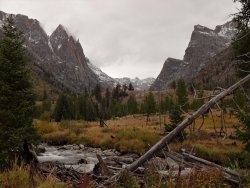
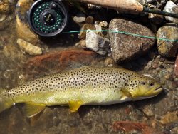
It started snowing fairly fast shortly after this so I stowed the camera and made good time back to the car. The next day it looked like the system was just cold and drizzle so I decided to fish the upper Green. It usually yields some trout (as well whitefish) and didn't disappoint. Not as fast as I've sometimes encountered but at least I have a photo proving I can catch a fish! A few other photos didn't come out well and I lost a few as well. Always fun there.
The weather system finally cleared out the next day but temps were dropping significantly. I decided to opt for a few days in East Fork/Desolation canyon vs Bear Basin. Really wanted my spinning outfit for the hike into Bear Basin and needed a bigger weather window.
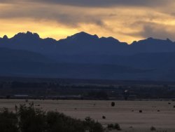
It was an easy stroll to Skull Lake, though I stopped to chat with several folks, 2 on their way out and 1 young hiker I shared the trail with until he left for Shadow Lake. It was great to see the reaction of the 2 younger guys on their first trip to the Winds. I doubt it will be their last! Didn't see anyone else for 48 hours.
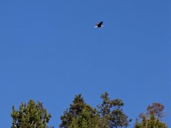
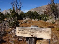
I didn't see a great spot to camp at the top of Skull so set up in under trees in a level area. Exploring later, I came upon established campsites not too far away, nearer the lake. Got cleaned up, had another cold dinner and enjoyed the sunset.
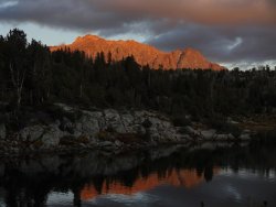
It was chilly early morning. I have an old 10F WM Versalite and Xlite pad. Probably low 20's so I've been in colder conditions. At times I felt a chill, but that may be from being too warm in spots and having a draft hit those. Sometimes it's hard to keep from sweating at times before the temps fall enough to zip fully up.
I took my time the next morning as the dayhike to Desolation Valley wasn't long and the first half to Pyramid Lake was heavily trodden.
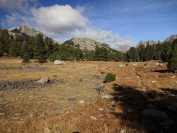
Midsummer's Dome in the center:
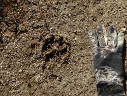
Probably a dog. I heard one barking near Mirror Lake on the way out.
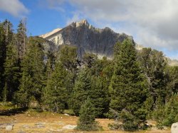
Maes Lake:
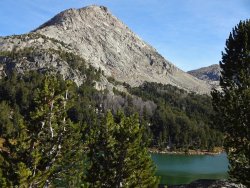
Pyramid L, looking NW:
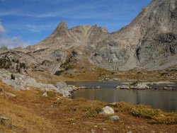
This is where the official trail ends and a use trail begins. Following that as outlined on the map it was fairly obvious, but disappeared at times. Still, a simple matter to head towards the obvious pass into East Fork valley. Great views back towards the Cirque too. On the return, I found a much more heavily trodden trail near Pyramid that didn't quite match up with the map. No cairn marking it's junction with the main trail, but good to know next time.
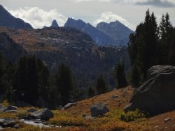
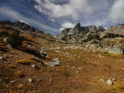
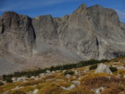
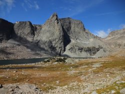
All this to myself, as far as I was able to tell. Part of why I love coming out here this time of year.
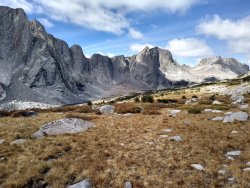
The trail was pretty much gone at this point. I just contoured around the slope, at times using the map to keep on the “trail”. Sometimes that helped find a route through pines or willows that wasn't immediately obvious. I went as far as across from Raid Peak, paused to take it all in then headed back.
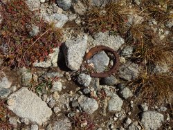
Yep, some form of trail is here...
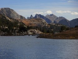
Views of the Cirque on the return to camp.
Another cold night. Heavy frost in the morning. Struck camp and headed out.
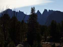
The backside of the Cirque is just as good as from Lizard Head Meadow. Even viewed in early morning silhouette.
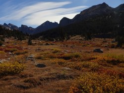
Marms and Dad's Lake in the distance:
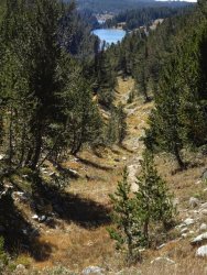
Talked to these guys. They were on their way to take down a camp. Let them know I hear a lot of elk bugling N of Skull.
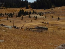
Not a monumental backpack, but fulfilling in it's own way:
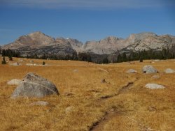
The time was up for nice weather in the backcountry. The next day the snow started. Hoback Canyon was slow going at times. Nearly whiteout. By the time I got to Jackson it was just very wet snow changing to rain. My plane wasn't until 1 so I opted for a 2nd breakfast (like a good Hobbit) at Bubba's.
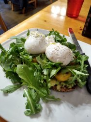
Thanks again to all who helped with advice. The golden trout still eludes me, but at least I didn't have to go as far as Flying Monkey not to catch one! Looking forward to next year when I introduce a few from a local hiking group to the Winds. Just hope the weather cooperates enough for the peaks to be seen at least a few days of the 5 they've got. A few years ago, there was about 7 miserable rain/sleet/snowy days mid-September when my GF kept asking "Where are all those mountains?"
On my 20th year of visiting the area, I was doing it solo again. My nephew bailed a few weeks before as he just had a big promotion and needed to relocate. My GF couldn't get the time off.
So, this became a mostly fishing trip. I like to target a specific location and have decent weather to make it worthwhile. I do shorter backpacks of 3-5 days so I can also fish the major rivers in the front-country and visit totally different parts of the range.
When going for golden trout, it's custom not to provide the name of the lake. I had heard of reports of large goldens being taken in a drainage. I recognized the “no-name” lake, confirmed it with the poster offline and checked with others regarding routes. I want to thank Rich Osthoff for getting his MegaScud flies out to me before I left.
I spent the first night at Signal Mountain CG in GTNP. Nice sunset and cool, foggy morning.


Since I just slept in the back of the SUV, packing up was easy and I left early for Lander. The weather report was showing a system coming in 4 days, so rather than 1 more day of acclimation, I decided to hit the trail the following morning. A little risky as SAR devotes a fair amount of resources to folks that aren't properly acclimated. But, figured I'd take it slow and there wasn't a lot of major climbing involved: only a ~1200' gain over several miles. The plan was to basecamp at the end of a use-trail, then dayhike to the golden lake via a faint use-trail.
My trail diet leaves something to be desired...I eat what I want, but the bars do get old... I'd made 2 turkey wraps for the first day and had some beef jerky as well.

After leaving the main trail, I saw or heard no one until I returned. I found an established campsite at the end of the trail. Set up camp late afternoon and was treated to a nice sunset. Didn't bother with a campfire.


The next morning was beautiful. Took my time with breakfast and a second cup of coffee, then strapped up for the “trail” to the lake. I had downloaded the gps-enabled map to my phone with the path marked, but as most know a lot of this is common sense and following whatever sign there is.
There were a few cairns and sometimes the trail was obvious. Other times, it was absent, in which the “continue in this general direction”, occasional backtrack-and-start-again game begins. After crossing this stream there was some disagreement with the mapped trail, but there was clear sign of “some” trail there. Fighting willows is never fun and somehow, they always seem to “eat” trails.

This is a view back along the final bit of the “trail” to the lake although, again, it deviated from that on the map. On the way back, I chose the map route, which frankly wasn't any better.

Anyway, I arrived late morning and the wind was blowing straight towards me making whitecaps though they don't show up well in the shot.

I spent the next 3 hours fishing with both spinning gear (Jake's Money Clip) and the MegaScud without seeing a single fish. Well, it's nice scenery anyway. So, I returned to camp, had a cold dinner and decided not to bother trying the lake again the next day. I broke camp and left about 9:30, really appreciating the speed at which I could travel on a well defined trail.
Luckily, these logs were dry or I wouldn't bother crossing on this.

I made it back to the car late afternoon, trading fishing notes with just 1 inbound hiker. I dumped my pack, pulled out a few things, changed into fresh socks and shoes and went back to town for a decent meal and shower. Only the next morning when loading the car did I realize that I had left my hiking poles and fishing rod at the trailhead!
So, throwing everything in the car in a hurried checkout, I buzzed up a series of switchback in heavy rain and sleet. But, everything was gone. I checked the kiosk and the restroom area, then headed on back. Stopped in the the FS office to leave contact info in case someone turned it in, but figured that was unlikely. My tent requires poles to set up, so I headed to a local outdoor store which had the newer version. Bought that as well as another canister of bear spray as my next stop was Dubois and I wanted to fish East Fork. Oh well. It's not the first time I've forgotten stuff at the TH. Hope whoever picked it up enjoys the equipment. At least I still had my fly rod.
Pulled into my favorite campground just outside of Dubois and set up camp. Couldn't get a good set with the foot of the tent. Pulled up a Y stake using a stick on the prongs, which slipped and I found my finger ripped open. This was not going well.... Luckily, the medical clinic was quite close so a few stitches and several curses later, I was finishing my setup.

Headed out the next morning to fish East Fork after picking up a few flies at the local shop. The water was low so going too far upstream wasn't an option. I started by fishing Wiggen's Fork just before the confluence but only had a whitefish and a missed take. Caught another few whitefish in East Fork, but no cutthroat. There were quite a few other fisherman at the walk-in sites. More than I usually see. The campground was also more fully occupied than usual. Scenic area though.

The next day I returned to a few different locations on the East Fork. I had a few missed opportunities, but it was slow. Chatted with one fellow that said it was slow for him as well. I was swinging nymphs. He suggested grasshopper or stimulator. Neither of those worked for me in the next hour or so. Might be a matter of timing too. Bright skies and low water make for wary fish, even in the deeper holes I was targeting. So, gave it up and hit one of my favorite spots on the Wind River but surprisingly, only had 1 fish (yep, whitefish again).
Weather was turning again, so I was using the next day as a travel day to Pinedale. It was snowing good near Togwotee Pass. Saw a truck on the side of the road so I pulled over and got to watch a sow and her cub tearing up the meadow. They slowly meandered towards the road, so I finally got a chance of fair photo with my simple p&s camera. I had originally guessed black bear, but when enlarged, it looks like that distinctive grizzly hump and dish face is there.

Grabbed a few supplies passing through Jackson and got to Pinedale in time for to use the shower at the Aquatic Center, then headed to camp at Fremont Lake. The next day was pretty miserable with more sleet and rain so I just did laundry, visited the FS office to check on a permit for next year and pondered how to make the best use of time with the forecast.
While the next day was still sleet/snow/rain but was supposed to be “isolated”. I decided to head to Green River Lakes TH to at least stretch my legs going into Clear Creek canyon. There were a few spots where the SUV rental was sliding a bit, but it was manageable. Sometimes the photos in stormy conditions turn out OK.


I noted the bear fence passing this camp in the meadow.

Somehow the peaks of Mordor come to mind when I see the pinnacles of Osborne:


It started snowing fairly fast shortly after this so I stowed the camera and made good time back to the car. The next day it looked like the system was just cold and drizzle so I decided to fish the upper Green. It usually yields some trout (as well whitefish) and didn't disappoint. Not as fast as I've sometimes encountered but at least I have a photo proving I can catch a fish! A few other photos didn't come out well and I lost a few as well. Always fun there.

The weather system finally cleared out the next day but temps were dropping significantly. I decided to opt for a few days in East Fork/Desolation canyon vs Bear Basin. Really wanted my spinning outfit for the hike into Bear Basin and needed a bigger weather window.

It was an easy stroll to Skull Lake, though I stopped to chat with several folks, 2 on their way out and 1 young hiker I shared the trail with until he left for Shadow Lake. It was great to see the reaction of the 2 younger guys on their first trip to the Winds. I doubt it will be their last! Didn't see anyone else for 48 hours.


I didn't see a great spot to camp at the top of Skull so set up in under trees in a level area. Exploring later, I came upon established campsites not too far away, nearer the lake. Got cleaned up, had another cold dinner and enjoyed the sunset.

It was chilly early morning. I have an old 10F WM Versalite and Xlite pad. Probably low 20's so I've been in colder conditions. At times I felt a chill, but that may be from being too warm in spots and having a draft hit those. Sometimes it's hard to keep from sweating at times before the temps fall enough to zip fully up.
I took my time the next morning as the dayhike to Desolation Valley wasn't long and the first half to Pyramid Lake was heavily trodden.
Midsummer's Dome in the center:

Probably a dog. I heard one barking near Mirror Lake on the way out.


Maes Lake:

Pyramid L, looking NW:

This is where the official trail ends and a use trail begins. Following that as outlined on the map it was fairly obvious, but disappeared at times. Still, a simple matter to head towards the obvious pass into East Fork valley. Great views back towards the Cirque too. On the return, I found a much more heavily trodden trail near Pyramid that didn't quite match up with the map. No cairn marking it's junction with the main trail, but good to know next time.


All this to myself, as far as I was able to tell. Part of why I love coming out here this time of year.

The trail was pretty much gone at this point. I just contoured around the slope, at times using the map to keep on the “trail”. Sometimes that helped find a route through pines or willows that wasn't immediately obvious. I went as far as across from Raid Peak, paused to take it all in then headed back.
Yep, some form of trail is here...

Views of the Cirque on the return to camp.

Another cold night. Heavy frost in the morning. Struck camp and headed out.
The backside of the Cirque is just as good as from Lizard Head Meadow. Even viewed in early morning silhouette.


Marms and Dad's Lake in the distance:

Talked to these guys. They were on their way to take down a camp. Let them know I hear a lot of elk bugling N of Skull.

Not a monumental backpack, but fulfilling in it's own way:

The time was up for nice weather in the backcountry. The next day the snow started. Hoback Canyon was slow going at times. Nearly whiteout. By the time I got to Jackson it was just very wet snow changing to rain. My plane wasn't until 1 so I opted for a 2nd breakfast (like a good Hobbit) at Bubba's.

Thanks again to all who helped with advice. The golden trout still eludes me, but at least I didn't have to go as far as Flying Monkey not to catch one! Looking forward to next year when I introduce a few from a local hiking group to the Winds. Just hope the weather cooperates enough for the peaks to be seen at least a few days of the 5 they've got. A few years ago, there was about 7 miserable rain/sleet/snowy days mid-September when my GF kept asking "Where are all those mountains?"
Last edited:
